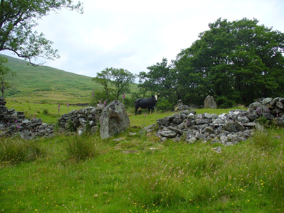
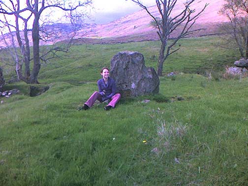
Great Moss Standing Stone, Emmott Moor, Lancashire

Standing Stone:  OS Grid Reference – SD 969 384

Getting Here

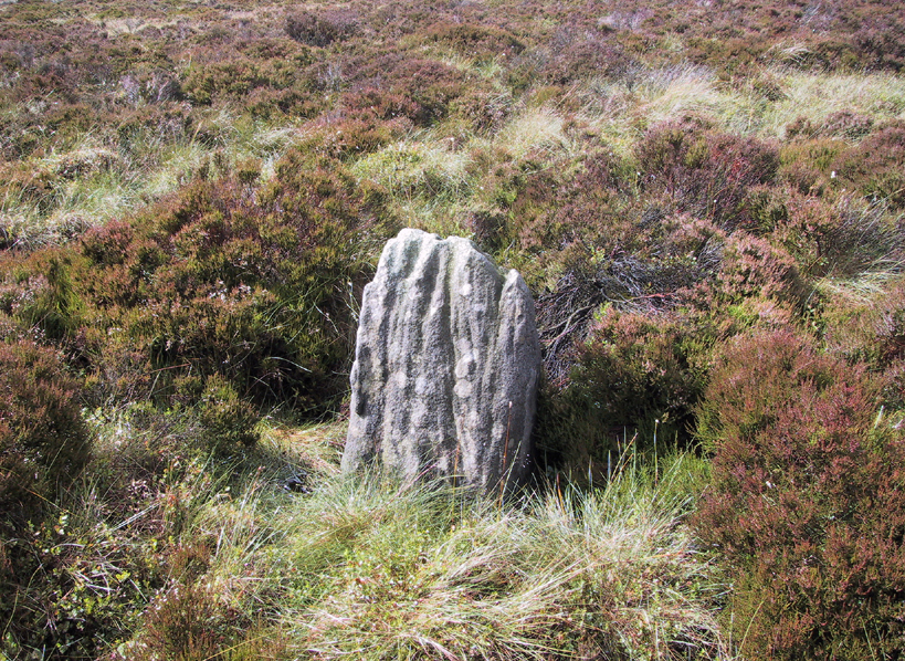
Great Moss Stone - looking north
Great Moss Stone – looking NE

Follow the directions to the Water Sheddles Cross Standing Stone on the Yorkshire-Lancashire border; and when you get to the reservoir, walk straight across the road and head almost straight up onto the moor as if you’re going to the rock outcrop ahead of you on the horizon, called the Wolf Stones.  After just a couple of hundred yards though, amble back and forth to find the stone.  It’s in the heather, close by.

Archaeology & History

Great Moss Stone - looking NW
Great Moss Stone – looking NW

I can find no history about this small stone, just over three feet high, which was almost lost in the boggy heather when I first came here.  Standing in a small pool in the peaty-ground, the stone is very worn, with one of Nature’s cup-markings on top.  There is the possibility that this stone may have been one of the old boundary markers pre-dating the 1614 case which questioned the exact boundary line marking the Yorkshire-Lancashire border — but this is purely hypothetical.  The Water Sheddles Cross is just a few hundred yards east of here.

© Paul Bennett, The Northern Antiquarian


Neriby, Bridgend, Islay

Standing Stone (destroyed):  OS Grid Reference – NR 3595 6053

Also Known as:

  1. Canmore ID 37722

Archaeology & History

This is another standing stone whose days are seemingly long gone.  It was last recorded in 1878 as being about 300 yards northwest of the old farmhouse at Neriby.  The old stone stood more than six-feet tall, but appears to have gone.  Anyone journeying this way might wanna scour the ground to see if the fella’s remains can be seen lying around anywhere – though the fact that an old quarry was dug hereabouts doesn’t bode well for a successful hunt.  If we’re lucky, the stone may have been buried or laid into  nearby walling.  There is, however, remains of an old tumulus a bit further up the way…

References:

  1. Royal Commission on the Ancient & Historical Monuments of Scotland, Argyll – volume 5: Islay, Jura, Colonsay and Oronsay, HMSO: Edinburgh 1984.

© Paul Bennett, The Northern Antiquarian

Todholes, Weston, Lanarkshire

Standing Stone (destroyed): OS Grid Reference – NT 038 456

Archaeology & History

This standing stone used to be positioned on the old boundary line between the Carnwatch and Dunsyre parishes.  It might be a good idea to check out the perambulation records to see if owt went off here, before its destruction.  About five-feet tall, it was positioned on a small rise in the ground, 500 yards south of Todholes.

References:

  1. Royal Commission on the Ancient & Historical Monuments of Scotland, Lanarkshire: Prehistoric and Roman Monuments, HMSO: Edinburgh 1978.

© Paul BennettThe Northern Antiquarian 


Standingstone Hill, Lesmahagow, Lanarkshire

Standing Stone (destroyed): OS Grid Reference – NS 759 351

Archaeology & History

The name of the place sort of gives the game away, but sadly we’ve got nowt to see anymore as the forest has covered it. The Royal Commission lads came here in 1971 and couldn’t find it, but later told that it “formerly stood on the summit” of the said hill. An important geomantic spot without any shadow of a doubt, probably having some relationship with an old tomb, either here or around the tree-covered summit of Tod Law, due east of here.

There’s a great deal more that’s been forgotten about up and about this region which will come to light as visits unfold.

References:

  1. Royal Commission on the Ancient & Historical Monuments of Scotland, Lanarkshire, HMSO: Edinburgh 1978.

© Paul BennettThe Northern Antiquarian


Shawton, Chapeltown, Lanarkshire

Standing Stone (destroyed): OS Grid Reference – NS 681 490

Archaeology & History

This is another Lanarkshire monolith that’s gone, but which was described first of all in the 19th century in the Ordnance Survey place-name book for the county.  The Scottish Royal Commission (1978) lads—who tried locating the site in September, 1973—told that,

“no trace now survives of the stone, 1.4m in height (i.e., about four-and-half feet tall – Ed.), that once stood in a field beside the public road about 120m northeast of Shawton Farmhouse.”

References:

  1. Royal Commission on the Ancient & Historical Monuments, Scotland, Lanarkshire: Prehistoric and Roman Monuments, HMSO: Edinburgh 1978.

© Paul BennettThe Northern Antiquarian


Clarkston Farm, Dillarburn, Lesmahagow, Lanarkshire

Standing Stone (destroyed):  OS Grid Reference – NS 832 426

Archaeology & History

The first reference I found of this once-proud standing stone was in the early pages of the Glasgow Archaeological Society’s Transactions, from 1897; but when the Royal Commission lads came to look for the site in 1971, it had long-since been destroyed.  Thankfully we have various folklore relics to tell us more!

Folklore

In Robert Chambers’ Popular Rhymes (1826), he told us several intriguing pieces of folklore about this once great monolith, writing:

“On the farm of Clerkston, in the parish of Lesmahagow, there had existed since creation an immense stone, or saxum, which, being deeply bedded in the middle of a good field, at a great distance from any other rocks, was productive of infinite inconvenience to the husbandman, and defrauded the proprietor of a considerable portion of territory.

“Beneath this stone, it was believed by the country people of the last generation, that there was secreted a vast treasure, in the shape of “a kettle-full, a boot-full, and a bull-hide-full,” of gold; all which got the ordinary name, reason unknown, of “katie Neevie’s hoord.” The credibility of this popular tradition was attested by a rhyme to the following effect:

Between Dillerhill and Crossfoord,
Here Lies Katie Neevie’s Hoord.

“Many efforts had been made, according to the gossips, to remove the stone, and get at the treasure; but all were baffled by the bodily appearance of the enemy of mankind, who, by breathing intolerable flame in the faces of those making the attempt, obliged them to desisted. Thus well guarded, the legacy of Mrs. Katherine Niven lay for centuries as snug as if it had been deposited in Chancery; and it was not till at least an hundred years after the last despairing effort had been made that the charm was at length broke.

“Mr James Prentice, the present farmer of Clerkston, had the address to convince several Irishmen, who had served him during the harvest, of the truth of the said rhyme; and, by expatiating upon the supposed immensity of the treasure, wrought up their curiosity and their cupidity to such a pitch, that they resolved, with his permission, to break the stone in pieces, and make themselves master of whatever might be found below. On the day after the kirn, therefore, the poor fellows provided themselves with a well-loaded gun, for the protection of their persons from the Devil, and fell to work, with punches and mallets, to blow up and utterly destroy the huge stone which alone intervened between them and everlasting affluence.

“They laboured the whole day, without provoking any visit from Satan, and at last succeeded in fairly eradicating the stone from the field which it had so long encumbered; when they became at once convinced of the fallacy of the rhyme, of the craft of Mr. Prentice, and of their own deluded credulity.”

References:

  1. Chambers, Robert, The Popular Rhymes of Scotland, William Hunter: Edinburgh 1826.
  2. Royal Commission for the Ancient & Historical Monuments of Scotland, Lanarkshire: Prehistoric and Roman Monuments, HMSO: Edinburgh 1978.

© Paul Bennett, The Northern Antiquarian
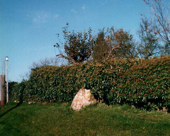

Tirai, Glen Lochay, Perthshire

Standing Stones:  OS Grid Reference – NN 5308 3670

Also Known as:

  1. Canmore ID 24172

Getting Here

Standing stones of Tirai

From Killin, travel down Glen Lochay, past Stag Cottage or Duncroisk and over the shallow river of Allt Dhun Croisg.  If you’re in a car you can park up a 100 yards past the river bridge and walk up the track from here.  After a 10 minute walk, above the trees you come to the derelict village of Tirai* where, until recently, you were greeted by a tall totem-pole of a gnarled tree (it was superb!) which is now Earth-lain, and a fine view of the evolving hills.  Here amidst the ruins we also find a standing stone or two.

Archaeology & History

The village of Tirai was deserted sometime in the 19th century (due to the disgusting clearances of the English), but at least two standing stones still live amidst its ruins.  The tallest is nearly four-feet tall in the middle of the grassy patch and is much used by grateful cattle to rub themselves against when midges and horseflies drive them mad!  The Scottish Royal Commission lads reckon the megaliths here are,

“possibly a survivor of a stone circle as a similar stone is used nearby as a gate-post to an enclosure and several other large stones have been incorporated in the walls of the surrounding buildings.”

This may well be so – but it is equally possible that these are merely the remains of standing stones which once stood along this ridge and which were taken for use in the village.

One of the Tirai standing stones

Of the remaining standing stones in this idyllic setting – the Royal Commission fellas counted possibly four of ’em – all are roughly the same size, between 3 and 4 feet high.  Johnstone & Wood (1996) also think the stones here may once have related to a prehistoric cairn in the village.

This is an utterly beautiful arena, even in the heights of winter.  The village sits on the rear slopes behind the old cailleach, and there are plenty of cup-and-ring carvings, both known and unknown scattering the rocks and nearby hills.  The curious Duncroisk Crosses carving is just visible from here, on the other side of the rocky gorge.  Lost tales and lost sites abound here also.  I did sit and wonder though… Considering that the villagers here left the old standing stones in place until very recent centuries at the heart of their hamlet, what uses did they make of it, or what tales did it speak?  Or had the purge of the Church already taken its toll…?

References:

  1. Gillies, William A., In Famed Breadalbane, Munro Press: Perth 1938.
  2. Johnstone, A.S.K. & Wood, J.S., ‘An Archaeological Field Survey of Deserted Townships at Tirai, Glen Lochay, Killin,’ Association of Certificated Field Archaeologists (Glasgow University) Occasional Paper no 9 (1996).

* The place-name Tirai means ‘land of good luck or joy,’ which truly speaks well of its spirit and setting to me.

© Paul Bennett, The Northern Antiquarian
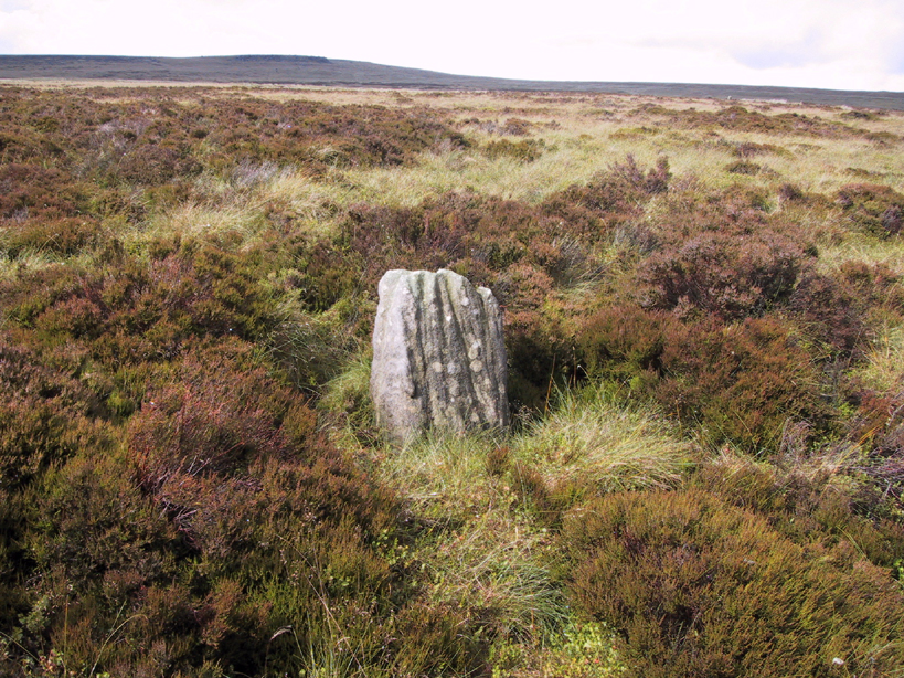

Blackhill, Hazelbank, Lanarkshire

Standing Stone (destroyed): OS Grid Reference – NS 829 442

Archaeology & History

No longer here, but about 200 yards north of the old farmhouse of Blackhill (with its ancient tumulus still in attendance across the road) could once be seen a decent standing stone, “fully six feet high.” It seems that this was sadly uprooted sometime before 1954.

References:

  1. Royal Commission on the Ancient & Historical Monuments of Scotland, Lanarkshire: An Inventory of the Prehistoric and Roman Monuments, HMSO: Edinburgh 1978.

© Paul BennettThe Northern Antiquarian


Walton Head, Kirkby Overblow, North Yorkshire

Standing Stone:  OS Grid Reference – SE 30335 49907

Getting Here

Along the A61 Harrogate-to-Harewood road, just below the roundabout where the A658 links up, is a small country road that turns towards the lovely village of Kirkby Overblow.  If you’re in a car, park up wherever you can hereabouts (being careful of the locals!).  Cross over onto the western-side of the A61 and walk along the small tree-lined field-edge until you find a spot to get over, where this stone stands.

Archaeology & History

It’s hard to suss out how many monoliths first stood here, but when William Grainge (1871) and Harry Speight (1903) described them, it was believed they had been uprooted in the 17th or 18th century.  Although one of them has gone, thankfully the scarred remnant of one is still here.

Site number 168 in Old Stones of Elmet, one of the two standing stones that were described in parish boundary records of 1577 as “two stones standing in Walton Head Layne” can be found northeast of the village, along the ancient church way between Rigton and Kirkby.  However, it is not as it once was! The boundary perambulation was redefined in 1767, when it was thought that a new monolith had been erected to replace the site of the old ones; but it turns out that some masons simply smoothed off the old stone and carved ‘K.F. 1767’ onto one of the original two. If you look at the base of the stone (which is more than 4 feet tall, leaning slightly to one side), it’s obvious that it’s been in the ground for one helluva long time. Much much longer than any old 1767 – or 1577 for that matter!  What we appear to have here is simply a worked remnant of a true prehistoric standing stone.

References:

  1. Grainge, William, The History and Topography of Harrogate and the Forest of Knaresborough, John Russell Smith: London 1871.
  2. Speight, Harry, Kirkby Overblow and District, Elliott Stock: London 1903.

© Paul Bennett, The Northern Antiquarian

The Great Stone, Downham, Lancashire

Legendary Rock:  OS Grid Reference – SD 78212 44402

Also Known as:

  1. Downham Cross (Byrne 1974)

Getting Here

The best way to locate this is probably by starting from the pub opposite the old church of St. Leonard and heading west along the village road, past three large gate-entrances, until reaching the conspicuous milestone by the road junction.  On the other side of the road, just before the gate entrance to Downham Hall, edged into the base of the wall, we find this ‘ere The Great Stone.

Archaeology & History

The Great Stone, Downham

What a truly beautiful little village we find in Downham, nestled quietly and with age at the northern edge of Pendle hill.  It’s tucked away, off any main road so maintaining its sense of age and almost reclusive nature.  There is hidden history a-plenty scattering the landscape here, but tales of our Great Stone — thought by some as an old monolith; remains of a Roman milestone by others; whilst some just denote it as nowt but a small stone — is what brought me here.  It’s name betrayed my expectation (I always hope for too much it seems…), but the small pock-marked stone has been embedded in its present position for at least 150 years, as the growth of soil and tree behind it shows.  Archaeo-historians say little of it (reputations y’ know!) until something substantial is found; but thankfully we came upon the lovely couple who are Lord and Lady Clitheroe of Downham Hall, who told us more…

Folklore

“There are a couple of humourous legends told of the Great Stone,” Lord Downham began… But to a (sometimes) courteous megalithomaniac like myself, the tales rang the all-too-familiar bell.

Close-up of the Great Stone

The original position of the stone, though not known for certain, was some short distance away either across the road, or further along in a nearby field.  When it was moved – Lord Downham said around 1830 – the remains of a body were found beneath it; but another source told in fact that it marked “the final resting place of two legionaries who died on the nearby Roman road during trouble with the Brigantes.” (An old Roman road is nearby)  But apparently this old stone also moves. When the church bell strikes midnight the stone is said to turn itself around upside-down. Where have we heard that before!?

The site is described in Clifford Byrne’s (1974) unpublished manuscript on the crosses of Lancashire, where he cites it as being the remains of a cross pedestal, but adds that “if ever a cross stood by the village green, no memory of seems now to exist.”  But Mr Byrne also described the all-too-familiar heathen folk tales, saying:

“A local man told the writer that the object is called Downham Stone and that it turns over every night at midnight.  We read elsewhere that the boulder is called “the great stone of Downham” and that it turns at the stroke of midnight by the church clock.”

References:

  1. Byrne, Clifford H., “A Survey of the Ancient Wayside Crosses in North East Lancashire,” unpublished manuscript, 1974.
  2. Lofthouse, Jessica, Three Rivers, Robert Hale: London 1946.
  3. Lofthouse, North Country Folklore, Robert Hale: London 1976.
  4. Winterbottom, Vera, The Devil in Lancashire, Cloister: Stockport 1963.

© Paul Bennett, The Northern Antiquarian