Hawk Stone, Spelsbury, Oxfordshire

Standing Stone:  OS Grid Reference – SP 33923 23544

Getting Here

Hawk Stone on 1885 map

Best visited out of season before the corn’s been planted. It makes it  easier to find and doesn’t annoy the land-owner here, who tends to be a decent dood.  From Chipping Norton go southeast along the B2046 road to Charlbury.  After about 1½ miles take the second right turning down the small country lane.  Go slowly down here for less than half a mile, watching the fields on your right.  You’re damn close!

Archaeology & History

The Hawk Stone

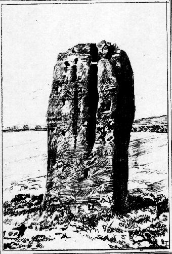
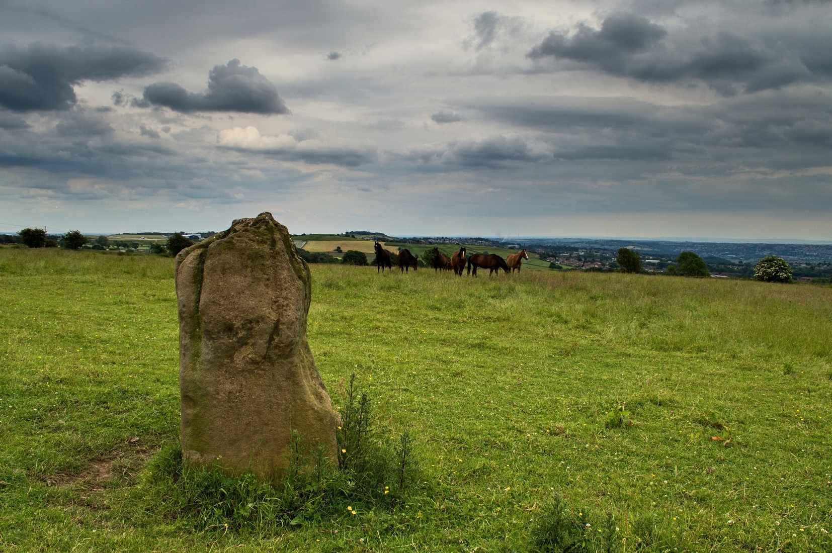
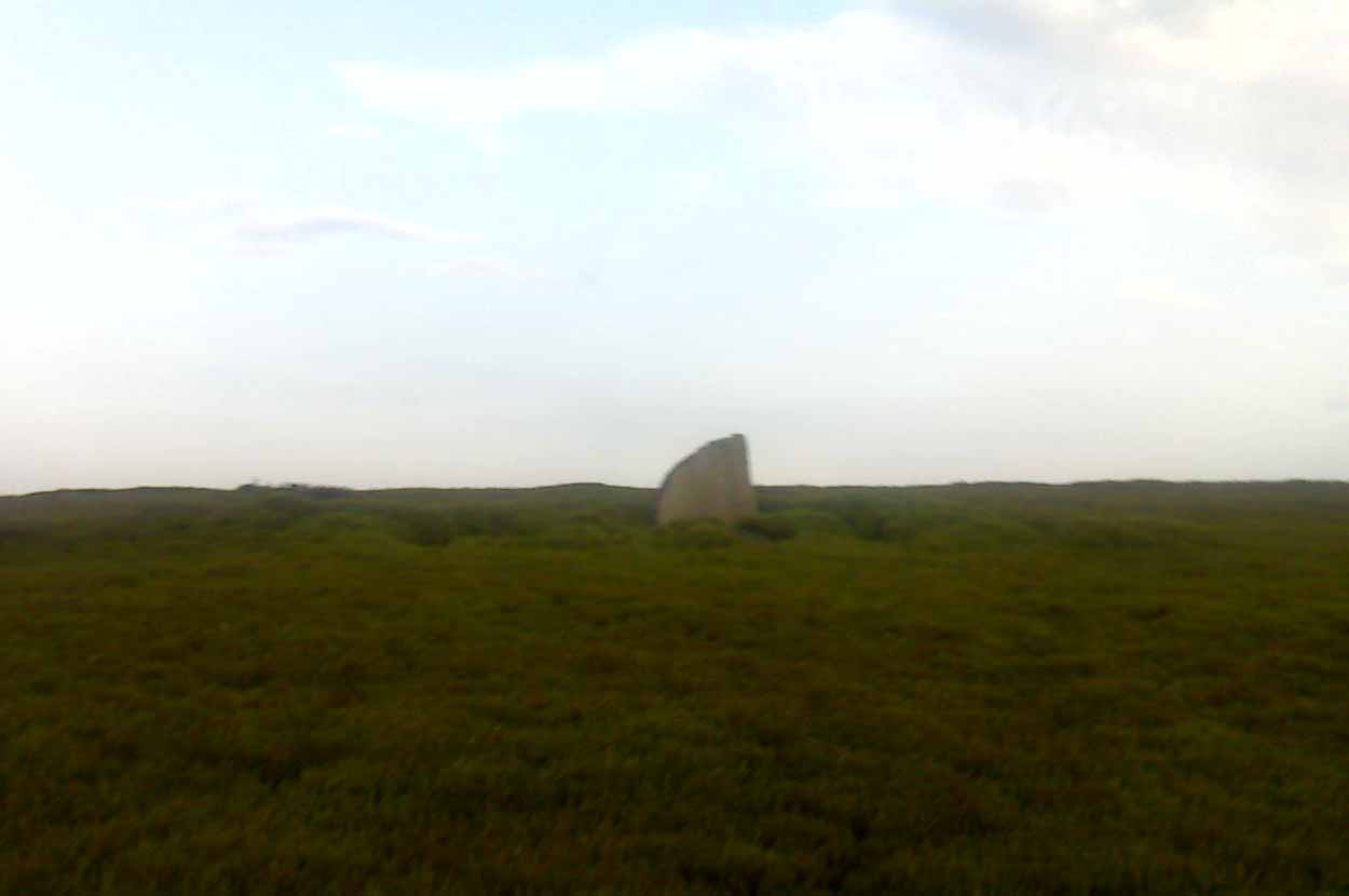
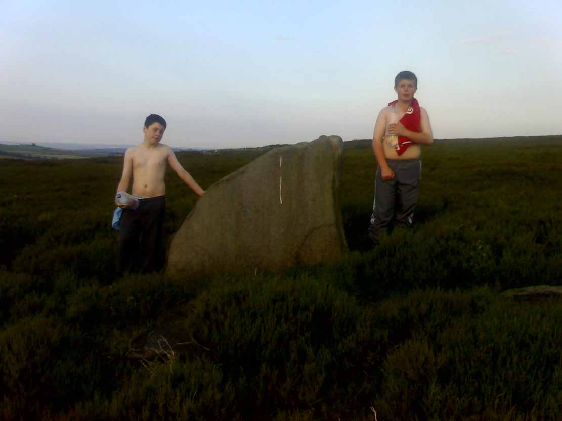
This impressive, weather-worn, eight-foot tall standing stone stands aloft in the middle of a field due west of the road between Chalford Green and Dean.  It’s an excellent monolith and one which, I think, has a lot more occult history known of it than described here.  Thought by O.G.S. Crawford (1925) and others in the past to have been “formerly part of a chambered structure,”  or prehistoric chambered tomb like that of the Hoar Stone at nearby Enstone, no remains of such a structure unfortunately remain today.  It is first illustrated and named on a local map of the region in 1743 CE, and the stone at least has fortunately managed to escape the intense agricultural ravages endemic to this part of the country.

The name “Hawk” stone has been fancied by some to relate to some obscure resemblence to a Hawk, or because there very often are hawks hovering over those upland fields – but these are unlikely.  It’s thought by place-name authorities more likely to derive from a corruption of ‘Hoar’ meaning a grey or boundary stone; and as it stands just yards east of the present township boundary line, this derivation seems more probable.

To all lovers of megalithic sites, we highly recommend a visit here!

Folklore

In local folklore and in the opinion of some earlier historians, the Hawk Stone formed an integral part of a stone circle here, but there is little known evidence to substantiate this.

Hawk Stone in summer
Hawk Stone in winter

A creation legend attached to this site tells that the stone was thrown, or dragged across the land, by a old witch or hag — though we are not told from where.  This is a motif found at megalithic sites all across the country (see Bord & Bord 1977; Grinsell 1976, etc).  In Corbett’s History of Spelsbury (1962) the author told of the folklore spoken of by one Mr Caleb Lainchbury who

“said the cleft at the top of the Hawk Stone at Dean was supposed to of been made by the chains of the witches who were tied to it and burnt. As witches seem to have been extremely rare in Oxfordshire it cannot have been a very common practise to burn them at Dean; but there may indeed have been some kind of fire ceremonies near the stone.”

Grinsell (1976) also tells how the Hawk Stone has that animistic property, bestowed upon other old monoliths, of coming to life and going “down to the water to drink when it hears the clock strike 12.”

This evidently important and visually impressive monolith also plays an important part in an incredibly precise alignment (ley) running roughly east-west across the landscape.  At first, Tom Wilson (1999) thought the alignment had previously gone unnoticed, but later we later found a reference to the same line in an early copy of The Ley Hunter (Cooper 1979). It links up with other important megalithic sites, such as the Hoar Stones at Enstone, Buswell’s thicket, and the ancient Sarsden Cross.

Similarly, when Tom Graves’ (1980) was doing some dowsing experiments at the Rollright stone circle a few miles west, he found what he described as an ‘overground’ (or ley) linking the ring of stones to the Hawk Stone, but no other connecting sites are known along this line.

References:

  1. Bennett, Paul & Wilson, Tom, The Old Stones of Rollright and District, Cockley: London 1999.
  2. Bord, Janet & Colin, The Secret Country, BCA: London 1977.
  3. Cooper, Roy, “Some Oxfordshire Leys,” in The Ley Hunter, 86, 1979.
  4. Corbett, Elsie, A History of Spelsbury, Cheney & Sons: Banbury 1962.
  5. Crawford, O.G.S., The Long Barrows of the Cotswolds, John Bellows: Gloucester 1925.
  6. Gelling, Margaret, The Place-Names of Oxfordshire – volume 2, Cambridge University Press 1954.
  7. Graves, Tom, Needles of Stone, Granada: London 1980.
  8. Grinsell, L.V., Folklore of Prehistoric Sites in Britain, David & Charles: Newton Abbot 1976.

© Paul Bennett, The Northern Antiquarian 


Thor Stone, Taston, Oxfordshire

Standing Stone:  OS Grid Reference – SP 3592 2208

Also Known as:

  1. Thunor’s Stone

Getting Here

Thor Stone, Taston, hiding in shadows on bright sunny day

Very easy! From which ever direction you approach the gorgeous little village of Taston, get to the Cross in the middle of the road and look up the slight hill and at the old walling on the right-hand side.  You can’t really miss it!

Archaeology & History

An impressive seven-foot tall standing stone resting up against the walling of Martin and Martha’s Thorstone Cottage, and which appears to have been recorded as far back as the late thirteenth century in the survey of the Chadlington hundred.  Indeed, according to the respective place-name authorities, the village of Taston itself appears to get its name from the Thor Stone, as it’s recorded as Thorstan in 1278 CE. (Gelling 1954)

Less than 100 yards away is a large old stone cross, the top of it now fallen, which may once have had some earlier pre-christian relationship with the Thor Stone; perhaps originating from other standing stones close by our now solitary Thor Stone (see Folklore, below).  No other monoliths or prehistoric tombs are presently associated with this site, but its folklore tells of earlier companions…

More than a hundred miles north of here we find an etymological sister in the old village of Thurstaston and where, not surprisingly, we have another Thor’s Stone — but in this instance the name applies to a huge rock outcrop with old pagan legends attached.

Folklore

Elsie Corbett (1962) tells that the creation myth for this stone was that it originated after the great god Thor cast a thunderbolt down from the heavens and this stone appeared as a result.  But more intriguing from an archaeological perspective is what Mike Howard (he of The Cauldron magazine) told us in a short article for the Gloucester Earth Mysteries magazine in 1994, which said that our grand old Thor Stone was once part of a stone circle.  He wrote:

“At Taston…are the rather battered remains of a megalithic circle known locally as the Thor Stones. It seems the original circle was dug up many years ago and the stones now reside in a neat pile at the crossroads in the centre of the village. The whole edifice resembles nothing less than an eccentric market cross, topped by a phallic stone.”

Although he doesn’t cite any sources for this bit of info (where’d you gerrit from Mike?), we need to take a more careful look at the old cross nearby.  And we find another piece of folklore relating to the Taston cross which said that it was placed there to abate the evil influences that were supposed to come from the Thor Stone.  This piece of folklore is simply one laid down by the Church which portrayed most things it did not understand, or sought to repress, as being the work of their own demonic power, Satan.

Between these two old monuments was once a huge old elm tree which, says Caroline Pumphrey (1990), was a meeting place of the local villagers in times gone by.  Whether this implies the Thor Stone to have been a moot spot is difficult to tell, although the erection of the cross would seem to add weight to this.

More recent screwy notions comes from one woman who reckoned, curiously, that the Thorstone got its name from some completely invented made-up goddess, saying:

“I believe its more likely to be a corruption of the name of ‘Hoar’, the great Goddess. Indeed the Hawk Stone, and various Hoar stones stand widely hereabouts and probably derived their names from the same deity.”

Utter drivel of course (there’s no such goddess as Hoar)! But — like the christians and others before them — people believe what they want to believe and this sorta nonsense is increasingly found all over the internet.  As is well known, the word hoar derives from ‘har’, being ‘grey’ or ‘a boundary’ (Gelling, 1954; Smith 1956); and numerous studies show this quite clearly.

References:

  1. Bennett, Paul & Wilson, Tom, The Old Stones of Rollright and District, Cockley: London 1999.
  2. Corbett, Elsie, A History of Spelsbury, Cheney & Sons: Banbury 1962.
  3. Gelling, Margaret, The Place-Names of Oxfordshire – volume 2, Cambridge University Press 1954.
  4. Grigson, Geoffrey, The Shell Country Book, George Rainbird: London 1962.
  5. Howard, Mike, ‘From Thor to Rollright,’ in Gloucestershire Earth Mysteries 18, 1994.
  6. Pumphrey, Caroline, Charlbury of our Childhood, Sessions Book: York 1984.
  7. Smith, A.H., English Place-Name Elements – volume 1, Cambridge University Press 1956.

© Paul Bennett, The Northern Antiquarian


Raven’s Stone, Elgol, Strathaird, Skye

Standing Stone (destroyed):  OS Grid Reference – NG 520 144

Folklore

This once-famous standing stone appears to have gone.  It was described in Otta Swire’s (1961:230) superb book on the folklore of Skye, where she wrote:

“Overlooking Elgol is Bidein an Fhithich. Near here once stood the famous Raven’s Stone, about which the Brahn Seer prophesied. It is believed that this prophecy, however, can never be fulfilled, as seventy or eighty years ago the stone was broken up and the main portion of it is now incorporated in one wall of the Glendale church, according to the Rev. A. R. Forbes’ Place Names of Skye. The stone was believed to have had some connexion with old pagan religious ceremonies.”

The Brahn Seer (more commonly known as the Brahan Seer) was Coinneach Odhar, a 16th century prophet who is said to have foretold the Battle of Culloden and other events.

References:

Swire, Otta F., Skye: The Island and its Legends, Blackie & Sons: Glasgow 1961.

© Paul Bennett, The Northern Antiquarian

Bel Stane, Causewayhead, Stirling, Stirlingshire

Standing Stone (destroyed?):  OS Grid Reference – NS 805 958

Archaeology & History

Nearly a hundred years ago Christina Buchan told the local writer Donald Morris (1935) about this seemingly forgotten and lost megalithic site.  The narrative she gave told:

“I remember a stone which was known among the Causewayhead people as the Bel Stane. (The name is significant)  It originally stood in the Doocot Park on Spittal Farm.  This park overlooks the high road from Causewayhead to Bridge of Allan and adjoins the steading of Spittal… When the road leading up through the village of Causewayhead was formed (about 1820), the garden of William Robb’s cottage near the foot of the Broad Loan was somewhat altered in shape.  He put up a new gate and, requiring a gatepost, he lifted the Bel Stane from Doocot Park and set it up at the front of his own house to support the gate.  It was a stone of pillar-shape and stood four or five feet above the ground, and I do not remember whether they were any markings on it.  The cottage became ruinous many years ago and the garden ran waste.  A new house is now built on the site, but the Bel Stane has been lost.”

There is a possible contender for the lost Bel Stane, used again as another gatepost, on the south-side of the road some 450 yards to the east (at NS 80922 95931).  The stone in question is somewhat fatter than usual gateposts, about four-feet tall, and has the eroded appearance of considerably greater age than many others.  The monolith isn’t mentioned in the Royal Commission’s Stirlingshire inventory. Further information would be very welcome.

References:

  1. Morris, David, B., ‘Causewayhead a Hundred Years Ago’, in Transactions of the Stirling Natural History and Archaeological Society, 1935.

© Paul Bennett, The Northern Antiquarian


Pathfoot Stone, Airthrey, Stirling, Stirlingshire

Standing Stone:  OS Grid Reference – NS 80604 96871

Also Known as:

  1. Airthrey Castle West
  2. Canmore ID 47166

Getting Here

Not too troublesome to locate really… It’s at the top-end of the University, just above the side of the small Hermitage Road, about 100 yards along.  Keep your eyes peeled to your left!

Archaeology & History

Pathfoot Stone

Today standing proud and upright, this ruinous standing stone has been knocked about in the last couple of hundred years.   Although we can clearly see that it’s been “fixed” in its present condition, standing more than 10 feet high, when the Royal Commission lads came here in August 1952 (as they reported in their utterly spiffing Stirlingshire (1963) inventory), it wasn’t quite as healthy back.  They reported:

“Many years ago the stone, which is of dark grey dolerite, fell down and was broken, and the basal portion, now re-erected, is only 3ft 10in high; two large fragments however, still lie beside the base, and the original stone is said to have stood to a height of 9ft 4in.  Of a more or less oblong section throughout, the re-erected stones measures 2ft 10in by 1ft 10in at ground level, swells to its greatest dimensions (3ft 2 in by 1ft 9in) at a height of 1ft 4in, and diminishes at the top…”

…and again!

But the scenario got even worse, cos after the Royal Commission boys had measured it up and did their report, it was completely removed!  Thankfully, following pressure from themselves and the help of the usual locals, the stone was stood back upright in the position we can see it today.  And — fingers crossed — long may it stay here!

Folklore

Commemorative plaque!

A plaque that accompanies the monolith tells that the old village of Pathfoot itself was actually “built around this standing stone” — which sounds more like it was the ‘centre’ or focus of the old place.  An omphalos perhaps?  The additional piece of lore described in Menzies (1905) work, that an annual cattle fair was held here,  indicates it as an ancient site of trade, as well as a possible gathering stone: folklore that we find is attributed to another standing stone nearby.

References:

  1. Fergusson, R. Menzies, Logie: A Parish History – volume 1, Alexander Gardner: Paisley 1905.
  2. Hutchinson, A.F., “The Standing Stones of Stirling District,” in The Stirling Antiquary, volume 1, 1893.
  3. Hutchinson, A.F., “The Standing Stones and other Rude Monuments of Stirling District,” in Transactions of the Stirling Natural History and Antiquarian Society, 1893.
  4. Royal Commission on the Ancient and Historical Monuments of Scotland, Stirlingshire – volume 1, HMSO: Edinburgh 1963.

© Paul Bennett, The Northern Antiquarian


Caratacus Stone, Winsford, Somerset

‘Standing Stone’:  OS Grid Reference – SS 8896 3355

Getting Here

You can’t really miss this.  Take the road south from Winsford, up the steep hill onto the moors and before you reach the crossroads, look up across the slope on your left where you’ll see a small building on its own.  Go there!

Archaeology & History

A curious upright monolith more than five feet long (though some of this is embedded in the ground) with the words ‘CARAACI NEPVS’ carved on one side, is strangely closetted in a silly ‘house’ of its own on the moortops!  But the origins and history of the stone are contentious.  Some proclaim it as prehistoric, others Romano-British, and others as being from the Dark Ages.  In the 1960s and ’70s, archaeological tradition had its origins in the Romano-British period, and certainly the carved lettering on the sides of the stone seem to indicate a Roman provenance; but as the great Exmoor historian S.H. Burton (1974) told,

“It is possible that the stone was erected hundreds of years before it was inscribed, and the existence of an ancient trackway alongside, leading to the Barle, strengthens this possibility.  But, like most things about the Caratacus Stone, this is guesswork.”

We know it stood here in the 13th century as it was described in perambulation records of 1219 and 1279 AD; but it’s more than likely to be a monolith erected in the Dark Ages.  Grinsell (1970) however is a little more cautious, telling:

“The likelihood of the person in whose memeory this stone was raised claiming kinship with the Caratacus who was the arch-enemy of Rome, c. AD 45-50, has on more than one occasion been questioned.  It is, however, too tempting to be abandoned by the present writer.”

The carving on the stone was deciphered by the legendary Prof. John Rhys at the end of the 1800s, telling it to have been Carataci Nepos, the Kinsman of Caratacus (and variants thereof), who held out against the Romans in south Wales until AD 50.  The old Celtic writer, R.A.S. Macalister, thought the stone to have been dedicated to a local christian hero, St. Carantoc, but this notion has been generally dismissed.

Folklore

The old stone is said to be a site where buried treasure exists — though none has ever been found.  There is also an old tradition that “ghostly horses and waggons rumble towards the stone at midnight” — but this as likely relates to its proximity with the old crossroads a short distance away.

References:

  1. Burton, S.H., Exmoor, Hale: London 1974.
  2. Grinsell, L.V., The Archaeology of Exmoor, David & Charles: Newton Abbot 1970.
  3. Page, John Lloyd Warden, An Exploration of Exmoor and the Hill Country of West Somerset, Seeley 1890.
  4. Vowles, Alfred, History of the Caratacus Stone, privately printed 1939.

© Paul BennettThe Northern Antiquarian


Holed Stone, West Overton, Wiltshire

Enclosure & Stone:  OS Grid Reference – SU 1285 7151

Aerial image of site

Getting Here

Follow the same directions as if you’re visiting the Polisher Stone at the top-end of Overton Down where it meets Fyfield Down.  From here, walk down the slope for a hundred yards or so where you’ll notice, just above the long grassy level, a line of ancient walling running nearly east to west.  It’s very close to the yellow marker in the attached aerial image shot to the right.  If you walk along this line of walling you’ll find what you’re looking for.

Archaeology & History

Overton’s Holed Stone

As I’ve only been here once, and briefly — under the guidance of the Avebury expert Pete Glastonbury — my bearings on this site may need revising.  There are two distinct sections of walling here: one has been excavated by Peter Fowler and his team; the other hasn’t. (correct me if I’m wrong Pete)  And in Fowler’s (2000) fine survey of this area he does not describe this very distinct holed-stone in the line of walling, or adjacent “linear ditch F4”, as it was called.  But then, many archaeologists don’t tend to find items such as these of any interest (unless their education stretches to other arenas, which isn’t usually the case). But the stone seems to be in a section of walling that isn’t in their survey; standing out in aerial imagery as a less well-defined, but still obvious line of walling that is closer to the fence, 70-80 yards north, with a decidedly Iron-Age look about it!

But, precision aside! — as you can see in the photos, the holed stone here isn’t very tall — less than 2 feet high; though we don’t know how deep the stone is set into the ground.  This spot is on my “must visit again” list for the next time we’re down here!

Folklore

Veritable vagabonds, Mikki, June, PeteG & Geoff, readying themselves for fertility rites!

There’s nowt specific to this stone, nor line of walling, nor settlement (as far as I know), but it seems right to mention the fact that in British and European folklore and peasant traditions, that holed stones just like the one found here have always been imbued with aspects of fertility — for obvious reasons. Others like this have also acquired portentous abilities; whilst others have become places where deeds and bonds were struck, with the stone playing ‘witness’ to promises made.

References:

  1. Fowler, Peter, Landscape Plotted and Pierced: Landscape History and Local Archaeology in Fyfield and Overton, Wiltshire, Society of Antiquaries: London 2000.

© Paul Bennett, The Northern Antiquarian


Bull Stone, Guiseley, West Yorkshire

Standing Stone/s:  OS Grid Reference – SE 20675 43469

Also Known as:

  1. Boon Stones
  2. Boul Stones
  3. Bull Stone of Otley Chevin

Getting Here

Bull Stone as ‘Pillar’, 1851 map

Worth checking this if you aint seen it before! Head up to the back (south-side) of Otley Chevin (where the cup-and-ring Knotties Stone lies sleeping), following the road there and park up near/at the Royalty pub.  Take the footpath behind the pub which crosses the fields and once into the second field, head diagonally down to the far-left corner.  From here, look over the wall — you can’t really miss it!

Archaeology & History

An intriguing site for various reasons.  All we have left to see of any value nowadays is this nigh-on 6-foot tall thick monolith, standing alone in the field halfway between West Carlton and Otley Chevin.  Completely missed in local archaeological surveys, the place was mentioned briefly by Slater (1880); though it appears to have been first described in detail by Eric Cowling (1946), who suspected the stone may have Roman origins (though didn’t seem too convinced!), saying that:

“near the ground the section is almost oblong, with sides three-feet six-inches by one-foot ten-inches; two feet from top, the section is almost circular.”

Sid Jackson’s 1956 sketch
Photo by James Elkington

The fact that the stone stands very close to the line of an all-but forgotten Roman road that runs right past it added weight to this thought (the road runs towards a Roman settlement a mile east of here near Yeadon).  But this standing stone is unlikely to be Roman.  More recent evidence seems to indicate a relationship with a now-lost giant cairn about 100 yards to the south.  The only remains we have of this place are scatterings of many small loose stones nearby.  And it seems a very distinct possibility that the extra standing stones that were once hereby, stood in a line.

The very first reference I’ve found about this site also indicates that there was more than one stone here in the past!  In 1720 this site was known as the ‘Boon Stones’; and the plural was still being used by the time the 1840 Tithe Awards called them the ‘Boul Stones.’  Initially it was thought that both words were plural for “bulls” — as A.H. Smith (1962) propounds in his otherwise superb survey — but this is questionable. (see Folklore)

Folklore

A piece of folklore that seems to have been described first by Philemon Slater (1880) relates to the pastime of bull-baiting here, that is –

“fastening bulls to it when they were baited by dogs, a custom…still known to the Carlton farmers” (North Yorkshire).

Cowling (1946) told that he heard the stone was said to be lucky as well as being a source of fertility.  This ‘fertility’ motif may relate to the meaning of the stone’s early name, the Boon Stones.  Both boon and boul are all-but obsolete northern dialect words.  ‘Boul’ is interesting in its association with a prominent folklore character, as it was used as a contemptuous term “for an old man.”  Now whether we can relate this boul to the notion of the ‘Old Man’ in British folklore, i.e., the devil, or satan — as with the lost standing stone of The Old Man of Snowden, north of Otley — is difficult to say.

More interestingly perhaps is the word ‘boon’, as it is an old dialect word for “a band of reapers, shearers, or turf-cutters.”  This band of reapers ordinarily consisted of five or six people and would collect the harvest at old harvest times.  And as the early description talks of Boon Stones, this plurality would make sense.  One curious, though not unsurprising folklore relic relating to these boons was described at another megalithic site (now gone) by John Brand (1908), where in the parish of Mousewald in Dumfries,

“The inhabitants can now laugh at the superstition and credulity of their ancestors, who, it is said, could swallow down the absurd nonsense of ‘a boon of shearers,’ i.e., reapers being turned into large grey stones on account of their kemping, i.e., striving.”

Standing stones with the folklore of them being men or women turned to stone is common all over the world.  If we accept the dialect word ‘boon’ as the first name of this old stone, there may once have been some harvest-time events occurred here long ago (and this is quite likely).  Equally however, we must also take on the possibility that this Bull Stone has always been a loner and that its name came from the now obsolete Yorkshire word, a bull-steann, meaning a stone used for sharpening tools, or a whetstone.

Take your pick!

References:

  1. Bennett, Paul, The Old Stones of Elmet, Capall Bann: Milverton 2001.
  2. Brand, John, Observations on the Popular Antiquities of Great Britain – volume 2, George Bell: London 1908.
  3. Cowling, Eric T., Rombald’s Way, William Walker: Otley 1946.
  4. Jackson, Sidney, ‘The Bull Stone,’ in Cartwright Hall Archaeology Group Bulletin, 2:5, 1956.
  5. Smith, A.H., English Place-Name Elements – 2 volumes, Cambridge University Press 1956.
  6. Smith, A.H., The Place-Names of the West Riding of Yorkshire – volume 7, Cambridge University Press 1962.
  7. Slater, Philemon, The History of the Ancient Parish of Guiseley, William Walker: Otley 1880.

© Paul Bennett, The Northern Antiquarian 


Nine Stones Monolith, Harthill, Derbyshire

Standing Stone:  OS Grid Reference – SK 2253 6256

Getting Here

Taking the roughly north-south road betwixt the village of Elton and the town of Youlgrave, rising up to see the great rock outcrop of Robin Hood’s Stride, park-up by the roadside and walk down the path across the fields to the Nine Stone Close stone circle. Once at the circle, look at the wall immediately south of here (looking towards the great Robin Hood’s Stride rock towers) about 100 yards away and you’ll see a large, nicely-worn ‘standing stone’ in the walling, with another a few yards to its side.

Archaeology & History

Nine Stones monolith, with stone circle behind

It seems like there’s been quite a lot written of this particular stone — much of it deeming, or speculating, that it once had summat to do with the stone circle of Nine Stones Close (which you can see in the background on one of the photos). The local archaeologist and writer, J. Percy Heathcote (1947) told us that around 1819, a Mr Glover said that this stone and a companion stood next to each other, but Mr Heathcote thought that,

“Judging from its size alone, only one of these is large enough to be compared to the stones in the circle.”

Standing Stone and Robin Hood’s Stride in background

Heathcote continued:

“Dr Phillips apparently assumes this stone to be connected with the circle in the same way as the similarly placed King Stone was connected with the Nine Ladies (Stanton Moor).  However, it seems more reasonable to suppose that the stone was brought by a farmer into the wall and not that he built the wall up to the standing stone.”

In more modern times however, John Barnatt (1978) thought that this stone was originally in the circle, but “has been moved across the field to the south to act as a gatepost.”

It’d be hugely improbable that it didn’t have summat to do with the stone circle, but exactly what, we can only speculate.

References:

  1. Barnatt, John, Stone Circles of the Peak, Turnstone: London 1978.
  2. Heathcote, J. Percy, Birchover – Its Prehistoric and Druidical Remains, Wilfrid Edwards: Chesterfield 1947.

© Paul Bennett, The Northern Antiquarian


New Hagg Standing Stone, Hallam Moors, South Yorkshire

Standing Stone:  OS Grid Reference – SK 25815 87058

Getting Here

New Hagg Stone
New Hagg Stone

From Redmires Road, follow the path on the opposite side of the road from the reservoirs that follows the “conduit”: a man-made dyke marked on the map at SK 2601 8578.  You’ll need to follow this for about 1km till you come to a junction with a path crossing a small bridge on your left, and a path to your right onto the moor.  You need to take the latter for about 200 metres downhill.  The standing stone is roughly 100 metres onto the moor in a NNE direction.

Archaeology and History

New Hagg, with kids for scale

None that I know of!  I didn’t know of its existence until I found it whilst wandering the moor one day.  Though I can find no record of it anywhere, the weathering on its top in comparison with other authentic standing stones suggest that it’s been stood for a very long time and probably since prehistory.

Four feet tall, the stone stands roughly half a kilometre SSE from the Headstone which can be seen from here – and roughly half a kilometre from the Reddicar Clough Long Cist, ESE of here.

© Geoff Watson, The Northern Antiquarian