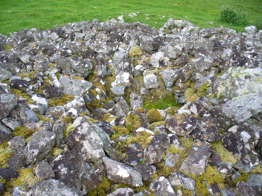
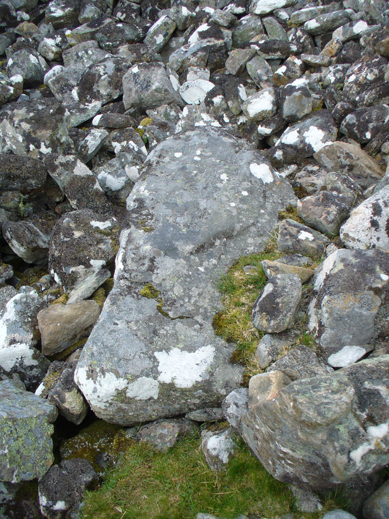
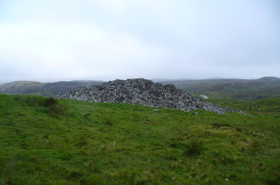
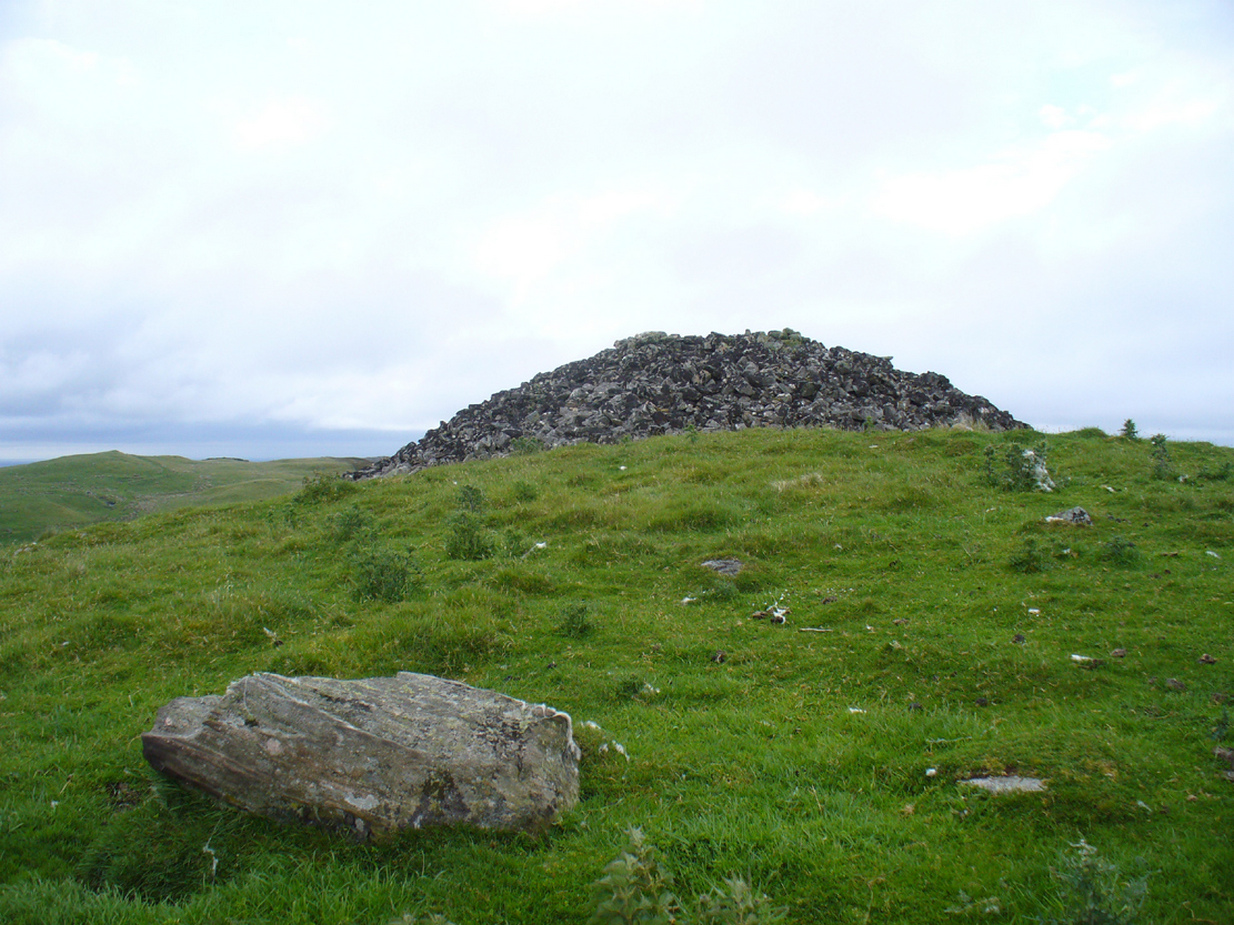
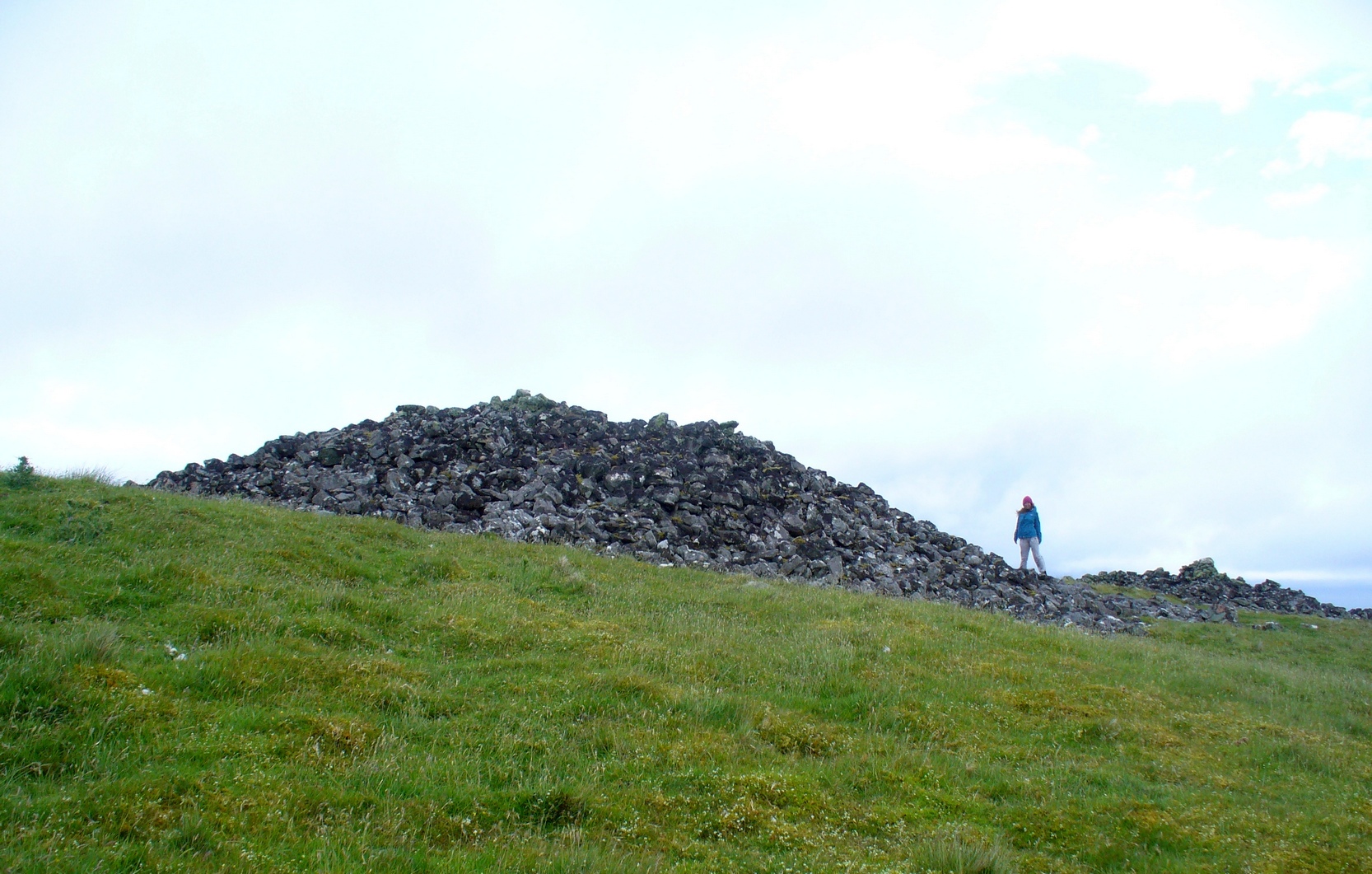
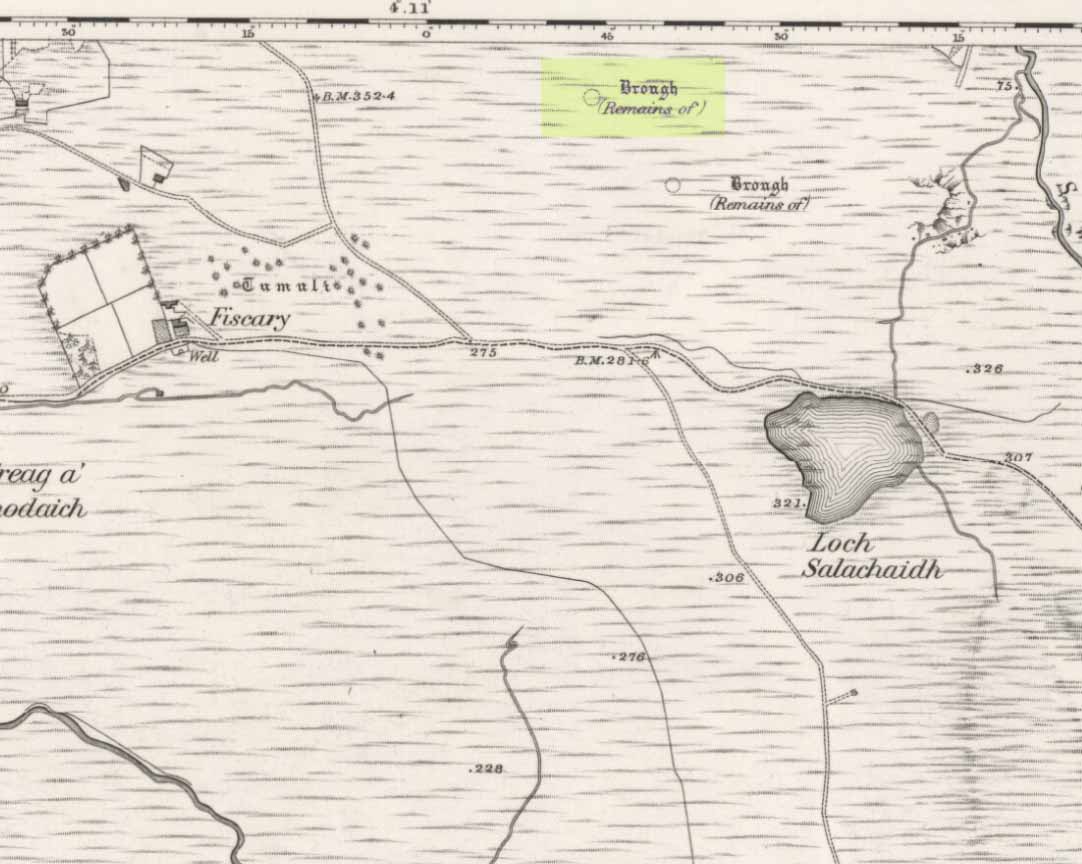
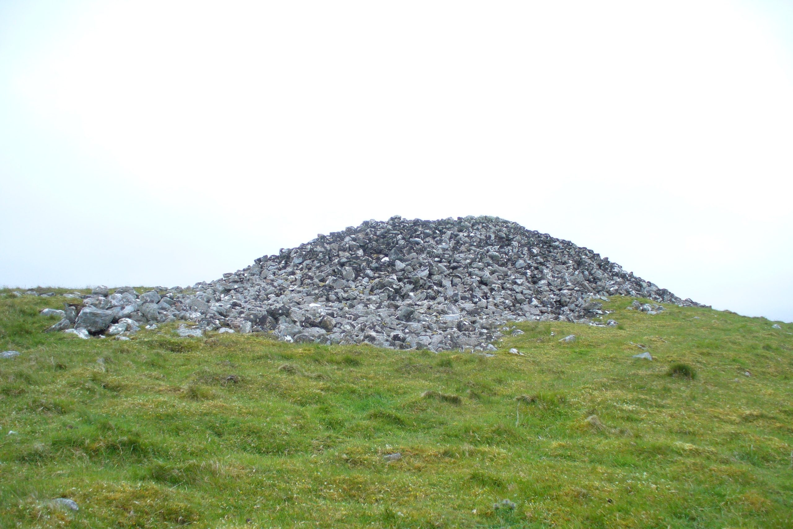
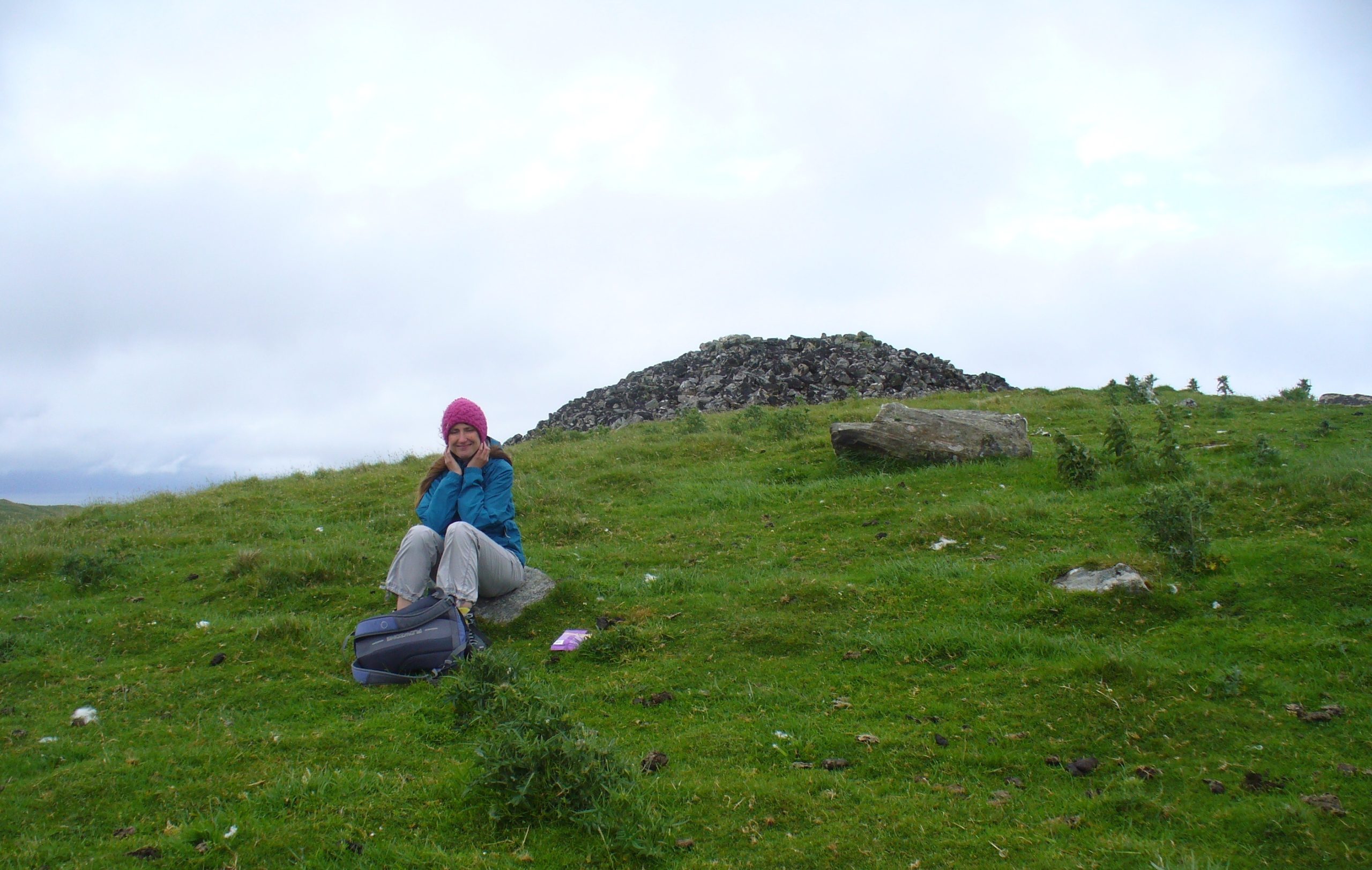
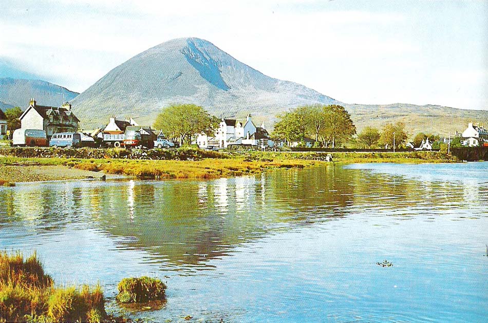
Beinn na Cailleach, Kylerhea, Skye

Sacred Mountain:  OS Grid Reference – NG 770 229

Also Known as:

  1. Beinn na Caillich

Getting Here

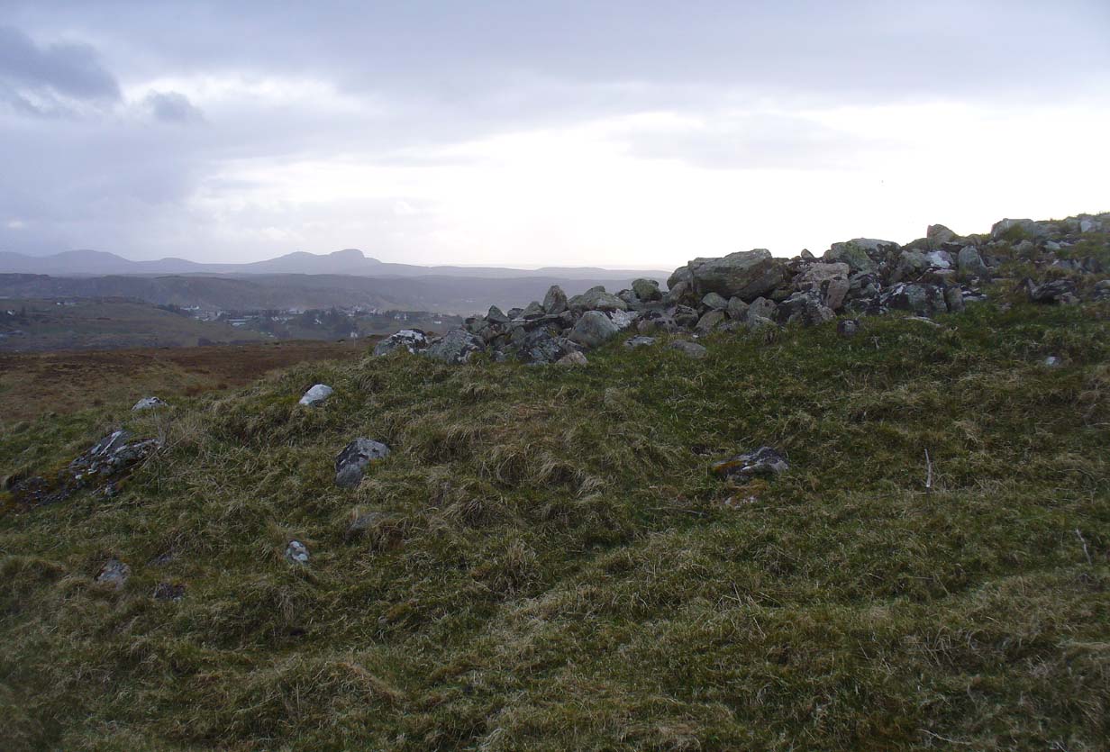
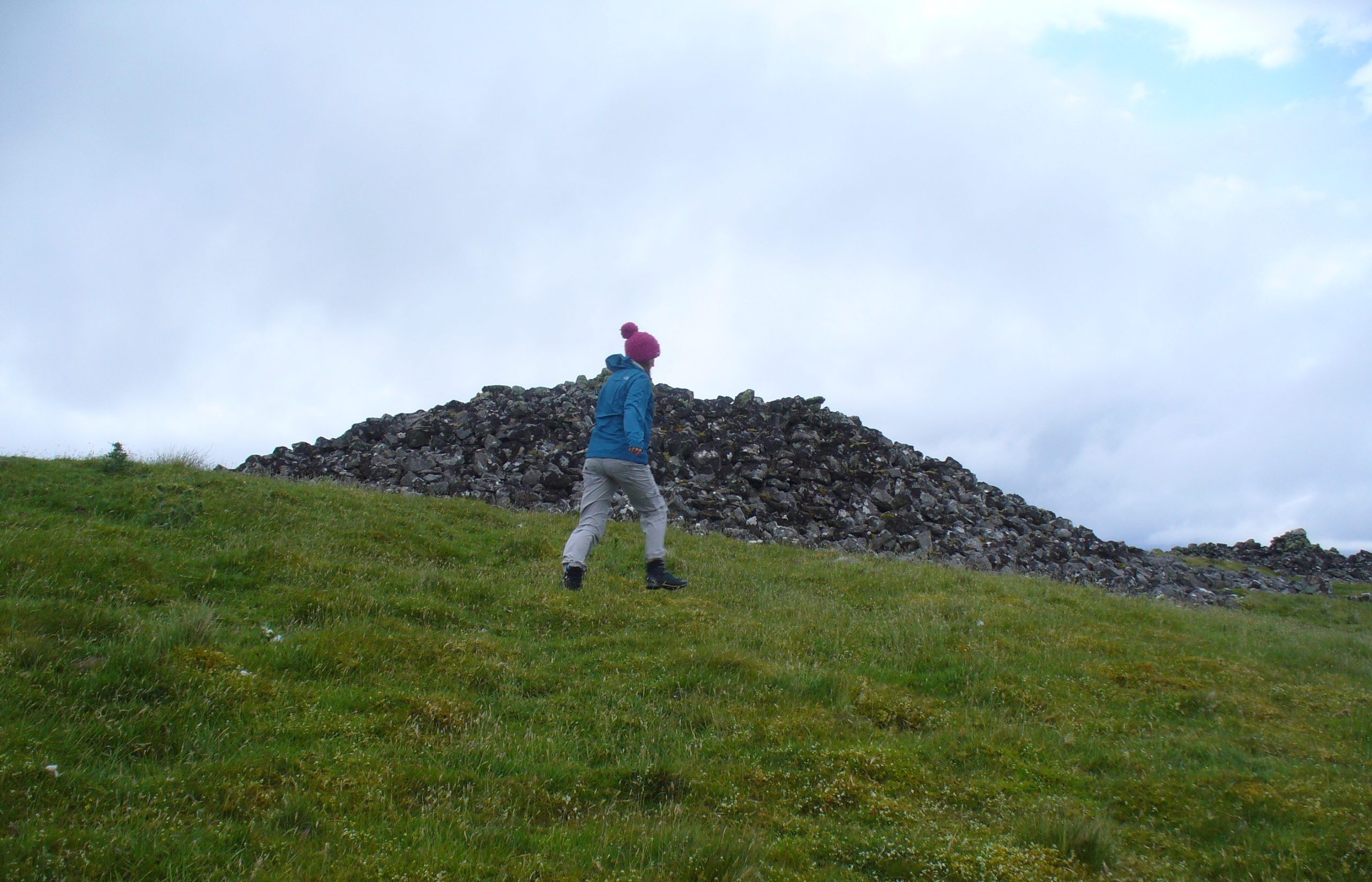
As you drive down the A87 road towards Broadford from the Kyle, just before Breakish there’s a small road on the left that runs down to Glen Arroch, where the forest lines the hill.  A couple of miles beyond the end of the forest, watch out for the TV mast on the slopes on the right-hand side of the road.  Stop here and go up the slopes on the left-side of the road (north), to the peak of Sgurr na Coinnich; and once here you’ll see the high rocky peak of Beinn na Cailleach a half-mile to your northeast.  

Folklore

The legend of this sacred mountain was described at some length in Otta Swire’s (1961) excellent work on the Isle of Syke.  She wrote:

“”As you drive down the road towards Broadford, three peaks can be seen to the north; the first two are Beinn na Greine (2,000 feet) and Scurr na Coinnich (2,401 feet); the third and most northerly is Beinn na Caillich (2, 396 feet). This last must not be confused with the Beinn na Caillich near Broadford, which is one of the Red Cuchullins although, just to make it more confusing, on the summit of our Beinn na Caillich, as on that of her larger sister, tradition has placed a woman’s grave. This time it is that of a giantess, one of the Fiennes: beneath her body is a large crock filled with gold and jewels, for she was a great lady, no less than Grainnhe herself, wife of Fionn, and at her burial every man of the Fiennes, for love of her and of their leader, cast their rarest jewels into the earthenware crock to do her honour. Her story, as is so usual in Celtic legend, is a sad one. Grainne is the daughter of the King of Morven and is reputed the fairest and truest princess in all Alban, so the Grey Magician, who hates all that is good, carries her off. One day, as Fionn and his men rest after hunting, an old, old woman, wrapped in the red mantle that denoted royal blood, comes to him, tells him of the theft of Grainnhe and begs him to rescue her. He agrees, whereupon she gives him a fir twig and three small pebbles, all highly magic; she then goes out of sight ‘on an eddy of the western wind, growing smaller as she went until she seemed no bigger than a butterfly, a honey bee, a red spider on a thin rope of its web, and a speck of dust in the sun’. Fionn sets out and after many adventures, during which he is assisted by several talking animals, he finds the Grey Magician’s palace and escapes with Grainnhe. Thanks to the old woman’s gifts, forests and mountains rise behind the fugitives, but before they can reach the Red river, to cross which is safety, the Magician overcomes the old woman’s charms. They reach the river bank only to find they cannot cross, and Fionn’s magic is exhausted. But Grainnhe has a jewel, a charm against death; as long as she wears it in her hair no evil can harm her; alternatively it will give her one wish and vanish. She takes it from her hair to wish for a boat and immediately sees, as in a vision, the fate to which she will condemn herself if she gives up her talisman. But Fionn is in peril through his efforts to save her, and already she loves him, so she lays the jewel on the water. A boat at once appears and takes them to safety.

Fionn and Grainnhe are married and live in great happiness until Grainnhe’s son is about to be born. Then come messengers to Fionn to tell him that sea-pirates are attacking his small dark-skinned allies, the Sons of Morna, who have sent to remind him of his pledge to assist them. Fionn longs to remain with Grainnhe but will not break his vow. He and his men spend three days defeating the sea-pirates and when he returns Grainnhe and her baby are gone, carried off by the Grey Magician. Fionn learns from his ‘tooth’ that she has been turned into a hind. He searches for her for many years, but she has been sent to run with the deer in lone Glen Affaric and he never finds her. Twelve years later, when the Fiennes are hunting, their hounds pick up a scent and follow it to a small copse; Bran, who is leading, is the first to enter it, whereupon, to the surprise of all, he turns at bay, teeth bared against the Fiennes and his fellow hounds of the pack and will allow no one but Fionn to pass him. Fionn finds him guarding a wild boy, with long hair and wild, beautiful, frightened eyes, who can make only such sounds as deer make. Fionn adopts him and teaches him human speech. Needless to say, he is Grainnhe’s son, but Grainnhe, the beautiful white hind of whom her son talks, is never found. After her death the Grey Magician permits her son to take her body, once more that of a woman, for burial, and the Fiennes make her grave on the summit of Beinn na Caillich, where she once ran as a hind.

It is recounted of this boy that he had in the centre of his forehead a tuft of deer’s fur where his mother’s tongue had licked him, and that it was from her that he got his gift of poetry. Once he was shipwrecked on Fladda and a party of hunters on the island offered him a share of their venison stew, to whom he made indignant reply: ‘When everyone picks his mother’s shank-bone, I will pick my mother’s slender shank-bone.’  The boy was Ossian.”

References:

  1. Bernbaum, Edwin, Sacred Mountains of the World, Sierra Club: San Francisco 1990.
  2. Swire, Otta F., Skye: The Island and its Legends, Blackie & Sons: Glasgow 1961.

© Paul BennettThe Northern Antiquarian 


Beinn na Cailleach, Broadford, Skye

Sacred Mountain:  OS Grid Reference – NG 601 232

Getting Here

Seems rather daft giving directions for a mountain, but… For incomers, cross the bridge onto the island and keep on the A87 road to Broadford.  A couple of mile the other side of the village westwards, take the small left turn in the trees and go to the dead-end.  The hill reaching up above you (west) is the legendary mountain to walk up!

Folklore

Beinn na Cailleach

This giant old mountain has been associated with the primal female creation figure, the cailleach, for many a moon. And strangely – for me anyway – I’ve not ventured to sleep with this old place in my passings here as I usually do wherever the cailleach resides.

It doubtless has many more tales than the one A.A. MacGregor (1937) mentions in his superb Peat-Fire Flame.  Here he tells the story of,

“the cairn situated on the summit of Beinn na Cailleach, not far from Broadford… This cairn is believed to mark the site of burial of a Norse princess who died at Ord. On her deathbed this princess commanded her attendants to convey her, when dead to the top of Beinn na Cailleach, and to bury her there, in order that she might lie in the wake of the winds from Norway.”

MacGregor then follows the tale with a lovely note on some boring old dood he obviously had little respect for, saying:

“It is the traditions associated with this cairn that MacCulloch, the geologist, in his Description of the Western Isles of Scotland, asks to be excused from repeating, since he considers them, one and all, to be unworthy of regard. But, then, MacCulloch was a most tiresome fellow; and he seems to have imbued most of his writings with something of the same tiresomeness”!

On the lower northeastern slopes of this great mountain we find another of the old woman’s abodes, the ‘Lochain Beinn na Cailleach’, where this great hag would no doubt wash her linen, as many old myths tell she did at other pools of the same name.

A slightly different version of the folktale was told by Archibald Geikie in his Note-book of a Field Geologist from 1858:

“The top of Beinn na Cailleaich is flat and smooth, surmounted in the centre by a cairn. Tradition tells that beneath these stones there rest the bones of the nurse of a Norwegian princess. She had accompanied her mistress to “the misty hills of Skye,” and eventually died there. But the love of home continued strong with her to the end, for it was her last request that she might be buried on the top of Beinn na Cailleaich, that the clear northern breezes, coming fresh from the land of her childhood, might blow over her grave.”

An early essay in the Gentleman’s Magazine in 1841 tells the grave atop of the mountain to have been the resting place of the Norwegian King Haco’s wife or his nurse. Derek Cooper (1970) meanwhile told us that whilst the cairn was “erected as a memorial to a Skye chieftain,” the cailleach of the mountain, or “the old woman is reputedly Saucy Mary, who laid a chain between Kyle and Kyleakin to exact toll from passing ships.”

There are other mythic place-names scattered around the edges of this mountain with hints of ancient female deities, or pagan goddesses — whichever way one cares to see them.

References:

  1. Cooper, Roy, Skye, Routledge: London 1970.
  2. Geikie, Archibald, The Story of a Boulder, MacMillan: London 1858.
  3. MacGregor, Alisdair Alpin, The Peat-Fire Flame: Folk-Tales and Traditions of the Highlands and Islands, Ettrick Press: Edinburgh 1937.
  4. o’ Crualaoich, Gearoid, The Book of the Cailleach, Cork University Press 2003.
  5. Swire, Otta F., Skye: The Island and its Legends, Blackie & Sons: London 1961.

© Paul BennettThe Northern Antiquarian


Fiscary (4), Farr, Sutherland

Cairn:  OS Grid Reference – NC 72858 62620

Also Known as:

  1. Canmore ID 6437

Getting Here

Approaching Fiscary 4, north

Approaching Fiscary 4, north

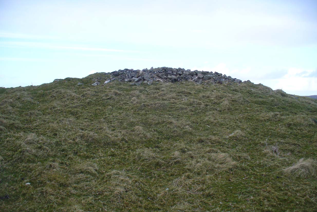
A mile east of Bettyhill on the A836 road, watch for the large piles of rocks up on the hill on your left (north).  Turn left on the tiny road past the first house for 150 yards and then on the track past the sheep-fanks through the gate and up the small hill.  The cairn is the smallest of the pile of rocks in front of you.

Archaeology & History

Of the four giant cairns clustered here at Fiscary, a mile east of Bettyhill, this one has received the least attention.  It is found amidst a massive cluster of archaeological remains running from the 19th century all the way back into the neolithic period. Quite impressive!

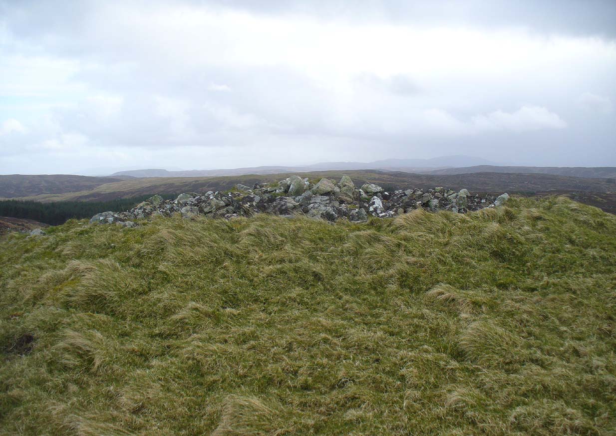
Sitting on top of the cairn the view is impressive: looking 360º with the Orkney islands s to the northeast, Durness and the rising mountains west and southwest, and endless craggy moorlands peppered with lochans driving in all directions to the south countless miles away.  This panorama of wilderness is something to behold…

Looking west out to sea

Looking west out to sea

Looking southwest

Looking southwest

The tomb itself, with the acceptable scatter of fallen rocks to the edges, is nearly 50 yards in circumference, measuring more than 12 yards east-west and nearly 14 yards north-south, with the Earth covering the older rocks to the edges with more and more vegetation as the years pass.  It stands about 5-6 feet high with the typical internal mass of thousands of stones making up the cairn.  No known excavations have ever been made here.

In the otherwise superb Royal Commission (1911) survey of Sutherland, they only had scant information to say about this tomb, telling that,

“The fourth cairn…measures 28′ to 30′ in diameter and is about 6′ high.  There are no signs of chambers visible and the cairn has been a good deal dilapidated.”

Even when R.J. Mercer (1981) came to give this area greater attention, he passed by the Fiscary 4 cairn with equal brevity, noting simply its dimensions, elevation above sea level and the fact that it is a “circular cairn on crest of hill.”

The tombs of Fiscary 12 and 3 are very close by some beginning some 257 yards (235m) to the east.  I cannot recommend this entire complex highly enough!

References:

  1. Henshall, Audrey S., The Chambered Cairns of Sutherland, Edinburgh University Press 1995.
  2. Mercer, R.J. & Howell, J.M., Archaeological Field Survey in Northern Scotland – volume 2, University of Edinburgh 1981.
  3. o’ Reilly, Kevin & Crockford, Ashley, What to See Around Bettyhill, privately printed 2009.
  4. Royal Commission on Ancient & Historical Monuments, Scotland, Second report and inventory of monuments and constructions in the county of Sutherland. HMSO: Edinburgh 1911.

© Paul Bennett,  The Northern Antiquarian 2016
Fiscary (3), Farr, Sutherland

Cairn:  OS Grid Reference – NC 73222 62484

Also Known as:

  1. Canmore ID 6446
  2. Pict’s House

Getting Here

Fiscary 3 giant cairn, looking west

Fiscary 3 giant cairn, looking west

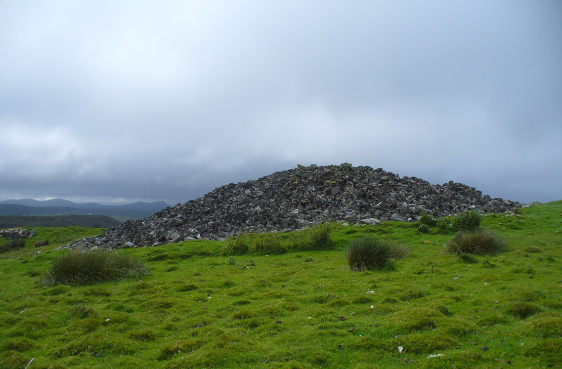
Along the A836 road from Bettyhill to Thurso, a mile east of the village keep your eyes peeled to your left (or to the right if you’re coming the other way!), looking north, and you’ll see some very large piles of stones a few hundred yards away. Go through the gate onto the rough grasslands and the first one you reach is the cairn in question. Y’ can’t miss it!

Archaeology & History

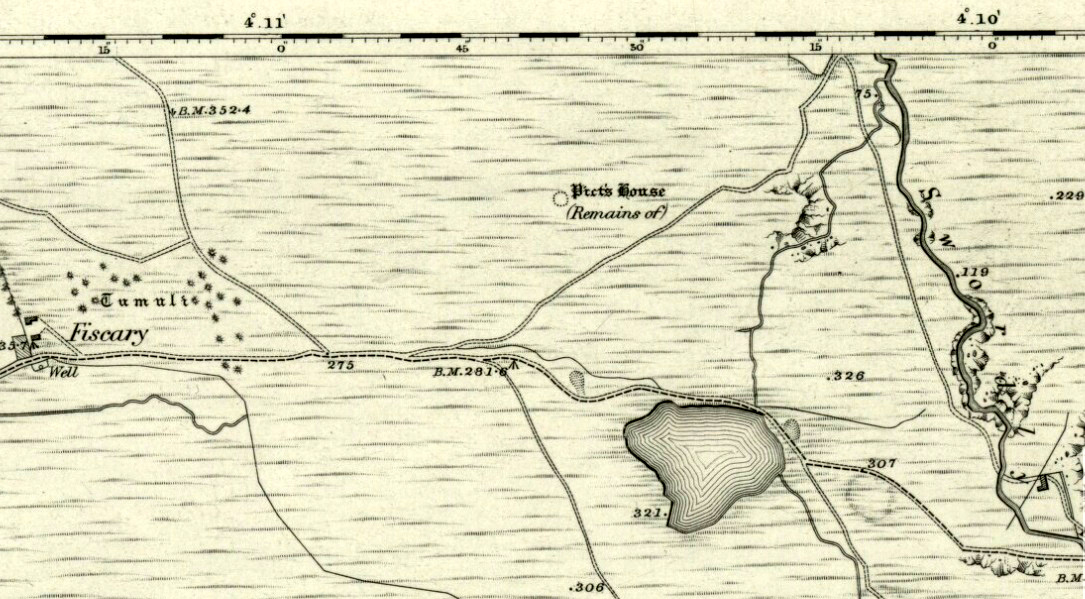
On 1878 OS-map as Picts House

On 1878 OS-map as Picts House

Close to the Fiscary 1 and Fiscary 2 tombs, this is the third and southernmost of the three giant cairns on this moorland hillside and is the second largest of the trio.  Curiously it was the only one highlighted by the Ordnance Survey lads in their cartographic analysis here in 1873—they somehow missed the others—when they told it to be a ‘Pictish House’, or broch.  A few years later when the Royal Commission (1911) fellas got their noses up here, they said that this,

“which is the most easterly, is circular in form, is about 68ft in diameter, and 15ft 6in to the apex, on which a small pile of stones has recently been erected.  The cairn does not appear to have been excavated, but the stones in several places have been pulled out, probably in attempts to discover the chambers or in pursuit of rabbits.”

Looking into its centre

Looking into its centre

Long stone at southern edge

Long stone at southern edge

Considering the size of this giant cairn and its close association with is neighbours 150 yards northwest, I’m surprised at the lack of attention it’s been given.  Within the collapse of stones on its southern-side we find an elongated stone which seems to have stood upright at some point in the past, either at the very edge of the cairn, or just inside it.  It may even have been a covering stone to a collapsed entrance, but without an excavation we’re not gonna know for certain.

The fact that this cairn is on the slopes south of the crowning cairns of Fiscary 1 and Fiscary 2 implies that this was built some centuries later than them.  Also notable here is that the view to the north is blocked and we are instead only looking across a panorama east, south and west.

Folklore

Looking across into the east

Looking across into the east

Local tradition told that this was a Pict’s house, or broch (it may well have been) and is shown as such on the first Ordnance Survey account of the region in 1878.  Otta Swire (1963) told that this landscape was once peopled by giants who made the land and played a part in the creation of some of the giant tombs around here.  One time local school-teacher at Bettyhill, Alan Temperley (1977) also told us how the fairy folk lived close to the giant tombs of Fiscary.

References:

  1. Gourley, Robert, Sutherland: An Archaeological Guide, Birlinn: Edinburgh 1996.
  2. Henshall, Audrey S., The Chambered Tombs of Scotland – volume 1, Edinburgh University Press 1963.
  3. Henshall, Audrey S., “The Distant Past,” in The Sutherland Book (edited by Donald Omand), Northern Times: Golspie 1991.
  4. Henshall, Audrey S., The Chambered Cairns of Sutherland, Edinburgh University Press 1995.
  5. Lelong, Olivia C., “Writing People into the Landscape: Approaches to the Archaeology of Badenoch and Strathnaver,” University of Glasgow 2002.
  6. o’ Reilly, Kevin & Crockford, Ashley, What to See Around Bettyhill, privately printed 2009.
  7. Royal Commission on Ancient & Historical Monuments, Scotland, Second report and inventory of monuments and constructions in the county of Sutherland. HMSO: Edinburgh 1911.
  8. Sutherland, George, Folk-lore Gleanings and Character Sketches from the Far North, John o’ Groats Journal: Wick 1937.
  9. Temperley, Alan, Tales of the North Coast, Research Publishing Company: London 1977.

Acknowledgments:  HUGE thanks to Aisha Domleo and for getting me up here.

© Paul BennettThe Northern Antiquarian

Fiscary (2), Farr, Sutherland

Chambered Cairn:  OS Grid Reference – NC 73112 62604

Also Known as:

  1. Canmore ID 6445
  2. Carn Chaoile

Getting Here

A mile east of Bettyhill along the A836 road, watch out for the large piles of rocks up on the hill on your left (north).  Go through the gate, past the Fiscary 3 cairn and 150 yards northwest you’ll reach the crowning cairn on the hilltop itself – the Fiscary 2 cairn.

Archaeology & History

Fiscary 2 cairn, looking NW

The second of the three giant chambered cairns on this moorland hillside is the largest (only just!) of them all.  Positioned right on top of the small hill, this great mass of rocks stands out from the roadside a quarter-mile to the south quite blatantly, yet it somehow evaded the eyes of the early Ordnance Survey lads in their visit here in 1873 (though the nearby Fiscary 3 cairn was plotted).  Odd…

Aish by the side o’ the cairn

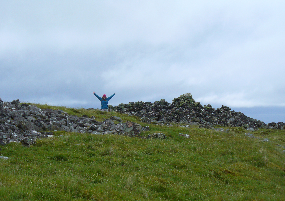
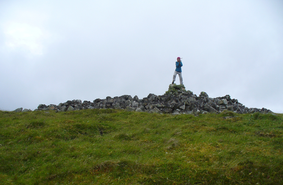
When I came here with Aisha and her clan a few weeks ago Nature was blasting us with full gales and so half her bunch returned after a short while, leaving us to get thrown about in the winds!  Even just trying to stand upright on this and its associated tomb proved difficult.  But despite this and the low grey clouds—typical of northern Scottish weather—it was obvious that the views from here would be superb, seeing far into the distance with a 360º view.  I have little doubt that other important prehistoric sites would be speaking with this giant neolithic cairn, but there is nothing in the archaeology accounts to help us on such matters.

The giant tomb is almost linked to its companion—Fiscary 1—by a low scatter of rocks running between them, with only a yard or two separating their disturbed masses.  Several archaeology students have posited that the two seemingly separate sites were, many thousands of years ago, perhaps one elongated chambered tomb, just like the ones found nearby at the Coille na borgie and Long Skelpick cairns; but it seems unlikely in this case…

Fiscary (2) on 1908 map
Fiscary (2), looking SE

Although Adam Gunn (1893) mentioned the “four large cairns” at Fiscally (the fourth and smallest is 262 yards to the west), the first real description I can find of the place comes from an article by a local man called Cathel Kerr (1892) who told us it was “about 220 feet in circumference, and 15 or 16 in height”; but most of his article dealt with his excavation into the adjacent Fiscary 1 tomb, which he noticed was connected by a stone platform that ran between the two sites.  This was the first mention of such a connecting platform—and a curious feature it is indeed.  When the Royal Commission lads came here in May 1909 they also noted this connecting platform.  They found that the cairn itself,

“does not appear to have been excavated.  It is circular with a diameter of about 52ft and is some 10ft high to the top of the modern pile of stones on its apex.  It presents a peculiar feature.  At the north end is clearly visible a broad platform of stones extending to a distance of 25ft from the base of the cairn and, though largely overgrown with turf, traceable by the outline of stones almost entirely around it.  This platform has been described as a neck connecting the two cairns (Fiscary 1 and 2, PB), but in reality it stops 7ft distant from the adjacent cairn.”

In strong gales at Fiscary 2
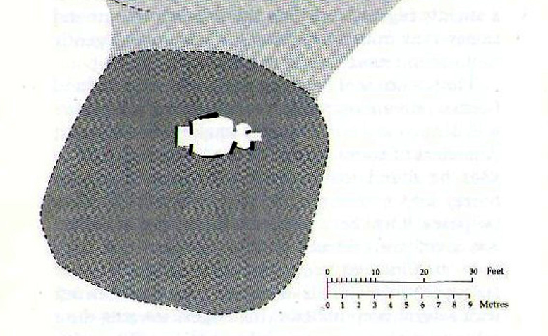
Henshall’s plan of Fiscary 1 & 2

Indeed, this “platform” seems to have been either deliberately constructed with the hilltop cairn positioned on top of it, or has been set around the tomb.  It’s difficult to say with any certainty without further excavation.

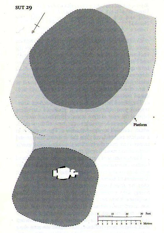
The great Audrey Henshall (1963; 1995) wrote extensively about this ancient monument in her works, finalizing her site entry in The Chambered Cairns of Sutherland (1995).  After describing in some detail the obvious archaeological association this site has with Fiscary 1, she gave us a detailed description on this one and wrote:

“The larger south cairn (Fiscary 2, PB) is bare, steep-sided, and has been little disturbed.  The diameters are between 19.5 to 21.5m, and the height is 5.5m measured from the NW.  The edge is clear for about half of the circuit.  The surrounding platform is quite low and is partly covered with peat and deep heather which in places obscure the edge.  The platform varies in width from 4.8 to 7.3m.  On the SE side the cairn edge is clear and there is no sign of the platform.  It appears on the NE side where it is largely free of heather, and the cairn material merges into its stones.  This part of the platform is edged by a rough kerb which fades away westwards into the spread of stones which links the two cairns.  In the area between the cairns the stones are mainly covered by peat on which grow turf and heather.  The spread of stones appears to be thin, but on the NW side of the cairn, where there is evidently a drop in ground level, breaks in the peat cover show that here the stone spread has considerable depth.  Round the W side the platform is heather-covered, and along the SW part, where the hill drops away steeply, there is a rough kerb at a lower level than elsewhere, within which the surface of the platform rises to the base of the cairn.  The S end of the platform, which here is bare stones, seems to turn sharply towards the S edge of the cairn, though the actual edge of the platform is indefinite.”

The likelihood is that this cairn is the oldest of the cluster of three found here, most likely constructed in the neolithic period.  Its position in the landscape would indicate that the site would have been built to commemorate the spirit of a local tribal elder, a King or Queen.  It’s a superb site and I’ll be visiting it again very soon indeed!

Folklore


Bouncy elven sprite flies by

The folklorist Otta Swire (1963) told that this region was once peopled by giants who created the landscape itself around here (a common attribute of giants the world over), and they also played a part in the creation of this and other giant tombs in the area.  The one time local school-teacher at Bettyhill, Alan Temperley (1977), also told us that the fairy folk lived close to the giant tombs of Fiscary.

References:

  1. Gourley, Robert, Sutherland: An Archaeological Guide, Birlinn: Edinburgh 1996.
  2. Gunn, Adam & Mackay, John, Sutherland and the Reay Country, John Mackay: Glasgow 1893.
  3. Henshall, Audrey S., The Chambered Tombs of Scotland – volume 1, Edinburgh University Press 1963.
  4. Henshall, Audrey S., “The Distant Past,” in The Sutherland Book (edited by Donald Omand), Northern Times: Golspie 1991.
  5. Henshall, Audrey S., The Chambered Cairns of Sutherland, Edinburgh University Press 1995.
  6. Kerr, Cathel, “Notice of the Excavation of a Chambered Cairn in the Parish of Farr, Sutherlandshire,” in Proceedings Society of Antiquaries, Scotland, volume 26, 1892
  7. Lelong, Olivia C., “Writing People into the Landscape: Approaches to the Archaeology of Badenoch and Strathnaver,” University of Glasgow 2002.
  8. o’ Reilly, Kevin & Crockford, Ashley, What to See Around Bettyhill, privately printed 2009.
  9. Sutherland, George, Folk-lore Gleanings and Character Sketches from the Far North, John o’ Groats Journal: Wick 1937.
  10. Temperley, Alan, Tales of the North Coast, Research Publishing Company: London 1977.

Acknowledgments:  To the beautiful Aisha Domleo, for her images, bounce, spirit and madness – as well as getting me up to see this cluster of sites. And a Huge thanks for use of the Ordnance Survey map in this site profile, reproduced with the kind permission of theNational Library of Scotland

© Paul BennettThe Northern Antiquarian

Fiscary (1), Farr, Sutherland

Chambered Cairn:  OS Grid Reference – NC 73102 62629

Also Known as:

  1. Canmore ID 6445
  2. Carn Chaoile
  3. SUT 29 (Henshall)

Getting Here

Fiscary 1 cairn - from Fiscary 2

Fiscary 1 cairn – from Fiscary 2

A mile east of Bettyhill on the A836 road, watch for the large piles of rocks up on the hill on your left (north).  Go through the gate, past the Fiscary 3 cairn and 150 yards northwest you’ll reach the crowning cairn of Fiscary 2 on the hilltop itself.  Fiscary 1 is just a few yards in front of you.

Archaeology & History

Although this is the smallest of the Fiscary cairns, it is the one that has had been investigated more than the others in this cluster—and you can tell as it’s been dug into.  However, saying that, when Aisha and me were here a few weeks ago, the wind was blowing with such strength that we could give it little more than a cursory overview, as we were both getting blown about like a pair o’ puffters in the gale that was raging in from the sea!  Twas quite overwhelming…

Fiscary 1 to the rear

Fiscary 1 to the rear

One of the first things you notice is how this cairn is inextricably linked, both physically and otherwise, to its close partner on the hilltop only yards away: the Fiscary 2 cairn.  Fiscary 2 reaches outwards towards where we now stand—slightly below the larger tomb immediately north (the airt of Death itself): almost as if an ancient Queen and Her King were resting still hand-in-hand in their respective burial sites.

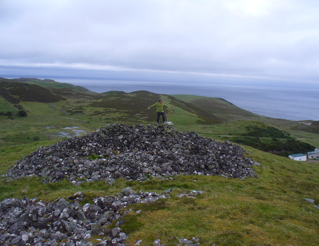
Aisha on top!

Aisha on top!

…And although such romance may seem nothing more than that, recall that we are probably looking at two giant archaic monuments whose birth emerged in the neolithic: when time was measured by night, not day; when the Moon was Prima Mater’s aide and portender; and patriarchy had yet to be borne…. Giant hilltop cairns were the places of our ancient shaman-kings, queens and tribal elders, whose integral relationship with the cycles of the world to which we are (still) bound, were culturally very different in some fundamental ways, before rites of passage were disposed of…. But I’m moving away from the modern history of the Fiscary tomb…. Soz!

Around the time when some of the indigenous northerners up here were seeing the fading lights of their animistic cosmology disappear into the emergence of ‘history’, when the traditional tales were ebbing, Fiscary 1 was at least being written about—albeit in a detached way, as a museum piece, a piece of architecture.  It’s the way things have become.  The tomb was excavated by a local man called Cathel Kerr in the latter half of the 19th century, although he reported that it had already been dug into a few years earlier.  Kerr told that some of the stones had been taken by an unnamed local for building purposes (not good!).  “It had been opened from the top” he said—continuing:

“and there was abundant evidence around the cairn, that large slabs of stone had been removed from the interior.  A little observation showed that there was the appearance of an internal chamber… The…cairn is about 150 feet in circumference and about 9 or 10 feet in height, and between it and (Fiscary 2) there is what seems to me to be a neck of stones joining the two cairns… Most of the neck joining the two cairns is covered over with turf, but a very slight observation reveals the fact that underneath it the mass of stones is continuous.  The apparent depth of stones is from 3 to 4 feet. It is most unlikely that this neck could have been formed by stones falling from the top of the cairns.

“The chamber, when opened, proved to be tripartite.  The entrance is from the west or northwest side, between two upright stones, with a large heavy slab thrown across them.  The passage is only 3 or 4 feet long, and about 3 feet high, and nearly the same in width.  This leads into a small chamber measuring about 6 feet by 3 feet.  In front of it, on the north side, a large upright slab projects, and helps to form part of the end of the inner chamber and a division between the two on the south side.  In all likelihood the stone corresponding to that one has been removed, so that there is nothing to mark the division between the chambers on that side.  The larger chamber measures 6 feet 4 inches by 7 feet 9 inches.  The sides are made up of large upright slabs and masonry, built up between the slabs.  The corners are all rounded and there is the appearance of vaulting by the stones overlapping one another.  The height of this chamber at present is about 5 feet.  The end of the chamber is made up by two upright stones, with nearly 2 feet of an entrance between them, leading into the innermost chamber.  This chamber is a very irregular oblong; indeed the ends are rounded.  On an average it is 5 feet 9 inches long, by 33 inches wide, and 3 or 4 feet in height.  It had the appearance of being covered over with slabs, some of which stood on edge inside; but of this I am not very sure, as the roofing of all the chambers has been interfered with.

“Inside there lay on the floor a large quantity of broken stones and black earth.  Underneath there was what seemed a mixture  of ashes and earth, with numerous pieces of charred wood, but no charred bones as far as I could see.  Underneath that layer there was ordinary gravel.  I found some fragments of bones on the innermost part, and some in the larger chamber.  They do not appear to me to be of very great antiquity.  A small vitrified mass was found on the floor.”

When the Royal Commission (1911) lads turned up to see the site in 1909 they reported—in a rather exaggerated manner—that the cairn “is now completely destroyed” and then in the next sentence said,

“The chamber is half filled-up with debris and only two or three large slabs remain, the others having disappeared.  Its diameter has been about 46ft, and its height 4ft to 5ft.”

If the Royal Commission believe that’s an example of something being “completely destroyed”, they should turn their eyes and attention to sites like the Nixon’s Station cairn on top of Ilkley Moor which, when I was young, was larger than any of the Fiscary cairns; but somehow under the watchful eyes of the regional archaeologists in the 1980s and ’90s, was levelled to the ground – i.e., properly destroyed!

Audrey Henshall's ground plan

Audrey Henshall’s ground plan

In more recent years the cairn has received the honourable attention of the great Audrey Henshall (1963; 1995) who, in her updated site profile of Fiscary 1, told us not much more about the site than her predecessor Kerr.  Contextualizing the place with its partner Fiscary 2 and the platform upon which it rests, she wrote:

“The paired cairns appear to be independent structures 8.5m apart, though a platform extending beyond the base of the south cairn, which has no internal features exposed, spreads to the base of the north cairn, which contains a ruined chamber… The north cairn is of bare angular stones with turf and heather only encroaching over the edges.  Its limits are well-defined and give a roughly square plan with short diameters of 16.5m… Kerr exposed the roofless tripartite chamber, and most of the structure which he recorded was visible in 1955 (Henshall 1963).  Less could be seen in 1992 as the chamber had been largely filled by loose stones…”

Much like the situation as it is today.  More recently a small pile of stones has been added to the top of the cairn, from whence the view is excellent to the north, east and west.  The larger Fiscary 2 cairn blocks the view directly south.

Folklore

Otta Swire (1963) not only told that this landscape was once peopled by giants who made the land and played a part in the creation of some of the giant tombs around here.  The one time local school-teacher at Bettyhill, Alan Temperley (1977), also told us that the fairy folk lived close to the giant tombs of Fiscary.

References:

  1. Eliade, Mircea, The Myth of the Eternal Return, RKP: London 1955.
  2. Gourley, Robert, Sutherland: An Archaeological Guide, Birlinn: Edinburgh 1996.
  3. Gunn, Adam & Mackay, John, Sutherland and the Reay Country, John Mackay: Glasgow 1893.
  4. Henshall, Audrey S., The Chambered Tombs of Scotland – volume 1, Edinburgh University Press 1963.
  5. Henshall, Audrey S., “The Distant Past,” in The Sutherland Book (edited by Donald Omand), Northern Times: Golspie 1991.
  6. Henshall, Audrey S., The Chambered Cairns of Sutherland, Edinburgh University Press 1995.
  7. Kerr, Cathel, “Notice of the Excavation of a Chambered Cairn in the Parish of Farr, Sutherlandshire,” in Proceedings Society of Antiquaries, Scotland, volume 26, 1892
  8. Lelong, Olivia C., “Writing People into the Landscape: Approaches to the Archaeology of Badenoch and Strathnaver,” University of Glasgow 2002.
  9. o’ Reilly, Kevin & Crockford, Ashley, What to See Around Bettyhill, privately printed 2009.
  10. Royal Commission on Ancient & Historical Monuments, Scotland, Second report and inventory of monuments and constructions in the county of Sutherland. HMSO: Edinburgh 1911.
  11. Sutherland, George, Folk-lore Gleanings and Character Sketches from the Far North, John o’ Groats Journal: Wick 1937.
  12. Temperley, Alan, Tales of the North Coast, Research Publishing Company: London 1977.

Acknowledgments:  Huge thanks to beautiful Aisha Domleo again, for help with some of the photos – and adding your elegant spirit and energy to the place – as well as getting me up here in the first place! 

© Paul BennettThe Northern Antiquarian

Gough’s Barrow, Long Compton, Warwickshire

Tumulus (destroyed):  OS Grid Reference – SP 2946 3090

Archaeology & History

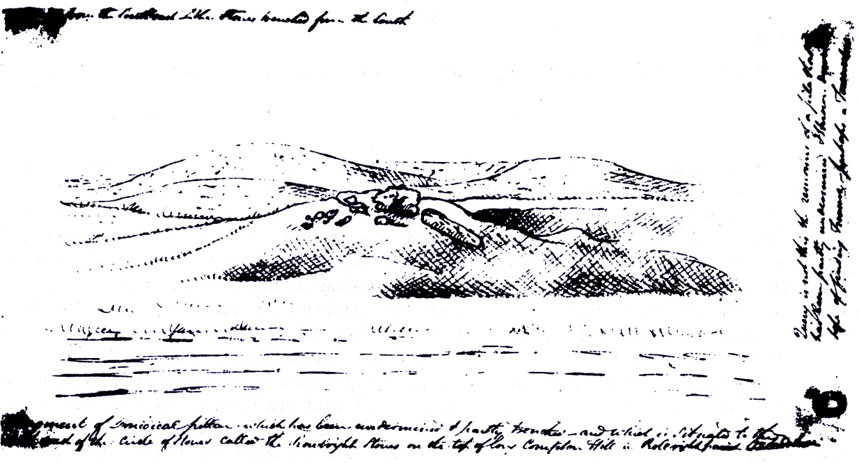
Only known drawing of Gough’s Barrow

In days of olde there were heathen sites around the edges of the beautiful Rollright Stones complex that have sadly fallen prey to the intensive agriculture of more modern ‘civilized’ times.  It’s become the way of things….. One site of importance in this geomythic  pantheon was the ‘Gough’s Barrow’—so named after a drawing was done of the site by Richard Gough, editor of the 1789 edition of Camden’s Britannia.  As far as I’m aware, it is the only one ever done of this monument.  The Oxford archaeologist George Lambrick (1988) saw “every reason to accept the position and details of the barrow”, upon which stood at least two large stones—one of which gained the description of a ‘druidical pillar.’

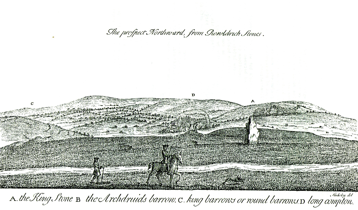
Stukeley's 1743 drawing

Stukeley’s 1743 drawing

The same barrow may have been recorded in one of drawings of the great William Stukeley, who visited the Rollright Stones in 1710 and then again in 1723.  On the left-side of the adjacent drawing you can see a denuded mound close to the edge of the picture, similar in shape and form to that drawn by Richard Gough.  It is probably the same tumulus or barrow.  Trial excavations at the site in 1983 looked for any remains of the old tomb, but nothing significant was uncovered.  Lambrick estimated that the site probably measured “about 18m wide and 20m long east-west,” and “was a megalithic barrow and was therefore probably Neolithic in origin.” 

References:

  1. Bennett, Paul & Chanter, James, The Complete Rollright Stones, forthcoming
  2. Bennett, Paul & Wilson, Tom, The Old Stones of Rollright and District, Cockley Press: Chipping Norton 1999.
  3. Burl, Aubrey, Great Stone Circles, Yale University Press 1999.
  4. Lambrick, George, The Rollright Stones, English Heritage 1988.
  5. Peters, Frances, “An Antiquarian Visit to the Rollright Stones,” in Wiltshire Archaeological & Natural History Magazine, volume 94, 2001.
  6. Stukeley, Willliam, Abury – A Temple to the British Druids, London 1743.

© Paul Bennett, The Northern Antiquarian

Lady’s Well, Blythborough, Suffolk

Healing Well:  OS Grid Reference – TM 450 762

Also Known as:

  1. Wishing Well
  2. Queen Ann’s Well
  3. Lady’s Fountain

Getting Here

The site is found down Spring Lane at the south end of Henham Park. The current A145 meeting the A12.

Archaeology & History

A large structure is a brick and stone arch and which has two low seats inside, giving the alternative name of Tramp’s or Traveller’s Rest having also brass cups attached to the structure for anyone wishing to drink there. The age of the fabric has said to be mainly 1780, although one view was that it was erected by the first Countess of Stradbrooke in the 19th century and may be that recorded in 1833 in the poem ‘Lady’s Fountain’ poem by Agnes Strickland (the alternative name Lady coming from the Lady Strickland).  Another view is that some of the fabric is 13th century in origin.   The structure is now dry and overgrown, apparently last having water in the 1900s.

ladyswell1

Folklore

The spring is said to be near the reputed to be the place of King Onna’s death (654 AD). This was the battle of Bulcamp where Onna was chased by the Pagan Penda along Kings Lane, a lane which cuts through nearby parishes of Sotherton, Henham and Blyford to here were they stood their ground and he and his son Firminus were killed and buried. The well being erected where the king’s body fell. The legend clearly explains the site’s other alternative name of Queen Anne’s well…Anne being close enough to Onna to be semantically changed over time, and misrepresented as a Queen rather than a King!

References:

  1. R.B. Parish, Holy wells and healing springs of Suffolk (in publication)

Links:

  1. Holy & Healing Wells – A Suffolk Field Trip


Priest’s Well, Tullibody, Clackmannanshire

Holy Well:  OS Grid Reference – NS 86069 95324

Also Known as:

  1. Canmore ID 47056

Getting Here

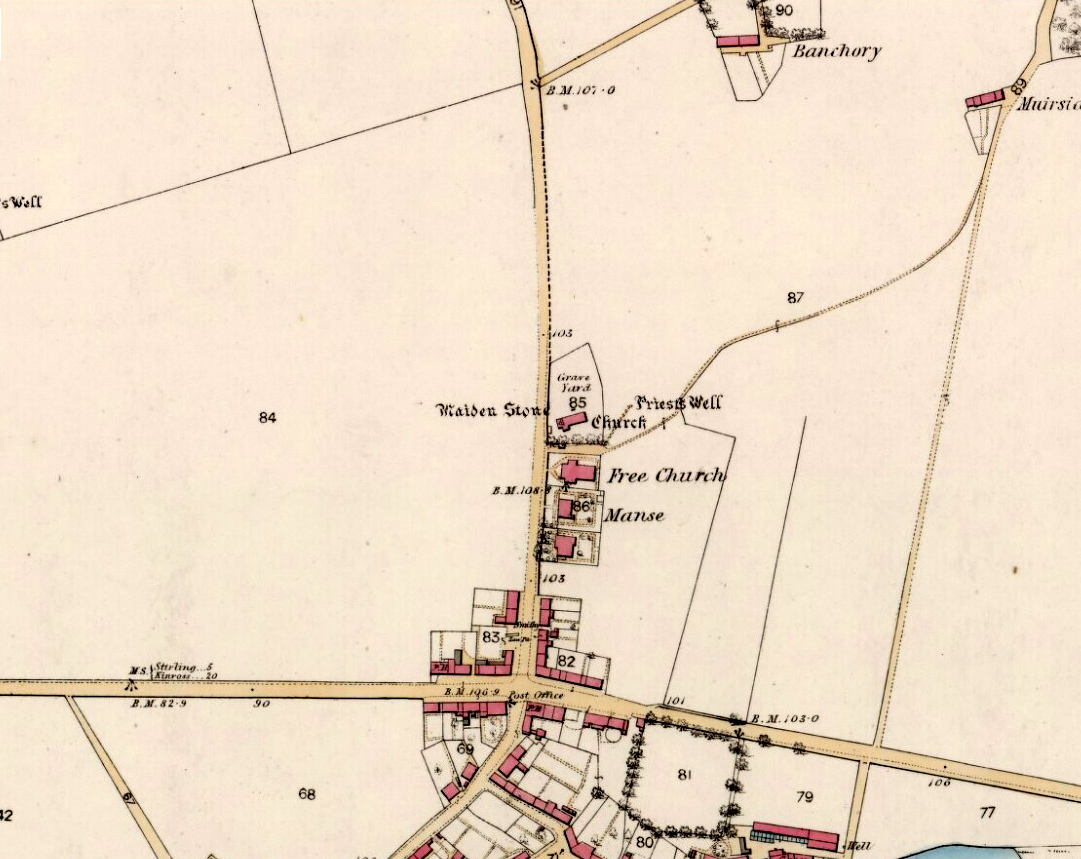
Priest Well on 1866 map

Priest Well on 1866 map

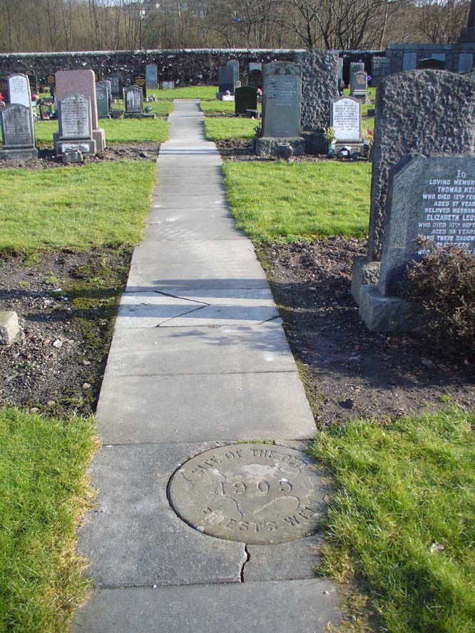
Along the A907 Stirling to Alloa road, turn onto the B9096 through Tullibody, turning up Menstrie Road until, on your right, you reach the old graveyard.  Walk along the track past the old section and go into the new graveyard. The second pathway down, keep your eyes peeled on the floor and you’ll see it.

Archaeology & History

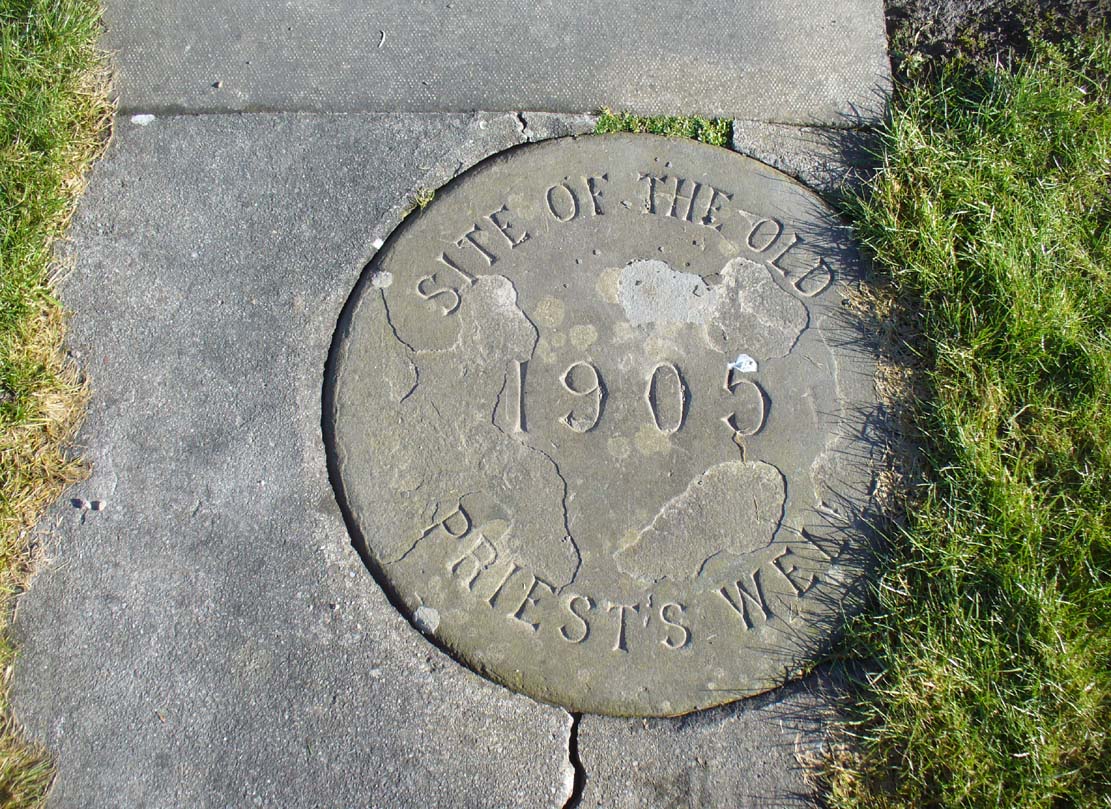
Just a flat carved stone laid in the expanded graveyard is all that remains to mark the site of this once sacred well.  On it, the inscribed slab reads, “Site of the old Priest’s Well – 1905.”

In the 19th century when the waters were still used by local villagers, Robert Kirk (1890) wrote the following,

Site of the Priests Well

Site of the old well

Carved commemorative stone

Carved commemorative stone

“Like the trees, we will now keep outside the dyke (round the old graveyard) and come to the Priest’s Well.  This well, an adjunct of the ancient building, appears to be coeval with the Old Church, and lay a few yards south of the Parsonage, which was demolished at the Reformation.  A small piece of ground in the immediate vicinity is known as the ‘Priest’s Croft’, and the adjacent field, tradition imagines to be the site of the original hamlet. When this well, from its proximity to the Churchyard, was condemned as unfit for human use, one old wife was heard to exclaim, “Na, na, I aye like a drink o’ the guid sweet priest.”

Despite being cited in the various Scottish holy wells reports, all mythic history of the site seems to have been forgotten.

References:

  1. Morris, Ruth & Frank, Scottish Healing Wells, Alethea Press: Sandy 1982.
  2. Kirk, Robert, Historical Sketch of Tullibody, Alloa 1890.
  3. Royal Commission on the Ancient & Historical Monuments, Scotland, Inventory of Monuments and Constructions in the Counties of Fife, Kinross and Clackmannan, HMSO: Edinburgh 1933.
  4. Simpkins, John Ewart, County Folklore – volume VII: Examples of Printed Folk-Lore Concerning Fife, with some Notes on Clackmannan and Kinross-Shires, Folk-Lore Society: London 1914.
  5. Walker, J. Russel, “Holy Wells in Scotland,” in Proceedings Society Antiquaries Scotland, volume 17, 1883.

© Paul BennettThe Northern Antiquarian

Stone of Mannan, Clackmannan, Clackmannanshire

Legendary Stone:  OD Grid Reference – NS 91114 91891

Also Known as:

  1. Canmore ID 48321
  2. Clackmannan Stone
  3. King Robert’s Stone

Getting Here

The Stone of Mannan

The Stone of Mannan

Take the A907 road between Alloa and Kincardine, and up the B910 into Clackmannan.  To get into the village, depending on which route you’re coming in, go up the Kirk Wynd or the Cattle Market—both of which lead you to the Main Street where, beneath the old clock tower, you’ll see the Market Cross and its companion erection just to the side. You can’t really miss it!

Archaeology & History

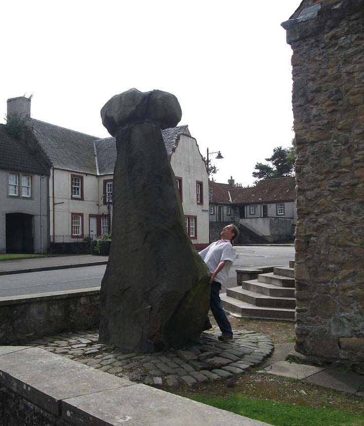
The phallic upright!

The phallic upright!

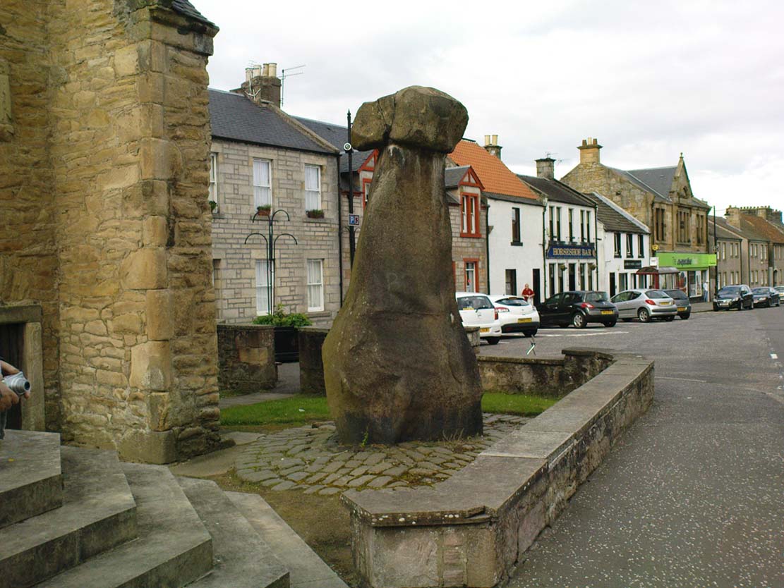
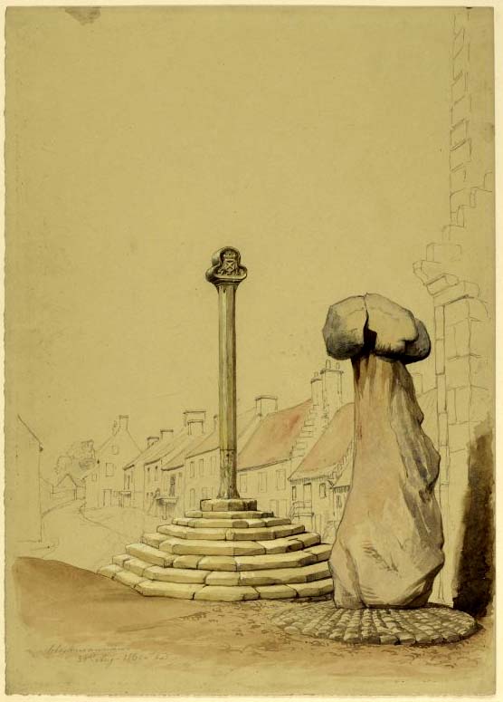
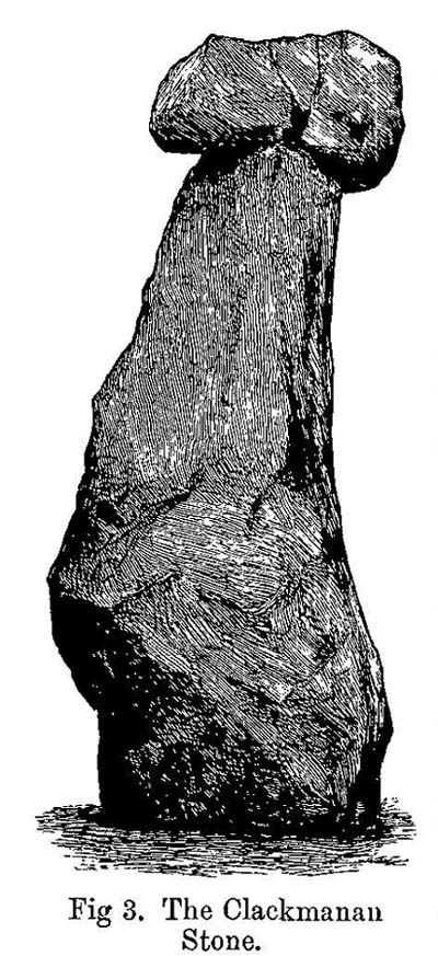
The history of this curious-looking giant phallic stone, sat quietly on the Main Street of sleepy Clackmannan village, isn’t as heathen as you’d expect when first seeing the huge upright—but there are mysteries and myths gathered about it.  The county of Clackmannan itself takes its name from this stone—but not the entire stone that we see today; merely the rounded, smaller element on top.  For it’s this that’s the real Mannan Stone. The rest of it, the tall upright pillar, was only attached to the smaller rounded stone—the Stone of Mannan— in the first-half of the 19th century.

First mentioned as a place-name in 12th century writings, the story of the stone was best told by Peter Miller (1889), who wrote:

“The old ‘clack’ or stone that forms the prefix to the name-word Clackmananmust be of considerable antiquity.  Its form and appearance have nothing to excite remark. The two larger portions of the stone are battened together with iron, and the portion forming the cleft appears to be detached from the larger one.  It is only the legend or tradition respecting its history and its association with the name-word Clackmanan that makes it interesting to the antiquary. Its dimensions are as follows: —It is over 3 feet in length, 2 in breadth, and about the same in thickness.  Its form is oval, and it has a deep cleft on its upper side.  The stone has nothing peculiar about it to indicate what it may have been originally, or the uses it was made to serve in early times.  There is no appearance of its ever having had an inscription or any ornamentation upon it.  It is simply a boulder-stone stone of whinstone, such as are found in abundance at the Abbey Craig near Cambuskenneth.  It was placed on the tall boulder slab on which it now stands, brought from the Abbey Craig in the year 1833 by the late Robert Bruce of Kennet, and the late Professor Fleming, who was then minister of the parish.  Previous to that time it lay on the ground alongside of the old jail and court-house of Clackmannan, close by the old cross of the town…”

Clackmannan Stone (after Miller)

Clackmannan Stone (after Miller)

The old stone & its upright

The old stone & its upright

Mr Miller then went on at some length to show the derivation of ‘Clackmannan’ to be from the old Irish, meaning “the stone of the monks.”  It seems a plausible theory too.  Despite this, Watson (1926) deemed it to be the ‘Stone of Manau’, being deemed vaguely as the people of the land north of the Forth.  The great Celtic scholar John Rhys (1888) declared Clackmannan to derive from the Irish deity or hero-figure, Manannan, as have other academic authorities since then.  But it’s all just a bit vague if we’re wanting ‘certainty’…

When T.C. Crouther (1936) wrote about this, he said how the Stone of Mannan had originally come from a position only a few hundred yards south of its present spot, at a place known as Lookabootye Brae  (NS 912 911), just above where the land begins to drop down closer to sea level.  This doesn’t seems too improbable.  Close to this spot could once be seen the sacred site of the Lady Well.

At the turn of the 21st century the stone was caged by the local council as it was beginning to crumble and was in danger of collapse; and so, the local council repaired the great upright and its sacred top-stone—albeit at the staggering cost of £160,000!!!  As the local people and other masons know to this day, the job could have been done for a fraction of that cost with equal efficiency.

Folklore

Said by T.C. Crouther (1936), the local council, and others to have got its name from the sea god Mannan, other legends have grown around this fascinating old rock.  When Edwin Adams (1863) wrote about it, these were the tales that local people gave him:

“Its legendary history is curious. When King Robert Bruce was residing in Clackmannan tower, and before there was a town attached to that regal mansion, he happened, in passing one day near this way on a journey, to stop awhile at the stone and, on going away, left his glove upon it.  Not discovering his loss till he had proceeded about half-a-mile towards the south, he desired his servant to go back to the clack (for King Robert seems to have usually spoken his native Carrick Gaelic), and bring his mannan, or glove. The servant said, ‘If ye’ll just look about ye here, I’ll be back wi’t directly,’ and accordingly soon returned with the missing article.

£From this trivial circumstance arose the name of the town which was subsequently reared about the stone, as also that of a farm at which the King stopped, about half-a-mile from the south, on the way to Kincardine, which took its name from what the servant said, namely, ‘Look about ye,’ and is so called to this day.”

But as the various dates in this tale simply don’t add up, it seems that the writer had been easily fooled.

References:

  1. Adams, Edwin, Geography Classified, Chapman Hall: London 1863.
  2. Drummond, James, Scottish Market-Crosses, Neill & Co.: Edinburgh 1861.
  3. Drummond, James,”Notice of Some Stone Crosses, with Especial Reference to the Market Crosses of Scotland,” in Proceedings Society of Antiquaries, Scotland, volume 4, 1862.
  4. Gordon, T Crouther, The History of Clackmannan, Civic Press: Glasgow 1936.
  5. Miller, Peter, “Notices of the Standing Stones of Alloa and Clackmannan,” in Proceedings of the Society of Antiquaries, Scotland, volume 23, 1889.
  6. Rhys, John, Lectures on the Origin and Growth of Religion as Illustrated by Celtic Heathendom, Williams & Norgate London 1888.
  7. Royal Commission on the Ancient & Historical Monuments, Scotland, Inventory of Monuments and Constructions in the Counties of Fife, Kinross and Clackmannan, HMSO: Edinburgh 1933.
  8. Royal Commission on the Ancient & Historical Monuments, Scotland, The Archaeological Sites and Monuments of Clackmannan District and Falkirk District, Society of Antiquaries of Scotland 1978.
  9. Simpkins, John Ewart, County Folklore – volume VII: Examples of Printed Folk-Lore Concerning Fife, with some Notes on Clackmannan and Kinross-Shires, Folk-Lore Society: London 1914.
  10. Small, John W., Scottish Market Crosses, Eneas Mackay: Stirling 1900.
  11. Watson, W.J., The History of the Celtic Place-names of Scotland, Edinburgh 1926.

Links:

  1. Nataraja’s Foot – Skullduggery

Acknowledgements:  Big thanks to author Marion Grace Woolley for use of her photo in this site profile. 🙂

© Paul BennettThe Northern Antiquarian