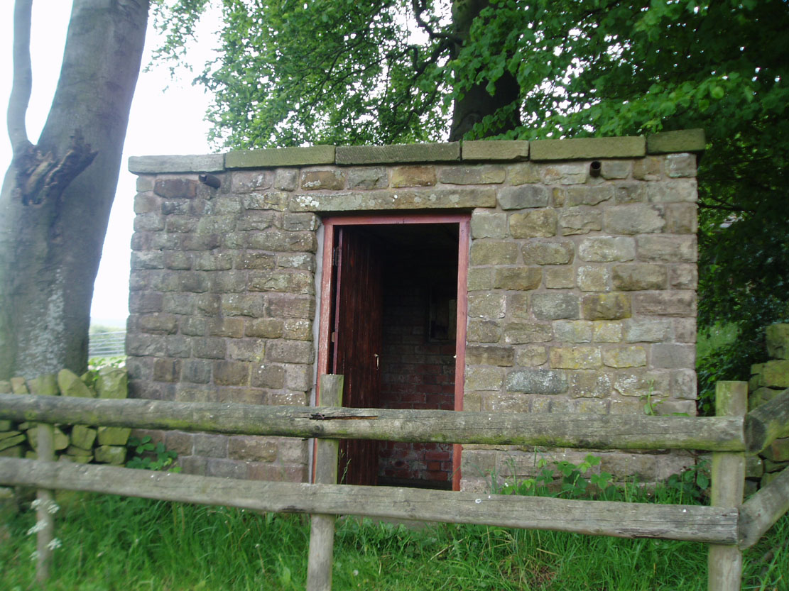
Just outside of Leek a right-hand lane leads to the small hamlet of Ashenhurst, turning left pass the gated road and on the right hand side at the next fork is the The egg well on the right in a small brick building.
Archaeology & History
The Egg Well is a curious site. No evidence appears to record it as a holy well, nor a spa— but it appears to be a secular healing well. Local tradition believes that the site was used by the Roman, but the older fabric was set in place by William Stanley, the owner of Ashenhurst Hall bewteen 1744 and 1752. The present house was erected in the 19th century.
Waters of the well
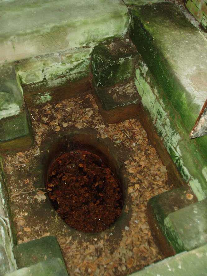
The name of the well is curious; it could refer to the shape of the basin, but could also refer to sulphurous waters although I could not detect a smell. Today, a rather ugly 19th century brick-built structure surrounds this stone lined bath-shaped structure, which was roofed at a later date.
Folklore
The site was used by the Romans, but there is no evidence. Its properties are recorded on the basin is this monogram and an interesting Latin inscription which reads:
“Renibus, et splenui cordi, jecorique medatur, Mille maelsi prodest ista salubris aqua.”
The translation being:
“The liver, kidneys, heart’s disease these waters remedy. And by their healing powers assuage full many a malady.”
References:
Parish, R.B., Holy Wells and Healing Springs of Staffordshire – in publication.
In Dronfield, St. John’s Well is to be found off Church street in the Forge in the courtyard adjacent to the glass roofed atrium on the left hand side.
Archaeology & History
J.C. Cox (1875–9) in his Churches of Derbyshire appears to the sole reference although he quotes a lost 1710 reference. He notes a St. John’s Well cited by Francis Bassano, c.1710, saying:
“…a well, close to the churchyard in St John’s Lane, called St John’s Well, from which “they usually fetch water now for baptising infants””.
Looking down the well…
…and into the waters
Despite only this slight mention, the site still survive. According to local historian Mr. Ken Ward, the well is that now found in the courtyard of the forge: a 16th century building now developed into a small shopping complex. He states it is 80 metres from the south porch of the church supporting Bassano’s location. The site is along Church Street (previously Church Lane) which he believes was once called St. John’s Lane. The well is a circular one with modern stonework on the top. However, this encloses a much older ring of six layers with a grill apparently opening out into a larger chamber below. It appears to be a deeper well than would be expected, but it is spring-fed and was presumably deepened for use in the forge.
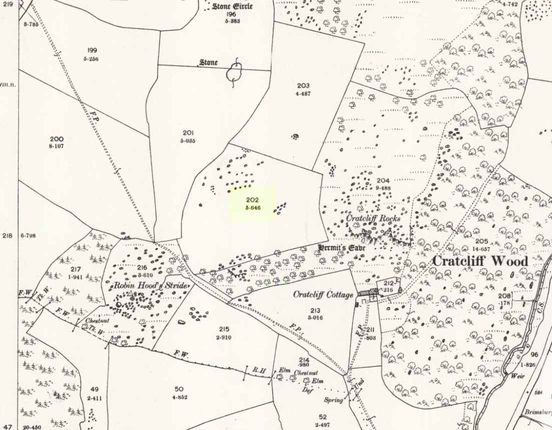
Taking the roughly north-south road betwixt the village of Elton and the town of Youlgreave, rising up to see the great rock outcrop of Robin Hood’s Stride, park-up by the roadside and walk down the path towards the impressive rocky rise of Robin Hood’s Stride. Keep to the fields below the Rise on its north side and head for the next wooded rise 2-300 yards west. In the field you’ll cross (field number 202 in on the map, right) before this wooded crag [Cratcliffe Rocks], the outline of the enclosure is beneath your very feet.
Archaeology & History
Aerial image of the Ninestone Ring enclosure
This blatantly obvious oval-shaped enclosure or settlement ring has had very little said of it in archaeological circles as far as I can tell. (please correct me if it has!) I found it quite fortuitously during aerial surveys of the nearby Nine Stones circle. It’s certainly quite large. With a general circumference of roughly 285 yards (260.5m), the relative diameters of this enclosure are—from north to south—91 yards (83m) and—east to west—80 yards (73.25m). The ditch alone is quite wide all the way around, almost giving it a ‘henge’ quality. Its southern section is nearly 10 yards across at one point!
The northwest section of the enclosure has been built into, or upon a small natural outcrop of rocks. But also at this point—as seen clearly in the aerial photo—on the other side of the wall just past the raised natural outcrop, is a long straight parallel linear feature, very probably man-made, running away to the northwest for at least 174 yards (159m). It too is quite large, averaging more than 13 yards (12m) across all along the length of this “trackway”: twice as wide as the nearest road and similar in form to the smaller cursus monuments that scattered neolithic Britain.
The site seems to be typical in form and structure to general Iron Age, or perhaps late Bronze Age settlements – but without a proper ground appraisal, this is a purely speculative appraisal. Any further information or images of this site to enable a clearer picture of its nature would be most welcome.
Acknowledgements: With thanks in various way to Pete Woolf, Dave Williams, Geoff Watson & Martin Burroughs.
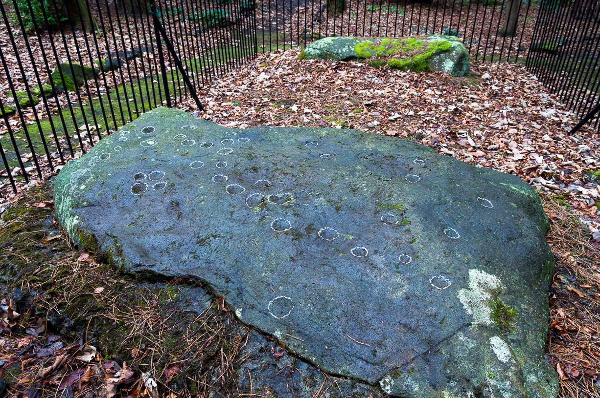
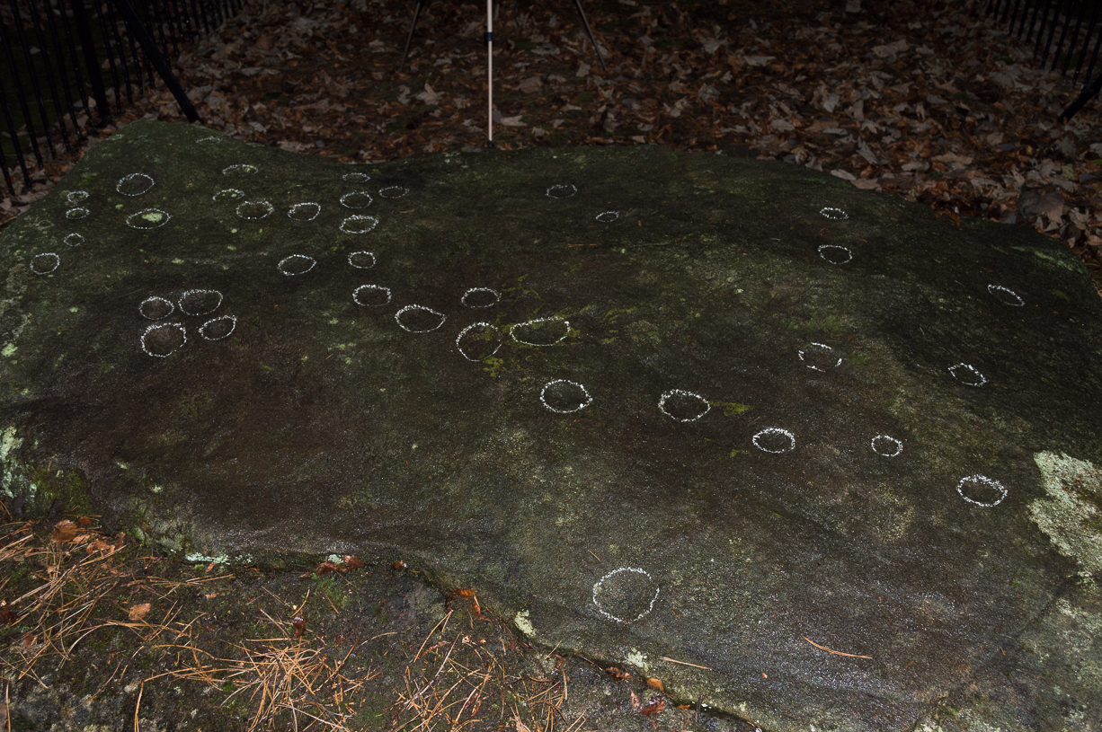
Panorama Stone 228, with cups highlighted (after James Elkington)
Come out of Ilkley/bus train station and turn right for less than 50 yards, turning left up towards White Wells. Go up here for less than 100 yards, taking your first right and walk 300 yards up Queens Road until you reach the St. Margaret’s church on the left-hand side. On the other side of the road, as well as a bench to sit on, surrounded by trees is a small enclosed bit with spiky railings with Panorama Stones 227, 228 and 229 all therein: the one in the centre being the one we’re dealing with here.
Archaeology & History
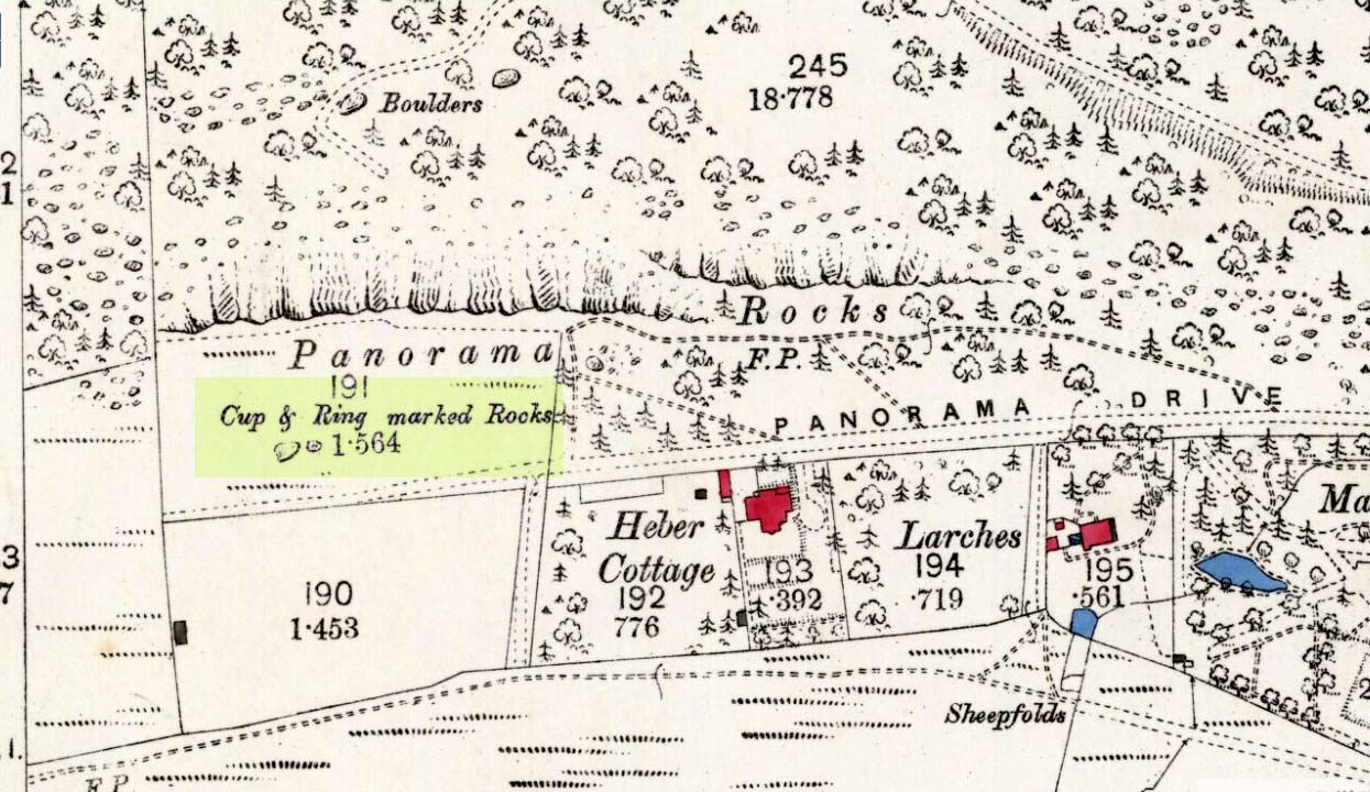
Originally located ¾-miles (1.2km) WSW of its present position in Panorama Woods (at roughly SE 10272 46995), along with its petroglyphic compatriots in this cage, the carving was moved here in 1890 when a Dr. Little—medical officer at Ben Rhydding Hydro—bought the stones for £10 from the owner of the land at Panorama Rocks, as the area in which the stones lived was due to be vandalized and destroyed. Thankfully the said Dr Little was thoughtful and as a result of his payment he had some of the stones saved and moved into their present position. However, this carving is but a fragment of its former self.
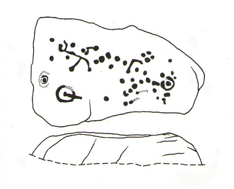
John Hedges 1986 sketchClose-up of cups (James Elkington)
It was originally to be seen within a large prehistoric enclosure—which was completely destroyed when rich houses were built hereby, without any evaluation of the site ever being made. But particularly impressive is the fact that this now enclosed sedated stone carving was originally the large rocky base for a small rocking stone, which also had cup-markings on it and a faint cup-and-ring. This is very unusual indeed – and perhaps unique in Britain? Thankfully, several Victorian antiquarians visited and made notes and a sketch of the site before it was uprooted and a large section of it destroyed. In J. Romilly Allen’s article (1879) he told that, just a couple of yards from the more famous and ornate Panorama Stone (229), a
“second stone is of irregular shape, measuring 15ft by 12ft, and supporting a smaller stone of triangular shape 6ft long by 4ft broad. Both upper and under stone are covered with cups and rings, but the sculptures have suffered much from exposure. The superimposed rock has eleven cups, two of which are surrounded by rings. The under stone has 42 cups, nine of which have rings. Amongst these are two unusually fine examples, one has an oval cup 5in by 4in, surrounded by two rings, the diameter of the outer ring being 1ft 3in. Another has a circular cup 3in diameter, and five concentric rings, the outer ring being 1ft 5in across.”
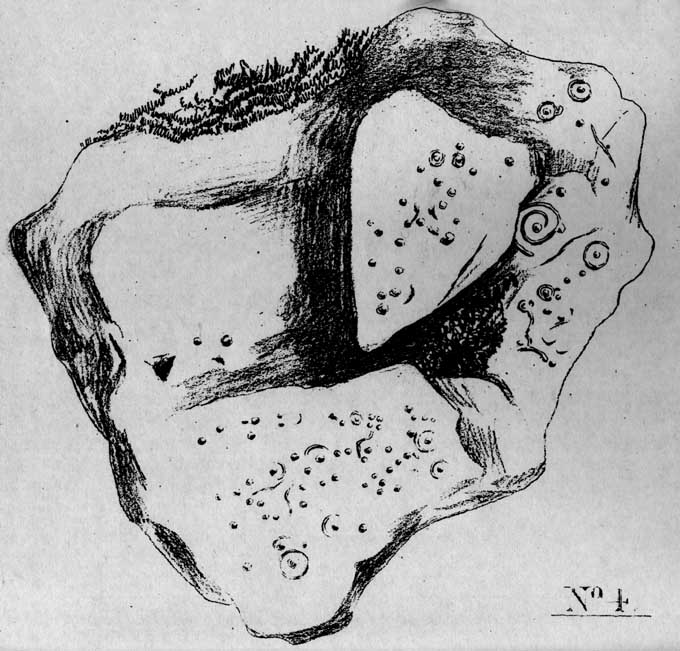
J.T Dales 1878 sketch, with CR227 on top of itOriginal location of stone
In a sketch of the site by J. Thornton Dale done about the same time as Allen’s visit, and reproduced here (apologies for the poor quality), the “five concentric rings” that Mr Allen mentioned are not shown, but clearly a spiral design had been seen by Mr Dale’s eyes. Fascinating…. The large mass of carvings immediately left of the spiral is in fact the smaller upper stone known by modern archaeologists as carving 227.
Today, all we can see of this petroglyph are two cup-and-rings, and one faint double-cup-and-ring; several incomplete rings or arcs, and at least another 30 single cup-marks, some of which have short limes running to or from them. The rest of original stone base with its other multiple rings or spiral design were obviously destroyed.
As with many of the Ilkley carvings, Boughey & Vickerman’s (2003) description barely does the stone justice. They described it simply:
“Large rock, now set in concrete base, the surface rapidly deteriorating. Over forty cups, three with single rings, one showing traces of a second, grooves.”
The mightily impressive Panorama 229 carving sits next to this one and is truly worth checking out!
References:
Allen, J. Romilly, “The Prehistoric Rock Sculptures of Ilkley,” in Journal of British Archaeological Association, volume 35, 1879.
Bennett, Paul, The Panorama Stones, Ilkley, TNA: Yorkshire 2012.
Bennett, Paul, Aboriginal Rock Carvings of Ilkley and District, forthcoming.
Boughey, Keith & Vickerman, E.A., Prehistoric Rock Art of the West Riding, WYAS: Leeds 2003.
Cowling, Eric T., Rombald’s Way, William Walker: Otley 1946.
Downer, A.C., “Yorkshire Archaeological and Topographical Association,” in Leeds Mercury, August 28, 1884.
Hadingham, Evan, Ancient Carvings in Britain, Souvenir Press: London 1974.
Hedges, John, The Carved Rocks on Rombald’s Moor, WYMCC: Wakefield 1986.
Heywood, Nathan, “The Cup and Ring Stones of the Panorama Rocks”, in Transactions Lancashire & Cheshire Antiquarian Society, Manchester 1889.
Speight, Harry, Upper Wharfedale, Elliott Stock: London 1900.
Acknowledgements: With huge thanks to both Dr Stefan Maeder for help in cleaning up the stones; and to James Elkington for taking the photos and allowing ’em for use them in this site profile.
Cup-marked stone, East Morton (photo thanks, Sue Patchett)
From the expanding village of East Morton, by the school at the west-end of the village, walk up the narrow Street Lane for nearly 600 yards, past the houses, until you reach a footpath on your left that takes you across the fields. Walk along here (following the line of walling) for 250 yards, then, take a sharp left and down the field for 55 yards (50m) until, right beneath the power lines, you’ll find the rock in question.
Archaeology & History
This is one in a small, little-known cluster of petroglyphs on the western outskirts of East Morton. It is located at the base of what are thought to be remnants of Iron Age walling. Carved onto an elongated earthfast stone are a number of very well-preserved cup-marks, with what seems to be a faint carved pecked line running out from one of the southernmost cup-marks and curving back on itself (we could do with a good sketch artist getting us a good drawing of this). You can see this faint line on the far-left side of the stone in Sue’s photo above.
Hedges 1986 sketch
The petroglyph was rediscovered by the northern antiquarian Stuart Feather (1959) in one of his many sojourns exploring the prehistoric remains of the area. In John Hedges’ (1986) survey, the carving was described simply as:
“Triangular smooth grit rock with fairly flat top on which are twenty cups, not all clear, some large and oval, a few grooves.”
Boughey & Vickerman’s survey (2003) made no note of any additional features on the petroglyph.
References:
Boughey, Keith & Vickerman, E.A., Prehistoric Rock Art of the West Riding, WYAS: Wakefield 2003.
Feather, Stuart, “Bronze Age Rock Carvings,” in Keighley News, March 7, 1959.
Hedges, John (ed.), The Carved Rocks on Rombalds Moor, WYMCC: Wakefield 1986.
Jackson, Sidney, “Massive Walling at East Morton,” in Cartwright Hall Archaeology Group Bulletin, 5:9, 1960.
Jackson, Sidney, “East Morton Ancient Walls,” in Cartwright Hall Archaeology Group Bulletin, 6:9, 1961.
Acknowledgements: Huge thanks to Sue Patchett for use of her photo.
Healing Well (destroyed): OS Grid Reference — TQ 3006 7734
Archaeology & History
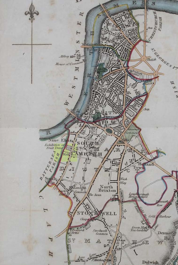
Site on 1824 map
In Thomas Allen’s (1827) huge survey of Lambeth parish, he told that there was little of any interest along Wandsworth Road, apart from a good orchard, “and a fine spring called Vauxhall Well.” According to Daniel Lysons (1792), it was located “not far from the turnpike”; and according to Mr Sunderland’s (1915), was to be found “on the right-hand side of the Wandsworth Road” as you walked down it to the south. Thankfully its position was highlighted on the 1824 map of the parish (right) that accompanied Mr Allen’s work.
It appears to have been built over in the latter-half of the 19th century, soon after William Thornbury (1878) wrote that he thought the well was still visible, but vanished soon after.
The waters were universally ascribed by all historians, from Mr Allen onwards, as being,
“esteemed highly serviceable in many disorders of the eyes, and in the hardest winter it is never known to freeze.”
The name ‘Vauxhall’ derives from that brilliantly famous family name of ‘Fawkes’ (as in Guy Fawkes), being the ‘hall of Fawkes’. The name was first recorded here as early as 1241. (Gover et al, 1934)
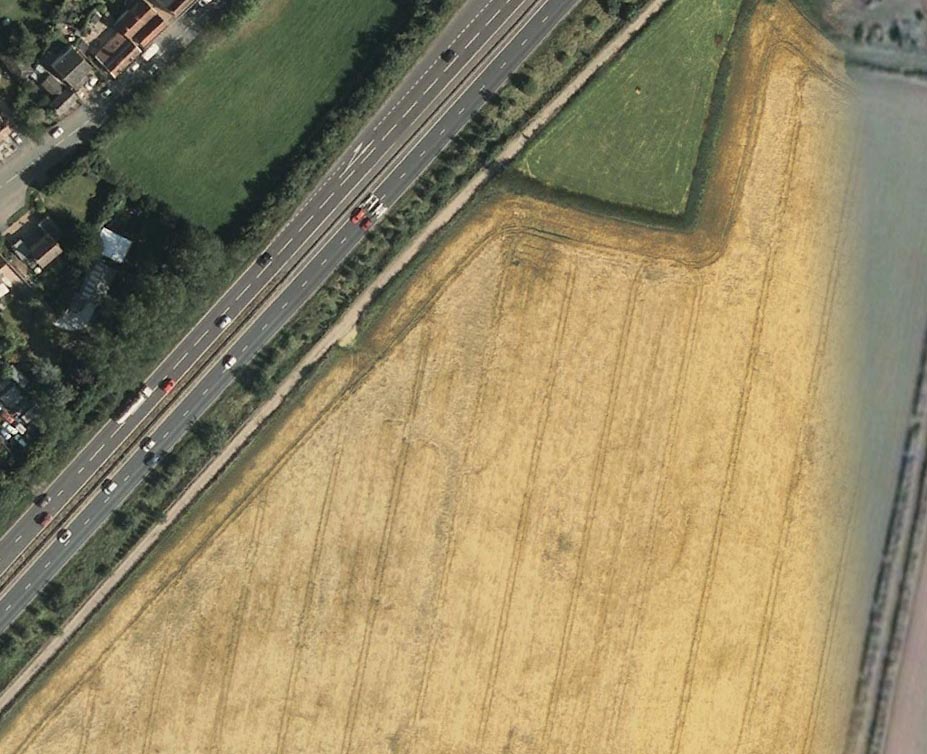
Faint flat outline of SE end + ancient circular enclosure
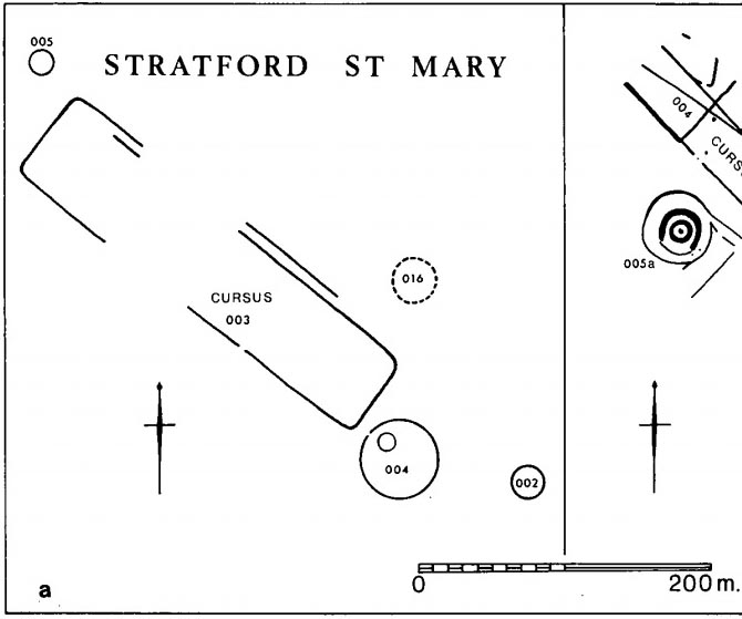
This short and dead straight cursus monument was first described in John Hedges’ (1981) survey, and later mentioned in Harding & Lee’s (1987) corpus on British henges as being in conjunction with a series of circular prehistoric monuments (three circular enclosures existed beyond its southeast and one to its northeast edges, one of which is visible in the aerial image, right).
Cursus ground-plan (courtesy Suffolk Institute Archaeology)
Most of the monument has been completely destroyed by roads and housing, but when complete was said to be 317 yards (290m) long, running from the southeast to the northwest. The flattened southeastern edge measures nearly 63 yards (57.3m) across, and its northernmost width was close to 65 yards (60m) wide.
In Patrick Taylor’s (2015) assessment of this (and other monuments) he thought that the cursus may have served an astronomical function. He may be right. It’s alignment, he told,
“has a very clear orientation 38.5º north of grid west. This represents an amplitude from true west of 40.9º. Allowing for a latitude of 51.97º and altitude of 0.95º, adjusted downwards for refraction to 0.50º, we get from (Alexander) Thom’s table a declination for a body setting to the northwest of 24.15.º This is only 0.23º, just less than half the width of the sun’s disc, more than the sun’s maximum declination in Neolithic times of 23.92º. The alignment thus points rather accurately towards the upper limb or last setting point of the sun.”
Faint remnants of a second cursus monument have been discovered 400 yards to the east.
References:
Harding, A.F. & Lee, G.E.,, Henge Monuments and Related Sites of Great Britain, BAR 175: Oxford 1987.
Hedges, John D. & Buckley, David, Springfield Cursus and the Cursus Problem, ECC 1981.
Last, Jonathan, “Out of Line: Cursuses and Monument Typology in Eastern England,” in Barclay & Harding’s Pathways & Ceremonies, Oxbow: Oxford 1999.
Martin, Edward A., “When is a Henge not a Henge?” in Proceedings of the Suffolk Institute for Archaeology & History, volume 35, 1981.
Acknowledgements: Many thanks to the Suffolk Institute of Archaeology and History, for use of their ground-plan diagram from Edward Armstrong’s article, ‘When is a Henge Not a Henge?’
Holy Well (destroyed?): OS Grid Reference — SJ 8464 9036
Archaeology & History
In Henry Taylor’s gigantic survey on the Ancient Crosses and Holy Wells of Lancashire (1906), he told that “records of the existence of holy wells in this (district) are scanty in the extreme.” Indeed. He certainly missed this one which, it seems (if modern lore is correct), has sadly fallen prey to that sickness which those ghastly people call ‘progress’. Cited to have been in or near the old graveyard of St. James church in the old village, this once ever-flowing spring of water was of great repute in earlier centuries, not only for general health, magick and traditions, but also supposedly in prolonging life itself!
One of the standard historians of Didsbury, Mr Fletcher Moss (1898), was of the view that this Well may have been the “origin of Didsbury, the place the Saxon settlers would choose first for their church and community.” He may be right. He told that,
“It was said ‘to be holy in papist times.’ Only last summer I several times saw three young ladies who came every morning to bathe their eyes and faces in it, saying, “It was good for sore eyes.” I could not see anything the matter with their eyes, but that may have been my ignorance, or that they were already getting better. In the spring time or early in May the well has often been nearly choked with wild flowers, and pins have been put in for luck. If rags or crutches were ever left there, it was when the water bubbled up in the roadway on the hillside. The flow of it is lessened by drains or sewers, and now it is taken down in pipes. The lane is enclosed with brick walls, and all the romance is gone; but in the longest drought or severest frost the water from the holy well has never failed, and though it may come from the churchyard, we and many others drink no other.”
In an earlier passage (Moss 1891), he talked about the longevity and good health of the local people and who credited the good water here:
“Like most of the old Didsbury folk who never bothered with doctors or change of air, Sam Gaskill, the last clerk, lived to be long past the fourscore years, for I remember him and others much older than he was, regularly going to the Holy Well for the water for their households. As in patriarchal and primitive times the villagers went to the well or spring at eventide and tarried and talked while the water flowed. It mattered nought to them that the water flowed from the churchyard, from the burial-place of their forefathers; they had always been healthy as their forefathers had been healthy, and they wanted no other water and would have no other; that always bubbled up fresh and sparkling in summer or winter, in drought or frost, and never failed.”
Nearby to the east, spirits of the dead were said to come from the old trees of Parrs Wood, long since destroyed by those self-righteous Industrialists…
References:
Million, Ivor R., A History of Didsbury, E. J. Morten 1969
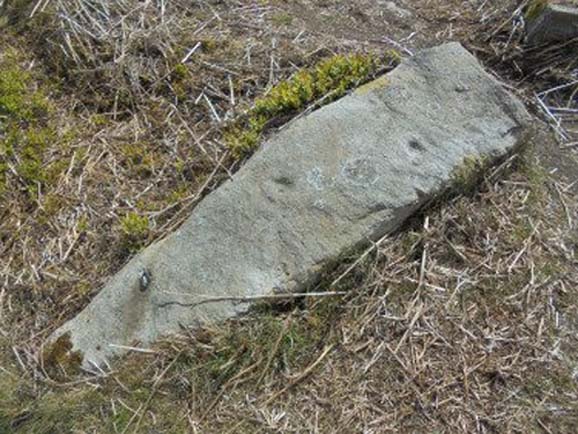
Cup-and-rings on gatepost (photo credit, Dave Whittaker)
From Ilkley, follow the same directions as if you’re going up to the superb Swastika Stone. Keep walking on the footpath, west, for 65 yards (59m), then walk into the heather on your left. Barely 5 yards in, you’ll see this fallen standing stone or gatepost.
Archaeology & History
First described in one of Stuart Feather’s (1964) old rambles, I first saw this stone in my late-teens and was as puzzled by it then as I am today. Upon an obviously worked stone that may once have stood upright (or was intended to do), two faint and incomplete cup-and-rings were carved – but when exactly? If this stone was cut from a larger rock into its present shape, were the petroglyphs already on it, or were they done when the ‘gatepost’ was created?
It was first described in one of Stuart Feather’s (1964) rambles up here and later included in Hedges’ (1986) survey, where he told it to be a, “recumbent gatepost with one cup with almost complete ring and one cup with vestigial ring.” Boughey & Vickerman’s (2003) survey added little more. And when a group calling itself Carved Stones Investigation got itself about £250,000 to “investigate” the Ilkley petroglyphs, I was hoping that they could have at least turned this stone over to see if other carvings were on the stone – but they just revisited all those found by others, made a new list, and took the money to be honest (no website and no book – as they should’ve done). Thankfully, local folk are having a look at this and others and doing the work they should have. Check it out when you’re next up at the Swastika.
References:
Bennett, Paul, Megalithic Ramblings between Ilkley and Baildon, unpublished: Shipley 1982.
Boughey, Keith & Vickerman, E.A., Prehistoric Rock Art of the West Riding, WYAS: Wakefield 2003.
Feather, Stuart, “Mid-Wharfedale Cup-and-Ring Markings: no.26, 27, 28 – Black Pots, High Moor, Silsden, near Keighley,” in Cartwright Hall Archaeology Group Bulletin, 9:10, 1964.
Hedges, John, The Carved Rocks on Rombalds Moor, WYMCC: Wakefield 1986.
Acknowledgements: Huge thanks to Dave Whittaker for the photo. Good luck with the plans fellas.
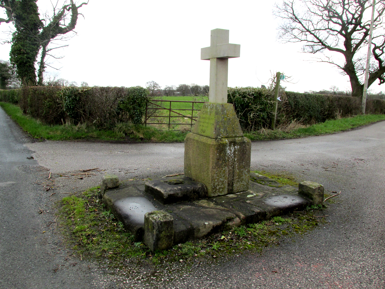
The Barton Cross from the road, showing the original socketed base and the cup marked paving stone to the right.
The cross is at the roadside on the south side of Barton Lane at the cross roads with the minor road between Cross House Farm and Barton House.
Archaeology and History
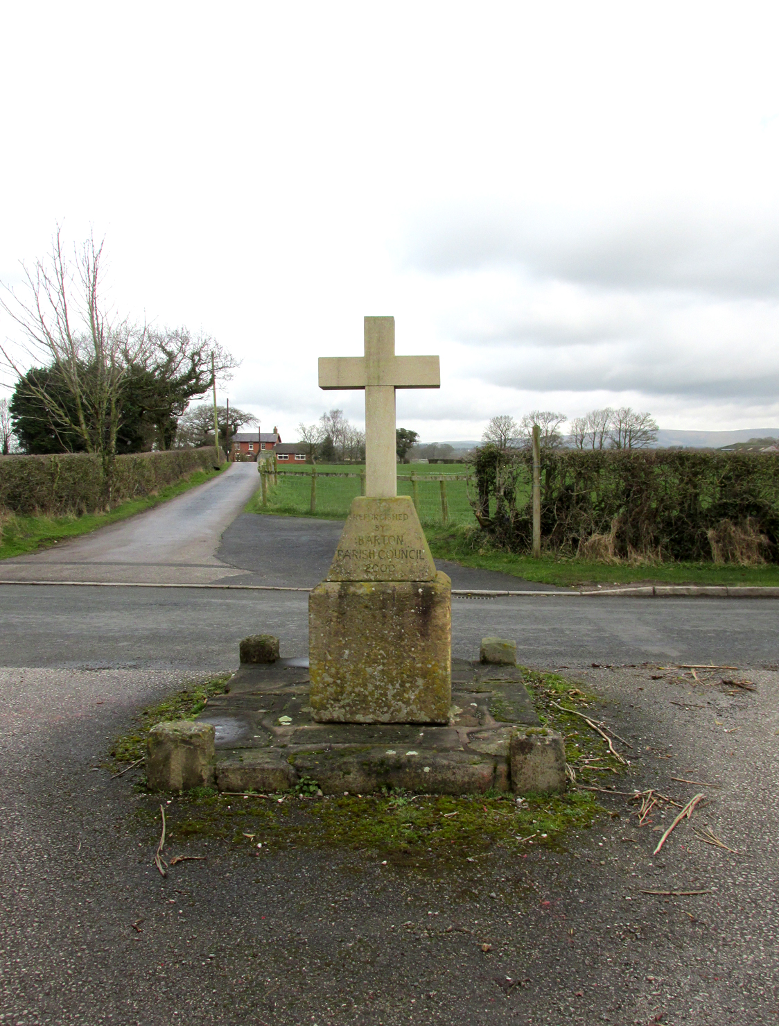
All that survives is the socketed base of a mediaeval cross on a raised paved platform with low raised square section pillars at each corner. Behind the original cross socket stands a large stone block (Described in the Historic England citation as “probably part of a cheesepress“) surmounted by a pyramidal block upon which a modern carved stone cross has been placed.
Henry Taylor (1906) writes in his Ancient Crosses and Holy Wells of Lancashire:
The South face of the Cross
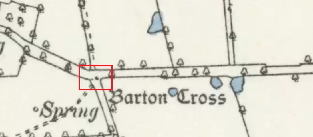
“Barton Cross. These words occur on the map in ancient Gothic letters in Barton Lane, one and a half miles in a westerly direction from Goosnargh Church, showing that in the year 1848 a complete cross stood here. The site is at the intersection of country lanes, and the map shows a small recess or lay-bye in which the cross was planted. Mr. Collinson [Reverend S.E. Collinson, Vicar of Broughton] writes that the base was thrown into a neighbouring pit at the time Daniel’s pedestal was buried. The base and part of the shaft of the Barton Cross have lately been restored to the old site. A new cross has been erected just behind by Mr. Myerscough. Mr. Collinson tells me that in going through some of the old parish registers he found an entry referring to ‘Barton Christ’. He not unnaturally thinks that there must have been a figure on the Cross giving rise to the name. Nothing else would account for it. The neighbourhood of Barton (a pre-Norman settlement) is interesting and deserves a thorough investigation.”
The ‘Daniel’s pedestal’ refers to Daniels Cross, near Broughton, of which Taylor writes:
“The base was removed about sixty years ago. It is now in a neighbouring pit. The facts were obtained from an old man who helped at the destruction of this landmark.”
The 1895 6″ map showing the Cross, with the nearby marl-pits coloured blue
The pyramidal stone block upon which the modern cross stands is inscribed on the northern face: “Barton Cross re-erected by Councillor R. Myerscough of Preston 1901” while the southern face is inscribed: “Refurbished by Barton Parish council 2000“.
One of the paving stones that surround the cross has pre-historic cup markings on it, and is the subject of a separate site profile.
Bearing in mind what was written about the original cross having been ‘thrown into aneighbouring pit’, it may be worth probing the nearby marl pits to see whether the original could be found.
Reference:
Taylor, Henry, The Ancient Crosses and Holy Wells of Lancashire, Manchester, Sherratt and Hughes, 1906