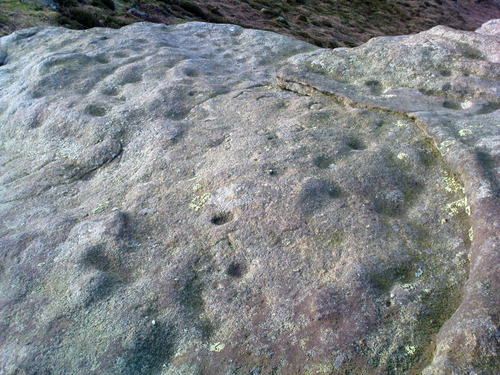
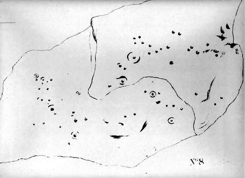
This is a lovely-looking stone in the pictures and diagrams, and is quite easy to find close to the meeting of the footpaths along Foldshaw Ridge and the Parks Lane track, near the gate. It lays at an angle in the short grass just by the path…but to me, all is not what it seems…
Archaeology & History
This was a carving I saw pictures of in the 1970s, and always thought it would be something to behold – but my first impression here wasn’t just disappointment, but the most distinct thought that the carving’s modern! It’s a real oddity. For a start, the cups in this carving are very small – much smaller than the countless authentic carvings on the moors here and at Ilkley to the south. And after seeing thousands of these things, this one didn’t seem at all right.
The lack of erosion on the cups may be due to it once accompanying a prehistoric tomb some time in the past, though no such remains have been noted here. However, at carved stones Middleton Moor 001 and Middleton Moor 2 — less than 100 yards to the east — cairns are in evidence next to the petroglyphs, indicating that this relationship occurs at some cup-and-ring stones in this small geographical region and, perhaps, explaining the ideosyncratic nature of this design.
But such speculation aside – the brief literary history of this stone is: first described by Stuart Feather in 1965 and illustrated by Sidney Jackson the same year. The rock art students Boughey & Vickerman’s (2003) described around sixty ‘cups’ etched onto the stone here, but they made no comment about either the odd nature of the cups or the possibility of it being modern. Perhaps it’s just me…
References:
Boughey, Keith & Vickerman, E.A., Prehistoric Rock Art of the West Riding, West Yorkshire Archaeology Service 2003.
From Killin, take the Glen Lochay Road past the Moirlanich Longhouse, but keep on for another mile, and take the track on the left up to Murlaganmore cottages. As the track turns right of the tree-line, cross the field (left) up towards the open gate as if you’re going to the Murlaganmore 2 carving, where you’ll see this large flattish rock in the grasses about 100 yards before it.
Archaeology & History
When we visited this old boulder last week, we had the misfortune of grey days and dark clouds throwing their faded light across this cup-marked rock, not really letting us see with any clarity the many cups which pepper (mainly) the edges of the rock. But the cups are faded anyway, so accounts tell, and the 15 which we counted were same 15 recorded about 100 years ago in C.G. Cash’s (1912) survey. There, he described this old stone as,
“about 200 yards south of the house, in the middle of the uppermost pasture. It is a large block of quartz schist stuck thick with garnets, and bearing fifteen cup-marks, only one of which — 3 inch in diameter and 1 inch deep — is really well defined, and several of which are faint.”
Faint cups barely visibleC.G. Cash’s early drawing
But despite the grey day (She was absolutely teeming with rain half of the time!), I found the setting here absolutely gorgeous, with the many shades of old trees and the clear blood of pure waters falling through the landscape. And, without doubt, there are other carved stones nearby that have yet to capture the attention of surveyors. You can smell them!
References:
Cash, C.G., ‘Archaeological Gleanings from Killin,’ in PSAS 46, 1911-12.
Royal Commission on Ancient & Historical Monuments, Scotland, The Archaeological Sites and Monuments of Stirling District, RCAHMS: Edinburgh 1979.
Cup-Marked Stone: OS Grid Reference – SE 0791 4422
Archaeology & History
Ant Stone, uncovered
Discovered today, amidst a cluster of other carvings not previously catalogued. This was hidden beneath a mass of vegetation, but after cutting and digging into the peat on top of the stone, several cup-marks became evident. By the side of the rock, measuring roughly 8 feet by 5 feet, was a small ant’s nest — hence the convenient name of the carving.
Central design of the carving
The main feature is the large, perhaps natural cup-mark, about 3 inches across. But three distinct artificial cup-markings were etched around the edges of this larger ‘cup’. When we found this stone, the daylight was nearing its end and we were unable to ascertain any further features carved onto the rock. Several other carvings were close by, none of which were included in the survey by Boughey and Vickerman. (2003) After we’d finished here, we covered the stone back over with its peaty quilt and hoped that the ants weren’t too pissed off about us disturbing them…
From East Morton village, take the moorland road, east, and up the steep hill. Where the road levels out there’s a right turn, plus (more importantly!) a trackway on your left which leads onto the moor. Go up this traclk and keep walking till you hit a moorland ‘footpath’ signpost. Stop here and walk due west (your left) onto the gently sloping rise of Stanbury Hill. Keep walking for a 250 yards or so, where the land has sloped gently down to the end of the spur; and just 50 yards before it drops down tot he stream below you’ll find a cluster of rocks scattered about. One of the stones here is this one!
Archaeology & History
This is an excellent carving first recorded, it seems, by Stuart Feather in 1977, as cited in the Yorkshire Archaeology Journal’s ‘Listings’ for 1978. It can be found some 27 yards west of a prehistoric cairn near the top of the ridge (14 yards east of the same cairn is the Spotted Stone carving).
Lunar Stone carvingSoutheast section, with 3 cup-and-rings?
We have to assume that when Mr Feather first located this stone that the faint cup-and-rings on the topmost southeast section of the rock had been exposed to the elements from Day 1, so to speak: as the designs here are quite faint and well-worn. Another not unreasonable assumption is that Mr Feather then proceeded to dig away at the rest of the rock, exposing other features on the stone which had laid under the soil for countless centuries, as the northernmost part of the carving has minimal erosion effects on it. Indeed, unless this is true, we have to start thinking that the carving was made over quite lengthy periods of time, due solely to the greater and lesser effects of weathering on different sections of the stone.
As seen in both the diagram and photos, this is a quite extravagent design. Consisting of several cup-and-rings, aswell as a double-ring, it is found amidst a small cluster of equally impressive, albeit very different carved rocks, all appearing to have a quite specific relationship with death and ritual. This and the other stones are found on the western end of a small serpentine ridge of land (Stanbury Hill), with streams flowing on the north and western sides and small remains of marshland to the south. The geomantic feature here, if relevant, relates to movements between the Earth, water, death and the setting sun: quite potent and important issues in the lives of the neolithic and Bronze Age peoples who lived hereby.
Northern section of carving – with calendrical cups?
The title of this stone carving — the Lunar Stone — should be quite evident: the design has all the hallmarks of celestial lunar movements around the ridge of the heavens; or here, pictured along the edges of the rock (symbolic of the firmament), upon and amidst which the moon travels in its rhythmic motion through the heavens. But don’t take that too seriously: it’s just an imaginative flutter that struck my otherwise distraught inability to know what I’m talking about!
References:
Hedges, John (ed.), The Carved Rocks of Rombald’s Moor, WYMCC: Wakefield 1986.
Head up to the Cow & Calf Rocks and walk to the large disused quarry round the back (west). You’ll notice a scattered copse of old pine trees on the edge where the hill slope drops back down towards Ilkley; and there, two raised hillocks (unquarried bits) rise up where the pine trees grow. The carvings are on the flat rocks atop of one of the two hillocks. If you’re walking up from Ilkley, once you’ve crossed the cattle-grid in the road and the moorland slope opens up above you, just walk uphill towards the copse of trees and watch out for the rock outcrop in the picture here.
Archaeology & History
Very well-known to locals, folklorists and archaeologists alike, the remains of these old glyphs have caught the attention of artists, historians and Forteans alike for the images and tales surrounding them. It was obvious that in times past, that the carved remains that we see today would have extended considerably further, but the quarrying destroyed much of it. Indeed, we’re lucky to have this small section of carved rock still intact!
The rocks were first described as the Hanging Stones in the local parish records of 1645, and their name probably derives from the old-english word hangra, meaning ‘a wood on a steep hill-side,’ which is very apt here. The first known description of the site as possessing cup-and-rings appears to have been in a small article in the local Leeds Mercury newspaper in 1871. Several years later J. Romilly Allen (1879) wrote a lengthier descripton of the site:
“The crags from which these masses have been detached are known by the name of hanging stones, and at their eastern extremity is a large quarry. Between this quarry and the overhanging edge of the cliff a portion of the horizontal surface of the rock was some years ago bared of turf, thereby disclosing the group of cup and ring sculptures shown on the accompanying drawing. It will be seen that the design consists of twenty-five cups of various sizes, from 1 to 3 inches in diameter. Seven of the cups are surrounded by incomplete rings, many of them being connected by an irregular arrangement of grooves. The pattern and execution are of such a rude nature as almost to suggest the idea of the whole having been left in an unfinished state. The sides of the grooves are not by any means smooth, and would seem to have been produced by a process of vertical punching, rather than by means of a tool held sideways.”
Allen and other archaeologists from this period saw some considerable relevance in the position of this and the many other cup-and-rings along this geological ridge, telling:
“The views obtained from all points over Wharfedale are exceedingly grand, and this fact should not be lost sight of in studying remains that may have been connected with religious observances, of which Nature worship formed a part.”
J. Romilly Allen’s 1879 drawing of the carvingsWater-assisted double-ring on eastern rock
A common sense point that seemed long-lost to many archaeologists, adrift as they went in their measurements of lithics and samples of data charts for quite a number of years. In recent years however, this animistic simplicity has awakened again and they’ve brought this attribute back into their vogue. Let’s hope they don’t lose sight of it again!
There are tons of other archaeological references to this fine set of carvings, but none add anything significant to anyone’s understanding of the nature of the designs. We must turn to psychoanthropology, comparative religion and folklore if we want to even begin making any realistic ‘sense’ (if that’s the right word!) of this and other cup-and-rings. Curiously, the nature of this and other carvings is a remit archaeology has yet to correctly engage itself in.
Hanging Stones with “21st century informal unauthorised carvings”
On a very worrying note, we need to draw attention to what amounts to the local Ilkley Parish Council officially sanctioning vandalism on the Hanging Stones, other prehistoric carvings and uncarved rocks across Ilkley Moor. As we can see on a couple of photos here, recent vandalism has been enacted on this supposedly protected monument. Certain ‘officials’ occasionally get their headlines in the local Press acting as if they’re concerned about the welfare of the ancient monuments up here, but in all honesty, some of them really don’t give a damn. The recent vandalism on this stone and others has now been officially recognised as an acceptable “tradition” and a form of — get this! — “twentieth / twenty-first century informal unauthorised carving” and has been deemed acceptable by Ilkley Parish Council as a means to validate more unwanted carving on the moorland “in the name of art”! Of course, their way of looking at this has been worth quite a lot of money to a small group of already wealthy people. But with Tom Lonsdale and Ilkley Council validating or redesignated ‘vandalism’ as “twenty-first century informal unauthorised carvings”, this legitimizes and encourages others to follow in their shallow-minded ignorant footpath, enabling others with little more than a pretentious ‘care’ for both environment and monuments to add their own form of ‘art’ on cup-and-ring carvings, or other rocks on the moors.
Hanging Stones with more “21st century informal unauthorised carvings”
You can see in some recent vandalism — sorry, traditional “twentieth / twenty-first century informal unauthorised carving” — at the top-right of the Hanging Stones photo to the side, a very ornate ‘Celtic’-style addition, akin to the quality carved by well-known stone-mason Pip Hall who, coincidentally, has now been granted a lot of money to “officially” carve her own work on another stone further down the valley from here. With Miss Hall, Mr Lonsdale, poet Simon Armitage and Ilkley Parish Council each playing their individual part in encouraging what is ostensibly vandalism…errr…sorry – I keep getting it wrong – I mean traditional “twentieth / twenty-first century informal unauthorised carving” on the Hanging Stones monument and other cup-and-ring stones on the moor, we can perhaps expect a growth industry in this field…..especially if you’re wanting to make more money for yourself in the name of art or poetry. And if you apply to Rachel Feldberg of the Ilkley Arts Festival, you may get good money for your work… Seriously! (this is no joke either)
Please contact Ilkley Parish Council and other relevant authorities and express your dismay at their lack of insight and concern for the knock-on effects of their decisions on this matter. Other plans to infringe even further onto Ilkley Moor are in the business pipeline…
Folklore
Just underneath the carved overhanging rocks (walk off the knoll to the bottom of the rocks, facing the town), is a small recess or sheltered cavity which, told Harry Speight (1900),has
“From time immemorial (been) known as ‘Fairies’ Kirk’, and traditions of it having been tenanted by those tiny sprites, the fairies, still exist among old people in the neighbourhood.”
Tradition goes on to tell that when the Saxons arrived here, they were wont to build a christian church by the Hanging Stones, but the little people strongly resented this and fought hard against the invading forces. As the Saxons started building the edifice of the new religion, during the night the fairy folk took down the stones and moved them into the valley below. In the morning when the Saxons found this had happened, they carried the stones back up to begin building again; but each night, the fairy folk emerged and again took the stones to the valley bottom again. Eventually, after much hardship, the Saxon folk gave up the idea of building on the Fairie’s Kirk, as it was known, and the church that still remains in Ilkley centre was decided as an easier place to build their edifice.
Traditions such as this (of fairies moving stones back to whence they came, or away from ancient archaeological sites) are found throughout Britain and appear to be simple representations of the indigenous peasant hill-folk who strongly objected to their own sacred sites (rocks, trees, wells, etc) being supplanted by the invading religious force.
In more recent years the observation of curious light phenomena over these rocks have been seen, both over here and the Cow & Calf Rocks…
References:
Allen, J.R., ‘The Prehistoric Rock Sculptures of Ilkley,’ in Journal of the British Archaeological Association, vol.35, 1879.
Bennett, Paul, The Old Stones of Elmet, Capall Bann: Milveton 2001.
Bogg, Edmund, Higher Wharfeland, James Miles: Leeds 1904.
Collyer, Robert & Turner, J. Horsfall, Ilkley: Ancient and Modern, William Walker: Otley 1885.
Gelling, Margaret, Place-Names in the Landscape, Phoenix: London 2000.
Hedges, John (ed.), The Carved Rocks of Rombald’s Moor, WYMCC: Wakefield 1986.
Leeds Mercury, ‘Prehistoric Remains at Ilkley’, 20 April, 1871.
Michell, John, The Earth Spirit: Its Ways, Shrines and Mysteries, Thames & Hudson: London 1975.
Size Nicholas, The Haunted Moor, William Walker: Otley 1934.
Smith, A.H., English Place-Name Elements – volume 1, Cambridge University Press 1956.
Speight, Harry, Upper Wharfedale, Elliott Stock: London 1900.
This takes a bitta getting to and won’t really be worthwhile unless you’re a rock-art nut! I s’ppose if you’re looking at the other decent cup-and-ring stones on the summit of Addlebrough, it might be worth looking at. In which case, walk a coupla hundred yards southeast towards where the walling meets and climb over. The walk a little further in the same direction and once you’ve gone less than 100 yards, look around. You can’t really miss it if you potter about.
Archaeology & History
Single cup-marked stone (photo by Richard Stroud)
This possible single cup-marked stone appears to have been discovered before me ‘n Richard Stroud got to the spot, by none other than Stan Beckensall himself — or at least it’s in Stan’s Prehistoric Rock Art of County Durham, Swaledale and Wensleydale book, where he describes it as it only can be done: “a single possible cup-marked stone…SSE of the summit cairn”, which is where you find this. (Another single cup-marked stone found nearby by Barbara Brown aint the same one as this.)
References:
Beckensall, S. & Laurie, T., Prehistoric Rock Art of County Durham, Swaledale and Wensleydale, County Durham Books 1998.
Follow the same directions to reach the Robin Hood’s Wood Stone, but head from there to the dirt-track about 30 yards away. This stone is just 10-15 yards on the south-side near the bend in the track. Look around!
Archaeology & History
Holden Cup-Marked Rock
If you can find this stone, the 2-cupped Robin Hood’s Wood Stone carving is only about 15 yards SW. But this poor example is a mere single cup-mark sitting near the centre of a large flat rock, half-covered in vegetation like its nearby compatriot. There’s a faint possibility of a second cup-mark on the rock, but it’s pushing it a bit! Thanks to the vegetation cover on the majority of the rock, the cup’s in a good state of preservation. Nowt much to shout about unless you’re a real cup-and-ring nut!
Follow the same directions as to reach the Tree of Life Stone carving. From here walk 7 or 8 yards east. You can’t miss it!
Archaeology & History
Coped Stone carving (after Boughey & Vickerman)
About 20 feet away from the more renowned Tree of Life Stone — and seemingly linked to it by a small stretch of ancient walling that runs between the respective stones — is this rather large boulder close to the walling with at least seven cup-marks on it. A number of vague lines run down and around the edges of some of the cups, but they can be somewhat hard to see if the light conditions aint right (I don’t recommend trying to suss it out on dark grey overcast days — unless you’ve got awesome eyes!). Immediately next to this rock is a large collection of small stones, looking to be the remains of some man-made construction from time past. The nature of this pile of rocks has yet to be ascertained, but it would be reasonable to assume that it was at one point earlier a much larger pile that has been plundered for use to make the drystone walls hereby. Less than 10 yards below this and the Tree of Life Stone carving is a line of ancient walling, at least Iron Age in nature, possibly earlier, running for some distance east-west up and across the moorland.
Cup-marks near top of the stone
The carving was described for the first time, albeit very briefly, by Eric Cowling (1937) in his lengthier description of the Tree of Life Stone, saying how “a small coped stone to the east has several scattered cups” on its surface — meaning this old thing! Boughey & Vickerman’s (2003) survey (2003) describe it as a “medium-sized, upstanding, worn rock. Seven or eight possible cups, mostly at the top of S face, but one at its bottom of E face.”
…And the poor old fella has had nowt else said of it until now! I reckon this carving will only be of interest to the most serious of meditators or hardened rock-art freaks!
References:
Boughey, Keith & Vickerman, E.A., Prehistoric Rock Art of the West Riding, WYAS 2003.
Cowling, Eric T., “Cup and Ring Markings to the North of Otley,” in Yorkshire Archaeological Journal, part 131, 33:3, 1937.
Cowling, Eric T., Rombald’s Way: A Prehistory of Mid-Wharfedale, William Walker: Otley 1946.
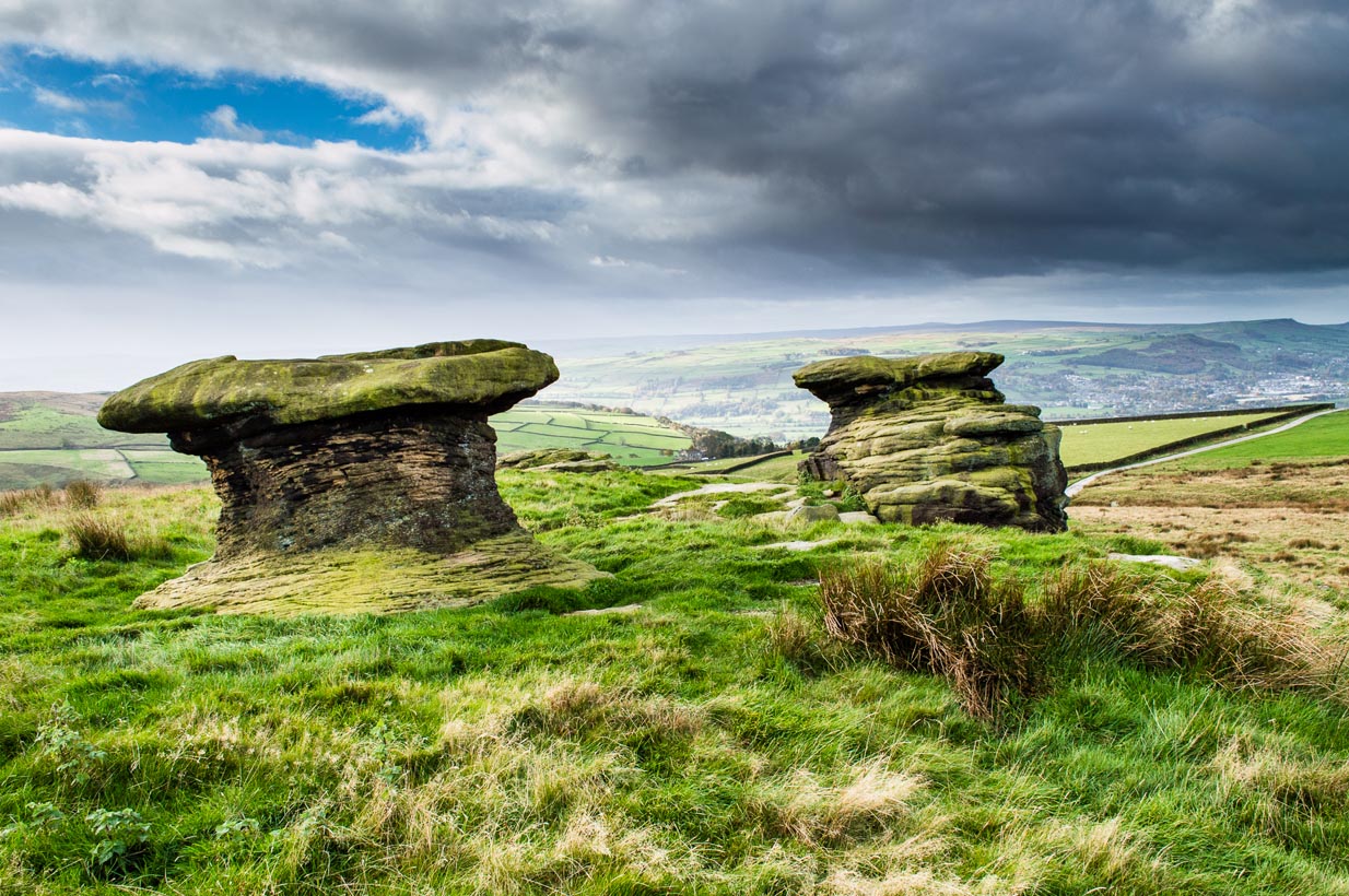
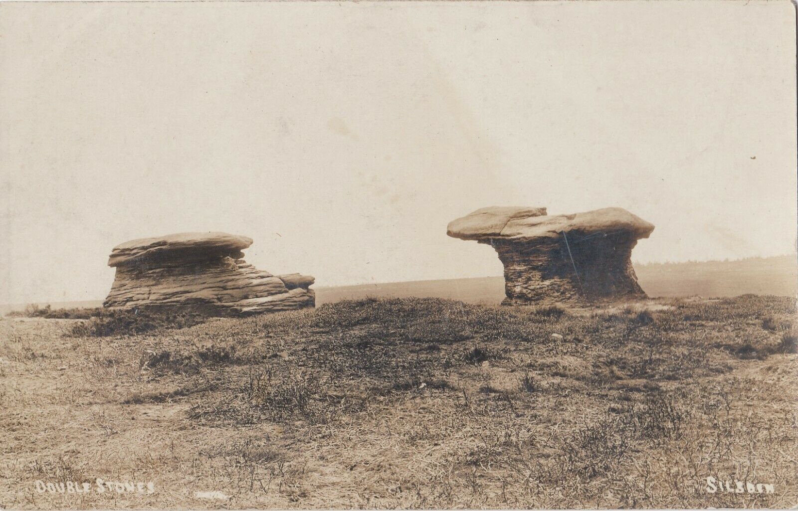
Various ways to get here, but the 2 most common are: (1) from Brunthwaite village, above Silsden, following the road uphill for a mile, then turning right (west) onto the moorland dirt-track to Doubler Stones Farm. Just before here there’s a footpath uphill (north) for 200 yards to the stones. (2) follow the Millenium Way footpath south up Addingham Moorside, onto Addingham High Moor. Keep going on the same path another 500 yards and they’ll appear ahead of you.
Archaeology & History
First described as the ‘Doublestones’ in the local Addingham parish records of 1786, these great mushroom-shaped rocks were later brought to the attention of archaeologists by J. Romilly Allen in 1879 and they greatly intrigued numerous Victorian antiquarians, who puzzled as much about their exotic forms as the cup-marks on their tops! Allen wrote of them:
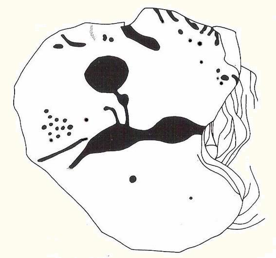
Cowling’s old drawingHedges (1986) sketch of the design
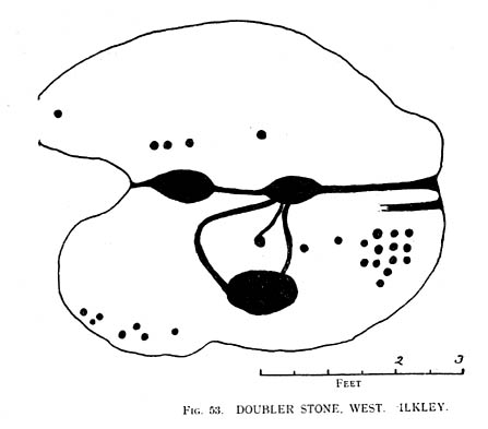
“These rocks are by far the most remarkable freaks of Nature to be seen in the district. They occupy a prominent position, perched on the extremity of a rocky knoll which juts out into the valley; and as seen from below, with their weird forms standing out clear and sharp against the background of blue sky, they present so extraordinary an appearance that they would at once attract the attention of even the most unobservant. In general outline they resemble gigantic toadstools; and I presume that they are called Doubler Stones from the fact of their shapes being almost identical. They may be appropriately described as Nature’s Twins. The upper surface of the cap of one of these stones has three large basin-shaped cavities in it. Two of these lie along the central axis of the stone, and measure respectively 1ft 3in by 2ft 9in deep, and 1ft 9in by 1ft 3in by 9in deep. They are united by a deep groove, a continuation of which runs out over the edge of the stone at each end. There is another basin lying to the west side of the two central ones, with one of which it is connected by grooves. It measures 2ft by 1ft 9in and is 9in deep. There is no direct evidence that these basins are artificial; but it is quite possible that they may have been so originally, and have been enlarged by natural agencies. But in addition to the basins, are twenty-six cup-markings of distinctly artificial origin. They vary in diameter from 2 to 4 in. One group of cups appears to be arranged in parallel rows.”
Doubler Stones, c.1890
Although the writer thought there were no artificial cup-markings on the other Doubler Stone (the one on the left in the photo), John Hedges (1986) and Boughey & Vickerman (2003) cite there to be at least two cup-markings on this rock. Other writers have given different numbers for the respective cup-marks thought to be on these rocks down the years.
If you’re into prehistoric rock-art, check this place out. If you’re a geologist and aint been here, you’ll be even more impressed!
Folklore
Approaching the Doublers (photo – James Elkington)
In Nicholas Size’s Haunted Moor (1934) he described the Doubler Stones as being the abode of ghosts and a place of sacrificial rites in ancient days. While in Guy Ragland Phillips’ Brigantia, we find that the word ‘doubler’ itself “is a large shallow dish, bowl or plate” – which we find on top of the greater one of these two well-worn-weirdoes. As well as being haunted, there is some other little-known, though not unexpected folklore here, which told these old stones to be the meeting place of witches in previous centuries.
In addition to this, we are told that the witches of Fewston valley to the west used to meet up with the more famous Pendle witches at these stones. One historian proclaimed that this notion was spurious, as it would be too far for the Pendle witches to walk – which says more about the historian in question than the people of previous centuries. The distance from Pendle to the Doublers can be traversed in a day and is an ideal meeting spot, away from the prying eyes of a wrathful Church, that sought war against the animistic practices of our ancestors.
References:
Allen, J. Romilly, ‘The Prehistoric Rock Sculptures of Ilkley,’ in Journal of the British Archaeological Association, volume 35, 1879.
Allen, J. Romilly, ‘Notice of Sculptured Rocks near Ilkley,’ ibid, volume 38, 1882.
Bennett, Paul, The Old Stones of Elmet, Capall Bann: Chieveley 2001.
Boughey & Vickerman, Prehistoric Rock Art of the West Riding, West Yorkshire Archaeology Service 2003.
Cowling, Eric T., Rombald’s Way, William Walker: Otley 1946.
Hedges, John, The Carved Rocks on Rombalds Moor, WYMCC: Wakefield 1986.
Jennings, Hargrave, Archaic Rock Inscriptions, A. Reader: London 1891.
Phillips, Guy Ragland, Brigantia: A Mysteriography, RKP: London 1976.
Size, Nicholas, The Haunted Moor, William Walker: Otley 1934.
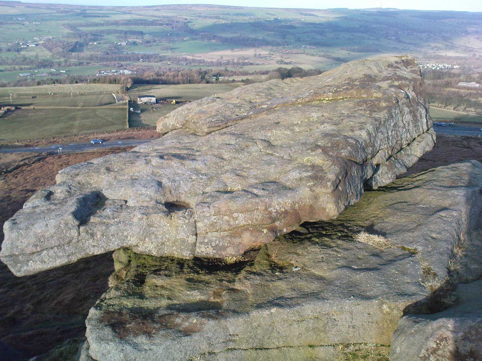
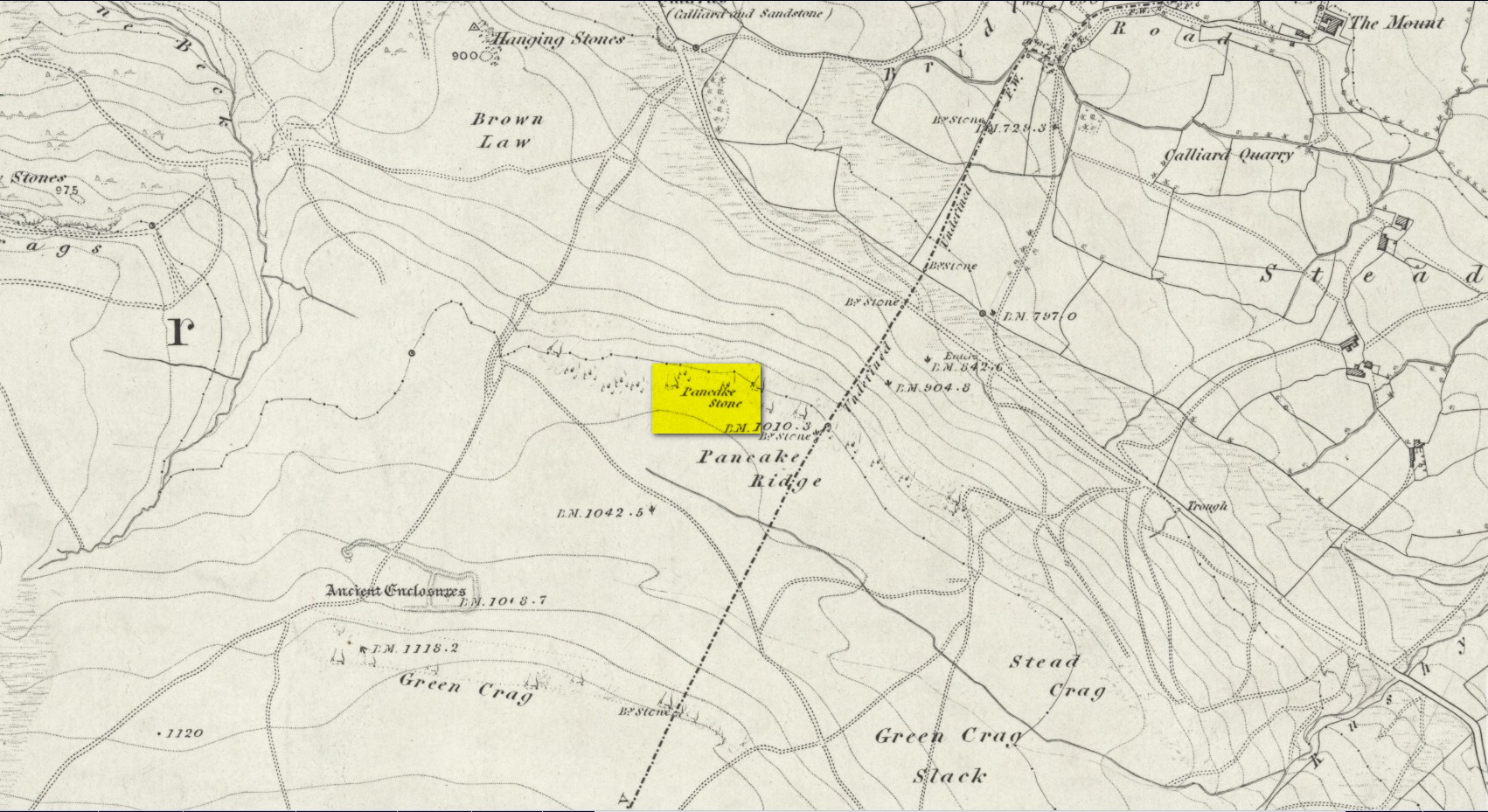
We were up here again the other week: wind, hail and snow blowing like hell, thankfully keeping the place to ourselves! To get here, head up Cow Pasture Road from the train station and up to the Cow & Calf Hotel near the famous rocks. Go past it a 100 yards or so and then look uphill onto the moors ahead of you. You’ll see a great over-hanging rock on the slope above you which looks as though its may fall down at any moment. That’s the Pancake Stone! Either walk up the steep path to get there quickly, or the longer route by taking the sloping diagonal path that runs eastwards until you’re on the same level.
Archaeology & History
Site shown on 1851 map
Highlighted on the first Ordnance Survey map of the region in 1851, this prehistoric carved stone had been known as the Pancake Stone by local people long before any antiquarians gave it their literary attention to the place. It would have had tales told of it, no doubt, but they were never written down. It’s an impressive, some would say precarious piece of rock: an elongated thin wedge of stone resting gently on the cliff edge, much like a rocking stone to be honest, seemingly hanging onto the edge of the geological ridge awaiting its fall down the slope; but that’s not gonna happen for many more centuries yet.
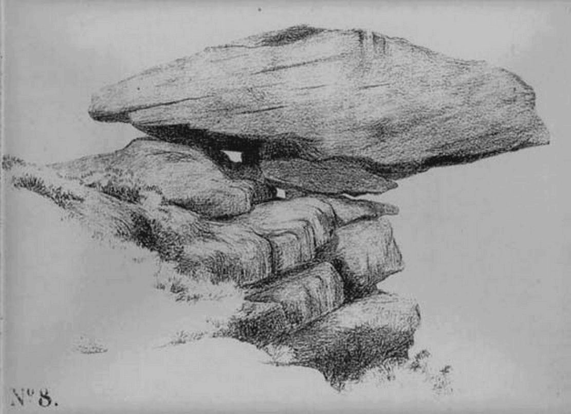
J. Thornton Dale’s 1879 drawingJ. Thornton Dale’s 1879 drawing
Much has been written about the petroglyph on the this wedge of stone, which covers much of its surface. Although a Mr J. Thornton Dale did a fine series of quite accurate drawings of this stone (and others on the moors) between 1878 and 1880, the first literary description of the Pancake rock carving appears to have been by the renowned J. Romilly Allen in 1882 (who evidently visited the stone on a cloudy or overcast day), saying that:
“On its upper surface are several cup-markings much obliterated by the actions of the weather, but some of them sufficiently distinct to prove their origin artificial, and to show that this rock was noticed in ancient times, and very possibly considered an object either of worship or superstition.”
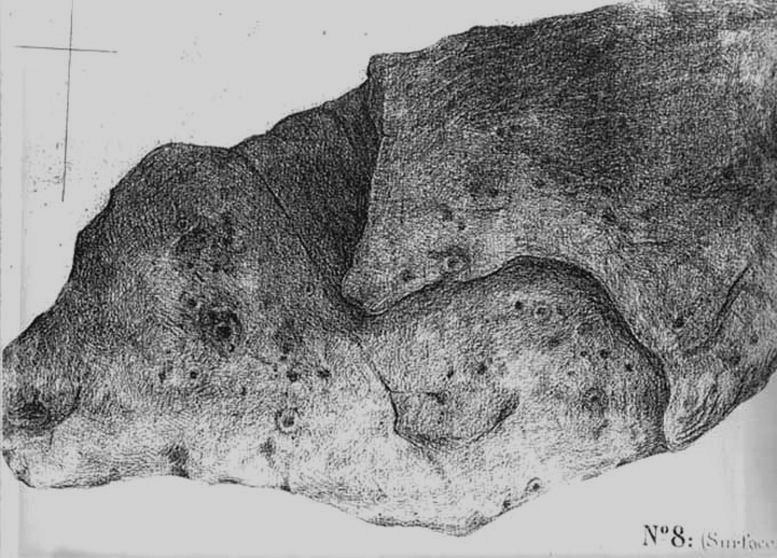
Close-up of CnRsLooking across the stone
This latter assumption is highly probable. Strong animistic notions (moreso than usual) would be very evident here. Its position on the land with its outward focus from here towards other notable points in the landscape (Almscliffe Crags is one obvious focus); as well as looking at the rock itself from other viewpoints, give the stone considerable ritual importance. Sections of the moorland plain behind it—known as Green Crag—was the Land of the Dead in ancient times, and it is more than likely that death rites would have been enacted here — though we may never know what form they took.
Dale’s 1879 sketch
The stone has what seems to be at least 54 cup-markings on its upper face, with numerous grooves meandering and connecting other points. In J. Thornton Dale’s 1879 drawing of the upper surface, you will note that a couple of the rings he included have all-but faded away and are not included in the more recent surveys. Of the primary design, rock art students Boughey & Vickerman (2003) described there being “six complete and five partial rings” amidst the morass, but much of the design is very worn and, originally, there was probably a bit more to it all. The rock upon which the main Pancake Stone rests also has some worn cup-marks etched on its surface, a couple of which can be made out in the top photo.
Folklore
Good old Nicholas Size (1934) added this site to his list as a place where he had visions of the old christian cult, upon whose bare face were enacted blood rites and sacrifice. One Beltane Eve when he decided to amble up onto the moor edge, he could see a strange glow coming from behind the rock. He continues:
“Then suddenly I noticed there was a figure dancing upon it. The figure seemed to swirl round and round with floating draperies, grey or white, and I can only say that it looked very uncanny. Stupidly, I wondered that anybody could be such a fool as to dance in the darkness upon that precarious footing…”
But such activities on these moors, at certain times of the year, have been enacted for many centuries. It’s just kept quiet and, as more modern pagans (as they like to call ’emselves) keep coming up here and to other places, so the original folk move to their older and increasingly more secluded spots… In the latter half of the 20th century the site was used as a focus by chaos magickians, shortly after the inception of that Current.
References:
Allen, J. Romilly, ‘The Prehistoric Rock Sculptures of Ilkley,’ in Journal of the British Archaeological Association, volume 35, 1879.
Allen, J. Romilly, ‘Notice of Sculptured Rocks near Ilkley, with some Remarks on Rocking Stones,’ in Journal of the British Archaeological Association, volume 38, 1882.
Boughey, Keith & Vickerman, E.A., Prehistoric Rock Art of the West Riding, West Yorkshire Archaeology Service 2003.
Cowling, Eric T., Rombald’s Way, William Walker: Otley 1946.
Hedges, John, The Carved Rocks on Rombalds Moor, WYMCC: Wakefield 1986.
Jennings, Hargrave, Archaic Rock Inscriptions, A. Reader: London 1891.
Size, Nicholas, The Haunted Moor, William Walker: Otley 1934.
Speight, Harry, Upper Wharfedale, Elliott Stock: London 1900.

 But such speculation aside – the brief literary history of this stone is: first described by Stuart Feather in 1965 and illustrated by Sidney Jackson the same year. The rock art students Boughey & Vickerman’s (2003) described around sixty ‘cups’ etched onto the stone here, but they made no comment about either the odd nature of the cups or the possibility of it being modern. Perhaps it’s just me…


")
")