Chambered Cairn: OS Grid Reference – NS 45217 91907
Also Known as:
- Canmore ID 282019
Getting Here

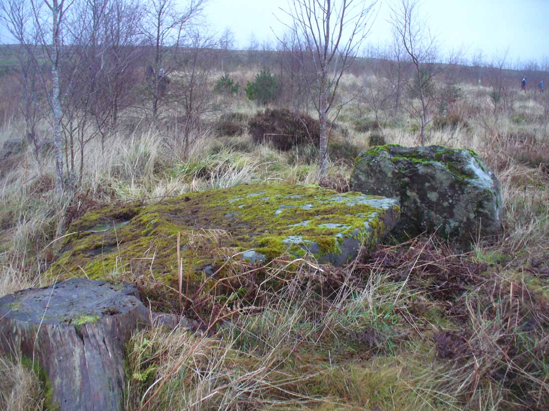
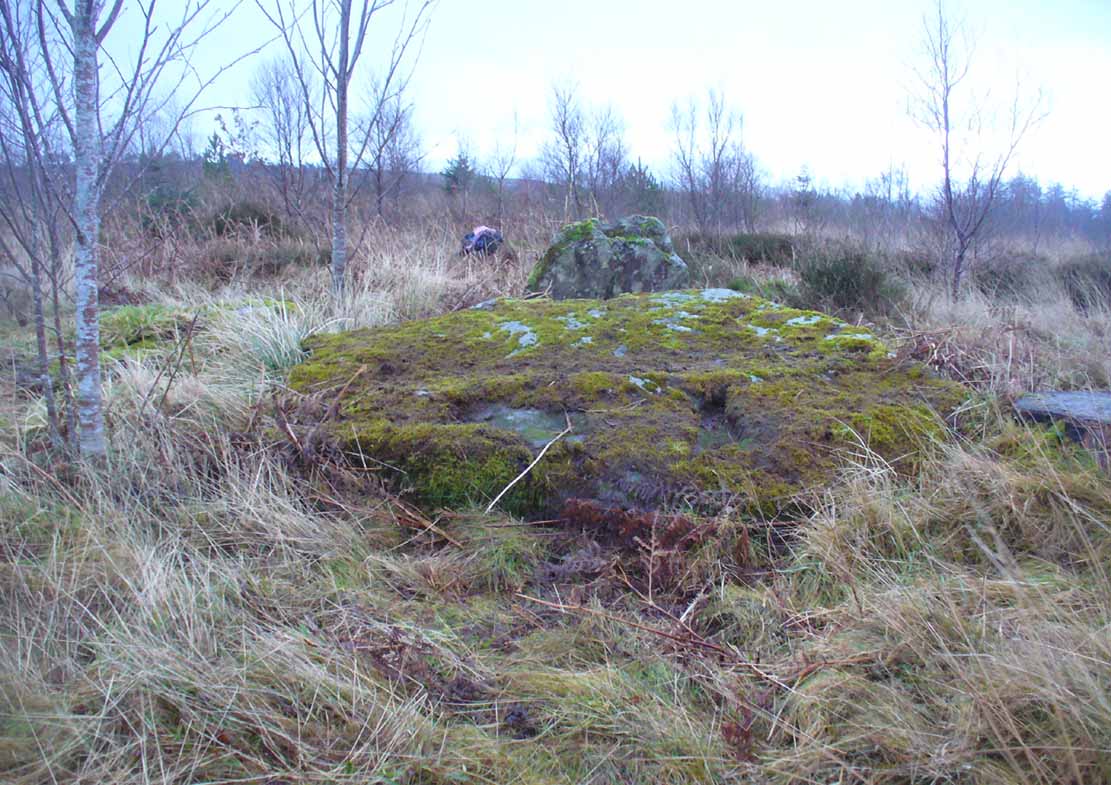
The main stones in this ruined cairn
On the B837 between Balmaha and Drymen at the hamlet called Milton of Buchanan, at the little road junction where the houses are on the right, go uphill for 1 mile (1.6km) until you reach the West Highland Way, where you need to go left (NW). Keep walking for another half-mile (if you get to end of the forestry plantation, you’ve gone too far) where, on your left, a small widening valley appears. Walk along the eastern edge of this, keeping your eyes peeled for a small upright stone and two large flat companions next to it.
Archaeology & History
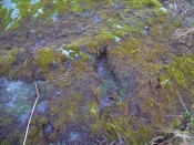
This site is really only for the archaeological purists amongst you, as the forestry plantation has truly taken its toll on the site and very little of it remains. It appears to have been described first of all in H.G. Smith’s (1896) masterful local history work—although popular tradition was not assigning the place as a prehistoric tomb of any sort. Rather, it possessed a somewhat familiar folklore element, well-known to occult historians and antiquarians. Smith told us:
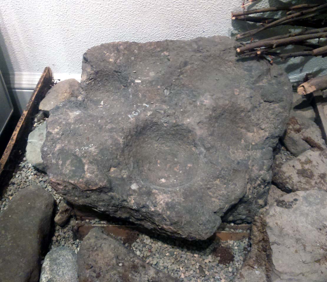
“Not far off, in Garradh-ban Wood, is the ‘Deil’s foot mark stone‘. It is a large flat stone, 7 feet long and 6 feet wide, with an impression on it not unlike a huge foot mark. There is another stone close to it, 7 feet by 5 feet. These stones were probably placed there for some purpose now unknown.”
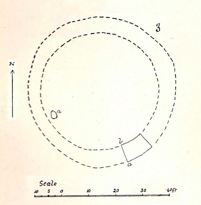
Mr Smith’s dimensions of the stones correlate closely with the modern analysis taken up by the archaeologists who visited the site more than 100 years later. Mainly comprising of two large stones on the ground with an accompanying upright monolith on the western side, the official Canmore account tells us:
“The cairn has been reduced to a low stony mound measuring 15m from N to S by 12m transversely and up to 0.5m in height. The chamber, which lies off-centre to the SW, comprises two upright stones and two displaced capstones. The overall plan of the chamber can no longer be determined, and the two upright stones are set splayed to one another; that on the W measures 0.53m by 0.25m and 0.15m in height, and that on the E is heavily laminated measuring 1m by 0.18m and 0.8m in height. The SE corner of one capstone rests on the smaller of the two uprights. It measures 2.1m by 2.03m and up to 0.3m in thickness, and has two fragments broken off at its NE corner. The second capstone lies immediately adjacent to the N, flush with the surface of the cairn, and measures 2.3m by 1.7m and 0.17m in thickness.”
When they assessed the site in 2006, archaeologists reported finding small pieces of quartz scattered over the surface of the cairn, but when we visited here last week, there was little trace of any.
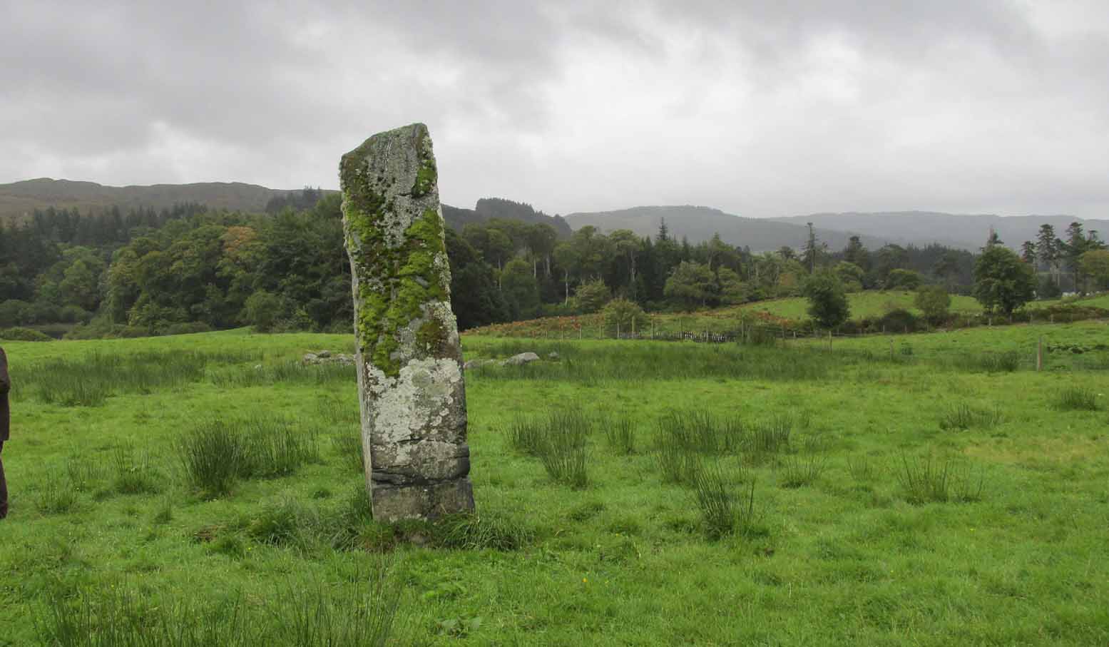
The ‘Deil’s foot mark’

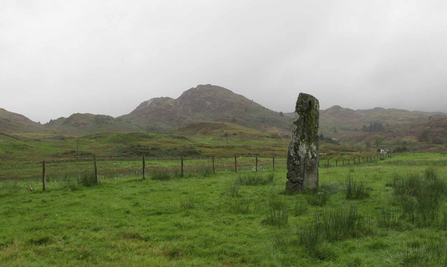
Garadh Ban, looking west
I was hoping that the “Devil’s footmark” on the stone was going to be a cup-marking of some form, as found at some other sites (Kilneuair church, etc)—but it wasn’t to be. Instead, it seems that the curvaceous indentation left by the ‘devil’ was simply a natural cavity. The folktale behind the name, and its possible cultural function, seems to have been forgotten.
Although (perhaps) unrelated, H.G. Smith told us of other remains not too far from here, which remain elusive and not in any official record-books. We had a quick meander over to see if there was anything to be seen, but daylight was fading fast and more searches are required. It sounds intriguing:
“A little above these ruins (of Cul-an-Endainn farmhouse at NS 4453 9244 – PB), on the right of the burn, but considerably above it, is a curious structure built of turf. It is quite round, and is 25 feet in diameter at the top and 15 feet at the bottom. It has entrances at the south, east and west. There are others of the same construction both above and below, but not so well defined.”
Recently, industrialists have gone onto this part of the countryside and have already began scarring the hillsides, perhaps even destroying these curious remains before we’ve had a chance to assess them. Hopefully however, they will remain untouched and allow us site analysis before any real damage is done.
Folklore
Followers of the christian cult said this site was a place where the devil had been.
References:
- Smith, H. Guthrie, Strathendrick and its Inhabitants from Early Times, James Maclehose: Glasgow 1896.
Acknowledgements: Many thanks to Aisha Domleo, Lara & Leo Domleo, Unabel Gordon, Nina Harris, Paul Hornby and Naomi Ross for their help and attendance in finding this ancient site.
© Paul Bennett, The Northern Antiquarian