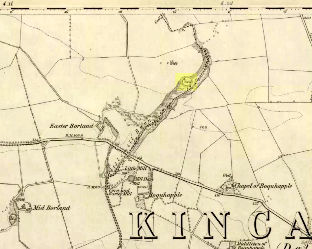
Dun: OS Grid Reference – NS 75074 90902
Also Known as:
- Canmore ID 46233
- Castlehill Wood
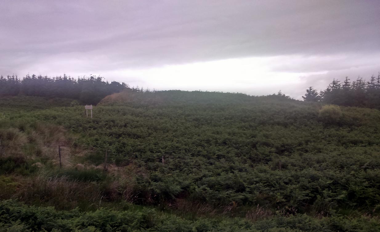
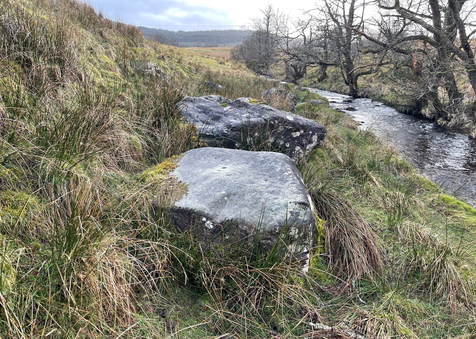
Take the Gateside Road from St Ninians or Polmaise Road out of Torbrex across the M9, heading out west onto the southern moors of Touch Hills, passing the Wallstale dun in the trees and then the Castlehill dun just off the road. Keep going uphill for just over half-a-mile, keeping your eyes peeled on the right for where the MOD lads play some of their war-games. Walk along the track here, following the line of the woods, until it gets to the spot where it doubles back on itself. Just here, about 30 yards in front of you, a rounded walled knoll gives the game away!
Archaeology & History

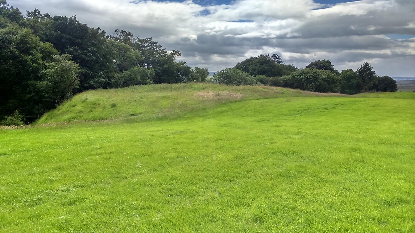
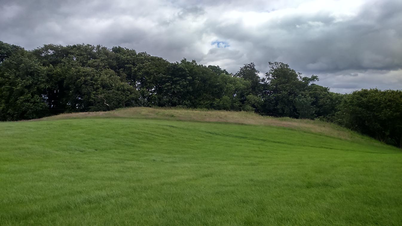
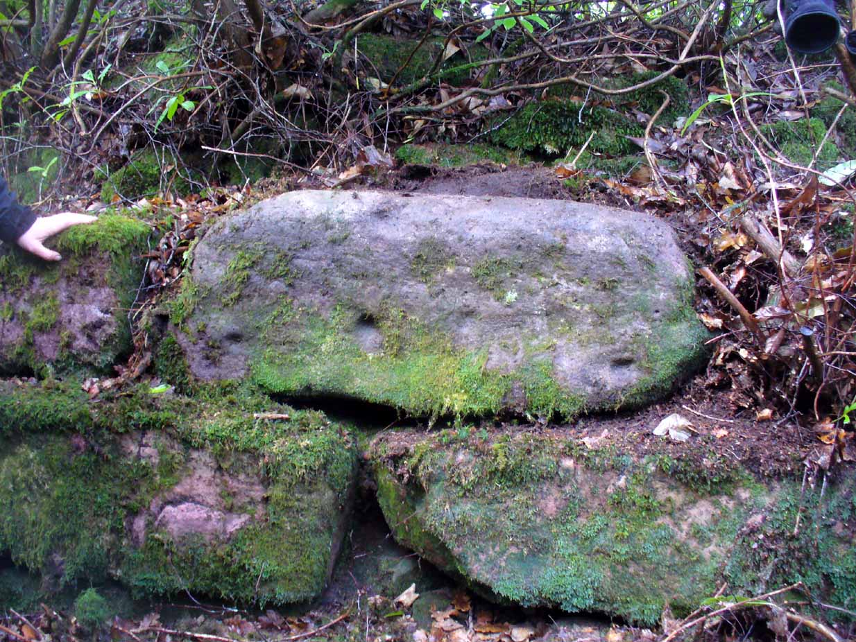
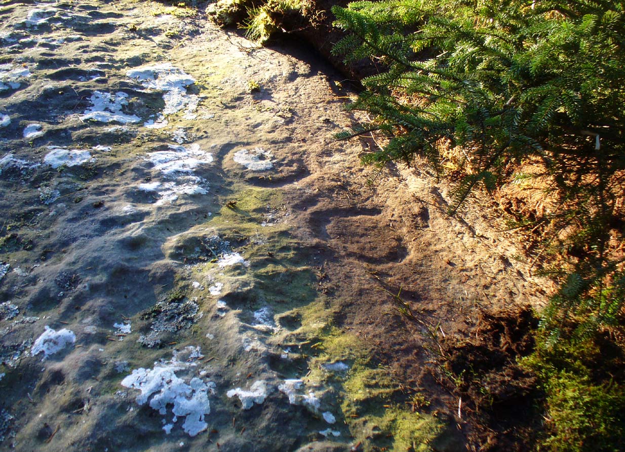
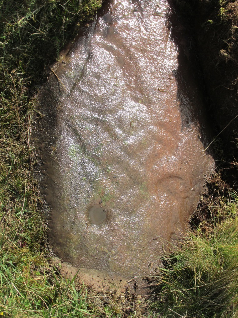
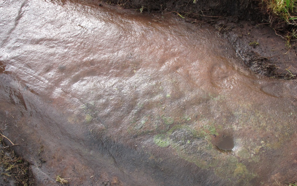
An impressive-looking site, not too far off the moorland road, it is one of more than half a dozen hillforts and duns found to the west of Stirling, all of them relatively close to each other—showing that a lot of human activity was going on here in the Iron Age and, probably, much earlier. Looking like a cross between a broch and a traditional hillfort, the site is best visited in the Winter and Spring months before the bracken starts to encroach and cover it.
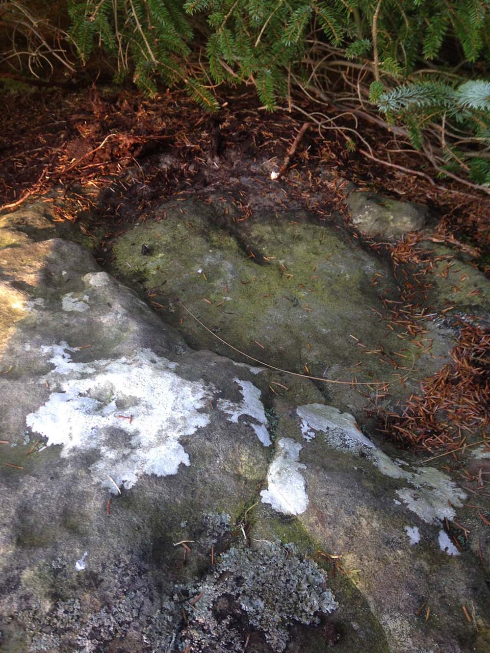
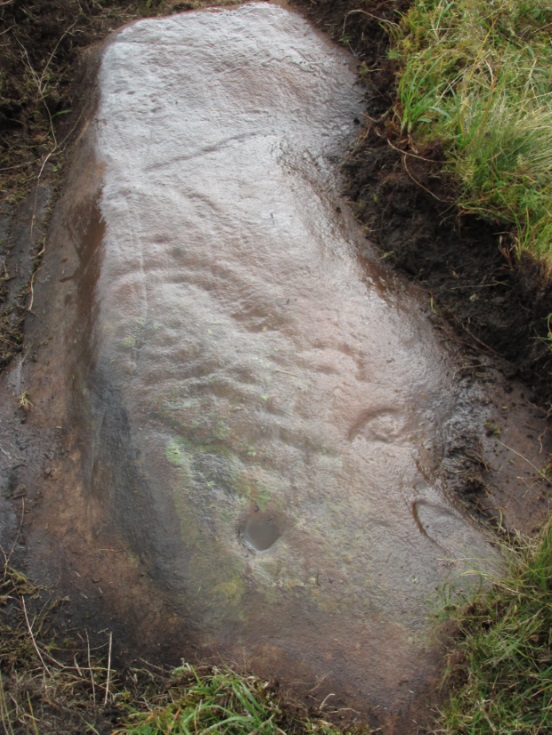
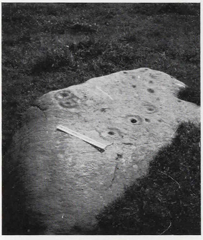
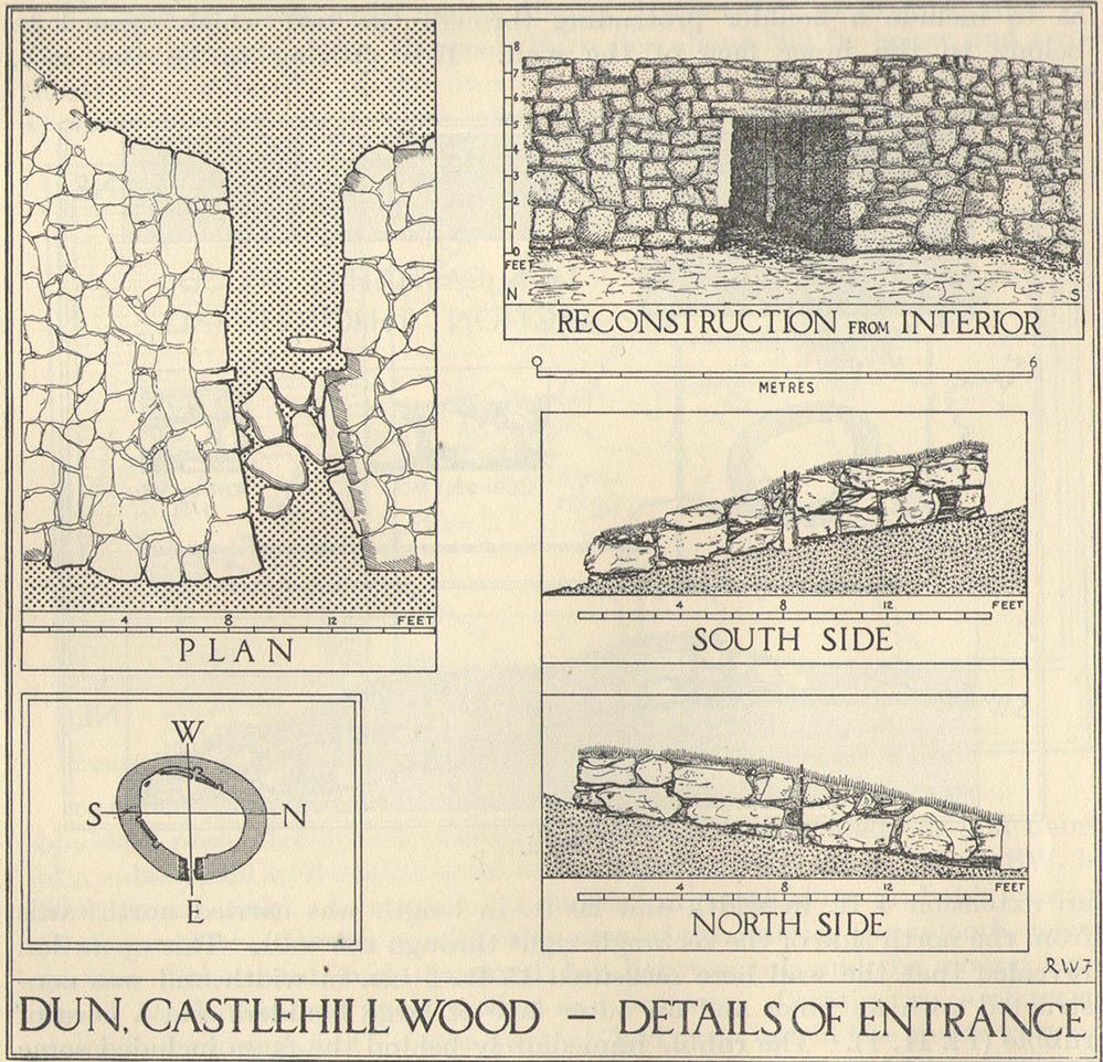
Officially rediscovered in 1952 and excavated three years later, it was thought to have been built in the 1st century AD and used for a few hundred years thereafter. As you walk up to the eastern edge of the monument, a large entrance, 4½ feet wide, allows you into the large open space within. From here, and walking around both the inner and outer walls, you get an idea of the huge amount of work it must have taken to build this structure. The walls alone which constitute the main of Castlewood Dun are, on average, 16 feet thick! The Royal Commission report for the area (summarizing the archaeological work of F.W. Feacham in the ’50s) gives the basic architectural features of the place:
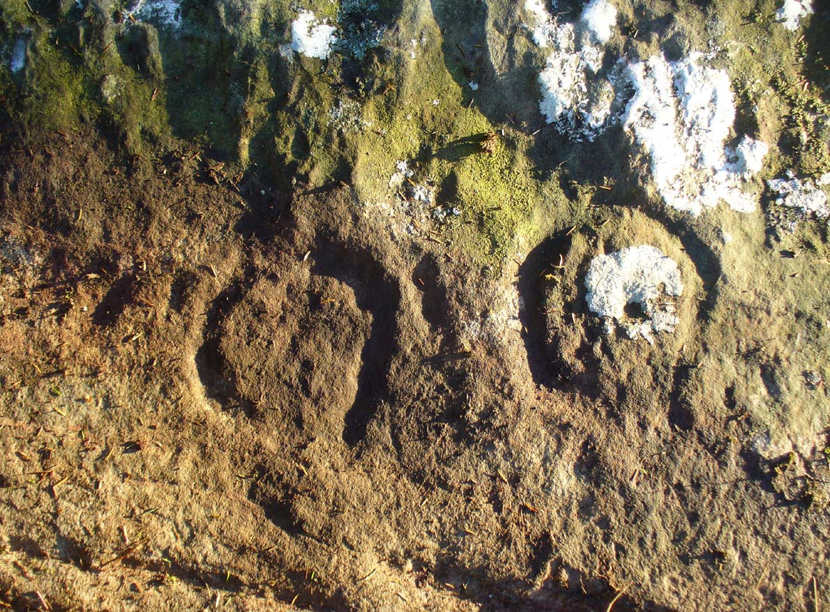
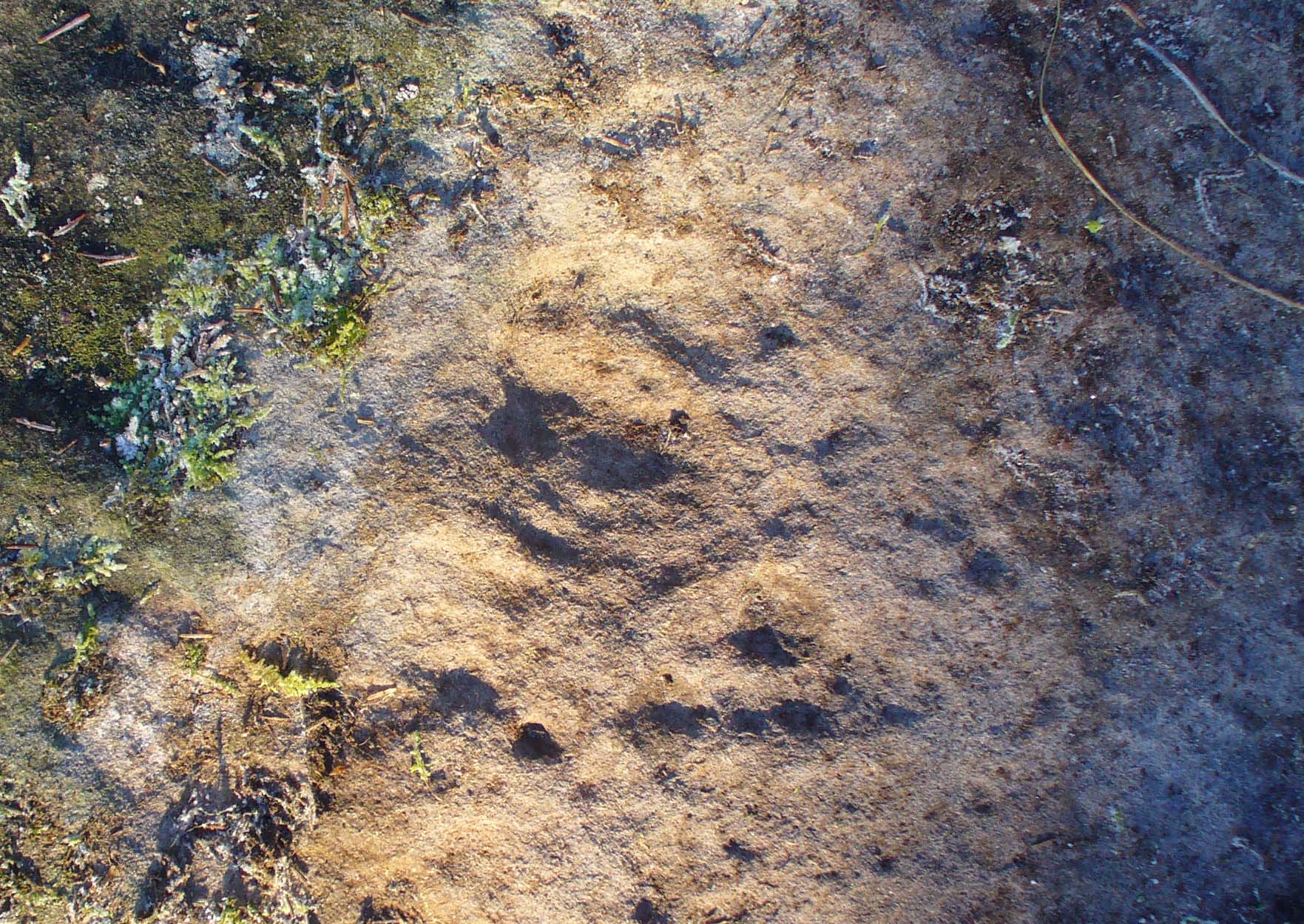
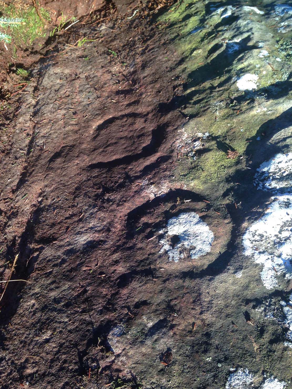
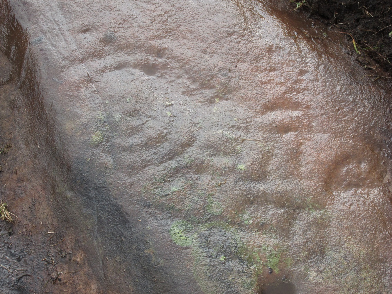
“The dun is oval in plan…and measures 75ft from NE to SW, transversely within a drystone wall 16ft thick. The faces of the wall are composed of large, angular blocks, and the core of boulders, small rubble and earth. The entrance in the E arc, is provided with door-checks. Within these, the passage measures 4ft 6in in width, and outside them 3ft 9in. A few paving-stones were laid to level the rough rock surface of the passage-floor. Traces of what might have been the bottom step of a stair, rising up the inner face of the wall, were found at a point 8ft N of the entrance. The dun had no mural stair or galleries, but two sets of mural chambers were located, one in the W and the other in the S acr of the wall. The former consisted of an entrance-passage, 6ft in length, which varied in width from 2ft at the outer to 3ft at the inner end, where it opened into a circular chamber 4ft in diameter. From either side of the passage a narrow duct or flue, about 19ft in length and 1ft 6in in width, led off obliquely through the core of the wall to debouch into the interior of the dun. The construction in the S arc consisted of a similar passage, one flue and a smaller chamber. Ash and a clinker of very light weight were found in the form of deposits in both passages and all the flues. …The excavator suggested they might have been corn-drying installations.”
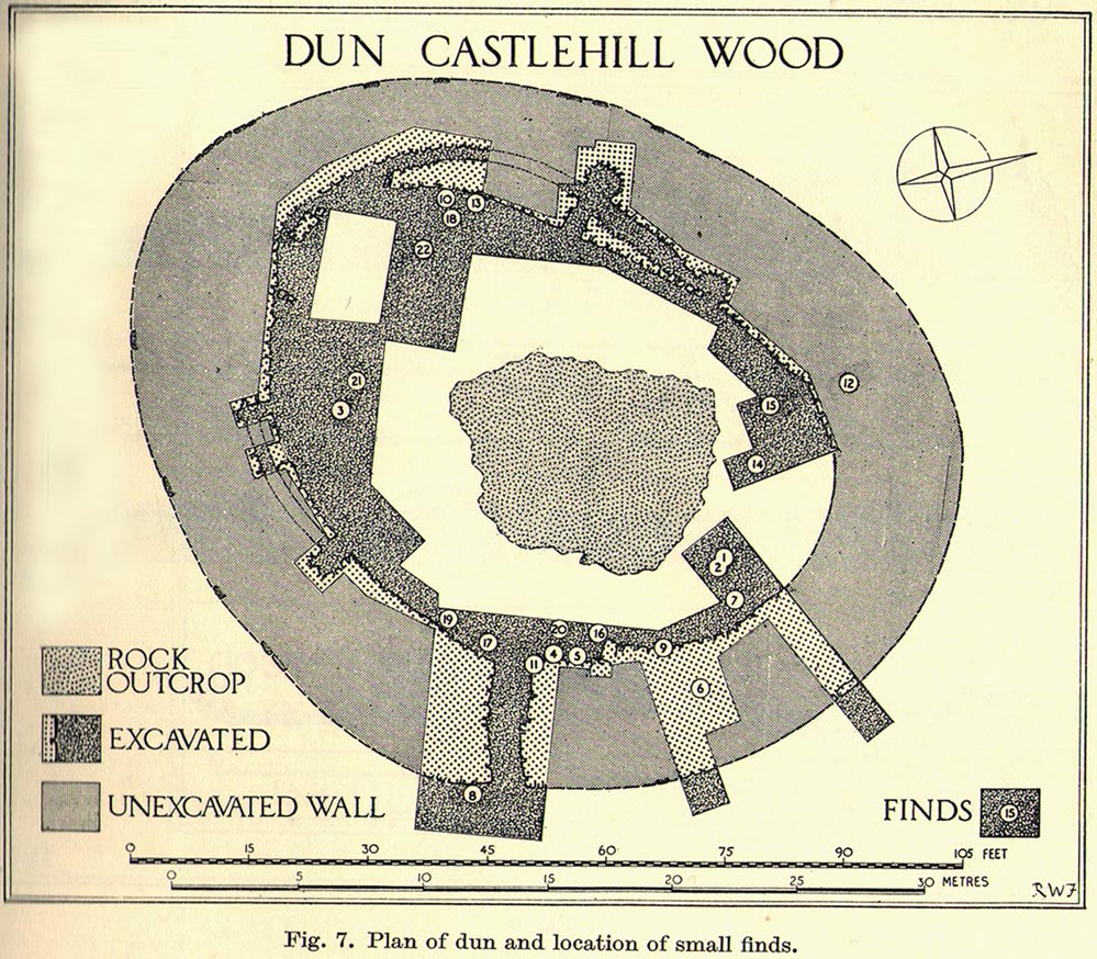
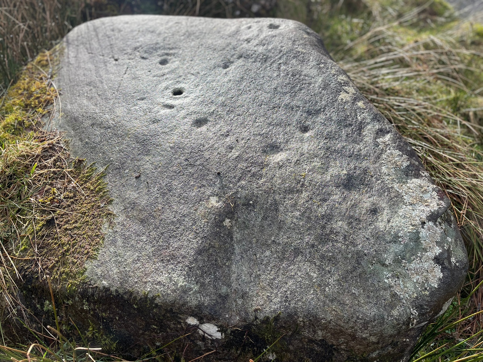
Apart from a small piece of Roman glass, quern fragments, anvils stones and a pot lid, the excavators found very little inside the dun—not even any hearths. The walling on the southwest and western edges was built onto a small cliff, making access slightly difficult from that side.
From the site itself, views are excellent, particularly in an arc through the north, east and southeast, with the western skylines being only a short distance away. This enabled relatively easy tribal communication with people at the other brochs, duns and forts in the area, across an otherwise large but difficult landscape in prehistoric times. A few hundred yards to the northeast, on the other side of the recently planted tree-farm (forestry plantation), a large D-shaped structure—possibly Iron Age, possibly medieval— is accompanied by lines of ancient walling running down the slopes.
References:
- Feachem, R W., “Castlehill Wood Dun, Stirlingshire“, in Proceedings Society Antiquaries, Scotland, volume 90, 1959.
- Feachem, R W., “Castlehill Wood, Polmaise”, in Discovery & Excavation Scotland, 1955.
- MacKie, E W. “English Migrants and Scottish Brochs’, in Glasgow Archaeological Journal, volume 2, 1971.
- Royal Commission on the Ancient & Historical Monuments Scotland, Stirling – volume 1, HMSO: Edinburgh 1963.
- Royal Commission Ancient & Historical Monuments, Scotland, Archaeological Sites and Monuments of Stirling District, Central Region, Edinburgh 1979.
© Paul Bennett, The Northern Antiquarian