There are no remains left of this old ‘weem’, earth-house, or souterrain as they are now commonly known. It was one of at least seven separate souterrains beneath the fields between the Barns of Airlie and Brae of Airlie, but very little is now known of this one. The first and only real note of the site was given in Mr A. Jervise’s (1864) essay on the antiquities of Airlie parish. Nearly a hundred years later when F.T. Wainwright (1963) went to investigate any possible remains, he found very little, telling:
“A possible location for Airlie III…presented itself on 24 June, 1951, when Mr D.B. Taylor and I noticed a considerable number of boulders and slabs cast up in the field which lies over the wall from the entrance to Airlie I (souterrain). The farmer was aware that there was a heavy concentration of stones spread over an area of two or three thousand square feet, but he could add no further information. In 1951 we were not able to do more than record this possibly significant scatter of stones—it lies between 150 and 200 feet west from the present entrance of Airlie I on a bearing of 260º—and to note that it could very well indicate a souterrain settlement.”
Most of the scattered stone was subsequently removed for use in walling and no trace remains of the place.
Described by the early 20th century antiquarian and megalithomaniac Fred Coles (1903) as being situated “about 1¼ mile SE from the church at Ythan Wells,” all trace of this stone circle has long gone, and had already disappeared when Coles was surveying the region, telling merely that it had been here “in open fields.” All subsequent explorations looking for remains of the site has proven fruitless.
References:
Barnatt, John, Stone Circles of Britain – volume 2, British Archaeological Report: Oxford 1989.
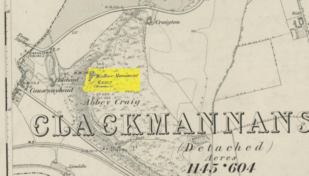
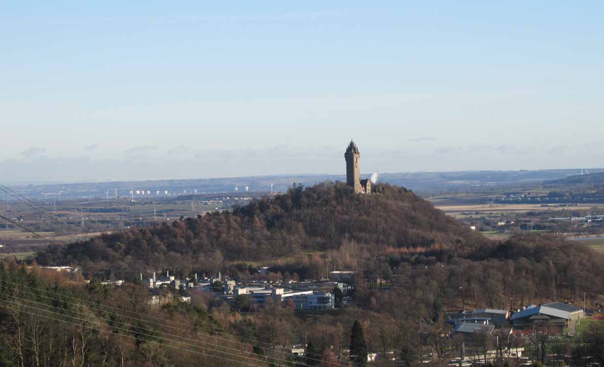
Most folk visiting here are coming from Stirling city. There are various buses to get here, which head out over Stirling Bridge along Causewayhead Road (the A9) for half-a-mile where, at the roundabout and the William Wallace pub, go straight across up the minor road, zigzagging back on itself, until you reach the signs for the Wallace Monument. Follow the well-defined footpath and, once on top of the hill, walk round the back of the mightily impressive tower.
Archaeology & History
Located right where the impressive Wallace Monument proudly stands, this prehistoric precursor to Sir William Wallace’s memory was where Scotland’s legendary hero and his men cast a clear and easy view over Bannockburn, where the halfwit english came for a fight—and deservedly lost! The structures that used to be inside the now denuded hillfort would, no doubt, have been used by Wallace’s men; but much of those prehistoric remains have now been destroyed. The visible remains of the fort can be seen round the back of the Wallace Monument: elongated rises of overgrown walling that run almost all the way round, getting slightly higher as you approach the more northern edges, like a semi-circular enclosure.
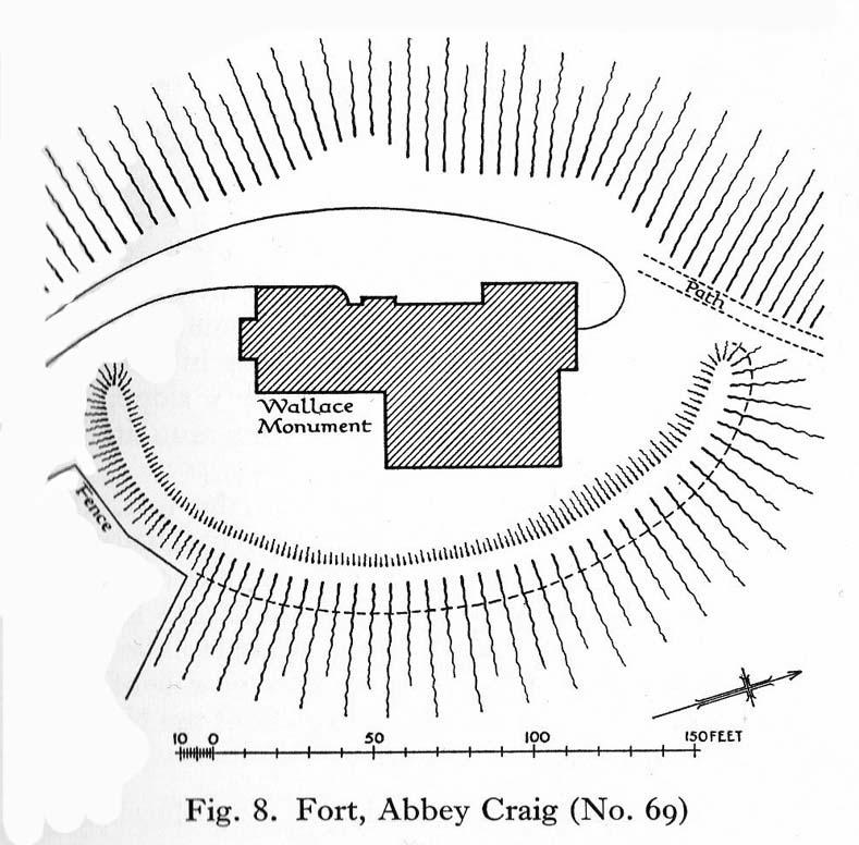
Royal Commission planAbbey Craig – and the great Wallace Monument
The site was described very briefly in William Nimmo’s (1880) early survey of the area, where he told that in 1784, “eleven brazen spears were found on the Abbey Craig, by a Mr Harley”, which he thought came from the time when the earlier ‘castle’ stood here. He was probably right. Many years later, the prehistoric remains were included in the county survey of archaeological sites by the Royal Commission lads (1963), who told that, near the north end of the summit of Abbey Craig,
“there is a fort which has been damaged by the construction within it of the Wallace Monument. All that remains is a substantial turf-covered bank, cresentic on plan and 260ft in length, the ends of which lie close to the brink of the precipice that forms the west face of the hill. The bank stands to a maximum height of 5ft above the level of the interior and presumably represents a ruined timber-laced wall, since numerous pieces of vitrified stone have been found on the slopes immediately below it.
The entrance to the fort presumably lay between one end of the bank and the lip of the precipice, but both the areas concerned have been disturbed by the construction of the modern approaches. The interior of the fort measures about 175ft from north to south, by about 125ft transversely and the interior is featureless.”
The fort was probably built sometime in the early Iron Age; so the next time you visit this fine spot, check the remains out round the back of the tower—and remember that our ancestors were living up here 2500 years ago!
Feacham, Richard W., Guide to Prehistoric Scotland, Batsford: London 1977.
Hogg, A.H.A., British Hill-Forts: An Index, BAR: Oxford 1979.
Nimmo, William, The History of Stirlingshire – volume 1 (3rd edition), T.D. Morison: London 1880.
Royal Commission on the Ancient & Historical Monuments Scotland, Stirling – volume 1, HMSO: Edinburgh 1963.
Royal Commission on the Ancient & Historical Monuments of Scotland, Archaeological Sites and Monuments of Stirling District, Central Region, Society of Antiquaries of Scotland 1979.
There is no written history of this site; only the quiet murmurings of a few locals whose families go back to when the English came and destroyed the people and their lives in the 18th and 19th century in the ethnic cleansing we known as The Clearances. As with the Darach nan Sith (the Oak of the Fairies) a few miles away, the local traditions were lost, and ancient monuments destroyed. Thankfully, due to the remote location of this site, its status remains….
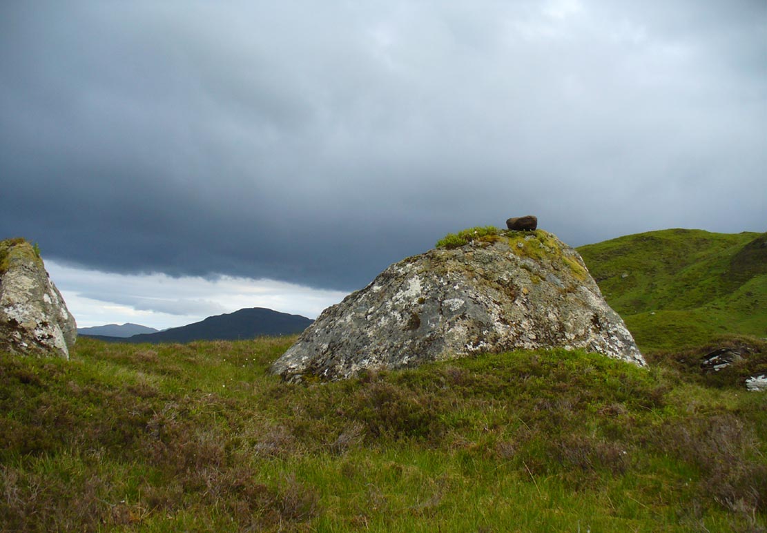
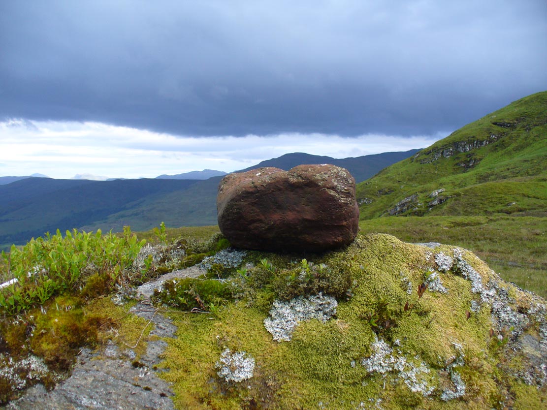
It is found 2000 feet up, near an old derelict village (english academic romancers term it as ‘sheilings’). An ancient track and stone bridge runs over the burn nearby, place-names evidence tells of a prehistoric tomb a few hundred yards west, and there’s a dispersal of forgotten human evidences scattering the south-side of the mountain all along here. The clach (stone) sits on the very top of a large earthfast rock; is an elongated loaf-sized smooth red-coloured stone, about 14 inches long and 8 inches wide, and of a different type and much heavier than the local rock hereby. It is said to have been a healing stone, used in earlier times to cure warts and other ailments.
Folklore
The Wart Stone itself
My first venture here was, like many in this area, amidst a dreaming. Those who amble the hills properly, know what I mean. I cut across the mountain slopes diagonally, zigzagging as usual, always off-path, resting by mossy stones and drinking the waters here and there. My nose took me to the mass of giant rocks hedging into the higher regions of Allt Ghaordaidh: a pass betwixt the rounded giants of Meall Ghoaordie and Meall Cnap Laraich, where only eagles and Taoist romancers might roam.
The great rock comes upon you pretty easily. Approaching it for the first time I wondered whether there might be petroglyphs on or around it, but the rich depth of lichens and its curious crowning elongated stone stopped any further thought on the matter. The setting, the eagles, the colour of day and the fast waters close by, stole all such thoughts away. In truth I must have walked back and forth and near-slept below the place for an hour or two before I gave way to rational focus! And then my curiosity got even more curious.
“This must be the place,” I mused, several times.
As you can see in the photo, a large natural earthfast boulder, six feet high or more, like a giant Badger Stone covered in centuries of primal lichens, has a large deep red-coloured stone on its very crown. The stone is unlike any of the local rock and is very heavy. I found this out when trying to prize it from its rocky mount, dislodging it slightly from the seeming aeons of vegetation that held it there. But the moment I moved it, just an inch or so above its parent boulder, a quiet voice inside me rose sharply into focus.
“You shouldn’t have done that!”
The Wart Stone. looking east
Quickly I set it back into place, shaking my head at what I’d done. One of those curious feelings you get at these places sometimes wouldn’t leave me, however much I tried to shake it off. …Silly though it may sound, the echoes inside kept saying over and over to me, “you’re gonna get warts now you’ve done that!” Logically, of course, that made no sense whatsoever. I’d only ever had one wart in my life, a couple of decades ago. And yet, a few days later, one of the little blighters emerged on my finger! So there was only one thing for it! If this was a Wart Stone, I should revisit it again and place my afflicted finger back onto the wart and ask it to be taken back into the stone.
A week or so later, I clambered all the way up the mountainside again and asked the place to forgive my stupidity and take back the wart. Apologising to the spirit of the stone, I rubbed my finger on the curious coloured rock and, I have to be honest, didn’t know what to expect.
I spent the next few hours meandering here and there over the hills and cast the thought of the Wart Stone back into my unconscious. But a few days later it had started shrinking – and within a week, had completely gone! This faint relic of an older culture, this Clach na Foinne had performed its old ways again, as in animistic ages past…
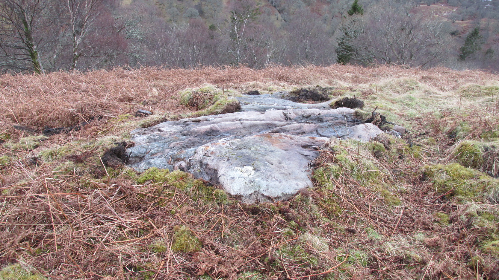
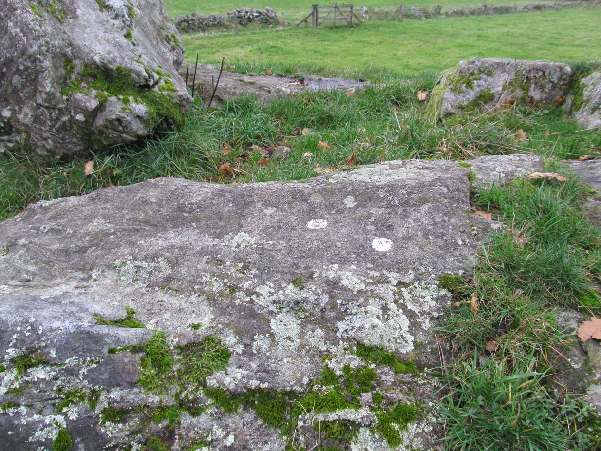
Going out of Killin towards Kenmore on the A827 road, immediately past the Bridge of Lochay Hotel, turn left. Go down here for just over 2 miles and park-up where a small track turns up to the right, close to the riverside and opposite a flat green piece of land—right by The Green cup-marked rock-face. Walk up the small bendy track for about ⅔-mile (1km) and eventually, high above the tree-line, the road splits. Right here, go through the gate and walk downhill, over the boggy land, cross the burn, then the overgrown wall, and a second overgrown wall. Very close hereby is a small rise in the land amidst the mass of bracken, upon which is the stone in question!
Archaeology & History
Close-up of some cups
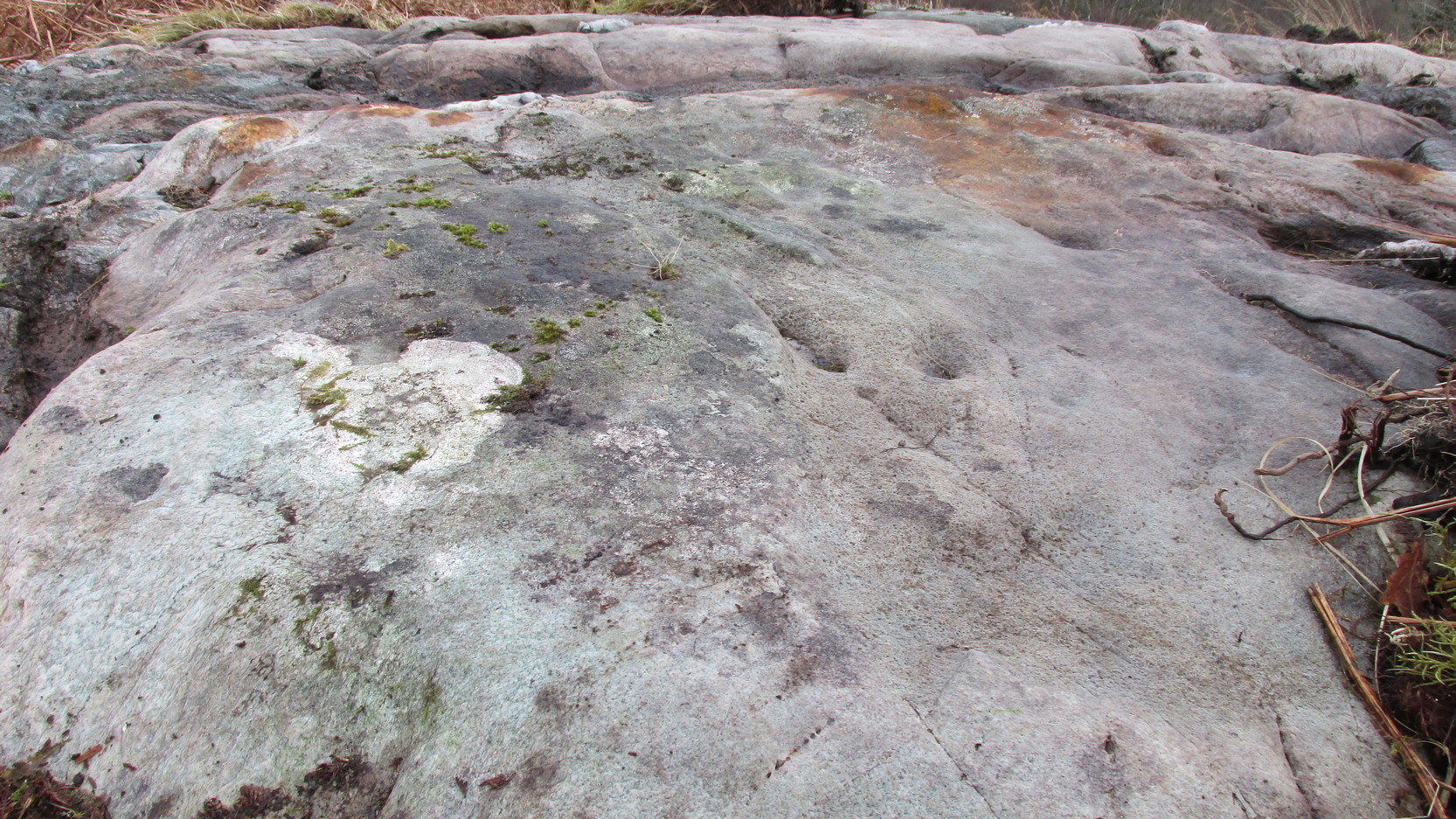
This large long, undulating, quartz-rich stretch of rock has two main petroglyphic sections to it, with curious visual sections of natural geological forms accompanying the cup-markings, found either side of the stone on its north and south sides. Its northern face has at least 20 cup-marks, of differing sizes, measuring between one and two inches across and up to half-an-inch deep. Their visual nature is markedly different to those on the more southern side of the stone, where they are generally smaller and much more shallow, perhaps meaning they were carved much earlier than their northern counterparts. One of the cups on this section has a very faint incomplete ring around it.
Running near the middle of the rock is a large long line of quartz and a deep cleft in which I found a curious worked piece of quartz shaped like a large spear-head, and another that looks like it’s been deliberately smoothed all round the edges. Both these pieces fit nicely in my hand. All around the edges of the stone, many tiny pieces of quartz were scattered, as if they had been struck onto the stone—either to try carving the cups (damn problematic!), or for some visual/magickal reason.
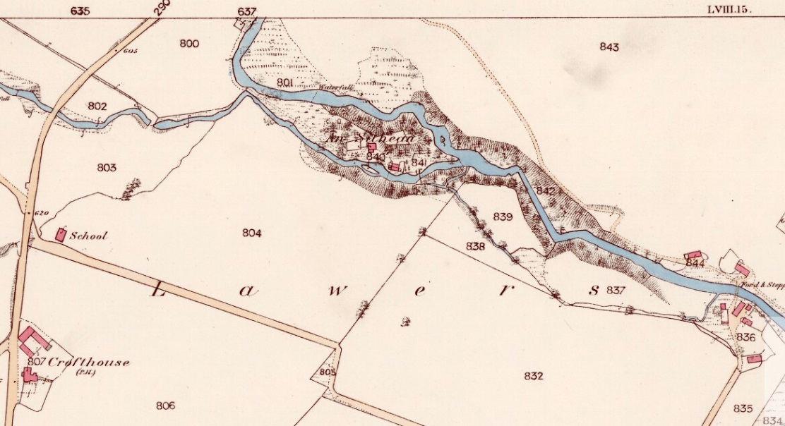
Take the A827 road on the north-side of Loch Tay between Killin and Kenmore, and roughly halfway along you’ll find the tiny hamlet of Lawers. Go down into the hamlet itself and, amidst the remains of the old trees where now are houses, nestled on a rise in the land with burns (streams) on either side, remains of the fairy mound of An Sithean still lives…
Folklore
Remnants of the legends of little people are legion in the Scottish mountains. Sadly, many of them died when the English arrived and culled the population in ‘The Clearances’ of the 19th century – none moreso than in the area surrounding Loch Tay. But thankfully, in the latter-half of the 19th century, a local man called James MacDiarmid (1910), took it upon himself to write down many of the old stories told by the remaining locals – as well as narrate those he remembered as a boy, as told by the elders around him. Whilst tales of ‘fairies’ and other such creatures are thought by city-minds to be little other than fantasies, mountain-folk cosmologies differ greatly to those who are disconnected from the natural world. Genius loci abound, and animism is the basic plinth integral to communities in the hills, where the world is much much more real. This is one such tale…
“Not many years ago there lived in the neighbourhood of Killin a man who was in the habit of recounting his wonderful adventures with the white horse of the fairies. When coming home one night from Kenmore market, and just as he was passing Sithean, Lawers, he heard most enchanting music proceeding from the knoll. Unable to resist the temptation, he gradually went nearer and nearer the fairies’ place of abode, till at last he was fairly among them. They received him most kindly, and on parting gave him one of their white horses to carry him home. His steed went through the air at a speed almost equalling that of lightning, and in a few minutes he found himself above a house at Clifton, Tyndrum, some twenty-five miles westward from Lawers. Happening to shout “ho!” when he was right above the chimney, the fairy horse threw him off its back, and down he dropped feet foremost through the wide, old-fashioned chimney, and alighted in the midst of a wedding party, much to their surprise and alarm. He continued in their pleasant company till daylight, when he returned home at his leisure, thanking the fairies for the pleasure they had so unexpectedly given him!”
Usually, tales such as this relate to the existence of prehistoric cairns or tumuli (burial sites), but no such archaeological remains have ever been known to live here. Equally curious is how the man in this tale wasn’t kept in the timeless realms, beloved of faerie-land, where reveries with them would take decades from a man’s life, even though it only felt like one night.
I’ve come across old locals who still speak, not just of the little-folk, but of other hauntings in this beautiful part of Loch Tay. May the land not be cursed by the fools who put their idea of ‘development’ in front of the genius loci here; lest madness and ill-fortune will prevail…
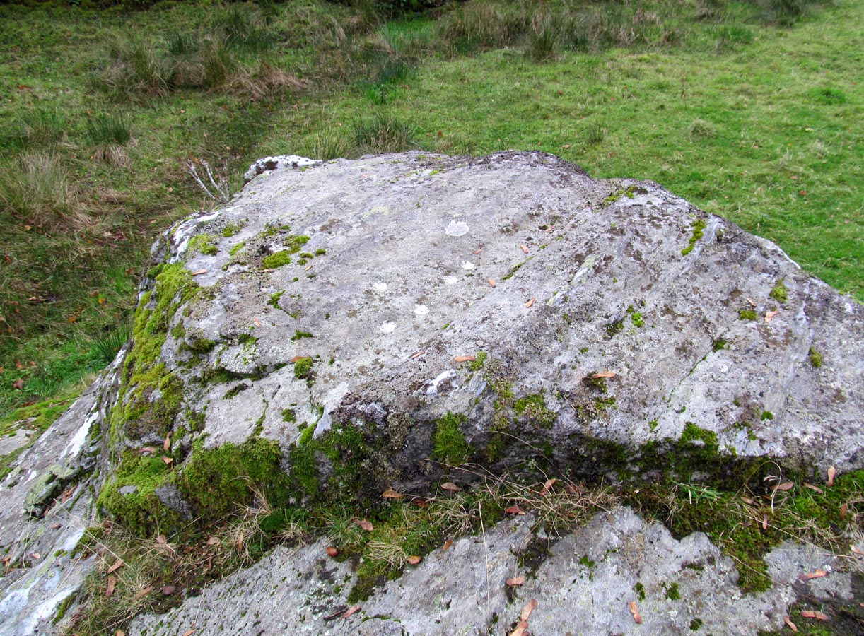
Take the same directions as if you’re going to the nearby Moirlanich 2 Carving (about 550 yards down Glen Lochay, on the north side of Killin). In the same field, about 150 yards northwest of Moirlanich 2, you’ll see another large rock close to the wall. That’s the spot!
Archaeology & History
Cup-marks highlighted
Looking down upon the River Lochay, with views east and west along the glen, here we find a carved rock that’s probably of interest only to the petroglyphic purists amongst you. Two simple cup-markings, about 5 inches apart, can be seen etched into the slightly sloping southern-face of this small rocky outcrop. The sacred mountain of the Creag na Cailleach rises to the immediate north.
From Killin, take the A827 road out of the north side of the village, turning left down Glen Lochay just before the Bridge of Lochay Hotel. 500 yards along the single-track road you’ll reach the electricity station. Just past this, in the field on your right, a large rock stands out just a few yards away. Go through the gate and walk to the spot!
Archaeology & History
Highlighted cup-marks
This is a simple cup-marked stone, perhaps used in ages gone by as a look-out spot by villagers. Only for the petroglyphic purists amongst you, this carving consists of just five cup-marks on the topmost section of the flat stone, with four of them roughly in a line and a solo one (the most pronounced of the them all) a few inches south of the row. The cup-marked Moirlanich 1 stone can be seen in the same field, 150 yards (137m) to the northwest.
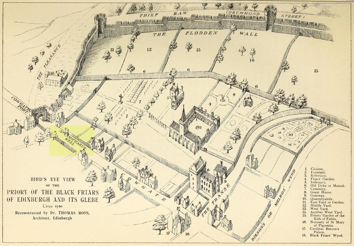
This ‘holy well of the dragon-slayer’ could once be found close to where old Cowgate meets St Mary’s Street. Highlighted on an old map of the city around 1540, and on Mr Bryce’s sketch of the old inner city at the end of the 19th century, we do not know when the Well acquired its name, but it may have been by an early group of jews, to whom the saint was important. Hereby in 1779 was listed a small piece of land called the ‘Silverwell Close’ which both Watson (1923) and Harris (1996) thought was a corruption of the St Michael’s Well, somehow. Watson (1923) explained that St Michael’s
“connection with fountains, or a ‘silver well’, is probably due to the legends of the miraculous spring of Monte Galgano in Apulia and Mont-Saint-Michele in Normandy.”
In Ruth & Frank Morris’ (1981) survey of Scottish holy wells, they report how, in the 16th century, this forgotten site was “a favourite resort” of local people. They told how,
“in 1543 an act of penance was ordered to be performed at the fountain of St. Michael.”
The greatest scattering of accounts relating to St Michael’s Well are found in the Records of the Burgh of Edinburgh, wherein we read:
29 July, 1556: “The prouest baillies and counsale foirsaid deputtis Dauid Symmer to be oursear of the well callit Sanct Michaellis well, and Johne Loch to the Mvs well, to caus tham be maid depar and preparit for watter gaddering.”
16 December, 1556: “The prouest baillies and counsale ordanis the thesaurar Alexander Park Auent the to reperell the wcllis callit Sanct Michaellis well, the Mws well, and the Stok well, and to begyn thairto at Sanct Mongois day nixt tocum, and ordanis Maister Johne Pirstoun to be oursear to Sanct Jlichaelis well, Johne Loch to the Mws well, and Alexander Barroun to the said Stok well, and quhat expens he makis thairon salbe allowit to him.”
Folklore
St Michael was a powerful mythic figure to the Muslims, Christians and Jews. In the old calendar in Scotland his festival date was September 29th and known as ‘Michaelmas’ (although other dates have been ascribed by the varying sects in other countries). In truth, this site should be highlighted for tourists, pilgrims, historians and religious followers alike due to the importance this mythic figure once held in the various pantheons.
This long-lost holy well was located on the southeast side of the town. It was highlighted on the first OS-map in 1849, but its waters were disrupted shortly after this. Daniel Conway (1882) told that,
“It flowed where there was a quarry used for the harbour works. The writer of this notice heard from two men, John Mulholland and Owen Graham, dwelling at Portpatrick in 1860, that they had seen on the rock beside the well what tradition said was the impression of the knees and left hand of St. Patrick.”
When the holy wells writer E.M.H. M’Kerlie (1916) came to visit this site, it was “no longer to be seen.” He wrote:
“The water which issued from a rock on the south side of the village is now diverted by means of pipes into another course.”
Royal Commission Ancient & Historical Monuments of Scotland,Inventory of Monuments and Constructions in Galloway – County of Wigtown, HMSO: Edinburgh 1912.
Walker, J. Russel, “‘Holy Wells’ in Scotland,” in Proceedings of the Society of Antiquaries of Scotland, vol.17 (New Series, volume 5), 1883.