Found to the southwest edge of Hildenley Wood, on the west side of the track between Malton and Coneythorpe Road, the waters from the initial source of the well runs into a small well-house, and from here Nature’s blood runs into a small pool. The first reference I’ve found of the place is in T. Whellan’s (1859) huge survey, where he said,
“There is on the verge of Easthorpe Wood a copious and pure spring of water known by the name of Holy Well, which tradition affirms to have been much resorted to by the monks of Kirkham Abbey…and even to this day healing virtues are attributed to it.”
In Whelan & Taylor’s (1989) survey of the site, they noted the existence of another well a short distance away, but did “not know of any sacred associations connected with this site, but its proximity to the Holy Well may suggest the recognition of this area as a sacred spot.”
Easy enough to locate. In Grassington go up the main street a coupla hundred yards, turning left up past the small church, taking the footpath on your right heading up to the fields that stretch to the north. Don’t mistake the remains of the medieval village that you’ll pass for the Iron Age and Romano-British site that we’re heading for, another coupla hundred yards up. You’ll notice a lot of old low walling structures on the slopes heading up above you. That’s the stuff!
Archaeology & History
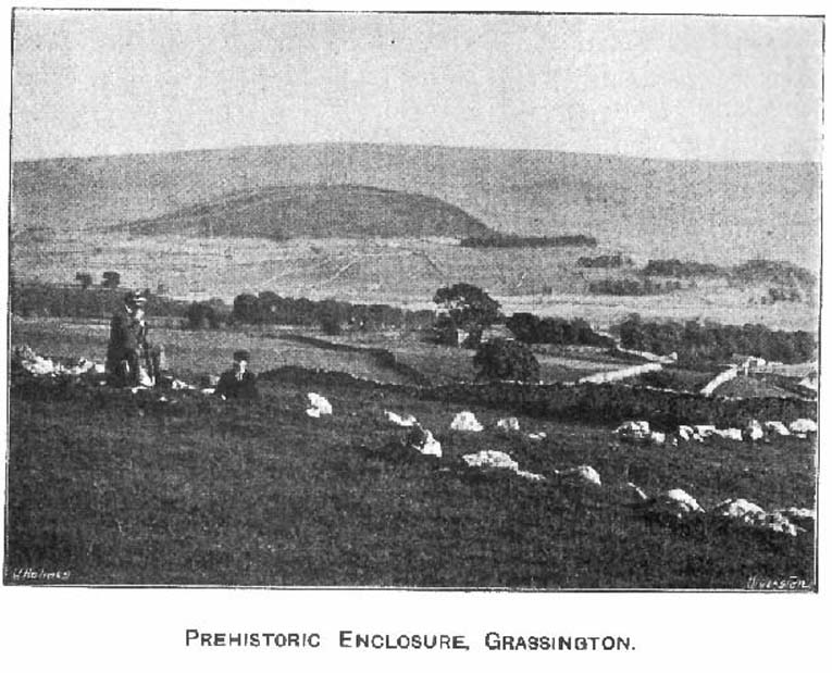
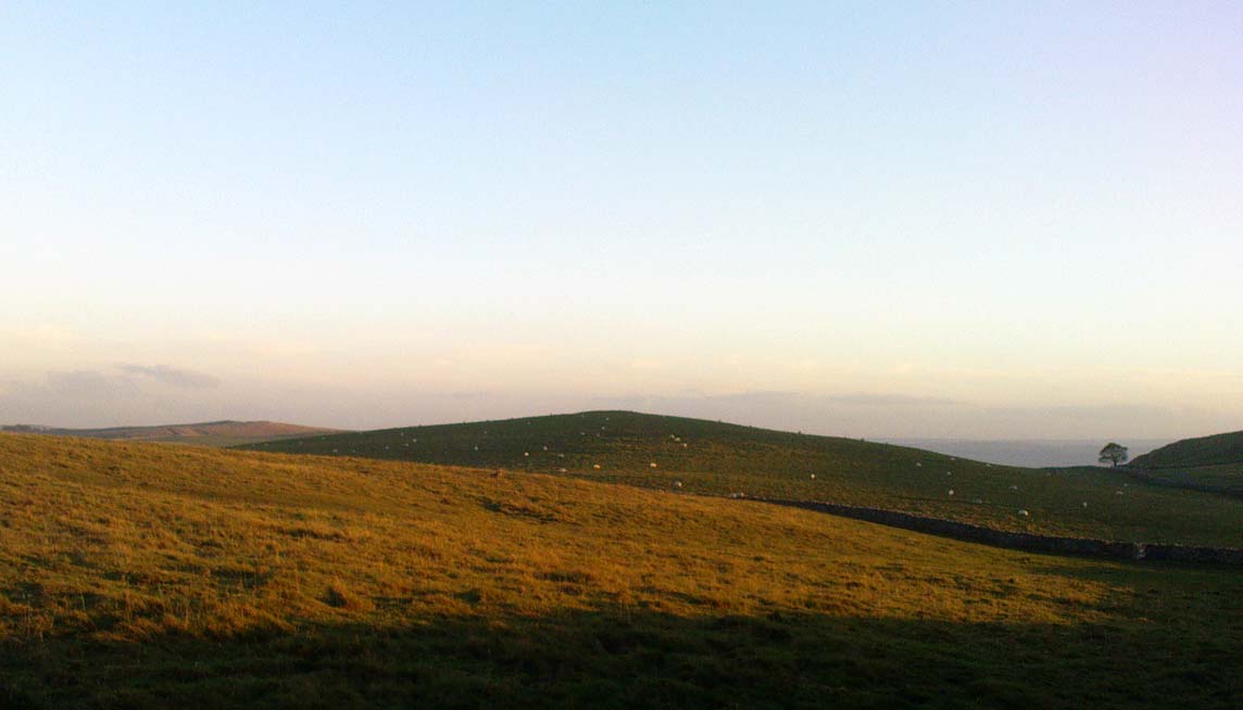
Despite the industrial devastation of the landscape on the hills around here, this entire area still teems with prehistoric archaeological remains, making you wonder just how much more once existed in this region. In bygone days Prof Anne Ross thought this region to be the capital of northern England in Iron Age days. She could be right: in just about every nook and cranny of small valleys and rivulets we find evidence of ancient people everywhere for miles around, settlement upon settlement in every direction you take. The remains found here at High Close Pasture typifying the examples any ardent antiquarian will come across in this region of upper Wharfedale.
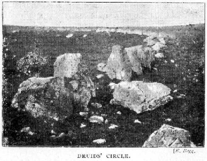
Druid’s Circle (Bogg 1904)Earliest known photo in 1899
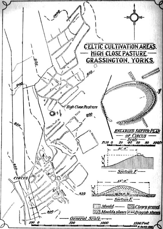
The settlement remains and ancient cultivations at High Close have been described by various writers over the last hundred years, with Edmund Bogg (1902) calling the most notable of the remains here the ‘Druid’s Altar’ (not to be confused with the other Druid’s Altar at nearby Bordley); a title that was similarly described as “The Druid’s Circle” when Eliot Curwen surveyed the area. It is also locally known as ‘The Circus’, after it being a place where celebrated events once took place. This Druid’s Circle section is,
“an oval area 150 feet long by 75 feet wide. It consists of a bank surmounted by a single or double-row of flat-topped stones about one-and-half feet high by 2 feet wide… This may have been a communal meeting place of the Iron Age folk, who cultivated these fields, and who lived in isolated huts.” (Elgee & Elgee 1933)
The notion of the circle being a communal meeting place was echoed by Mr Curwen (1928) in his slightly more detailed description of this place. He told that the interior of the Druid’s Circle had been levelled:
“It lies eight feet below the surrounding banks to the northeast and east, to which it rises with a gradient of 8 in 21. The bank to the north is less high, while to the south and west the arena, while seperated from it by the bank, is above the level of the sloping hillside. The encircling bank is surmounted by a single (and) double row of stones for three-fourths of its extent. These are apparent to the east and south, but are less so to the west, as along this side a stone wall has been built actually along the bank of the Circus; the stones belonging to this bank are, however, quite clear below the footings of the wall. From northeast round by south to southwest the row of stones is double. Those in the inner row, forty-six in number, stand some eighteen inches high; they are about two feet wide and are flat-topped, the line is almost continuous, and in parts the stones are placed edge to edge. A second row of smaller stones backs the larger ones. Entrance is obtained to the central level area by a gap to the southwest. No fosse surrounds this earthwork. To the southeast, a lynchet four feet high runs off it, while to the north a low stoney bank runs off in a NW direction, and one of the larger stony banks approaches to within a few feet of the northwest.”
In the fields above, particularly on the east and north of this notable ruined stone ring, the extensive “cultivation pastures” as they’ve been called, are evident all over the place. Hut circles and copious other antiquities can all be found within a square mile of this spot. If you like your Iron Age archaeology, this area will knock yer socks off!
…to be continued…
References:
Bogg, Edmund, Higher Wharfeland, James Miles: Leeds 1904.
Charlesworth, Miss D., ‘Iron Age Settlements and Field Systems,’ in Archaeological Journal, volume 125, 1968.
Curwen, Eliot, ‘Ancient Cultivations at Grassington,’ in Antiquity, June 1928.
Elgee, Frank & Harriett, The Archaeology of Yorkshire, Methuen: London 1933.
Raistrick, Arthur & Chapman, S.E., ‘The Lynchet Groups of Upper Wharfedale, Yorkshire,’ in Antiquity, June 1929.
Speight, Harry, Upper Wharfedale, Elliott Stock: London 1900.
From Malham village go over the lovely old bridge and follow the road up and round, keeping to the left (not up the Gordale Lane) where the junction appears a few hundred yards along. Follow this steep and winding road all the way to the top for a couple of miles until you hit a junction seemingly in the middle of nowhere. Park up somewhere to the left and notice the hillock which you’ve just passed on your right (east) with a bittova flat top to it. Cross the stile and go up to it!
Archaeology & History
Although somewhat overgrown thanks to the persistence of Nature, this good-sized burial mound on top of this, one of many small hills in and around the moors hereby, is a fine specimen to behold and a fine place to sit and drink in the view. Although not quite having the grandeur of the Great Close Hill tomb a mile to the north, the countryside hereby is still impressive and was of obvious importance in the mythic landscape of our Bronze Age ancestors. If you think otherwise, there’s obviously summat wrong with you.
Approaching the tumulusSeaty Hill tumulus
Although we can only see the remains of one singular round tomb today, at least two other tumuli were once in evidence in this large open field but they were dug out many years back. There were probably even more of them, but any trace has long since gone. Thankfully this one was given the attention of decent archaeologists some fifty years back, when Arthur Raistrick (1962) and his mates got stuck into the place. His initial account of the place told us how it was,
“…surrounded by a shallow ditch and bank enclosing a low mound 66 feet diameter, rising about 4 feet above the ditch bottoms. In the original surface of the hill top there had been dug two holes, circular and partly impinging on one another, both 3ft 6in deep. In the northwesterly one of these a skeleton had been carefully placed in a sitting position, with knees drawn well up, and was facing the second hole which is to the southeast. This hole was almost filled by a carefully built cairn of limestone boulders, but nothing was found either in or beneath it. No artifact of any kind was found with the skeleton. Both holes had been filled in with fine sandy and gravelly loam to the natural ground level and then covered with a low mound, 15 feet in diameter and 1 foot high, of coarser gravel and small boulders. The second mound, 66 feet diameter, of limestone rubble and boulder clay and 3 feet high above ground level, was put over this and provided with a kerb of large limestone boulders buried in the toe of the mound. A shallow ditch was then dug and its spoil thrown outwards to form a shallow bank.
“In the surface of the large mound there were not less than 13 secondary burials of early Iron Age, each in a small saucer-shaped depression filled in with gravelly loam. These burials are extremely fragmentary and are more like token burials than complete ones. In three of them, beads were found, one of jet, one of blue glass and one of carved limonite. In a burial nearly over the central older burial, a skeleton was arranged with a bone (musical) pipe between the knees, where also there were several small bones of hand and wrist and part of an iron knife. The (musical) pipe was made from the tibia of a sheep, perforated with three finger holes, with a well-shaped speaking lip and mouthpiece. The pipe was playable… A full account of this unique instrument has been published elsewhere… In two of the burials there were recognizable fragments of iron knives, and in two others pieces of iron of unrecognized use, all in positions which could have been under the knee of a more primitive skeleton. By analogy and style the primary burial has been assigned to the Early Bronze Age, and the Iron Age burials to the period first century BC to the first century AD.”
It would be intriguing to ascertain how many people from this period were playing flute-like instruments such as the one found here, and whether (as with other musical instruments in all other tribal cultures on Earth) magickal virtues were assigned to it, or the music it liberated. Certainly in a great number of places around this very area where this instrument was found, many natural sites still abound with the hugely underrated virtue of silence; and upon the still air amidst which music would be cast, the echoes or else faint sense of such sound would evoke a marvel — curious or dreamt — to those upon who it fell. If you think otherwise, there’s definitely summat wrong with y’!
References:
Raistrick, Arthur & Holmes, Paul F., Archaeology of Malham Moor, Headley Bros: London 1961.
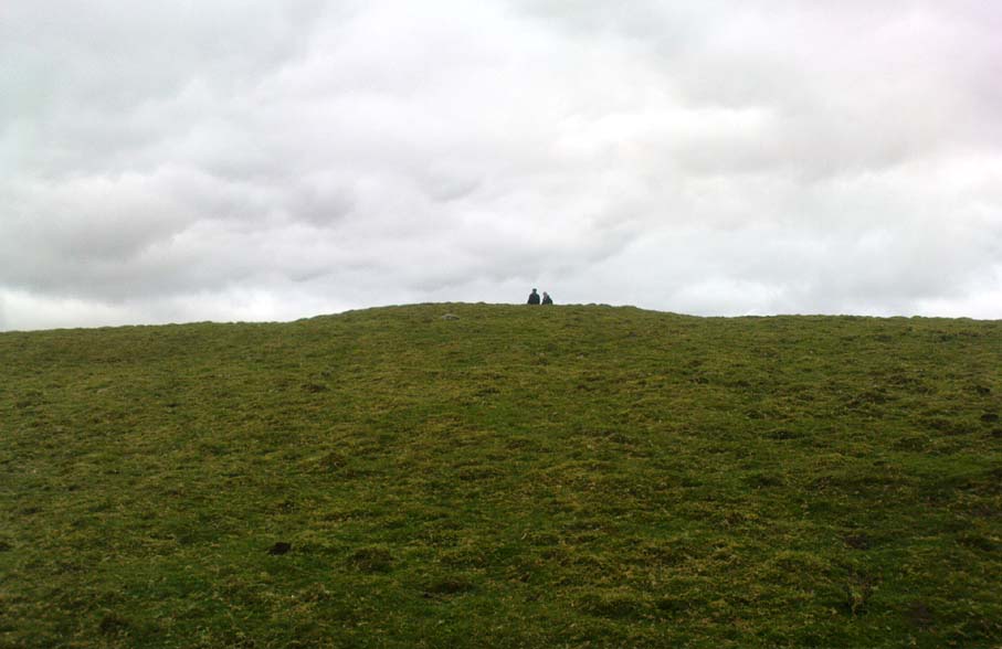
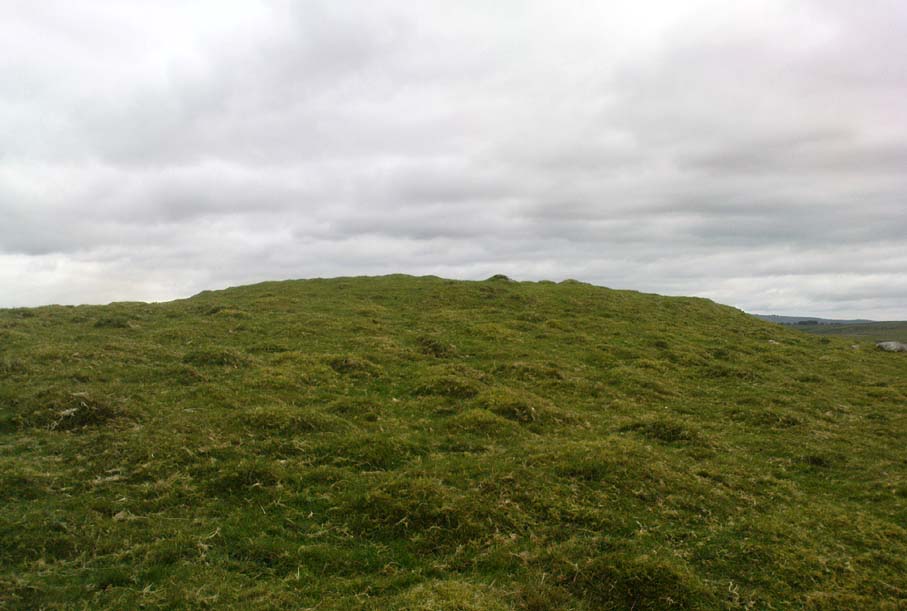
The Nanny Howe burial mound was one of a group of at least three tumuli that could be found on what is now the wooded hilltop of Coate Moor, a mile east of Great Ayton. Large and conspicuous in previous centuries, the site was described briefly in Elgee’s (1933) archaeological survey as being in association with a prehistoric settlement, which itself appears to have long since succumbed to forestation. An essay on the state of this apparent Bronze Age burial mound was written by Mr Hayes (1966), who told us:
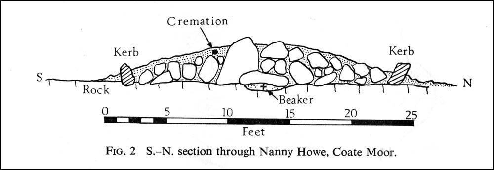
“The kerb of the barrow was exposed and noticed by J.N Grayson whilst excavations were in progress on Great Ayton Moor. S.V. Morris, A.N. Pacitto and the writer examined the site. It was a cairn of about 30ft diameter and 3ft high in the centre, with a strong kerb of stones set on edge of 25ft diameter. Its construction, of massive stones was similar to the chambered cairn on Great Ayton Moor, one mile to the north, and very like the food vessel-urn tumulus on Danby Rigg which also had a kerb of the same diameter…
“When the heather and turf were removed on the south-east side of Nanny Howe, a mass of cremated bones with part of the rim and side of a typical Iron Age ‘B’ jar were found only 6-9in under the turf. This was clearly a secondary burial long after the cairn was built. The sherd may have been a token offering, but more probably the remainder of the pot so near the surface of the mound had been eroded. No other secondary burial was found, although almost all the cairn was removed.
“Under large boulders in the central area was a shallow pit or depression… Only minute specks of charcoal and some small burnt stones distinguished its filling from natural sand. It was about 3ft in diameter and not more than 9in deep… In it were the broken sherds, more than 80 in number, of a beaker… There were no signs of bones or cremation, although presumably a contracted skeleton had accompanied the beaker. In the acid sand all bones would perish quickly… No other relics were found in the cairn.”
To which Mr Hayes and his team concluded the Nanny Howe tomb was an example of a typical “beaker burial” as they used to like calling them, set within a ring of stones over which the cairn was piled; and long after this, seemingly the Iron Age, a secondary cremation was inserted.
Folklore
Folklore ascribed the entire settlement here to have heathen origins, with Nanny Howe also standing out with folklore of its own. As Mr & Mrs Elgee (1933) wrote:
“Half a mile east of Captain Cook’s monument…on Easby Moor is the Devil’s Court, where, according to tradition, witches congregated under the presidency of their lord and master. We therefore examined the Court and found what we expected, a typical moorland Bronze Age settlement site, with stone-walled enclosures, shallow pits, flint implements and many barrows, one of which is named Nanny Howe, after a famous witch, it is said, who also frequented Nanny Nook, a right-angled bend in a stone wall near Wayworth Farm, Commondale, marking another settlement site.”
Another tale of this legendary witch was narrated by folklorist and historian Richard Blakeborough in one of his many tomes, where he told:
“Again, old people of Great Ayton still aver that on a certain night a once noted witch, Nanny Howe, may be seen riding astride on a broomstick over Howe Wood just at midnight. This witch, so mounted, is said once to have chased the devil for miles — on this occasion the two must have fallen out ; perhaps at that time honest folk got their due. Howe Wood is near Kildale.”
Whatever the source of such stories, the respective archaeologists of Elgee and Hayes wondered if they derived from some pre-christian rites and events. Hayes asked:
“Was the person interred in Nanny Howe a famous witch? Or were the witch and the devil legends connected with the site faint echoes of ceremonials and rites held here?”
It would seem likely that the local peasant communities hereby were, thankfully, not inflicted with the empty spirituality of the christian cult when it tried taming the souls of the villagers living in and around here. The folklore would seem to reflect simple peasant gatherings and celebrations, frowned upon by those weird clergy-folk, no doubt striving to get the local children into their more demonic pastimes…
References:
Blakeborough, Richard, Wit, Character, Folklore and Customs of the North Riding of Yorkshire, W. Rapp: Saltburn 1911.
Elgee, Frank & Harriet, The Archaeology of Yorkshire, 1933.
Gutch, Mrs E., Examples of Printed Folklore Concerning the North Riding of Yorkshire, David Nutt: London 1899.
Hayes, R.H., “Nanny Howe, Coate Moor, Cleveland,” in Yorkshire Archaeological Journal, part 164, 1966.
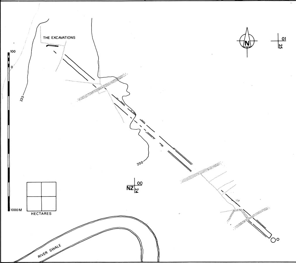
A huge linear monument that could once be found on the flats just north of the B6271 road running between the villages of Scorton and Brompton-on-Swale, east of the ancient A1 road, has long since been ruined. Although found quite a few miles north of the main Thornborough henge and cursus complex, a number of students still posit that this northern monument was part of the same “ritual landscape” arena.
Plan of the cursus (after P.Topping, YAJ 1982)
First discovered in 1949 following aerial survey analysis by Prof. J.K. St. Joseph, this huge dead straight cursus monument ran for at least 1.3 miles (2.1km) and would have been considerably longer if the self-righteous advance of industry hadn’t quarried it away (such is “progress”!). Built along a southeast to northwest axis, the southern end of the cursus was straight and flattened (as opposed to convex, as found at some cursuses), as Peter Topping’s (1982) illustration of the monument here shows, but the northwestern end of the cursus has not been found. As Mr Topping himself wrote:
“The southwestern terminal, which shows clearly on the aerial photographs, consists of a straight transverse ditch which joins the two main ditches at right angles. Clustering around it was a series of ring-ditch cropmarks. The aerial photographs also show a series of bleach marks between the ditches at the southern end of the cursus, which may represent a series of contiguous mounds. This area of the cursus also features what appears to be smaller outer ditches…”
Topping also commented on a most “noteworthy feature” in the accuracy of the ditches that constitute the length of the monument, being so “remarkably straight considering the distance over which they extend.” Features which, in bygone days, a number of respected archaeologists denied our prehistoric ancestors the ability to execute.
Hopefully readers will forgive me citing more of Topping’s extensive notes regarding the archaeological analysis of this site, but I think they’re worthwhile. Of the ditches that make up the outline of the cursus, he told:
“The ditches of the cursus are the two most prominent features of this site on the aerial photographs. …The only evidence available for the existence of the cursus in the area to be excavated was a section exposed in the adjacent gravel quarry. This section clearly illustrated quite distinct re-cut features visible in the profiles of both ditches, and evidence of this recutting was also discovered in the excavated areas. However, one anomaly which did distinguish the excavated sections from those exposed in the quarry was the variable depth of the ditches. In the quarry-face sections the western ditch had a maximum depth of 60cms, while in the excavated area its maximum depth was 45cm; similarly, the eastern ditch had a maximum depth of 65cm in the quarry and a maximum depth of 43 cm in the excavations. This may have resulted from the actions of hillwash or ploughing reducing the height of the old land surface in this area where the ground naturally rises, or alternatively indicate no more than an uneven depth to the ditches. Their width was fairly consistent, the maximum width of the eastern ditch being 3.40m, while that of the western ditch was 3.85m.
“Recutting in both ditches was indicated by a V-shaped notch beneath the main profile of the ditch…
“Closely datable artifacts were sadly lacking in the ditches, the one possible exception being (a) flint…possibly an arrowhead, from the upper fill of the eastern ditch… The upper fill of the eastern ditch also produced (a) flint…”
But in all honesty, these flint finds were probably of little importance to the cursus itself and can be discounted as of any relevance outside of being stray hunting flints. Three other flints were discovered by the western ditch aswell, again with little significance to the monument. But the next part of the excavation work explored what Topping called the ‘Central Feature’, of which he said:
“Bleach marks on Prof. St. Joseph’s aerial photographs revealed what appeared to be a series of axially-placed contiguous mounds situated between the main ditches, and extending the whole length of the long axis of the monument as then known. The presence of this feature was confirmed in the excavated area. A low central mound was uncovered, within and respecting the lines of the ditches, which had a maximum height of 32cm above the old ground surface.”
Upon further excavation they found what one would have expected: little more than the upcast of earth and gravel dug out from the ditch that makes up the cursus, i.e., spoil-heaps made where they’d dug out the cursus lines with little other significance. This feature is obviously apparent in many cursuses. Of greater interest was the pit- or post-hole on the eastern ditch.
“This was stratigraphically related to the cursus to the extent that it was sealed by the same layer of hill-wash that had buried the cursus ditches. In addition, this feature clearly respected the limits of the eastern ditch. The dimensions of the pit/post-hole were: maximum diameter at its base, 1.12m, the maximum width at its top, 2.10m, length, 4.19m, and a maximum depth of 60cm.
“…Distinct tip-lines were evident leading in and downwards towards the centre of the feature, this central area being relatively stone-free. This could suggest that the feature originally held a post which was subsequently removed at a later date.”
I’d say this notion is highly likely! In the event that a complete excavation could have been made here, it’s probable they would have found other pit-holes into which upright wooden posts were erected around the time the cursus was constructed. When Topping and his team excavated sections of the eastern ditch-floor, they found what appeared to be the truncated base of another post-hole. He told:
“This feature was sectioned and found to be flat-bottomed and to have a depth of only 3cm and a diameter of 25cm. The fill was indistinguishable from the fill of the cursus ditch and contained no traces of organic material…although the exact function of this feature is unknown.”
Topping’s conclusion about the nature and function of this monument is a simple one:
“it can be seen as part of a concentration or complex of magico-religious structures.”
And although this is a somewhat tentative notion based on the limited archaeological evidence here, it does accord with standard views in comparative religion on the animistic relation humans had with natural and man-made monuments from this and later periods of history; as well as reflecting the findings on the origin and development of human consciousness in Jungian and other applied psychology schools. The construction of this gigantic landscape feature occurred at a period in human history when the division between the sacred and the profane had yet to emerge culturally. In all likelihood, Mr Topping’s notion is correct.
Follow the same directions as to reach the so-called Smiley Stone carving and look just 10 yards SE.
Archaeology & History
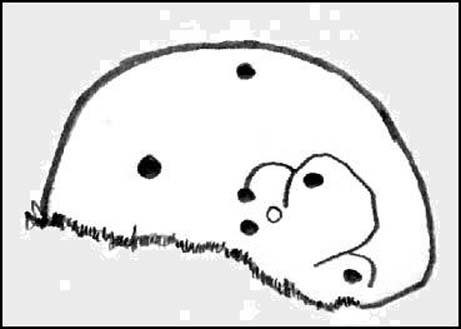
About 10 yards away from the Smiley Stone is another of Middleton Moor’s ‘dubious carvings’ to me. I remember seeing the drawing of this years back, perhaps a decade after Stuart Feather first described it (1966) and remember thinking it looked a bloody good carving. But when I saw it for the first time in February 2005 with Richard Stroud, not only could I hardly see what was supposed to be there, but once I’d seen the alleged design, some doubt came over me regarding its archaic nature. That doubt still remains.
Faint cups & linesDesign on carving 447
There certainly seems to be a few faded cup-marks on the stone — which looks to be broken from a larger, circular worked stone of a much more modern age (an old mill stone perhaps?) — but the lines which both Feather and the grand pair of Boughey & Vickerman (2003) copy into their survey, are all too vague and certainly not ancient in my book. Perhaps some local folk were still etching cup-marks and lines onto stones into the medieval period and later, like the ones found on the Churn Milk Joan monolith near Hebden Bridge…
References:
Boughey, Keith & Vickerman, E.A., Prehistoric Rock Art of the West Riding, WYAS: Leeds 2003.
Feather, Stuart, “Mid-Wharfedale Cup-and-Ring Markings, no.47: Middleton Moor, Ilkley,” in Cartwright Hall Archaeology Gorup Bulletin, 11:9, 1966.
Follow the same directions to reach the Bordley ‘circle’ (it’s actually a much denuded burial site). Look up the hill (south) at the limestone escarpments above you, walk past the Hammond Close Stones and head up the slopes in front of you. If you get to the top of the hill without noticing the extensive prehistoric walled structures you’ve passed, then start to slowly amble here and around the tops and the slopes you’ve just walked up. They’re everywhere!
Archaeology & History
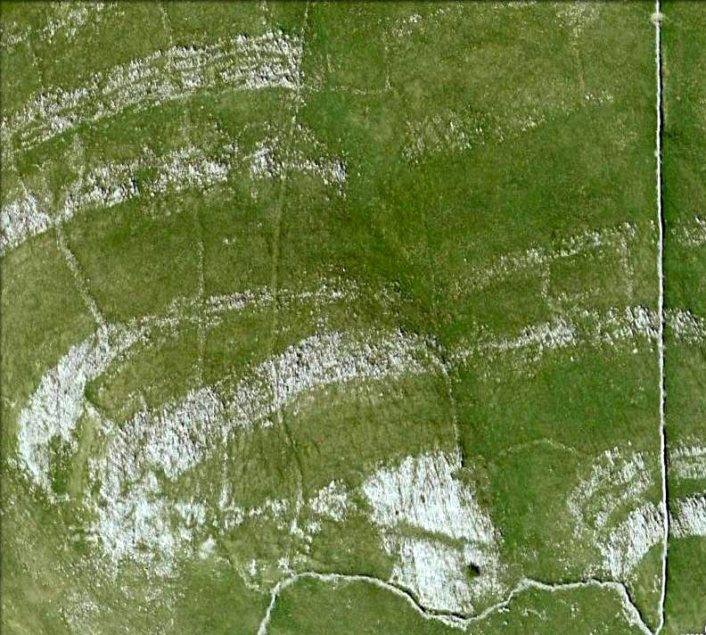
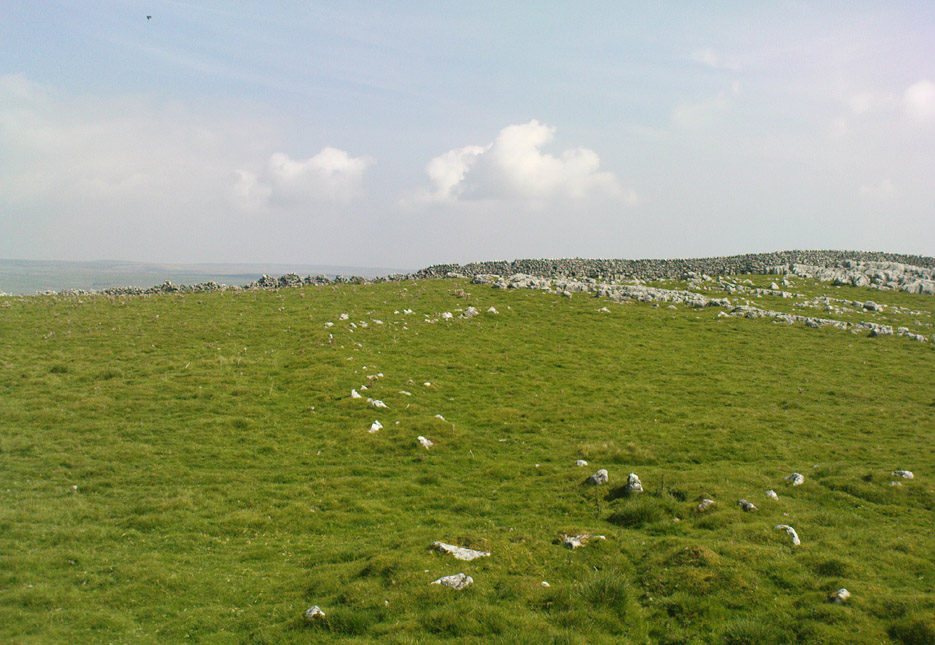
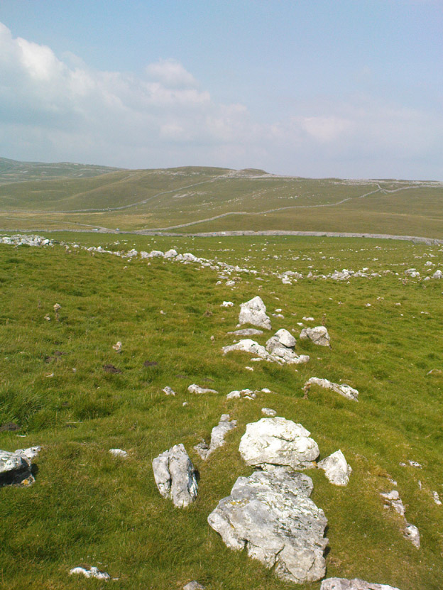
The grid reference here has to be considered as a general one. The site we’re looking at, upon the tops of this wonderful limestone-enriched hill, is quite extensive and covers much more than the simple eight-figure grid ref I’m using to direct you here. On the way up the slope from the Bordley ‘circle’ site, you’ll notice how the natural lines of limestone have been used to define lines of walling. The remains of many smaller stones have been laid into the natural rock outcrops, and others set into the earth and sectioned off smaller enclosures within the greater whole. It was obviously a huge and time-consuming exercise to create these large rocky sections, some of which appear to have actually been cut into the rock. The aerial image here shows clearly the lines as they were laid out, intruding the extensive natural bedrock covering the landscape, not just here but much further afield. Indeed, the large set of enclosures here at Hammond Field typifies dozens and dozens of other such sites in the hills north and west of here.
Enclosure walling running E-WTopmost line of walling
The trouble with this and other sites in the Upper Wharfedale region is dating them. Although we typically ascribe an Iron Age date to many of these settlements, we know that many of them were added to and maintained by peasants and farmers well into medieval times. And why not!? They’re excellent, solid and need little maintainance! The sections we’re looking at here in this particular site may have had their origins in the Bronze Age. It seems a reasonable assumption considering the existence of the Bordley circle site and several other denuded burials along the same ridge at the bottom of the slope. But the majority of the ‘enclosed’ sections running up and around this hill seem to have Iron Age and Romano-British stamps on them. It’s likely that some of the ‘enclosed’ sections would have been constructed to keep cattle in, aswell as being living quarters for people. At least one well-defined hut circle can be seen along the north-facing edge of the hill and, perhaps, even the fallen remains of a once upright standing stone.
The topmost part of the Hammond Close hill is all but surrounded by Nature’s limestone, with a large oval grassy region in the middle of it all; but on the eastern side of the hill, the natural limestone walls are lacking and so were supplemented by the work of people who built an additional protective line of walling, running north for some 45 yards from the small craggy ridge at the top, along the level, until it meets up with more natural limestone. The man-made walling is built into this aswell. Halfway along this length of north-south walling is another section, running to the east for nearly 40 yards before bending slightly for another 25 yards into yet more natural outcrop.
Partition walls on north slopeStretches of walling: from ancient to modern
I could spend the next few paragraphs describing all the walled sections visible on this hill and down its edges, but don’t wanna bore you with the small detail of it all! Aswell as that, if you climb over the eastern walls and walk a short distance across the rocky hill, you’ll start seeing other prehistoric settlement remains beneath your feet. And on the hill across directly to your north, we find more extensive remains at the very large Lantern Holes settlement, dating again from the Iron Age, if not earlier.
The ancient remains are all over the place round here! So those of you who love good outdoor wanderings, prehistoric archaeological sites and excellent views, give this place your attention! It’s well worth it!
References:
Dixon, John & Phillip, Journeys through Brigantia – volume 2: Walks in Ribblesdale, Malhamdale and Central Wharfedale, Aussteiger: Barnoldswick 1990.
Go over Ilkley Bridge and take your first left, on & over the roundabout, then follow the road as it bends uphill. Keep going until you reach the fields and moors either side of you, up Hardings Lane, stopping at the bend in the land where it meets a couple of dirt-tracks. Go up the track onto the moor and follow this right into the moorland (avoiding the path to your right after a few hundred yards) where it follows the edge of the walling again. After a few hundred yards there’s a gate on your right. Go thru this and, after 40-50 yards, walk up into the heather. You’re damn close!
Carving no.484
Archaeology & History
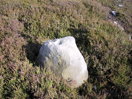
This is another cup-marked stone that’ll only be of interest to the petroglyphic purists amongst you, as it’s another one of those incredibly interesting single cup-marked rocks — this time with an additional single line running from it! WOWWWW….! The photo here just about does it justice, as in some light conditions you wouldn’t even notice it. There’s also the possibility that this ‘carving’ was actually Nature’s handiwork.
It was first described by our old mate Stuart Feather in 1965, and was then included in Boughey & Vickerman’s (2003) survey as stone 484, describing it as, “medium-sized, approximately square rock of fairly smooth grit. One cup with groove leading from it.”
References:
Boughey, Keith & Vickerman, E.A., Prehistoric Rock Art of the West Riding, WYAS: Wakefield 2003.
Feather, Stuart, “Mid-Wharfedale Cup-and-Ring Markings: Nos. 36, 37 and 38, Middleton Moor, Ilkley,” in Cartwright Hall Archaeology Group Bulletin, volume 10, 1965.
ACKNOWLEDGEMENTS: to Richard Stroud for use of his photo
To be found a couple of hundred yards west of Askwith Moor Road, head towards the bottom of the row of grouse-butts, following the fence that runs into the moorland across from the dusty car-park.
Archaeology & History
Single cup-marked stone
This single cup-marked stone — list as carved stone no.529 in Boughey & Vickerman’s (2003) survey — was reported when some English Heritage doods came here and found this small upright stone (probably part of a larger prehistoric monument, e.g., walling or cairn) and gave the cup-marking their “all clear” stamp and thought it authentic. But if memory serves me right (which it doesn’t always do these days!), I’m pretty sure Graeme Chappell came across this possible carving in the early 1990s during one of our many forays over these moors. It’s a cute little thing — though only for the purists amongst you perhaps — but, of course, needs to be seen in the context of its proximity to the many other prehistoric monuments across this moorland plain.
References:
Boughey, Keith & Vickerman, E.A., Prehistoric Rock Art of the West Riding, WYAS: Wakefield 2003.
Stuck in the middle of the moor, at the bottom (southern) side of the Lippersley Ridge promontory. Head towards it from the Askwith Moor Road, along the track past Sourby Farm and onto the end. Then walk along the easy footpath which that takes you below the southern side of the ridge and, about 100 yards before getting to the end of the rise, look around in the heather. You’ll find it.
Archaeology & History
Graeme Chappell’s early photo of the carving
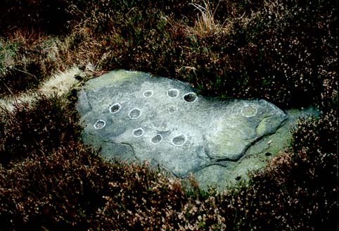
Graeme Chappell rediscovered this seemingly isolated cup-marked stone during one of our many exploratory ambles upon these moors in the early 1990s. The carving is a pretty simple one, consisting of between 10 and 12 cupmarks on the upper surface of a reasonably large elongated stone. No discernible rings or other lines seem to be visible. There are no other cup-and-ring stones close by; but two small prehistoric cairns can be found along the same sloping ridge east and west of here when the heather is low, and the larger Lippersley Pike Cairn stands out on the western end of the ridge 450 yards away. A more detailed exploration of this part of the moor may bring other previously unknown findings to light.
References:
Boughey, Keith & Vickerman, E.A., Prehistoric Rock Art of the West Riding, WYAS: Wakefield 2003.