To search for any sites in the northern counties of England (previously known as Brigantia), click on the list of relevant counties, below. Please note that not all these english counties were truly in Brigantia, but they came close to its southern edges; and as parts of them tickle the edges of the southern Pennines, I thought they should be included. Hope that’s OK with everyone!
From Burley train station, take the road uphill onto the moor edge, turning right at the top. Go on for a few hundred yards and park up round the sharp bend. Walk up the steep-ish path on the right-hand side of the rocky valley of Coldstone Beck. Once your on the level with the moors, veer to your right (west) on the footpath parallel with the walling. Barely 50 yards along, watch in the grasses and heather to your left (south). Keep looking and you’ll find it. (apologies for just a 6-figure grid-ref for this stone, but I paid little attention to its position when I was in walkabout mode)
Archaeology & History
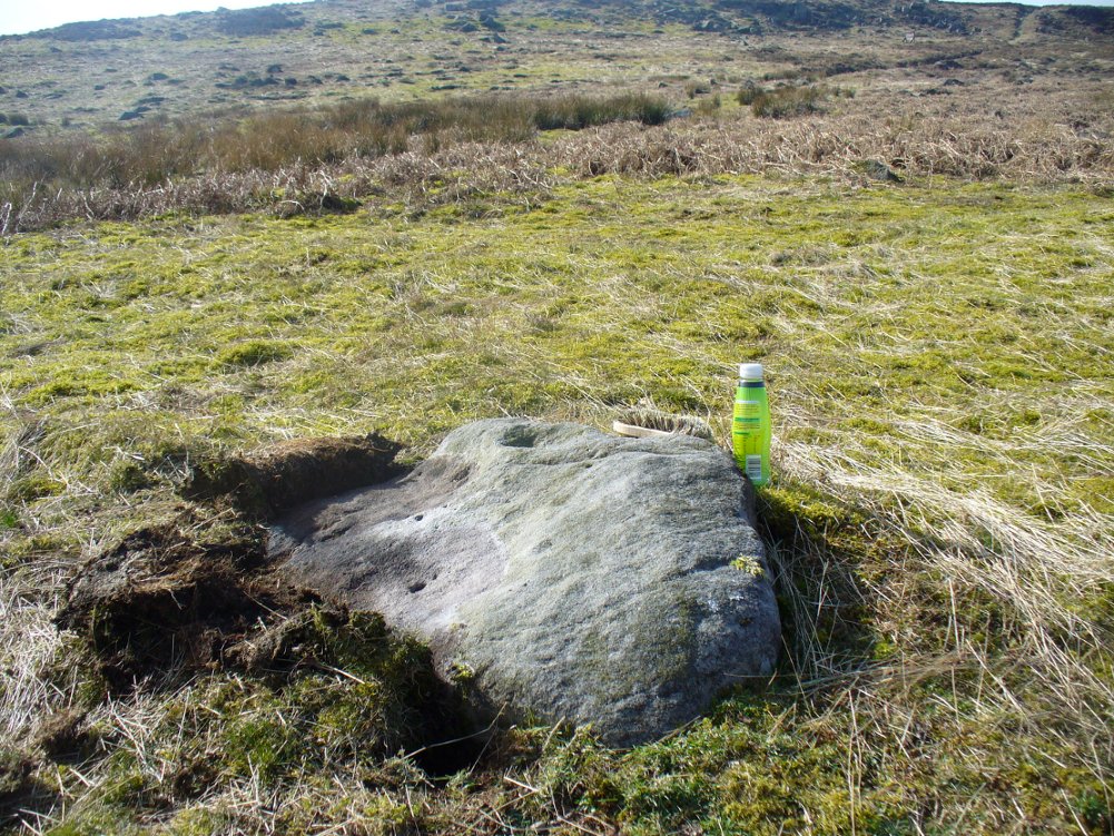
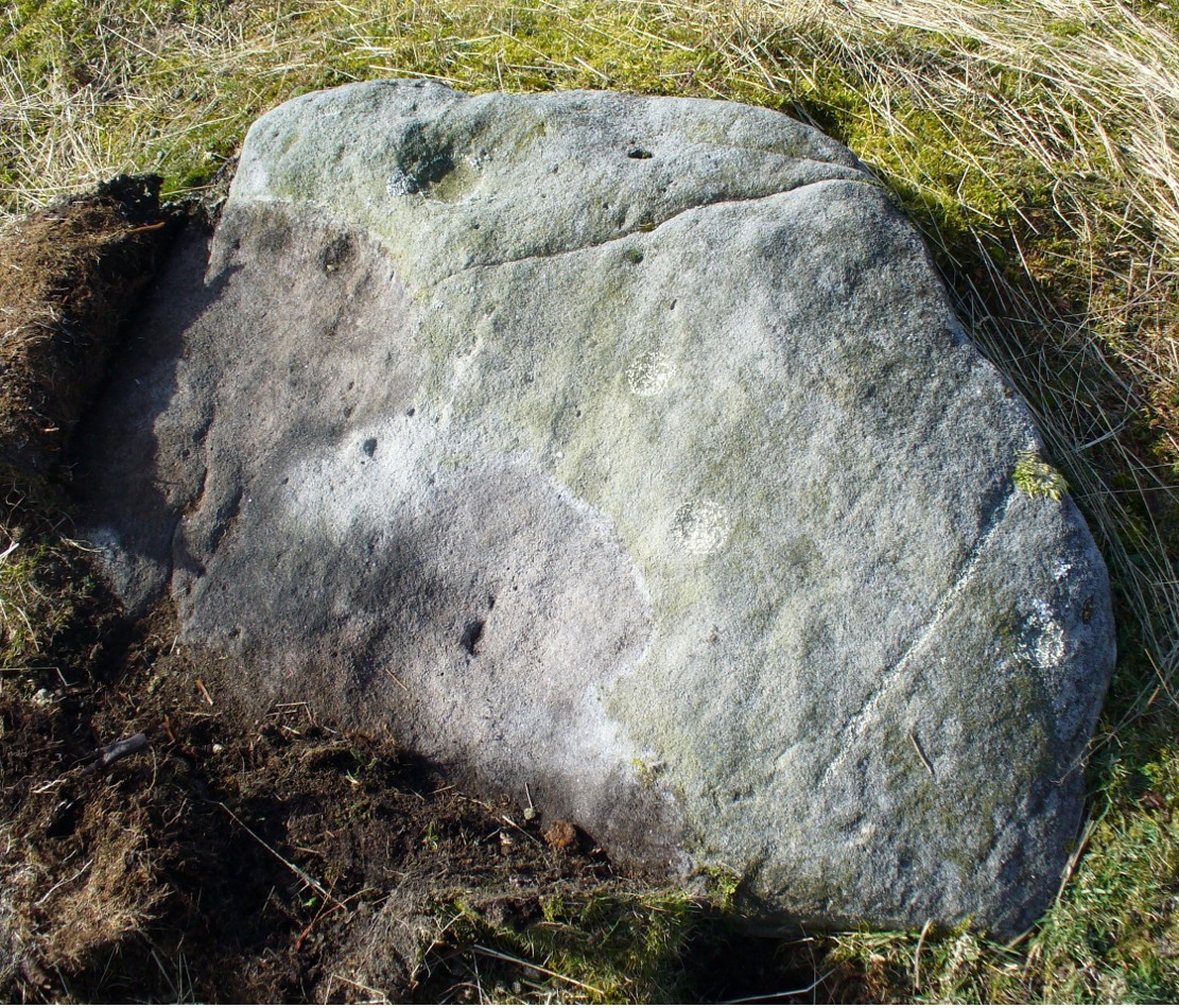
A couple of hundred yards east of the Cold Stone monolith is another petroglyph that has evaded the diligent archaeologists of the region! But it’s easily missed if the daylight conditions aren’t too good. The most notable element on the stone is the large, possibly natural cup-marking on its top-right SW side. It’s that which initially gets your attention and, due to its initial singularity on the rock, you’d turn away and shake your head, muttering that well known petroglyphic mantra of “dunno.” But when the sun and air are clear or low on the horizon, other more faint etchings, almost lost in the worlds of erosion, catches the eye.
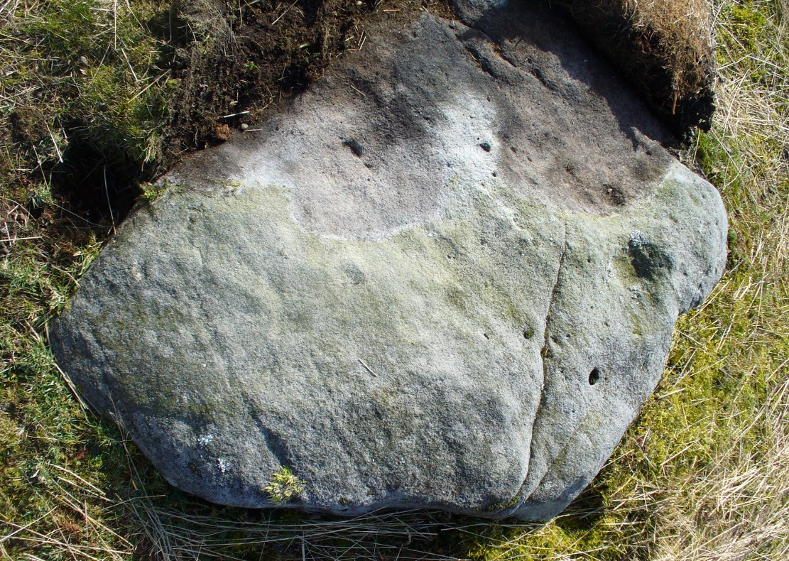
Carving faintly highlightedLooking straight down
At least four cups are visible on the stone, perhaps six, mainly near its middle and faintly highlighted in one of the images here. But there is also a pecked carved line here too, running across the shorter northern side of the stone. Near the bottom of this line there is the faint impression of a carved ring, but whether this is a trick of the light or real, I won’t hazard to guess. Not far away is the curiously shaped Chair Stone and its cup-marks. Others are in the vicinity.
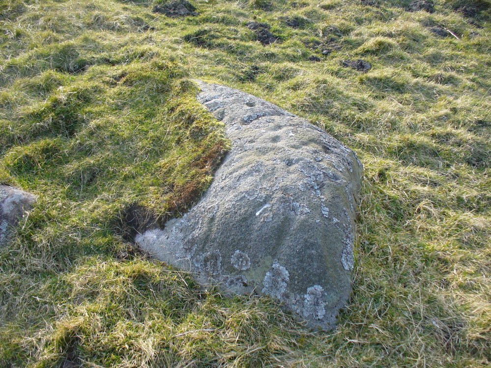
This is another of the many unrecorded cup-and-ring carvings in the region—and one in a small cluster hereby. It was rediscovered several years ago on a Northern Antiquarian outing and, thankfully, remains in good condition. Encrusted by layers of gorgeous lichens, deep into the rock, it has hence proven difficult to explore the entirety of the exact design without tearing off the old lichen covering—which I’ve no intention of doing.
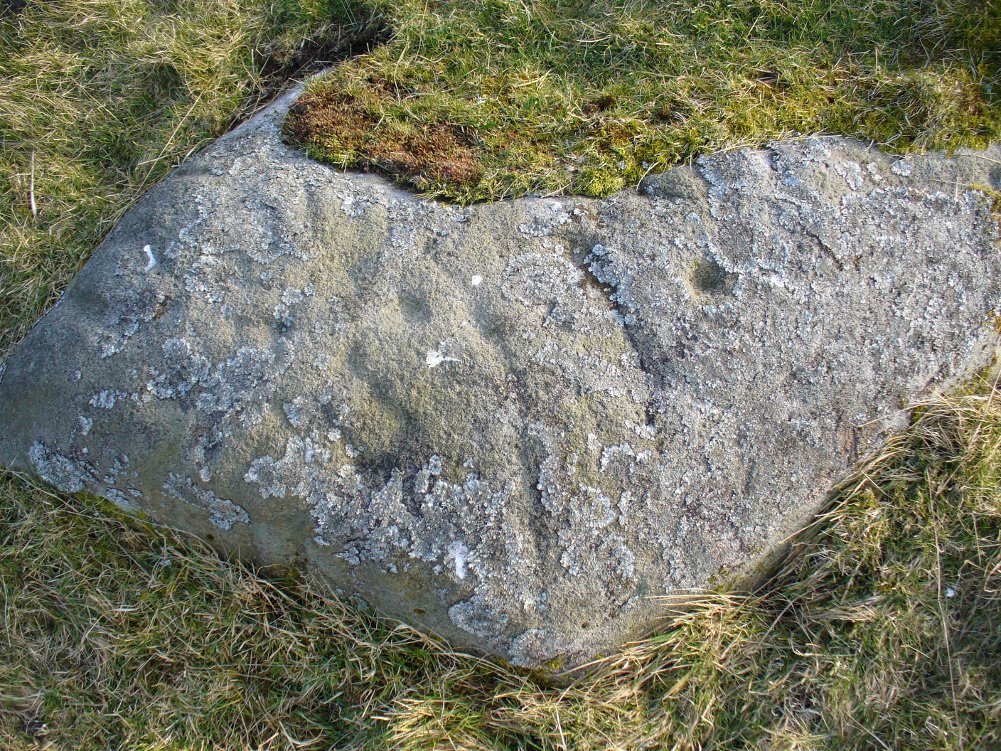
Lichen Stone, from above
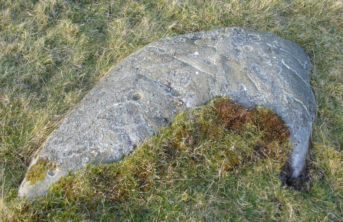
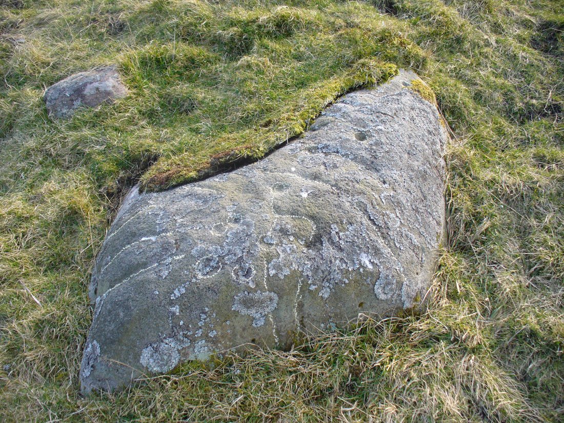
There are at least a dozen cup-markings etched onto the upper surface of this curved stone, with the majority of them clustering around its eastern side. It seems there’s only one cup-marking on the western section of the rock, with the majority of them carved near the middle of the rock and then moving to its eastern section. But the curious features are the interlinking carved lines which you can see have been highlighted on the top and sides of the stone. Initially you get the impression that they’re natural, but it becomes obvious the more you look at them that they’re an integral part of the carving. Some of the lines typically link-up with other cups, whilst a number of them have been carved along and down the vertical faces of the rock, primarily on the east and north-east edges. At least seven of them have been done and they all reach down to ground-level.
Cups & carved linesCarved lines highlighted
It seemed obvious that an even larger design was apparent on the rock, but the stone had been covered in an age of lichen (hence the name) which I didn’t want to disturb; and although no distinct cup-and-ring can be seen here, it looked as if one such motif might have been hiding beneath the lichen cover. But let’s leave the rock and lichen to their own quiet life and move on our way…. to the other carvings nearby, like the impressive Fraggle Rock, or the more basic Snake Stone. Then follow your nose and seek out the other carvings in these fields…
From Burley-in-Wharfedale train station, take the road uphill to the moors, turning right at the top, until you hit the bend where the stream and rocky valley of Coldstone Beck appears. Walk up the right-hand (west) side of the beck until the moorland levels out. Walk along the footpath above Stead Crag for a coupla hundred yards, keeping your eyes peeled for the largest upright stone in the heather about 50 yards into the moors. The other way is to get to Woofa Bank Enclosure and keep walking east through the heather for a coupla hundred yards till you see the tallest upright stone in the heather.
Archaeology & History
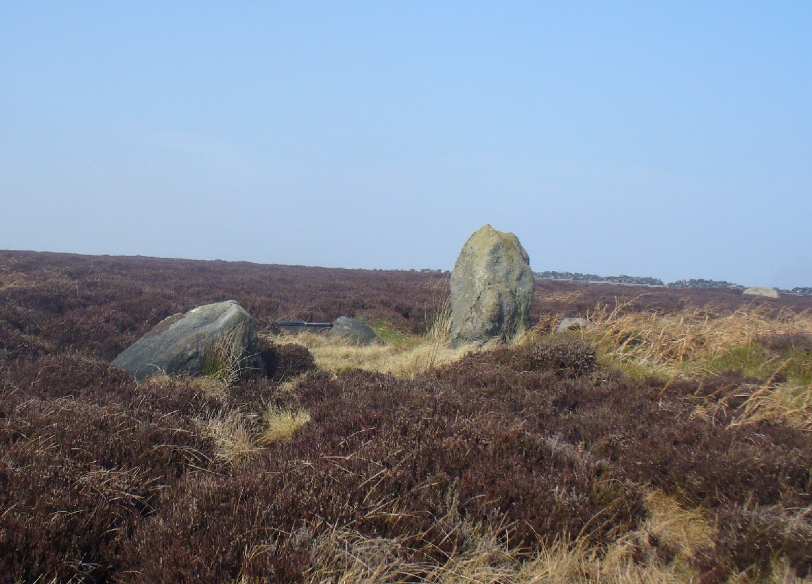
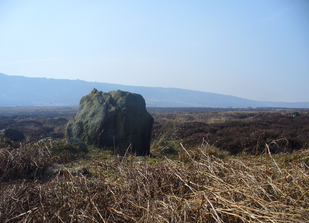
Apart from my own short entry about this site in The Old Stones of Elmet, we have no archaeological account of this standing stone, less than four feet tall and nearly as wide at its maximum, living in a landscape renowned for its excess of neolithic and Bronze Age remains. For those of us who love our megaliths it’s nothing special — but at the same time it’s worth looking at, if only because of the other mass of prehistoric remains close by. It received its name from the adjacent Coldstone Beck a short distance to the east, whose etymology isn’t clear.
Cold Stone, looking eastGazing into a hazy SW
Although we know that many of the sites on this ridge are prehistoric in origin (incredibly some of it still aint registered by those who get paid to do such things), we also need to take into consideration that this site may have been effected by the early industrialists who also made their mark on this section of the moor: they have scarred some cup-and-rings along here, destroyed other remains and left incisions on some rocks which could easily be mistaken as ancient. There is also the possibility that this upright and its adjacent stones were once part of a cairn. If evidence comes to light that the Cold Stone is more recent, we will of course amend this site entry.
Folklore
A number of Cold Stones are found scattered across upland Britain, in the form of crags or solitary stones. In North Yorkshire and beyond, the name is sometimes a corruption of a Call Stone, i.e., a site where village matters were called out prior to the institution of a bell-man. The old Market Cross in Kendal village, also known as the Cold Stone was where village notices were proclaimed.
References:
Bennett, Paul, The Old Stones of Elmet, Capall Bann: Chieveley 2001.
If you park in the first car park at Greenaway Country Park past the lake, and then walk along the road taking the footpath on the left around the lake, continue until one crosses a bridge, just below the Warden’s Tower taking a path which follows a small stream, past a pond and then continue until there is a bridge on the left. Just after this is a path on the right you will reach the Gawton Well.
Archaeology & History
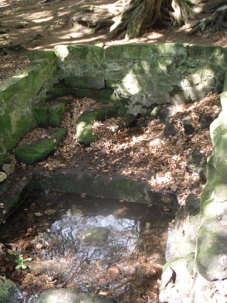
The spring, voted one of the most mystical places and certainly one of the most atmospheric of Staffordshire’s ancient wells, is found on the remains of the Kynpersley Estate. It fills at first an elliptical stone basin, then a small rectangular basin and then a larger one which could have formed a bath. There is a semi-circular stone just after this and it then flows through a number of large rocks forming a stream. The site has an excellent arrangement: the juxtaposition between the man-made and the natural.
Perhaps what makes this well one of the most evocative and interesting is the fact that it arises in an oval grove of yew trees. Some folklorists and New age Antiquarians have seen this as being evidence of some pagan origin of the well and although it is interesting that the site is unconverted to the Christian faith. However, one must be careful. Firstly the trees do not look that old and secondly the presence of a nearby Warden’s Tower, a folly, suggests that this is perhaps a 18th century piece of antiquarianism. I have been unable to find much more of its history.
Folklore
The Gawton Stone
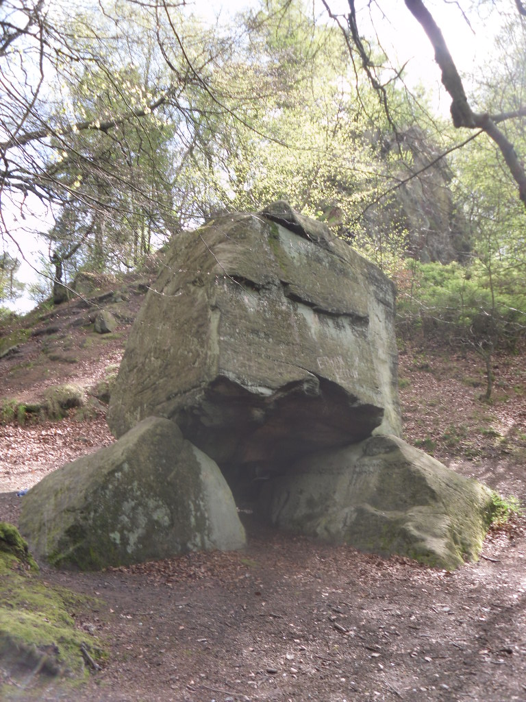
This suggestion of the site being a folly may be justified by the presence of Gawton’s Stone. This is just up from the spring, being a large stone supported by three other stones. Some antiquarians identified erroneously this as either a druidic altar or megalithic structure (it would be impossible to lift the structure). However it is here that legendarily a hermit lived called Gawton who used the well. Often landowners would employ a hermit to add some romance to the estate, although the stone does not particularly look like a comfortable place. Certainly local tradition states that the man came from Knypersley Hall in the seventeenth century, although the house is 18th century and no name is recorded as living there of any note! The house itself dates from the 12th century. Robert Plot (1686) in his work on Staffordshire states that:
“There are many waters such as the water of the well at Gawton Stone…which has some reputation for the cure of the King’s evil..”
The King’s evil was a skin complaint generally called scrofula which was only thought to be cured by the touch of the reigning monarch. Now rarely do I try out springs, but at this time my little boy was suffering with eczema and having tried all sorts of creams I said flippantly try some of the well’s water. I collected it from near the source in a drinking bottle, it felt unusually silky to the skin, and applied some to an area of dry peeling skin on his cheek. Remarkably by the time we had walked from the well to the car the area have healed itself rather miraculously. I only wished I had collected some more to use later, although the area on his face disappeared for good….
In all Gawton’s Well deserves to be more well known, a magical site of which my only clue, many years ago before the internet, to its existence before reaching it was a circle on the OS-map! A site which may reveal its secrets with greater research, which I plan to undertake whilst preparing for the Staffordshire book below.
References:
Parish, R.B., Holy wells and healing springs of Staffordshire (forthcoming) full set of references within.
Plot, Robert, A Natural History of Staffordshire, Oxford 1686.
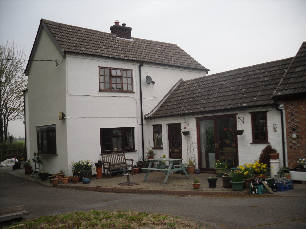
One of the most unusually sited of Nottinghamshire’s holy wells is St. John’s Well at Welham. It lies beneath a private kitchen floor in a house in Bonemill Lane in Welham, just off the Clarborough Road out of Retford.
Archaeology & History
The well itself is undoubtedly an ancient one. The Domesday Book refers to ‘Wellun’; this changed to ‘Wellum’ by 1166, and by the 16th century had become ‘Wellom’; but in Chapman and Andrews map of Nottinghamshire in 1775 was shown as ‘Welham’. None of these sources call it St John’s Well and it is not so named until 1710, either as a re-dedication once the Reformation zealouts had died down, or perhaps coined by John Hutchinson to give the bath a story to explain its healing waters. It is shown on Chapman’s map of Nottinghamshire (1774) as ‘Well House’. Piercy (1828) gives the greatest information and states that the hamlet of Welham was named after St. John’s Well whose waters contained magnesium and gypsum and was:
“good for rheumatics and scorbutic diseases. Its waters formed into a large bath, and remained entire during the early part of the 18th century, it was famous for many cures, but latterly it has lost much of its celebrity.John Hutchinson, Esq. erected a cottage adjoining, and enclosed the bath, to preserve it from injury. Cold baths like this were formerly regarded with superstitious reverence, being supposed to possess a sovereign remedy for agues such as rheumatism.”
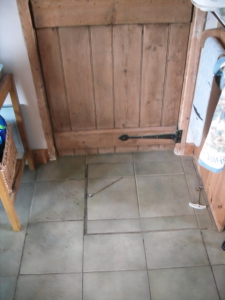
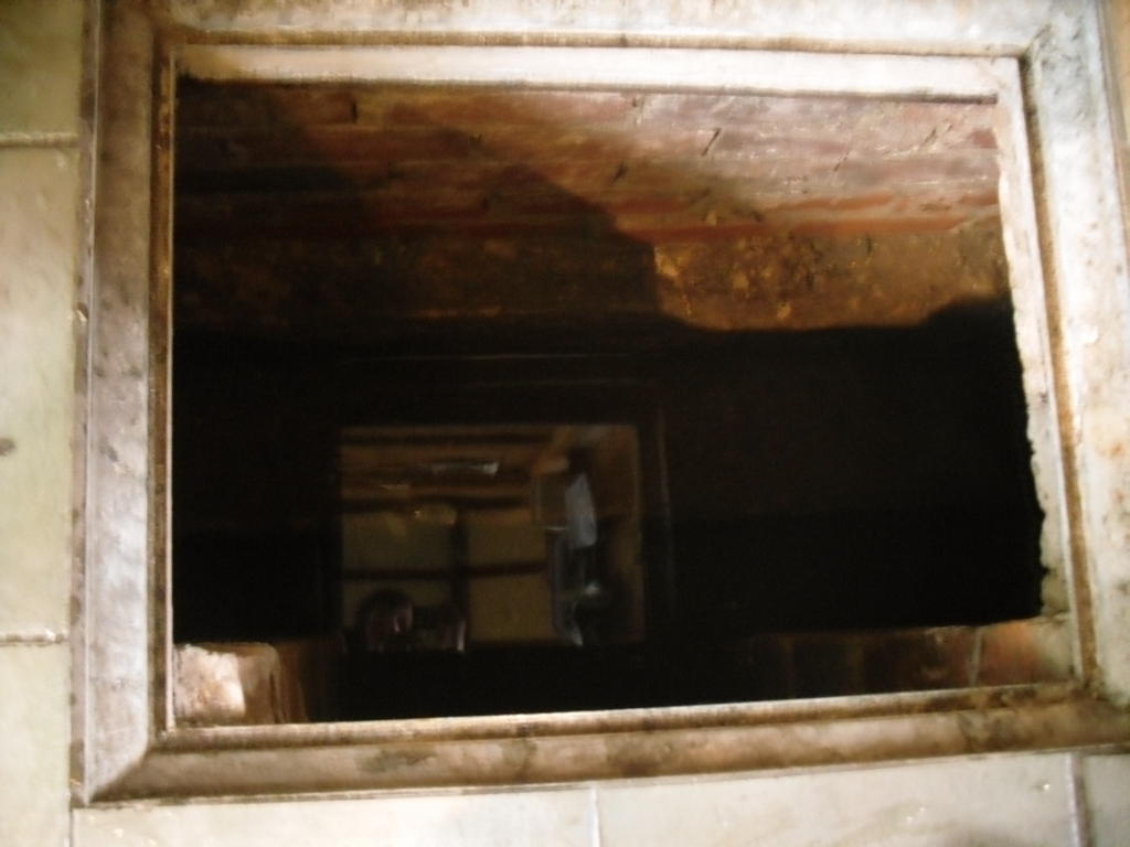
The well-coverLooking into the well
By 1832 White’s Directory notes that it had lost much of its former celebrity. A Robert Walker was a bath keeper at the Well house and may well have been the last one as it appears the well soon fell into terminal decline and I can find nothing is noted of it until 1938. At this time it is noted that its water was still used to provide several cottages in the village. An article written in 1957 states the bathhouse disappeared stating the coming of the railway encouraged people to move away to find more effective spas around the 1830s. It goes on to note that the actual spring location was lost. This I thought was to be the situation, but local investigations not only showed the house to be still existence but the bath still remained! Records show that the estate, was bought by an Arthur Robert Garland of Welham Hall from the deceased estate of John Henry Hutchinson of Clarborough Hall acres117.3.16 along with Well House Cottage and garden for the sum of £3200 on in 1910. He then sold the cottage and garden to Fred Anderson on 1910 for £130. This was subsequently bought by the late Mr Eric Durham on 1955, later to be purchased by the current owner, Mr Whelan, in 1975.
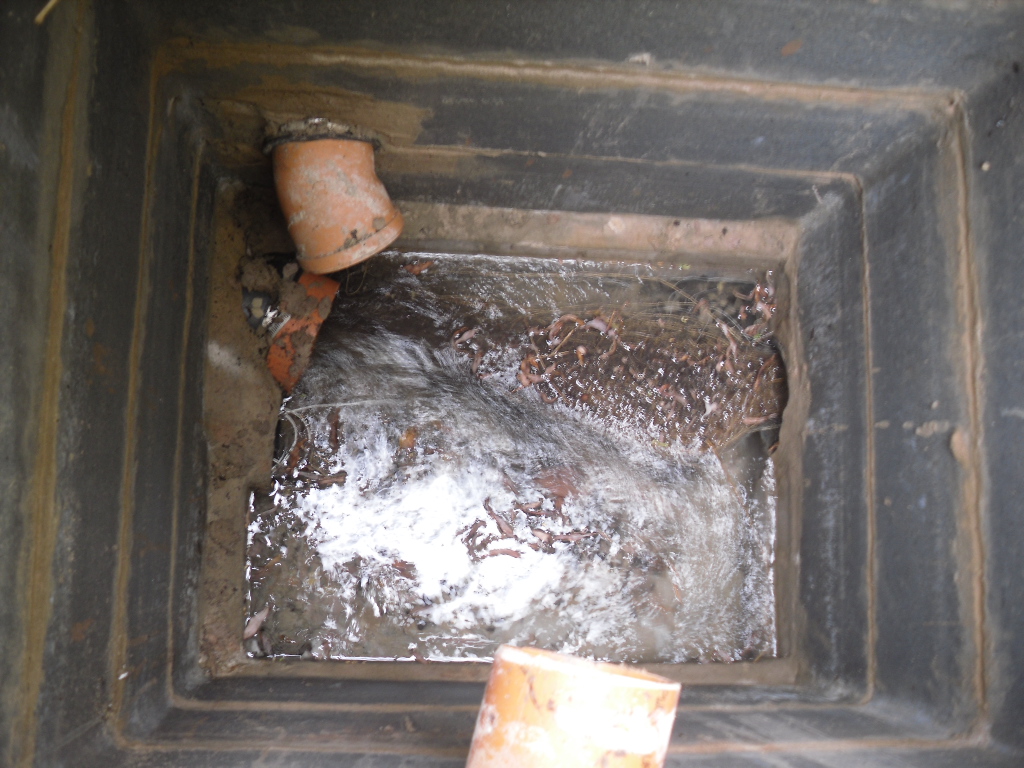
The present house, although it had been added onto in the last century, has its core fabric as John Hutchinson built it. The large house being the well keeper’s abode with the side building, now a modern kitchen was the bath house. Arriving at the house, I was at first shown the site by Mr. Whelan the spring which filled the bath which was diverted to the side of the house, the spring itself arising close to the footpath behind the house. A man-hole cover in the drive way revealed that the spring flows at a fast rate, several gallons per minute. He notes that it had a very high mineral content, soaking through the gypsum in Clarborough hills. He stressed it is drinkable, in small quantities, due to its high magnesium and sulphate (like Andrews Liver Salts). It is quite chalky to taste flat but is very pleasant to drink if aerated. However he did not recommend long term drinking was probably not good for one’s health.
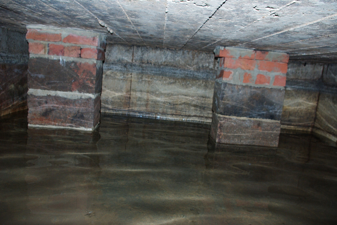
In the kitchen, a small trap door can be removed and beneath the remains of the bath is revealed. This appears to as Mee (1938) describes; a stone basin twelve feet square with a flight of steps entering the water. I scrambled down into this bath and found it presently to have two stone steps which enter the bath, although bricks built upon these suggest that there may have been more.
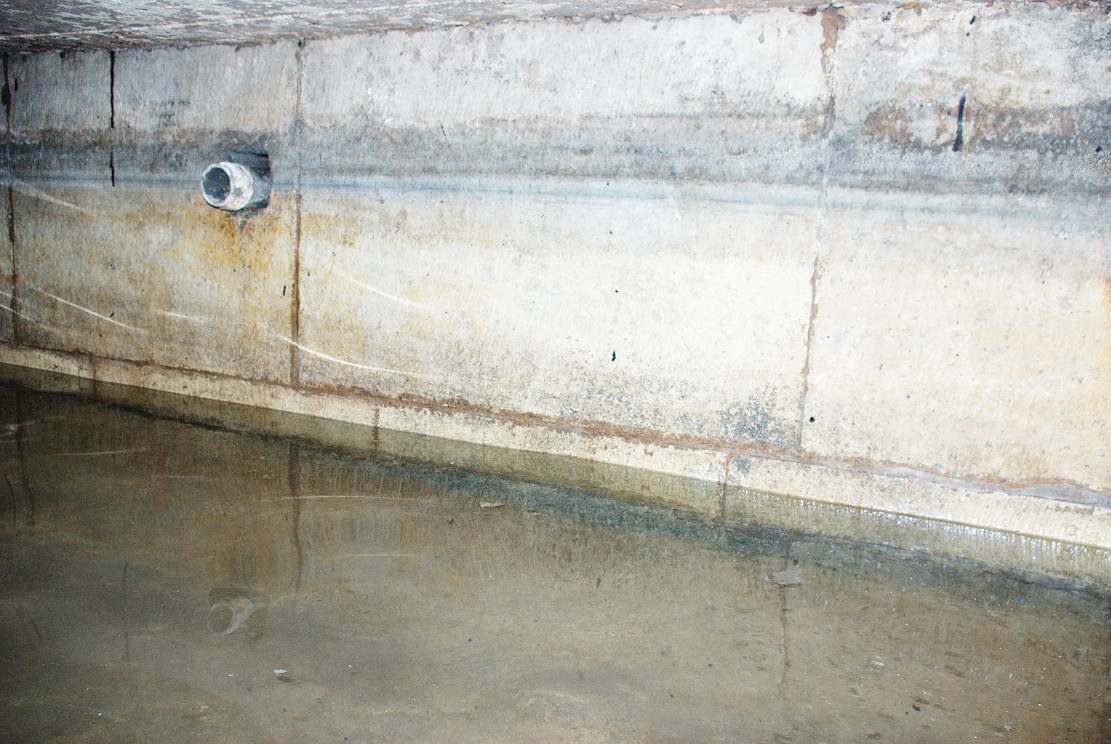
Remarkably the bath still remains enclosing an area fifteen feet by twelve feet, and despite the water being diverted, was full to over a two foot of water. The present kitchen is supported by four brick pillars but this does not appear to have damaged the fabric of the bath which is in fine condition, being made of good quality neat squared stonework. A pipe is found four feet high or so in the wall and a line around it made by the presence of water indicates that the water was of a considerable depth supporting the fact that it was large enough to be a hazard, explaining how Thomas Heald, Vicar of Babworth drowned in it on the 18th June 1759. Mr. Whelan informs me that although the house is not a listed building previous owners had sensibly preserved the bath. Around 30 years ago he was often showing local school children, but it appears now to forgotten. So there it remains a curious relic preserved in its most unusual place.
Folklore
John Piercy (1828) notes:
“Here was, until lately, a feast, or fair, held annually on St. John’s day, to which the neighbouring villagers resorted to enjoy such rural sports or games as fancy might dictate.”
What is interesting about this account is the reference of games and a fair suggesting that if the well itself did not have such a dedication, the saint was celebrated in the locale. This may indicate that indeed the well was so dedicated or that Hutchinson chose this name because of the local fair. Without further information we shall never know.
It must be noted that due to its location, under a private kitchen, that the site is not readily viewable so please don’t turn up unannounced.
References:
Mee, Arthur, Nottinghamshire, Hodder & Stoughton: London 1938.
Parish, R.B. (2010) Holy Wells and healing springs of Nottinghamshire
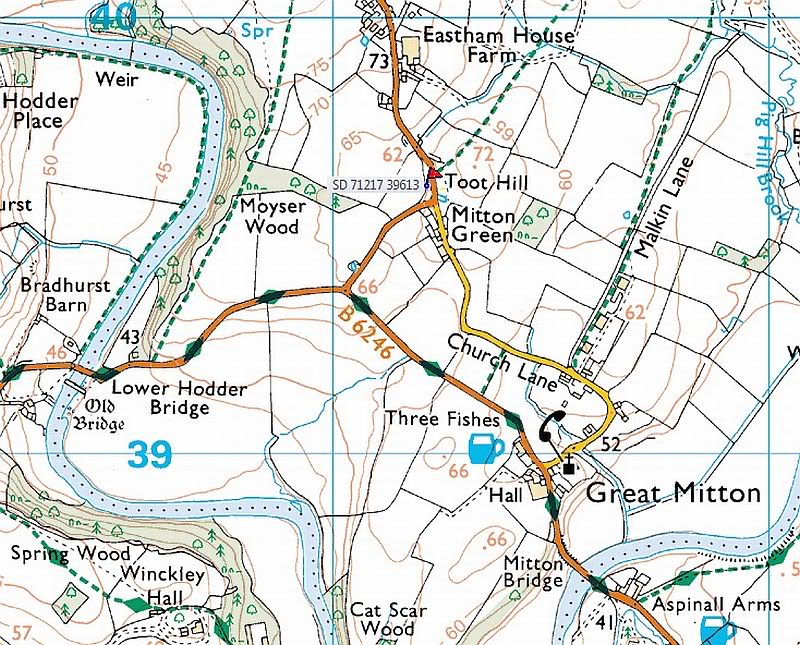
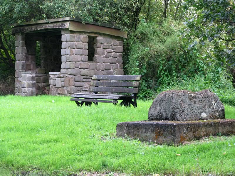
From Great Mitton village centre, take the B6246 road NW turning right up the B6243 road a quarter-mile past Great Mitton Hall. Same distance again, and just after where the road bends left, on the same side of the road you’ll see a wooden bus-stop. The site is just on the grass next to it.
Archaeology & History
The old site by the road (after QDanT)
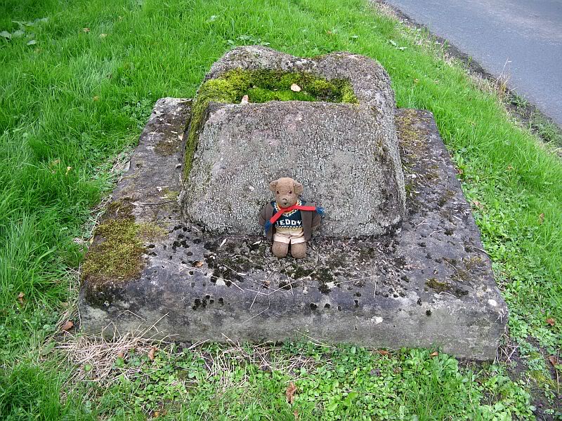
In a region with many old crosses hiding away in the landscape, we have very little history about this particular wayside cross and its stony base, found below the western edge of Toot Hill. It will no doubt have had something to do with the monks of the once-prestigious Whalley Abbey a few miles away, but we know not what! The great Lancastrian historian John Dixon would, no doubt, have known something of this place, but he is sadly no longer with us… The only thing I can presently find is a passing mention in Fred Ackerley’s (1947) local history work, who told:
“Continuing along the high road past Mitton Green one sees the base of a roadside cross and directly opposite this cross-base is Toot Hill, where in ancient times it is probable that village meetings were held.”
Close-up of the cross-base, with Teddy! (after QDanT)
Toot not being a just “a look-out hill” (Smith 1954), but in some cases places where ancient temples were built, “upon high totes” — though we have no record of such a temple, christian or heathen, upon this hill. So the reason for the stone cross at the bottom remains a mystery. Although, atop of the hill, we see marks very reminiscent of something much more archaic and heathen in nature, still visible in the crop-marks…
References:
Ackerley, Frederick George, A History of the Parish of Mitton in the West Riding of Yorkshire, Aberdeen University Press 1947.
Smith, A.H., English Place-Name Elements – volume 2, Cambridge University Press 1956.
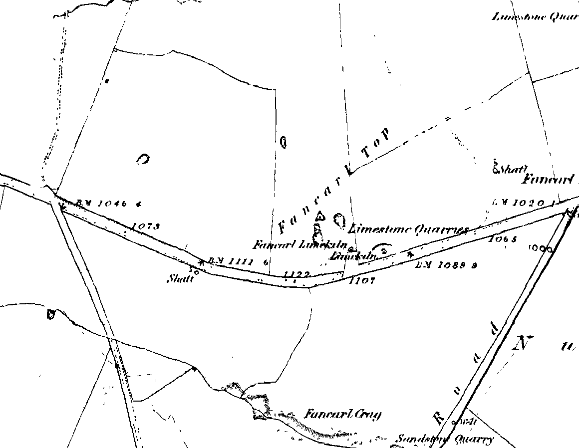
1st edition OS-map – the unmarked circle’s near the middle
Along the B6265 road between Grassington and Pateley bridge, heading east, past the hamlet of Hebden, a mile or so on where the road goes uphill, stop where it levels out a bit (before it goes further uphill to Stump Cross), a half-mile before the rocky outcrop of Nursery Knott on the left (north) side of the road. A gate into the field on the same side is what yer after, with a small disused quarry therein. Go up here to the quarry-top and then walk uphill for literally 100 yards and the curious small ring is right there.
Archaeology & History
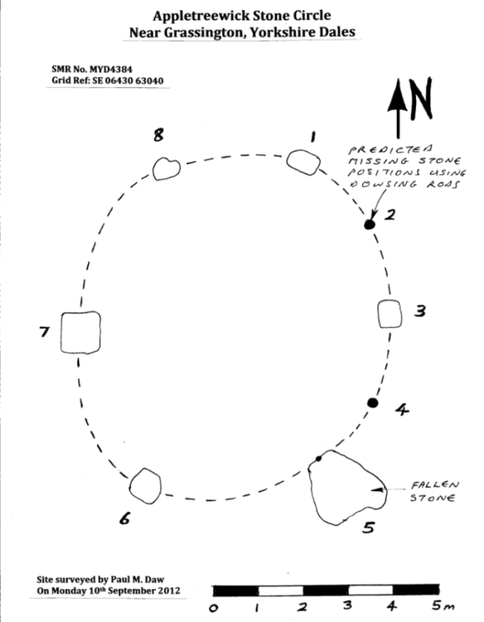
Appletreewick stone circle (courtesy Paul Daw)
This small stone circle sitting on the grassy ridge overlooking the ritual rocks of Simon’s Seat and central Wharfedale to the south and the Yorkshire heathlands east and west, is probably not what it once was. Overcome by the excess of industrial workings in the fields and moors all round here, it is probable that its present condition is far from its original state. Indeed, if we move back to the 18th century, we find that place-name and map evidences tell us the site was a tomb. The 1771 Greenwood map names the site as the Fancairn — an etymological curiosity in itself, possibly deriving from the ‘Windy Cairn’, which makes sense. The place-name fell into its present title of ‘Fancarl’ after the great Ordnance Survey chaps came, heard dialect and went on their way…
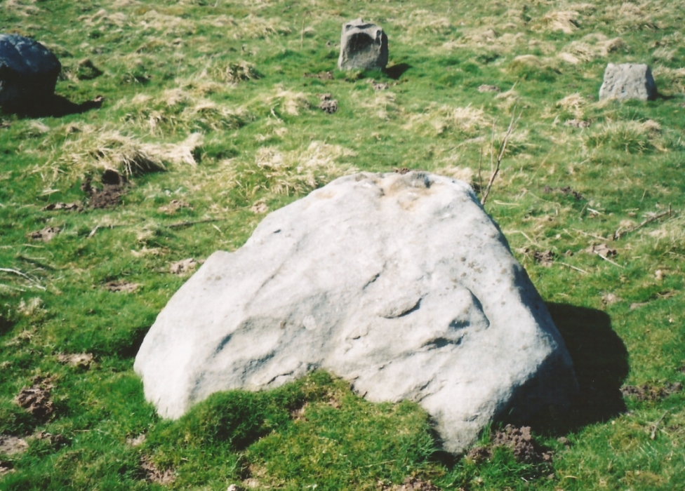
The largest rock in the ring (courtesy Paul Daw)
The circle doesn’t appear to have been noted by the great Yorkshire historians Harry Speight and Edmund Bogg in their literary rambles here (rather odd), but was brought to our attention first of all (in a literary sense anyway) by Arthur Raistrick. (1965) He first “surveyed” the site in 1950, but said little until a short remark was printed in the Yorkshire Archaeological Journal, where the notes told it to be one of “two stone circles, one with clear standing stones, 30ft in diameter, and the other a double circle of small recumbent stones, 12ft in diameter.”
Ground-plan & missing stones (by Paul Daw)
The second, smaller double circle he mentions is probably a hut circle or cairn, faint traces of which are seen in the adjacent field. Remains of a prehistoric enclosure were also once evident in the same field; and thankfully to the south (across the road) we can still find many examples of cup-and-rings at Skyreholme.
John Barnatt (1989) and Aubrey Burl (2000) include the site in their relative major surveys, with both of them citing the circle, of six small stones, to measure 8.5m by 7.5m. The survey shown of this small stone ring was done by Paul Daw following his visit to the site on Monday 10th September 2012.
Folklore
Although we can only see six stones in this ring today, when the surveyor Paul Daw (2012) did a ground-plan of the place, he also did a dowsing survey of the site and found there were originally two extra stones on the eastern side of the circle. An archaeological dig would be interesting to see if post-holes or the remains of these two additional stones are under the turf. He wrote:
My dowsing survey revealed that the stone circle measured 7.7 metres diameter (N-S) and 7.0 metres (E-W). A reaction was received over the centres of stones 1, 3, 6, 7 and 8 indicating that they are still standing in their original positions, but stone number 5 to the south-south-east of the circle had a reaction at its northern end, which indicates that it was once standing but had fallen outwards. It is not therefore an earthfast stone, as speculated by A. Raistrick, when he visited the site. The stone measures 1.65 m x 1.65 m x 800 mm and fans out like a shell from bottom to top. It would have been an impressive stone when standing, but was top heavy, and the most likely stone to fall.
Stones 1, 3, 6, and 8 are all of a similar size, are much more stable, and stand at about 500 mm high. Stone 7 in the western sector is 800 mm high, and measures 950 mm x 850 mm, and looks like a rectangular block, with slightly rounded edges.
I also obtained a reaction at positions 2 and 4, indicating that there were once stones standing in these positions. To the north of the stone circle there are a number of stones lying on the surface. A. Raistrick suggested that there may have been another small stone circle in this area, but my dowsing rods did not detect anything, and it is probable that these are random stones lying on the surface.
This entire region is bedevilled with faerie, goblin and giant lore, plus creation myths of our peasant ancestors (Sutcliffe 1929) — some still living if you’re lucky enough to talk with the old folk, who might tell you a thing or two, or might not, depending on how you smell.
References:
Barnatt, John, The Stone Circles of Britain – 2 volumes, BAR: Oxford 1989.
Burl, Aubrey, The Stone Circles of Britain, Ireland and Brittany, Yale University Press 2000.
Daw, Paul M., “Appletreewick Stone Circle, Yorkshire Dales,” unpublished survey report 2012.
Tumulus (destroyed): OS Grid Reference – TA 4160 1748
Archaeology & History
In and around East Yorkshire, the fabled Yorkshire antiquarians William Greenwell and J.R. Mortimer uncovered and excavated many now-lost prehistoric tombs—some of which, beneath the rounded tumulus of earth, were constructed out of wood instead of stone. A little-known site, now long gone, once existed in what is now the North Sea, just a few hundred yards off the Easington coast. Other sites close by are soon to be completely swallowed back into Earth’s body, right on the water-line, but the site described here has long gone. What little was known of it was described in Mortimer’s (1905) magnum opus, where he told:
“On the beach at Easington, in Holderness, under a tide-demolished barrow, Dr Hewetson and the writer on April 21st, 1894, discovered a double cist made of broad slabs split from the outer shell of the decayed trunk of a willow tree. This barrow had been swept away by the waves, and its site was at about half-tide-line, and a considerable way from the very low cliffs. Lining the grave with wood (the branches of trees) would not be difficult to accomplish and would be practised as a protection to the body.”
A henge monument and several other prehistoric barrows have been located in and around Easington, but they’re fading fast!
References:
Mortimer, J.R., Forty Years Researches in British and Saxon Burial Mounds of East Yorkshire, A. Brown: London n.d. (1905).
The 6″ OS map of 1913 has a ‘Fairy Well’ marked on the northern edge of Preesall Hill. Travelling north through the village on the B5377, the Hill is to your right. Immediately past it is a stile, cross over this and go straight on with the hill to your right. The approximate site of the fairy well is now marked by a boggy area at the foot of the hill.
Archaeology & History
Almost a footnote in Reverend William Thornber’s 1852 paper on the Britons, Saxons and Danes in the Foreland of the Fylde, here is how this site is described by him in the quaint (to our eyes) language of the mid-nineteenth century:
“…the hill of Presal, (the ‘Pressonde’ of Domesday), with its well all but deified; and although the votaries, like those in the pool of Laconia, may not have cast into it cakes of bread-corn to Juno,* yet a bush was named ‘Beggar’s bush,’ from the circumstances of the offerings of rags and clouts being affixed to it, over which a prayer was said; for Bishop Hale ridicules a superstitious prayer for the blessing of clouts for the cure of diseases.”
In addition, the following reference was found on-line:
“…If the travellers had lingered, however, they would observe the inhabitants placing half eggshells on the edge of the Fairy Well at the foot of Preesall Hill; a practice of the local school children even at the beginning of the 20th century. Recording some of the traditions of the country areas of 19th century Wales, Sir John Rhys in his “Celtic Folklore”, mentioned how half eggshells were left out for the fairy folk to use as cooking pots in which to prepare food and brew beer for the reapers at harvest time.”
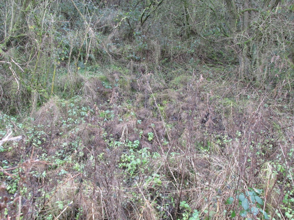
Close-up of the boggy waters
The Beggar’s Bush is long gone, but the red colour of the deposits in the adjoining ditches would indicate a chalybeate (iron-bearing) spring rather than a well, and the northern slope of the hill seems to have become an unofficial children’s play area. Curiously, at the top of the hill, next to the playground of the Fleetwood’s Charity School, there is a modern ‘beggar’s bush’, festooned with white and yellow plastic strips, in a small nature trail area…
* quoted from Borlase, in his Natural History of Cornwall (1758): “…In Laconia they cast into a pool, sacred to Juno, cakes of bread-corn; if they sunk, good was portended; if they swam, something dreadful was to ensue.”
¶ http://www.lancastrians4ever.homecall.co.uk/lancastrians4ever/precha1.htm – Believed to be an online digest of out of print Preesall history publications by Stan Jones
References:
Thornber, William, ‘Traces of the Britons, Saxons and Danes in the Foreland of the Fylde,’ in Proceedings and Papers of the Historic Society of Lancashire and Cheshire, Liverpool 1852.
Acknowledgements: – My thanks to the staff of the Local Studies Department, Borough of Blackpool Library Services for their assistance
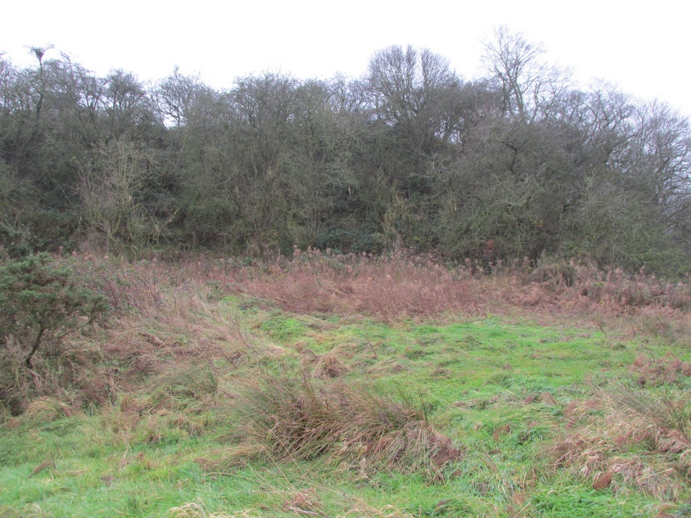
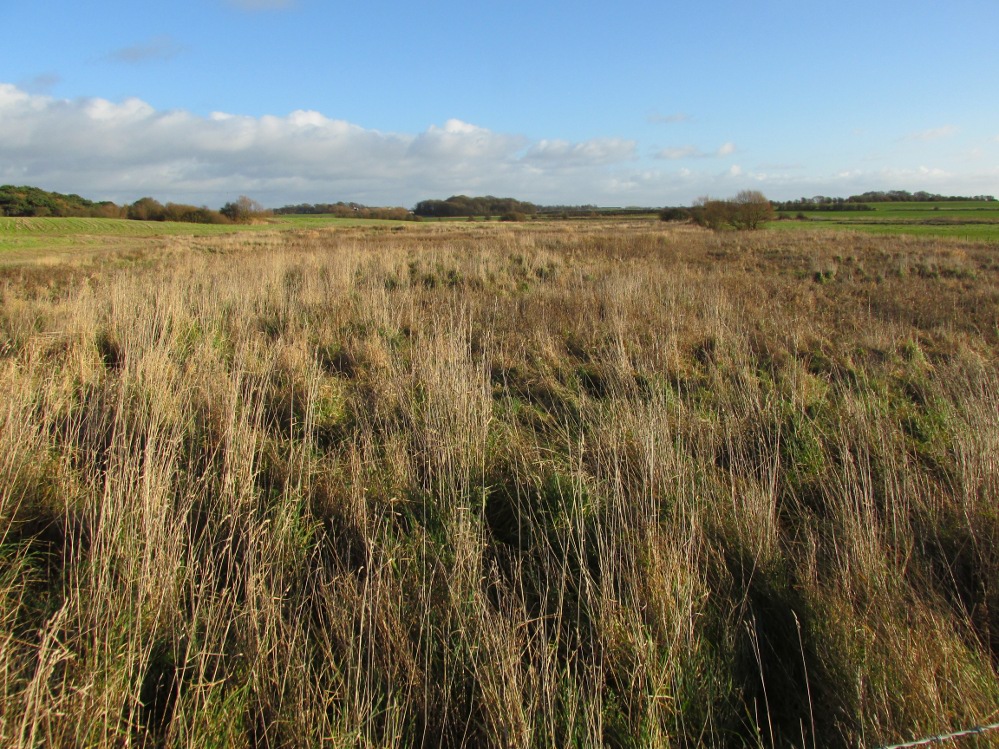
The boggy ground of the Bull Spring – from the site of possible cairn
To get here, leave Staining village along Mill Lane, turning right at the windmill along Smithy Lane. Walk along Smithy Lane, then 2-300 yards past a derelict piggery on the left go into the gated trackway on the right, and Bull Meadow is to the south-east, a boggy area at the western end of OS parcel 356. Be prepared to cross barbed wire fences.
Archaeology & History
Like the Staining Wrangdomwell or Fairy Spring recorded elsewhere, knowledge of this site owes its historical survival to the writings of Blackpool cleric, Rev. William Thornber (1803 – 1885), who wrote in 1851 about the now forgotton ‘Teanla’ or Hallowe’en bonfire cairns of Hardhorn:
“…but here adjoining the cairns are attached two wells, the one celebrated as Fairy or Wrangdomwell, and the other, issuing from a huge oblong mound of stones, as Bel spring or vulgarly Bull spring, in the Bull meadows, evidently bearing the same name as Beltain Meadow in Blackpool. Here on this Hardhorn oblong cairn, ceremonies were observed for the purpose of obtaining health to the herds of the farmers of the township – to free the wheat-land from tares, weed &c. – to bring good luck to the votaries, and to enquire into the secrets of futurity.
The ceremony was thus:- first, large fires were lighted, two or three families joining at a circular cairn, the ashes of which were carefully collected. Then the white stones, which at first, had circled the fire were thrown into the ashes, and being left all night, were sought with anxious care at sunrise, when the person who could not distinguish his own particular boulder was considered fey, i.e. some misfortune would happen to him, during the course of the ensuing year¹.
As a finale, the stones recognised were thrown, as an offering, on the oblong cairn to the god or saint who presided over it, and the well, and thus, such collections were made in a succession of years, as to astonish the curious. The water of the wells also had a sovereign virtue for healing the disease of men and cattle….”
The healing procedure at the wells is transcribed in the description of the nearby Fairy Well. Mr Thornber continues:
“The site of the large circular cairn (at Bull Meadow) is not now easily to be distinguished, since Mr. Fisher, the proprietor of the field, has carted away upwards of twenty loads of the refuse that composed it, but the soil around it is burnt red and black. This farce was carried on in its pristine glory long after the reformation; for rational Christianity (sic), which had been almost lost previously, progressed but slowly in the district of the Fylde. Even the waters of Marton Mere (SW of Bull Meadow),…were held sacred.”
Perusal was made of the Schedule to the 1839 Tithe map which revealed a ‘Bull Meadow’, owned and occupied by William Fisher, and from this, its location was able to be identified on the OS map.
Possible source of the waters
Like Wrangdom Well, half a mile to the north-west, the Bull Spring issues from an area of swampy ground, and the exact place of issue was hard to pinpoint when this writer visited in December (see photo the right). The oblong cairn—if indeed that is what it is—can still be identified, about 2 feet above the marsh, it is firm to stand on but not easy to distinguish owing to the amount of vegetation.
¹ Writing in the January 1883 edition of the The Folk-lore Journal, the Reverend Walter Gregor describes ‘ristin the halla-fire’ a broadly similar Scottish ritual carried on in the Fraserburgh area up to the late 18th century.
References:
Thornber, William, ‘Traces of the Britons, Saxons and Danes in the Foreland of the Fylde,’ in Proceedings and Papers of the Historic Society of Lancashire and Cheshire, Liverpool 1852.
Tithe Map & Schedule Transcript – ‘The Township of Hardhorn with Newton’ Surveyed by Thomas Hull in 1838, with Schedule dated 1839.’
Acknowledgement: My thanks to the staff of the Local Studies Department, Borough of Blackpool Library Services for their assistance.


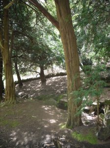 Perhaps what makes this well one of the most evocative and interesting is the fact that it arises in an oval grove of yew trees. Some folklorists and New age Antiquarians have seen this as being evidence of some pagan origin of the well and although it is interesting that the site is unconverted to the Christian faith. However, one must be careful. Firstly the trees do not look that old and secondly the presence of a nearby Warden’s Tower, a folly, suggests that this is perhaps a 18th century piece of antiquarianism. I have been unable to find much more of its history.