St Medan’s Well, Kirkton of Kingoldrum, Angus

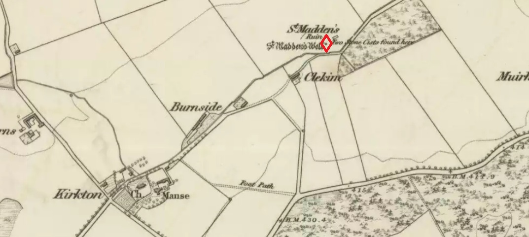
Holy Well (destroyed): OS Grid Reference – NO 33410 54961

Getting Here

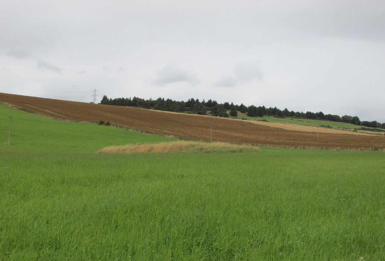
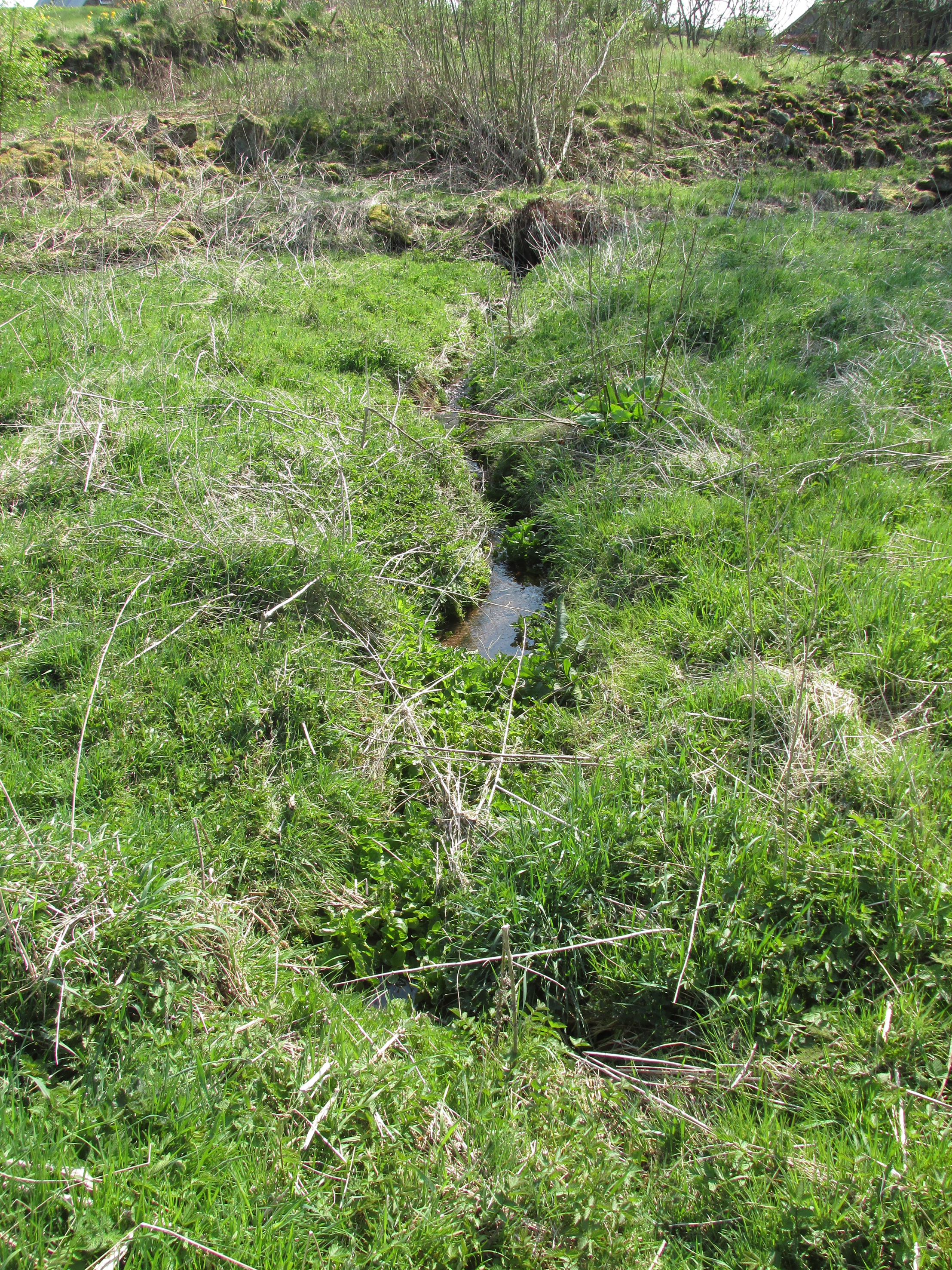
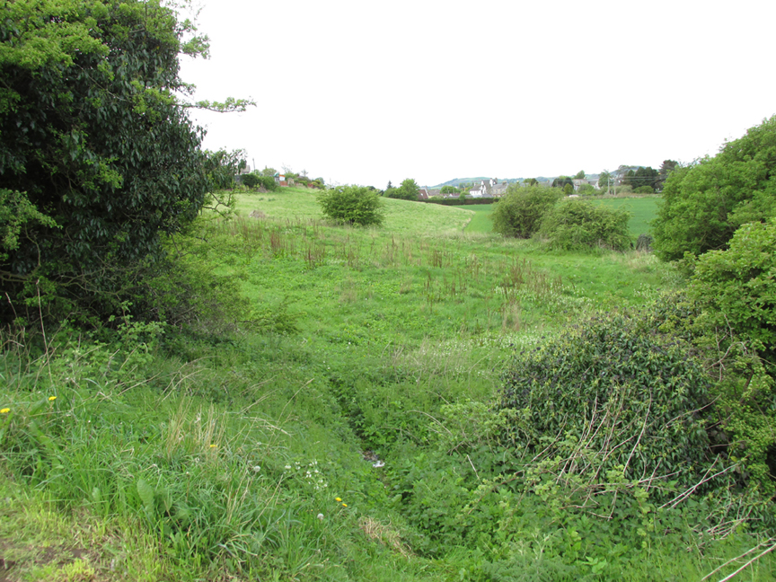
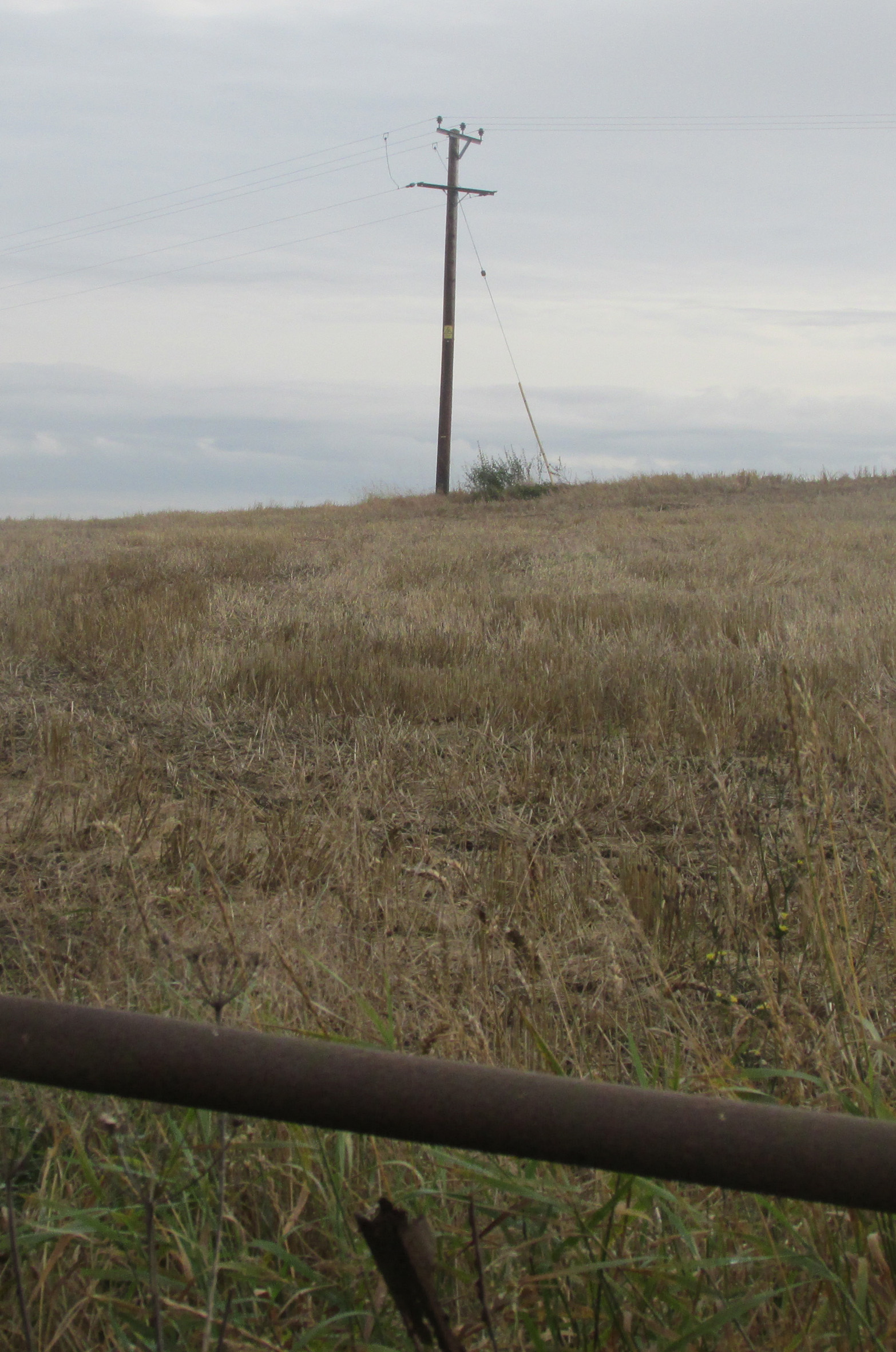
Travelling away from Kirriemuir towards the Braes of Angus on the B951, park outside the now disused Church of Scotland, and walk up the hill past the adjoining house, and turn left through the farm gate into the field. The site of the Well will be seen in front of you on the slope as a patch of nettles between an electricity supply pole and its ground tensioning wire.

The site of the well from the roadside.

Archaeology and History

According to Hew Scott’s Fasti Ecclesiae Scoticae (1925), ‘The church of Kingoldrum was dedicated to St Medan, and not far from it is St Medan’s Well‘.  The Canmore record in respect of  finds in the churchyard (Canmore ID 32254) has the following note in respect of a field visit by a Canmore official on 12 November 1975: ‘According to Mr Mackintosh, session clerk, St Medan’s Well (name verified) was a spring well situated on a hill slope “some 50 yards S of the cottage of the SW of the church. The ground was improved within living memory, and there is now no trace of the well.”‘

A close up of the well site.

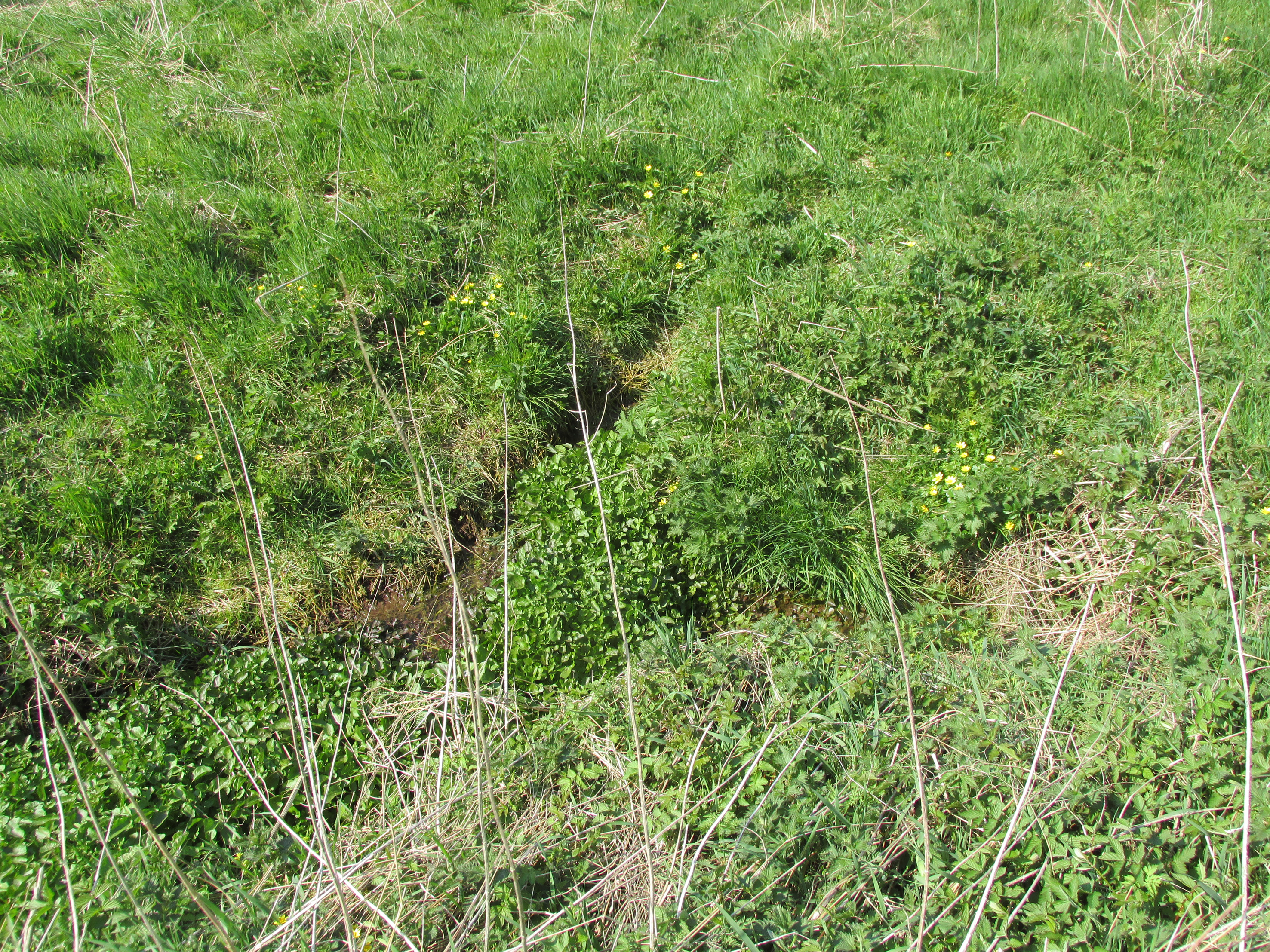
Despite what was stated in the above quote, the site of the well is visible as a patch of nettles exactly where stated, the adjoining house owner confirming that the water is now piped to a cistern in front of the house, and marked by a blue painted stone.

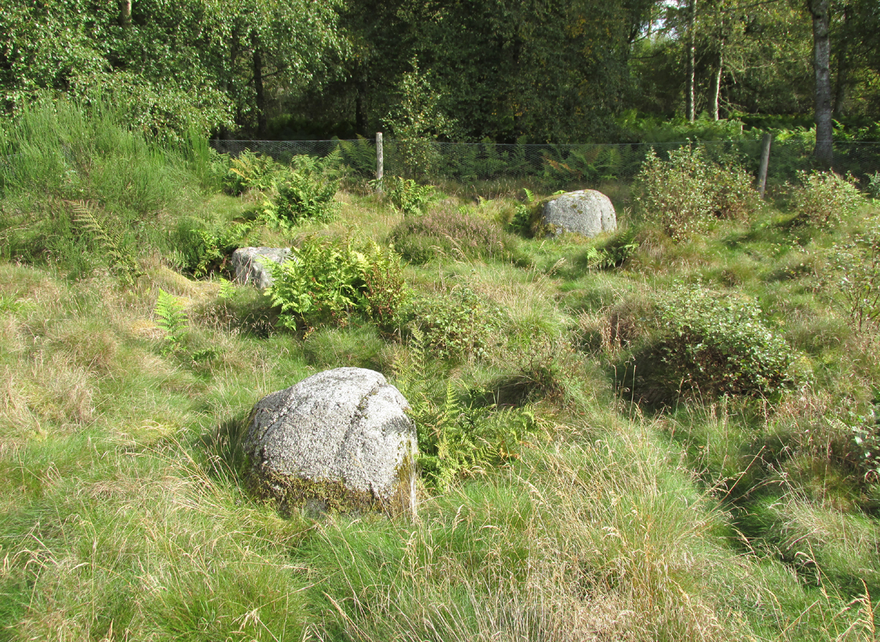
The well is not recorded in the Ordnance Survey Name Books, nor is its position shown on the maps, and that usually reliable source of information on the history of this area, Andrew Jervise, does not mention it in his Epitaphs and Inscriptions in North East Scotland.  As this writer does not have access to the works referenced by Hew Scott, he feels that, in common with other saint’s wells, there may be some uncertainty as to the exact identity of the patron saint of the well, but it is likely to be a separate person to Saint Madden who gave his name to St Medan’s Knowe at nearby Kirkton of Airlie. The argument for this separate identity is strengthened by the discovery in 1843 of a quadrangular bronze coated iron bell that had been buried with other artifacts in the Kingoldrum churchyard. The history of the bell of St Madden of Kirkton in Airlie is historically recorded.

The Water from the well is piped to a roadside cistern in front of the blue painted stone

Alexander Forbes (1872) refers to a St Medan whom he identifies as Saint Medana, and who may be the patron of the well and the original owner of the bell, but he records this Irish born saint as having been active in Galloway, but that she “ended her days near the blessed bishop and confessor Ninian” who was active in Angus. He writes of her: “A native of Ireland, fleeing from the admiration of a soldier, came in a vessel with two handmaidens only to Scotland…where she lived a life of labour and poverty. The soldier pursued her, whereupon she and her maidens embarked upon a stone, which floated thirty miles to a place called Farnes….the soldier still pursued her, and passed without noticing it, the house where she lodged with her maidens, but his attention was drawn to it by the crowing of a cock. She now climbed into a tree, and finding that it was her face and eyes that were the soldier’s attraction, she plucked out her eyes. The soldier repented, and the virgin descending from the tree washed her wounds in a fountain which then and there sprang up“. It seems we can not know if this is the mythic history of the origin of St Medan’s Well.

References:

  1. Forbes, Alexander, Kalendars of Scottish Saints, Edmonston & Douglas: Edinburgh, 1872.
  2. Scott, Hew, Fasti Ecclesiae Scoticanae, the Succession of Ministers in the church of Scotland from the Reformation – Volume V, Oliver and Boyd: Edinburgh 1925.

Links:

  1. Kingoldrum Parish Church

© Paul T. Hornby 2016 The Northern Antiquarian 


Maypole, Hemswell, Lincolnshire

Maypole: OS Grid Reference – SK 92954 90947

Historic photo from Church Street

Also Known as:

  1. English Heritage ID: 196736

Getting Here

In Hemswell Village at the junction of Church Street and Maypole Street.

History & Archeaology

According to a 2010 report in the Scunthorpe Telegraph, the Hemswell villagers,

“claim to be the hosts to one of the oldest maypole celebrations in the world, dating back to at least 1660”.

The then clerk to the parish council, Dianne Millward is quoted as saying:

“Hemswell is widely regarded in historical circles as having one of the oldest if not the oldest celebrations for May Day. We have pictures of the pole being prepared for the big day in the very early 1900s.”

Hemswell maypole on 1906 map

This writer has not yet been able to independently verify these claims.

May Day is still celebrated in the village with dancing around the maypole and an accompanying fete. Recent online photographs show that it is now only children, in ‘historic’ fancy dress who ribbon-dance around the Pole.

© Paul T. Hornby 2016 The Northern Antiquarian


The Maypole, Alconbury, Huntingdonshire

Maypole (removed):  OS Reference Number TL 18554 75972

Getting Here

Maypole Square, outlined in red on the 1901 OS map

Maypole Square forms the junction of High Street, Church Way and Chapel Street in the centre of the village.

Archaeology & History

The Alconbury Maypole had passed out of living memory by 1942, but was historically attested by the ‘Maypole Square’ in the centre of the village.

Folklore

C.F. Tebbutt wrote in 1950:

“At Alconbury, it is remembered that about 1890 an old soldier, who lived in the corner house (east end) of the row of cottages facing Maypole Square, used to dig holes in the road opposite the row and set up May bushes there on May day”.

References:

  1. C.F.Tebbutt, “Huntingdonshire Folk and their Folklore”, in Transactions of the Cambridgeshire and Huntingdonshire Archaeological Society, Volume VI, part V, 1942.
  2. C.F.Tebbutt, “Huntingdonshire Folk and their Folklore II”, in Transactions of the Cambridgeshire and Huntingdonshire Archaeological Society, Volume VII, part III, 1950.

© Paul T. Hornby 2016 The Northern Antiquarian


St. Medan's Knowe, Kirkton of Airlie, Angus

Cairn:  OS Reference Number – NO 32021 52100

Also Known As:

  1. Battle Cairn
  2. Canmore 32360
  3. Cantsmill
  4. St. Madden’s Knowe

Getting Here

St Medan's Knowe, from the W
St Medan’s Knowe, from the W

At Kirkton of Airlie, park next to the church and walk north eastwards along the track, past the houses Crabra and Cleikheim, and cross the burn by the small bridge and the mound will be seen ahead of you in the field.

Archaeology & History

A largely flat topped, rectangular mound, measuring, according to Canmore,  28 metres by 22 metres, 2.2 metres high on the west side and about ½ metre high on the east side. There is a quantity of rubble strewn on the top among which are two stone slabs, described in 1958 as being possible cist cover stones. The site has clearly suffered considerable disturbance.

The site highlighted in red on the 1865 6" OS Map.
The site highlighted in red on the 1865 6″ OS Map.
The site from the north

Andrew Jervise, writing of the site in 1864 described it as having been 300′ in circumference and 6-7′ high before the owner started to remove it for agricultural ‘improvements’ around 1859. He described it as being sometimes known as the ‘Battle Cairn’. As part of the demolition of the mound, agricultural workers in October 1859 unearthed a large cinerary urn half filled with human bones and protected by a large sandstone flag.  Jervise writes:

“After the urn was found, care was taken removing other parts of the hillock; and on further reducing the surface, the top of a large boulder was exposed, upon and around which the mass of loose stones and earth appear to have been raised which composed the mound. The boulder, as far as ascertained, measures about 6 by 7½ feet; and the urn was found about four feet to the north east of the stone. At the distance of about four yards from the spot where the urn was found, there appeared to be a separate circle, rudely constructed of stones and earth – stones predominating. In this circle, at pretty regular distances, deposits of human and animal bones were found; and each of these deposits appeared to have been protected by two flat stones set up in a triangular form, resembling (an inverted letter V)…none of the deposits was more than 8″ below the surface”.  In February 1861, “..a stone cist was found a little to the south east of the boulder….it was 5 feet long by 2 in breadth. The lid, a single slab, was upwards of 6 feet in length…the depth of the cist was 2 feet….It was nearly empty, but one could see, from the soft, black, unctuous earth that was taken out of it, that it had contained a body.”

Jervise continues:

“The name of St. Medan’s Knowe is certainly significant, but, whether it would imply that the place had been that of his burial, or one of those of his ministry, and so been the original place of worship at Airlie – are interesting particulars upon which history and tradition are silent”.

Stone slabs on top
Stone slabs on top

The Ordnance Survey Name Books, and the 25-inch OS map of 1865 record the finding, 20 yards to the west of the knowe, of a bronze spear head, which was at that time in the possession of a Mr Dixon, a merchant of Kirriemuir, which may go some way to explaining the alternative name of the site as ‘Battle Cairn’.  The Name Books further record the testimony of a William Duncan that, ‘there have been 7 or 8 stone coffins and an urn found in the knowe, and that he believes a number more might be found if sought for, as the half of it is not yet excavated‘.

From the surviving evidence, it is very likely that Kirkton of Airlie was the centre of a cult of St. Madden (also known as ‘Medan’ and ‘Madan’), with the adjacent Holy Well, the (now destroyed) hamlet of St. Madden’s, and a Dewar’s land occupied by the hereditary custodians of St. Madden’s Bell. This site has no connection with St Medan’s Well at nearby Kirkton of Kingoldrum, that St Medan probably being a St Medana.

References:

  1. Andrew Jervise, Notice of Antiquities in the Parish of Airlie, Forfarshire, Proceedings of the Society of Antiquaries of Scotland, June 1864.
  2. Royal Commission on the Ancient and Historical Monuments of Scotland, The Archaeological Sites & Monuments of Central Angus, Angus District, Tayside Region, HMSO: Edinburgh 1983.
  3. Scotland’s Place Names

© Paul T. Hornby 2016 The Northern Antiquarian

Witch Hillock, Marykirk, Kincardineshire

Tumulus & (possible) Stone Circle: OS Grid Reference – NO 64400 67323

Also Known as:

  1. Canmore ID 36002
  2. Inglismaldie

Getting Here

The Wicth Hillock
The Witch Hillock

Travelling north on the Bridgemill to Fettercairn road, park at the layby just before the junction with the minor road (left) through the Forestry Commission’s Inverury Wood.  Go through the gate and walk along the track to the end where it joins another track and turn right. About 300 yards along, the Hillock is in a fenced enclosure to the right, accessible over a stile.

Archaeology & History

The site was not mentioned in the Statistical Accounts, nor is the origin of the name recalled, from which it is reasonable to assume that ‘witches’ (howsoever that term was interpreted in the days of persecution by the Kirk Sessions) met there. This is reinforced by there being a plot of land due west called ‘Witchfield’.  The Canmore report describes the mound as  being,

“situated near the edge of a low natural escarpment..measuring about 18m. in diameter and 2m. high.”

The Ordnance Survey reported in the mid-1860s that the Hillock was,

“An artificial mound….a remarkable looking object….enclosed with ornamental wire fencing, the name is well known in the district, but is not mentioned in the Statistical account nor any other document in the possession of the authorities. James Glenny, Gardener at Inglismaldie states that he assisted to open this, under directions from the Earl of Kintore, about Seven years ago, and that after clearing away the top soil there were found several stone coffins containing human bones and a clay urn containing what appeared to be calcined human bones….”

The site shown at the top of the 1865 6" OS Map.
The site shown at the top of the 1865 6″ OS Map.
The Hillock with 3 stones in the foreground

Another remarkable feature of the Hillock enclosure is an arc of three large earth fast boulders to the north-west of the mound. It has the appearance of being an incomplete, possibly four poster circle. The stones are not listed by Aubrey Burl (2000) as being part of a circle, and if indeed it was a circle there doesn’t seem to be any evidence of the fourth stone, which would have been positioned nearest to the Hillock.  Unless the Hillock was imagined to be the ‘missing’ fourth stone.

Three stones - once part of a circle?
Three stones – once part of a circle?

A ‘well’ is shown on the modern OS map in the corner of the enclosure nearest the stile, but there was no evidence of this on the day of my visit.

Despite its rather remote location, it was noticeable by the well trodden state of the long grass on the day of my visit that the site receives quite a few visitors – a venue still for witches?

References:

  1. Burl, Aubrey, The Stone Circles of Britain, Ireland and Brittany, Yale University Press 2000.
  2. Royal Commission on the Ancient and Historical Monuments of Scotland, The Archaeological Sites & Monuments of South Kincardine, Kincardine and Deeside District, HMSO: Edinburgh 1982.

© Paul T. Hornby 2016 The Northern Antiquarian


St. Madden’s Well, Kirkton of Airlie, Angus

Holy Well:  OS Grid Reference – NO 3179 5188

Also Known as:

  1. Canmore ID 32367
  2. St. Madan’s Well 
  3. St. Medan’s Well

Getting Here

One of the present issues of St. Madden's spring looking south.
One of the present issues of St. Madden’s spring looking south.

At Kirkton of Airlie, park next to the church and walk north eastwards along the track, past the houses ‘Crabra’ and ‘Cleikheim’ and the spring that once supplied the Holy Well will be seen on the opposite side of the burn in a small fenced off enclosure. To the north east of the enclosure is a small hillock known as St Medan’s Knowe.

Archaeology & History

According to the Ordnance Survey Name Books, St Madden’s Well was located in a hamlet called St Maddens, which has since been almost entirely destroyed.  In the mid nineteenth century a number of stone coffins and pottery were recovered from around the site, and the well was described as,

“filled up and defaced, the spring…still to be seen issuing into the mouth of a covered drain that was made some few years ago”.

There are now two issues of water from the spring, while nothing now remains of the original well housing. An adjoining resident informed me that the local landowner had gone to some trouble to try to find any evidence of the well housing, but had found nothing.

St. Madden's Well highlighted in red on the 1865 6" OS Map.
St. Madden’s Well on 1865 Map

As is often the case with these early mediaeval Scottish saints there is some confusion as to St Madden’s identity. To some writers his Saint’s day is accepted to be April 29th, and he has been identified as Saint Middanus, abbot of the monastery of Holywood, but Bishop Alexander Forbes considers he is more likely to have been a Bishop Medanach listed in the Dunkeld Litany.

To confuse things even more, J.M. MacKinlay (1904) wrote:

“The Hamlet of St Madden’s or St Medan’s in the parish of Airlie, where are also St Medan’s Well and St Medan’s Knowe, probably retains the name of St Modan, believed to have been a contemporary of St. Ronan.  Skene says: ‘Modan appears in the Scotch calendars as an abbot on the fourth February, and as a bishop on the fourteenth November; but the dedications to him are so much mixed up together that it is probable that the same Modan is meant for both'”.

Andrew Jervise provides the following quote about St Medan:

“..bishop and confessor whose feast is held on 14th November was in great favour with King Conran c.503 – Coll. for Aberdeen and Banff.”

Another issue of the spring

Whosoever St Madden was, his quadrangular bell was the subject of an extant fifteenth century deed whereby the bell with its appurtenant parcel of land was granted to the Countess of Moray as dewar (hereditary keeper of a Holy Relic with appurtenant land), together with “the infeftment being completed by (the Countess) being shut up in a house and then receiving the feudal symbols of earth and stone.” On the death and subsequent disposal of the estate of the last dewar in the nineteenth century, the bell was sold along with a load of rubbish, its true identity and value not being realised at the time.

References:

  1. Andrew Jervise, The History and Traditions of the Land of the Lindsays, Edinburgh, Sutherland & Knox 1853.
  2. Andrew Jervise, Epitaphs and Inscriptions from Burial Grounds and Old Buildings in the North East of Scotland, Edinburgh, Edmonston and Douglas 1875.
  3. James Murray MacKinlay, Influence of the Pre-Reformation church on Scottish Place-Names, Edinburgh and London, William Blackwood and Sons 1904.
  4. Dom Michael Barrett, A Calendar of Scottish Saints, Fort Augustus 1919.
  5. Bishop Alexander Forbes, Kalendars of Scottish Saints, Edinburgh, Edmonston and     Douglas 1872.
  6. Scotland’s Place Names
  7. Andrew Jervise, Notice of Antiquities in the Parish of Airlie, Forfarshire, in Proceedings of the Society of Antiquaries of Scotland, June 1864

© Paul T. Hornby 2016 The Northern Antiquarian


The Maypole Tree, Little Paxton, Huntingdonshire

Maypole & Ritual Tree (destroyed):  OS Grid Reference TL 18831 62757

Getting Here

Imposing trunk of The Maypole Tree, right background

The road layout of the village has changed since the destruction of the Tree, but its approximate position was on the north side of the present High Street, at the junction with the east side of St James’ Road.

Archaeology & History

The Little Paxton Maypole Tree was a very late survival of a tradition where Mayday revellers danced around an actual tree rather than a symbolic tree in the form of a maypole.  It was described as “a tall straight elm tree” that stood in front of what was then the village Post Office, and from what may be the only surviving photograph, it appears that only the very substantial trunk survived of what was clearly a very old tree.

The 1887 6" OS Map, showing the Maypole Tree outlined in red
The 1887 6″ OS Map, showing the Maypole Tree outlined in red

A Miss Ethel Ladds, who had been born in Little Paxton, recalled in the early 1940s:

I remember the old tree very well, it was always called ‘the Maypole’, but I don’t know any more about it, except that they used to dance round it“.

The St Neots Advertiser recorded that the Maypole Tree was blown down in a great gale on 24th March 1895.

Folklore

While this writer has been unable to find direct folklore relating to the Little Paxton Maypole Tree, it may be worth remarking that botanically the Elm tree is a cousin of the Stinging Nettle, the Hop and Cannabis.  Another Elm Tree used for May revels was the Tubney Elm, near Fyfield in Berkshire and recorded by Matthew Arnold, in his ‘Scholar Gipsy’.

References:

  1. C.F. Tebbutt, “Huntingdonshire Folk And Their Folklore”, in Transactions of the Cambridgeshire & Huntingdonshire Archaeological Society, Volume VI, Part V, 1942
  2. C.F. Tebbutt, “Huntingdonshire Folk And Their Folklore”, in Transactions of the Cambridgeshire & Huntingdonshire Archaeological Society, Volume VII, Part III, 1950
  3. Gerald Wilkinson, Epitaph For The Elm, Arrow Books, London, 1979

© Paul T. Hornby 2016 The Northern Antiquarian 


Trinity Well, Trinity Gask, Perthshire

Healing Spring:  OS Grid Reference — NN 9631 1812

Also Known as:

  1. Canmore 25993

Getting Here

The spring is by the trees. The roof of the church is visible past the tree
The spring is in the trees. The roof of the church is visible past the tree

Take the B8062 North from Auchterarder, and turn right immediately after crossing Kinkell Bridge. Continue through the hamlet of Trinity Gask, and take the next turn left. The Well is situated in the wooded area of land to your left, before you reach the church on the right. I tried visiting in summer but was beaten back by the boscage of man high nettles, goose grass and brambles. An autumn visit was made, and access was readily available to the wooded area over a barbed wire fence from the field behind the wood.

Archeology & History

The Canmore description quotes from an August 1967 report by an Ordnance Survey inspector:

“Trinity Well is now dry, and all that remains is an overgrown hollow. A manhole cover nearby suggests the spring is now piped.”

On the day of my 2014 visit, the water was flowing from an issue on the field side of the woodland. There was some low walling on the field side of the enclosure, otherwise no masonry or paving was visible. Any there may have been is now either buried or robbed for building material.

The waters still flow despite a 1967 report to the contrary

The 1796 Statistical Account has this to say: ‘ The most noted well in the parish is at Trinity Gask. It is remarkable for the purity and lightness of its water; the spring is copious and perennial. Superstition, aided by the interested artifices of popish priests, raised, in times of ignorance and bigotry, this well to no small degree of celebrity. It was affirmed, that every person who was baptised with the water of this well, would never be seized with the plague….. But the extraordinary virtue of Trinity Gask well has perished with the downfall of superstition, and the introduction of a free and rational enquiry into nature and religion.’

Walling is visible behind the spring issue

The 1837 New Statistical Account goes on to say: ‘….the Trinity Well, a little to the South of the manse, of great renown in Popish days for the performing of miraculous cures, fortifying against plague, witchcraft and such other evils. The right of bleaching at this well is one of the privileges of the minister’.

The Rev. John Wilson writes, in The Gazetteer of Scotland: ‘…a noticeable object is a well famous in Roman times for alleged thaumaturgic properties…’.

Processions to the Well were made on Trinity Sunday and the first Sunday in June

References:

  1. The (First) Statistical Account of Scotland, 1796, Volume 18, page 487
  2. The New (Second) Statistical Account of Scotland, 1837, Volume 10, page 335
  3. Morris, Ruth & Frank, Scottish Healing Wells, Alethea: Sandy 1981.
  4. Wilson, John, The Gazetteer of Scotland, W.A. & K. Johnston: Edinburgh 1882

© Paul Hornby, The Northern Antiquarian 


St Bunyan’s Well, Leuchars, Fife

Holy Well:  OS Grid Reference NO 45252 21483

Getting Here

St Bunyan's PlaceIf travelling from Dundee or Newport, turn right into Meadow Road, the last turning before the roundabout in the middle of the town. On the right is a large white-painted building where bicycles are sold. The site of St Bunyan’s Well is on the patch of empty land opposite, to the left nearest the road.

Archaeology & History

Site of St Bunyan's Well
Site of St Bunyan’s Well

The Well is named in conjunction with the ninth century Culdee chapel of St Bunyan on the nearby Temple Hill, now known as School Hill.  St Bunyan has been remembered by various alternative names:  Bunoc, Bonac, Bonoc, Bonnoch, Bunan, Bernard and Bennett, and W. Reid noted in 1909,

“A crown charter of 1539 refers to a yearly market on St. Bonoc’s Day, and a further reference to the Chapel of St Bonach occurs in the confirmation of a charter by James VI.”

Forbes’ Kalendars of Scottish Saints records, under the entry for Saint Bonoc that one of the Endowments of Saint Fergus at St Andrews was the jawbone of Saint Bonoc, given by Bishop David Rhynd.

The mid nineteenth century Ordnance Survey Name Book correspondents Messrs. Pillans and Keddie described the well: “In the village of Leuchars. A excellent Spring Well in the village of Leuchars it is built round with cut stones, and is Kept in good repair by the inhabitants. the date when it was first Constructed is not known but it said to have been before the reformation, dedicated to St. Bunyan hence its name.”

The Reverend Kettle in the Old Statistical Account for Leuchars adds: “There is a most excellent well flowing with an abundant Stream of Soft water near the west en of the village (for the village is now extending westward) called by the name of the saint to whom the Chapel was no doubt consecrated.”

An elderly couple whom I met remembered a small well-house, but I didn’t ask them when it was demolished.  The Saint is remembered in Leuchars by the road name of a modern development in St Bunyan’s Place.  St Bunyan’s Well probably dried up as a result of the increased water demand following the establishment of RAF Leuchars in 1920. The Saint now has his waters extracted by Scottish Water’s Meadow Road Pumping Station.

References:

  1. Reid, William., “Notice of the Discovery of a Group of Full-Length Stone Cists at the School Hill, or Temple Hill, Leuchars“, in Proceedings Society of Antiquaries, Scotland, volume 43, 1909.
  2. Forbes, Alexander Penrose, Kalendars of Scottish Saints, Edmonston and Douglas, Edinburgh, 1872
  3. http://stat-acc-scot.edina.ac.uk/link/1791-99/Fife/Leuchars/18/585/

Link:

  1. Canmore

© Paul T. Hornby, The Northern Antiquarian


Lady’s Well, Leuchars, Fife

Holy Well :  OS Grid Reference NO 45573 21645

Also Known as:

  1. Lady Well

Getting Here

Lady's Well at Leuchars
Lady’s Well at Leuchars

Entering Leuchars from Dundee or Newport go straight ahead through the roundabout; entering from Cupar or St.Andrews turn right at the roundabout, then up School Hill and bear left up the Pitlethie Road, then immediately past a long terrace of bungalows, turn left up an unmade road opposite the school, where you can park up.  Walk down the track, noting the Castle Knowe Motte across the fields ahead and follow the track to the right, and there at the bottom of the slope, below modern housing, is the site of the Lady’s Well.

Archaeology & History

There seems to be only minimal information about Lady’s Well. To the south lies the ancient church of St Athernase, described architecturally as the second finest Romanesque church in Britain (after Durham Cathedral) and apparently built by some of the same masons who built Durham.  Prior to the building of St Athernase, a ninth century Culdee church, dedicated to St Bonoc (also known as St. Bennet or St. Bonach or St.Bernard) stood on the School Hill which rises over Leuchars.  School Hill was anciently known as Temple Hill, perhaps indicating a connection with the Knights Templar.

Writing in the Old Statistical Account for Leuchars in the 1790s, the Reverend Kettle wrote:

“A little north of the east end of the village, to the convenience and comfort of the inhabitants, there is another well of equal excellence, called the Lady well, no doubt consecrated to the Blessed Virgin”

The mid nineteenth century Ordnance Survey name book has the following entry referring to the Lady’s Well, contributed by a Messrs Pillans and David Keddie:

“The site of a Spring Well in a small piece of open ground adjoining the Village of Leuchars. It ran dry before the year 1843 from some unaccountable reason. and in that year A New well was sunk and opened a short distance from it. which since supplys its place. This last was done by subscription by the inhabitants of the village the original well was sunk and opened for use by a Lady of the name of “Carnegie” who formerly Lived at “Leuchars Castle” hence the name “Lady’s Well” it was never resorted to as a holy Well.”

Despite this, we must bear in mind the Kirk’s powerful post Reformation antipathy to holy wells, which may be reflected in the story given by the above two correspondents.

While your writer was bimbling around Leuchars, a chance (?) meeting led to him being introduced to probably the oldest residents in the town (mid- to high-90s).  They only remember the Lady’s Well site being known as ‘The Well Green’ where the old Fife County Council waterworks were once situated, and there we may have the reason for the Well’s physical demise:  modern water extraction to serve Leuchars RAF Station and its ancillary barracks and housing has lowered the water table, leading to the spring drying up as it passes from living memory

Links:

  1. Canmore
  2. Leuchars St. Athernase, Church of Scotland
  3. http://www.scotlandsplaces.gov.uk/digital-volumes/ordnance-survey-name-books/fife-and-kinross-shire-os-name-books-1853-1855/fife-and-kinross-shire-volume-44/61
  4. http://stat-acc-scot.edina.ac.uk/link/1791-99/Fife/Leuchars/18/585/

© Paul T Hornby 2014-16, The Northern Antiquarian