Cup-and-Ring Stone (lost): OS Grid Reference – NN 880 252
Archaeology & History
A long lost carving, probably quite impressive in design, was recorded by John Laurie, schoolmaster in Monzie. He told us that,
“a large Druid stone with rude carving upon it lies on the side of the public road between the villages of Monzie and Keppoch. This stone was one of a Circle which Mr Monroe, the then minister, caused to be broken and dispersed.”
When Fred Coles looked for the remains of this “circle” at the beginning of the 20th century, he questioned Laurie’s location of the site, but found remains of one in an adjacent field consisting of two stones, but told that “on neither of them could we discern any carving of any sort.” It’s likely that the carving has been completely destroyed, or if we’re lucky it may be hiding in some nearby walling.
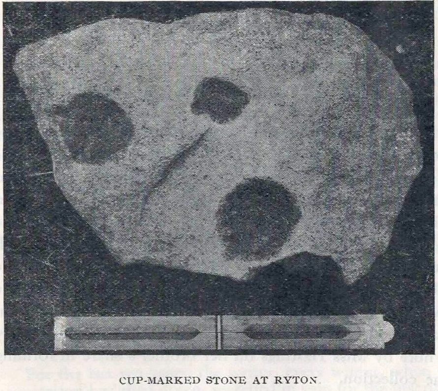
Cup-Marked Stone (removed): OS Grid Reference – NZ 1480 6417
Archaeology & History
Ryton cup-marked stone
In a short piece read before Newcastle’s Society of Antiquaries in 1942, a Mr Cocks (don’t laugh!) told that when a friend of his was clearing out an old land drain in his garden, he found this fragmented cup-marked stone, “which had been made use of as a corner slab on the drain”! It was located “about 40 yards south-west of Tweedy’s Buildings,” on the west side of town. Broken from a larger piece of stone, the attached photo here shows the simple design of the basic cup-marks, measuring respectively 2½, 2 and 1⅝ inches across. Mr Cocks told that “there are also two finger-tip hollows on the stone tone which or may not be natural. A dark line running between the cups is a natural fissure.”
Last we heard, the stone was living in a box somewhere in the archives at the Great North Museum, Newcastle.
References:
Cocks, W.A., “A Cup-Marked Stone at Ryton,” in Proceedings Society of Antiquaries Newcastle-upon-Tyne, volume X, no.2, January 1943.
Cup-and-Ring Stone (lost): OS Grid Reference – SE 0965 4797
Archaeology & History
In Ronald Morris’ (1989) gazetteer of British petroglyphs, he included this curious entry but gave no real details regarding its appearance or history. Listed by the Royal Commission lads, it would seem to have been located immediately south of the dismantled railway where it used to cross the Addingham-Ilkley road, but no one seems to have seen it either before or since Morris’ description. Any help regarding its whereabouts would be appreciated.
References:
Boughey, Keith & Vickerman, E.A., Prehistoric Rock Art of the West Riding, WYAS: Wakefield 2003.
Morris, Ronald W.B., “The Prehistoric Rock Art of Great Britain: A Survey of All Sites Bearing Motifs more Complex than Simple Cup-marks,” in Proceedings of the Prehistoric Society, volume 55, 1989.
Cup-Marked Stone (lost): OS Grid Reference – NO 074 458
Archaeology & History
In J. Romilly Allen’s (1882) lengthy essay on rock art in Scotland, he mentions a singular boulder that was “found by Dr Rattray” at Laighwood, near Butterstone—but, unlike him, he gave no further details regarding its appearance or exact whereabouts. It was included in the Royal Commission (1990) survey of the area, with no additional details. It remains lost. In the event that you manage to rediscover it, grab some good photos of it and stick ’em on our Facebook group. (the grid-reference to this site is an approximation)
Royal Commission on the Ancient & Historical Monuments of Scotland, North-East Perth: An Archaeological Landscape, HMSO: Edinburgh 1990.
Acknowledgements:Huge thanks for use of the Ordnance Survey map in this site profile, reproduced with the kind permission of the National Library of Scotland.
Healing Well (destroyed): OS Grid Reference – NO 4032 3025
Archaeology & History
This old water supply had no direct ‘holy’ nature, despite its proximity to the cathedral, the old market cross and St Clement’s Well some fifty yards away! Most odd. A much more mundane story lies behind this long lost water source. The Dundee historian William Kidd (1901) told us,
“When the public wells were erected, about the year 1749, to supply the town with water from the Lady-well reservoir at foot of Hilltown, one was placed on the High Street, on the east side of the Cross, and was called the Cross Well.”
It didn’t have too long a life either—much like the old Market Cross, for,
“In the year 1777 that quaint structure was demolished. The platform and octagonal tower were carted away as rubbish, the least decayed stones being selected to be used in other buildings. The stone shaft, also, was preserved, and placed beside the Old Steeple. With the demolition of the Cross, the Cross Well was cleared away from the High Street, but, as water was an essential to the people, the well was re-erected behind the Town House in St. Clement’s Lane. In that situation it remained for nearly one hundred years, when, being rendered unnecessary by the introduction of the Lintrathen water supply, it was also demolished, along with the old buildings in the Vault and St. Clement’s Lane, to make room for the additions to the Town House.”
References:
Colville, A., Dundee Delineated, A. Colville: Dundee 1822.
Cup-Marked Stone (lost): OS Grid Reference – NO 186 480
Archaeology & History
When J. Romilly Allen (1881) wrote about the megaliths and petroglyphs of Glenballoch, the owner of the property—a Mr George Harris—informed him of other archaeological finds in the locale: one of which was a cup-marked stone with distinct linear elements, whose description reminded me, slightly, of Ilkley’s Idol Stone. It was found a short distance east of the Glenballoch (or Craighall Mill) stone circle. Allen told how,
“Mr Harris…informed me that about twenty years ago he had dug up a stone with cup-markings upon it, on the opposite side of the valley to the south-east of the Glenballoch stone. The stone lay horizontally with the cups uppermost. It was split up and is now built into the out buildings of Glenballoch Farm. The two largest fragments form the cover and sill of the hole through which the shaft of the threshing machine passes through the wall of the horse-mill, into the house. A third fragment is built in above the window at the opposite side of the house, and is of greenish hue. Mr Harris expressed his great regret at not having known the value of this stone when he broke it up, and he is evidently proud of the stone which remains, and is determined that no ill shall befall it as long as he remains its guardian. The cup marks on the stone which was broken appear to have been arranged symmetrically in two rows, and Mr Harris affirms distinctly that they were alternately circular and rectangular.”
These three stone fragments have not been seen since. They may still be covered over in the spot Mr Harris described, but no one seems to have found them. In the event that someone manages to find them, see if you can get a few good photos and stick ’em on our Facebook group.
Follow the directions to reach our superb Swastika Stone from Ilkley, visible due to the iron railing that surround and protect the carving on the cliff edge. From here, keep walking west along the Millenium Way footpath, over the stile of the first wall, then the second wall—six in all—for ⅔-mile (1km), where you’ll see another small crag of rocks on your right, just yards from the footpath. You’re damn close!
Archaeology & History
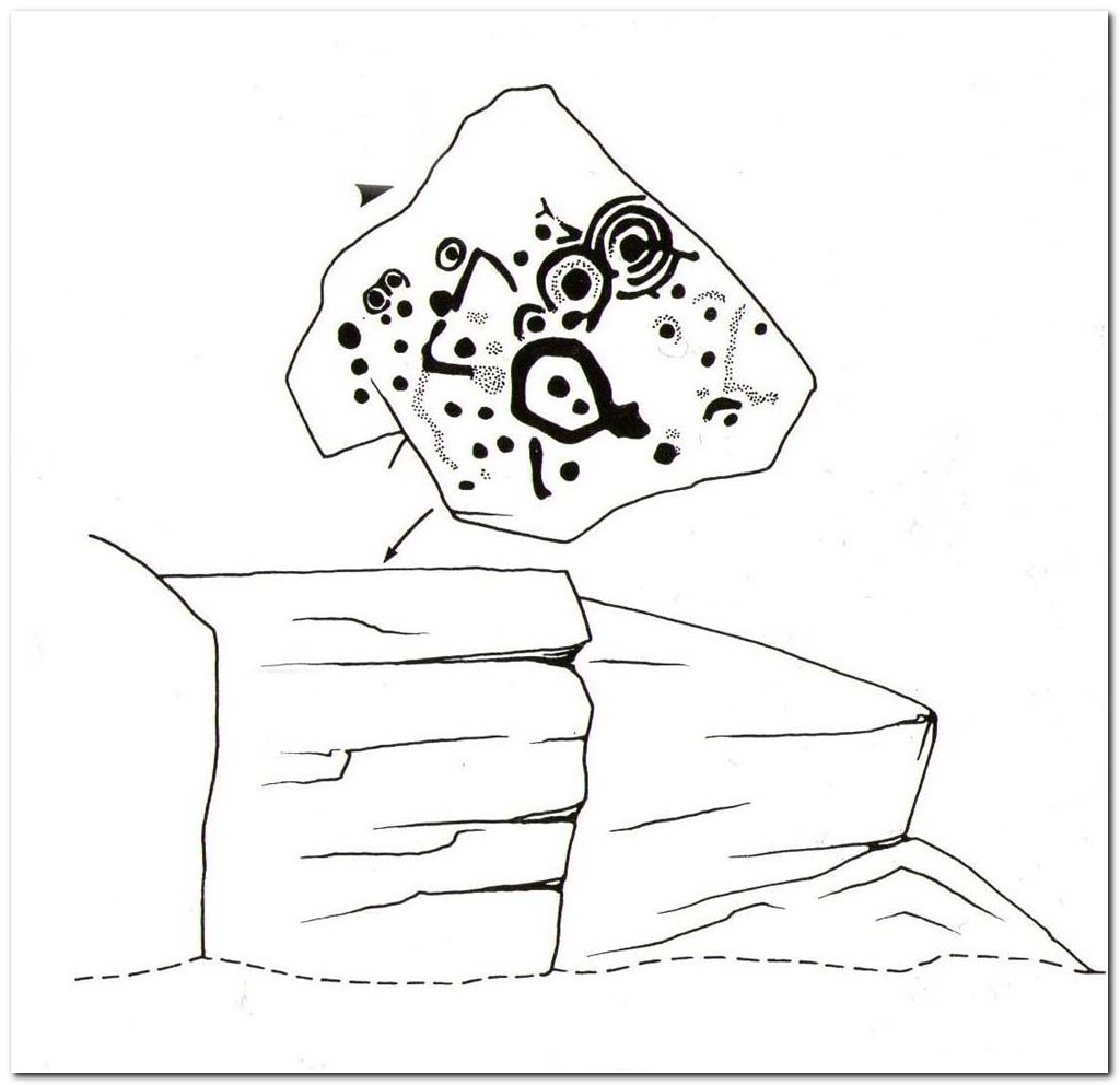
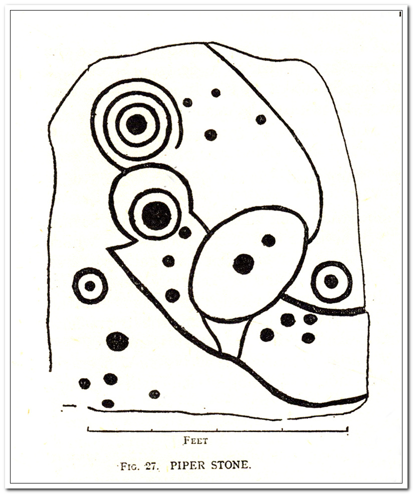
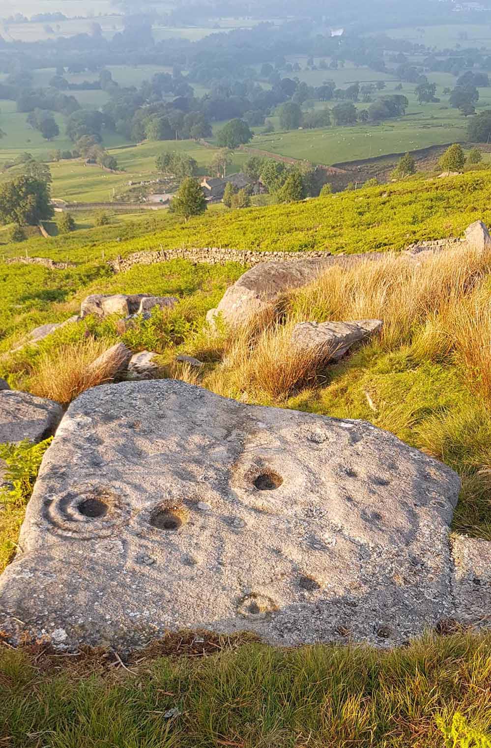
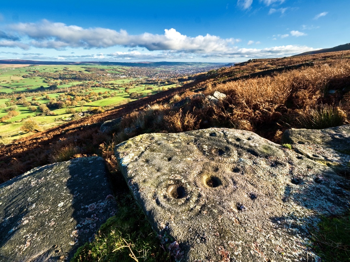
When the great J. Romilly Allen (1882) visited the Ilkley petroglyphs in 1878, the Piper Stone was one that he wandered over to see—and he had this to say of it:
“At the edge of Piper’s Crag is a horizontal rock-surface, and on a portion of it, measuring 5ft by 7ft, are carved a series of fifteen cups varying in diameter from 2 to 3 ins. Of these, one is surrounded by a single ring, four by a double ring, and one by a triple ring.”
Hedges 1986 sketchCowling’s 1940 sketch
This type of description, whilst accurate on the whole, rarely does justice to the carving. It was echoed more than 100 years later in John Hedges’ (1986) survey, when he described the large rock jutting out to possess merely, “a complicated design of cups, rings and grooves.” When Boughey & Vickerman (2003) did their follow-up survey, they added nothing more.
In an attempt to give some sort of meaning to the carving (and many others), the late great Eric Cowling (1940; 1946) placed it within Henri Breuil’s (1934) classification system, which assigns all carvings different degrees of complexity and form, from Classes 1-4. The Piper Stone entered Breuil’s Class 3A, being one “with deeply cut and smoothed down grooves.” Whilst this may sound good on the surface, in truth such classifications are utterly meaningless outside of the tables and graphs of statisticians and the boring. They give the appearance of quantitative research, but they have as much bearing on the nature of the carvings as an energy dowser healing the place with crystals.
In the flesh, in the real world—so to speak—from the Piper Stone we are looking, not just at the carving, but its place in the landscape: an ingredient that more and more emerging archaeologists are recognizing has a synergistic relationship with some petroglyphs. And here we have an impressive landscape that reaches out ahead of us for many miles. We look primarily to the north: the Land of the Dead in many traditional northern cultures. But our panorama here is 180º, with east and west horizons having the potential for measuring equinoctial periods in the cycle of the year. But in truth this is sheer speculation.
It’s a worthwhile carving to see, both for its views and its excess of non-linearity. In its form, Rorscharch impressions of early humans emerge; the usual solar and lunar symbols can be seen; star systems seem apparent; maps or settlement ground-plans could be there. We know that somewhere within it is the animistic ‘spirit’ of the rock itself, but the forms it exalts are, once again, all but lost on us modern folk…
References:
Allen, J. Romilly, “Notice of Sculptured Rocks near Ilkley,” in Journal of the British Archaeological Association, volume 38, 1882.
Allen, J. Romilly, “Cup and Ring Sculptures on Ilkley Moor,” in The Reliquary and Illustrated Archaeologist, volume 2, 1896.
Anonymous, Walks around Cup and Ring Stones, TIC: Ilkley n.d. (c.1990).
Baildon, W. Paley, “Cup and Ring Carvings: Some Remarks on their Classification and a New Suggestion as to their Origin and Meaning,” in Archaeologia, volume 61, 1909.
Bennett, Paul, “Cup-and-Ring Art”, in Towards 2012, volume 4, 1998.
Bennett, Paul, The Old Stones of Elmet, Capall Bann: Milverton 2001.
Boughey, Keith & Vickerman, E.A., Prehistoric Rock Art of the West Riding, WYAS: Wakefield 2003.
Breuil, Henri, “Presidential Address for 1934,” in Proceedings Prehistoric Society East Anglia, 7:3, 1934.
Collyer, Robert & Turner, J.H., Ilkley: Ancient and Modern, William Walker: Otley 1885.
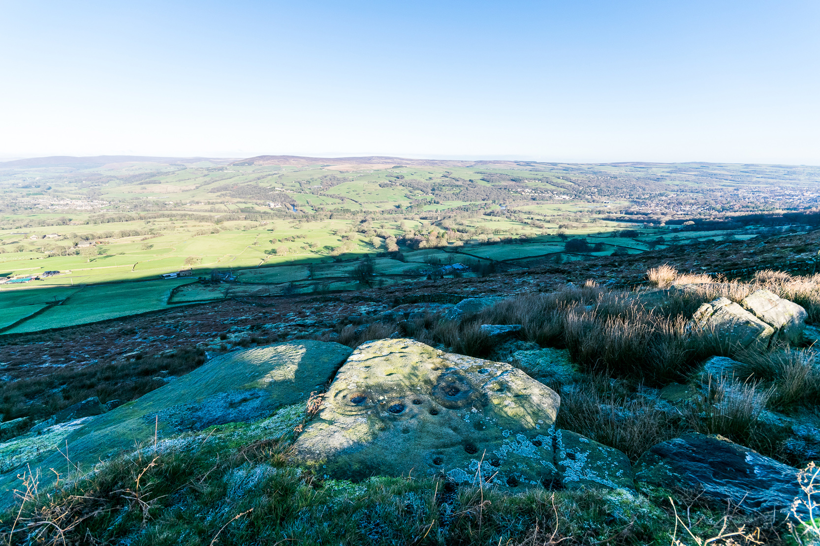
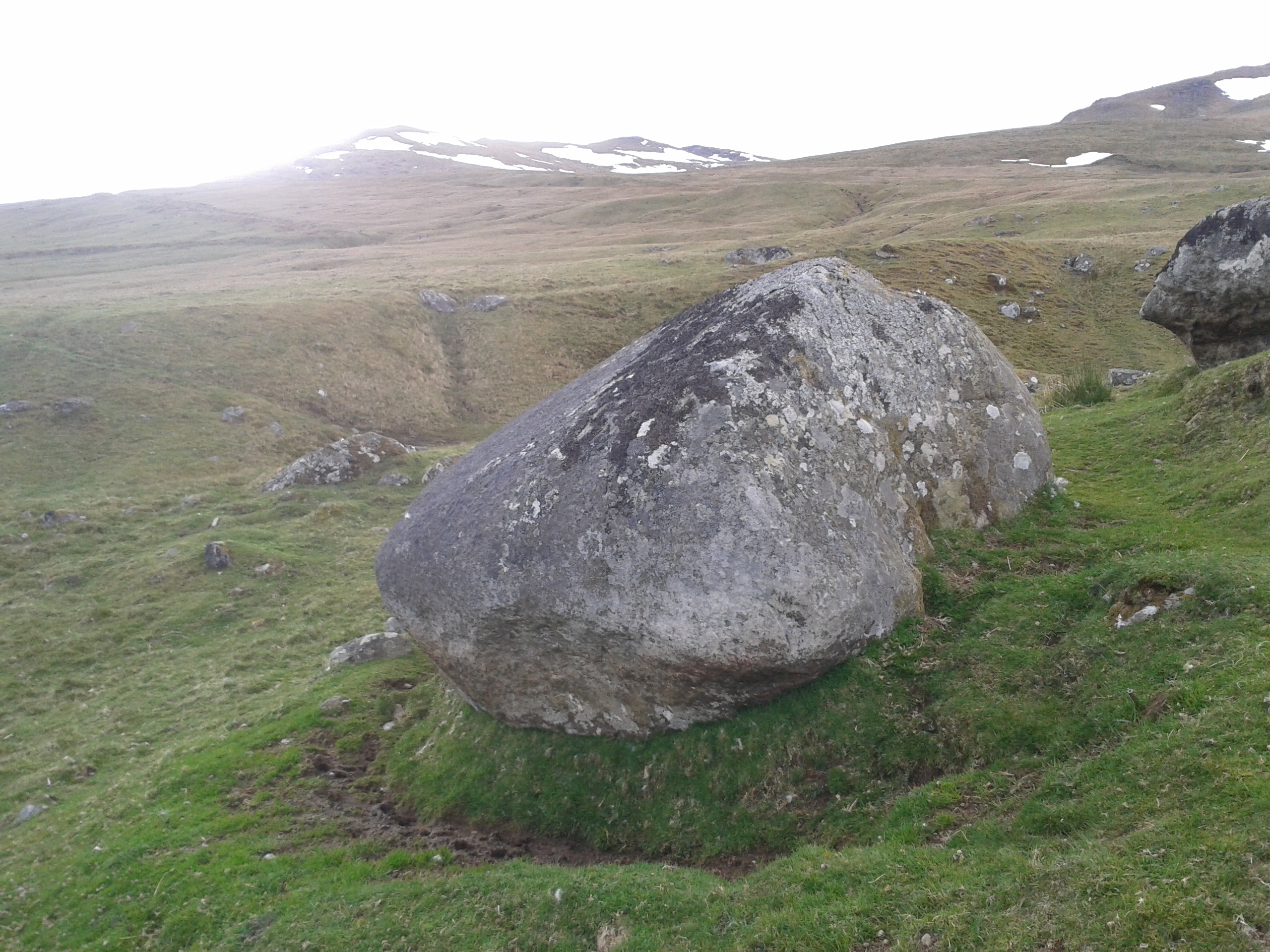
Follow the directions to reach the faint but impressive Allt a’ Choire Chireinich (04) petroglyph. Standing here, you’ll notice the large boulder that looks as if it’s fallen down the slope immediately to your left. You can’t really miss it.
Archaeology & History
Beneath the gorgeous excess of ancient lichens you can make out at least three cup-marks on the south-facing sloping rock-face in the top-half of the boulder. There may be some other faint cups on here, but due to the lichens they are very difficult to see, so I’m erring on the side of caution regarding their veracity. This is another one of those carvings likely to be interest only to the most ardent petroglyphic nuts amongst you.
Follow the directions to reach the faint but impressive Allt a’ Choire Chireinich (04) petroglyph. Standing here, look straight down at the dried-up burn barely ten feet below you, where you’ll see a small sloping rock. That’s it!
Archaeology & History
Nothing much to see here apart from a single shallow cup-marking. Most likely of interest only to the most ardent petroglyphic explorer, but worth looking at when you’re visiting the more impressive carvings nearby.
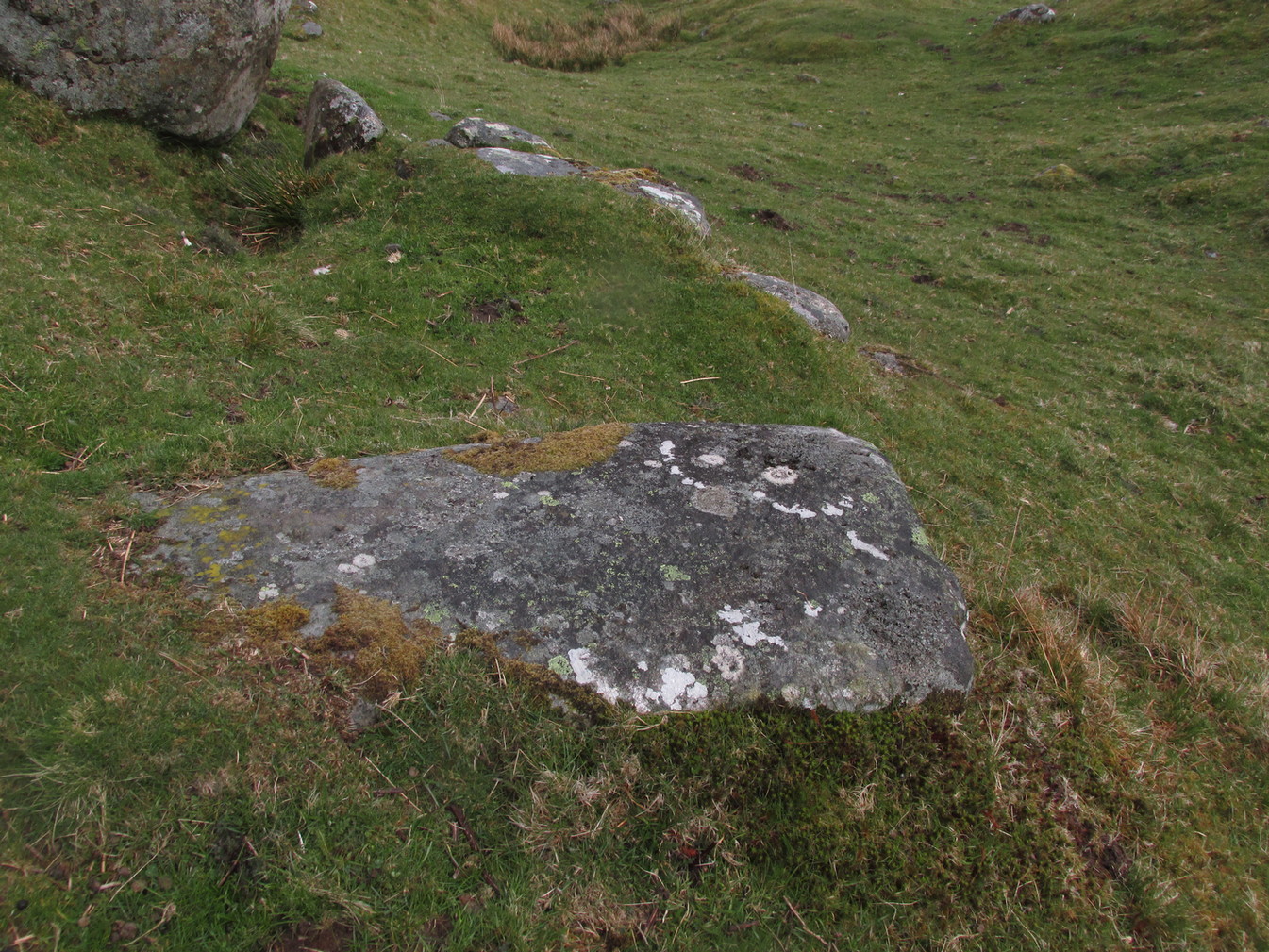
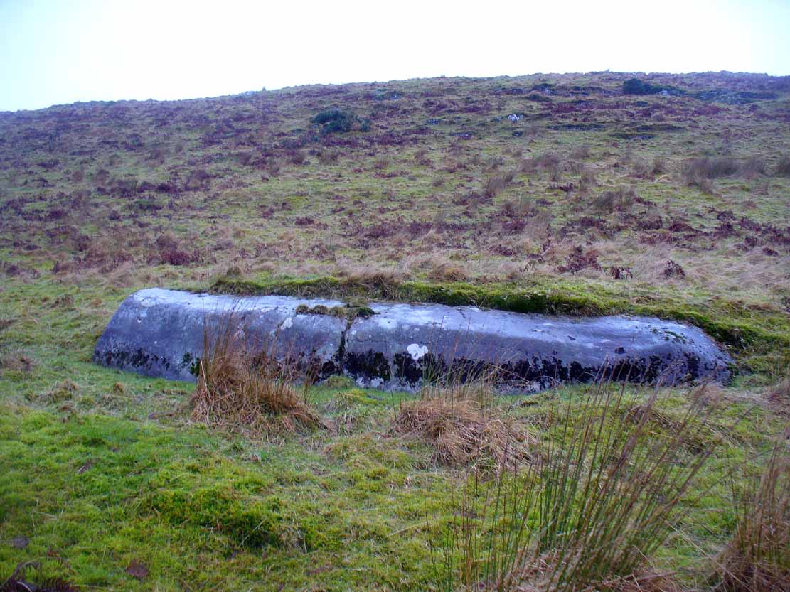
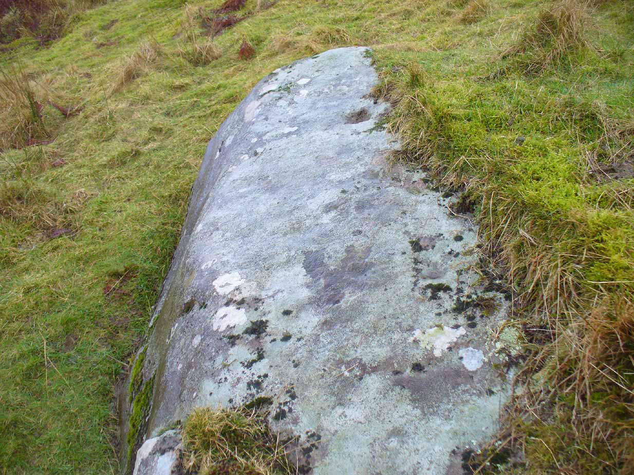
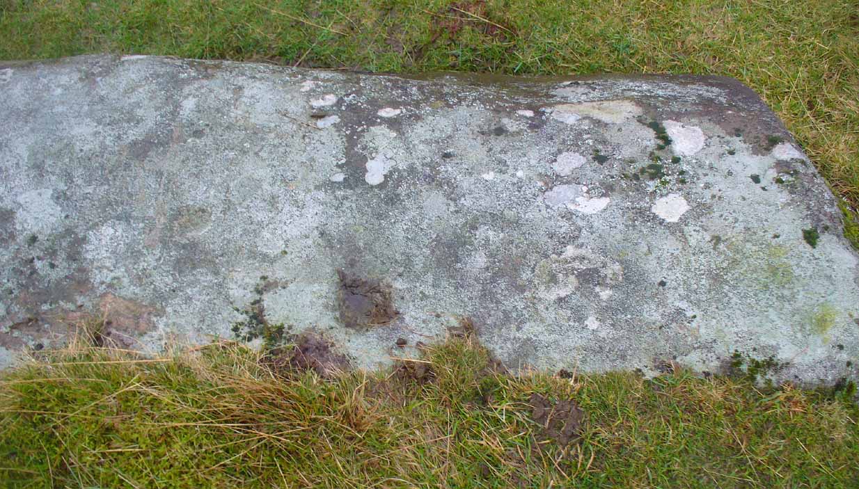
The easiest way to see this is to reach the Nether Glenny 2 Cairn, looking north to the slope a coupla hundred yards away, where you can see a long rock halfway up. If you can’t see it from here, walk to the impressive Nether Glenny 35 Carving, where the large long slab is much more obvious on the hillside. Walk through the gates to the Nether Glenny 37 carving and then diagonally up to the rock itself. You can’t really miss it.
Archaeology & History
This 15-foot long stone halfway up the slope was said by the Royal Commission lads to have “four possible cup-marks” on it, whereas there are at least nine of them and maybe as many as eleven! Most of them are dead certs as prehistoric etchings, not just ‘possibles’.
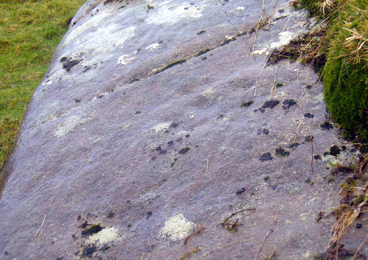
Small faint cluster of cupsSome of the faint cups
The more visible cup-marks here are found on the more western end of the stone, just below the grass-line. The cups here are quite distinct, measuring some two-inches across and nearly half-an-inch deep in two of them. The others in this section are a little smaller and further down the slope of the rock. Seemingly not noticed for a long long time however is a small cluster of very faded cups, gathered like a very faint 4-star Pleiades cluster more than halfway along out in the photo here (I hope!).
The biggest of the cups
This entire area is covered with cup-and-ring stones, possessing one of the greatest densities of carvings anywhere in Scotland.When we visited the place last week, Nature was pouring with rain, so we weren’t able to sketch the design. Something that we’ll hopefully amend in the near future!