Sadly this site can no longer be seen, but it was evidently something worth seeing in its day. Twas found “on the north side of Loch Laich, opposite Castle Stalker.”
Archaeology & History
In 1758 W. Burrell wrote about “a very large circular heap of stones, called Cairnbane, in which are said to be several subterraneous apartments, the passages leading to them, supported by large beams of timber in some places, in others by large stones, the entrance is now closed with a stone.” But in 1760 Richard Pococke reported that he could enter the cairn, saying that,
“on the west side of it a little way up is a very difficult entrance which leads to a cell about two yards long and one and a half broad, a this by a sort of door place to another about the same dimensions. I observed in some parts the stones on the side are laid flat, in others edge way, and a little sloping, and large stones are laid across on the top; To the north of it is a low heap of stones, in which three mouths of entrances are very visible, and there seemed to be two more; …the large one is twelve yards long at the top and about a yard broad: It is not improbable that these cells were built all round and several stories of them one over another.”
Explorations here by A.S. Henshall and the Royal Commission for Historic Scotland were unable to find the site and it has been deemed missing or destroyed. I have yet to seek out any folklore relating to this lost site, but would be very surprised if there wasn’t something loitering in some of the old tongues and tomes!
References:
Royal Commission on the Ancient & Historical Monuments of Scotland, Argyll – volume 2: Lorn, HMSO: Edinburgh 1975.
This old stone is another one tucked away, but not too far south of Oban. Take the Kilninver road and keep heading southwest, past Loch Seil. Instead of following the road right, to Clachan and then onto Seil Island, bear left and towards Armaddy Castle. Where the single-track road turns into the woodland towards the castle, the track keeps on into the rocky hills. Keep going for about another 500 yards. You’re nearly there!
Folklore
By the coast just north of Loch Melfort, near the hamlet of Degnish, is the grand old Armaddy Castle. On the other side of the trees from here, to the east, Scottish writer and folklorist A.A. MacGregor tells there to be an old standing stone. In his Ghost Book of 1955, he tells the tale of a local man called Donald MacDougal who, returning home after his day’s work at the castle, crossed over the old burn of Eas nan Caerdach where the standing stone can be found, just past the bend in the track.
On reaching it, Donald became aware of a strange light a short distance in front of him. Thinking at first it was the lamp of his co-worker making for the Home Farm, he walked past the stone – but it wasn’t until he got home himself and found he was alone that he questioned what on earth he’d seen! Upon asking other people in the neighbourhood, it was found that other locals had seen the same light, traversing the land from the old standing stone along the footpath to the farm.
References:
MacGregor, Alasdair Alpin, The Ghost Book, Robert Hale: London 1955.
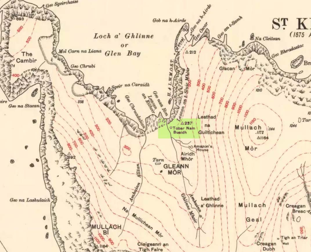
This legendary healing spring (the Well of Virtues) is on the north side of the island, a few hundred yards northwest of the legendary Amazon’s House. Martin Martin (1703) told that this well,
“near the female warrior’s house is reputed to be the best, the name Toubir-nim-buey, importing no less than the well of qualities or virtues; it runneth from east to west, being sixty paces ascent above sea; I drank of it twice, and English quart at each time; it is very clear, exceeding cold, light and diuretick; I was not able to hold my hands in it above a few minutes, in regard of its coldness; the inhabitants of Harries find it effectual against windy-chollicks, gravel, head-aches; this well hath a cover of stone.”
The reverend Kenneth Macaulay (1764) also wrote of this place, giving additional details:
“Near the fountain stood an altar on which the distressed votaries laid down their oblations. Before they could touch the sacred water with any prospect of success, it was their constant practice to address the genius of the place with supplication and prayer. No one approached him with empty hands. But the devotees were abundantly frugal. The offerings presented by them were the poorest acknowledgements that could be made to a superior being, from whom they had either hopes or fears. Shells and pebbles, rags of linen, or stuffs worn out, pins, needles or rusty nails, were generally all the tribute that was paid; and sometimes, though rarely enough, copper coins of the smallest value.”
T.S. Muir’s sketch
There was a very small stone-built well-house with a low roof covering the top of the spring, inside which a small pool formed. The small well-house was described by Thomas Muir (1883) and ruins of it are reported to still cover the sacred waters, which run into an old stone trough. Muir called it the ‘spring of many virtues’, describing it as one of five holy wells on this small isle.
In James MacKinlay’s (1893) magnum opus he reported that its waters could cure deafness.
References:
Macaulay, Kenneth, The History of St. Kilda, James Thin: Edinburgh 1974 (original edition 1764).
MacKinlay, James, Folklore of Scottish Lochs and Springs, William Hodge: Glasgow 1893.
Martin, M., Description of the Western Isles of Scotland, Andrew Bell: London 1703.
Mathieson, J., “The Antiquities of the St. Kilda Group of Islands,”in Proceedings Society of the Antiquaries Scotland, volume 62, 1928.
Muir, Thomas S., Ecclesiological Notes on some of the Islands of Scotland, David Douglas: Edinburgh 1883.
A sacred well site that appears to have gone missing sometime in the 20th century — as has its compatriot, the Well of the South Wind. F.M. McNeill (1954) wrote that,
“this is one of the magic wells of antiquity. It lies north of Cnoc nam Bradhan, not far from the Hermit’s Cell. Here, in olden times, sailors and others brought offerings to charm up a wind from the north.”
No doubt this heathen water source is known to a few old locals. The magickal act of invoking the wind both here and at its compatriot seems to hint at ancient pre-christian rites that have thankfully been recorded before they were finally vanquished. (the grid-reference cited above is an approximation)
References:
McNeill, F.M., Iona: A History of the Island, Blackie & Sons: Glasgow 1954.
We were up here again in July 2009, but I’ve still not been across onto the island itself — just stared from the lochside, dying to swim across and spend a night or three alone on the island amidst this legendary landscape. Basically, get to Talladale on the A832 (halfway between Gairloch and Kinlochewe), then walk up to the loch-side to your right (east) for a mile till you reach the small wooded outcrop. Look north, betwixt the two isles and its the one in the middle with the Crag of the Bull and Maire’s Cairn rising up the mountain face behind. But you can reach it via a boat trip from one of the local harbours. Staying there overnight however, would seem more troublesome. It seems that a winter visit seems best!
Folklore
This ‘holy well’ has a prodigious occult history which, sez my nose, is still maintained by one or two old Highland folk up here. This small island (one of many in this long loch) was the Isle of the Druids in old days: legend telling it to be the teaching ground of these shady priests. Even the Iona druids came here. The main relics on on the island are the old holy well, accompanied by an old legendary tree into which all local people flocked and wedged coins at least once in their life. This devotional rite eventually took its toll, with so many of the coins covering the old tree with metallic scales to a height of nine feet, eventually killing it.
The well itself was said to cure insanity — no doubt the remedial quality given to the waters after neophyte druids had spent many days of ritual solitude here, eventually sipping its life-giving fluid to revive them from their ordeal.
It eventually became sanctified by the Church: legend saying it was St. Maelrubha (the same dood who turned the healthy Applecross heathens into church-goers) who was the guilty party. Indeed, the name Maree itself, was proclaimed as deriving from this old saint, though local lore tells it to derive from the pagan ‘ane god Mourie.’
Elizabeth Sutherland (1985) reported that remains of the sacred tree were still visible. It is also said that no-one makes ritual commemmoration here anymore. Hmmmm… don’t always believe what you read.
In the 18th century, when Thomas Pennant visited this sacred well, he described that,
“in the midst is a circular dike of stones… I expect the dike to have originally been druidical, and that the ancient superstition of paganism had been taken up by the saint (Maelrubha) as the readiest method of making a conquest over the minds of the inhabitants.”
References:
Dixon, John, Gairloch in North-west Ross-Shire, Co-op: Edinburgh 1886.
MacKenzie, Kenneth C., Loch Maree: The Jewel in the Crown, privately printed 2002.
MacKinlay, James M., Folklore of Scottish Lochs and Springs, William Hodge: Glasgow 1893.
Pennant, Thomas, A Tour in Scotland and Voyage to the Hebrides, MDCCLXXII, John Monk: Chester 1774.
Polson, Alexander, Gairloch, George Souter: Dingwall 1920.
Sutherland, Elizabeth, Ravens and Black Rain, Constable: London 1985.
Watson, W.J., Place-Names of Ross and Cromarty, Northern Counties Printing: Inverness 1904.
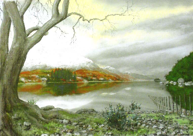
* This beautiful painting is one of many done by local artist, Bryan Islip. It is taken from his 2010 Calendar, Scotland’s Wester Ross, and is available direct from him. If you’d like to know more, or want copies of his calendar or other artworks, email him at: pico555@btopenworld.com – or check his website at www.picturesandpoems.co.uk
Not hard to find really. From Ballachulish, take the western coastal road south, as if you’re going to Oban. After about 5 miles you’ll hit the lovely hamlet of Duror (nowt much here: a hotel, small school and a few cottages). Stop here and walk across the River Duror. A couple of fields down on your left-hand side you’ll see what you’re looking for!
Archaeology & History
Described as “one of the most impressive standing stones in Lorn,” northern Argyll, it “is situated in a level field 180m NW of Acharra. It measures 3.7m in height and 1.1m by 0.6 m at the base, and tapers to a pointed top about 0.4m in thickness; the long axis lies NE and SW.”
Aubrey Burl (Thom, Thom & Burl 1990) thought: “it is possible that this, and other stones near Loch Creran, once marked a prehistoric trackway, 4.5 miles in length.”
Folklore
On the potential folklore side of this monolith, Burl mentions how this monolith – also known as the Hard Stone – “and the site on which it stands, is called Cnoc nam Aingeal, or ‘Angel’s Hillock.'” Does anyone know the story behind this?
References:
Royal Commission on the Ancient & Historical Monuments of Scotland, Argyll: volume 2 – Lorn, HMSO: Edinburgh 1974.
Thom, A., Thom, A.S. & Burl, A., Stone Rows and Standing Stones, BAR: Oxford 1990.
Not quite halfway along the A828 road between Oban and Ballachulish, just before the village of Barcaldine, a large expanse of forested land unfurls on the slopes to your left (east). You can either just walk straight into the woods and follow your nose, or do the easier thing and head up the track into the woods from Mill Farm. As you walk up, keep an eye out for where the open land to your left starts fading. Once here, head straight north into the trees (it’s not too bad and a few animal paths help you along the way). Walk into the trees for a couple of hundred yards and look around. If you hit the triangulation pillar (Cnoc Reamhar), walk back 100 yards.
Archaeology & History
There are actually two monuments here: a small overgrown cairn not far from the forest edge, kerbed with several large boulders between one and three feet high – 15 of which were still in situ in 1974 – with the inner section lower than the surrounding stones. The other more impressive site and much easier to locate is the tall standing stone, nearly 8 feet tall, about 100 yards east of the cairn.
I liked the feel of this place. There’s good clean waters all round, a coupla decent little waterfalls close by, an abundance of healthy wildlife and an old holy well apparently dedicated to St. Columba in the trees a short distance away, though I never got a look at it.
References:
Royal Commission on the Ancient & Historical Monuments, Scotland, Argyll – volume 2, HMSO: Edinburgh 1974.
On this curious, broken, basin-shaped rock — thought by some to have at one time played a part in an old cross whose remains are in the Abbey Museum — are two deep cup-shaped hollows, in which were once “three noble globes of white marble” that were used for oracular purposes and were said to have originated in druidical rites. In Miss McNeill’s (1954) survey of the island, she tells that:
“near the edge of the path leading to St. Oran’s Chapel, there lies a broad, flat stone, with a slit and a cavity on its surface. Here there used to lie some small round stones which pilgrims were wont to turn sunwise within the cavity; for it was commonly believed that the ‘brath’, or end of the world, would not arrive until this stone should be worn through.”
The small stones that were once in the Brath were ordered by the Church to be thrown into the sea; but local folk replaced them with three other small stones, maintaining the traditional rites of this stone until they eventually stopped sometime in the 19th century. But in Major-General James Forlong’s (1906) study, he tells of a somewhat earlier mythic origin to this old stone, saying:
“In Iona the Druids are said to have made the flat altar stone called Clachan-nan-Druidhean, or Druid’s Stone, the stone of fate or of the last day, with round stones fitted into cup hollows on the surface, which the pious pilgrim turns round. The world will end when the stone is worn through. The Culdee monks preserved this monument.”
And what little is left is still preserved to this day. The curious “end of the world” motif was something that was grafted onto an earlier mythos: what Mircea Eliade called the “myth of the eternal return”, wherein Nature’s annual cycle —from birth, life to death and subsequent renewal, endlessly, through the seasons—was the original status, later transmuted by the incoming judaeo-christian cult of linear time and milleniumism relating to a literal “end of the world” when their profane myth of Jesus returning to Earth occurs. We might also add that the stones which once rested into the hollows of the Clach Brath would likely have possessed divinatory and healing qualities, as comparatiove studies suggest.
References:
Eliade, Mircea, The Myth of the Eternal Return,
Forlong, J.G.S., Faiths of Man – volume 1, Bernard Quarithc: London 1906.
Holder, Geoff, The Guide to Mysterious Iona and Staffa, Tempus: Stroud 2001.
McNeill, F. Marion, Iona: A History of the Island, Blackie & Son: Glasgow 1954 (4th edition).
As you enter the village from the east, onto the A861 road, the Strontian Hotel is on the right-hand side of the road and you can’t fail to notice. Stop!
Archaeology & History
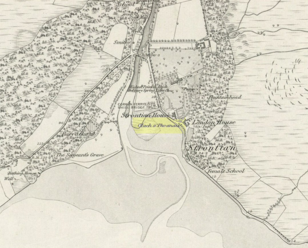
Clach a’ Phaonais on 1872 map
Shown on the first edition OS-map of the region in 1875, this old worn standing stone, more than six-feet tall, can be seen at the edge of the drive. There’s an iron ring is attached to it, which I thought might have made it an old Bull Stone in bygone days, but no such lore is remembered. Also known as the Branks Stone, it’s Gaelic name probably means the ‘stone of penance,’ and folk were chained to it in eaelier days for bad behaviour. It was widespread across the Highlands to tie criminals to stones and wooden poles, naked, for 24 hours and let the midges get to them. Crime was down to a minimum up here!
Folklore
As the locals at Strontian Hotel told me (thanks Finlay), “several stories have emerged locally. It marks a clan chief’s grave, a sighting stone for the equinox but the most plausible one is based on the fact that there is an iron ring on the side of the stone facing the loch and it was used to tie up barges taking lead from the local lead mine. It supplied the raw material for shot during the Napoleonic and Crimean wars.”
Aknowledgements: Big thanks to Anne and the Megalithic Portal for additional help on this one.
Another great mountain of the ‘Old Woman’: primal creation deity of these hills. Whether she holds sway over the land here for many months, as she does on Mull and Skye, I cannot find. One creation legend here tells that one of the furrows down the side of the mountain – called Sgrìoh na Caillich – was said to be made by her as she slid down it in a sitting position. The small loch on the way up to her summit – Lochan na Caillich – was one of her washing places; and the Beinn na Caillich Beag, immediately east, speaks of other legends, now seemingly lost to us. It’s highly likely that some of the megalithic remains nearby had some mythic relationship with this old hill, though I aint found any studies along these lines…yet!