Wallace’s Well, Dunfermline, Fife

Healing Well:  OS Grid Reference – NT 08782 87275

Also Known as:

  1. Spa Well
  2. Wallace Spa

Archaeology & History

The ruins of this little-known site, dedicated to the legendary Sir William Wallace, can still be seen in the form of an overgrown stone ruin just off the footpath that runs through the Pittencrieff Glen out of the town centre.  In earlier times the waters were evidently of some repute, as a Council meeting in May 1773 reported with some disdain the closure of the waters by a Mr Chalmers:

“This Day the Council considering that the entry from the Town to the Well of Spaw is now shut up by Mr. Chalmers, which was a particular privilege to ye Inhabitants of the Burgh, Do hereby appoint the Provost to intimate to Mr. Chalmers that the Town will not give up that privilege, and to require him to oppen an entry thereto as formerly.”

We don’t know whether the miserable Mr Chalmers gave access to the well, as there seem to be no Council meeting notes telling us the outcome.  My guess would be that the local people got their way, hopefully at Chalmers expense!  More than 70 years later, another Mr Chalmers (1844) wrote about the well in a more respectful light:

“On the north edge of the rivulet, a little below this bridge, at the foot of the Tower Hill, there is a famous well, named the Wallace Spa, or well of Spa, which was formerly much resorted to by the inhabitants of the town for its excellent water, but which has been long since disused. It is noticed here simply on account of the traditionary antiquity of its name, Sir William Wallace, it is said, having once, in the haste of a flight, drank a little of it, out of the palm of his hand.”

In spite of there being local folklore of William Wallace, the local historian Ebeneezer Henderson (1879), in his giant work on Dunfermline, thought there was a more prosaic origin to the well’s name. He told,

“This well is still in existence, about fifty yards south of the ruins of Malcolm Canmore’s Tower — Tower Hill.  The water is reported as being “very cold at all times.” The water should be analysed.  The well during the period of its being used was known as the “Spaw Well,” and the ” Well of Spaw,” and, by and by an easy, natural transition, ” Wallace Spa;” and thus the name of the well has sometime been connected with that of the great Scottish hero.”
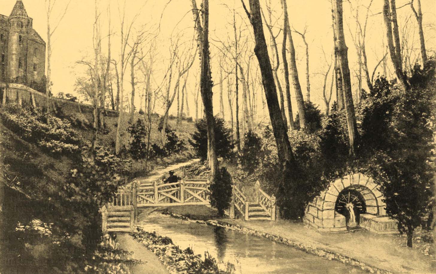
The Well after 1900
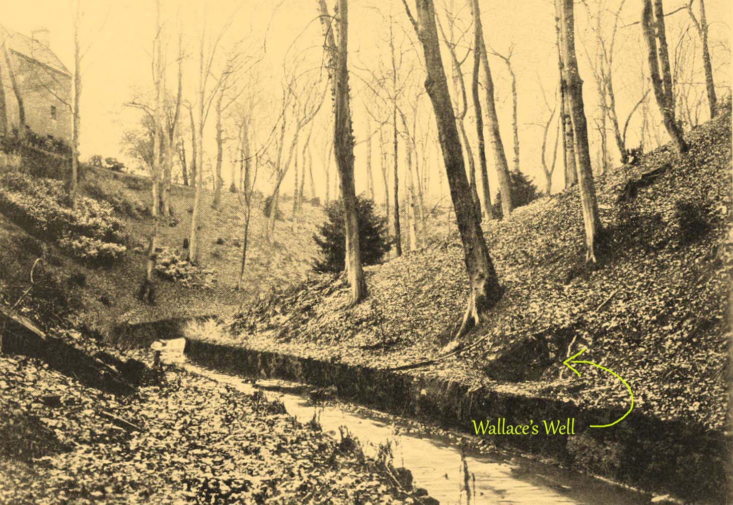
pre-1900 image

By the end of the 19th century, the well had become almost buried by earth and foliage, but was subsequently brought back to life following architectural improvements of the glen around the turn of the 20th century.  In Patrick Geddes’ (1904) work he gives us “before and after” portraits (attached here) showing how it had been restored.  He also mentioned “its tradition of medicinal value”, but could give no further information regardings the ailments it was reputed to cure…

References:

  1. Chalmers, Peter, Historical and Statistical Account of Dunfermline, William Blackwood: Edinburgh 1844.
  2. Geddes, Patrick, City Development: A Study of Parks, Gardens and Culture-Institutes, St George Press: Birmingham 1904.
  3. Henderson, Ebenezer, The Annals of Dunfermline, John Tweed: Glasgow 1879.

© Paul BennettThe Northern Antiquarian

Whitefield Stone, Auchtermuchty, Fife

Cup Marked Stone: OS Grid Reference – NO 23958 13177

Getting Here

Take the B936 out of Auchtermuchty, and park at the small car park for Auchtermuchty Common on your right just before Lumquhat Mill.  Follow the path through the Common southwards and along the narrow strip until the Common opens out past the boundary stone. Head for the sign board on the right and when you get there turn left and march straight up the hillock and the stone is ahead of you in front of a gorse bush.

Archaeology & History

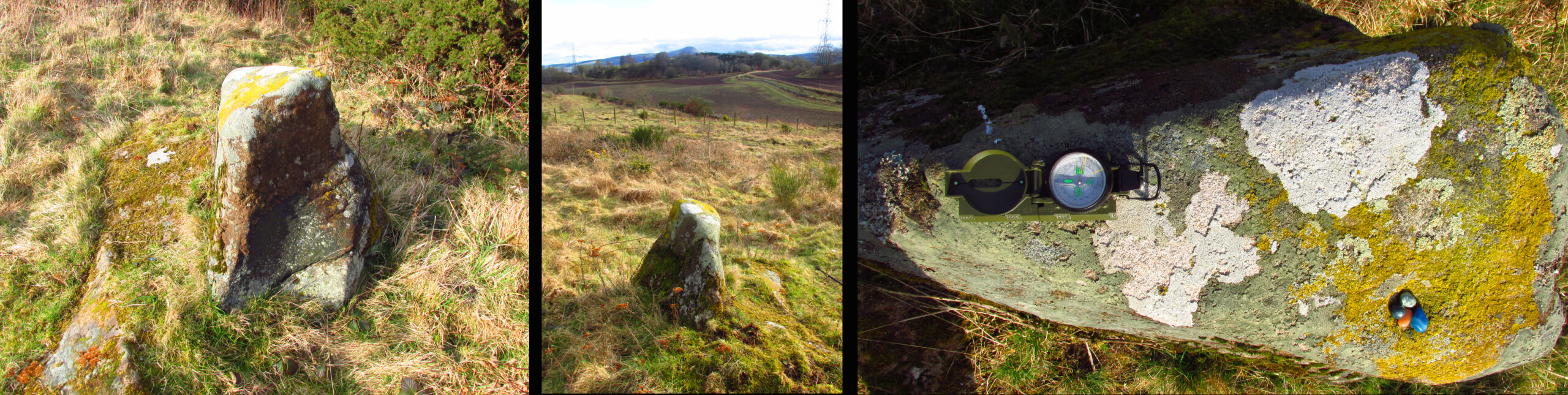
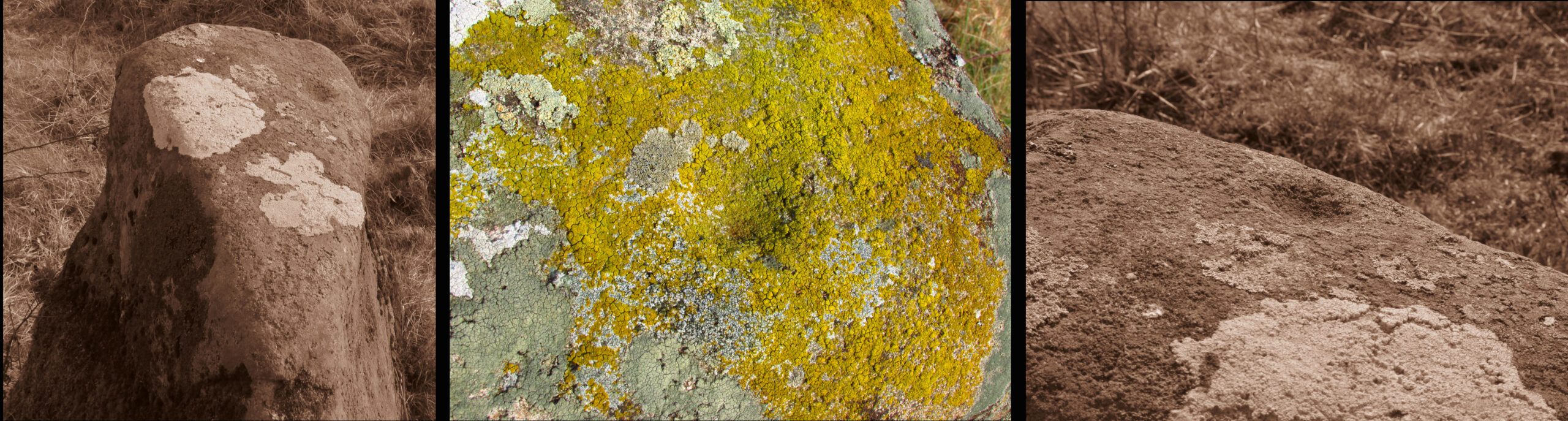
A curious little stone that I found quite by chance. It is wedge shaped in plan, bearing one large cup mark on its top surface. The cup is approximately 2″ in diameter and about ¾” deep.  The raised part of the stone is about 3′ high, it is 3′ long and about 13″ wide at the blunt south end, although at ground level it is nearly 3′ wide at this end.

The stone is orientated due N-S, the south end aligning with the peak of East Lomond (a mythic hill of which at least one legend survives), while the north end points to the river port of Newburgh. It gives the impression of having been carved as a direction marker from what was a much larger stone, which, if this is the case may have originally borne more cups.

Left to Right 1.Facing North – the stone looks to have been cut down from a larger boulder. 2. The summit of East Lomond due South. 3. Aligned North – South.
The cup mark.

Folklore

The first time I visited, there were three small polished coloured stones at the foot of the rock, while the second time there were four stones within the cup. A long term resident out walking his dog told me he knew of no folklore relating to the stone, but that over the last thirty years he had kept seeing offerings of stones in the cup, so the rock clearly still has some ritual significance for local heathens/pagans…

© Paul T Hornby 2021

St. Brendan’s Well, Abernethy, Perthshire

Holy Well (lost):  OS Grid Reference – NO 191 161

Also Known as:

  1. Brendan’s Well
  2. Brendi’s Well

Archaeology & History

In 1897, when Butler wrote his history of the village, he told that a certain well, “adjacent to the Gattaway stream” (thought to be the Nethy Burn which passes Gattaway farm) was known to old locals as Brendan’s Well, with the name still surviving as ‘Bredni Well’.  There were a number of large boulders around it that had been scattered by blasting, but which Butler thought were, “in all probability placed originally near the wall as a guide for pilgrims.”

The site was included in Ruth & Frank Morris’ (1982) survey, adding simply that the site was named “after the saint who lived here in the seventh century.”  In the christian calendar, St. Brendan’s day was May 16.

When the local antiquarian Paul Hornby looked for the well, a local lady told him that she thought an occasional but regular boggy patch that appeared in her garden was due to the underground waters from St Brendan’s Well.

References:

  1. Butler, D., The Ancient Church and Parish of Abernethy, Edinburgh 1897. Page(s): 102
  2. Morris, Ruth & Frank, Scottish Healing Wells, Alethea: Sandy 1982.

© Paul BennettThe Northern Antiquarian

Cragganester (11), Kenmore, Perthshire

Cup-Marked Stone:  OS Grid Reference – NN 65858 38750

Getting Here

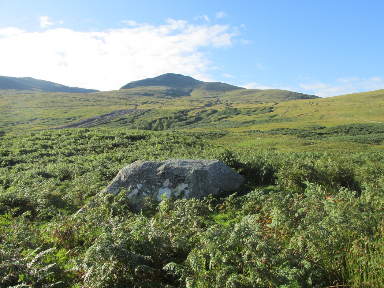
Cragganster 11 in situ

From Killin, take the A827 road to Kenmore. 6 miles along, on your right, is the track down to the Big Shed at Tombreck.  Keep on the A827 for exactly ⅓-mile (0.53km), and opposite the driveway to Craggantoul is a small parking spot.  A few yards on the road, over the burn, go thru the gate on your left.  Follow the straight line of walling up for 400 yards it meets where another line of walling running right (E), into the boggy pasture-lands. Walk along here for roughly another 400 yards then go up the slope as if walking up Ben Lawers (N).  You’ll come to 2 large boulders next to each other where the slope levels out.  It’s the one on your left!

Archaeology & History

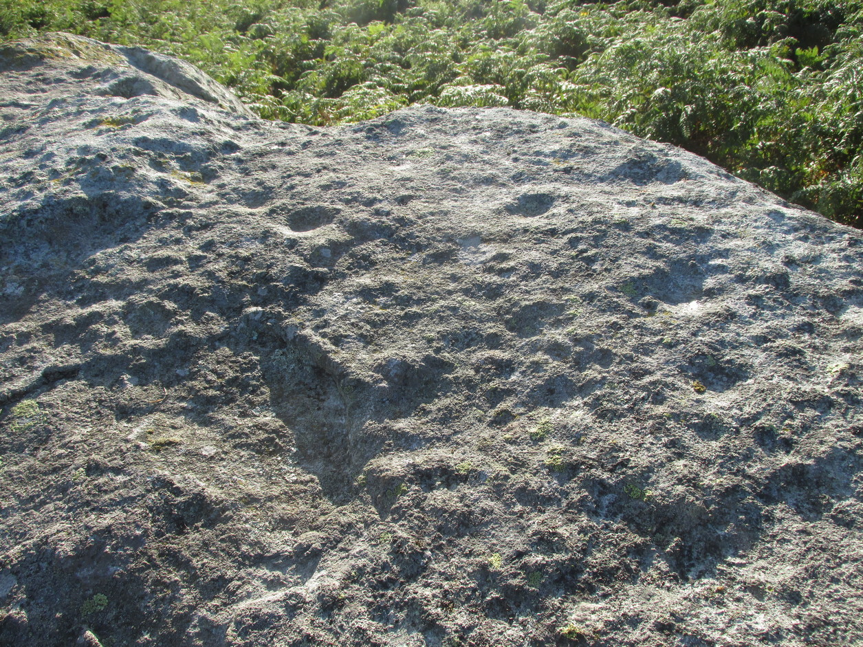
This carving is really for the purists amongst you.  It’s like most of the carvings along this contour line in that the design is simplistic.  Consisting of at least nine cups all on top of the stone, they can be difficult to see amidst the rough garnet and lichen-encrusted rock.

Cupmarks on its west face
Looking down on the cups

On one of our visits here, when the light cut across the surface at a lower angle, it seemed as if one of the cups had a faint ring around it; but it looked as if the outline of it had been started, but then for some reason the ring was never actually carved.  This outline is very faint.  We’ve found examples of this at two of the Duncroisk carvings, several miles to the west, where the faintest trace of a ring was outlined, but never carved.  Of the cup-marks: five of them are carved on the east-side of the rock and are pretty easy to see (with the ring around one of them), whilst the other four—slightly more difficult to make out—are on its west side.  A couple of hundred yards north you can see the Cragganester 10 carving.

© Paul BennettThe Northern Antiquarian

Bombie, Kirkcudbright, Kirkcudbrightshire

Stone Circle (destroyed):  OS Grid Reference – NX 7079 5018

Archaeology & History

This stone circle was destroyed sometime in the early 1780s by some moron who cared little for our ancient sites.  Its destruction was described by Robert Muter in 1794—the earliest known reference to the site—when he told:

“Near the Roman camp there is a Druidical temple, which was destroyed within these eight years, by the hands of an ignorant Goth, who carried off the stones, split them, and applied them to build a contemptible bridge over an insignificant rivulet, called Buckland Burn.  The stones were seven in number, of round granite, and of unequal sizes.  The smallest at least three feet in diameter.”

In the 1850s, when the Ordnance Survey lads came this way to map and seek out the place-names of the area, the ‘Clownstane’ was one such place they listed.  In seeking an explanation of the word, a local man told them the folk memory from seventy years prior:

“Mr. Bell of Balgreddan says the name Clownstane originated from the Stones of a Druid Circle which stood convenient to this place and which was broken up and removed to build a bridge near by.”

Fred Coles (1895) included the site in his survey of the Kirkcudbright circles, simply reiterating how,

“According to Dr Muter, the stones “were seized by some vandal for the building of Buckland Bridge.””

References:

  1. Coles, Fred R., “The Stone Circles of the Stewarty of Kirkcudbright,” in Proceedings of the Society of Antiquaries Scotland, volume 29, 1895.
  2. Muter, Robert, “The Parish of Kirkcudbright,” in Statistical Account of Scotland – volume 11, William Creech: Edinburgh 1794.

Links:

  1. Canmore notes on Bombie
  2. Ordnance Name Book on the Bombie Circle

© Paul BennettThe Northern Antiquarian

Little Balmae, Kirkcudbright, Kirkcudbrightshire

Stone Circle (destroyed):  OS Grid Reference – NX 691 447

Archaeology & History

In an area littered with neolithic and Bronze Age remains, the great Fred Coles (1895) reported a stone circle that was destroyed sometime roughly between 1890 and 1911.  When he visited the place with his colleague, Mr E.A. Hornel in 1887, the megalithic ring had already been tampered with.  It was, he said,

“found to consist of five granite boulders, all of them large, in situ, and the ridgy grassy hollows of five others—removed, no one can say when.  In the centre of this nearly true circle, 90 feet in diameter, is a slight mound, possibly artificial.”

In 1911, when the Royal Commission lads visited the area, they could find no stone circle and reported how “no information could be obtained concerning it” from the local farmer.  This might have been because he destroyed it.  Some land-owners do such things, as we know; but in this case we may never know.

The site was listed without comment in the Master’s magnum opus (Burl 2000), but he gave it the “uncertain status” category; whilst John Barnatt (1989) questioned whether this was a destroyed stone circle or merely a natural setting that Cole had misinterpreted.

References:

  1. Barnatt, John, Stone Circles of Britain – volume 2, BAR: Oxford 1989.
  2. Burl, Aubrey, The Stone Circles of Britain, Ireland and Brittany, Yale University Press 2000.
  3. Coles, Fred R., “The Stone Circles of the Stewarty of Kirkcudbright,” in Proceedings of the Society of Antiquaries Scotland, volume 29, 1895.
  4. Royal Commission Ancient & Historical Monuments, Scotland, Inventory of Monuments and Constructions in Galloway – volume 2: County of the Stewartry of Kirkcudbright, HMSO: Edinburgh 1914.

Links:

  1. Canmore notes on Little Balmae

© Paul BennettThe Northern Antiquarian

Balmae (2), Kirkcudbright, Kirkcudbrightshire

Cup-and-Ring Stone:  OS Grid Reference – NX 68649 44700

Also Known as:

  1. Balmae House
  2. Balmae 5 (Coles)

Archaeology & History

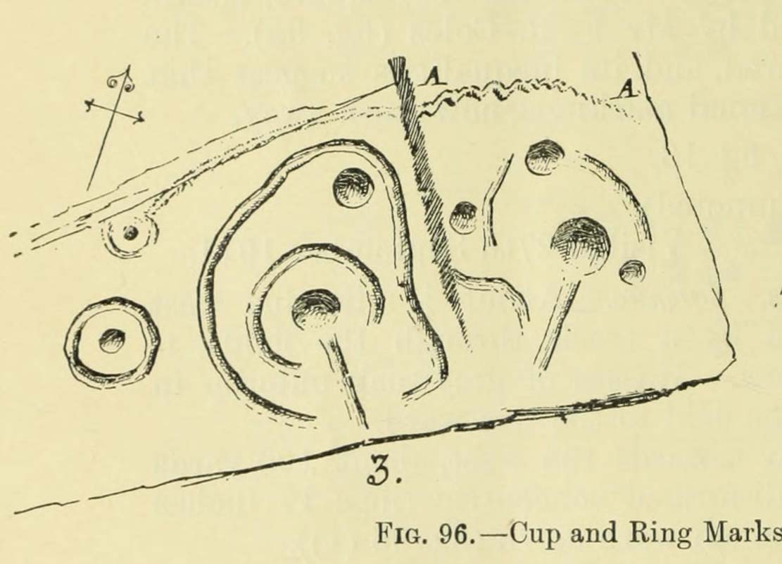
Coles’ 1895 sketch

Amongst a good cluster of petroglyphs, this ornate little fella may have been one visited by George Hamilton (1886) when he visited Balmae and outlying districts, seeking out petroglyphs!  We don’t know for certain though, as his descriptions are somewhat vague.  However, a few years later the great Fred Coles (1895) came a-wandering in search of the same carvings and, as happens in this line of business, uncovered a few new ones during his rummaging.  This was one of them, which he described, very simply, as hiding

“but a few yards from Ross View Cottage, on its N.W. … (with) eight cups being associated with four rings and several grooves, both straight and curved.”

It was only a few years later when the Royal Commission lads (1911) came in search of it and they told how,

“the main design is a central ringed cup with a connected groove, and two outer cups which an outer circle curves eccentrically to enclose.”

But when Ron Morris (1979) explored the area in the 1970s, he was unable to locate this and a number of other carvings that had been reported by Coles.  Since then, the carving has been relocated at the grid reference cited above.  Also since then, a great deal many more carvings have been found in this locale by the experienced petroglyphic fingers of Maarten van Hoek. (1993)

References:

  1. Coles, Fred, “A Record of the Cup-and-Ring Markings in the Stewartry of Kirkcudbright,” in Proceedings Society Antiquaries, Scotland, volume 29, 1895.
  2. Hamilton, George, “Notices of Rock Sculpturings of Cups and Circles in Kirkcudbrightshire,” in Proceedings Society Antiquaries, Scotland, volume 21, 1886.
  3. Morris, Ronald W.B., The Prehistoric Rock Art of Galloway and the Isle of Man, Blandford: Poole 1979.
  4. Royal Commission Ancient & Historical Monuments, Scotland, Inventory of Monuments and Constructions in Galloway – volume 2: County of the Stewartry of Kirkcudbright, HMSO: Edinburgh 1914.
  5. van Hoek, M., “Balmae”, in Discovery & Excavation Scotland, 1993.

Links:

  1. Canmore – short notes on Balmae (2)

© Paul BennettThe Northern Antiquarian

St. Fillan’s Tree, Killin, Perthshire

Sacred Tree:  OS Grid Reference – NN 5708 3249

  1. St Fillan’s Ash

Archaeology & History

Long since gone, this great olde ash tree could once be found on the south side of Killin’s Mill building, close to the bridge at the Falls of Dochart.  It was deemed to be ‘sacred’ by local people – just as all trees were, once upon a long time ago.

In John Shearer’s (1883) wonderful book on the ancient ways of the Perthshire people, he described the tree as being adjacent to the earthfast rock known as St. Fillan’s Seat:

“At the side of it grows a large ash tree which is held sacred by the natives as no person will burn any of the branches although fallen to the ground nor destroy them in any manner.  However, there was one who had the hardihood to take one of the branches for a caber to repair his house.  Strange to tell the first fire that was kindled burned it to the ground as a punishment for this impious sacrilege.  Of course no person since has troubled it or taken any of the wood.  The branches that fall lie till they rot.”

The brilliant Killin historian, W.G. Gillies (1938) reported that the tree was still standing until it was “blown down by a gale in 1893″—but it didn’t quite kill it off for good; for in September 1911, C.G. Cash visited Killin and this was one of the many places he looked for and, despite local folk telling him about the more famous St Fillan Stones (still in existence and found at the Mill), he saw the last remnants of this great Ash, telling simply that,

“the mere dead stump of St Fillan’s Ash-tree still stands against the south post of the mill gate.  And quite near it is a young ash, said to be its descendant.  This younger tree has an out-curving branch that was said to have been the gallows-branch in olden days; but it is obviously too young and too weak.”

…So, does anyone know precisely which is the “descendant” of St. Fillan’s Ash and where happens it to be growing?

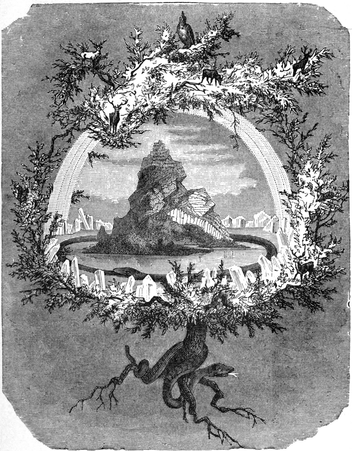
In Norse myth, the ash tree Yggdrasil was the tree of Odin and was one of the primal ingredients in their Creation myths.  It stood at the centre of the cosmos: an axis mundi no less, linking the many worlds and was the abode of the gods.  Its mythologies are extensive.  In Scotland, the myths of the ash are not so well known, but there’s little doubt that it possessed a sanctity and certainly has many traditions of it own, which are unfortunately outside the remit of this site profile.

References:

  1. Cash, C.G., “Archaeological Gleanings from Killin,” in Proceedings of the Society of Antiquaries of Scotland, volume 46, 1912.
  2. Elders, E A., “Saintly stones in a Perthshire village,” in Country Life, December 1962.
  3. Gillies, William A., In Famed Breadalbane, Munro Press: Perth 1938.
  4. Shearer, John, Antiquities of Strathearn, D. Phillips: Crieff 1883.

© Paul BennettThe Northern Antiquarian

Hangie’s Stone, Cargill, Perthshire

Standing Stone: OS Grid Reference – NO 15751 35578 

Also Known as:

  1. Gallowshade
  2. Canmore ID 28479

Getting Here

Turn right off the A93 at Cargill onto the side road by Keepers  Cottage and up the hill to Gladsfield Wood at the top on your right. Park up at the top side of the Wood and walk straight along the narrow track for around 450 yards and what may be the remains of the stone will be seen between a pair of mature trees.

Archaeology & History

In 1862 the stone was described in the Ordnance Survey Name Book for Perthshire:

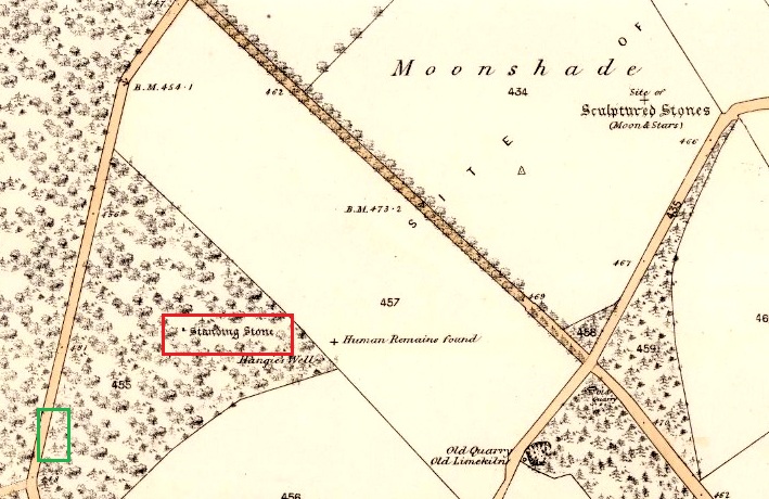
‘And about 150 yards from the same object [Hangie’s Well], in a north-westerly direction, there is a small Standing Stone, having the appearance of the ancient monumental standing stones.’

It seems the stone had been removed by the time Fred Coles (1909) came to see it nearly fifty years later.  He told us:

“On the day of my visit the mist was so abnormally dense and confusing that it was with considerable difficulty the wood itself was identified; and as its interior is an utter wilderness of trees, shrubs, brambles, broom, wild roses and tall grass, besides being a pheasantry, it is just possible that the monolith searched for evaded my zeal.  I think not, however, because, hearing a hedger at work on the Newbigging side of the wood, I made for him; and after plying him with various questions, could get no statement to the effect that he had, though living so near, ever seen any conspicuously tall Stone in the wood.

“On retracing my steps, I searched a fresh portion of the wood, and noticed one biggish block of whinstone lying on the grass in a slight hollow of the ground. It was somewhat cubical, about 2 feet 6 inches square, and fractured.  This may he a portion of the former monolith, possibly; and with this dubious result I had to be content.”

In 1967 the archaeologist O.G.S. Crawford described “a sharp-edged boulder standing near the spot marked on the map,” but was not certain if it was the stone.  It had no markings on it.

25 in OS map of 1866 showing original position of stone outlined red and position of possible remains of stone in green

Moving on to 2020, and I found the same impenetrable jungle that Coles described more than a century earlier.  When a site has been destroyed I can normally take a photograph of where it once was, but not in this case.  I continued westward over difficult and potentially ankle snapping terrain that had recently been replanted with conifer saplings, until I got out of the planting area to a line of mature trees next to the track through the wood.

One large elongated stone presented itself that had clearly lain there for many years judging from the moss growth, a short distance away at NO 15641 35478.  Could this be the top part of the standing stone, dragged from its original position some 500 feet to the north-east?  It is of grey whinstone, heavily veined at the base, with white quartz and tapering to a pointed tip.  It has a squarish base measuring approximately 3 feet across by at least 2 feet deep and is some 7 feet in length.  It doesn’t look to be natural, so is it a likely candidate for our missing stone?  Felled by a man with a hammer and chisel and dragged by a heavy horse to the edge of the field as part of the ‘improvements’, so beloved of nineteenth century landowners…

We can’t prove it is the remains of Hangie’s Stone which may, after all, still lie buried in the boscage…

The possible remains of Hangie’s Stone

The stone in its original position was next to the Roman road from Camelon via Stirling and Muthill to Kirriemuir near to the junction of a road to Inchtuthill Roman Fort, so may have once been a way marker, although it is not of Roman origin.

References:

  1. Coles, Fred R., “Stone Circles Surveyed in Perthshire (South-east District),” in Proceedings of the Society of Antiquaries Scotland, volume 43, 1909.
  2. Margary, Ivan D, Roman Roads in Britain, John Baker: London 1973.
  3. Ordnance Survey Name Book
  4. Sedgley, Jeffrey P., The Roman Milestones of Britain, BAR Reports No. 18: Oxford 1975.

© Paul T Hornby 2021

Thistle Brig, Stanley, Perthshire

Legendary Rock: OS Grid Reference – NO 10842 32040

Getting Here

The easiest way to see the site is to stop at the car park at Craighall on the B9099 south of Stanley, and follow the path to the river.  The remains of the Brig will be seen on the other side of the Tay from the riverside walk.

Archaeology & History

The Thistle Brig was described in the nineteenth century Ordnance Survey Name Book as:-

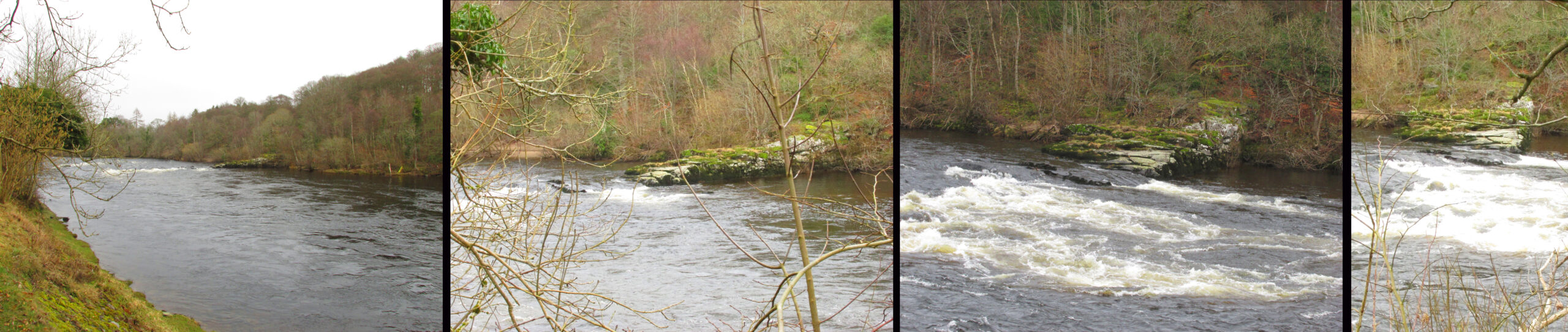
‘A remarkable spot in the River Tay, when the breadth of the river becomes suddenly narrow by the protrusion of a bed of trap rock which crosses it at this place.’

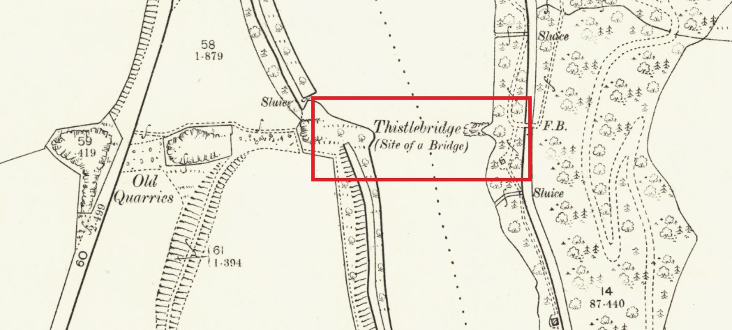
Thistle Brig & the quarries for its hard stone on the 1901 25 in OS-map

According to local historian Alexander Scott, the Thistle Brig formed a convenient place to ford the Tay until  much of it was blasted away by explosives some time in the mid-nineteenth century in order to improve the flow of the river.  Old maps imply that an actual bridge may have spanned the Tay hereabouts at some time in the past.  The seemingly little known folklore of this site relates to an invasion by the Danes in the early mediaeval period. Elsewhere there are similar stories, so the truth or otherwise depends on where you are in Scotland, but this one may have more validity as the tale seems to give its name to the place!

The name ‘Thistle Bridge’ has been applied on old postcards to a stone footbridge over a side channel or lade between the road and the River Tay to the south of the Brig, and is not the subject of this profile.

The remains of the Thistle Brig – a hard basalt dyke on the east bank of the River Tay

Folklore

Alexander Scott, writing of the Brig:-

“…tradition holds that here the thistle received the distinction  of becoming the national emblem of Scotland.  In one of the many invasions the country suffered from foreign armies, the Danes, on one occasion, having landed on the east coast sacked the town of Montrose and continued on their march across the country, burning and pillaging as they went.  While crossing the Tay at this ford at night, the incident occurred of one of the leading soldiers arriving on the opposite side suddenly coming in contact with a thistle with his bare leg, which caused him to emit a shreik of pain.

“The noise was heard by the Scots, who had been encamped nearby, and the alarm thus given was the means of securing a victory over their enemies. The thistle was thereafter honoured as the national badge.”

Reference:

  1. Scott, Alexander, St Martins and Cambusmichael, A Parochial Retrospect, Munro & Scott 1911.

Link:

  1. Ordnance Survey Name Book

© Paul T Hornby 2021