Holy Well (destroyed): OS Grid Reference – NT 0976 8666
Archaeology & History
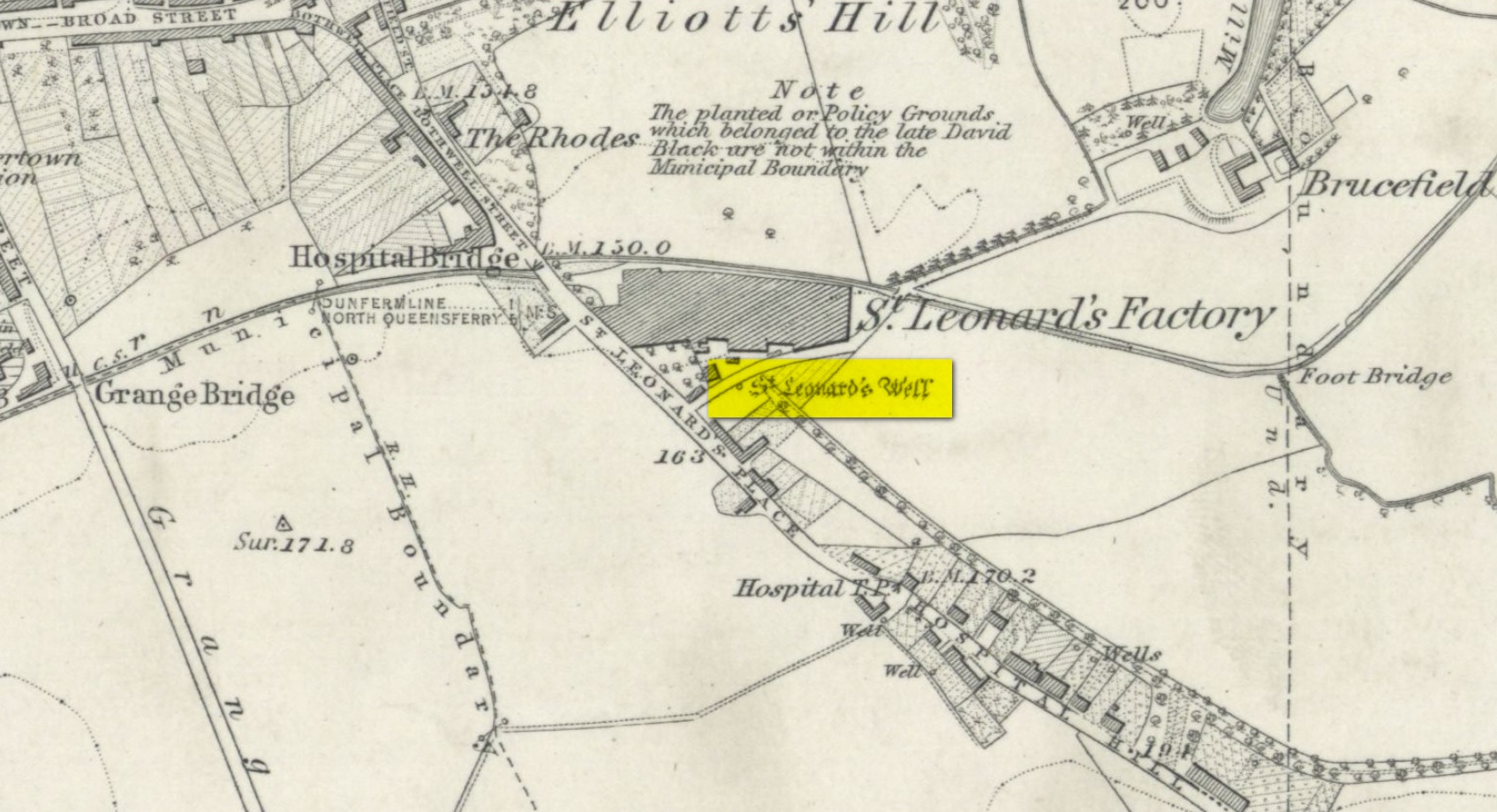
There seems to be very little information available about this holy well, lost long ago and now hidden beneath the foundations of a food superstore! It was found in close association with both a chapel and a hospital in St. Leonard’s name—both of which have also been destroyed. The water from here may have been used by the monks for patients in the hospital, but that’s purely speculative. St. Leonard was known to be connected with lepers, which may be something that the waters here were used to treat. But again, I’m speculating…
When the Ordnance Survey lads came here in 1853, the waters were still running and they subsequently added it to their map a few years later. The site was still visible when Erskine Beveridge (1917) came here, telling us briefly that,
“St. Leonard’s Well still remains a little to the south-east, and, though now built up, is recognisable.”
But a few years later it had been destroyed and its position was shown on the updated OS-map of 1926 as “Site of.” The old well had gone…
References:
- Beveridge, Erskine, The Burgh Records of Dunfermline, William Brown: Edinburgh 1917.
- Simpkins, John Ewart, Examples of Printed Folk-lore Concerning Fife, with some Notes on Clackmannan and Kinross-shires, Sidgwick & Jackson: London 1914.
- Walker, J. Russel, “‘Holy Wells’ in Scotland,” in Proceedings of the Society of Antiquaries of Scotland, vol.17 (New Series, volume 5), 1883.
Acknowledgements: Big thanks for use of the 1st edition OS-map in this site profile, Reproduced with the kind permission of the National Library of Scotland.
© Paul Bennett, The Northern Antiquarian