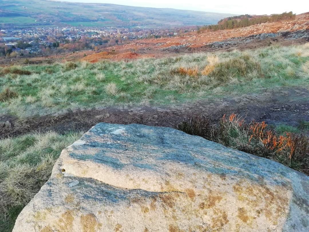
From Ilkley, go up to White Wells (ask a local if y’ get stuck) and walk round the back of the building. Walk to the trees and then follow the footpath up onto the moors; but after 70 yards a small footpath on your right goes up the slope. Take this and after about 90 yards it veers round to your left, following the contours up towards the copse of trees. Another 100 yards up it meets with another path and once here, just yards in front of you, right by the side of the footpath, is the stone in question.
Archaeology & History
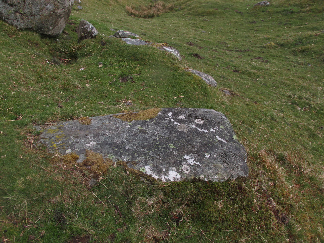
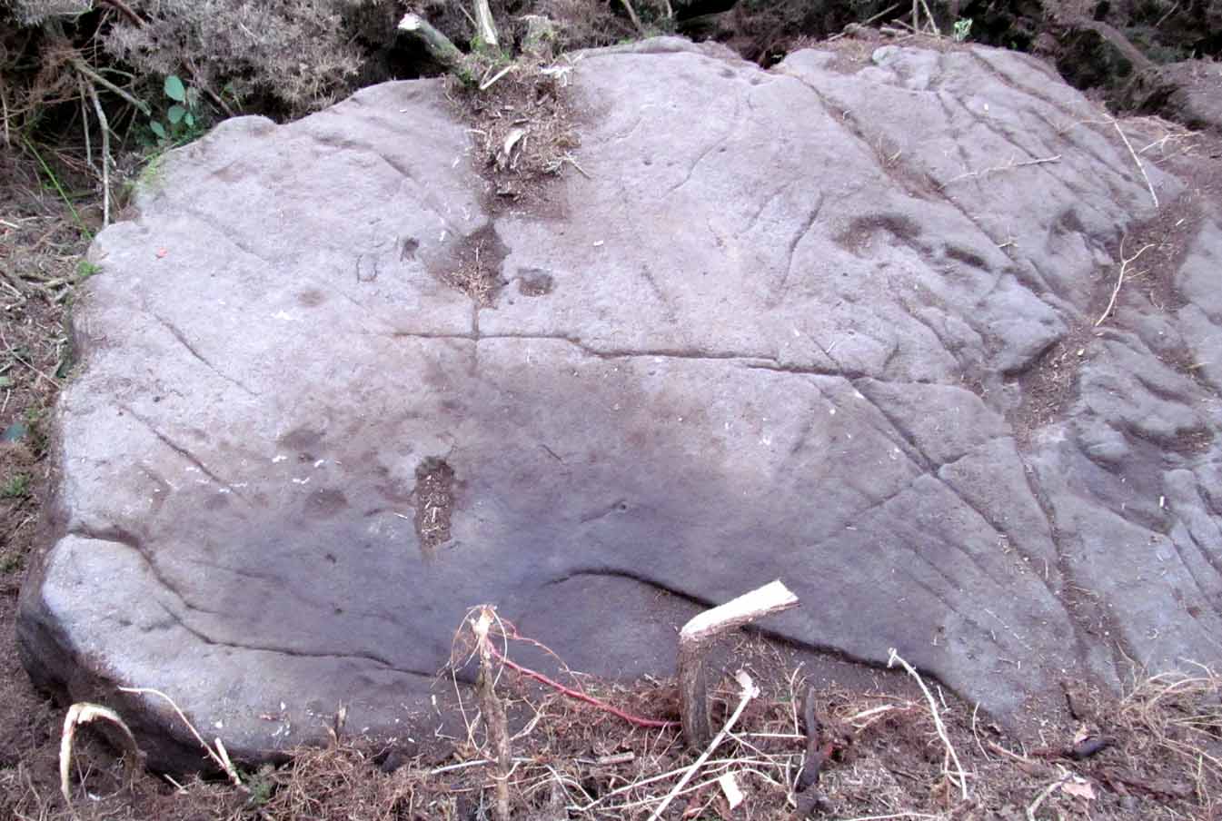
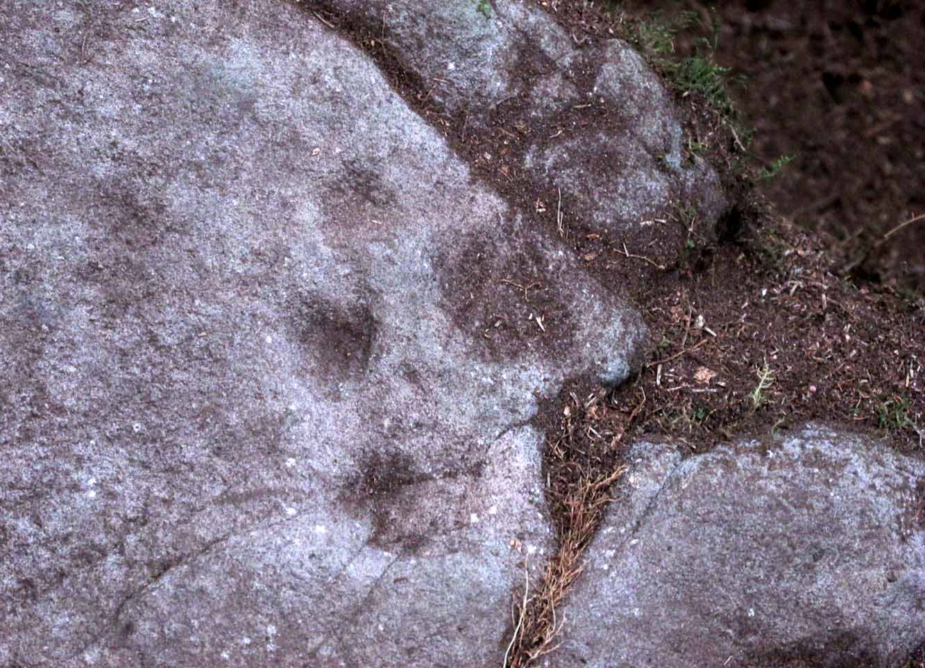
First described in John Hedges (1986) survey, this simple cup-marked stone typifies many petroglyphs on these moors: a barely visible design much eroded by centuries of wind and water, with markings perhaps only of interest to the devoted student and explorer. But at least it’s a good place to sit, rest and watch the valley below.
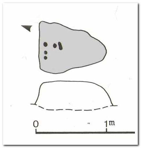
Looking down at the cupsHedges 1986 sketch
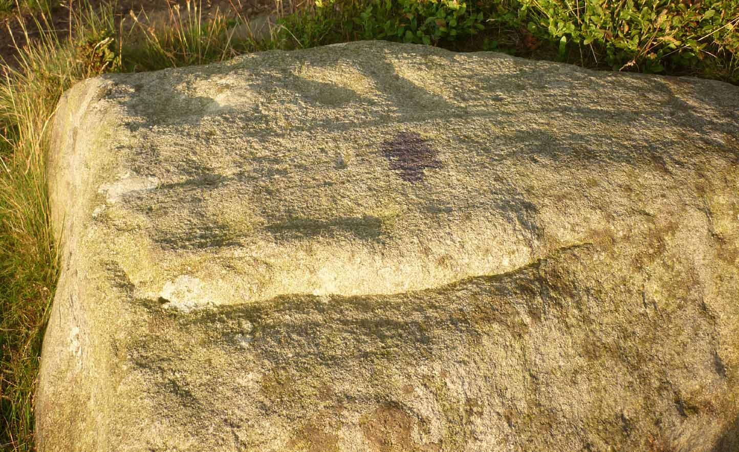
This old fella looks to have only five cupmarks on its supper surface, one of which is elongated, as shown in Hedge’s drawing. However, when he saw this, he thought the elongated ‘cup’ consisted of three of them in a line, all linked up. He saw a “medium sized smooth grit rock standing in grass, its surface triangular in shape, with flat top sloping slightly N to S. Three cups connected by a groove, c. four other cups, all shallow and worn.”
This description was echoed in Boughey & Vickerman’s survey (2003), where they thought that the “triangular top surface has about seven worn cups, three connected by a short groove.” But if the light isn’t quite right, this can be very difficult to see.
References:
Boughey, Keith & Vickerman, E.A., Prehistoric Rock Art of the West Riding, WYAS: Wakefield 2003.
Hedges, John (ed.), The Carved Rocks on Rombalds Moor, WYMCC: Wakefield 1986.
Cup-and-Ring Stone: OS Grid Reference – NS 8551 8819
Archaeology & History
Looking down on C-7c
Near the northwestern end of the small geological ridge that runs to the west of Castleton farmhouse, close to an awesome nine-ringed carving, we find this more simplified triple-ringed petroglyph. And although the carving is easy enough to describe, its labelling (as ‘Castleton 7c’) is rather troublesome. As with other carvings in this locale, the name of the stone is based on a survey done by Maarten van Hoek in the mid-1990s. But van Hoek’s sketch of Castleton 7c and the one shown in our photos, whilst very similar, possess attributes that aren’t on van Hoek’s drawing. Now this isn’t too odd, as many petroglyphs look different when lighting conditions change; to the point where some features you can see one day are almost invisible the next. But this carving has attributes that are very difficult to miss – and van Hoek’s detailing tended to be good. But, all this aside: until we can verify with certainty one way or the other and despite my suspicions that this isn’t what van Hoek described, I’m still entering this carving as Castleton 7c. So – now that bit’s out of the way…!
When we visited the site two years ago the day was dark and overcast, so we didn’t really have good conditions for seeing any faint carvings. But this wasn’t faint, thankfully. It was completely buried beneath soil and gorse bushes, but thankfully Paul Hornby managed to unearth the one you can see in the photos. If it is the Castleton 7c petroglyph, it was rediscovered by van Hoek on one of his ventures here in 1985.
Carving showing wavy lines on right…and from another angle
When we visited the site we only managed to uncover a small section of the stone, as the roots of the surrounding gorse prevented us from seeing more. (it’s tough stuff unless you’ve got the right gardening equipment!) The section we uncovered consisted of a cup-and-triple-ring. This is consistent with van Hoek’s sketch and description; but we also found there were two very notable ‘arcs’ on the outer edge of the rings—nearly opposite each other—as if another, fourth ring had been started. You can’t really miss these elements – and even in the poor lighting conditions we had, these outer arcs are very evident on a number of photos – especially when they are expanded to full-scale. However, as I mentioned, we were unable to uncover all the rock; but when van Hoek was here there was far less herbage. What he saw on this carving was as follows:
“Deturfing part of this ridge revealed a fine cup with three rings with a broadly pecked tail; one solo cup; one large oval ring with small central cup; and a faint cup with two rings, the outer one incomplete. The rock slopes 12º ENE.”
Crap drawing done in crap lightingvan Hoek’s 1996 sketch
The “broadly pecked tail” he mentions is also not really clear in any of the 60 photos we took. There is a faint line that runs through the three rings, into the central cup and out the other side: a single curving line no less. It’s certainly visible, but it’s far from broad. But there are a number of other lines coming out of the rings. These maybe just natural scratch marks, or even scratches acquired from farming activity. It’s difficult to say. In the poor light that we had, there as looked to be a single cupmark a few inches away from the rings, but this isn’t consistent with the position of the cupmark on van Hoek’s sketch.
There’s a simple solution to all this: we need to revisit the site and expose more of the rock. At least that will tell us once and for all whether this is the same as van Hoek’s stone, or whether we’ve found yet another new carving. Watch this space, as they say! 😉
References:
van Hoek, Martin A.M., “Prehistoric Rock Art around Castleton Farm, Airth, Central Scotland,” in Forth Naturalist & Historian, volume 19, 1996.
Follow the directions to reach the faint but impressive Allt a’ Choire Chireinich (04) petroglyph. Standing here, you’ll notice the large boulder that looks as if it’s fallen down the slope immediately to your left. You can’t really miss it.
Archaeology & History
Beneath the gorgeous excess of ancient lichens you can make out at least three cup-marks on the south-facing sloping rock-face in the top-half of the boulder. There may be some other faint cups on here, but due to the lichens they are very difficult to see, so I’m erring on the side of caution regarding their veracity. This is another one of those carvings likely to be interest only to the most ardent petroglyphic nuts amongst you.
Follow the directions to reach the faint but impressive Allt a’ Choire Chireinich (04) petroglyph. Standing here, look straight down at the dried-up burn barely ten feet below you, where you’ll see a small sloping rock. That’s it!
Archaeology & History
Nothing much to see here apart from a single shallow cup-marking. Most likely of interest only to the most ardent petroglyphic explorer, but worth looking at when you’re visiting the more impressive carvings nearby.
Table Stone carving (photo by Jonathan Warrenberg)
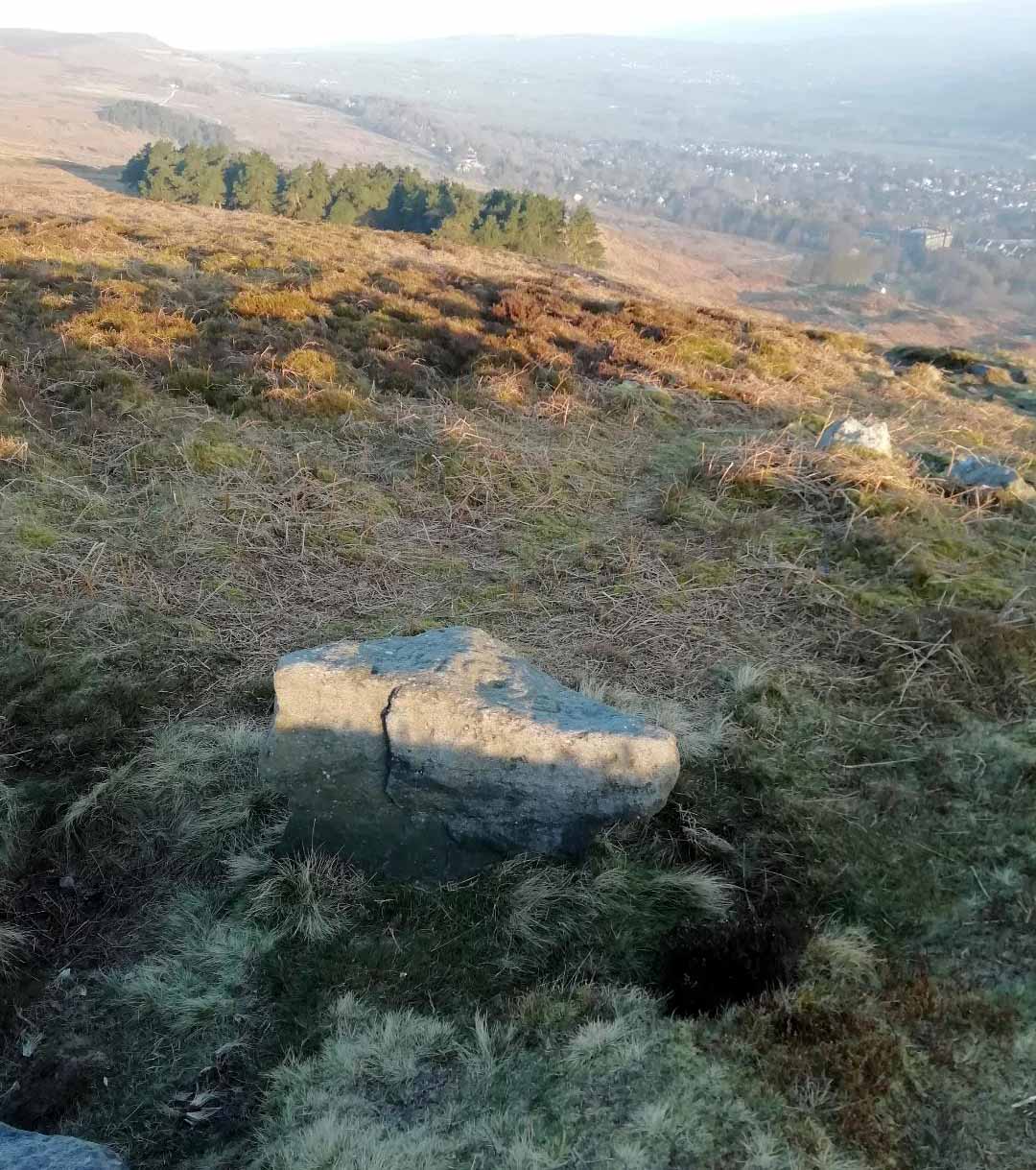
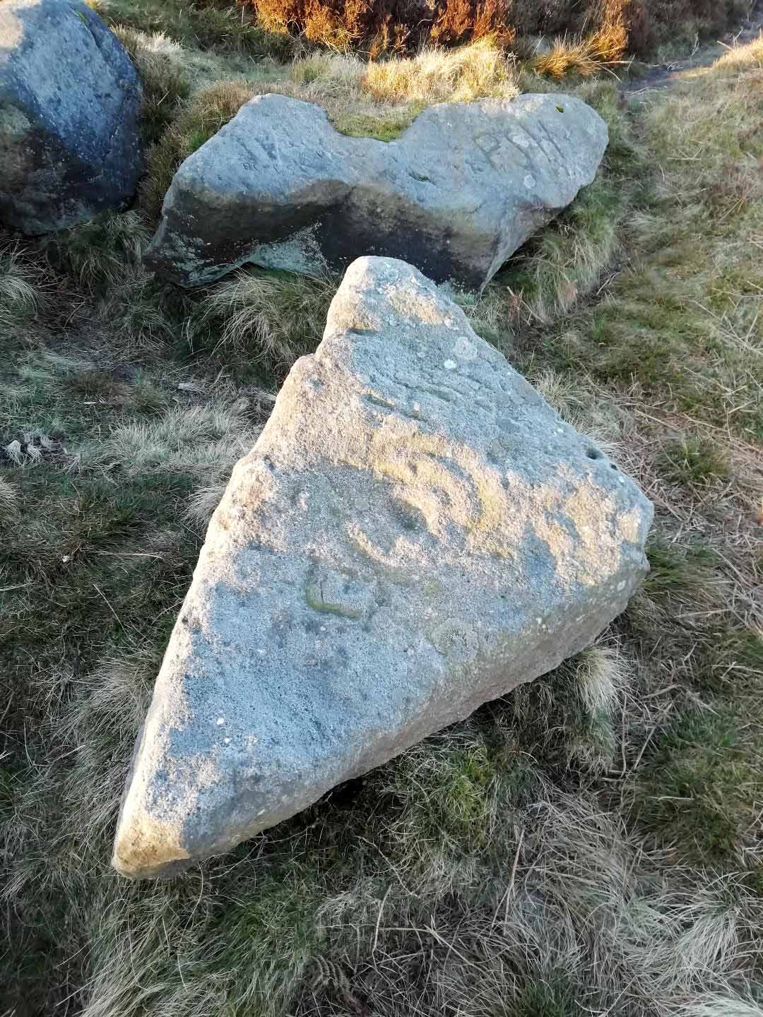
From Ilkley walk up to the White Wells and follow the footpath behind it up to the cliffs, up the stone steps and onto the moor itself. Once you’ve climbed the steps, walk uphill onto the moor for 100 yards, then turn right up a small path for another 80 yards until you reach the large Coronation Cairn with its faint cup-and-ring stone. From here there are two paths heading west: take the higher of the two for just 30 yards where a small group of rocks are by the path-side on your right. The curiously-shaped ‘upright’ one is the stone in question. You’ll see it.
Archaeology & History
Found high up on top of an oddly-shaped stone, somewhat like an anvil or small table (hence the name, courtesy of Jonathan Warrenberg), is carved a slightly worn, incomplete cup-and-double-ring. This aspect of the design is the one that stands out the most; but you’ll also see a cup-and-half-ring there too.
The carving seems to have been described for the first time in John Hedges (1986) survey (though I may be wrong), who described an additional feature to the design, saying:
“Small grit rock in possible cairn material, cut all round as if one pedestal, top surface triangular, sloping slightly SW to NE, overlooking Wharfe Valley, in grass and crowberry. Large cup with two vestigial rings, second large cup with vestigial ring. Possible third ring of corner edge (hewn off). Recent carving of initials spoils original carving.”
John Hedges 1986 sketchLooking from above (photo – Jonathan Warrenberg)
His description of the stone being “in possible cairn material” doesn’t seem true – although a number of petroglyphs are associated with cairns of varying sizes. Several other carvings can be found close to this one.
In Boughey & Vickerman’s (2003) later survey, they copy Mr Hedges earlier description, but with less detail.
The view from this stone is quite impressive. Even with the minor tree cover that would have existed when this carving was done, you’d still have clear views up and down the winding wooded valley that was carved by the River Wharfe. The moors to the north at Denton and Middleton with their own petroglyphic abundance could be chanted at with ease from here when the winds sleep. Tis a good spot to sit… if you’re lucky enough to get some silence…
References:
Boughey, Keith & Vickerman, E.A., Prehistoric Rock Art of the West Riding, WYAS: Wakefield 2003.
Hedges, John (ed.), The Carved Rocks on Rombalds Moor, WYMCC: Wakefield 1986.
Acknowledgments: Huge thanks to Jonathan Warrenberg for the use of his photos in this site profile – and also due credit for giving the stone its modern title. 🙂
As with other carvings in this locale, the name of the stone is based on a survey done by Maarten van Hoek. (1996) It’s a pretty simplistic design within the impressive Castleton complex, found at the southeastern end of the gorse-covered rocky ridge, about 70-80 yards west of the farmhouse. It was uncovered on a visit here by Nina Harris, Paul Hornby, Frank Mercer and Lisa Samson on Sunday 19 November, 2018.
The cup-marked stoneLarge cup & arc of 3
Unlike the others in the Castleton complex, this carving is probably of interest only to the hardcore petroglyph hunters. The design consists of at least ten cup-marks on the uncovered section of the rock, one of which appears to have a broken circle with two ‘entrances’ either side of it, so to speak. The most notable element in the design is close to the edge, where an arc of three cups almost corners a larger cup right at the edge. There may be more carved elements to be found on the westerly side of the stone, which was covered in deep vegetation when we came here.
References:
van Hoek, Martin A.M., “Prehistoric Rock Art around Castleton Farm, Airth, Central Scotland,” in Forth Naturalist & Historian, volume 19, 1996.
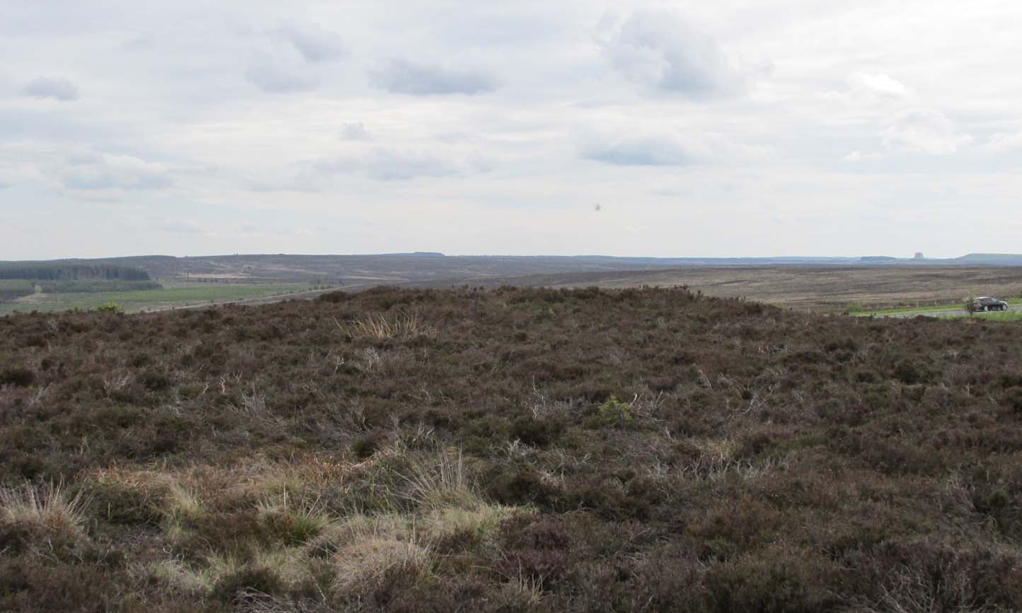
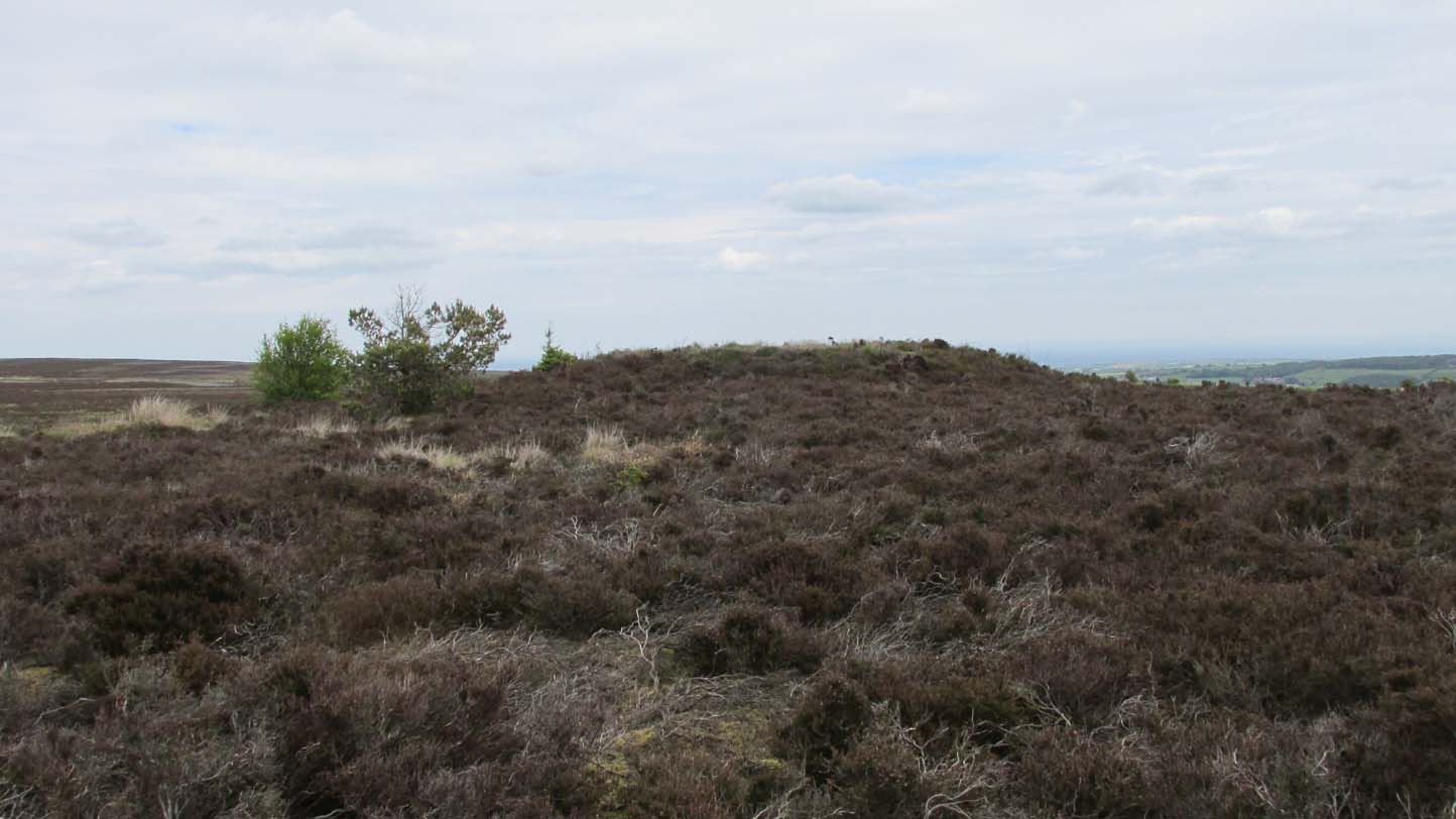
Prehistoric companion to the more pronounced Pen Howe (1) Bronze Age cairn just 20 yards to the west, this overgrown tumulus is hardly noticeable when the heather’s deep and is probably only of interest to dedicated antiquarians and geomancers. Its position in the landscape, whilst not as prominent as its companion and the nearby Breckon Howe, would still have been important to its builders and the relative proximity of the two tombs may imply a continuity of tribal companionship in the Land of the Dead. But hey! – that’s just a silly idea of mine! 🙂
Rising barely three feet above ground level, this is slightly smaller than Pen Howe (1), being just 13 yards across; and there is no indication that it has ever been dug into.
References:
Elgee, Frank, Early Man in Northeast Yorkshire, Frank Bellows: Gloucester 1930.
Acknowledgements: Big huge thanks to my Lindsay Mitchell for getting us up to see this old tomb (which is nearly as old as Linzi 🙂).
Along the A169 road between Sleights and Pickering, some two miles south of Sleights turn right as if you’re going to the tombs of Flat Howe and the Bride Stones, but just park up 80 yards along by the cattle grid. From here, a fence runs southeast and the mound is on the near skyline, just over 100 yards away. Just walk through the heather to reach it.
Archaeology & History
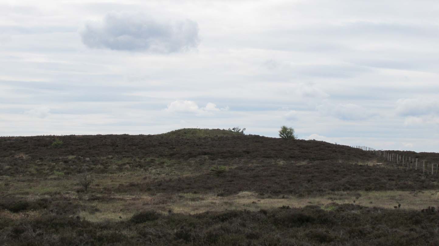
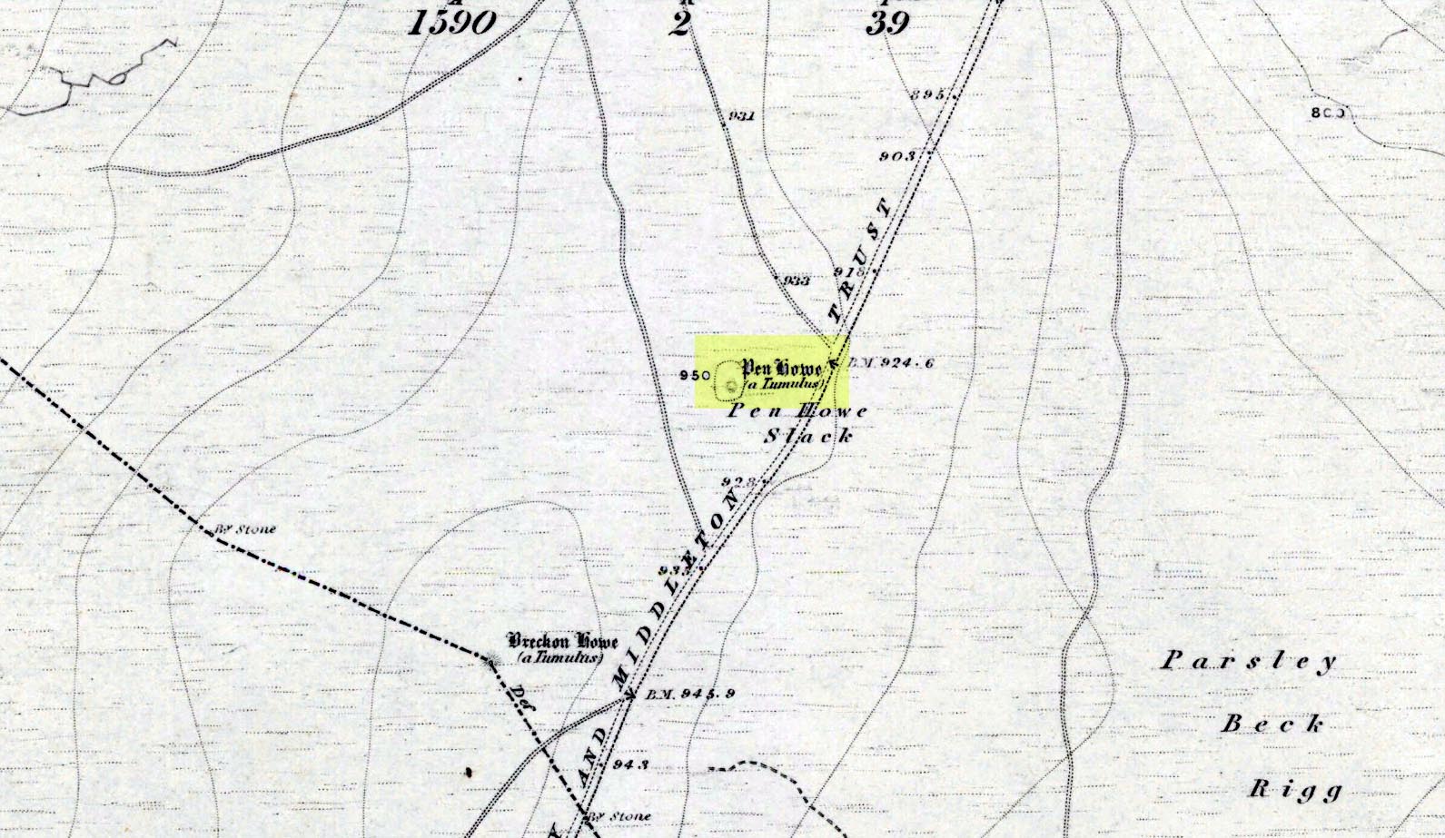
Shown on the first OS map of the area in 1853, this somewhat overgrown prehistoric tomb is one of two in close attendance to each other (see Pen Howe 2); and is some 435 yards (398m) away from the more prominent Breckon Howe tomb to the southwest. Like others on Sleights Moor, no real archaeological attention has been paid here, with Frank Elgee (1930) only giving it the slightest mention in passing.
Pen Howe on 1853 mapPen Howe, looking SE
Smaller than its nearby companions of Flat and Breckon Howe, the overgrown cairn raises about four feet above ground level and about 20 yards across. Probably Bronze Age in origin, it has a slightly concave top that gives the impression that someone at sometime in the not-too-distant past has had a bittova dig here to see if there’s owt inside. But we have no record of such a thing.
surmounted by a relatively recent boundary stone, sits at the highest point on the moors in these parts. Despite this (as with others on these moors), very little has been written about the place and it has received only minimal attention in archaeology tomes. Even the renowned pen of Frank Elgee (1912; 1930) gave it only passing mention. Perhaps it aint a bad thing to be honest.
References:
Elgee, Frank, Early Man in Northeast Yorkshire, Frank Bellows: Gloucester 1930.
Acknowledgements: Big huge thanks to my Lindsay Mitchell for getting us up to see this old tomb and its companion. (which is nearly as old as Linzi 🙂 )
Round Barrow (destroyed): OS Grid Reference — SU 1510 4330
Also Known as:
Durrington 70
Archaeology & History
Cunnington’s sketch of the barrow remains
This was one of four ploughed-out round barrows (or ‘ring ditches’ in modern archaeo-jargon) that once existed immediately southeast of the well-known Woodhenge and was the closest of the four to the monument, being just 60 yards away. It was first noticed as a faint crop mark in an aerial survey photograph taken in 1926 of the fields hereby. When it was investigated at ground level by Mr & Mrs Cunnington in August 1928, “no trace could be detected on the surface” of any extant monument—which they described as ‘Circle IV’ in their superb survey.
The Cunnington’s (1929) account of the excavation they did here was pretty brief, telling:
“The soil was removed and the chalk brushed over that part of the area enclosed within firm lines. Beyond a few shards of pottery in the soil, nothing whatever was found. As the ditch was comparatively shallow and the filling-in was in patches dark in colour, with much ash and some burnt flints in it, a considerable length was dug out, as shown (in the sketch, above). A few fragments of pottery similar to some of that from Woodhenge were found in and below the old turf line.
“The only find of interest was that of a piece of glass slag on the actual bottom of the ditch. It is true it was at the shallowest point, but there was no evidence of disturbance.
“Conclusion — Like those of the other rings (Woodhenge Circles 1, and 3, PB) this ditch may have originally surrounded a Bronze Age burial, placed on the surface and covered with a mound, both of which were destroyed when the ground was levelled.”
References:
Cunnington, M.E., Woodhenge, George Simpson: Devizes 1929.
Royal Commission Historical Monuments, England, Stonehenge and its Environs, Edinburgh University Press 1979.
Wainwright, G.J. & Longworth, Ian, Durrington Walls: Excavations 1966-1968, Society of Antiquaries: London 1971.
Round Barrow (destroyed): OS Grid Reference — SU 1511 4327
Also Known as:
Durrington 69
Archaeology & History
Cunningham’s sketch of Woodhenge-3 barrow
This was one of four ploughed-out round barrows (or ‘ring ditches’ in modern archaeo-jargon) that once existed immediately southeast of the well-known Woodhenge complex, constructed approximately 95 yards away. As with others in this field, the site was first noticed as a faint crop mark in an aerial survey photograph taken in 1926. When it was subsequently investigated at ground-level by Mr & Mrs Cunnington in August 1928, “no trace could be detected on the surface” of the monument in question—which they described as ‘Circle III’ in their superb survey.
Very little was found in the Cunnington’s (1929) excavation, as their following brief account indicates:
“The soil was removed and the surface of the chalk brushed, over the whole of the area enclosed within this ditch.
“Only one small oval-shaped hole was found, near the edge of the ditch at “a” (above), 33in x 22in, and only 5in deep in the chalk; in it were a number of fragments of bones of a small ox and pig, a piece of burnt clay and a flint scraper weathered white.
“As there was nothing dateable in the circle it was not thought worth while to excavate more than a short section of the ditch. Pottery comparable with that found at Woodhenge came from the old turf line and from the bottom of the ditch.
“Conclusion — Like those of the other circles (Woodhenge circles 1, 2 and 4, PB) it is probable that this ditch was originally made round a Bronze Age burial that had been placed on the surface, and that it was destroyed together with the covering mound when the ground was levelled.”
References:
Cunnington, M.E., Woodhenge, George Simpson: Devizes 1929.
Royal Commission Historical Monuments, England, Stonehenge and its Environs, Edinburgh University Press 1979.
Wainwright, G.J. & Longworth, Ian, Durrington Walls: Excavations 1966-1968, Society of Antiquaries: London 1971.