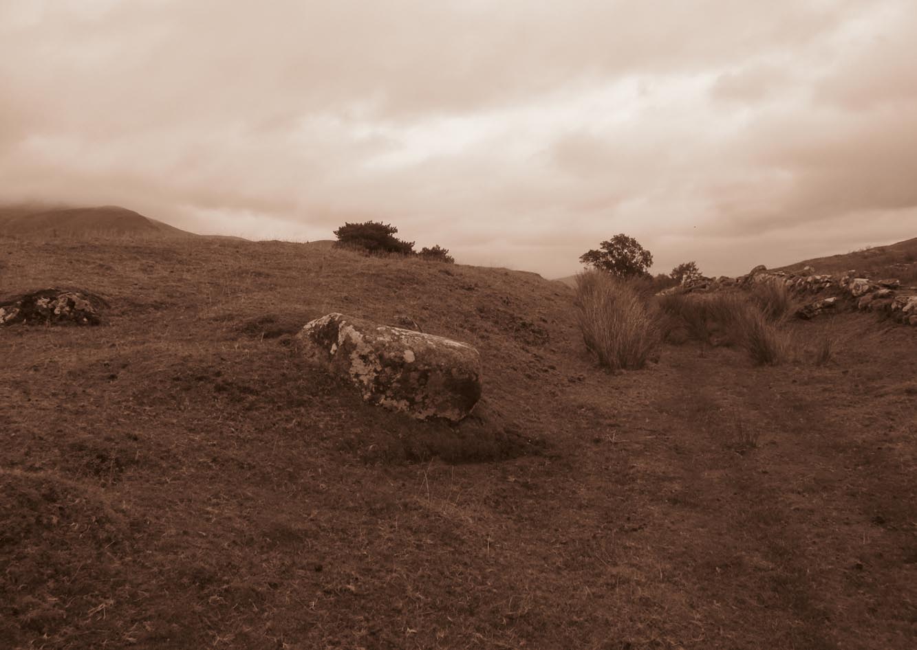
Tumuli (destroyed): OS Grid Reference – TL 584 600
Archaeology & History
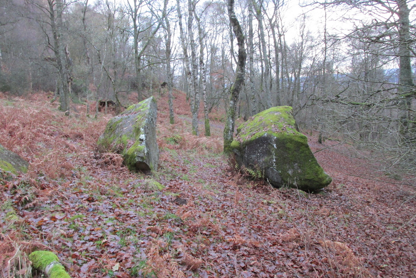
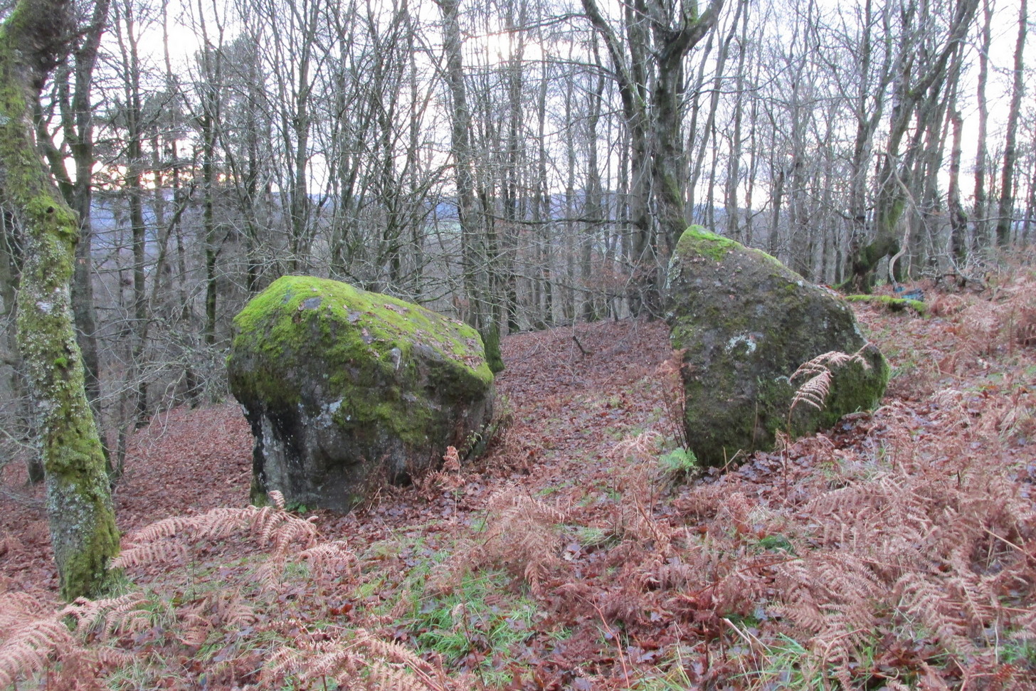
The precise location of two prehistoric burial mounds at place with the conspicuous name of Beacon Hill, has yet to be satisfactorily located. Their existence is recorded way back, in 1279 according to P.H. Reaney (1943), when they were described as Tweynhowes, being on the boundary of Swaffham Priory. Information on them is scant and scattered with the earliest seeming to be an account by Thomas Kerrich (1817), who reported their removal and finds therein, in 1815. The editor of Archaeologia told us:
Beacon Hill urn, 1817
“The Rev. Thomas Kerrich…exhibited to the Society, an Urn, which had been found a few days before by some labourers who were employed to remove one of the Barrows upon Newmarket-heath, called the Beacon Hills. “It stood upon what probably was the surface of the earth before the tumulus was raised. The diameter of the barrow was near thirty yards, and the perpendicular height probably about eight or nine feet. There are more of these tumuli remaining, some of them very near to the place on which this, out of which the urn came, lately stood. They command an extensive view over the town of Cambridge, Gog-Magog Hills, &c.”
Subsequently a short piece in the Cambridge Chronicle in 1846 told the following:
“Two of the barrows on the edge of Newmarket Heath, belonging to the group called the Beacons, were examined in May 1846 by a party from Cambridge. In one of them nothing was found as it appeared to have been previously opened; in the other the remains of a British interment, consisting of rude vase (now in the Cambridge Antiquarian Museum), a few bones and some ashes, were discovered.”
This was echoed nearly forty years later in a survey by Charles Babbington (1883), who gave little by way of extra information; and was echoed again in Cyril Fox’s (1923) huge archaeological survey. Herein, Mr Fox told us that the two barrows were located at the “east end of a four-mile racecourse.” The only additional lore we’ve had since then is a collation of by the Royal Commission lads who thought that the respective tombs were located more precisely as the grid-references TL 5839 5998 and TL 5850 6004 respectively.
Reaney, P.H., The Place-Names of Cambridgeshire and the Isle of Ely, Cambridge University Press 1943.
Royal Commission Ancient Historical Monuments, Inventory of Historical Monuments in the County of Cambridgeshire – Volume 2: North-East Cambridgeshire, HMSO: London 1972.
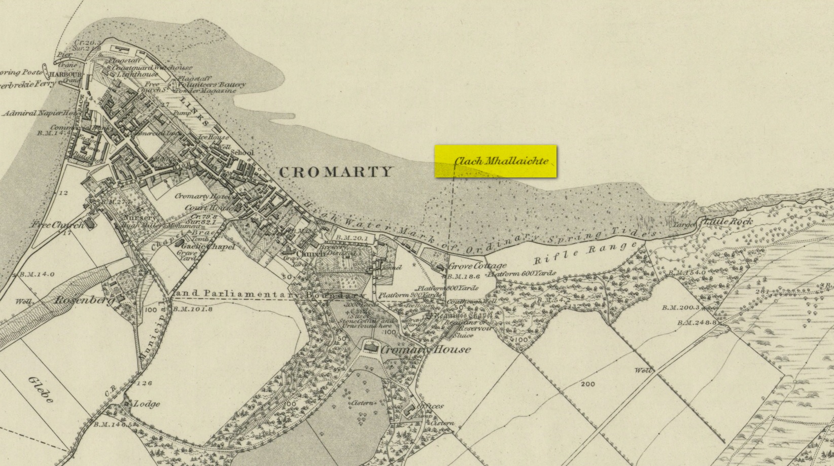
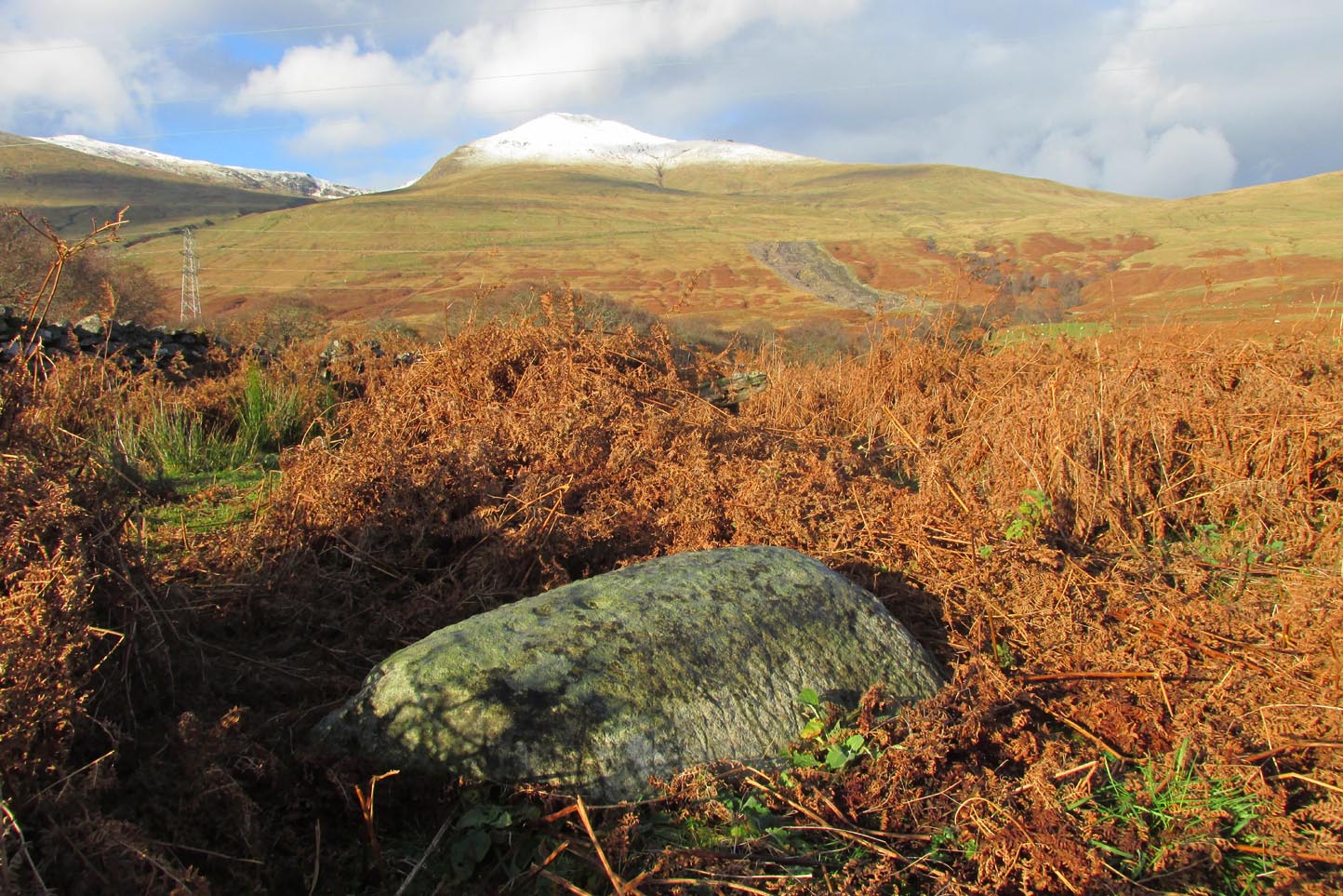
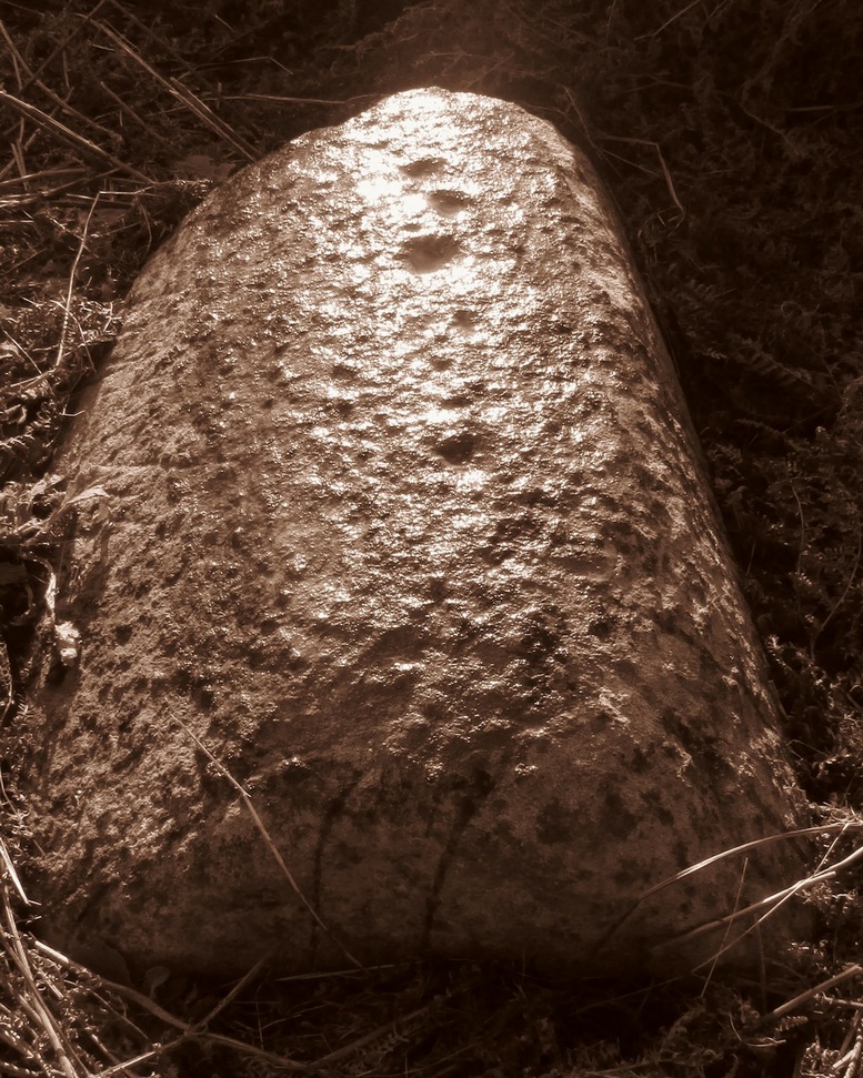
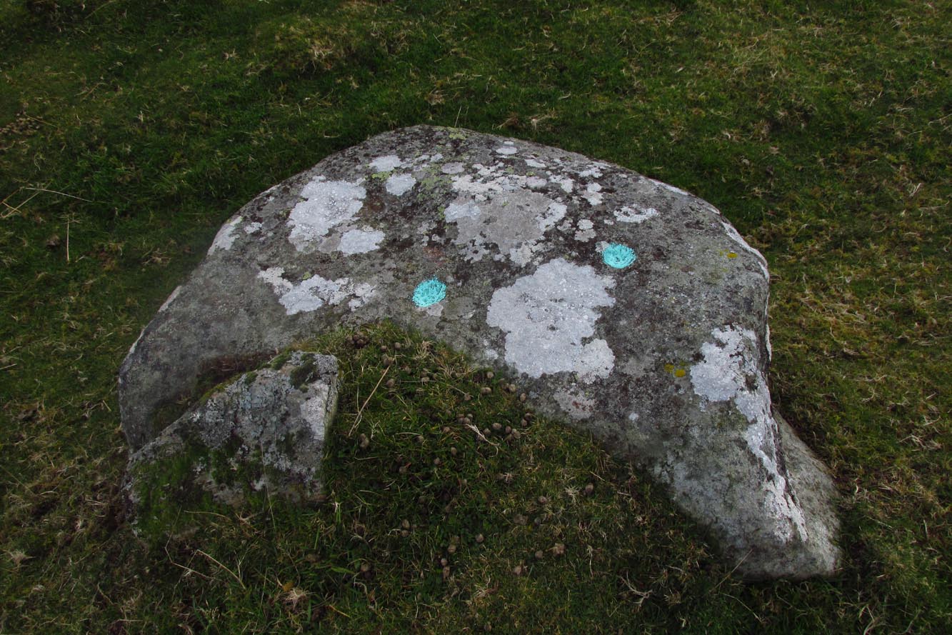
This large boulder found off the Cromarty coast, was highlighted on the 1880 OS-map of the region. It is one of the ancient boundary stones of the township.
Folklore
We know from the vast array on the folklore of stones that many were imbued with magickal abilities, some of which were witnesses to vows and others to make curses from. This large boulder off the coast of Cromarty was, according to Donald MacKenzie (1935), a place where the latter used to be done. He told us:
“At Cromarty there is a big boulder known as the Clach na Mallachd (‘Stone of Cursing’). Curses were delivered when an individual stood or knelt bare-kneed upon it.”
In an earlier account by the Ordnance Survey lads in one of their Name Books, they gave the following tale that had been narrated to them:
“A large stone Situate at the Low Water, and forming one of the boundary Stones of the burgh, the reason of its having this name is, that a young lad while Sitting on it was overwhelmed by the advancing tide and drowned, his mother when told of it, cursed the stone, hence the name Clach Mallach (Accursed Stone)”
References:
MacKenzie, Donald A., Scottish Folk-lore and Folk Life, Blackie: Glasgow 1935.
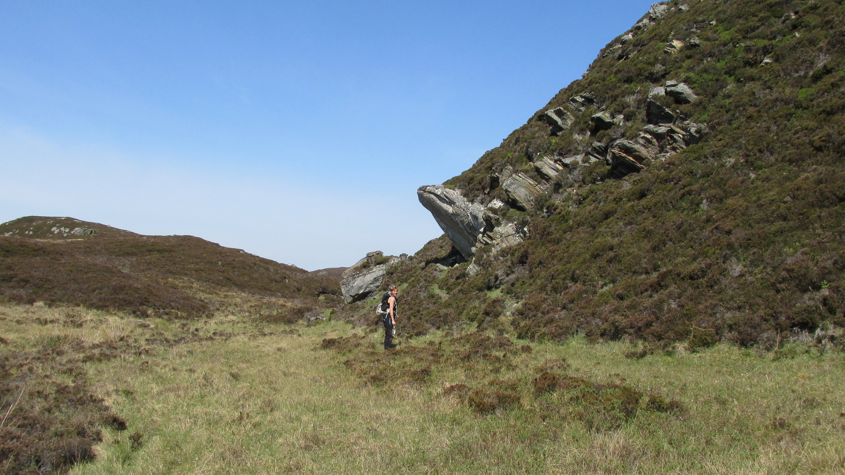
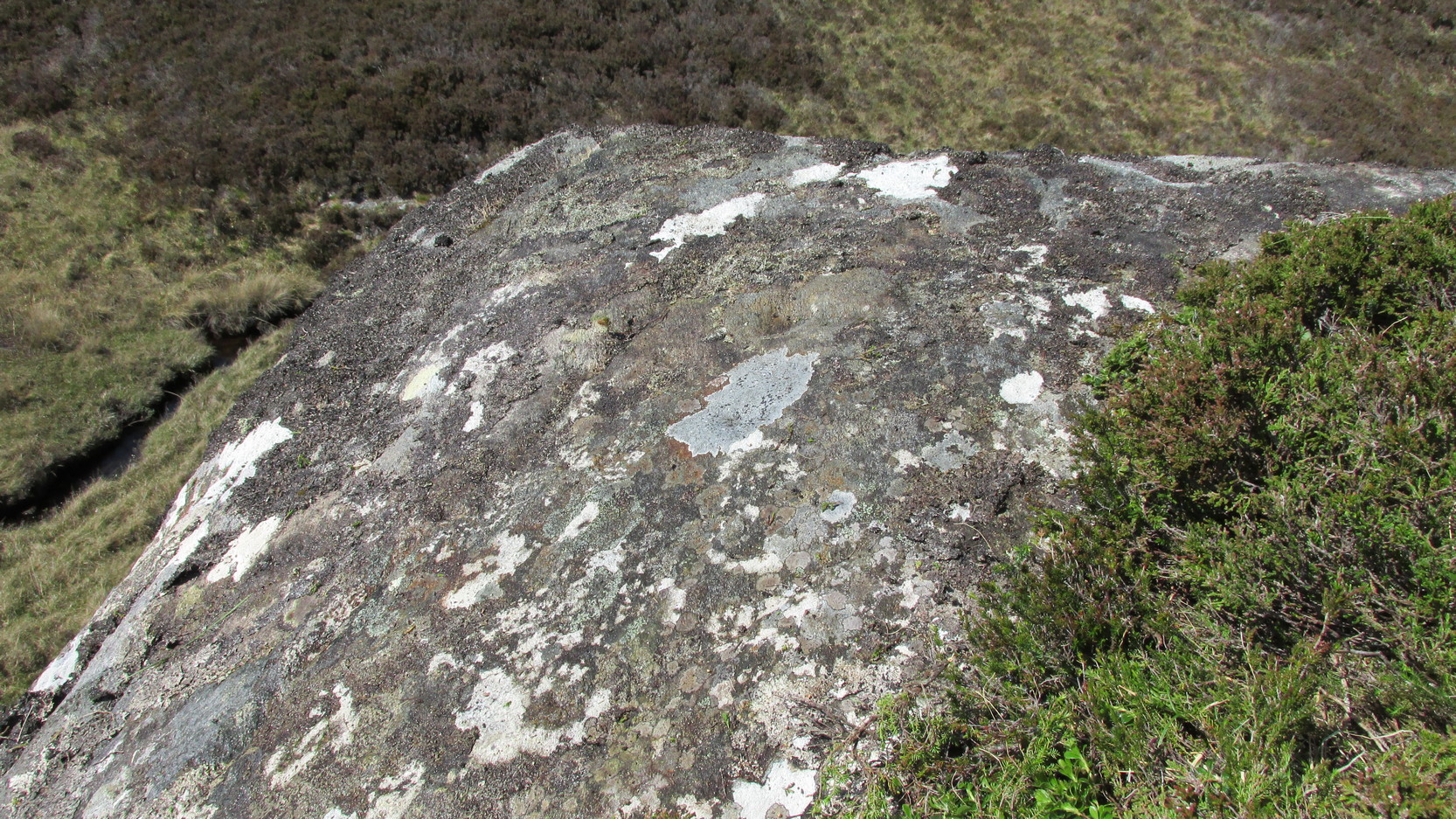
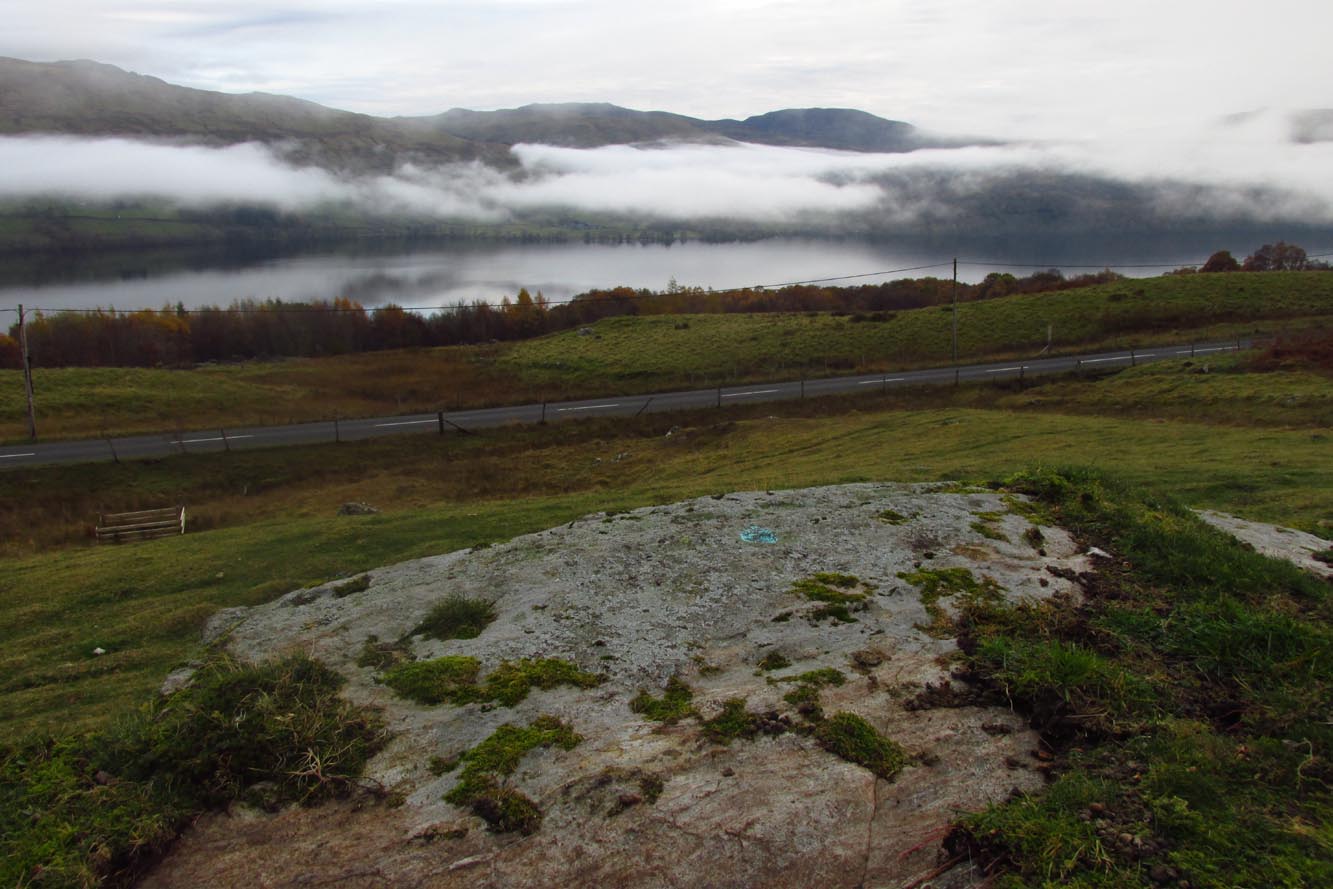
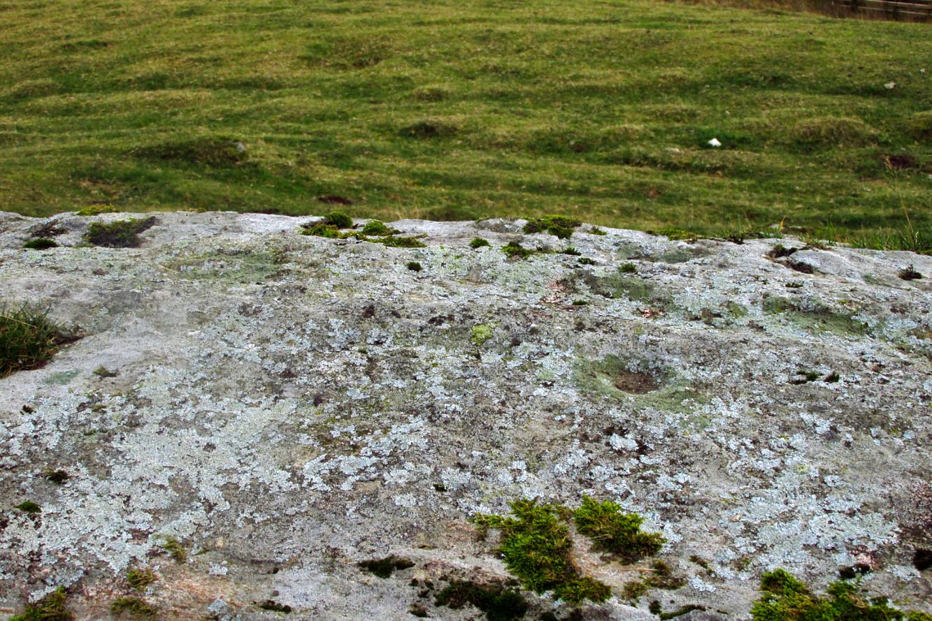
Difficult to reach, this large protruding rock on the west side of Thorrisdail Hill, was known as the Thorrisdail Stone in the old boundary records. It’s a bittova giveaway when you find it, as its name is inscribed on the lower face of the stone – etched a century or two ago by the look of it.
Thorrisdail Stone, with Sarah stood belowOne of the cupmarks highlighted, upper middle
It’s a difficult rock to climb upon if you aren’t used to such things – and you need to do this if you want to see the cupmarks; although they’re hardly worth seeing unless you’re a petroglyph freak! If you go to the trouble so see them, make sure to squat down carefully, being even more careful not to fall off (you’re screwed if y’ do). Once in position, you’ll see between three and five very faint shallow cups etched onto its flat surface. You can just make one of them out in the photo here. The more impressive thing to see here is the small standing stone that seems to artificially crown the top of the rounded hill to which the Thorrisdail Stone is attached.
Acknowledgements: Huge thanks to Sarah MacLean for her company and landscape knowledge in visiting this and other nearby antiquarian remains. And to Aisha Domleo, for getting me into this neck o’ the woods.
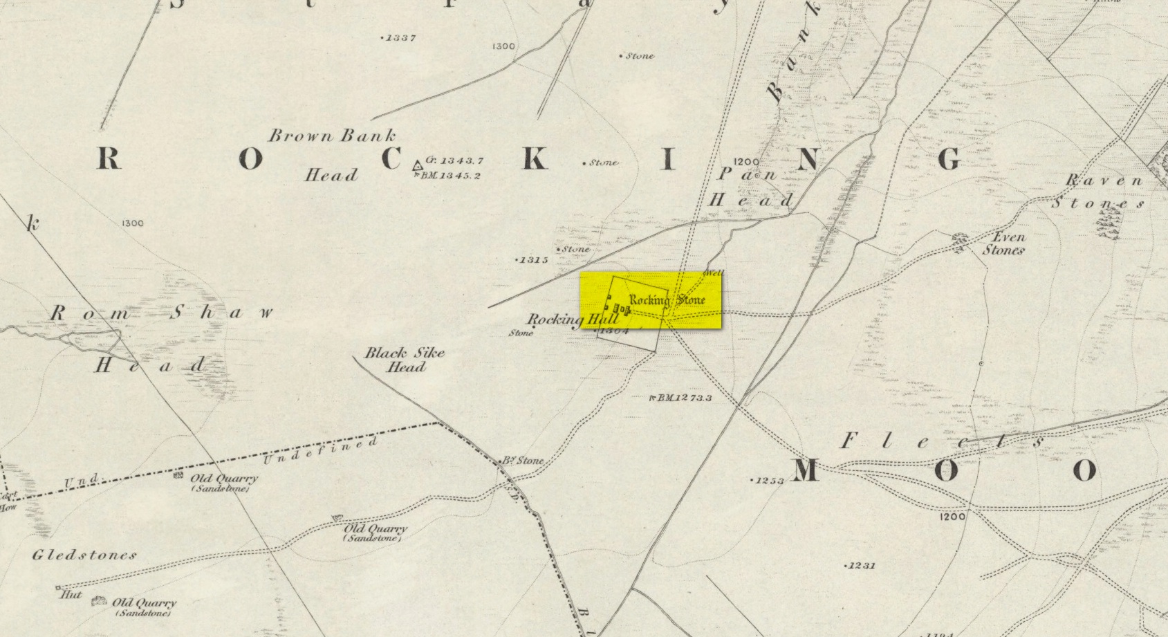
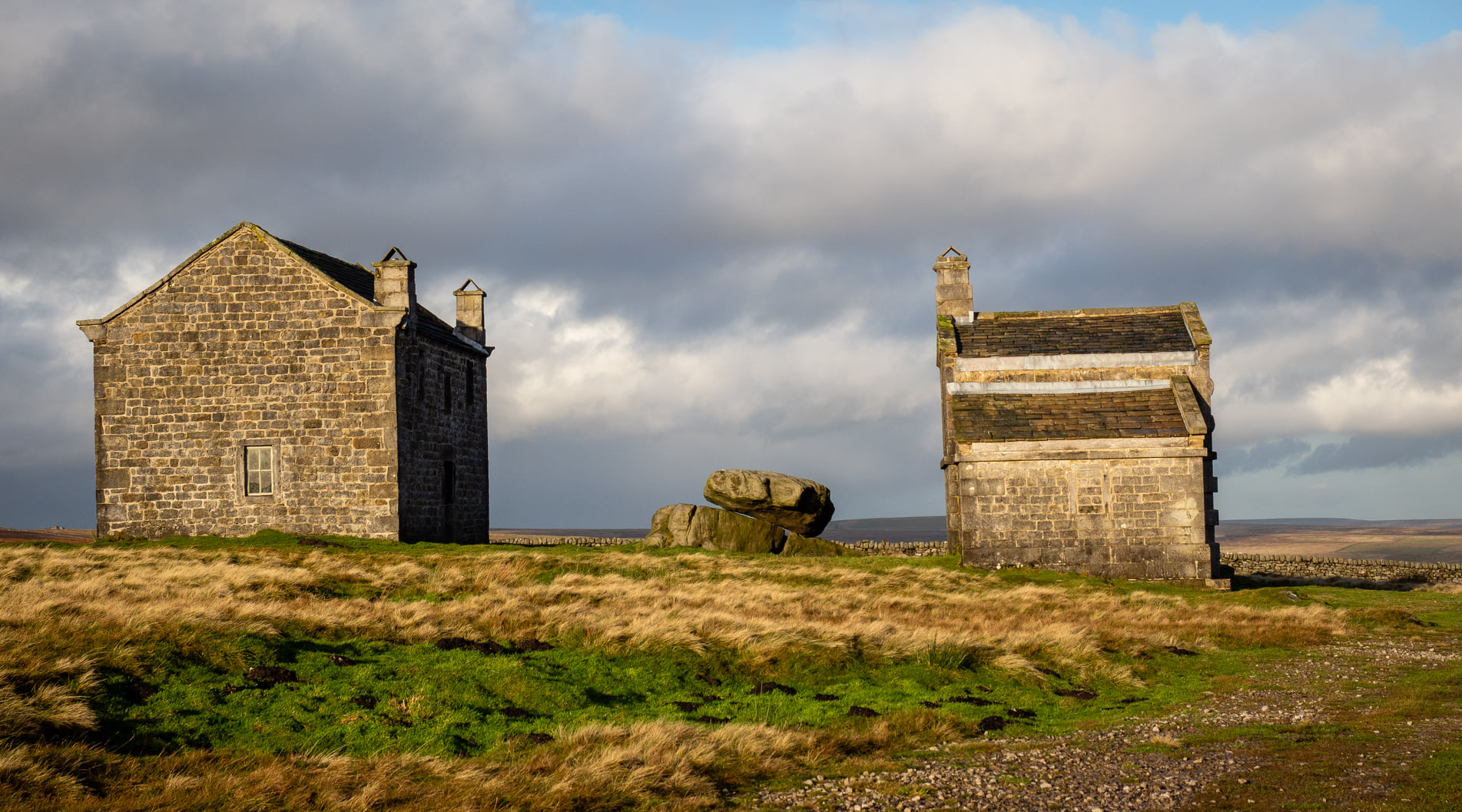
Visiting this site is a bittova walk across the moors, with probably the best route being along one of two footpaths from near the Outdoor Centre following (whichever is your preference) the moorland track or path westward onto the open landscape. Tis a 2½ mile walk before you reach two large buildings stuck high up in the middle of nowhere. Y’ can’t miss them. Equally unmissable is the large blatant rocking stone between the buildings. Gerron top of it!
Archaeology & History
Rocking Stone, in situ
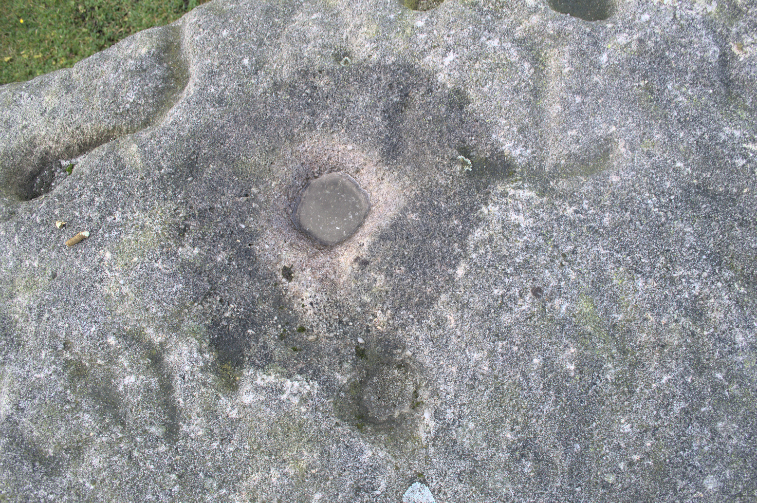
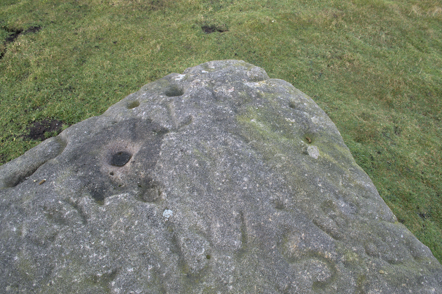
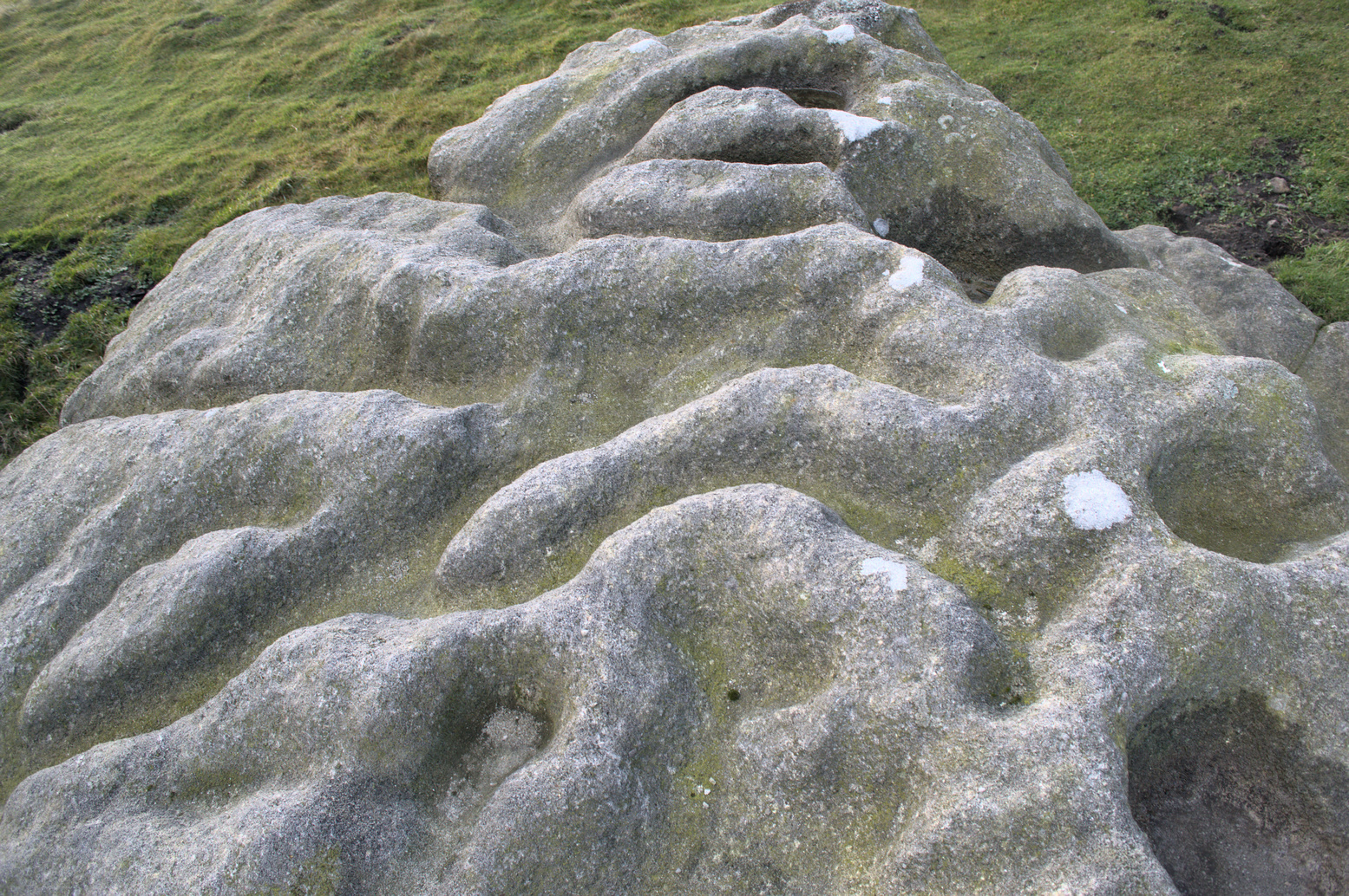
This impressive-looking rock that sits between the two buildings has a number of cup-markings of varying sizes across its topmost surface: some deep and some not-so-deep. There are perhaps as many as 20 of them on different parts of the stone, but some have been intruded on by more recent graffiti. On a recent visit to the site, photographer James Elkington and his young assistant MacKenzie, saw what looked like “a very faint ring around one of the cups” – which doesn’t surprise me. On one section of the stone we see a fascinating series of natural curves and geological undulations, some of which may have been modified a long time ago when the cupmarks were etched. But whether they were added to or not, it’s more than likely they’d have had some significance in the mythic nature of the rock.
The earliest description telling us that this possessed any prehistoric attributes seems to have been written by William Grainge (1871), in his huge work on the history of this region. He told that,
Faint ring highlightedSome of the many cups
“This rock…is eleven feet in length, seven feet six inches in breadth, and two feet six inches in thickness. The whole of the upper surface is thickly indented and grooved with cups and channels; the artificial character of which can be easily seen by anyone. This logan rests upon a lower rock, the upper surface of which is about three feet above the ground, fourteen feet in length, and nearly the same in breadth.”
Folklore
Curvaceous nature & cups
Although this yummy-looking geological sight no longer rocks, it wasn’t always that way. Indeed, according once more to the pen of Mr Grainge, although “it does not rock now, it has done so within living memory” – meaning that it would have been swaying at the beginning of the 19th century. We can only take his word for it. Also, as with many rocking stones the length and breadth of the land this, unsurprisingly it was adjudged to have been a place used by the druids.
References:
Grainge, William, The History and Topography of Harrogate and the Forest of Knaresborough, John Russell Smith: London 1871.
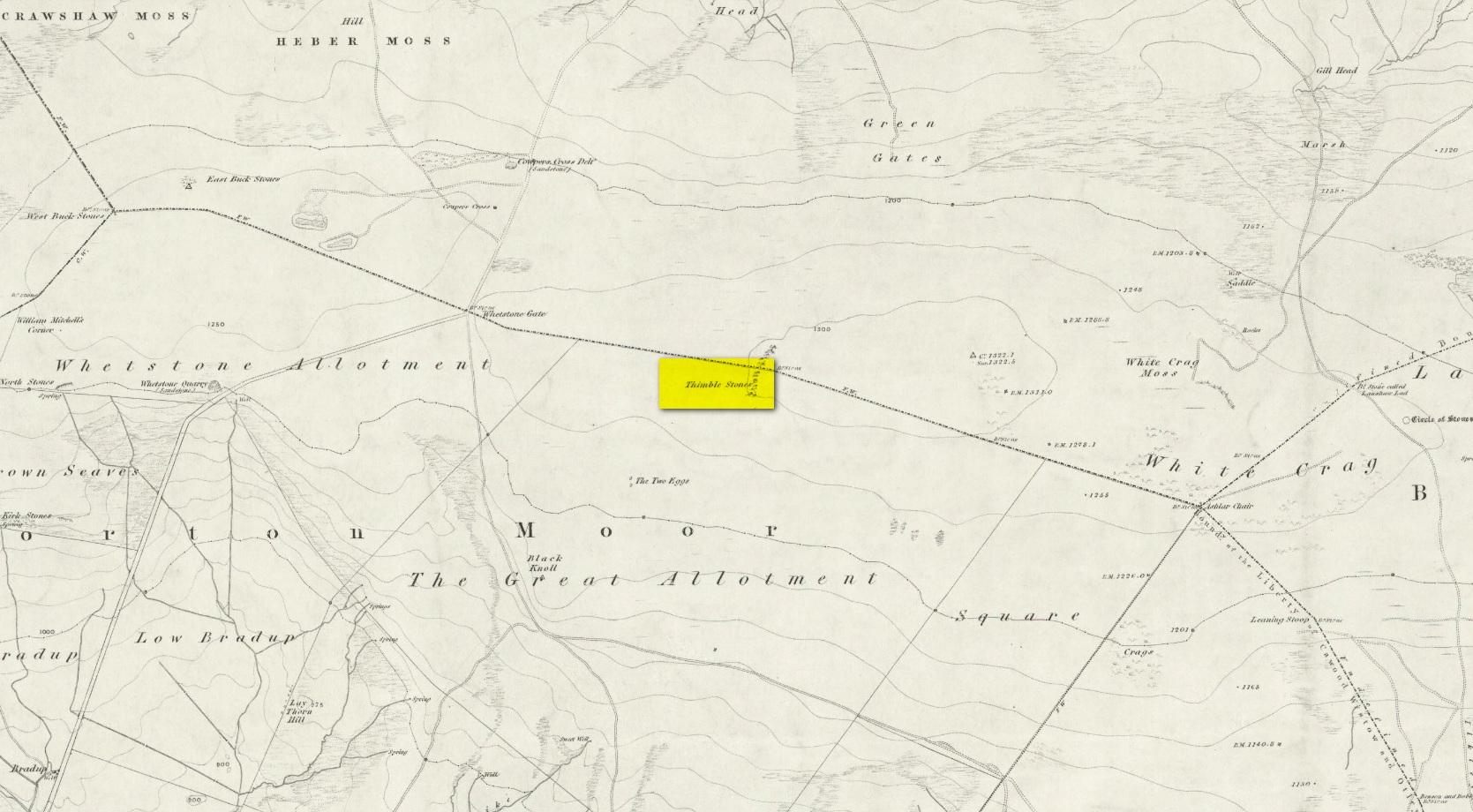
You can either head up to the Twelve Apostles stone circle, then a short distance west to the Ashlar Chair and head just head west along the moorland footpath that runs parallel with the old walling for ¾-mile (1.2km). This is the boggier route, beloved of real walkers! The other route is from the top of the Roman Road that bisects the moor at Whetstone Gate. From here, where the normal ‘road’ meets up with the dirt-track at the very top of the moors, take the footpath east for ½-mile (0.75km) until you reach the large cluster of rocks, just over the wall on your right-hand side. The carving is on top of one of them there stones.
Archaeology & History
Without doubt there’s one helluva spirit to this cluster of large weather-worn rocks whose bodies gaze in every cardinal direction—and it’s a place where me and a number of earlier historians thought cup-and-rings could be found. The first petroglyphic context of the rocks was made in the 1860s by the grand 19th century historians Forrest & Grainge (2012) where they gave it the usual druidic associations, so beloved of academics and antiquarians alike at the time. They wrote:
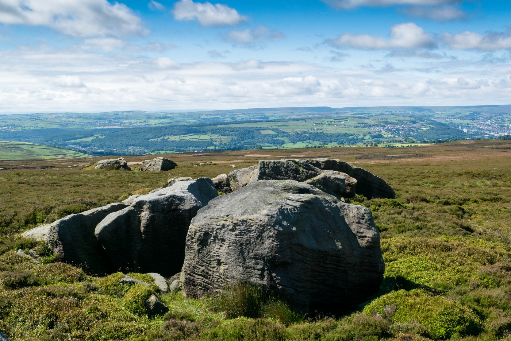
Very faint cup-and-3-ringsThimble Stones gazing south
“The Thimble Stones are a ½-mile north of the Two Eggs, with which they are nearly in line. They are of the same outcrop of stratification and appear as though they had been pushed upwards by some force acting from beneath, breaking them up with a vertical fracture, and separating them so as to leave wide spaces between the blocks. They are about a furlong in length and in front about 10ft in height, diminishing eastward to the level of the ground. Two of them a few feet apart are 7ft high, and bear on their eastern angles the cups and channels which we designate the marks of Druidic consecration.”
Subsequently, in Collyer & Turner’s (1885) work they told that the rocks “bear cups on two margins”; and when the great Harry Speight (1900) came here, he found they were “bearing cups and grooves.” Yet no-one reported any rings. And in the countless visits I’ve made here—thinking that there must have been cup-and-rings!—no such symbols have ever cried out. The various large ‘bowls’ and lines that Nature has carved here—some of which may have been important in ancient days—are all that the casual eyes can see. Until now…
The local rambler and photographer James Elkington and James Turner were up here a couple of years ago. The light was falling through a clear bright sky and so, as James likes to do at such times, he clicked his camera a few times to catch the landscape. Clambering onto the rocks, Mr Turner unknowingly stood upon the carved rings, and when he moved his foot Mr Elkington spotted them! And as we can see on the image above, only just, there’s a single cup-mark surrounded by a concentric triple ring. Incredibly faint, it is without doubt the real McCoy—and the highest of all petroglyphs on these moors. In the photo it seems that there may be other elements to the carving, but until conditions allow for a further examination, we won’t know for sure.
James is hoping to get back up there when conditions are just right so he can get clearer photos. But if you hardcore antiquarians and petroglyph seekers wanna get up there y’selves to get some photos of your own, please send us whatever you might find.
Folklore
On the esoteric side, the Thimble Stones was a place favoured by the progenitors of the ritual magickal Order, the Illuminates of Thanateros, in years gone by.
References:
Allen, J. Romilly, ‘Cup and Ring Sculptures on Ilkley Moor,’ in Reliquary & Illustrated Archaeology, volume 2, 1896.
Bennett, Paul, The Old Stones of Elmet, Capall Bann: Milverton 2001.
Boughey, Keith & Vickerman, E.A., Prehistoric Rock Art of the West Riding, WYAS: Wakefield 2003.
Collyer, Robert & Turner, J. Horsfall, Ilkley, Ancient and Modern, William Walker: Otley 1885.
Feather, Stuart, “Mid-Wharfedale Cup-and-Ring Markings,” in Bradford Cartwright Hall Archaeology Group Bulletin, 6:3, 1961.
Forrest, Charles & Grainge, William, A Ramble on Rombald’s Moor, Northern Antiquarian: Bradford 2012 (1st published 1867-69).
Hedges, John (ed.), The Carved Rocks on Rombalds Moor, WYMCC: Wakefield 1986.
Speight, Harry, Upper Wharfedale, Elliott Stock: London 1900.
Acknowledgements: Huge thanks as always to James Elkington for use of his photos.
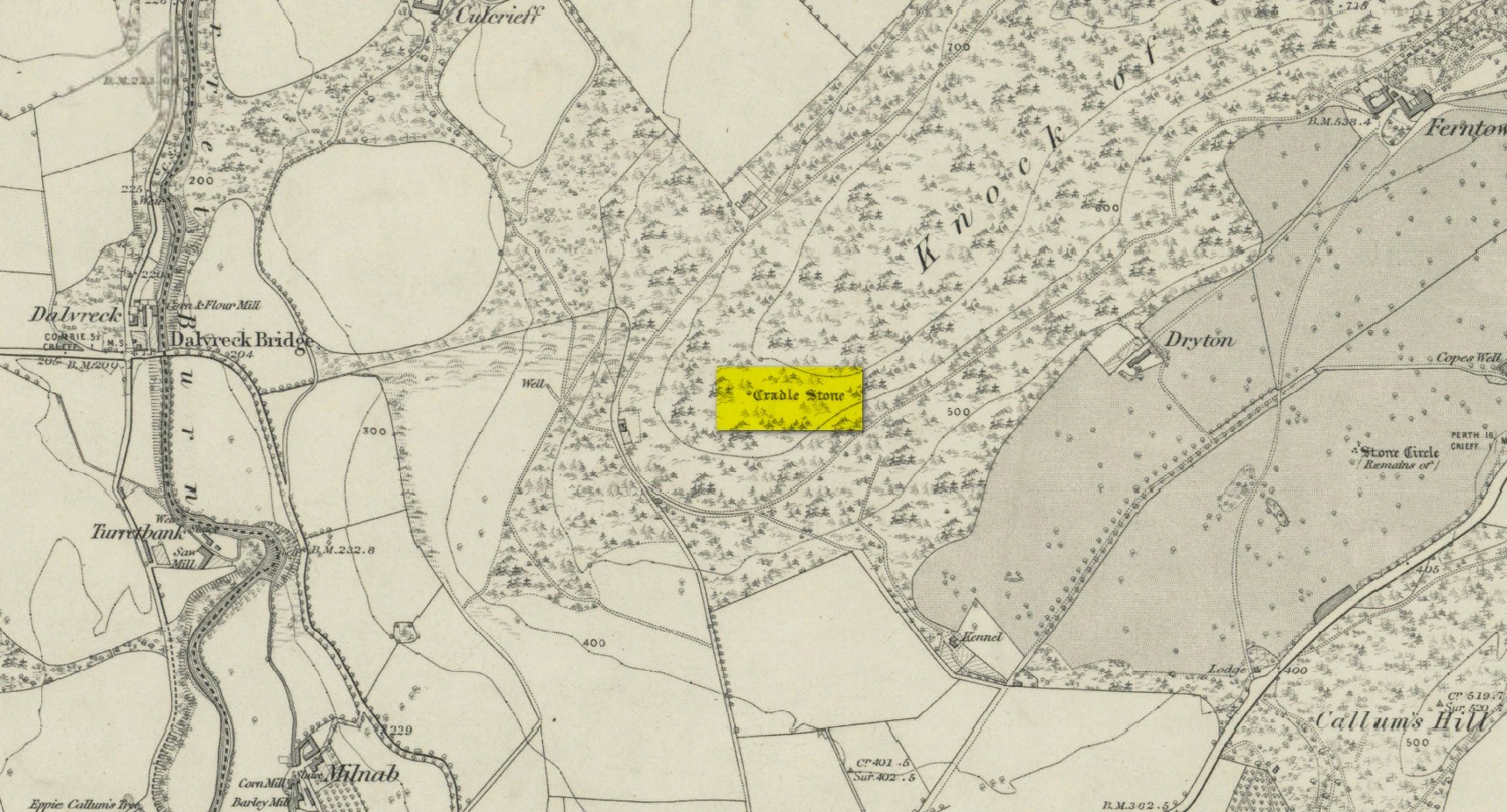
A bit troublesome to locate if you don’t know the area. Get into the town centre where the paved St George Square is by the main road. Cross the road and go up Hill Street, which runs straight into Ferntower Road. A few hundred yards up turn left up Ewanfield, all the way to the very end at Crieff Hydro. From here you’ll see the path uphill by the tennis courts. Walk up and past the holiday chalets until your hit the road that curls round the bottom of the woods. Go along until you find the car park and just above here by the roadside is a tourist board showing the Knock Walk footpath. The Cradle Stone is about 250 yards up the Knock Walk from here, 100 yards into the woods on the right.
Archaeology & History
This large broken boulder is the result of it once living further up the hillside. One of Nature’s great forces then kicked the olde fella and he rolled down the hill to its present position. It was mentioned in a detailed 19th century geological survey by Mr Thomson (1836), where he told:
“At Crieff, in Perthshire, there occurs a series of low hills running parallel to the Grampians. These hills consist of old red sandstone and greywacke. On one of them, the Cnock, the village of Crieff is built. Upon the south-east side of this hill, towards the southern extremity, not far from the summit, there are deposited a number of boulder stones of syenitic granite. The largest of these is called the ‘Cradlestone’. It is nearly spherical, quite smooth on the surface, and 29 feet in circumference. It has been split in two by lightning, (according to the tradition of the place,) and one of the fragments has made one complete revolution down the hill and then stopped. The weight of this boulder is about 30 tons. The nearest mountains of syenitic granite, are those in the neighbourhood of Bennevis, distant more than 60 miles north-west…”
The stone was subsequently entered in Fred Cole’s (1911) outstanding survey of the local megaliths, although acknowledged it has having no archaeological pedigree. The Cradle Stone, he wrote, is
“the appellation printed in Old English lettering on the Ordnance Map, given to one of two huge boulders difficult to find in the fir-woods at the western extremity of the Knock, and at a height of nearly 600 feet, midway between Knockearn House and Culcrieff. On visiting the site, the conclusion became apparent that these two blocks were merely natural curiosities, and had no interest for the archaeologist beyond the name.”
Folklore
In volume 10 of the New Statistical Account it was told how local folklore attested the Cradle Stone as being where the babies came from, perhaps intimating some fertility legend long since forgotten.
The main thing attached to this giant broken stone is the old folk-tale that used to be more well-known in the 19th century than it is today. It was narrated at length in Macara’s (1881) fine pot pourri of local histories and legends and which I hope you can forgive me citing in its entirity here:
“In the memory of men still living, two well-known weavers, named James Livingstone and James M’Laren, lived in Barnkettick, at the west end of the town. Livingstone was a thorough wag, and M’Laren was somewhat of a simpleton. Livingstone was in the habit of telling his neighbour all sorts of extravagant stories about ghosts and witches. The facility with which the latter fraternity could turn themselves into hares and scamper about was an accepted fact, which M’Laren as truly believed as his Bible.
“The Rocking or Cradle Stone on the brow of the Knock, behind the town, was supposed to be of Druidical origin, and for ages drew forth the fear and wonder of the natives. A belief prevailed that something valuable was buried in its foundation, and worth lifting, if it could only be got at. Livingstone having heard of “Whang, the Miller” directed McLaren’s attention to the subject of valuable treasure being beneath the cradle stone, which was greedily swallowed, and he expressed his astonishment that no one tried digging for it.
“Livingstone suggested that they both should try it, and divide the spoil. M’Laren agreed, and it was resolved to make the attempt that night after dusk. The necessary picks and spades were soon borrowed. Livingstone called on an acquaint- ance or two, and informed them of the “ploy,” and they readily agreed to arrange and have some fun at the “howking” of the treasure.
“The acquaintances were up at the spot early, with a view to set some snares for hares, so that the journey would combine pleasure with profit. They had also provided a few “squibs” for contingencies. At the time appointed the two weavers, with their implements on their shoulders, arrived at the stone and set to work. M’Laren did so with strong impressions of a coming calamity, which soon made him feel the greatest terror. Livingstone worked with a will, and upbraided M’Laren with cowardice.
“With that a strange, unearthly sound came up the hill, and on looking round, a ball of fire was seen careering through the underwood. M’Laren felt queerish and almost speechless. Another hissing sound was heard, and the strange fire came nearer. Livingstone still wrought on, telling M’Laren never to heed, as these things were only bits of falling stars. M’Laren thought otherwise. They were in the neighbourhood of Monzie, where it was certain there were plenty of witches, and it was evident something “no canny” was brewing. He would have given anything to have been at his loom.
“In an instant three or four fiery darts from different directions came hissing along, and darted through the heath at their feet. M’Laren was paralysed with fear. Livingstone ceased work instantly, and jumping out of the trench he made, yelled he smelt brimstone, rushed from the stone and was lost in the darkness. Poor M’Laren’s limbs trembled like a leaf and were scarcely able to support him. As he was trying to follow his companion, another fire shower rained about him, and down the hill he went like a deer, yelling on Livingstone to wait on him.
“As he neared the parks above Milnab, the hares acid rabbits were scampering in all directions, and a few found their necks in the snares, which caused them to squeal at the pitch of their voices too. M’Laren being now thoroughly convinced that the witches were let loose, speed was added to his limbs, and with supernatural fleetness he bounded over all obstructions and found himself in an instant or two in his room, and jumped into bed. A cold sweat broke out all over his body and his heart beat with sharp thuds, shaking the bed. It was some time ere he could collect his scattered senses, so as to realise whether or not he was dreaming. The moisture in his eyes caused every blink of the fire to appear like the horrid hissing fire darts of the Knock. After a time he fell into a stupor, the recent events being still vividly before his mind.
“His cronies on the Knock tumbled amongst the heather and broom, shouting with joy at the success of the scheme. After giving vent to their excited feelings they went back to the Cradle Stone and lifted the picks and spades, and on their way home went round the snares and found a good “take.” As they were killing the hares, Livingstone suggested that a live one be taken to M’Laren, which was readily agreed to. On reaching home, Livingstone slipped into M’Laren’s house, and all seemed at rest. Creeping quietly ben to Jamie’s end of the bigging, he tied the live hare to the foot of his bed. As he was retiring he jostled against the hen roost and set the cock a-crowing, which so far roused Jamie that he thought it was scarcely morning yet. The cock crowed away, and soon the neighbouring roosts bestirred themselves, and all the cocks in the neighbourhood returned the vocal sound, as if it were morning.
“Poor Jamie, on reflecting, resolved that if he got over the present raising of “Auld Clootie” scathless, he would pledge himself never to trouble him or his again. As he thus pondered he thought he heard a strange pattering on the floor, and an occasional slight pull at the bed. On straining his eyes and looking floorwards he saw something not unlike a reputed witch moving about the foot of the bed. On closer observation this was fully confirmed, and he instinctively roared for help. His daft brother was now roused, and he roared also, and the hamlet dogs lent a willing voice. The wags who had collected outside rushed in, and on putting some fir roots on the fire the blaze showed Jamie, nearly demented, in bed, with his wearing clothes still on, and some dogs entering the room set a-worrying the hare. At the sight of well-known faces Jamie jumped out of bed. So much excited that it was feared that the joke had been carried rather far. Livingstone was still equal to the occasion, and drawing a bottle of whisky from his pocket handed round a few glasses, and in a short time “they didna care for deils a boddle.” Jamie was advised to divest himself of his clothes and go to bed, which he did, and soon fell into a deep sleep, and awakened next morning not much the worse. The affair got wind, and many a country fireside was made merry by the story of the Cradle Stone treasure.”
Macara, Duncan, Crieff: Its Tradtions and Characters, D. Macara: Edinburgh 1881.
Thomson, Thomas, Outlines of Mineralogy, Geology and Mineral Analysis – volume 2, Baldwin & Cradock: Edinburgh 1836.
Acknowledgements: Big thanks for use of the 1st edition OS-map in this site profile, Reproduced with the kind permission of the National Library of Scotland.
Were it not for the valuable records in the Scottish Statistical Accounts, we’d have lost all knowledge of this site. It was described in notes by by Colin Baxter (1793), where he told us:
“About 200 yards west from the church of Monivaird, a barrow was opened some years ago, in which two urns were found, each containing a stone of a bluish colour, very hard about four inches long, and of a triangular shape, somewhat resembling the head of an axe.”
The site was subsequently mentioned in the Ordnance Survey Name Book of the parish, with some additional bits of information:
“In the year 17–, there was found, about one hundred yards to the westward of the old church of Monzievaird, a barrow containing a stone-coffin, in which were inclosed two coarse earthen urns, the one filled with burnt bones, the other containing the bones of the head. Of these, the under jawbone and the teeth were very entire. In the stone coffin was also found a stone hatchet, bluish-coloured, very hard, about four inches long, and of a triangular shape, a remain which proves the barrow of very remote antiquity – prior to the use of iron. The stone hatchet is preserved at Ochtertyre.”
No traces remain of the site; and although the stone axes came to be in the possession of Sir William Murray of Ochtertyre, the urns and other remains have long since been lost.
Folklore
The name of ‘St Serf’s Water’ derives from it this area being dedicated to St Servanus in early times; the holy well of St Serf could be found a short distance south from where this tomb was built.
References:
Baxter, Colin, “United Parishes of Monivaird and Strowan,” in Statistical Account of Scotland – volume 8, William Creech: Edinburgh 1793.
From Killin, take the A827 road to Kenmore. 6 miles along, on your right, is the track down to the Big Shed at Tombreck. Keep on the A827 for exactly ⅓-mile (0.53km), and opposite the driveway to Craggantoul is a small parking spot. A few yards on the road, over the burn, go thru the gate on your left and walk up the path for less than 100 yards. The stone is just a coupla yards on your right (if you reach the derelict tractor, you’ve gone about 10 yards past the stone).
Archaeology & History
Cupmarks along the top
This is another one of the many simple cup-marked petroglyphs scattering the Cragganester and Tombreck regions beneath the slope of Ben Lawers. It’s an elongated, smoothly-shaped ‘female’ stone, aligned north-south, possessing four distinct cups along its crown: three in a small line at the south-end of the stone and a single one close to the north end. However between these is what may be another, shallow fifth cupmark—but this is uncertain.
One notable feature here is that the rock is encrusted with small garnets. This geological ingredient isn’t uncommon in this area, and we’ve found that quite a proportion of the petroglyphs hereby possess this feature. It was probably of some importance to the people who carved them.
Acknowledgements: Thanks to Paul Hornby for use of his photograph.
Although you could just as well follow the directions to reach the Cragganester 22 carving (exactly 100 yards away), it’s probably easier to get there from where the track leads down to Balnasuim, but there’s nowhere to park any vehicle here—unless you’re on a bike! Across the road from the Balnasuim track is a gate. Go thru this and then follow the fence immediately on your left, running parallel with the road for roughly 250 yards (218m), until you reach a denuded wall that runs onto the hillside above you. Follow this up for roughly 200 yards (96m) until you reach a grass-lined track. Walk to your left and keep your eyes peeled for a reasonably large rounded boulder next to the track 40 yards on. That’s it!
Archaeology & History
2 cupmarks highlighted
This is one of the many simplistic petroglyphs in the Cragganester complex, probably only of interest to the fanatics amongst you! There are two distinct cup-marks on this nice rounded ‘female’ stone, one near the top and one near the middle, amidst the olde lichen growth. Loch Tay stretches along the glen below here, but only a portion of it is visible nowadays. In times gone by, tree growth probably prevented any vision of the waters below…
It’s a bittova pain-in-the-arse to reach this and its associated carvings, as there’s little place to park along here. The easiest is to park 600 yards east of Tombreck at the spot just by the small bridge at Craggantoul. Keep your eyes truly peeled! From here, walk along the road for ⅔-mile where you’ll hit a gate taking you onto the boggy hillside. Go diagonally up here for 150 yards where you’ll hit an overgrown track and small disused quarry. Some 50 yards along you’ll see a small rock outcrop on your left (as if you’re going back to the road). That’s the spot!
Archaeology & History
Close-up of cupmark
Not previously recorded, this simple petroglyph on a small rock outcrop—barely 50 yards above the A827 Killin-Kenmore road—comprises of one clear cup-mark prominently etched near the middle of the upper surface; and another possible cup on the left (eastern) section of the rock. Cragganester carvings 19 and 20 are respectively about 100 yards NE and NW of here but, like other carvings nearby, is only gonna be of interest to the fanatic nutters out there!