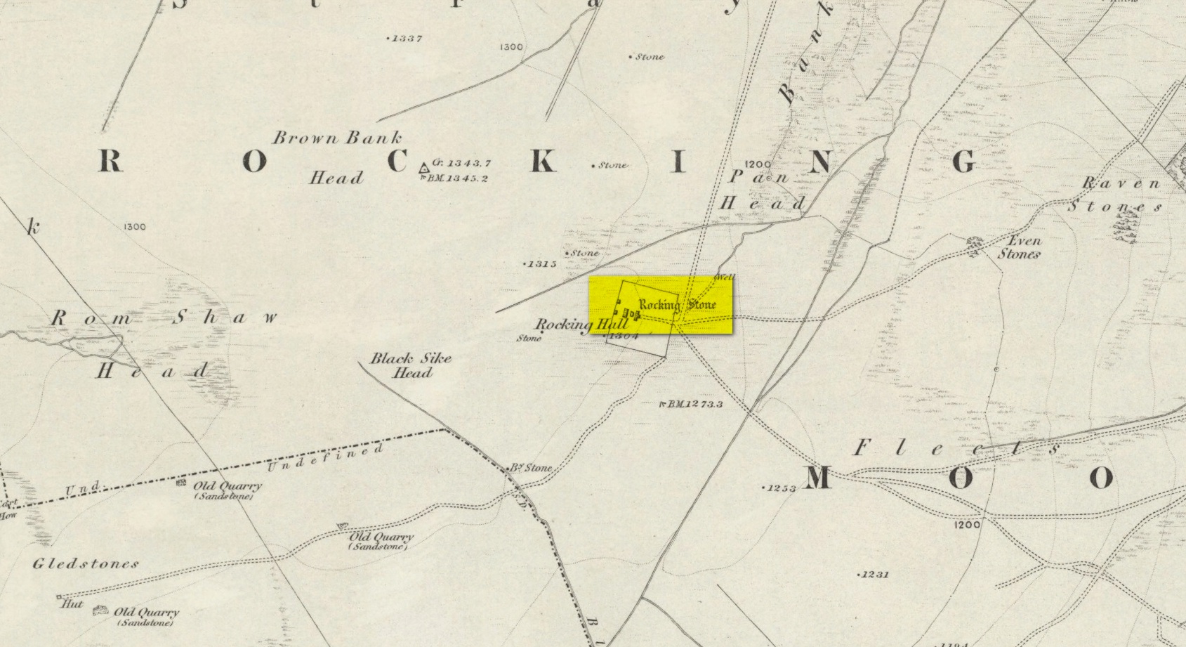
Visiting this site is a bittova walk across the moors, with probably the best route being along one of two footpaths from near the Outdoor Centre following (whichever is your preference) the moorland track or path westward onto the open landscape. Tis a 2½ mile walk before you reach two large buildings stuck high up in the middle of nowhere. Y’ can’t miss them. Equally unmissable is the large blatant rocking stone between the buildings. Gerron top of it!
Archaeology & History
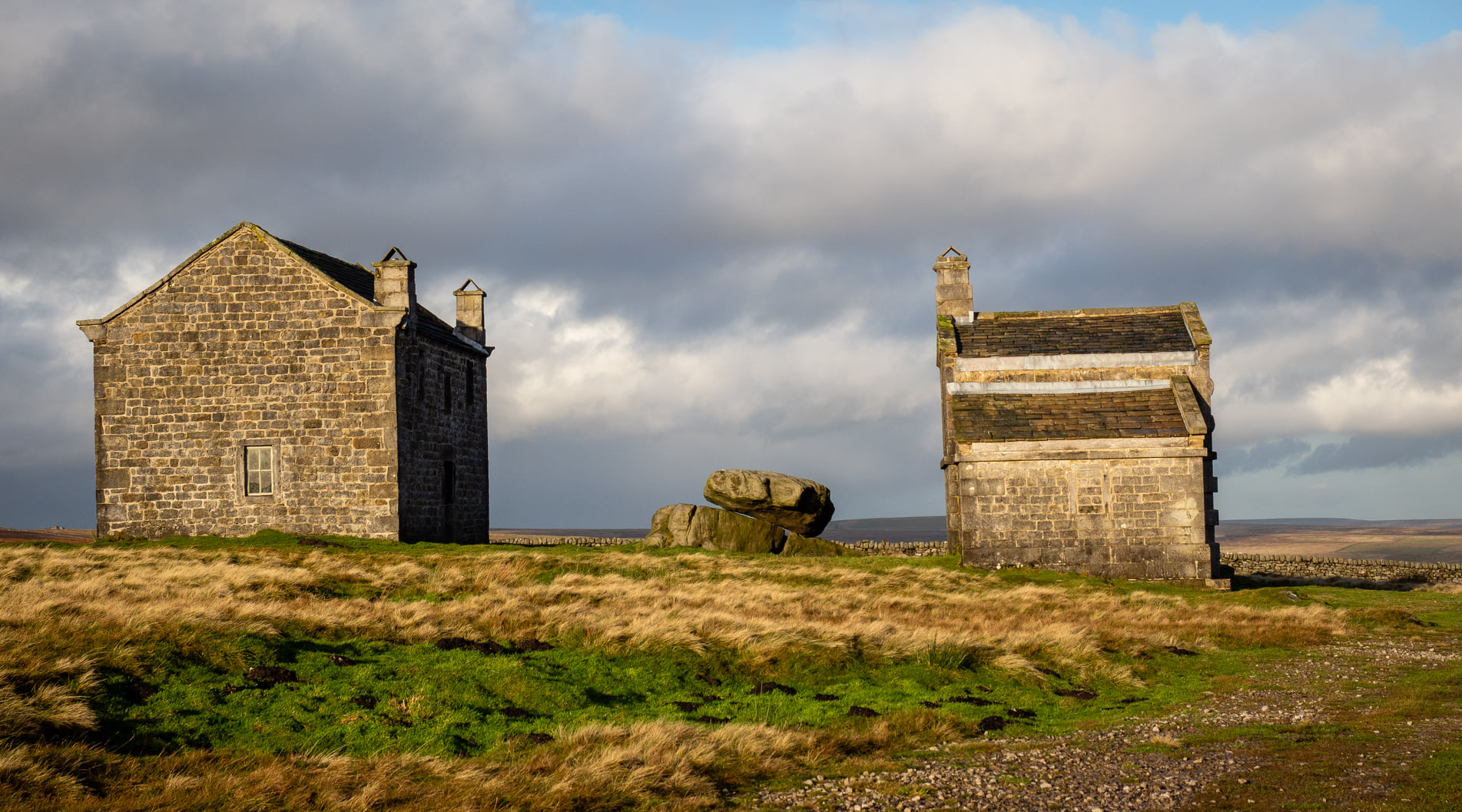
Rocking Stone, in situ
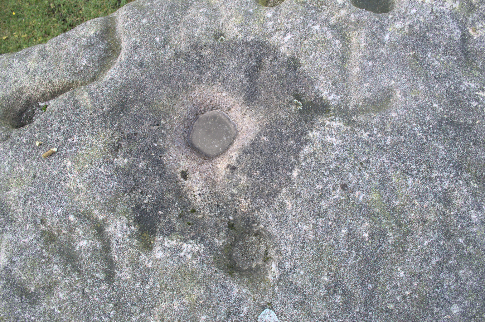
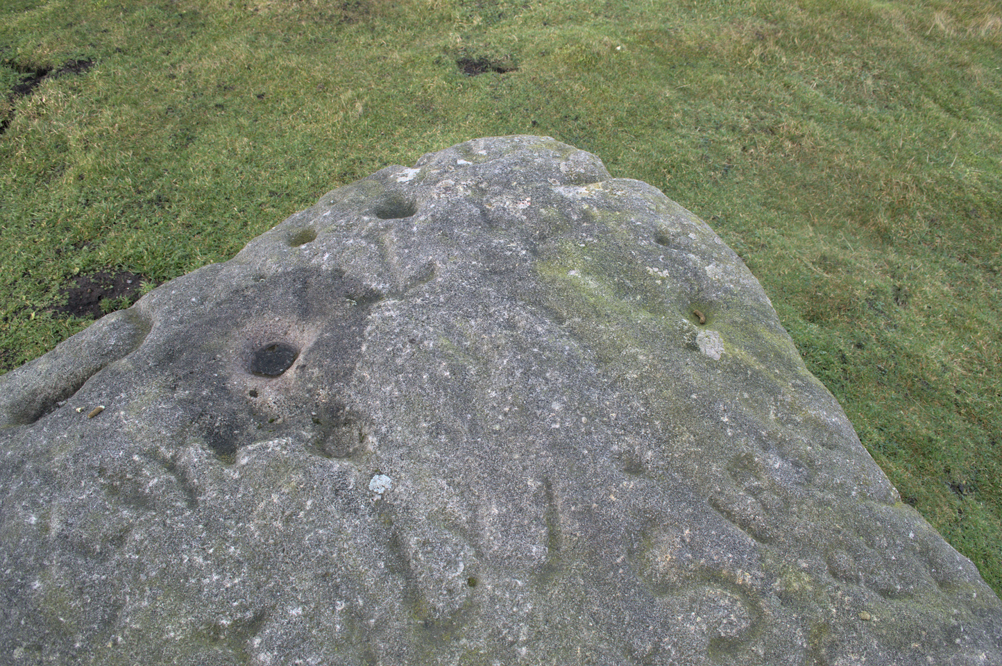
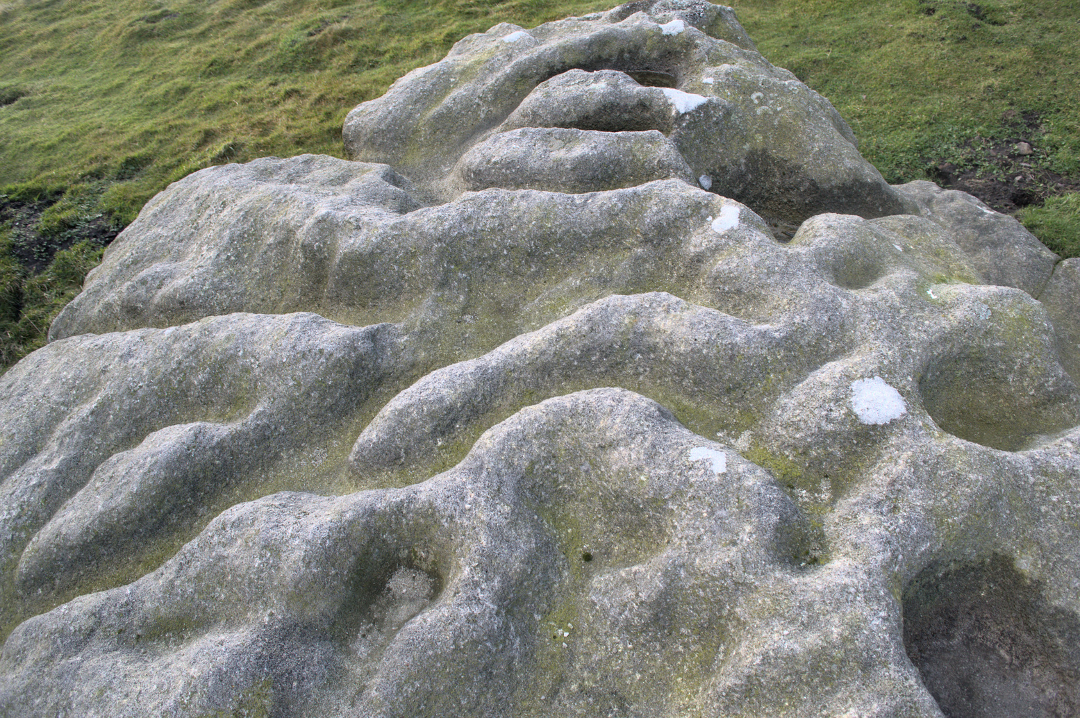
This impressive-looking rock that sits between the two buildings has a number of cup-markings of varying sizes across its topmost surface: some deep and some not-so-deep. There are perhaps as many as 20 of them on different parts of the stone, but some have been intruded on by more recent graffiti. On a recent visit to the site, photographer James Elkington and his young assistant MacKenzie, saw what looked like “a very faint ring around one of the cups” – which doesn’t surprise me. On one section of the stone we see a fascinating series of natural curves and geological undulations, some of which may have been modified a long time ago when the cupmarks were etched. But whether they were added to or not, it’s more than likely they’d have had some significance in the mythic nature of the rock.
The earliest description telling us that this possessed any prehistoric attributes seems to have been written by William Grainge (1871), in his huge work on the history of this region. He told that,
Faint ring highlightedSome of the many cups
“This rock…is eleven feet in length, seven feet six inches in breadth, and two feet six inches in thickness. The whole of the upper surface is thickly indented and grooved with cups and channels; the artificial character of which can be easily seen by anyone. This logan rests upon a lower rock, the upper surface of which is about three feet above the ground, fourteen feet in length, and nearly the same in breadth.”
Folklore
Curvaceous nature & cups
Although this yummy-looking geological sight no longer rocks, it wasn’t always that way. Indeed, according once more to the pen of Mr Grainge, although “it does not rock now, it has done so within living memory” – meaning that it would have been swaying at the beginning of the 19th century. We can only take his word for it. Also, as with many rocking stones the length and breadth of the land this, unsurprisingly it was adjudged to have been a place used by the druids.
References:
Grainge, William, The History and Topography of Harrogate and the Forest of Knaresborough, John Russell Smith: London 1871.