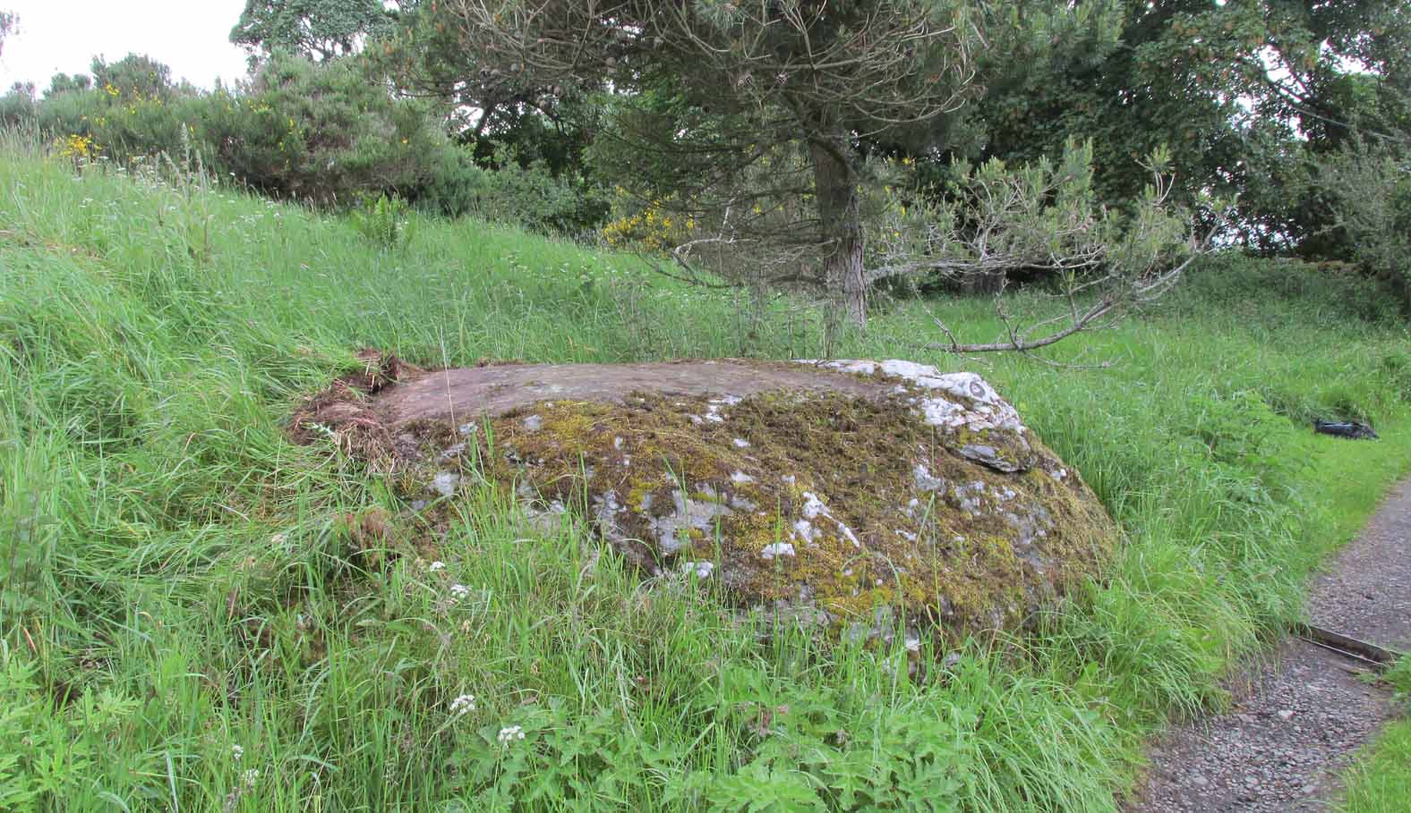
Out of Aberfeldy, take the A826 road as if you’re going up Glen Cochill. Not far up, just where the housing of Aberfeldy itself ends and the green fields open up either side of you, keep on the road for a half-mile where you meet a small copse of trees on your left, with a dirt-track that runs down the slope. Go down here and follow the slightly meandering track for 0.8 miles (1.3km), a short distance past the Ursa Major Stone where the track splits. Take the track to the left and there, less than 100 yards on you’ll hit a large boulder on your left. That’s it!
Archaeology & History
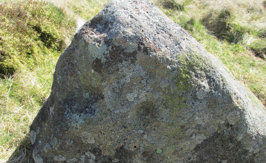
Not previously recorded, this simple cup-marked stone will probably only be of interest to petroglyph aficionados, or those folk who are into ‘energies’ at sites. This latter aspect is due entirely to the carving being etched onto a huge rock, much of which is composed of quartz—which isn’t too unusual in this part of the world. But that aside…
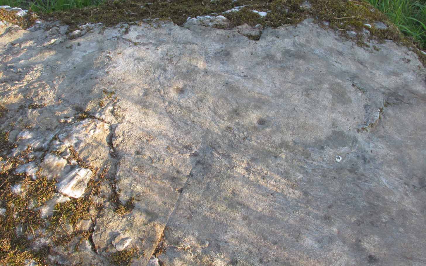
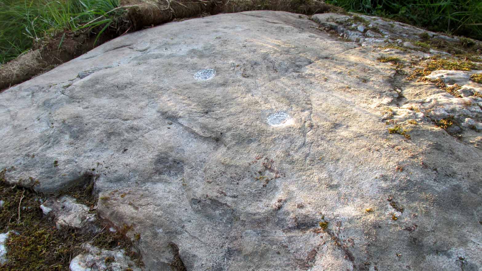
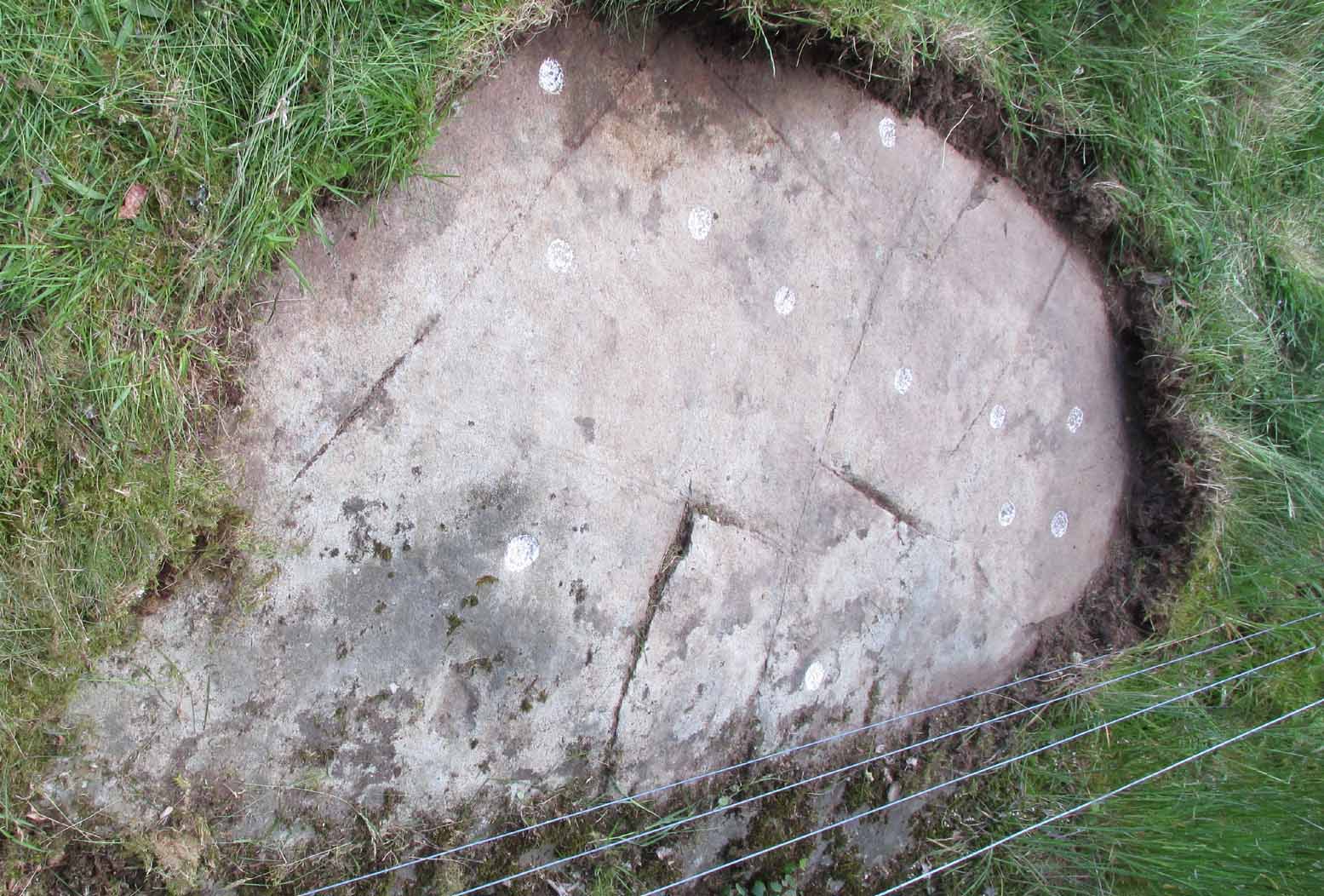
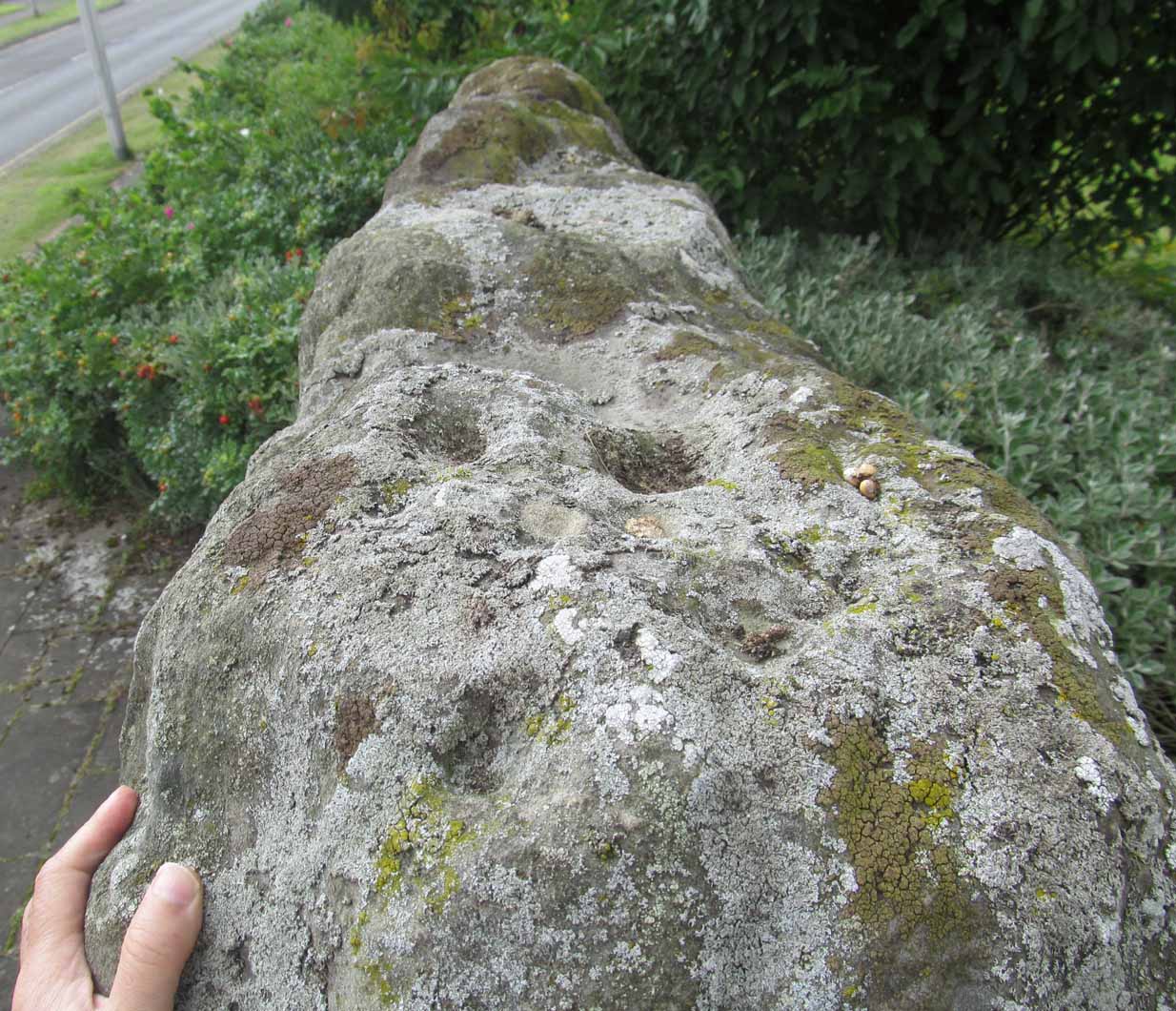
Looking down at the cupsThe cupmarks highlighted
It is one in a group of carvings within a few hundred yards of each other, with its nearest neighbour 20 yards to the north. That one’s covered in cups—but on this large Quartz Stone, only two of them exist, on the top near the centre. Just a couple of inches across and half-an-inch deep, they’re pretty clear once you see them. The raised piece of ground behind the stone is artificial and has variously been described by antiquarians and archaeologist alike, as either a prehistoric dun, or a stone circle. Whatever it may be, some of it is certainly man-made. Check it out – and mebbe ask the friendly fat fella who lives nearby and what he thinks.
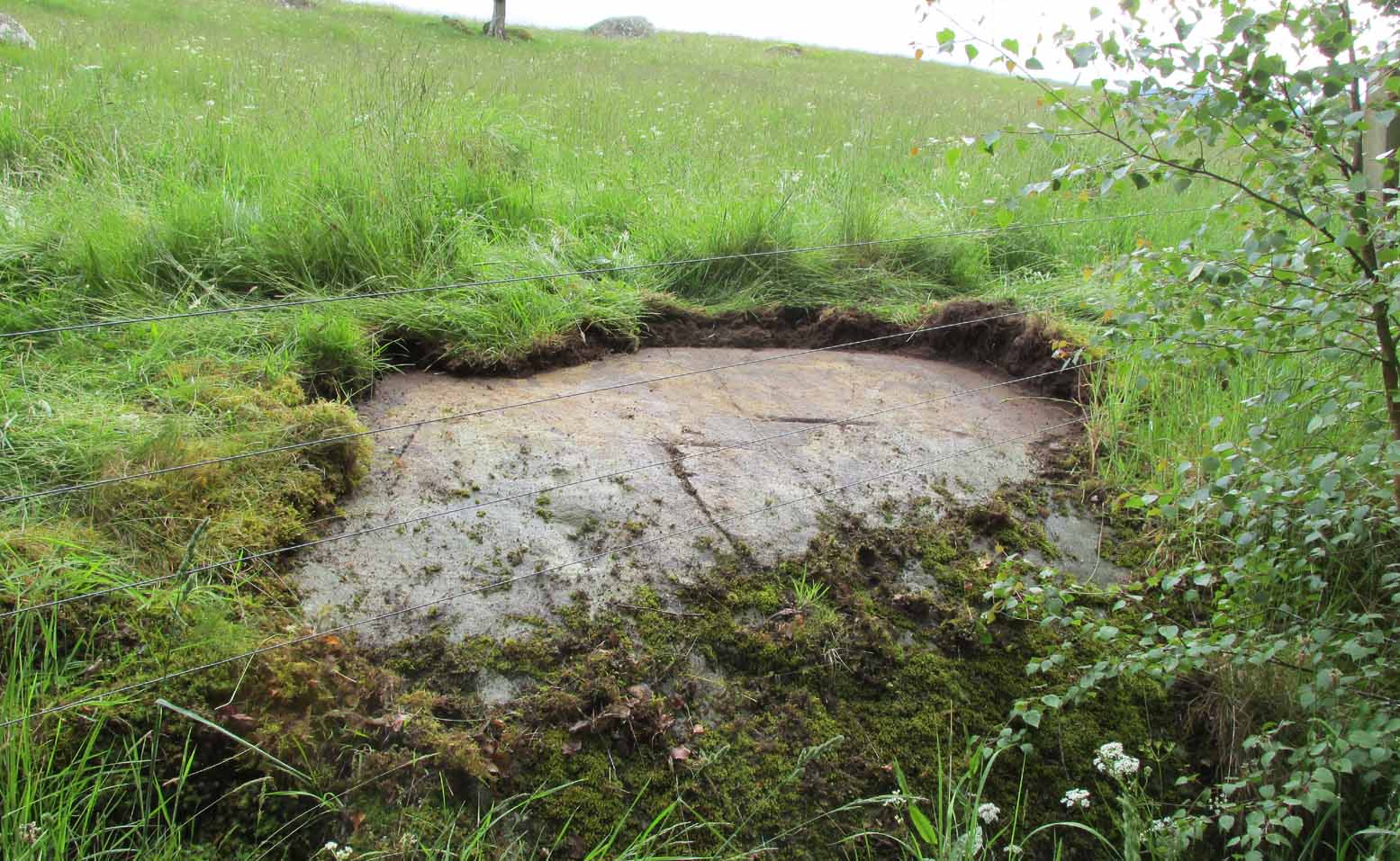
Out of Aberfeldy, take the A826 road as if you’re going up Glen Cochill. Not far up, just where the housing of Aberfeldy itself ends and the green fields open up either side of you, keep on the road for a half-mile where you meet a small copse of trees on your left, with a dirt-track that runs down the slope. Go down the track, bending to the right, then the left and then on for a quarter of a mile until the lines of trees appear either side of you. Barely 200 yards along, the track swerves slowly to your right, and the field above you slopes uphill. Keep your eyes peeled at the fencing on your right and you’ll see a stone sloping towards you right by the fence with faint cup-marks on it. You’ll find it!
Archaeology & History
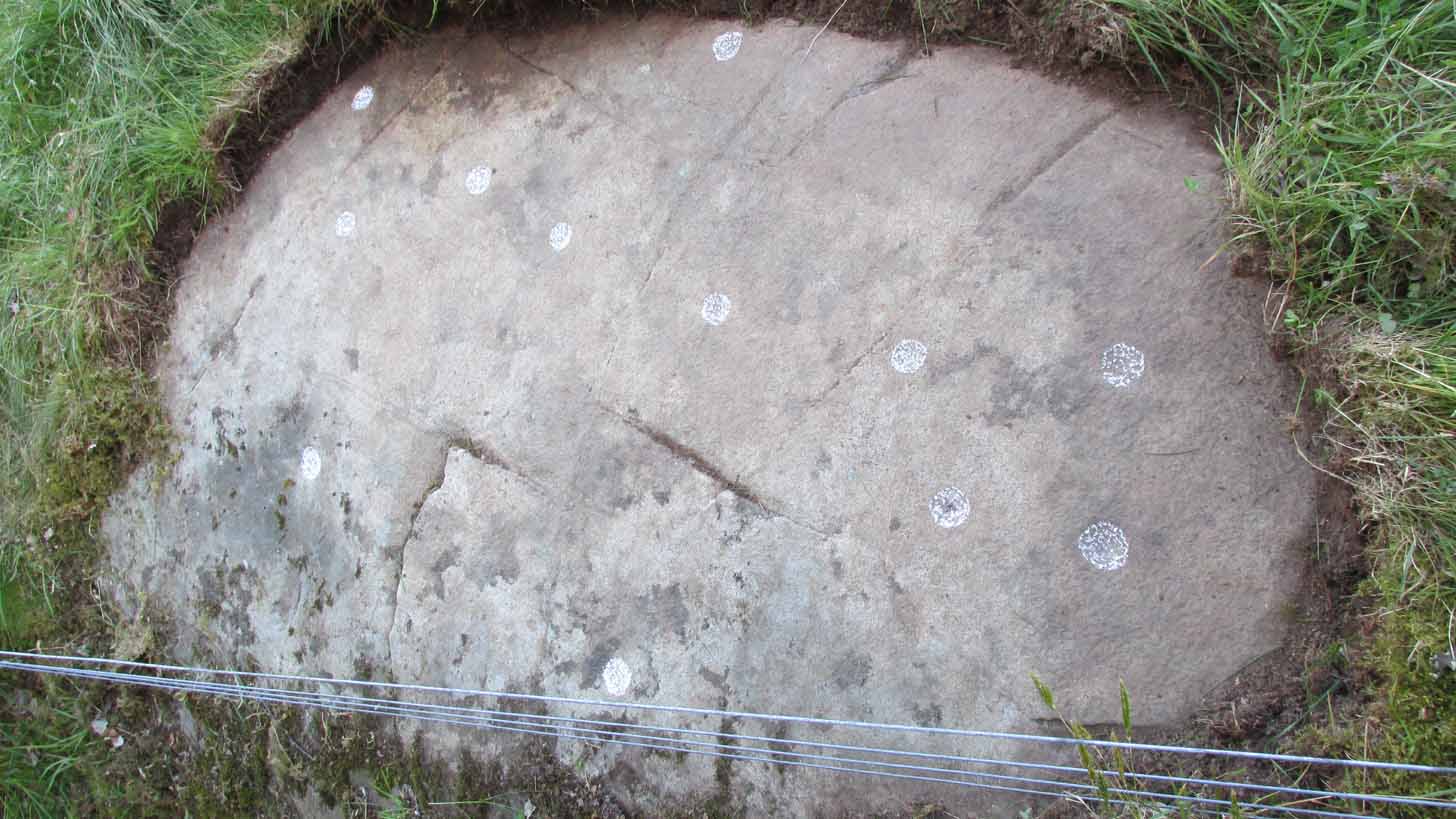
A truly fascinating cup-marked stone recently uncovered by Paul Hornby on another one of our TNA meanderings. Fascinating because of the curious arrangement of the cups on the stone. Often, cup-marked stones have little to interest the causal visitor – but this one’s different. As can be seen quite clearly, the cups are arranged in the shape of the constellation of the Great Bear, or Ursa Major – albeit with an extra ‘star’ in this design. But it’s damn close! In all likelihood (he says with his sceptical head on 😉 ), the design is fortuitous when it comes to the Ursa Major. I know from many years experience how easy it is to see meaningful shapes and designs in the almost entirely abstract British petroglyphs, but the design is very close to the constellation we all got to know when we were kids.
Looking along the stoneGazing down at Ursa Major
The stone itself slopes upwards at an angle of about 60º, before starting to level out as it rises. All of the cup-marks have been pecked onto this sloping surface (the vast majority of carvings are found on top of stones). Altogether, at least twelve faint and shallow cups were exposed when we looked at it—measuring the usual inch to inch-and-half across—but it is likely that more of them are hidden beneath the turf at the top of the stone. We could discern no rings or other features in the design.
This is just one carving amidst a good cluster of petroglyphs within a few hundred yards of each other (the Quartz Stone being one of the nearest) that are well worth checking out if you like your rock art. It may also be of interest to astronomy students, or those exploring archaeo-astronomy.
References:
Yellowlees, Sonia, Cupmarked Stones in Strathtay, RCHAMS 2004.
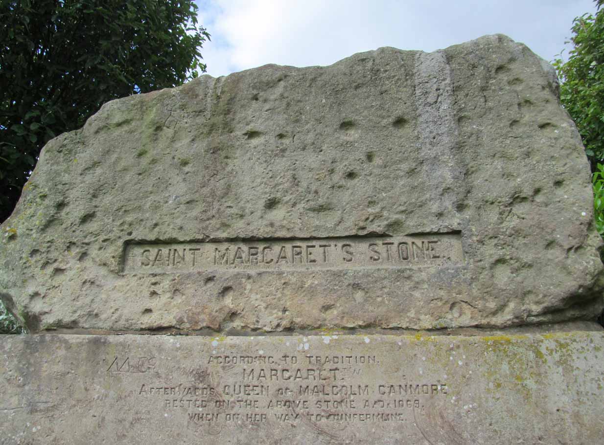
Take the A823 road out of Dunfermline south towards Rosyth. A half-mile before you hit the motorway roundabout, at the roundabout where Carnegie Avenue takes you east, turn west and park up along the road where the modern business park lives. 30-40 yards from the roundabout, set back on the pavement, you can’t really miss the huge flat slab of stone, covered in cup-markings, resting on a stone plinth with ‘St Margaret’s Stone’ stamped on it!
Archaeology & History
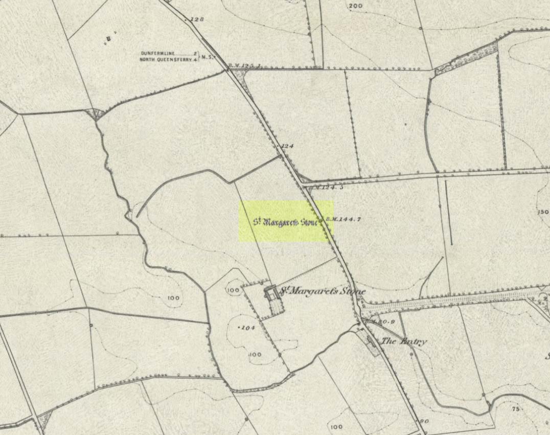
On the 1856 OS-map of this area, St Margaret’s Stone is shown at the roadside just above a farm of the same name, a short distance away from its present location. In October 1879, Alexander Stewart (1889) told us that funds were raised and steps taken to properly fix and preserve this ancient ‘resting-place’ of Queen Margaret on the Queensferry Road. It was quite a few years later before it was moved the few hundred yards further to its present location.
Cups on stone’s edge
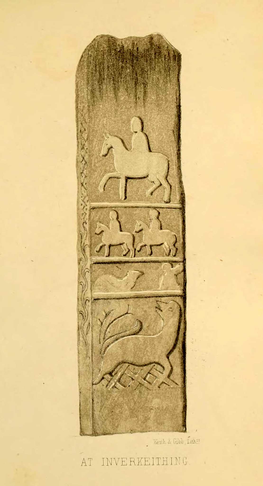
Early writers tell us that originally its position in the landscape was on the crest of one of the rises in the land between Dunfermline and the sea, making it visible for some considerable distance. This would seem to have been a deliberate placement. In my mind, and in accordance with the placement of many a prehistoric tomb, St Margaret’s Stone may originally have been part of a neolithic or Bronze age cairn, long since gone. The size and shape of the rock implies it too, with similarities here of the impressive cist or gravestone found inside the Netherlargie North cairn at Kilmartin. However, this wasn’t the thought of the prodigious Scottish historian, William Skene. He thought that St Margaret’s Stone originally stood upright, being a Pictish-style standing stone that was mentioned in the first Statistical Account of the area. The brilliant Scottish antiquarian, John Stuart (1856)—who gave us an illustration of the ‘standing stone’ in question—told us:
“It has been supposed by some that “St. Margaret’s Stone,” a block now lying on the side of the highway leading from Inverkeithing to Dunfermline, and about midway between these places, can be identified with the standing stone referred to in the Statistical Account. Mr Skene has noted below a sketch of St. Margaret’s Stone:- “The sculpture upon this stone has been lately chipped off in mere wantonness, so as to leave few traces of the subject recorded upon it.” He farther states that it formerly stood erect, and was called “The Standing Stone.” According to Mr. Skene’s measurement, St. Margaret’s stone is about nine feet and a half in length, one foot in thickness, and four feet broad at the widest end, and broken off to a narrow point at the other.”
The missing ‘standing stone’
In this instance, Skene was confusing St Margaret’s Stone with the lost Pictish monolith (left) that used to exist nearby, which had carved horse figures and other memorial designs upon it and which he thought had faded away. Whereas the large slab we are looking at here, and which Skene visited and measured, is covered on one side by a gathering of prehistoric cup-markings—much earlier than any Pictish or early christian carvings. At first glance, it seems that some of these cups may well be natural, but it has to be said that some of them are distinctly man-made. And if we were to believe the archaeo-accounts of the stone, the cupmarks are only to found on one side of the stone. This is incorrect. As we can see here, a number of cupmarks run along the edge of the stone. We cannot say for sure whether all of them are artificial, but they certainly look like it! Also, on the other side of the flat surface, one or two single cups are visible. It would be good if we could get an artist to give us a detailed impression of the prehistoric carvings without the modern engraving of St Margaret’s Stone etching on the main face. (is there anybody out there!?)
The Royal Commission (1933) lads visited the stone in 1925 and, several years later in their write-up, told us simply:
“This stone…stands with its main axis due north and south and measures 8 feet 6 inches, by 4 feet 7 inches, by 1 foot 6 inches. On one side the entire surface is cup-marked, the markings varying in size from 1¼ inches to 3¼ inches and having an average depth of from ½ to ¾ inch.”
When the Scottish petroglyph writer and explorer, Ron Morris (1968) came to the site, he gave it an equally brief description, merely telling us:
“On standing stone (8 1/2 feet high, 4 1/2 feet wide), built in to roadside fence, over 80 cups, up to 4in in diam, 3/4in deep, some run together as rough dumbells.”
It’s well worth checking out!
Folklore
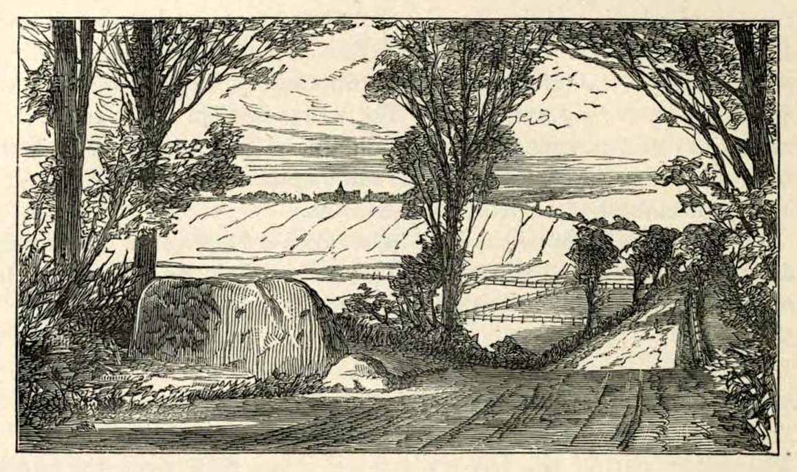
St Margarets Stone in 1825
When the Saxon Queen Margaret landed on the shores just west of Queensferry at Rosyth Castle (NT 1087 8200), legend reputes that she and her entourage made Her way north towards Dunfermline. Halfway along the ancient track She rested at this large stone which, thereafter, gained the name by which we know it today. It was said that Queen Margaret subsequently visited the stone on a regular basis for periods of solitude. The tale probably has some germ of true in it. Additional ingredients also told that,
“The large stone here is associated with St Margaret and was visited by women who hoped to conceive or sought a successful birth. The eight-foot high stone is said to mark the resting place of St Margaret when she journeyed between Queensferry and Dunfermline. Margaret had eight successful pregnancies and probably needed to rest quite a few times on her travels!”
The fertility aspects of the rock were not the only pre-christian virtues attached to it. We also find that oft-cited motif of rocks moving of their own accord: in this case, as J.B. MacKie (1905) told us, local people had always
“been told that the stone rose from its bed and whirled thrice round in the air every time it heard the cock at the adjoining farm crow.”
Cocks crowing are symbolic of sunrise, obviously, and this lore may simply represent a folk memory of the spirit in/of the stone being animated at that time of day. It’s a motif found at ancient sites all over the place!
Royal Commission Ancient & Historical Monuments of Scotland, Inventory of Monuments and Constructions in the Counties of Fife, Kinross, and Clackmannan. HMSO: Edinburgh 1933.
Rupert-Jone, John A., Rosyth, A. Romanes: Dunfermline 1917.
Stewart, Alexander, Reminiscences of Dunfermline and Neighbourhood, Scott Ferguson: Edinburgh 1889.
Along the A65 near Draughton, go (south) uphill at Height Lane until it levels out. ¾-mile (1.2km) up, a modernized stone milepost is where the road crosses the ancient Roman Road. From here, walk west for just over a mile (1.8km), past the trees on your right, until you approach another small copse further along on your right. In the field just before the copse, walk uphill until you reach the highest of the two rises and walk about. You’re damn close!
Archaeology & History
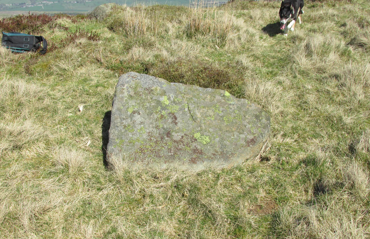
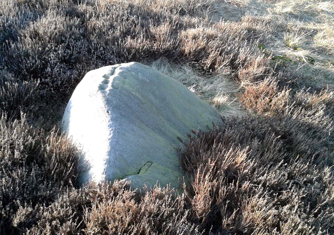
Nor Hill cupmarked stoneCupmarks, top & side
This small cup-marked rock was rediscovered by Chris Swales in April 2018. It’s probably only for the purist petroglyph fanatics amongst you, consisting of just a single cup-mark on its vertical west-face, and another near its top western edge. Official records show no other carvings in the immediate vicinity, but local antiquarians may find it profitable in surveying the area for other potential remains.
The quickest way to get here is to follow the directions to the Sharp Haw Trig Stone. From the Trig Stone keep heading down the footpath until you see the gate at the bottom. Go through the gate and Rough Haw is straight in front of you. Head towards Rough Haw and you will see a track going straight up the middle. Go right up that track and over the top till your on the summit, keep walking forward about 50-60 yards and you will see it.
Archaeology & History
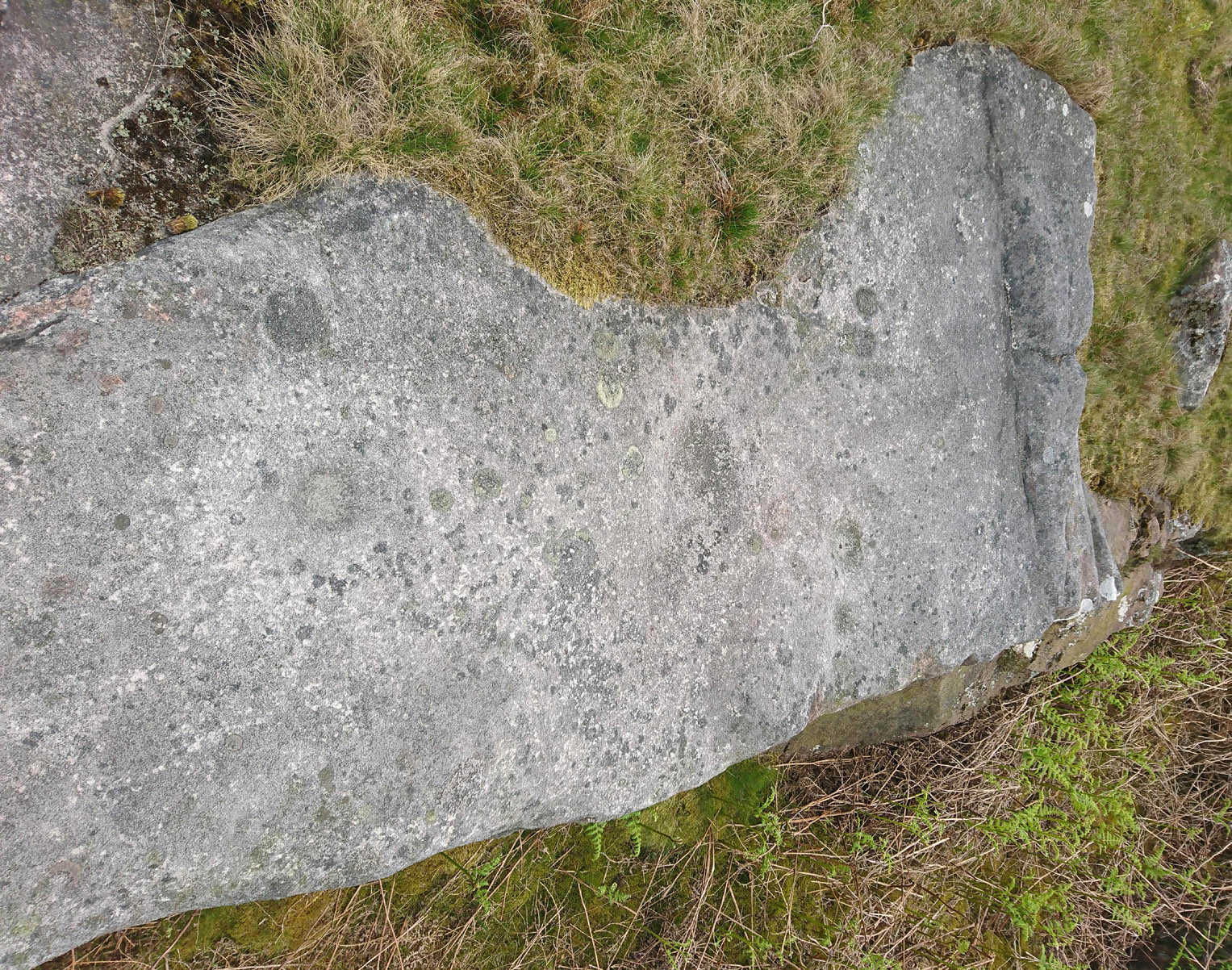
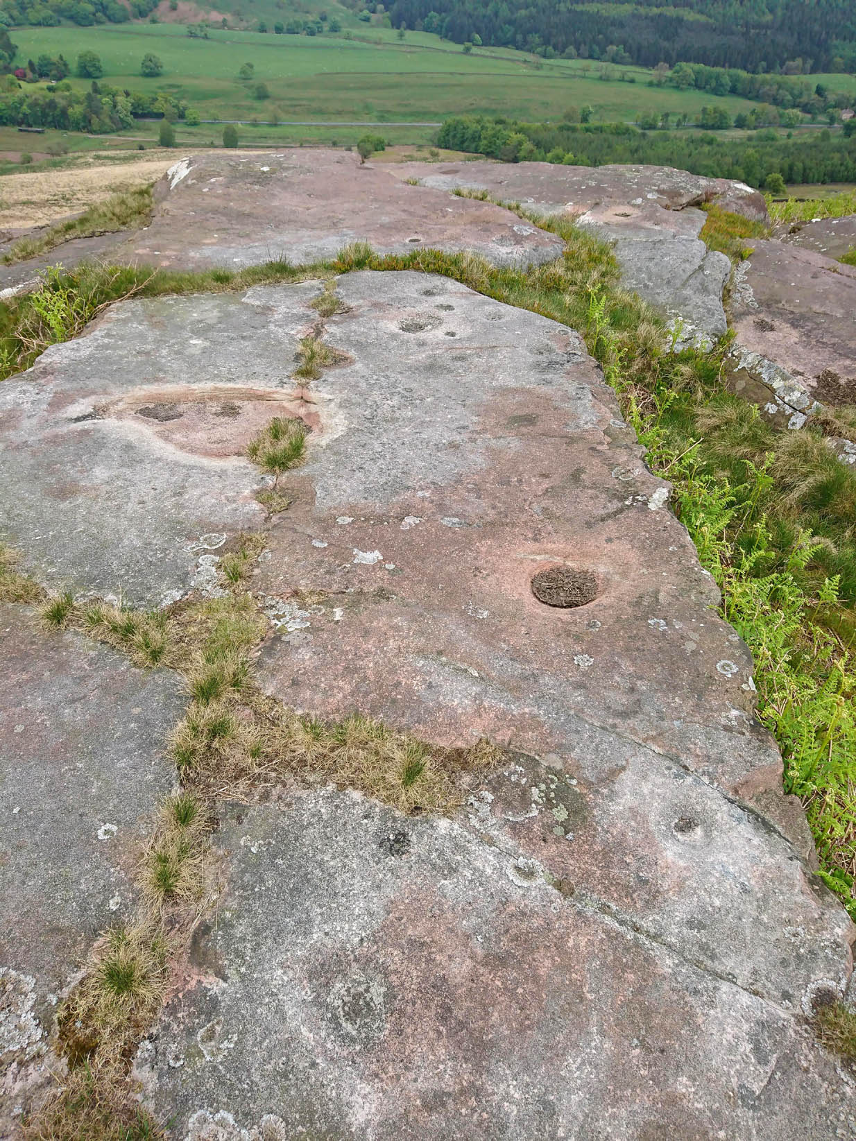
Second lot of cups
Some petroglyphs have been found near the top of the prehistoric Iron Age settlement called Rough Haw, a few miles north of Skipton. Not previously recorded, this long flat stone and its companion are littered in cup markings (perhaps a couple of dozen). There could be more cups and other markings than we saw today, but by the time we reached here the sun had disappeared, so poor daylight made it difficult to see if there were any more. Another venture up onto this hillfort might be worthwhile to see if anymore can be found.
Along the moorland road between Cow & Calf and The Hermit pub, park up at the small wooded bit by the right-angle bend and cross over the Coldstone Beck. Walk up onto the moor itself and stick to the path that runs roughly parallel with the slowly-drying stream, towards Lower Lanshaw Dam. About 100 yards before it, walk left, into the heather, for about 50 yards. You’re damn close!
Archaeology & History
Lower Lanshaw Dam carvingClose-up of cupmarks (by James Elkington)
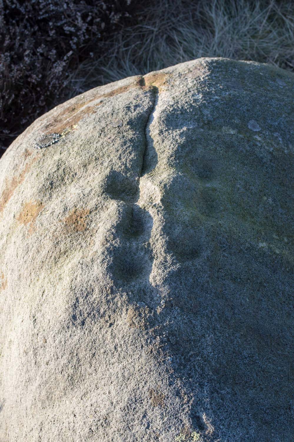
This is another neolithic or Bronze Age carving I first came across during one of my weekly rambles across these hills as a child, and upon revisiting the place a few days ago with James Elkington, found it associated with nearby cairns and what looks to be the remains of prehistoric walling – none of which I noticed when I was a kid. The petroglyph is a simple design, primarily consisting of two rows of three cup-marks: one row of three along the top or spine of the rock, and another one immediately beneath it, an inch or so below. The topmost line of cups runs into a natural crack in the rock, which runs down the northwest edge of the stone. A possible faint cup and partial ring emerges on the southeast side of the topmost row of cups, but this is difficult to make out. On the sloping northwest face of the rock is another single cup-marking.
References:
Bennett, Paul, Of Cups and Rings and Things, unpublished: Shipley 1981.
Acknowledgements: Many thanks to James Elkington for use of his photo to illustrate this petroglyph
Take the same directions as if you’re visiting the Lanshaw Dam 2 petroglyph, then keep walking directly towards the Lanshaw Dam, 130 yards east. Halfway between the two, closer to the footpath, look out for a stone of similar shape and dimensions to Lanshaw 2, just by a prehistoric cairn. You’ll find it!
Archaeology & History
Cup-marked stone & cairnClose-up of cup marking
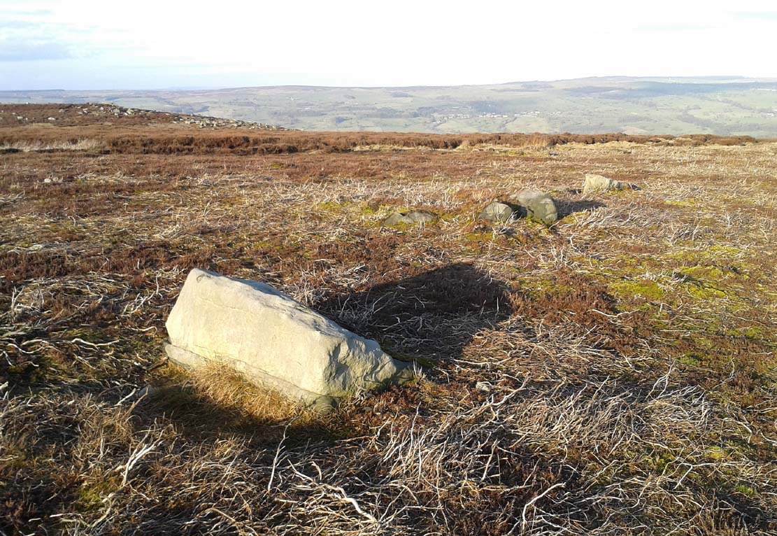
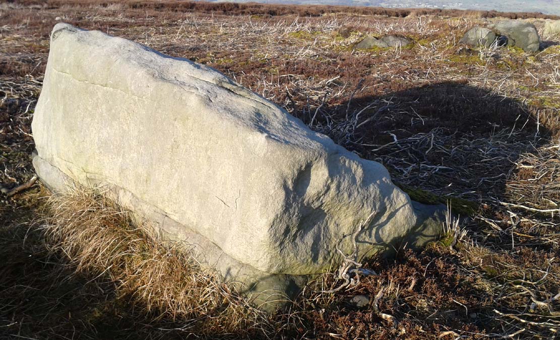
As with a great number of petroglyphs in and around Yorkshire, this large single cup-marked rock is found in close association with a reasonably large prehistoric cairn (several others are close by), some 3 yards in diameter. The cup-marking here is larger than yer average cup-mark on these moors, being four inches across. It can clearly be seen on the southern vertical face of the rock and doesn’t appear to have been recorded before. On the whole, it’s nothing special to look at and is probably just one for the petroglyphic purists amongst you.
The quickest way here is bedevilled with troublesome parking (and an unhelpful local at Malling Cottage). That aside, roughly halfway along the A81 between the Braeval roundabout (near Aberfolye) and Port of Meneith, turn down the track at Malling, following it round for 300 yards through the farm, then another 500 yards or so until you reach a junction with a gate on your left. Walk down the track to your right, roughly alongside the Lake of Menteith, for nearly 700 yards until you reach the gate into the forestry commission land. Go thru the gate and turn immediate right, following the fence for about 200 yards where a clump of stones lives. You’re there!
Archaeology & History
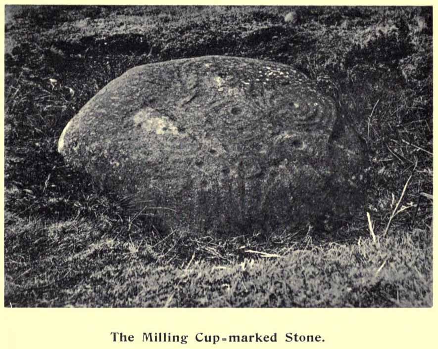
The Peace Stone in 1899
This seemingly isolated petroglyph, known about by local people in the middle of the 19th century and earlier, was said to have been “held in great reverence.” It was first mentioned in literary accounts in 1866, when the oral traditions about it were more important than any archaeocentricism. But things change with the times: local people were kicked off their lands, old stories and knowledge of sites were lost, and the ‘discipline’ of archaeology was beginning to look at these curious carved rocks with puzzled minds.
The Peace Stone was described at some length and with considerable accuracy in Mr A.F. Hutchison’s (1893) gazetteer on the ancient stones of Stirlingshire. It was one of the regions only known petroglyphs at that time and thankfully he gave us a good account of it, saying:
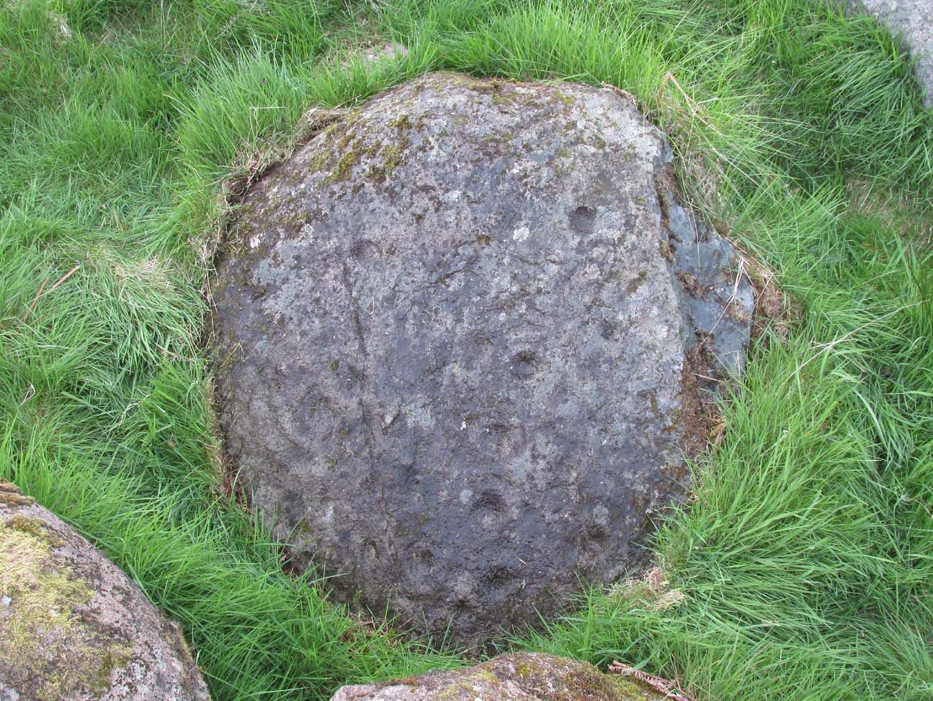
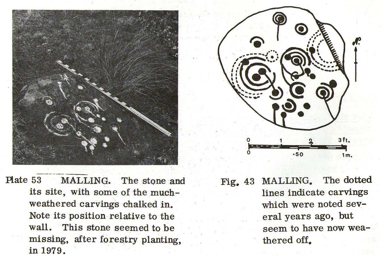
“On the west ride of the Lake of Menteith, about half a mile south from the farm-house of Malling, this stone is to be found, lying at the boundary of the arable land. The ground at the place rises into a slight eminence, on the top of which the stone lay till some seven or eight years ago, when a labourer took it into his head that a stone on which so much labour had evidently been spent must have been intended to cover something valuable. He proceeded to excavate the earth at the side with the intention of getting at the buried treasure, with the result that the stone slipped down into the hole which he had made, where it now lies. It is quite possible, however, that an interment, if no treasure, might be found beside it on further research. The stone is roughly circular on the surface, measuring about 4 feet in diameter. It is entirely covered with cup and ring marks—22 cups in all—varying in size from an inch to two inches in diameter. The cups and rings are very symmetrically formed. Nearly in the centre is a fine one surrounded by four circular grooves. Others have incomplete triple and quadruple circles, with radial duct dividing them. There are other curious curves that sometimes interlace, and near the lower side of the stone are five or six cups with straight channels running out from them over the edge. This is an extremely interesting stone. It is unique in our neighbourhood, so far as I know, in showing these symmetrical carvings. They are now, however, much weather-worn.”
Ron Morris’ sketch & photoClose-up of faded cups
When Alison Young (1938) came to write about the carving, she echoed Hutchison’s thought that the stone might originally have covered a tomb—but we simply don’t know and it should be treated as guesswork, as there are no known prehistoric tombs anywhere hereby.
Years passed before the next archaeological visit – by which time the stone had been uprooted and moved, apparently “ploughed up by the Forestry Commission”, and when Ron Morris (1981) last sought it out found that “the stone was un-traceable”. On a previous visit, before being moved, he found it to be,
“a cup-and-three-rings, 3 cups surrounded by two rings…and 6 cup-and-one-ring. One of these and 2 cups form part of the design of the cup-and-three-rings. There were also at least 7 other cups, and a number of grooves, some forming lines from a central cup, or a cup-mark, downhill. Greatest diameter visible in 1977 30cm (12in) and depth of carving 3cm (1 in)… Many of the carvings are so weathered as to be visible only when wet in early morning or late evening.”
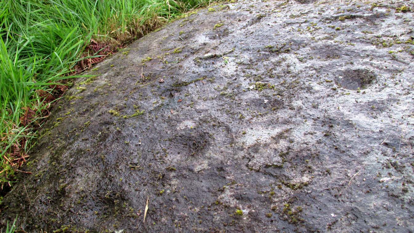
And when we visited the site a few days ago, the stunning sunlight that had followed us all day, sadly faded and disallowed us better photographs of the site. Huge apologies…. But it’s worth visiting when the daylight’s good, perhaps when you’re exploring the huge number of brilliant petroglyphs at Ballochraggan and Nether Glenny on the hillside 1½ miles immediately north of this “outlier”, as Brouwer & van Veen (2009) called it.
Folklore
In a landscape bedevilled with stunning petroglyphs, traditions and folklore of them is all but gone; but the story of the Peace Stone was thankfully captured in words by Mr Dun (1866), who told us:
There is a curious prophecy connected with a stone situated near the ruins of the chapel of Arnchly, and which is worth recording. From time immemorial this stone went under the name of the Peace Stone, and it was held in great reverence by the natives. One Pharic McPharic, a noted Gaelic prophet, foretold that, in the course of time, this stone would be buried underground by two brothers, who, for their indiscretion, were to die childless. By-and-by the stone would rise to the surface, and by the time it was fairly above ground, a battle was to be fought on “Auchveity,” that is, “Betty’s Field.” The battle was to be long and fierce, until “Gramoch-Cam” of Glenny, that is, “Graham of the one eye,” would sweep from the “Bay-wood” with his clan and decide the contest. After the battle, a large raven was to alight on the stone and drink the blood of the fallen. So much for the prophecy then; now for the fulfilment. About fifty years ago, two brothers (tenants of the farm of Arnchly), finding that the stone interfered with their agricultural labours, made a large trench, and had it put several feet below the surface. Very singular, indeed, both these men, although married, died without leaving any issue. With the labouring of the field for a number of years, the stone has actually made its appearance above ground, and there is at present living a descendant of the Grahams of Glenny who is blind of one eye, and the ravens are daily hovering over the devoted field. Tremble ye natives! and rivals of the “Hero Grahams,” keep an eye on Gramoch-Cam!
The name of Betty’s Field came from an earlier piece of folklore: where a prince out hunting a stag was caught in one of the deep bogs hereby, only to be rescued by a local lass. In return for her help, she was given a large piece of land which was to bear her name.
References:
Armit, Ian, “The Peace Stone (Port of Menteith parish),” in Discovery & Excavation Scotland, 1998.
Dun, P., Summer at the Lake of Monteith, James Hedderwick: Glasgow 1866.
Hutchison, A.F., “The Standing Stones and other Rude Monuments of Stirling District,” in Transactions Stirling Natural History & Antiquarian Society, volume 15, 1893.
Hutchison, A.F., The Lake of Menteith: Its Islands and Vicinity with Historical Accounts of the Priory of Inchmahome and the Earldom of Menteith, Stirling 1899.
Maitland, Mrs, “Cup Marked Stones”, in The Scottish Country Woman, 1935.
Mallery, Garrick, “Pictographs of the North American Indians,” in Bureau of Ethnology of the Smithsonian Institution, volume 4, 1886.
Morris, Ronald W.B., The Prehistoric Rock Art of Southern Scotland, BAR: Oxford 1981.
van Hoek, Maarten, “Menteith (Port of Menteith parish) Rock Art Sites,” in Discovery Excavation Scotland, 1989.
On the main road (A94) through Scone, go east along either Murrayshall Road or Bonhard Road for a short distance until you go out of the town and into the countryside. About ⅓-mile (0.5km) along the country lane, go left at the road junction; and just another ¼-mile on, notice the field-gate on your left. As you’ll see, the standing stone is just over 100 yards away in that field.
Archaeology & History
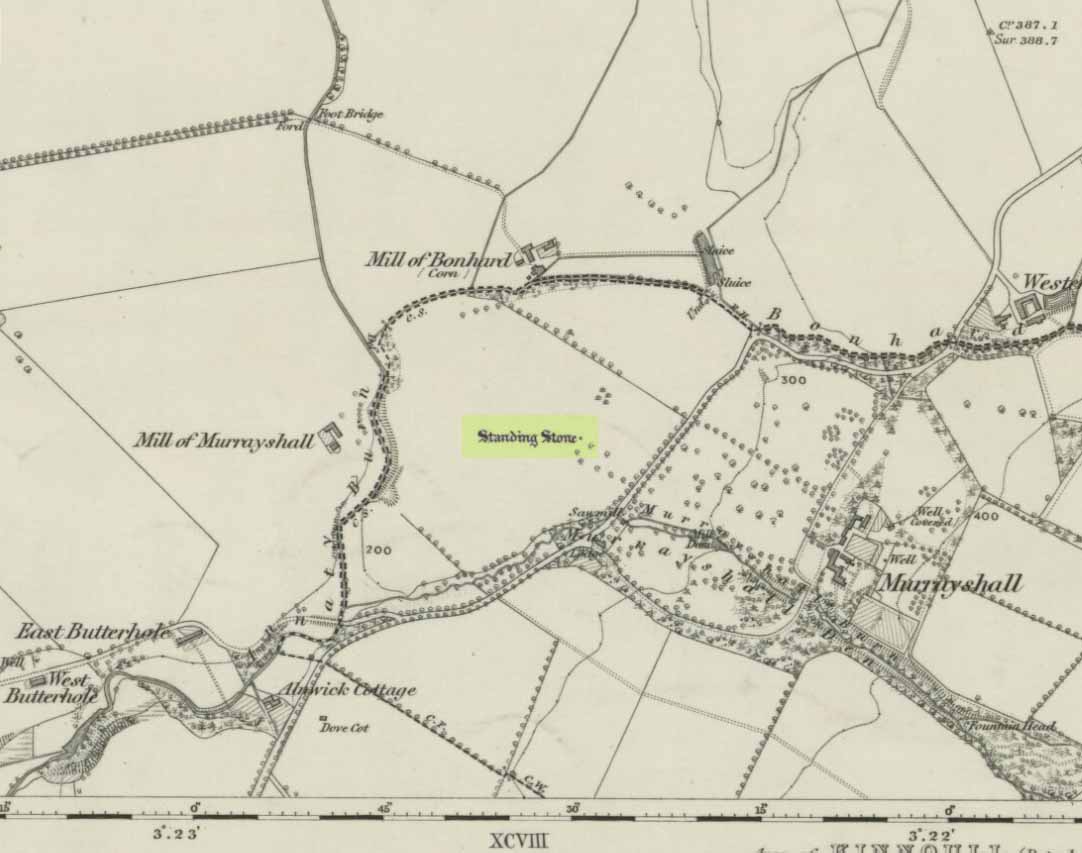
Murrayshall on 1867 map
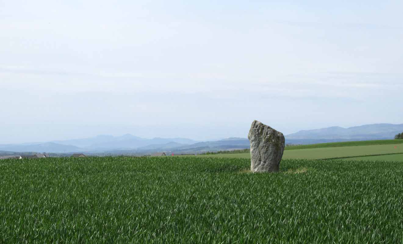
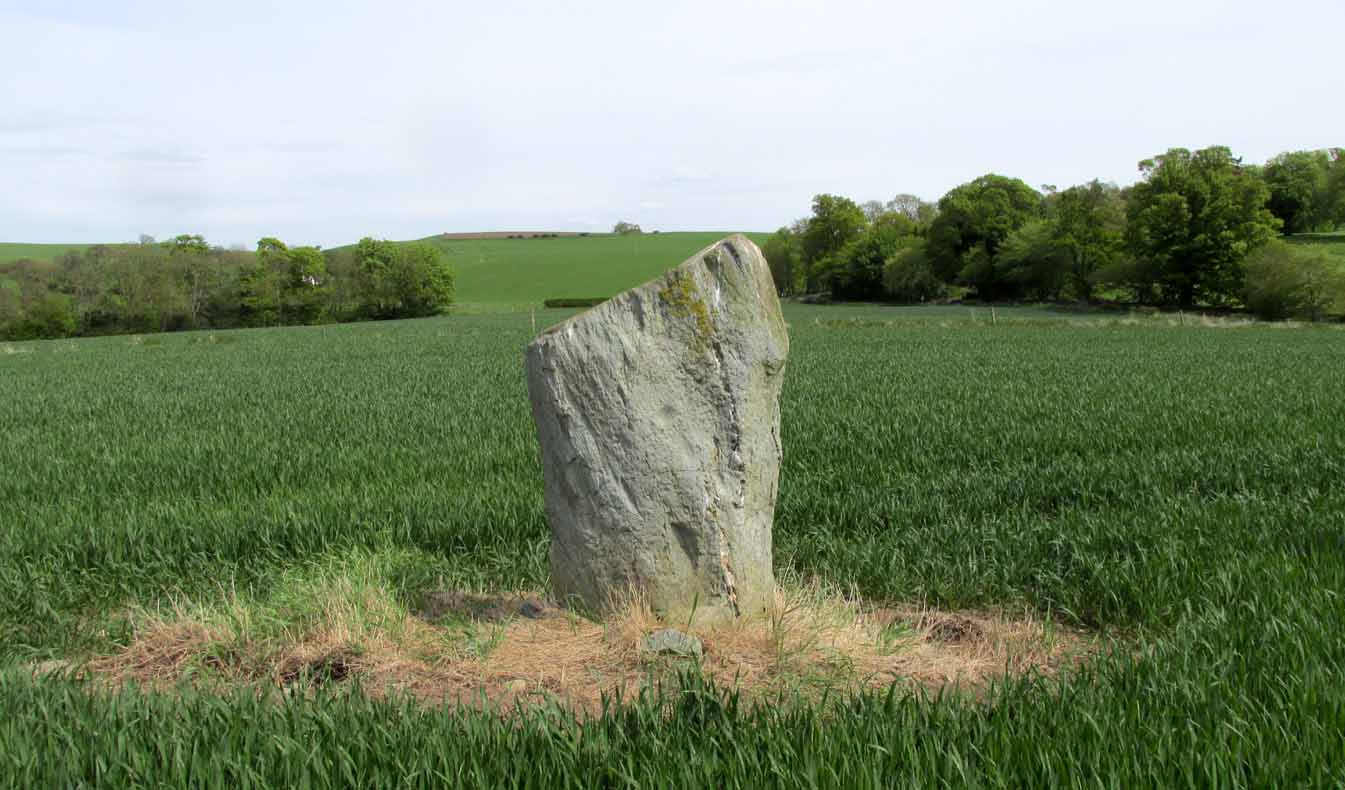
In a region littered with megaliths, this fine upright single stone stands, quite deliberately, at a point in the field where you have excellent 360° views, which to the north looks way into the orgasm of the Scottish mountains. History and tradition seem to tell it has always been a loner, without companions, but no archaeological excavation has taken place here to my knowledge; and the apparent proximity of some type of prehistoric ring-ditch 30 yards away may be related to the stone. But we don’t for sure…
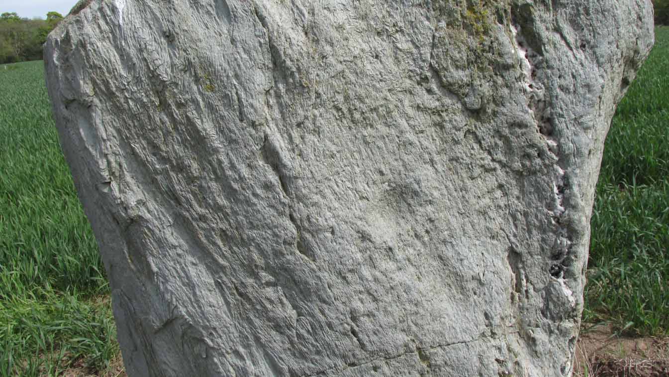
Close-up of cupmark
North-face with cupmark
Despite being shown on the first OS-map of the region in 1867 and despite being a large monolith more than 6 feet tall, very little seems to have been said of it. It was included in Swarbrick’s (2012) poorly arranged survey; and the Royal Commission (1994) merely listed it, without comment, other than to say “it bears no markings.” Yet when Paul Hornby and I visited the place recently, a large single cup-mark is plain to see on the north-face of the stone.
Although the stone is alone in this field, once you start exploring the hills a short distance to the south and the farmed fields heading north and east, masses of prehistoric sites begin to appear. It’s well worth checking out!
References:
Royal Commission on the Ancient & Historical Monuments of Scotland, South-East Perth: An Archaeological Landscape, HMSO: Edinburgh 1994.
Swarbrick, Olaf, A Gazetteer of Prehistoric Standing Stones in Great Britain, BAR: Oxford 2012.
Acknowledgements: Huge thanks as always to Paul Hornby for getting us to this site. Plus, accreditation of early OS-map usage is reproduced with the permission of the National Library of Scotland.
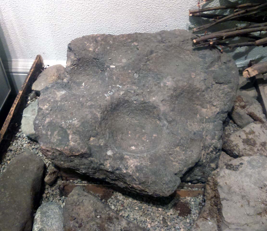
This is a curious stone and may not be the type of ‘cup-marked’ rock we’re used to. Maybe… It is presently housed in Stirling’s Smith Art Gallery & Museum, where a small note tells that is was originally found “on the top of the Ochils, near Mount Alt Farm, Path of Condie in 1893.” The stone was found at the same time, and adjacent to, a prehistoric collared urn—which implies it had an association with a cairn or cist, or burial site of some sort (which isn’t uncommon). However, the exact location of its original whereabouts has been forgotten.
Broken off from a larger piece of stone, the remaining piece of rock has six cup-markings cut into it, between one and three inches across. The smallest cup is what we might call a ‘normal’ size, but the rest of them get increasingly large and may have been more functional than purely mythic in nature. In a small note attached to the stone in the Museum, they add the interesting note that,
“There are…indications that in some places they may be related to transhumance: the practice of moving sheep, cattle and goats to higher pastures in the summer, where they may have been used to mark routes or sources of water.”
They may indeed – amongst a variety of other things too. But the suggested relationship with cattle occurs in stones found near Haworth, West Yorkshire, where large man-affected carved ‘cups’ such as the ones here, were known to be filled with milk at specific times of Nature’s calendrical rhythms, for the spirits of the place to give good fortune to the farmer and local people. We know of one instance where this practice still occurs and goes back generations in the same family. Examples of this animistic practice have also been found in the Scottish Highlands.