Feizor, Lawkland, North Yorkshire

Standing Stone (destroyed):  OS Grid Reference – SD 78570 67177

Archaeology & History

Feizor on 1851 map
Feizor on 1851 map

There have been no previous archaeological reference to this site (until now), which was included in early place-names records (Smith 1961) and was also highlighted on the first Ordnance Survey map of the region around 1851.  Probably as a result of the archaeological lacking, the upright stone has finally succumbed to the destructive actions of modern man. When we asked the farmer if he knew owt about any standing stone here, he said he knew “nowt abaat that.”

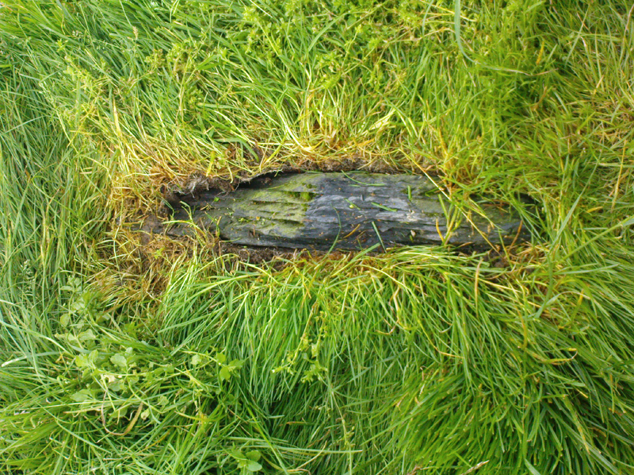
Feizor stone stump
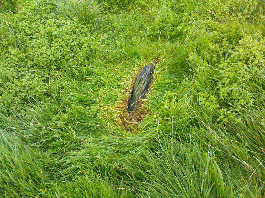
and from another angle

All that can be seen today is the very small stump of stone, just visible above ground level, in the middle of the field.  It’s not easy to spot either, as the grasses grow over what’s left.  But we found the slim remnant of the stump embedded in exactly the spot marked on old and modern maps, measuring 24 inches in length and just 4 inches across at the widest, with what seemed like worn rounded edges at either end.  We were unable to ascertain the depth of the remaining stone in the ground. The stone looks simply as if it’s been snapped at the base.  We have no idea how tall this standing stone was.

If any local people know anything more about this stone, or have any old photos, we’d love to hear from you — and would obviously give due credit for any help on this matter.

References:

  1. Smith, A.H., The Place-Names of the West Riding of Yorkshire – volume 6, Cambridge University Press 1961.

Links:

  1. Feizor stone remnants & walks to nearby prehistoric sites

© Paul Bennett, The Northern Antiquarian 


Mitton Church Cross, Great Mitton, Lancashire

Cross:  OS Grid Reference – SD 7154 3896

Getting Here

Great Mitton Churchyard Cross (after ‘QDanT’)

Take the B6246 road northwest out of Whalley, or else east from Hurst Green, until you hit the little village of Great Mitton, with its churchyard in the middle.  Go into the churchyard and you’ll find this weird-looking cross!

Archaeology & History

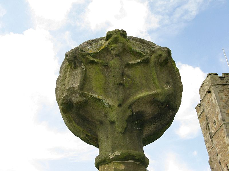
The curious-looking upright in the churchyard here has a mixed history by all accounts.  The oldest portion of the cross is universally ascribed to be the top section, rediscovered when it was dug up “shortly before 1801.” (Ackerley 1947) It possesses a carving of the crucifixion on one side, and some curious figures carved on the other, which some ascribe to being Jesus, but could well be the triple female element which would still have been prevalent in peasant culture at the time it’s thought to have been carved.  The original shaft carrying the ‘cross’ had long since been destroyed and so, according to Jessica Lofthouse (1946),

Carved crosshead (© ‘QDanT’)
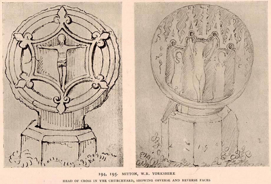
Early drawing of cross-head

“In 1897 it was ‘re-erected to commemorate the 1300th anniversary of the reintroduction of christianity into Britain,’ with the new shaft we see today.  This is the oldest relic in Mitton.”

In J. Buckler’s early 1841 drawing of both sides of the carved cross-head we can see in greater detail the nature of the medieval rock art and this was described in Aymer Vallance’s (1920) decorative analysis of carved crosses in England.  He told that

“the cross-head at Mitton, Yorkshire…is peculiar inasmuch as the crucifixion is sculptured on both faces, but in totally different fashions.  That on the west face has the arms stretched horizontally, within a sexfoil frame, and might well be of the thirteenth century.  Whereas the sculpture on the east face, though much more weatherworn, is of a style that could not have been designed before the fourteenth, or perhaps even the fifteenth century.  The arms of the Christ in this instance are drawn upwards in an unusually oblique direction.  It is impossible that these two representations could have been executed at one and the same date.  The circular outline of the head, too, is peculiar, and suggestive rather of a gable-cross than of a standing cross.  Possibly the west face only was sculptured in the first instance, for a gable-cross, the sculpture on the east face being added later in order to adapt the stone for the head of a churchyard cross.”

Although I’ve gotta say that the three carved figures with the upright arms strikes me more as three females than any crucified character and may be an early depiction of the three Mary’s.

One of the early ministers at Mitton church was none other than John Webster, who wrote the highly influential work, Displaying of Supposed Witchcraft, which denounced much of the Church’s obsession and murder of countless people under the auspice of some spurious devil and demonological bollocks which, even today, some still suffer to endure.   Webster was only at Mitton for a few years, before moving into deeper Yorkshire and setting up at Kildwick.

References:

  1. Ackerley, Frederick George, A History of the Parish of Mitton, Aberdeen University Press 1947.
  2. Lofthouse, Jessica, Three Rivers, Robert Hale: London 1946.
  3. Vallance, Aymer, Old Crosses and Lychgates, Batsford: London 1920.

Links:

  1. Pictorial Journey of East Lancashire Crosses

© Paul Bennett, The Northern Antiquarian


Withgill Cross, Great Mitton, Lancashire

Cross:  OS Grid Reference – SD 7060 4062

Getting Here

Withgill cross location (after QDanT)

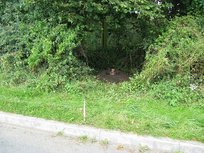
From Great Mitton village, go up (north) the slightly winding B6243 road for a mile, then take the left turn up the minor country lane, for about 300 yards, till you reach a tiny crossroad of tracks, one leading down to Scott House and the other up to Withgill Farm.  Stop here!  You’re damn close.  From what our man ‘QDanT’ says, this is now to be found behind the hedge by the roadside, on the side of the road where the track runs up to Withgill Farm, tucked low and overgrown close to the ground.  Good luck!

Archaeology & History

Described by Mr Ackerley (1947) as being found

“in the coppice beside the gate to Withgill is the base of another road-side cross,”

Cross-base (after QDanT)

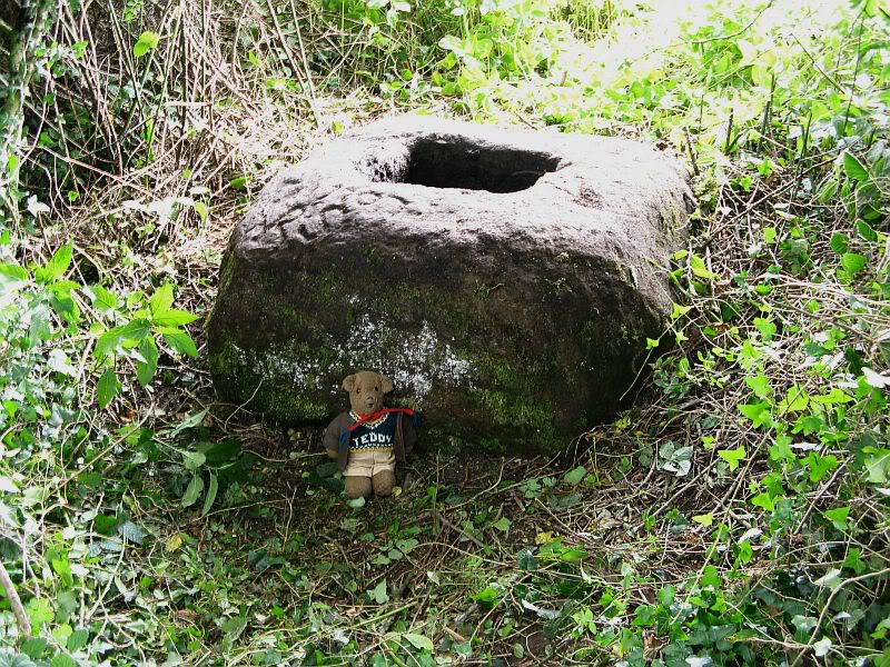
all but overgrown by ivy and lost to the causal eye.  Thankfully our man Danny got on his bike and found the remains of the little fella, all-but invisible beneath the vegetative growth!  Beneath the vegetation, John Dixon told there to be “some interesting 17th century graffiti,” but there’s not much that remains of the old cross.

Folklore

There is a curious story about a legendary church that was once supposed to have been up the track on the hill just above here at the farm.  The story goes,

“that when Mitton church was built, it ought to have been built on Withgill Knowle: that there was a church somewhere about there, and that the stones from it were carted down to Mitton in one night and used in building the present church.”

This bitta folklore is a motif found commonly at prehistoric sites, where stones from our ancient places were uprooted and moved (destroyed) to give way to the new christian mythos.  To my knowledge, no such prehistoric sites are known hereby.  Mr Dixon – over to you dear sir!

References:

  1. Ackerley, Frederick George, A History of the Parish of Mitton in the West Riding of Yorkshire, Aberdeen University Press 1947.

Links:

  1. Pictorial Journey of East Lancashire Crosses
  2. Teddy’s Exploration of the Withgill Cross Base

© Paul Bennett, The Northern Antiquarian


Rudstoop Monolith, Cragg Vale, West Yorkshire

Standing Stone/s:  OS Grid Reference – SD 99269 23652

Getting Here

Site on 1st edition OS-map

From Mytholmroyd, go up the Cragg Vale Road, then 2 miles up take the road steep on your right down and round St. John’s Church, then keep going along the road up to Withens.  About a mile up, a road turns sharply right.  Go up here for a few hundred yards, past the trees, and 100 yards on the road splits in a ‘V’.  Stop here.  Go into the field on your left which slopes downhill and less than 100 yards down you’ll see the large long stone laid in the grass.  That’s it!

Archaeology & History

The fallen stone, with Teddy! (image courtesy ‘QDanT’)

Included in the Addenda of The Old Stones of Elmet (p.222), here is a recumbent monolith more than 8 feet long and 6 feet across which really needs to be resurrected as it would be an impressive sight! Found halfway up Withens Clough, a local land-owner told me it was one in a row of several such stones, though no trace of the others can be found. Found in the appropriately called Standing Stone Fields, it was last shown on the 1850 OS-map, as the attached illustration shows and is positioned just above the “S” of the smaller highlighted “standing stone”, just where the little blob is! The small valley to its immediate west is called Rudstoop, from which I give the stone its name.

A description of the site is given in F.A. Leyland’s scarce commentary on the History of Halifax (c.1867), where he wrote:

“Standing Stone Fields: Not far distant from Hill Top, in this township (Erringden), there is a rough piece of ground known by this name.  It is situated on the slope of the same hill as the remain last described and commands a view of the northern side of Sowerby, with the outlines and rocks of Langfield and the Withens. The locality was anciently the site of a number of upright single stones: most of these have been broken up and used in the construction of the adjoining fences. But one, the last of the series, which the quarrying operations on the spot respected during the whole time they were carried on, was undermined and overthrown a few years ago, by a number of mischievous boys. The rock is a slab of millstone grit, measuring upwards of 9 feet in length, 7 feet 8 inches in width, at the base, and 4 feet 9 inches at the top: at the latter point it is 9 inches thick, and is 1 foot 6 thick at the base. The remain has, originally, been pyramidal in form, but the apex has been either broken off by violence or reduced to its present dimensions by decay.”

An impression of the land here indicates the other, lost monoliths, were in a row which headed east from here, towards the cup-and ring-marked ‘Upper Lumb Stone’.  There is also the possibility that these monoliths were aligned with the enigmatic Two Lads cairns less than a mile SW of here.

Well worth checking out!

References:

  1. Bennett, Paul, The Old Stones of Elmet, Capall Bann: Milveton 2001.
  2. Leyland, F.A., The History and Antiquities of the Parish of Halifax, by the Reverend John Watson, M.A., R.Leyland: Halifax n.d. (c.1867)

Links:

  1. More images of the fallen monolith

© Paul Bennett, The Northern Antiquarian


Dull Cross, Aberfeldy, Perthshire

Cross:  OS Grid Reference – NN 80710 49136

Also Known as:

  1. Cross of Dull
Dull cross (by Ferelith Molteno)

Getting Here

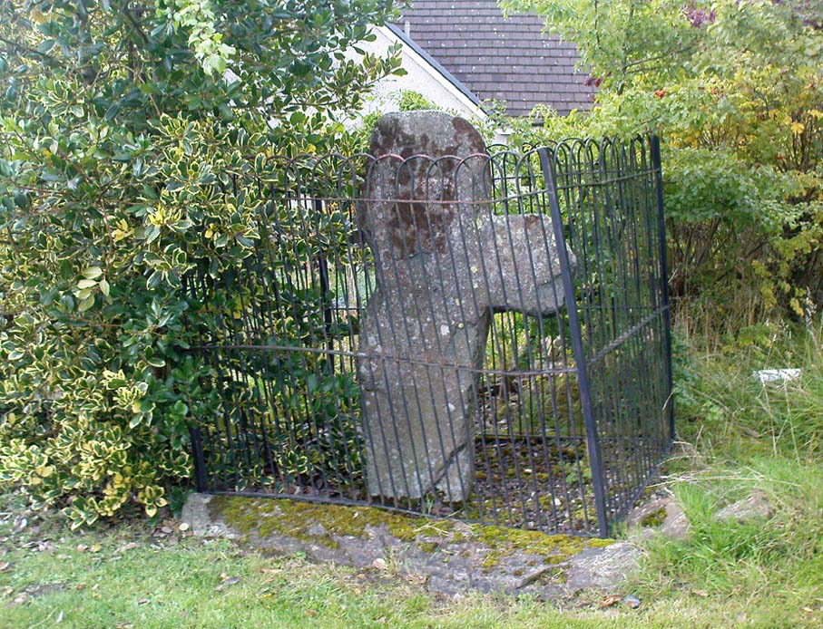
From Aberfeldy, take the B846 road over the river bridge, past Weem, a couple of miles down the valley until you see the small road on the right which leads up to the ancient hamlet of Dull.  Go up and round the corner until you reach the centre of the village; and here the road turns back downhill.  At this point, right by the roadside, entrapped within old railings, you’ll see the Cross of Dull.

Archaeology & History

Dull Cross behind bars

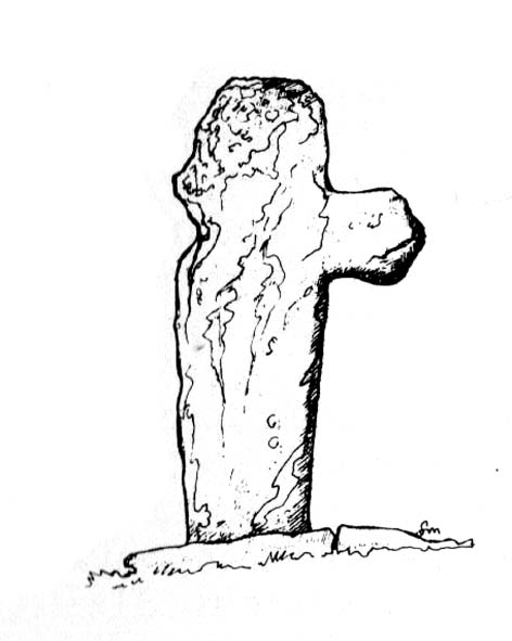
Standing more than three feet tall, the remains of this old cross with one of its extended arms broke off in previous centuries, was one of three such monuments that used to stand in the valley.  This and its associates were, according to christian legend, placed as markers at an ancient centre of christian learning at Dull around the time of Adamnam (who died in Glen Lyon in 704 AD).  The area was said to be an early druid college, which was later incorporated into early christian teachings.  Hilary Wheater (1981) also told that in previous centuries, if anyone fell foul of the law,

“Within the boundaries of these crosses debtors, offenders or miscreants were protected from retribution.  One of the crosses stands in the centre of Dull village to this day, having been used as a market cross in more recent times, and the other two, having been stolen for use as gateposts during the (19th) century, were placed in the old kirk at Weem for safety.”

References:

  1. Stuart, John, The Sculptured Stones of Scotland, Aberdeen 1856.
  2. Wheater, Hilary, Aberfeldy to Glenlyon, Appin Publications: Aberfeldy 1981.

© Paul Bennett, The Northern Antiquarian


Standing Stone Hill, Heptonstall, West Yorkshire

Standing Stone:  OS Grid Reference – SD 95355 30184

Getting Here

Standing Stone Hill monolith

From Hebden Bridge, go up the Heptonstall road, going round the village and onto and through Slack, keeping straight on the road until it goes uphill for a short distance, then levels out; then watch out for the small right-turn and the single-track road heading to a dead-end.  Go right to the end, the very end, and go through the gate and walk up the track onto the moor.  As you reach the ridge and the moorlands north open-up before you, note the small ‘standing stone’ on your right, about 10 yards off-path.  Go up past it, following the path up the small hill and keep going till you hit the triangulation pillar.  From here, keep walking on the same path ESE for another 200 yards.  Y’ can’t miss it!

Archaeology & History

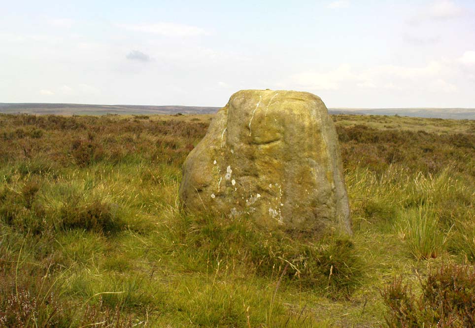
The name of the place rather gives the game away a bit, yeah…?  When I first moved to nearby Hebden Bridge in the 1990s, I noted the conspicuous place-name ‘Standing Stone Hill’ on the maps — so when I met local earth-mystery enthusiast John Billingsley and asked him about any remains up here, he said, with conviction, “there’s nowt up there!” (or words to that effect)

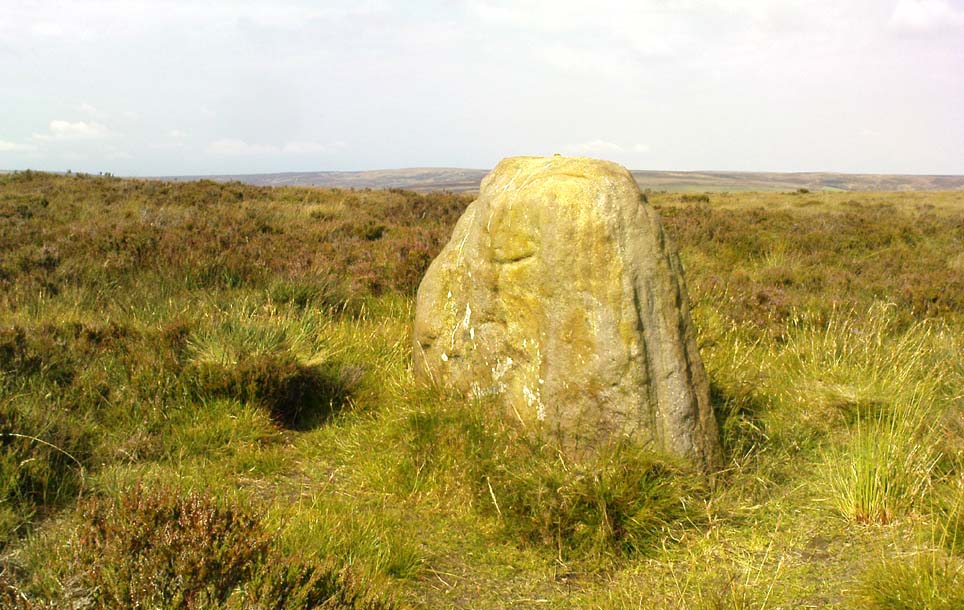
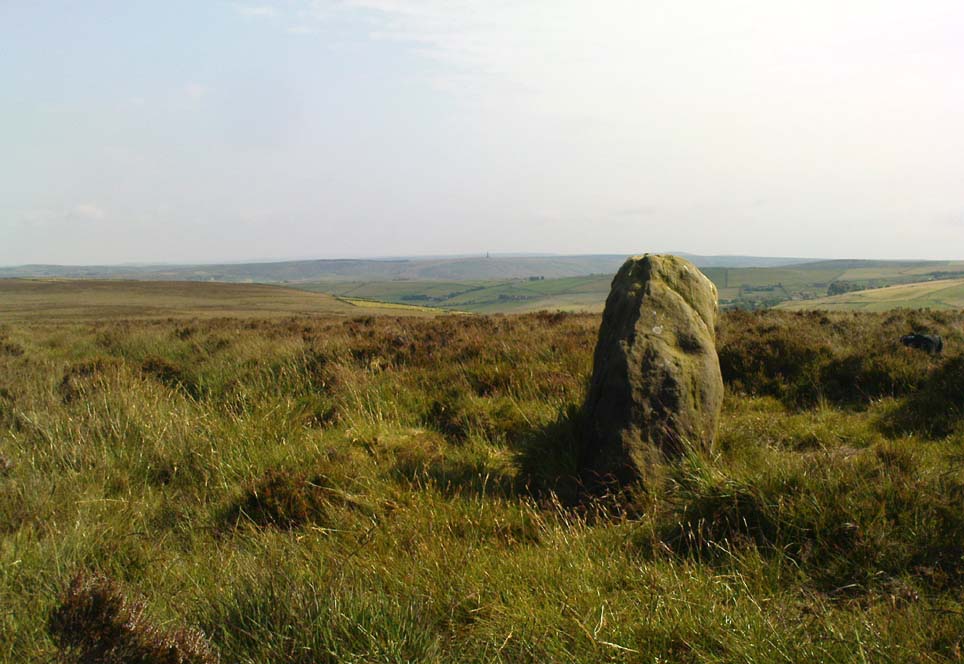
“Are y’ sure?” I asked. To which he repeated his dictum. But I wasn’t convinced of his words and, like any decent chap with energy for old stones and such things, wouldn’t take ‘no’ for an answer and went to check for myself – and wasn’t too surprised when I found this lovely looking standing stone — and a fine specimen of a monolith it is indeed!

Standing stone, looking south
Standing Stone, looking east

Although not a tall specimen by any means, this rounded and weather-worn upright has fine character and age to it.  Standing more than 3 feet in height and nearly as wide, the stone has a faded but distinct artistic carving of the letter ‘T’ on its western face (which you can make out on the photo, hopefully).  It was thought this may have been an old boundary marking, but the stone aint on any boundary line so possibly relates to some local family who marked it with that deluded notion of ‘ownership’ of this part of the desolate moors.

It’s a beautiful spot up here, out on its own.  I’ve sat here many times, both alone and with good heathen friends, gazing across the endless silence on days coloured with snows, mists, bright sunshine and heavy rains.  It has that feeling of solitude, of being forgotten, of being truly untouched.

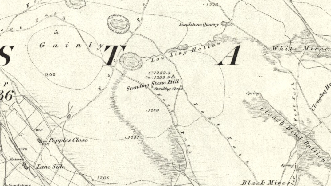
Standing Stone Hill on 1851 map

There are a couple of other possible standing stones on this section of moorland.  One in particular appears to have been taller in bygone times and is marked on the 1851 OS-map of the region about 100 yards southwest of the triangulation pillar (you’ll notice it on your right, off-path, as you’re walking towards the pillar—shown at the position on the map here, right).  Further west is the tall medieval Reaps Cross, where corpses were rested in their journey over the moors.

References:

  1. Bennett, Paul, The Old Stones of Elmet, Capall Bann: Milverton 2001.

© Paul Bennett, The Northern Antiquarian

Gwytherin Churchyard, Denbighshire

Stone Row: OS Grid Reference – SH 8767 6147

Also known as:

  1. Gwytherin Church Standing Stones
  2. The Four Stones

Getting Here

From the Denbigh road (A543 and A544) turn off at Llansannan for Gwytherin on the B5384 for 6 miles or so. At the village of Gwytherin St Winifred’s church stands roughly in the middle of the place at a junction of four roads. The church stands upon a small round hill and within the confines of the churchyard (north side) are four small standing stones – you can’t really miss them!

Archaeology & History

At the northern side of the churchyard near the wall there’s an alignment of four small standing stones probably dating from the Bronze Age.  The stones stand roughly 3 metres or 6 feet apart and are about 1 metre or 3 feet in height.  The westernmost stone has a Latin inscription carved onto it which is ‘VINNEMAGLI FILI SENEMAGLI’, or, ‘The Stone of Vinnemaglus, son of Senemaglus’, which is generally thought to date from the Romano-British period in the 5th-6th century AD and to be a grave marker.  Most probably the inscription was carved onto the prehistoric stone during the early Christian period — the stones themselves being from pre-Christian times.

The general thinking is that these stones belonged to a Bronze Age settlement that stood here long before any church was founded.  Perhaps there were other stones here forming a linear alignment that must have meant something to the ancient folks who lived here.  There has also been speculation as to whether the inscribed standing stone could actually mark the grave of St Winifred herself.

The churchyard is circular, indicating that it is a pagan sacred site.  Celtic churches being built on sites like this to Christianize them, but not entirely forget the meaning to the peoples of “the old religion,” as it’s called.  Also in the churchyard stand three ancient yew trees — yet another sign that the site is a holy one.

The first church in Gwytherin was founded by St Eleri (Elerius), a Welsh prince, in the mid-7th century.  He may be identical with St Hilary, a saint commemorated at a village of that name near Cowbridge, South Glamorgan.  Other than that, Eleri and his mother, Theonia, founded a double monastery here: one for men and the other for women, to which a young St Winifred (of Holywell) came to and was elected second abbess after Theonia.  St Eleri was probably a disciple of St Beuno, uncle to St Winifred, and also her cousin.  Here in 650 or 670 AD Winifred was buried in the churchyard — her relics being taken to Shrewsbury abbey in 1138.

References:

  1. Burl, Aubrey, From Carnac to Callanish, Yale University Press 1993.
  2. Houlder, Christopher, Wales: An Archaeological Guide, Faber & Faber: London 1978.
  3. Hulse, T.G., Gwytherin: A Welsh Cult Site Of The Mid-Twelth Century, (unpublished paper) 1994.
  4. Nash-Williams, V.E., The Early Christian Monuments of Wales, Cardiff, 1950.
  5. Westwood, J.O., “Early Inscribed Stones of Wales,” in Archaeologia Cambrensis, 18:255-259, 1863.

Copyright © Ray Spencer 2011


Pillar of Eliseg, Pentrefelin, Llangollen, Denbighshire

Cross:  OS Grid Reference – SJ 20267 44522

Also Known as:

  1. Eliseg’s Pillar

Getting Here

The Eliseg Pillar

From Llangollen, take the A542 north for about three miles up along the famous Vale of Llangollen.  At the ruined abbey of Valley Crucis continue along the same road for another ½-mile whence, at the side of the road in a field and upon a small mound, stands the ancient monument: the Pillar of Eliseg.

Archaeology & History

The sandstone pillar or pillar-shaft stands upon a large square-shaped base stone which sits atop a tumulus — a Bronze Age burial mound (cairn) inside which were found, during excavations in 1803, the remains of a body, perhaps that of a Romano-British or Dark-Ages chieftain (possibly Eliseg?), with what were described as “blue stones” both beneath and on top; the cremated body lying within a stone-slab chamber along with a silver coin.  But the ancient pillar monument itself is much later in date — probably mid-9th century AD, though there has been speculation by some historians that the pillar was actually a tall cross, alas without its head, dating from a couple of centuries earlier, with the inscription being carved onto it sometime between 840-845 AD.  It was erected by Prince Cyngen fab Cadell (Concenn) about the year 844 in memory of his great-grandfather Eliseg or Elise.  Cyngen died in Rome in 854 AD.

Over the centuries the pillar has suffered from the ravages of time.  Its long Latin inscription was originally 31 lines divided into readable paragraphs running horizontally but now only 7 or 8 of these lines are visible.  But fortunately the writer and historian Edward Lhuyd made a drawing of the monument and its inscription back in 1696.  The inscription when translated reads as follows:

1. Concenn son of Cadell, Cadell son of Brochmail, Brochmail son of Eliseg, Eliseg son of Guoillauc

2. Concenn therefore being great-grandfather of Eliseg erected this stone to his great-grandfather Eliseg

3. It is Eliseg who annexed the inheritance of Powys…throughout nine (years) from the power of the English which he made into a sword-land by fire

4. Whosoever shall read this hand-inscribed inscription stone, let him give a blessing on the soul of Eliseg

5. It is Concenn Who…with his hand…to his own kingdom of Powys…and which…the mountain…the monarchy Maximus…of Britain…Concenn, Pascent…Maun, Annan.

6. Britu, moreover, (was) the son of Guorthigirn (Vortigern) Whom (St) Germanus blessed and whom Severa bore to him, the daughter of Maximus the king who slew the king of the Romans and

7. Convarch painted this writing at the command of his king Concenn

8. The blessing of the Lord (be) upon Concenn and all members of his family and upon all the land of Powys Until the day of judgement or doom. Amen.

The upper section of the pillar, which is broken at the top, was re-erected on top of the burial mound in 1779 which probably means that the monument is not in its original place.  The lower section was sadly broken away from the shaft during the English Civil war and has long since disappeared. However, this monument is still quite an impressive site and can be seen from a great distance around.

References:

  1. Bartrum, P.C.,  Early Welsh Genealogical Tracts, Cardiff: UWP, 1966.
  2. Barber, Chris, More Mysterious Wales, Paladin 1987.
  3. Houlder, Christopher, Wales: An Archaeological Guide – the prehistoric, Roman and early medieval field monuments, Faber and Faber, London 1974.
  4. Tyack, George S., The Cross in Ritual, Architecture and Art, William Andrews: London 1900.
  5. Westwood, J.O., Lapidarium Walliæ – The Early Incised and Sculptured Stones of Wales, Oxford University Press 1879.

Copyright © Ray Spencer 2011 


Newtyle, Dunkeld, Perthshire

Standing Stones:  OS Grid Reference – NO 04489 41057

Also Known as:

  1. Doo’s Nest
  2. Druid’s Stones
  3. New Tyle

Getting Here

Newtyle’s standing stones

From Dunkeld travel southeast on the A984 road to Caputh and after about 1½ miles, set back a few yards from the road amidst the trees below the Newtyle Quarries (whose mass of slate and loose rocks cover the slopes), you’ll see these two large monoliths.  There’s nowhere to park here, but there’s a small road a coupla hundred yards before the stones aswell as a space to park on the verge by the side of the road a few hundred yards after them.  Take your pick!

Archaeology & History

When we visited these two tall standing stones a few weeks ago, guerilla archaeologist Hornby and I were a little perplexed at the state of these stones, wondering whether they were a product of the fella’s who dug the quarries above here, or whether they were truly ancient.  It seems the latter is the consensus opinion!

They were described by the great Fred Coles (1908) in one of his lengthy essays on the megaliths of Perthshire, where he thought the two stones here were all that remained of a stone circle that once stood on the flat, above the River Tay, but whose other stones “were destroyed in the making of the road” which runs right past here.  Not so sure misself!  He told that,

“An old cart-track runs up between the stones, leading from the main road…up to the quarry. The mean axis of the two stones runs N 13° W and S 13° E (true), and although their broader faces do not point towards the centre of a circle on the west, it is certainly much more probable that the other stones were on this side, the lower and flatter ground, than on the east, where the ground slopes and is more broken and rough.

“Both stones are of the common quartzose schist, but they differ considerably in shape.  A is 6 feet 7 inches high at the north corner, but only 4 feet 10 inches at the south, and its vertical height at the east is only 3 feet.  The basal girth is 13 feet 3 inches, and in the middle 15 feet 9 inches.  The broad east face measures 5 feet.  Stone B is level-topped and 5 feet in height; it has a basal girth of 12 feet 4 inches, and at the middle of 11 feet 8 inches.  Its two broad faces are of the same breadth.”

Little else was said of the two stones for many years and, to my knowledge, no real excavation has been undertaken here.  But when Alexander Thom (1990) visited the site he found that,

“This two stone alignment showed the midsummer setting sun.  The south stone may possibly, by itself, have shown the setting Moon at major standstill.”

Aubrey Burl’s description of the stones was succinct and echoed much of what Coles had said decades earlier, telling:

“Two very large stones stand only 9 feet (2.7m) apart in an unusually closed-in environment for a Perthshire pair.  The ground rises very steeply to the east.  To the west the stones overlook the valley of the River Tay.

“Both are of local quartzoze schist and are ‘playing-card’ in shape.  As usual it is the westernmost stone that is taller, 7ft 2in (2.2m) in height.  Its peak tapers almost to a point.  Conversely, its partner is flat-topped and only 4ft 9in (1.5m) high.  The pairing of such dissimilarly shaped stones has led to the interpretation of them as male and female personifications.”

Alex Thom’s groundplan
Back of the smaller stone

Burl’s latter remark thoughtfully recognises that such animistic qualities are found in many other cultures in the world and this ingredient was also an integral part of early peasant notions in Britain; therefore such ingredients are necessities to help us understand the nature and function of megalithic sites.  We must be cautious however, not to fall into the increasingly flawed modern pagan notion of such male and female ‘polarizations’, nor the politically-correct sexist school of goddess ‘worship’ and impose such delusions upon our ancestors, whose worldviews had little relationship with the modern pagan goddess fallacies, beloved of modern Press, TV shows and pantomime festival displays.

Folklore

In Elizabeth Stewart’s history of Dunkeld, she narrates the tale told by an earlier historian who told that,

“these two upright stones at the Doo’s Nest, but says they are supposed to mark the graves of two Danish warriors returning from the invasion of Dunkeld.”

References:

Burl, Aubrey, From Carnac to Callanish, Yale University Press 1993.
Coles, Fred, “Report on Stone Circles Surveyed in Perthshire – Northeastern Section,” in Proceedings of the Society of Antiquaries, Scotland, volume 42, 1908.
Stewart, Elizabeth, Dunkeld – An Ancient City, Munro Press: Perth 1926.
Thom, A., Thom, A.S. & Burl, Aubrey, Stone Rows and Standing Stones – 2 volumes, BAR: Oxford 1990.

© Paul Bennett, The Northern Antiquarian

Brown Beck Stone, Agra Moor, North Yorkshire

Standing Stone:  OS Grid Reference – SE 13499 82440  —  NEW FIND

Also Known as:

  1. Agra Moor Standing Stone

Getting Here

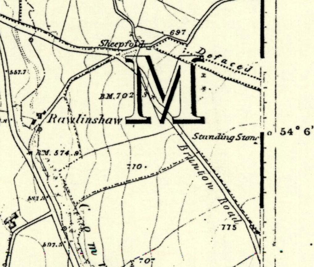
Agra Moor standing stone

From Masham, take the Fearby Road to the village, keep going on the same road through Healey village and less than a mile on where the road forks, bear to the right past and go along the gorgeous little-known vale of Colsterdale.  It’s bloody beautiful!  Less than 2 miles on, walk up the notable track veering to your right, diagonally uphill.  Walk along till you get to the moor edge.  Go thru the gate and follow the swerving uphill path to the bottom of Slipstone Crags.  Once you level out at the Crags top, look across the small valley to your left and, on t’other side, you’ll notice a standing stone upright in the heather, just 100 yards on the flat on the other side of the valley.  Head right for it!

Archaeology & History

Looking west

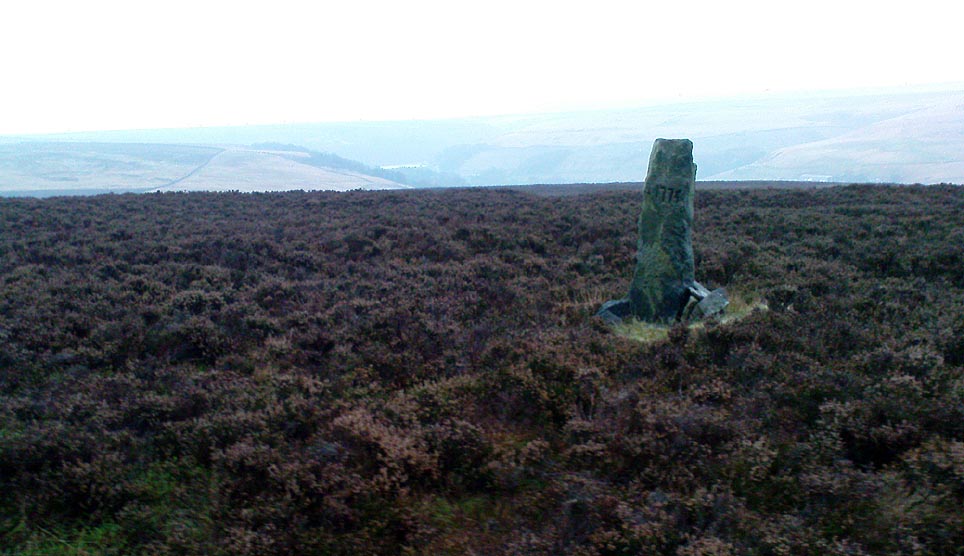
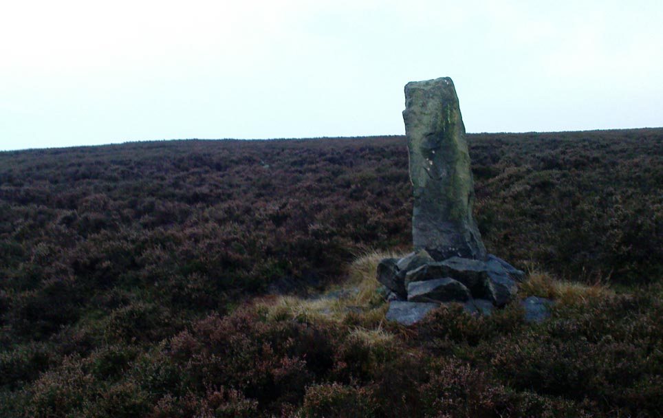
There are no known written references to this standing stone, which we visited for the first time yesterday, in a brief wander to the nearby Agra Woods cup-and-ring stones a few hundred yards southeast.  The monolith stands some four-and-half-feet tall and, at its base, is more than three feet broad and just one foot wide.  Just to its side and almost completely covered in peat and vegetation is what may have been another once-upright companion asleep in the Earth.  Another possibly fallen stone is less than 10 yards west.  The upright stands on the flat moorland overlooking the confluence of two (once) fast-flowing waters of Brown Beck and Birk Gill; and the landscape that reaches out from here is something to behold!

We found the remains of other old monuments on the moor, but some were obviously related to the industrial mining not far away.  However, two or three other small upright stones and a large stone circular structure were also located which very obviously predated any industrial or medieval workings.  We need to revisit this moorland and spend more time exploring to see what other things are hidden, lost midst the peat and heather.

© Paul Bennett, The Northern Antiquarian