Newtyle, Dunkeld, Perthshire

Standing Stones:  OS Grid Reference – NO 04489 41057

Also Known as:

  1. Doo’s Nest
  2. Druid’s Stones
  3. New Tyle

Getting Here

Newtyle’s standing stones

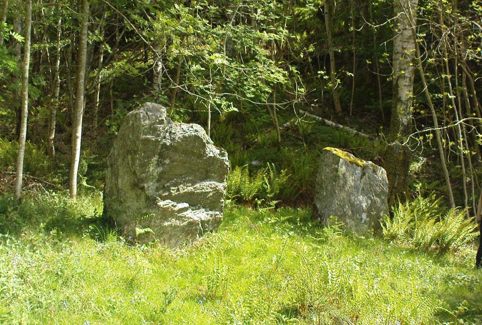
From Dunkeld travel southeast on the A984 road to Caputh and after about 1½ miles, set back a few yards from the road amidst the trees below the Newtyle Quarries (whose mass of slate and loose rocks cover the slopes), you’ll see these two large monoliths.  There’s nowhere to park here, but there’s a small road a coupla hundred yards before the stones aswell as a space to park on the verge by the side of the road a few hundred yards after them.  Take your pick!

Archaeology & History

When we visited these two tall standing stones a few weeks ago, guerilla archaeologist Hornby and I were a little perplexed at the state of these stones, wondering whether they were a product of the fella’s who dug the quarries above here, or whether they were truly ancient.  It seems the latter is the consensus opinion!

They were described by the great Fred Coles (1908) in one of his lengthy essays on the megaliths of Perthshire, where he thought the two stones here were all that remained of a stone circle that once stood on the flat, above the River Tay, but whose other stones “were destroyed in the making of the road” which runs right past here.  Not so sure misself!  He told that,

“An old cart-track runs up between the stones, leading from the main road…up to the quarry. The mean axis of the two stones runs N 13° W and S 13° E (true), and although their broader faces do not point towards the centre of a circle on the west, it is certainly much more probable that the other stones were on this side, the lower and flatter ground, than on the east, where the ground slopes and is more broken and rough.

“Both stones are of the common quartzose schist, but they differ considerably in shape.  A is 6 feet 7 inches high at the north corner, but only 4 feet 10 inches at the south, and its vertical height at the east is only 3 feet.  The basal girth is 13 feet 3 inches, and in the middle 15 feet 9 inches.  The broad east face measures 5 feet.  Stone B is level-topped and 5 feet in height; it has a basal girth of 12 feet 4 inches, and at the middle of 11 feet 8 inches.  Its two broad faces are of the same breadth.”

Little else was said of the two stones for many years and, to my knowledge, no real excavation has been undertaken here.  But when Alexander Thom (1990) visited the site he found that,

“This two stone alignment showed the midsummer setting sun.  The south stone may possibly, by itself, have shown the setting Moon at major standstill.”

Aubrey Burl’s description of the stones was succinct and echoed much of what Coles had said decades earlier, telling:

“Two very large stones stand only 9 feet (2.7m) apart in an unusually closed-in environment for a Perthshire pair.  The ground rises very steeply to the east.  To the west the stones overlook the valley of the River Tay.

“Both are of local quartzoze schist and are ‘playing-card’ in shape.  As usual it is the westernmost stone that is taller, 7ft 2in (2.2m) in height.  Its peak tapers almost to a point.  Conversely, its partner is flat-topped and only 4ft 9in (1.5m) high.  The pairing of such dissimilarly shaped stones has led to the interpretation of them as male and female personifications.”
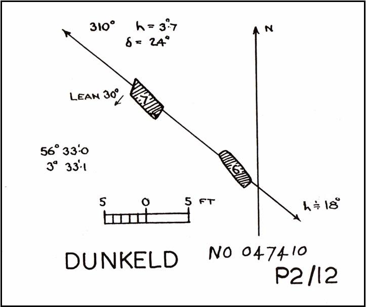
Alex Thom’s groundplan
Back of the smaller stone

Burl’s latter remark thoughtfully recognises that such animistic qualities are found in many other cultures in the world and this ingredient was also an integral part of early peasant notions in Britain; therefore such ingredients are necessities to help us understand the nature and function of megalithic sites.  We must be cautious however, not to fall into the increasingly flawed modern pagan notion of such male and female ‘polarizations’, nor the politically-correct sexist school of goddess ‘worship’ and impose such delusions upon our ancestors, whose worldviews had little relationship with the modern pagan goddess fallacies, beloved of modern Press, TV shows and pantomime festival displays.

Folklore

In Elizabeth Stewart’s history of Dunkeld, she narrates the tale told by an earlier historian who told that,

“these two upright stones at the Doo’s Nest, but says they are supposed to mark the graves of two Danish warriors returning from the invasion of Dunkeld.”

References:

Burl, Aubrey, From Carnac to Callanish, Yale University Press 1993.
Coles, Fred, “Report on Stone Circles Surveyed in Perthshire – Northeastern Section,” in Proceedings of the Society of Antiquaries, Scotland, volume 42, 1908.
Stewart, Elizabeth, Dunkeld – An Ancient City, Munro Press: Perth 1926.
Thom, A., Thom, A.S. & Burl, Aubrey, Stone Rows and Standing Stones – 2 volumes, BAR: Oxford 1990.

© Paul Bennett, The Northern Antiquarian

Brown Beck Stone, Agra Moor, North Yorkshire

Standing Stone:  OS Grid Reference – SE 13499 82440  —  NEW FIND

Also Known as:

  1. Agra Moor Standing Stone

Getting Here

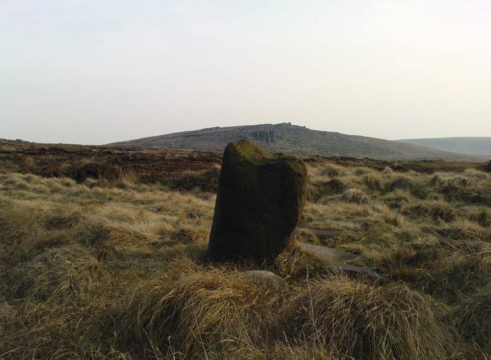
Agra Moor standing stone

From Masham, take the Fearby Road to the village, keep going on the same road through Healey village and less than a mile on where the road forks, bear to the right past and go along the gorgeous little-known vale of Colsterdale.  It’s bloody beautiful!  Less than 2 miles on, walk up the notable track veering to your right, diagonally uphill.  Walk along till you get to the moor edge.  Go thru the gate and follow the swerving uphill path to the bottom of Slipstone Crags.  Once you level out at the Crags top, look across the small valley to your left and, on t’other side, you’ll notice a standing stone upright in the heather, just 100 yards on the flat on the other side of the valley.  Head right for it!

Archaeology & History

Looking west

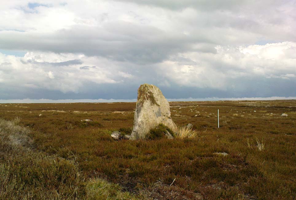
There are no known written references to this standing stone, which we visited for the first time yesterday, in a brief wander to the nearby Agra Woods cup-and-ring stones a few hundred yards southeast.  The monolith stands some four-and-half-feet tall and, at its base, is more than three feet broad and just one foot wide.  Just to its side and almost completely covered in peat and vegetation is what may have been another once-upright companion asleep in the Earth.  Another possibly fallen stone is less than 10 yards west.  The upright stands on the flat moorland overlooking the confluence of two (once) fast-flowing waters of Brown Beck and Birk Gill; and the landscape that reaches out from here is something to behold!

We found the remains of other old monuments on the moor, but some were obviously related to the industrial mining not far away.  However, two or three other small upright stones and a large stone circular structure were also located which very obviously predated any industrial or medieval workings.  We need to revisit this moorland and spend more time exploring to see what other things are hidden, lost midst the peat and heather.

© Paul Bennett, The Northern Antiquarian 


Acharn, Killin, Perthshire

Standing Stone:  OS Grid Reference – NN 56141 31601

Getting Here

Acharn’s standing stone

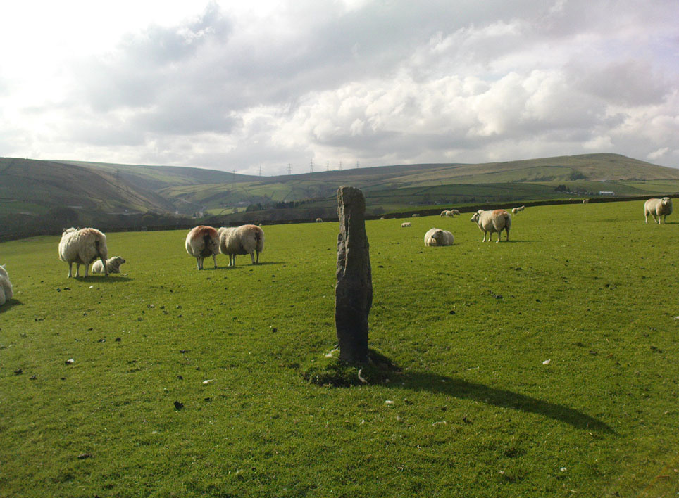
This one’s easy as it’s right by the roadside, so making it dead easy for those lazy ones amongst you who don’t like walking!  You can find it just past the turn-off (signed) for Acharn Lodge, a few hundred yards along the A827 road (off the A85 by the garage) from Lix Toll, less than a mile before reaching Killin.

Archaeology & History

This solitary standing stone, not much more than about three feet tall, originally stood in the adjacent field and was moved to the edge of the road sometime ago.  It was described briefly in William Gillies’ Breadalbane (1938) where he said, “Its height is 3 feet 10 inches and its girth at the base 6 feet 2 inches… This solitary stone is possibly the sole survivor of a group that once formed a circle,” though gives no more information to support this idea.  It seems more likely that the stone accompanied a cairn, that was levelled by farming sometime in the 19th century.

References:

  1. Gillies, William A., In Famed Breadalbane, Munro Press: Perth 1938.

© Paul Bennett, The Northern Antiquarian

Rudston Monolith, East Yorkshire

Standing Stone:  OS Grid Reference – TA 09803 67740

Getting Here

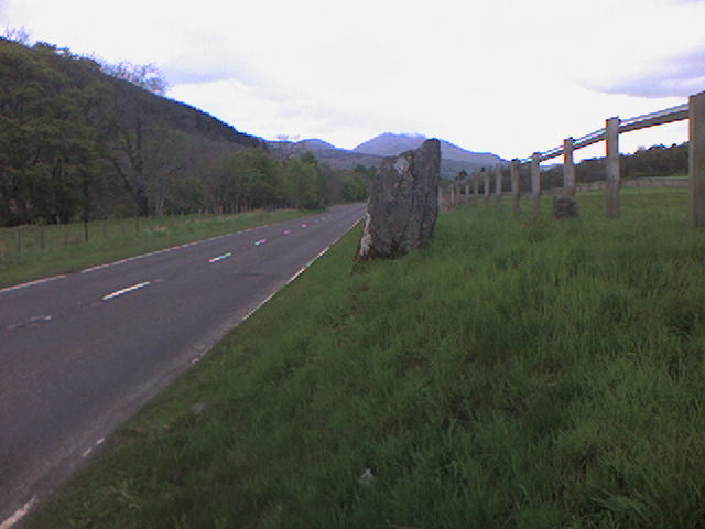
Rudston’s monolith (photo by ‘QDanT’)

To get to the monolith travel along the B1253 road to the west of Bridlington for about 5 miles or from York take the A166 in an easterly direction then onto the B1251 and at Fridaythorpe take the B1253 east again toward Bridlington. The huge stone cannot be missed from the road and from the surrounding area. It stands within the graveyard of All Saints’ church at the north-eastern side of Rudston village.

Archaeology & History

Located in the graveyard of All Saints’ church, this huge and mighty monolith or menhir stands at 25 foot 9 inches high (7.7 metres), and is the tallest prehistoric standing stone in Britain. It is estimated to weigh 40 tons, and it is thought to be the same in height below ground as what it is above the ground, though I don’t know whether anyone has ever checked that theory out. It probably dates from the Bronze-Age about 1,600 BC. Because of vandalism and erosion the top of the stone now has a lead cap, so it is said the stone could have originally been 28 feet high. So where has the top part gone to, I wonder. We are told that the stone was dragged, or rolled on logs, all the way from an outcrop at Cayton Bay some 10 miles as the crow flies to the north.

Royston’s 1873 drawing
Rudson Monolith (Louise Hutchinson 1988)

Rudston monolith stands at the end of at least one cursus monument on an old prehistoric alignment (see the Rudston B Cursus entry).  It would appear to have played an important ingredient in a huge ceremonial landscape on the Gypsey Race.  Also in the churchyard (north-east corner) there is a large slab-stone cist which was removed from a nearby round barrow and also a gritstone. At Breeze Farm about one mile to the south-west of the village is the site of a Roman villa.

Folklore

The folklore elements tell us that this is, in fact, a phallic stone and in pagan times some form of ritual was held around the monolith, but then the Christian church was built around it in the Dark Ages – it was a case of Christianity adopting the pagan religion and allowing the stone to stay where it was, but what else could they do because the stone was to big to move, so a lot of tolerance was in order here. The present church of All Saints’ dates from the Norman period. In any case the stone had stood here for a good 2,000 years or more before any church was established in the village. According to the legend, the devil hurled the huge stone at the first Christian church on the site, but as usual he just missed – doesn’t he always!

References:

  1. Bord, Janet & Colin, Ancient Mysteries of Britain, Diamond Books: London 1991.
  2. Anderton, Bill, Guide To Ancient Britain, Foulsham: London 1991.
  3. Darvill, Timothy, AA Glovebox Guide – Ancient Britain, AA Publishing Division: Basingstoke 1988.
  4. Royston, Peter, Rudston: A Sketch of its History and Antiquities, George Furby: Bridlington 1873.

© Ray Spencer, The Northern Antiquarian 2011


Stones Farm, Todmorden, West Yorkshire

Standing Stones:  OS Grid Reference – SD 92520 23593 and SD 92256 23800

Getting Here

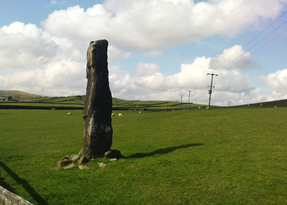
One of the Stones monoliths, looking west

If you wanna drive here, be prepared for a long uphill winding haul, with very poor turning, single-track roads and no parking spots.  It’s dodgy as hell!  But, if y’ must – from the central roundabout in Todmorden, take the road diagonally across as if you’re going to the train station, and barely 50 yards up, take the right turn under the railways arches, bearing sharp left, then up the very steep zigzagging dangerous road for a mile or so.  You’ll eventually reach Stones Lane on your left.  Go down this, nearly to the end, slowly – and keep your eyes peeled until you see the big one!  You can’t miss it!  If you want walk up (a much safer, healthier and preferable route), take the Calderdale Way route up past Dobroyd Castle, and where you get to the top of the hill and the fields open up ahead of you, look down the slope into the field for one stone, and up past the shrubs to Centre Hill.  You can’t miss them!

Archaeology & History

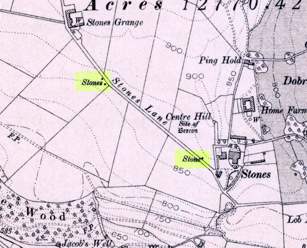
Three 'stones' on 1911 map
Three ‘stones’ on 1911 map

This is a quite extraordinary sight to those who visit here for the first time.  Moreso because, until very recently, the place was excluded from all text-books and surveys.  But if you like your megaliths, this place is well worth the trek up the hill.  You’ll be amazed!  The tallest and largest of these giant monoliths was recorded when a team from Ordnance Survey mapped the area in 1844, but gave no antiquated note to it.  When another Ordnance Survey team re-surveyed the area again in 1911, they noted two other ‘stones’ three fields away to the northeast.  More than a decade later, the industrialist historian Abraham Newall (1925) described them at some length in his fine work on the region.

Stone 1, looking NW
Stone 2, at top of hillock (soz about the crap picture)

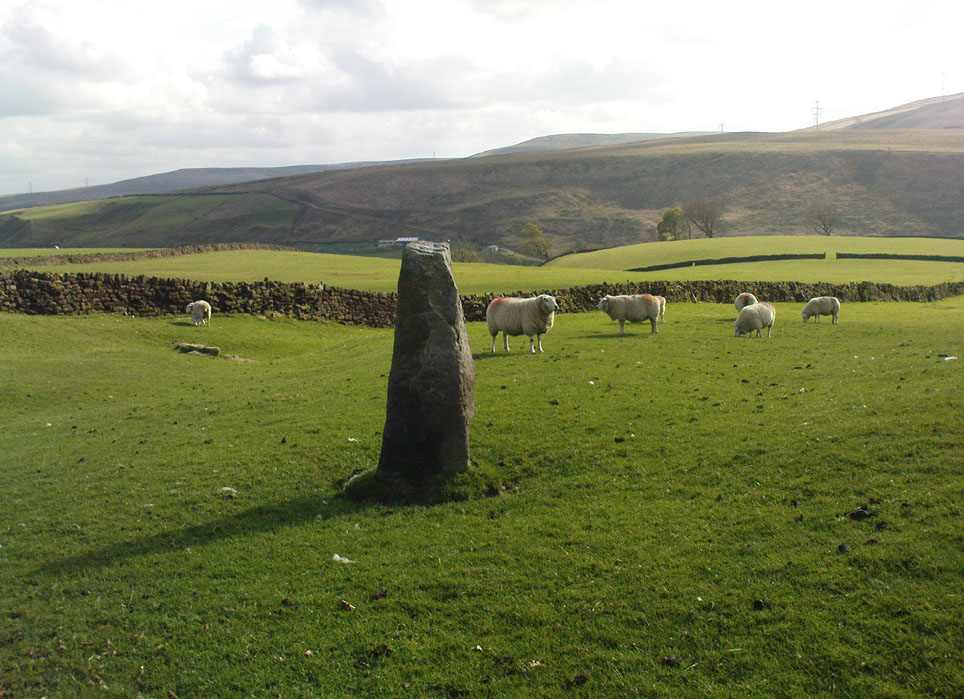
The first thing generally noticed is the 12-foot tall standing stone near the bottom of the field (stone 1). Then you’ll see the curiously-worked thin standing stone, nearly as tall, on the hillock at the top of the same field (stone 2). This stone has been surmounted onto an old millstone and the hillock itself was once an old beacon hill.  Then on the other side of the road a few hundred yards along, another stone just over 4-feet tall can be seen (stone 3); and in the same field is another one laid down at the side of a well (stone 4). This stone used to stand just where the water appears.  It’s seems probable that other standing stones may once have been in close attendance, but have been destroyed over time.

Stone 3, looking south
Stone 3, looking west

Stone 1 is hemmed in at the base by several stones, giving the impression that it was resurrected at some time in the recent past. Several local stories attest to this. Stone 2 was once further down in the same field but was moved to its present position in the 19th century and was, it is alleged, moved there to commemorate the Battle of Waterloo.  Several local historians contest this.  Stone 3 has nothing said of it; apart from by the local farmer who said it once had a companion (as illustrated on the early map, above).  We were told that this companion (stone 4) was uprooted and a spring of water appeared where it stood, so they laid it down in the position it still occupies, just by the spring 10 yards into the field.

If you’re into megaliths and live in Yorkshire or Lancashire, check these beauties out! Just respect the local farmer – he’s not into ignorant tourists clambering over walls. (don’t say you’ve not been warned!)

References:

  1. Bennett, Paul, The Old Stones of Elmet, Capall Bann: Milverton 2001.
  2. Newell, Abraham, A Hillside View of Industrial History, J. Bentley: Todmorden 1925.

© Paul BennettThe Northern Antiquarian


Nafferton Slack, Driffield, East Yorkshire

Standing Stone (destroyed):  OS Grid Reference – TA 040 587

Archaeology & History

Information on this stone is sparse and the grid-reference cited is a close approximation of its precise location.  And were it not for the records of Victorian folklorists, its existence may have been completely lost.  The first reference I’ve found of it is in Nicholson’s East Yorkshire (1890) survey, but I am hoping that someone, somewhere, made archaeological notes of the site (am I hoping for too much here…?)  The stone appears to have stood upon, or was very close to, the local boundary line between Nafferton and Driffield—which means there could be a record of it in any perambulation accounts of the region.

Folklore

John Nicholson (1890) told us the following intriguing bitta folklore about this stone, saying:

“About half way down the hill forming the eastern slope of Nafferton Slack, by the roadside, to prevent waggons leaving the roadway, stood a large stone, which was believed to have wonderful powers.  At night, at certain seasons, it glowed like fire, sometimes it seemed but the portal of a well-lighted hall; and one old stone-breaker declared he had heard wonderful music issuing therefrom, the like of which he had never heard before; while on one occasion he had seen troops of gaily-dressed elfins repairing thither, some on foot and some on carriages, and they all went into this mysterious hall.  The old man is dead, the stone is gone, and the fairies have departed.”

Some twenty years later, Mrs Gutch repeated the story, but added no further details.  One wonders whether the information about a fairy hall implied the former existence of a mound or tumulus next to the old stone (a few hundred yards south, just off the same boundary line, we find the remains of the curiously named tumulus of Cheesecake Hill).  Any further info would be most welcome…

References:

  1. Gutch, Mrs E., Examples of Printed Folk-lore Concerning the East Riding of Yorkshire, David Nutt: London 1912.
  2. Nicholson, Folk-lore of East Yorkshire, Simpkin Marshall: London 1890.

© Paul Bennett, The Northern Antiquarian


Causeway Edge, Littleborough, Lancs

‘Standing Stone’:  OS Grid Reference – SD 97239 17135

Getting Here

Causeway Edge stone, looking east

Get up to the Aiggin Stone and turn your back to Robin Hood’s Bed and Blackstone Edge, facing (roughly) north.  There’s a small path just to the left of the Aiggin Stone, running northwest (don’t take the more pronounced footpath on its right, or you’ll get a bit lost).  Walk down this path for about 60-70 yards and you can’t miss it!

Archaeology & History

Initially I thought this was the stone described in James Maxim’s (1965) exploratory study of the ancient route of the Long Causeway, not far from the Aiggin Stone, running up between Littleborough and Sowerby Bridge, across the Yorkshire border — but I quickly realised my error!  Maxim’s upright was one of the boundary markers and is a good 100 yards away from this little fella, seemingly divorced from history.  But he’s a curiosity that could do with an explanation…

Standing Stone; and Robin Hood’s Bed on horizon

The stone is less than a metre tall but appears to have had been a little taller in earlier days, having the top of it knocked off — either accidentally or otherwise (someone suggested that the small stone on the ground by its side was once the top of the stone).  It stands just a yard to the side of an old causeway running from the disused quarries a few hundred yards away, up to the Aiggin Stone.  It may have been an old wayside marker stone.  It’s certainly old and nobody seems to have said owt about it, so I thought that I’d highlight it here.  Any further info on the little fella’s history would be most welcome!

In the heathlands above here we found remains of old walling in the edge of the ancient peat, some of it cutting through into view and some of it still beneath the surface.  There wasn’t much of it (though we weren’t here for long), but it looked familiar and old…  How old is hard to say at the moment.  Who built them?  How much more can be found nearby?  Were they part of the quarrying operations, or destroyed by them? Anyone know owt more?

References:

  1. Maxim, James L., A Lancashire Lion, J.L. Maxim Trustees: Leeds 1965.

© Paul Bennett, The Northern Antiquarian

Turley Holes Stones, Cragg Vale, West Yorkshire

Standing Stones: OS Grid Reference – SD 9954 2199

Also Known as:

  1. Turley Holes Moor Standing Stones

Getting Here

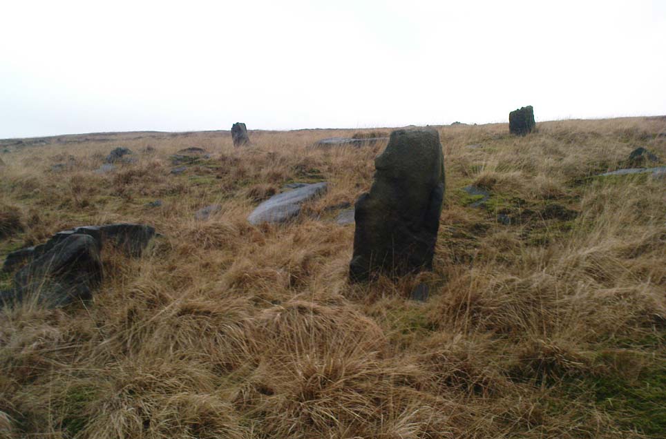
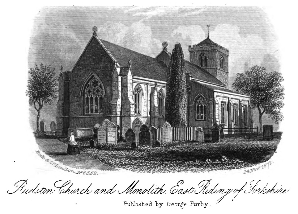
The 3 main stones (on a piss-wet thru afternoon!)

Get right to the top of the valley, past the end of the tree-line where the moor opens up ahead of you. Keep going till you reach the farmhouse on the left (there are usually sheepdogs outside, barking their heads off!). Take the track on the right, making sure y’ close the gate (the farmer here is infamous – so please shut the gate!). Cross the yummy stream at the bottom & double-back on y’self. If or when y’ reach the derelict house (an old shooting house), drop down the small valley, over the stream and stick to the bottom edge of the slope. (if y’ don’t reach the house, just cross the stream and keep to the contours) Keep walking for about 200 yards, keeping your eyes peeled for some uprights!

Archaeology & History

As with the Turvin Stone a half-mile southwest of here, this too is a very peculiar site.  ‘Peculiar’ inasmuch as no-one really seems to be able to make head or tails what the place actually was.  As you’re approaching the place, it looks like some decent ‘four-poster’ stone circle is ahead of you; but once you reach the place there are a veritable number of other earthfast rocks and tumbled stones all round, making your initial appraisal of the place suddenly grind to a halt! Added to this is the oddity of finding the standing stones on a considerable geological slope, unlike most other megalithic sites in the region (and elsewhere for that matter!).

The tallest standing stone

The tallest, easternmost of the three stones (SD 99547 21992) is more than five-feet tall and is lower down the slope than the other uprights here.  Almost ‘surrounded’ by some denuded stone enclave (a large robbed cairn perhaps?), this is the most visually impressive of the stones here.  Up the slope from here 15 yards (13.56m) away is what may, or may not, be a simple earthfast boulder (at SD 99535 21999): but it’s upright, about 3 feet tall, and due to proximity gives the impression that it was part of whatever monument this site once was.  Due west of the tallest standing stone nearly 20 yards (17.6m) away, is a more rounded stone of ‘female’ character, less than 4 feet tall (at SD 99528 21993).  That’s the general gist of the place.

If you visit here you’ll notice another smaller upright a short distance further down the slope in the green, less than three feet tall  And there’s possibly another one of similar stature more than  200 yards SSE.  But what is this place?  Is it prehistoric?  Was it built in the Dark Ages?  Medieval times?  Does anyone have a clue!?

References:

  1. Bennett, Paul, The Old Stones of Elmet, Capall Bann: Milverton 2001.
  2. Burl, Aubrey, Four Posters: Bronze Age Stone Circles of Western Europe, BAR 195: Oxford 1988.

© Paul Bennett, The Northern Antiquarian

Turvin Stone, Cragg Vale, West Yorkshire

Standing Stone:  OS Grid Reference – SD 98924 21378

Getting Here

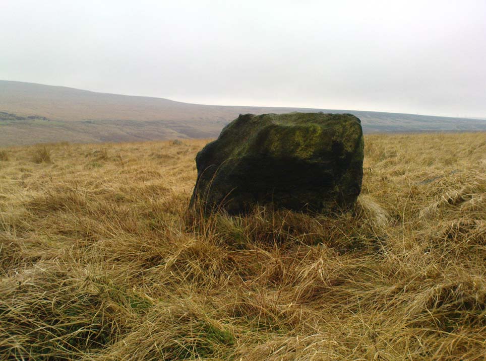
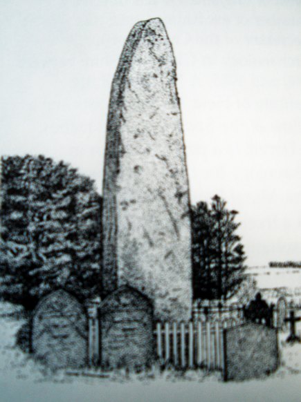
Turvin Stone (lookin’ south)

From Mytholmroyd, take the Cragg Vale road (B6138) up and up and up, until you get past the tree-level and the hills open up on either side of you.  Take note of the farmhouse on the right-hand side of the road a half-mile on and park where you can.  Walk down the track by the farmhouse (known as Washfold Road) and cross the stream at the bottom.  OK – from here walk straight up the hill in front of you! (not along the footpath)  In less than 100 yards it levels out and you’re onto the moorland proper.  From here walk straight west for about 400 yards.  If you deviate a little, don’t worry.  You’ll see this small upright stone as you’re getting closer, seemingly in line with several other rocks, almost giving the impression you’ve come across a stone row.  Good luck!

Archaeology & History

The slim upright

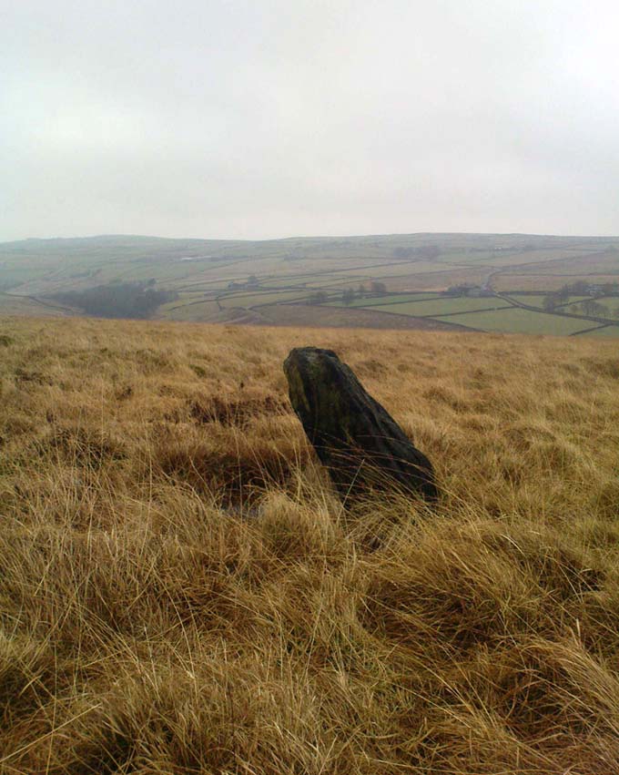
This small squat standing stone is just over three feet tall (1m), about 10 inches thick and 3½-feet across.  Leaning at an angle into the ground, this broad but thin monolith has sunk some distance into the moorland peat.

It was located on February 15, 2011, in the company of Dave Hazell (pacemaker in tow!) on our first sojourn of the year.  It hasn’t been mentioned in any previous surveys and aint in anyway what you’d call impressive.  Nearby are the early remains of old walling north, east and west of here (one of them being a small enclosure of some type), for which I can again find no other references.  What looks distinctly like the remains of a large cairn isn’t far away either.  However, it may be that some of the remains up here are medieval in nature and it would be of benefit if someone who specializes in remains from that period could have a look here.  The equally curious Turley Holes standing stones can be seen a half-mile northeast of here.

© Paul Bennett, The Northern Antiquarian

Parc-y Meirw, Llanychaer, Pembroke

Standing Stones:  OS Grid Reference – SM 9988 3591

Also Known as:

  1. Parc y Marw
  2. Parc y Meirw

Archaeology & History

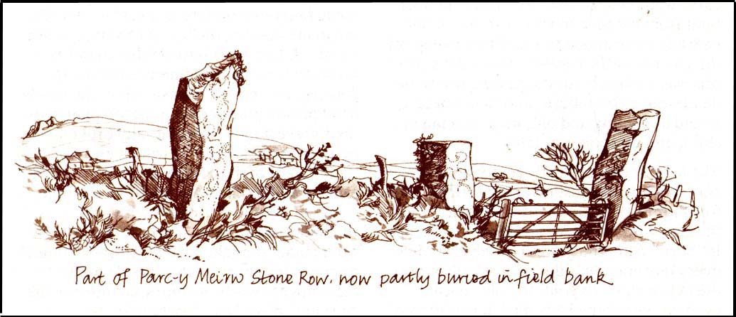
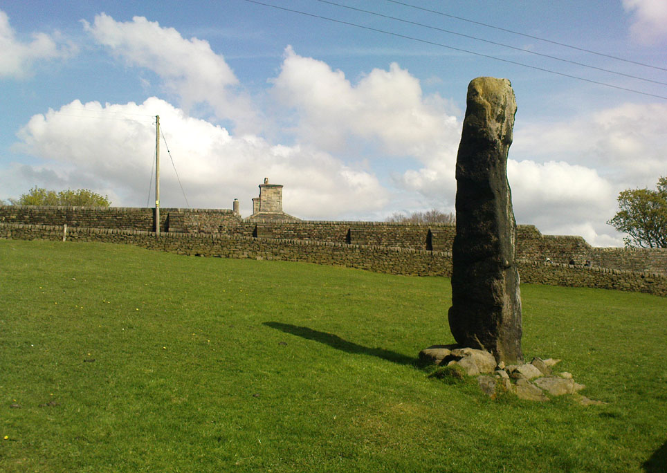
Parc y Meirw - by Liz Haines
Parc y Meirw – by Liz Haines

This is an impressive and well-known megalithic stone row, found just 4-5 miles inland from the coastal town of Fishguard.  The drawing here is used courtesy of Elizabeth Haines, landscape artist, and gives a fine representation of the site as I’m sure you’d agree!  Consisting of at least eight standing stones — four still upright and four laid down — aligning northwest to southeast, the tallest stone stands at the southerly end measuring 11 feet tall.  The stone row is found in a region rich in prehistoric remains.  Aubrey Burl (1993) said of the place:

“Four of the eight stones in this unusual row still stand, trapped in a  field-wall, tow of them now gateposts.  Thom suggested that the line, 131ft (40m) long, was laid out downhill towards the WNW and the minor northern moonset just north of Mount Leinster ninety-one miles away across the Irish Sea.”

Quite a distance!  And perhaps because of this, Burl thought that the nature of this line of stones was more archaeological than astronomical, with its focal point being more likely up the slope to the ESE instead.

Folklore

There was once an adjacent chambered tomb here which, when it was “destroyed for a house in 1844 brought the owner no luck” (Thom, Thom & Burl 1990) – which is damn good to hear!  There was a piece of folklore mentioned by E.L. Barnwell (1868) and other writers that the fields here marked the fall of three Welsh princes in the Battle of Mynydd Carn in 1084.  In Roger Worsley’s (1988) fine tour of Pembrokeshire’s historical sites, he tells how these megaliths in the “field of the dead” are also haunted, saying:

“A local tale tells of Ladi Wen, a ghostly White Lady wandering about the fields at night, and who will kill anyone who ventures near; it was enough to keep villagers away from the site well into this century, though the stone row is over five thousand years old.”

References:

  1. Barber, Chris & Williams, John Godfrey, The Ancient Stones of Wales, Blorenge: Abergavenny 1989.
  2. Barnwell, E.L., “Alignments in Wales,” in Archaeologia Cambrensis, volume 14, 1868.
  3. Burl, Aubrey, From Carnac to Callanish, Yale University Press 1993.
  4. Thom, Alexander, Thom, A.S. & Burl, Aubrey, Stone Rows and Standing Stones, BAR 560: Oxford 1990.
  5. Worsley, Roger, The Pembrokeshire Explorer, CCP: Abercastle 1988.

ACKNOWLEDGEMENTSA huge thanks to Elizabeth Haines, Landscape Artist, for use of her drawing of Parc-y Meirw.

© Paul Bennett, The Northern Antiquarian