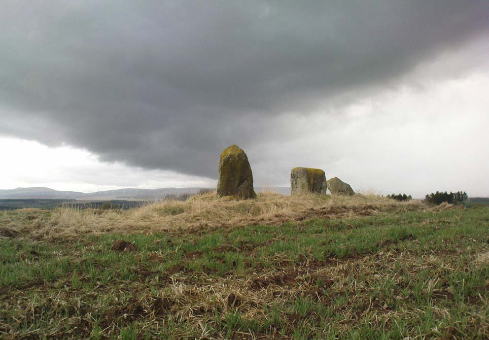
Virtually nothing is known of a stone circle that was described in the 18th century old Statistical Account of Scotland, where a ring of stones was seen “in the parks of Gleneagles.” Its exact whereabouts remains unknown and the grid-reference given for the circle is an approximation. The writer told that this was “supposed to have been places of Druidical worship,” and it is mentioned alongside the megalithic sites at nearby Sheriffmuir and the Glebe.
The circle is mentioned without further details on the Canmore website. A number of stones above St. Mungo’s Well looked promising when I was bimbling in the area the other week — and as the landscape levels out above the well towards Glen Devon, we have a promising panorama, but there was nothing there. It would be good to have a team of us bimbling round here to see what could be found. However, the site may well have been destroyed. Any further information about this site would be hugely welcome!
References:
Sinclair, John, The Statistical Account of Scotland, 1791-1799 – volume 3, EP: Wakefield 1979.
Along the A9 dual carriageway between Blackford and Auchterarder, take the A823 road south, up the Glen Eagles road as if you’re heading towards Pool of Muckhart and Dunfermline. Less than 100 yards up the road, turn immediately right and go past the standing stone of Gleneagles B for a coupla hundred yards or so, where there’s a left turn (down to Peterhead Farm). Stop here and look into the field in front of you. You can’t really miss it!
Archaeology & History
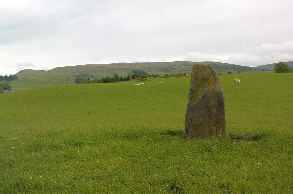
Gleneagles ‘A’, gazing west
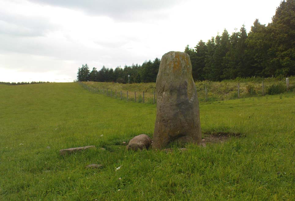
This short standing stone, more than 3ft tall, has an elegance about it which megalith lovers alone will understand! Maybe it’s the setting; maybe the feel of the land; or maybe something else. I dunno… On my first visit to the site, Nature was wearing a grey overcast cloak, but the site and I didn’t seem to care; and although the view from here doesn’t have the same grandeur of Glen Eagles to view as its companion stone a few hundred yards to the east might have, there felt a greater welcoming at this smaller stone. Odd, considering this monolith had been knocked over and re-positioned by the farmer in the not-too-distant past. Anyway…less of this subjective nonsense of feelings from the landscape and megaliths! Utter drivel all of it!
The earliest measured account of the stone is to be found in Mr Hutchison’s (1893) essay, where he notes this and its companion close by, giving us the dimensions of this monolith:
“This (stone) is roughly columnar in shape, but wider at the base than above. Its height is 3ft above ground; circumference at base 6ft. 5in., diminishing to 4ft. 2in at the top. It is of metamorphic schist. The line of direction between these two gives a horizontal angle of 260°.”
Since that day, in the mass of archaeology essays that have been scribed, this smoothed upright gets only a minimal description. Charles Calder’s (1947) account is typical, saying simply that it is,
“Somewhat cylindrical in form with a girth of 7 feet at the base, it rises with a decided tilt towards the west to a height of 3 feet 10 inches above ground-level.”
The stone fares better in Andrew Finlayson’s (2010) fine local survey of megalithic ruins, where he points out that this and its compatriot stone Gleneagles B, are in an alignment with the fallen Boat Stone and the upright White Stone, a few miles to the southwest. This line works on 1:50,000 map, but when transferred to larger-scale surveys, the alignment misses each outlying site by 20-30 yards here and there.
Standing Stones (destroyed): OS Grid Reference – NN 7643 2086
Archaeology & History
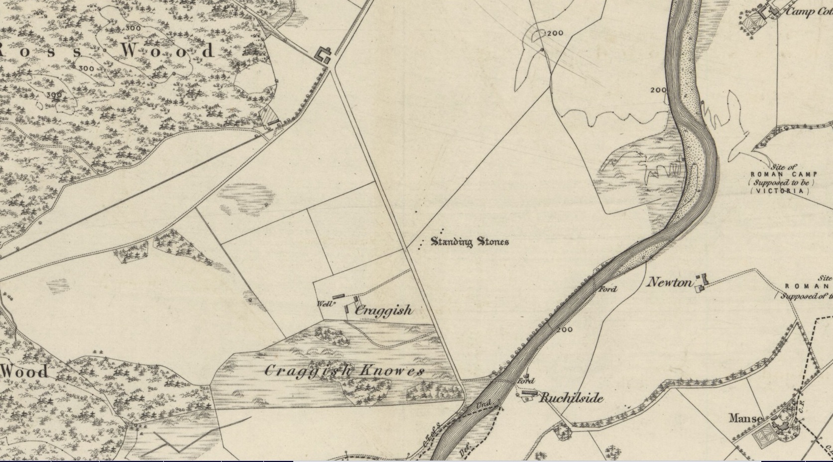
Site shown on 1886 OS-map
Highlighted on the 1866 OS-map was an impressive cluster of standing stones that sadly met their demise sometime around at the end of the 19th century. They were mentioned to “still exist” when the local writer Samuel Carment passed them in 1882, but had been destroyed by the time the Ordnance Survey lads resurveyed here in 1899. Altogether there were at least six of them, standing aligned sharply northeast-southwest and were described in one of Fred Coles’ (1911) essays, who lamented their passing. Listed in the stone row surveys by Burl (1993) and Thom (1990), the prime description we have of them was by Cole himself, who told:
“This site has also been wantonly bereft of its group of megaliths. Up to so recent a date as 1891 there were several. These were shown on the (Ordnance Survey map) as three in one line and two in another, on a field about one furlong NE of Craggish farmhouse, close to the road coming down from Ross, and nearly a quarter-mile NW of the ford across the Ruchil at Ruchilside.”
In Finlayson’s (2010) colourful survey of the local megaliths he told that the stones,
“Stood, by the road, in what is now ‘The Whinney Strip’: a boulder-strewn strip of land 20m wide dividing up otherwise flat and even grazing land.”
References:
Burl, Aubrey, From Carnac to Callanish, Yale University Press 1993.
Cole, Fred, “Report on Stone Circles Surveyed in Perthshire, Principally Strathearn,” in Proceedings of the Society of Antiquaries, Scotland, volume 45, 1911.
Thom, A., Thom, A.S. & Burl, Aubrey, Stone Rows and Standing Stones – 2 volumes, BAR: Oxford 1990.
Acknowledgments: Big thanks for use of the early edition OS-map in this site profile, Reproduced with the kind permission of the National Library of Scotland.
Take the B824 road that runs between Dunblane and Doune and, whichever direction you’re coming from, watch out for the large statue of David Stirling by the roadside (y’ can’t really miss it!). Stop here. Then, walk along the dirt-track into the field by the side of the statue, keeping your eyes peeled 50 yards along, for the upright stones in the field on your right, at the top of the brow of the hill.
Archaeology & History
Glenhead Farm standing stones
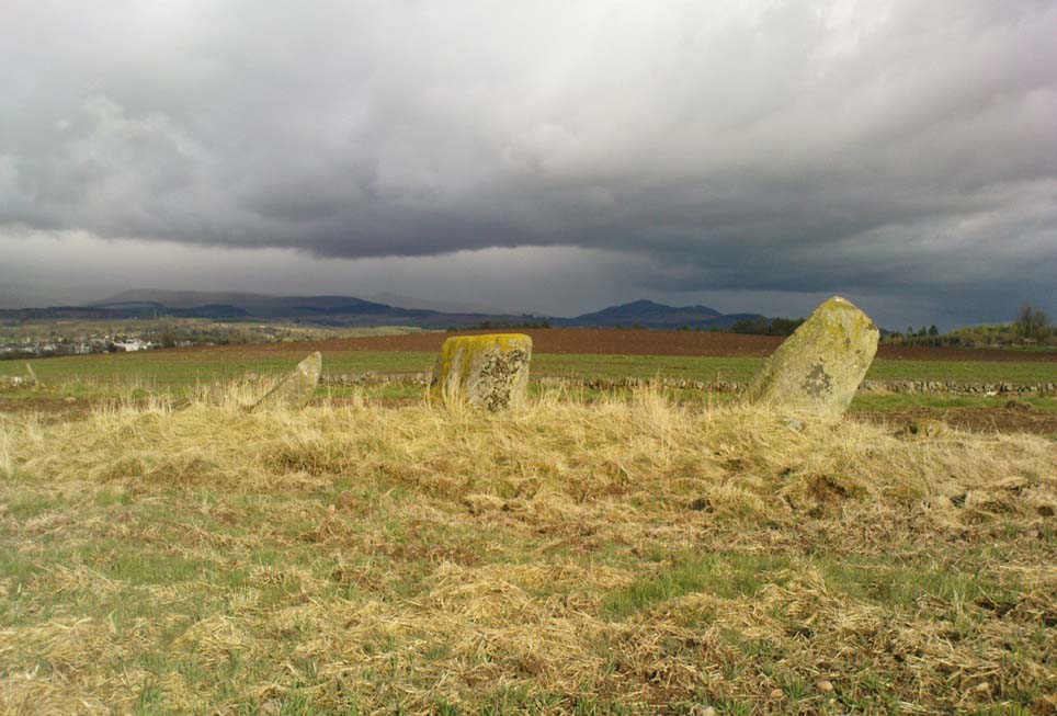
A few hundred yards south of the large Glenhead Standing Stone, we come across this curious small row of three reasonably large standing stones which — the more you look at them — give the distinct impression that they may be the remains of a large prehistoric tomb. But archaeology records are silent on this matter and we must contend with what we can see. At the northernmost end of the row, a fourth stone lays amongst the vegetation: it may have once stood alone, or maybe been snapped from its fellow monolith. 20 yards south is a large mass of stone; perhaps from an old building, perhaps cairn spoil (does anyone know?)
The local historian Moray Mackay (1984) thought that the line of stones here were once a part of something larger, saying:
“Originally it was probably a circle of six stones, with a seventh in the middle, and this central stone can still be identified by its flat top on which are the mysterious and well known cup-marks, much weathered but plainly visible. Close to the site, urns and stone hammers were unearthed last century.”
Glenhead stone row, looking north
Of the three remaining upright stones, it is the central one which has the cup-markings visible on its top and side (Allen 1882), with a lovely covering of almost luminous lichen giving it extra effect! (a separate TNA Site Entry for the cup-marked stone will be written in due course)
The famous astroarchaeologist Alexander Thom and his son (1990) described the place as,
“A three stone alignment showing about 33° N declination in one direction and 31° S in the other, but the azimuth comes from the stones only and so cannot be accurate. Perhaps the line is lunar to the hill in the SW…”
In Thom’s (1967) earlier work he posited that the alignment may relate to the rising of the star Capella around 1760 BC, but this is untrue. Thom’s error however, was not of his making, but due to the false dates that archaeologists ascribed to megalithic ruins at the time – dates which Thom used in his research, believing that the archaeological fraternity would know what they were talking about! In their collaborated text, Aubrey Burl added how,
“these stones stand on a hill summit at 360ft (110m) OD. The row is on a north-facing slope. Three stones stand. A fourth, prostrate, 6ft 6 in (2m) long, lies against the NE pillar. The row has a NNE-SSW axis. The northernmost stone is 3ft 6in high, the centre 4ft, and the SSW, characteristically the tallest, 6ft 6in… The line is about 27 feet (8.3m) long. The central stone has 23 cupmarks on its top and 4 more on its western side.”
…to be continued…
References:
Allen, J. Romilly, “Notes on some Undescribed Stones with some Cup-Markings in Scotland,” in PSAS 16, 1882.
Burl, Aubrey, From Carnac to Callanish, Yale University Press 1993.
Take the A820 road from Dunblane to Doune. About a mile west of the motorway, keep your eyes peeled for where the small road on your right is signposted to Argaty and Kilbryde. Stop here and walk up the footpath on the left-hand side of the road. A couple of hundred yards up, take the right turn on the track and where the small copse of trees is, go through the gateway, keeping yourself to the left edge of the trees running parallel to the field. About 100 yards or so up, you can’t miss him!
Archaeology & History
Quite a huge fella this one! Standing more than 6 feet high, the monolith is nearly as broad, giving an impression of great size to the old stone. The stone’s nature and date is troublesome: although ostensibly labelled as Bronze Age, alongside the walling which runs down from here we see a great number of other large stones, some of which give the distinct impression of being length of Iron Age walling — but without excavation, its nature remains a puzzle. The monolith stands close to being on top of a rise in the land, which geomancers understand as being important sites of spirit, or places where the dead were rested — but we have no record of any tombs here, so are left with the options of walling or a spirit site.
…and from another angle
On its east-face, the stone has a number of what appear to be curious large cup-markings, but they appear to be little more than the effect of weathering and erosion. There’s also a solid piece of long metal sticking out of the same side, which was obviously done by someone in recent centuries — so maybe a local farmer and his mates stood this one up? Or they were planning on using it as a gatepost…
The site is well worth looking at, best in the winter months when access is easier. It has the feel of other sites close by, hidden from the record books, though probably long gone.
References:
Royal Commission on the Ancient & Historical Monuments Scotland, Stirling – 2 volumes, HMSO: Edinburgh 1963.
Royal Commission on the Ancient & Historical Monuments of Scotland, Archaeological Sites and Monuments of Stirling District, Central Region, Society of Antiquaries of Scotland 1979.
One helluva climb to reach this little fella. I simply started at Dalgirdy cottage, some 5 miles along Glen Lochay, on the right-hand side of the road. Then, walk right up the burnside, all the way up until it begins to level out and the old shielings appear. When you’ve got to where they just about finish, about 50-70 yards on the east side of the burn, you’ll see the small stone standing upright, all alone. You can’t really miss it!
Archaeology & History
Allt Ghaordaidh, looking south-ish!
No previous written records exist that describe this small standing stone, whose nature and age may be akin to that at nearby Tirai, found amidst the derelict village a couple of miles east, lower down the slopes — i.e., it may have simply been part of some of the ancient village remains and shielings found close by, either side of the rushing burn. But whether it’s only medieval or much more ancient than that, its position in the landscape alone (much like Tirai’s uprights), deserves to be known about.
There are considerable amounts of ancient remains scattering the mountains slopes all round here: some have been catalogued, but a lot of it has not. This little standing stone is at last alive again! (take good food and kit when visiting here)
Standing Stones (destroyed): OS Grid Reference – SY 6070 8701
Also Known as:
Jefferey and Jone
Archaeology & History
Described in early field-name listings as ‘Jefferey and Jone’, this was another group of standing stones, whose precise nature is difficult to truly discern, that met with an untimely end in the middle of the 19th century. They may have been part of a large tomb, or even a stone circle. Marked on the early Ordnance Survey map of the area as ‘Standing Stones (site of)’, they appear to have been described firstly by John Hutchins (1774) close to other megalithic remains, who told that:
“A little north of Hell Stone near Blagdon are four upright stones, near to, and equally distant from each other, about two feet high, except that one is broken off even with the ground.”
In Warne’s (1866) classic text he mentioned these petrified monoliths,
“In a small valley, on the down of Portesham Farm, there stood within these last ten years, four upright stones… By the direction of the then occupier of the farm, Mr Manfield, these stones were built into an adjoining wall.”
A few years later another account by H.C. March, which referred to Mr Warne’s description, gave another report citing information from one who was present at the destruction of the site:
“Warne says they have been built into an adjacent wall: but a man who was present at the ceremony stated that, by the spot where they once stood, a hole was made for them, and they were decently interred. The place where they are said to lie can be pointed out, as well as a wall which contains four large stones.” (Harte 1986:54)
Historian and folklorist Jeremy Harte (1986) concluded that the megaliths must obviously have been destroyed around the year 1855. However, the historical references of Jeffrey & Jone being moved into the adjacent walling appears to be verified by independent researchers who’ve found standing stones hereby.
Folklore
Very probably the remains of petrified ancestors, a curious rhyme describes a forgotten folktale of these lost standing stones relating to them as possessing spirit, or once being alive. They were thought of once as being a family who lived in the hills:
“Jefferey and Jone,
And their little dog Denty
and Edy alone.”
Sadly, I can find nothing further that might enrich the folktales that were obviously once spoken of these monoliths.
References:
Harte, Jeremy, Cuckoo Pounds and Singing Barrows, Dorset Natural History & Archaeological Society 1986.
Hutchins, John, The History and Antiquities of Dorset, John Bowyer & J Nichols: London 1774.
Warne, Charles, The Celtic Tumuli of Dorset, John Russell Smith: London 1866.
‘Standing Stone’ (destroyed): OS Grid Reference – TQ 282 804
Also Known as:
Oswald’s Stone
Ossul Stone
Archaeology & History
Described as far back as 1086 in Domesday — as Osulvestane — this old stone was mentioned in numerous old documents, but its ancestral importance had long since been disregarded by modern Londoners. Probably heathen in nature, the stone was referenced in various texts as Osulfestan (1167 and 1168), Osolvestone (1274), Oselstone (1290), Ossulstone (1610) and variants thereof all the way through literary accounts until the emergence of the self-righteous judaeo-christian Industrialists in the 19th century, bringing about its destruction. (they’ve never really stopped to be honest) The grand place-name masters Gover, Mawer & Stenton (1942) told us a bit about the old stone, saying:
“This was probably a stone marking the meeting-place of the Hundred. It has been surmised that its site was near the present Marble Arch, but in 1484…there is mention of Westmynster lane leading between Tyburn and les Osilston Pyttes. Westmynster lane is the later Park Lane…and in a Grosvenor Estate map of 1614… Osolstone is marked as a field-name about halfway down Park Lane on the east side just beyond the present South” Street.
According to the Victoria County History of London (volume 1), the stone was actually in position up to 1822, “but was then earthed over.” However, it was resurrected during the construction of the modern Marble Arch in 1851 and stood up against the monument for several years until its eventual demise around 1869.
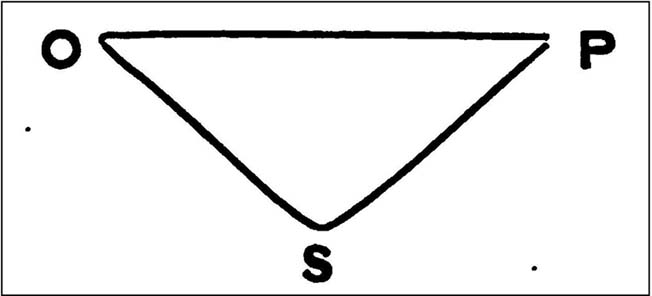
W.H. Black’s isosceles triangle, showing Oswulfs Stone at ‘O’
One intriguing commentator on Oswulf’s Stone suggested a more recent Roman origin, due to him finding that the monolith played an important part in a precise isosceles triangle. In a talk given to a meeting of the London & Middlesex Archaeological Society on 10 January, 1870, William Black (1871) reminded his audience that he had,
“already shown that the sculptured and inscribed marble sarcophagus or sepulchral monument…at Clapton had served as a geometric point from which numerous measures extended to boundary points of Hackney and its neighbouring townships.”
And when he explored this potential at Oswulf’s Stone he found even more geometry. Alexander Thom and Alfred Watkins would have been proud of him! His research led him to compare two relative antiquities, both of which he deemed to be Roman:
“Of these two monuments the first is Ossulstone, from which the great Hundred…derives its name. Its position and identity I had discovered some years ago by reversing my method of determining the uses of geometric stones: that is, by finding, from the proper boundary points, a centre where lines of proper quantities unite, so as to make them serve as radii from such centre to the said boundary points…
“Ossulstone is figured in Sir John Roque’s great map of 1741-1761, sheet XI, in the very spot to which my process on other maps had led me; and it is there called the ‘Stone where soldiers are shot,’ situate near the northeast angle of Hyde Park. It was afterwards covered with an accumulation of soil, and is now dug up and lies against the Marble Arch, as stated in my petition, presented last session to the House of Commons, for the protection of ancient uninscribed stones, mounds and other landmarks…
“The second line leads to the well-known sculptured stone, undoubtedly of Roman work, formerly uninscribed, but now bearing an English inscription below the sculpture dated ‘1685’, which (now) forms part of the front wall of a house on the eastern side of Payner Alley… I had already found…that this stone had geometric uses… Now I find that this stone is equally distant from the newly-discovered Sepulchre as that is from Ossulstone.”
But the position of William Black’s stone and that mentioned in the early records described by Gover, Mawer & Stenton, are two different sites—albeit by only 700m—meaning that Black’s triangle never initially existed even if it was a Roman milestone. The likelihood is that the stone was moved about as London slowly grew on top of the once fair Earth. (the OS grid-reference given for the site is an approximation based on the 1614 Grosvenor map) Does anyone know owt more about the place, have any old drawings, or have copies of the old maps showing where the stone once stood?
References:
Black, William Henry, “Observations on the Recently Discovered Roman Sepulchre at Westminster Abbey,” in Transactions of the London & Middlesex Archaeological Society, 4:1, 1871.
Gover, J.E.B., Mawer, Allen & Stenton, F.M., The Place-Names of Middlesex, Cambridge University Press 1942.
Sharpe, Montague, Middlesex in British, Roman and Saxon Times, G. Bell: London 1919.
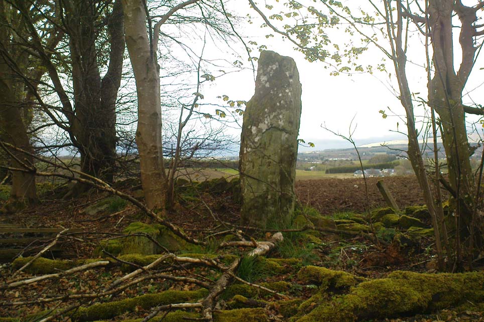
The standing stone that could once be seen here is long gone. Its existence was reported in John Stuart’s (1854) short essay on stone circles of the region, in which he told:
“On the summit of the Hill of Balnoon, or rather on its neck towards the east, there was till lately a lofty upright stone called The Conwath or Conway Stone, and by some The Charter Stone. It was surrounded by a slight ditch.”
A recumbent stone in the field immediately north may relate to Stuart’s old report.
Folklore
In the same article, Mr Stuart told some interesting folklore which strongly implies the stone to have had importance for women. He said:
“It has been said that funerals coming from the west end of the parish were accompanied to this stone by the females of the family, and that the funeral here rested for a time, and the females returned (the stone being in sight of the churchyard). My informant (the minister of the parish) states, that a cairn on the hill of Auchinhamper was used for a similar purpose by funerals coming from the east end of the parish. On visiting the stone, however, I found that the churchyard was not visible from that spot.”
From Shieldaig, take the A896 road east to Torridon and Kinlochewe (a bloody superb part of Scotland – perhaps the best!) for a couple of miles, round the stunning bay of Ob Mheallaidh, till you reach the tiny hamlet of Balgie. From here, walk upstream following the small River Balgie until you hit Loch Damh. At the edge of the rugged and boggy flatland shortly before the loch itself, amble about in the rushes on your right (west). You’ll find it!
Archaeology & History
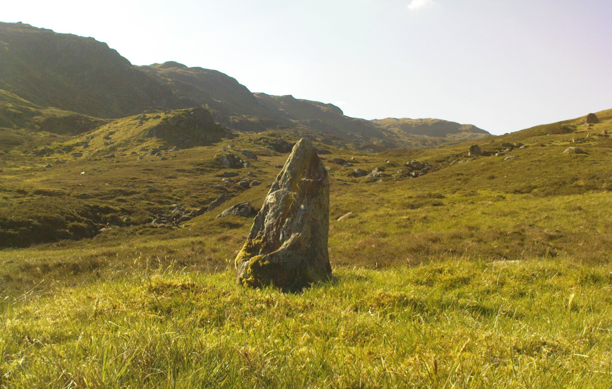
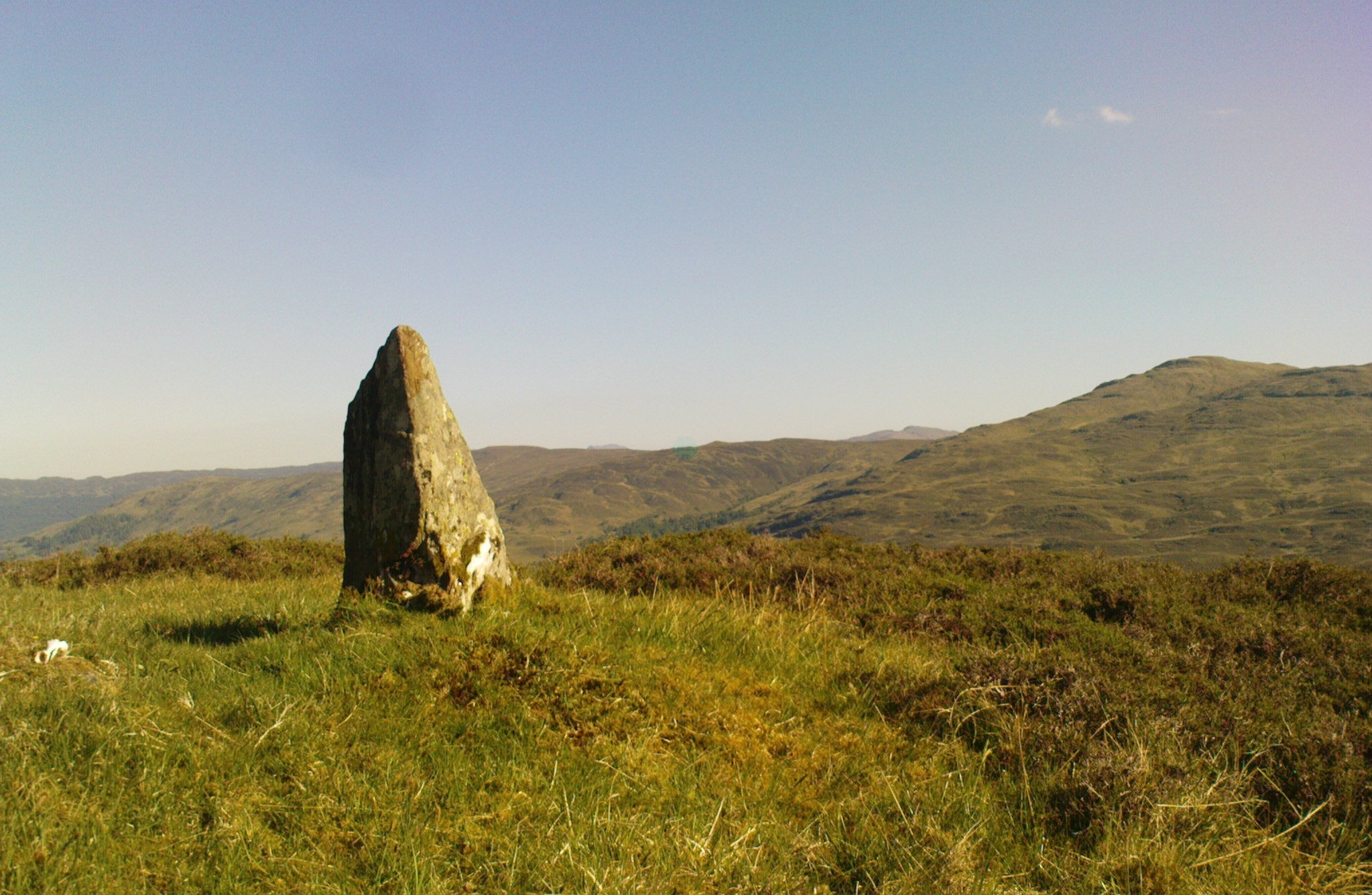
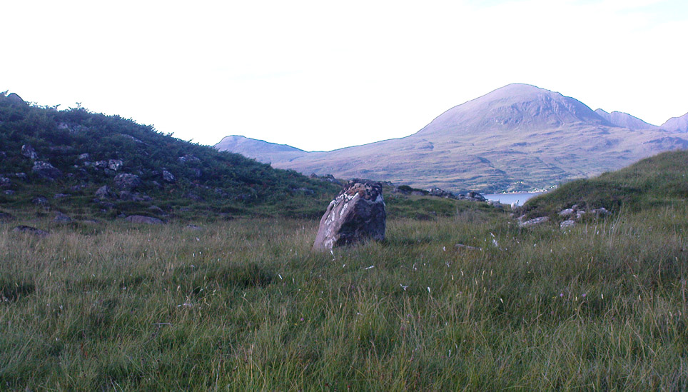
This is a small but chunky standing stone was rediscovered by Dr J. Havelock Fidler in the 1980s. Less than four-feet tall, it stands alone at the edge of the boggy landscape, with superb views all around (the hill in the background photo is An Ruadh-mheallan). There are other human remains scattered amidst the rocky landscape close by, including the remains of old buildings not far away, but this prehistoric monolith seems to be an isolated example. However, the landscape here is so vast that it’s highly likely that other standing stones remain hidden in these ancient mythic hills…
References:
Fidler, J. Havelock, Earth Energies, Aquarian: Wellingborough 1988.