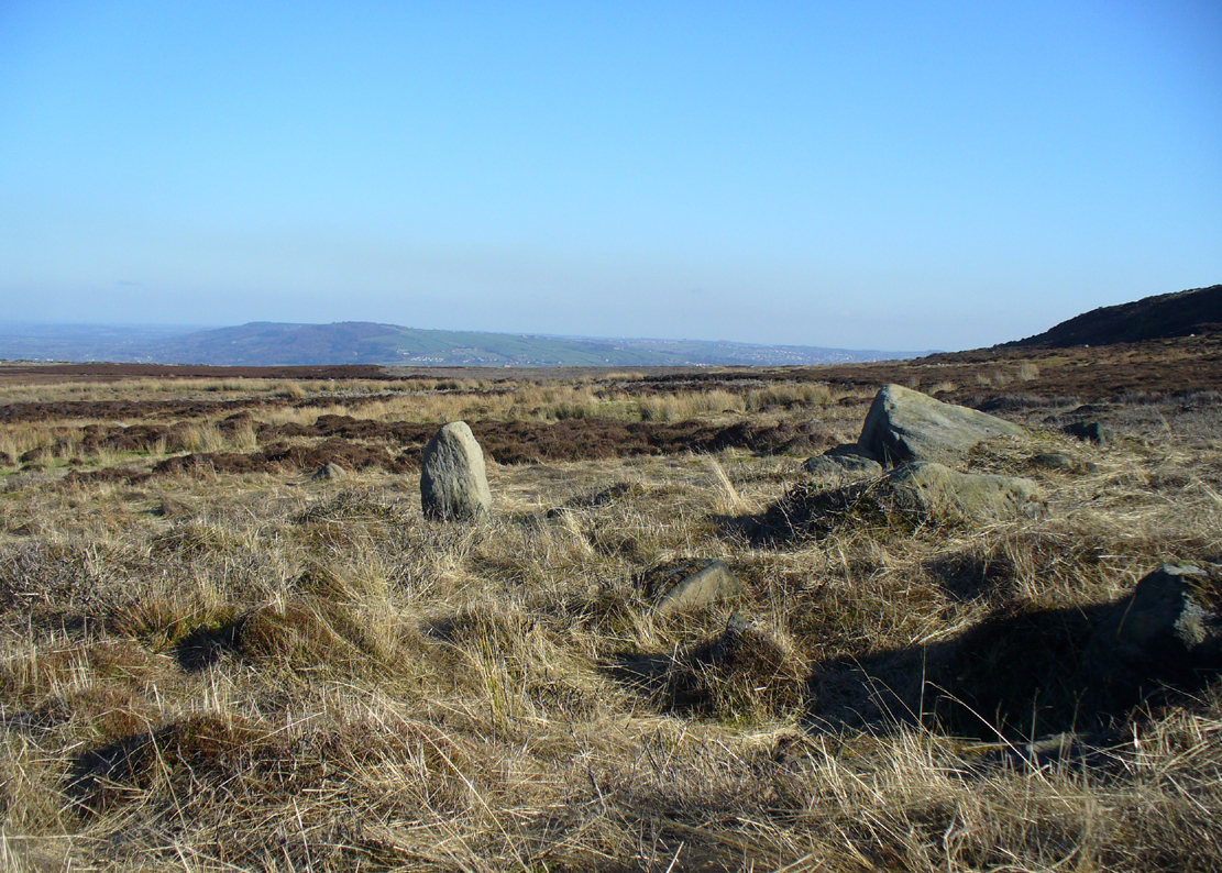
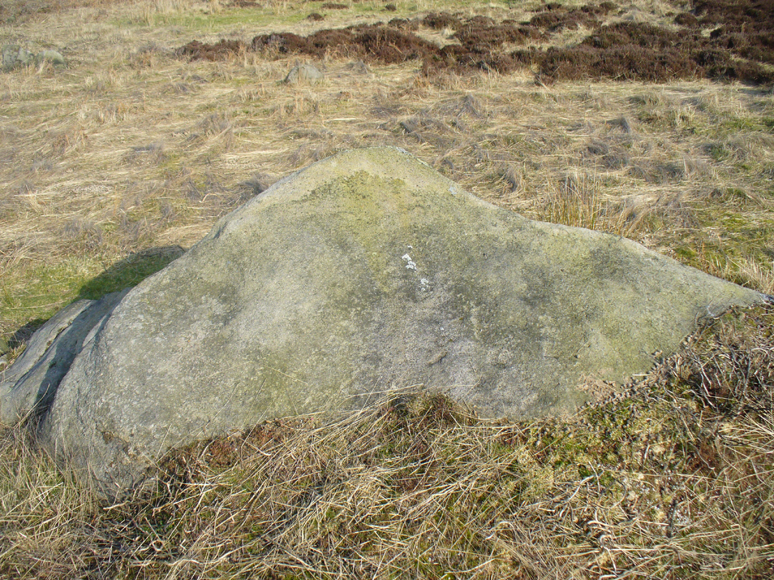
Follow the directions to reach the impressive Woofa Bank prehistoric enclosure. You need to find the walling that constitutes the enclosure itself and walk along to its eastern side where you’ll reach an ‘opening’, as if it may once have been an entrance at that side of the enclosure. A reasonably large sloping rock is on one side of this ‘entrance’. You can’t really miss it!
Archaeology & History
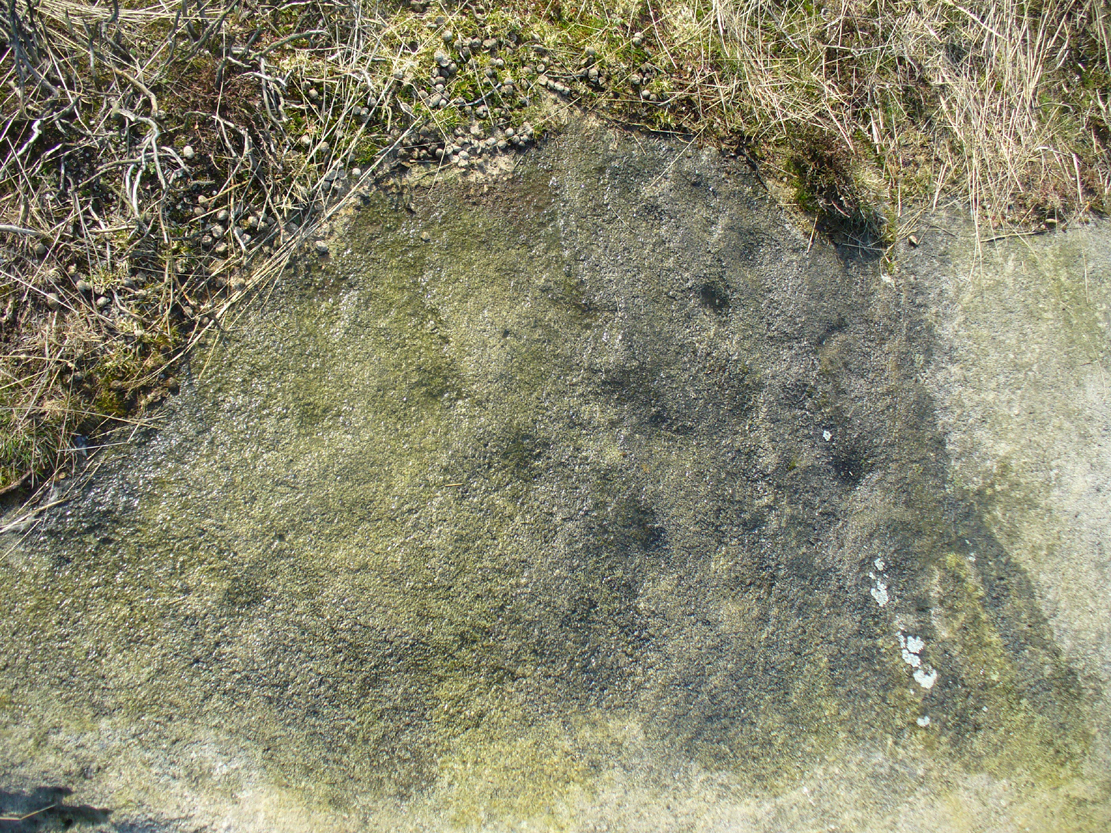
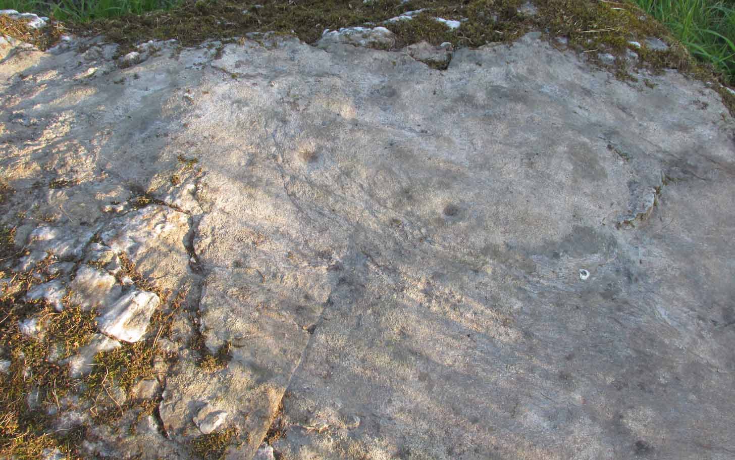
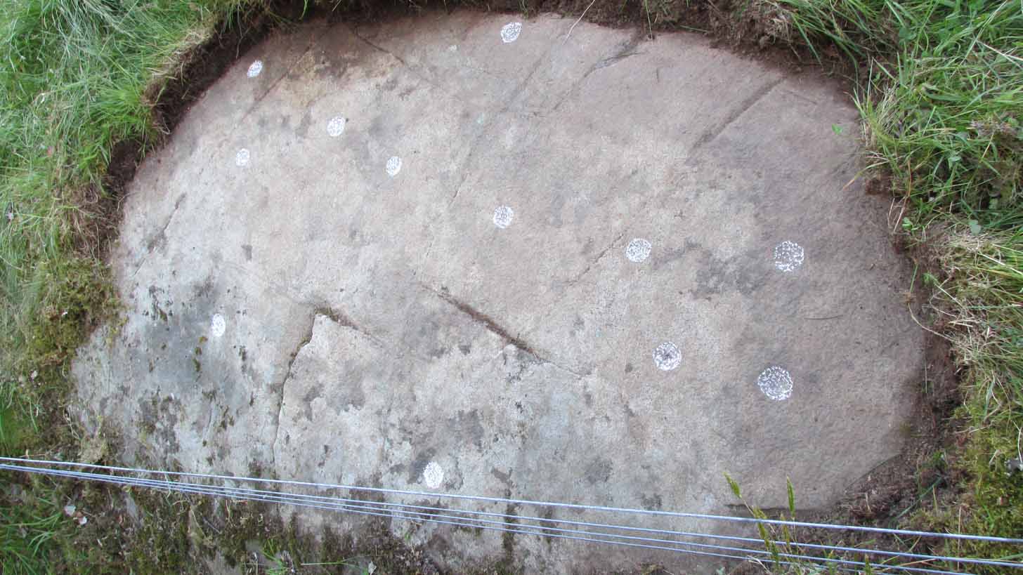
Unlike many of the other petroglyphs found within the Woofa Bank enclosure, the design on this one is faint — very faint indeed (much like the recently uncovered triple-ring petroglyph by the Thimble Stones). Comprising simply of a small cluster of cup-marks, you’ll struggle to see this one — unlike its compatriot on the western wall of the enclosure.
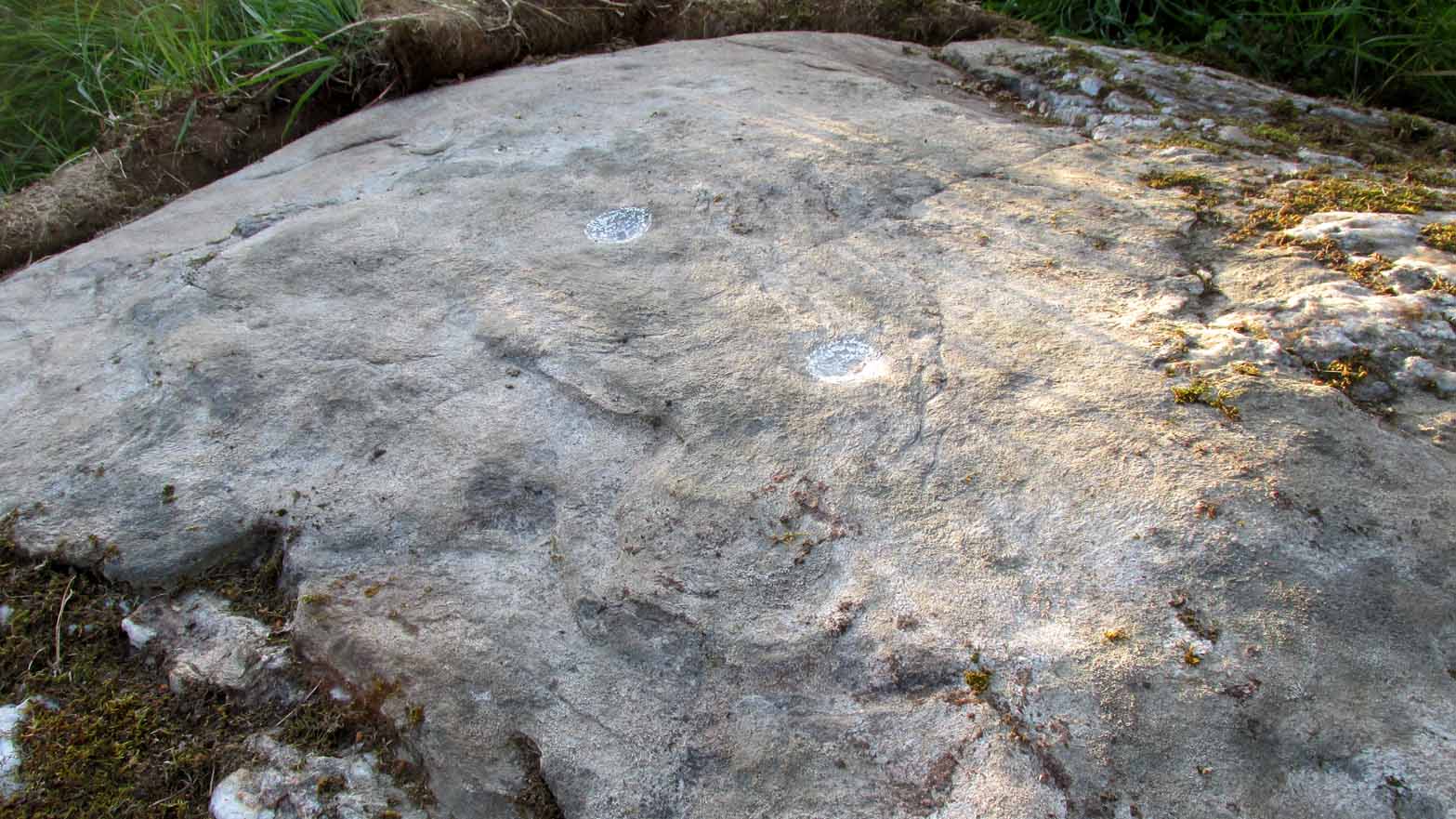
Looking down on the rockSome very faint cupmarks
It consists of a single cup-mark on the northern edge of the stone, whilst on the sloping southern part of the rock are a number of very faint cups, eroded by them there millenia of Nature’s wind and weathering. One or two of the cups are just visible in good lighting, but what are almost certainly a few more can be seen when the rock is wet and in low daylight hours. It’s a design that’s probably only of interest to the hardcore petroglyph fanatics, but without doubt this is yet another carving within this obviously important prehistoric enclosure.
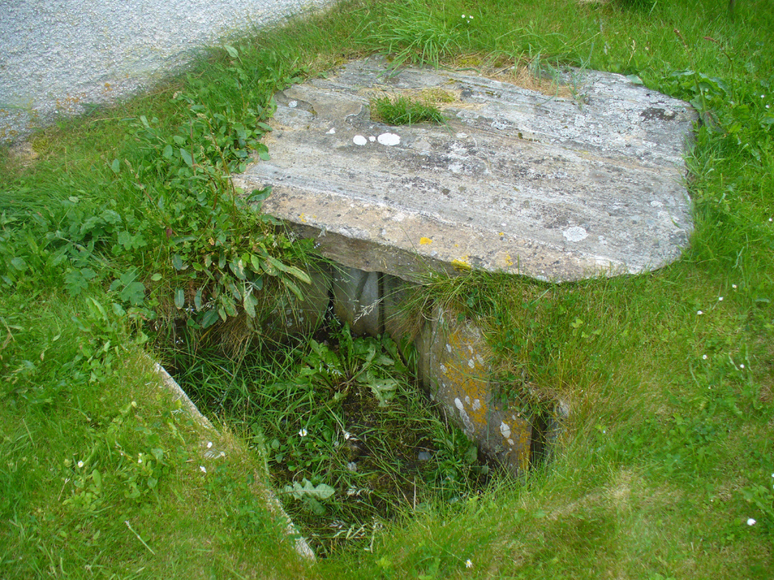
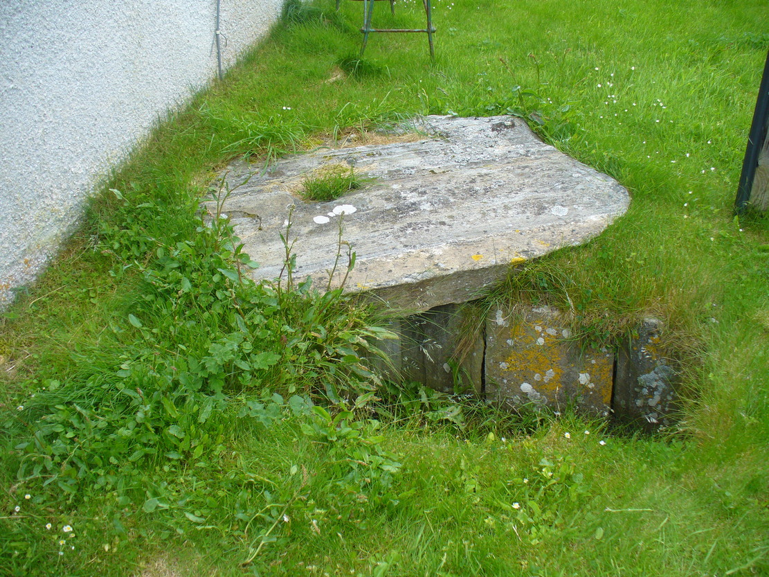
Dead easy. From the top of the hill at Bettyhill, take the road east out of the village along the A836 Thurso road. At the bottom of the hill, on your left, you’ll see the white building of Farr church Museum. Walk to it and instead of going in the door, walk past it and round the back, or north-side of the church where, up against the wall, you’ll see this small stone-lined hole in the ground. Y’ can’t really miss it.
Archaeology & History
Originally located 7½ miles (12.1km) to the south at Chealamy (NC 7240 5017), in the prehistoric paradise of Strathnaver, it was uncovered following road-building operations in 1981 and, to save it from complete destruction, was moved to its present position on the north-side of Farr church museum. It was fortunate in being saved, as it was covered by a large boulder which the road operators tried to smash with a large jack-hammer; but in breaking it up, they noticed a hole beneath it. Thankfully, old Eliot Rudie of Bettyhill—a well respected amateur historian and archaeologist in the area—was driving past just as it had been uncovered by the workmen. He recognised it as being a probable cist and so further operations were stopped until it was investigated more thoroughly.
The relocated cist
The cist—measuring some 4 feet long by 3 feet wide and about 1½ feet deep—contained the burial of what was thought to be a man in his mid- to late-twenties. The remains were obviously in very decayed state and it was thought by archaeologist Robert Gourlay (1996), that the body itself had been “deposited in the grave (when it was) in an advanced state of decomposition.” Also in the cist they found a well-preserved decorated beaker, within which Gourlay thought “probably contained some kind of semi-alcoholic gruel for the journey of the departed to the after-life.”
References:
Gourlay, Robert, Sutherland – An Archaeological Guide, Birlinn: Edinburgh 1996.
Gourlay, Robert B., “A Short Cist Beaker Inhumation from Chealamy, Strathnaver, Sutherland”, in Proceedings Society Antiquaries Scotland, volume 114, 1984.
Gourlay, Robert & Rudie, Eliot, “Chealamy, Strathnaver (Farr) Beaker Cist”, in Discovery Excavation Scotland, 1981.
Acknowledgments: To that inspiring creature Aisha Domleo, for her bounce, spirit and madness to get me up here; and for little Lara too, for meandering to the church museum where this cist can be seen; and to Eliot Rudie, who pointed it out to us.
In the middle of Bridge of Earn village, take the Heughfield Road until, ⅓-mile on you hit the T-junction. Turn left along Forgandenny Road and go along the curvaceous road for just over a mile where you need to keep your eyes peeled for the small left turn that takes you up the dead straight road. At the top, turn left at the junction and go ⅔-mile, turning right at the next junction until after 400 yards you reach the houses on your right. Go up the footpath opposite the houses (south) until, after nearly 400 yards, it splits. Bear right and zigzag up the track for nearly a mile till you reach a large opening in the forest. 40 yards up the slope to your left is the stone—at last!
Archaeology & History
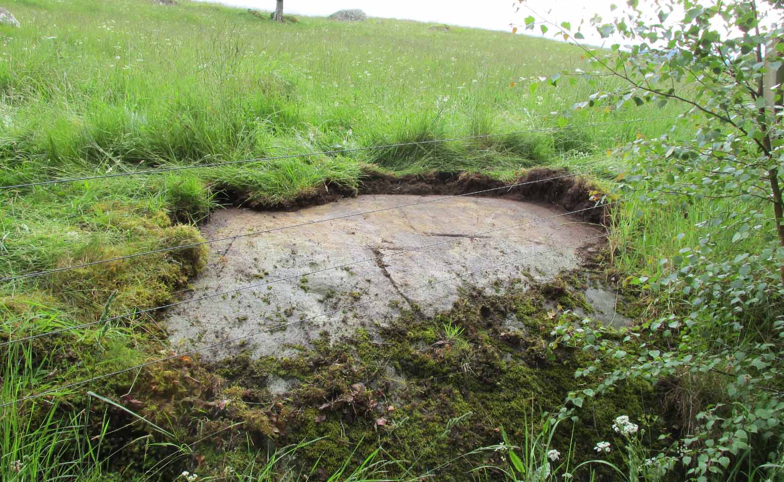
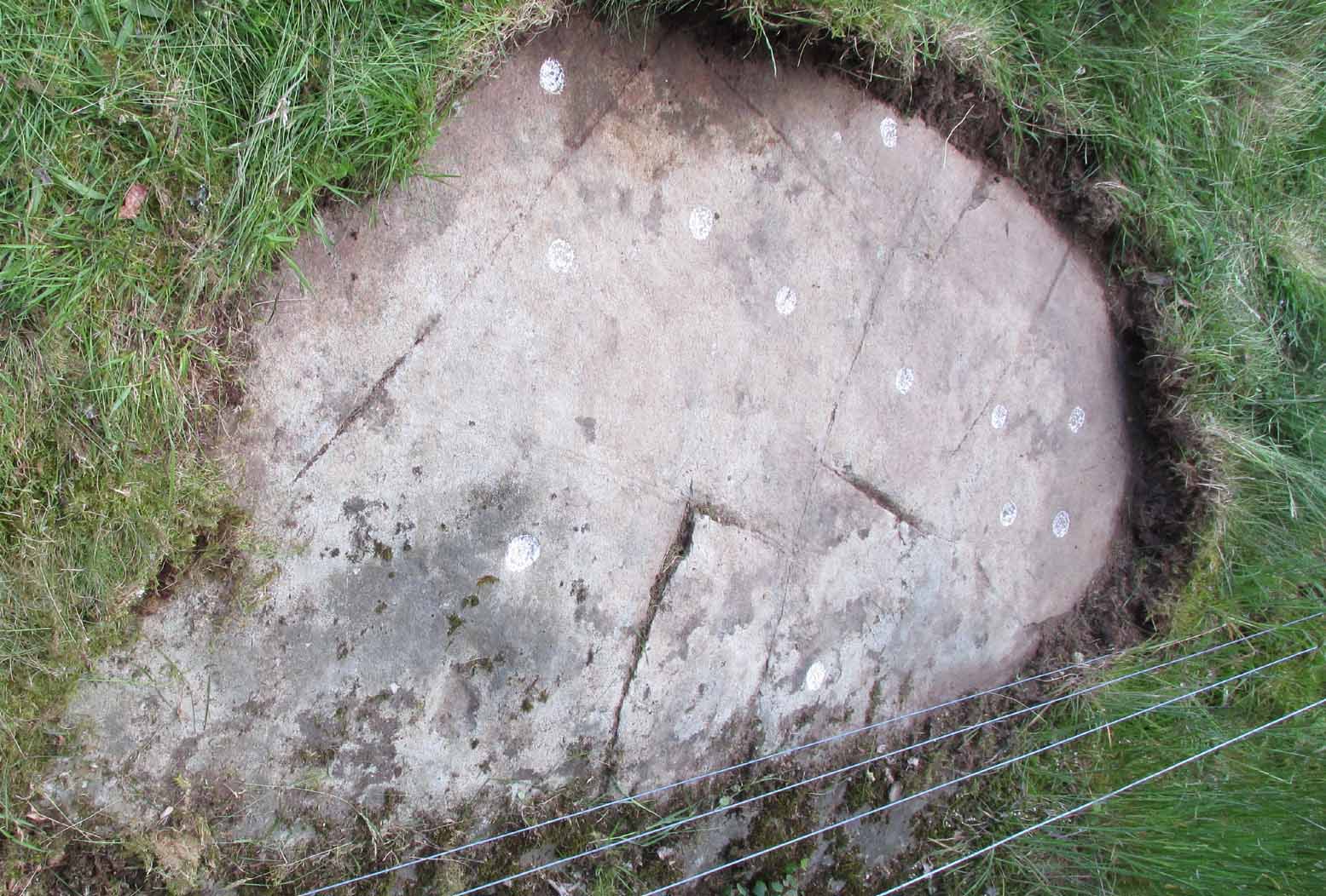
After the trail to get here, you might not be overly impressed by what you see – and it’s nothing special to look at to be honest. But its location is a good one: reasonably high up on a sloping plateau which would have given good views were it not for the surrounding forestry plantations. The only literary description of the site was the brief one in Discovery & Excavation Scotland, shortly after being rediscovered. Mrs Johnson (1960) wrote:
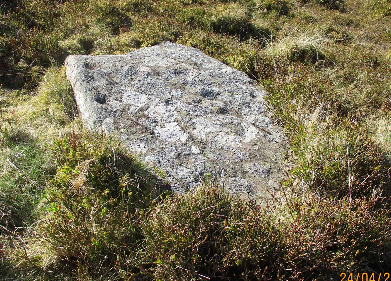
Close-up of the carving
“A cup-marked stone was found by Mr. J. R. Morrison on the N side of West Dron hill. The stone measures approx. 4ft long by 1ft 9in broad.
There are 17 cup-marks: five of which have channels, and two of which are joined in the form of a dumb-bell. The stone lies with its longer axis NE-SW, and its broad face uppermost.”
Its seeming isolation is a peculiarity that I don’t buy. Other carvings are going to be in the locale, probably on the same north- or north-east facing ridges – but due to the dense forestry, any other petroglyphs will remain hidden for quite some time…
References:
Johnson, M., “Dron, Perthshire,” in Discovery & Excavation Scotland, SRG 1960.
Acknowledgements: Huge thanks to Theresa Hughes for the use of her photos of this carving.
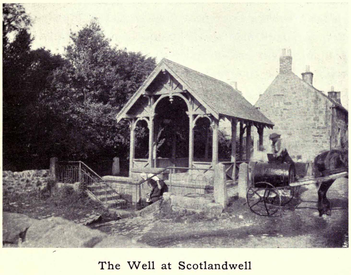
Whichever way you come into the hamlet—be it along the A911 from either Milnathort or Glenrothes, or up the B920 from Ballingry side—the only little carpark to use is about 20 yards from the main road junction, on the west-side of the road, appropriately named Well Road. The site is unmissable beneath the small well-house at the end of this short cul-de-sac.
Archaeology & History
When a village is named after a well, you know that its waters held some considerable importance! Mentioned as early as 1218 as “de fonte Scotie” and subsequently many variations thereof in centuries thereafter, the place-names authority Simon Taylor (2017) thinks it may have been mentioned as early as 1090 CE.
Scotland Well in 1915The clear cold waters
Although there has never been a direction dedication of the Scotland Well to any saint, as J.M. MacKinlay (1904) and others have pointed out, in the village itself was an ancient medieval hospital that belonged to “the Trinity or Red Friars” that was built for the benefit of the poor by the Bishop of St. Andrews, some 22 miles to the east. The hospital was at first dedicated to St. Thomas and subsequently to the Virgin, or St Mary. Holy wells dedicated to both saints are renowned the world over as having great medicinal properties, but no extant written document relates either saint to the well.
Folklore
The main reason for this site maintaining such an honourable place in Scottish history is its association with the two great Scottish heroes, Sir William Wallace and King Robert the Bruce. In the pseudonymous Historica’s (1934) literary rambles, he told that, after coming down out of the Lomond Hills,
“We descend the narrow defile—the Howgate—into Scotlandwell—Fons Scotia—famous for its medicinal springs, where tradition says King Robert the Bruce came to take the waters for scrofula and leprosy in 1295. The great Sir William Wallace—according to ‘Blind Harry’—also has associations here. His famous swim to the Castle Island, for a boat to take over some of his men to capture the english on St. Serf’s, took place from below Scotlandwell.”
In Ruth & Franks Morris’ (1982) fine survey of Scottish wells, they told that upon their visit to the Scotland Well, three people they met still thought highly of its curative properties. “Of these three people,” they said,
“one was a sufferer from cancer which was the cause of a painful skin rash. He had been persuaded to try the water and found that it did him so much good that he was driven from Edinburgh to the well, a round trip of some 80 miles, at at regular intervals to drink the water and take back with him two demi-johns of it.”
According to the man concerned, it did him the world of good and cleared the stubborn body rash he’d been suffering!
References:
Day, J.P., Clackmannan and Kinross, Cambridge University Press 1915.
Historicus, Historic Scenes within our Limits, Kinross-shire Advertiser: Kinross 1934.
MacKinlay, James M., Influence of the Pre-Reformation Church on Scottish Place-Names, William Blackwood: Edinburgh 1904.
Morris, Frank & Ruth, Scottish Healing Wells, Alethea: Sandy 1982.
Taylor, Simon, The Place-Names of Kinross-shire, Shaun Tyas: Donington 2017.
Acknowledgements: Big thanks for being able to use the 1st edition OS-map for this site profile, Reproduced with the kind permission of the National Library of Scotland.
From Pickering take the moor road towards Whitby (A169) for approx. 12 miles. After passing the huge Fylingdales Early Warning radar on the right (you can’t miss it), the road dips down to cross Eller Beck as a dog leg. After a half mile turn off left (west) towards Goathland (signposted). There’s a free car park on the left where you can sit for awhile and enjoy the views. Follow the road under the North Yorks Moor railway bridge, and after a third-of-a-mile the road turns slightly left. Park in the little lay-by and follow the track onto the moors. Cross the small stream and walk along the narrow track through gorgeous heather for a mile and a half. Ahead you will see Simon Howe prominent on a ridge, with a stone row leading to it.
Archaeology & History
This impressive prehistoric tomb was first described in deeds as early as 1335 as Simondshou, which A.H. Smith (1928) translates to mean ‘Sigemund’s mound’ – alluding it to have been either the burial of someone with that name, or a name given to it by the incoming Vikings, oh so many centuries ago. The latter is the more probable of the two…
Simon Howe (photo by James Elkington)Hayes’ 1947 photo of Simon Howe
With excellent views in all directions, this monument is found high up in the landscape at the meeting of four paths that are closely aligned to the cardinal directions. It was highlighted as a tumulus on the 1854 OS-map of the region and subsequently included in Windle’s (1909) listings as a “round barrow”, found in association with “three upright stones” running to the northeast. There are in fact four stones.
Not much has been written about it in archaeological circles. Thankfully a brief survey of it was undertaken in 1947 by Raymond Hayes (1988) after a moorland blaze had cleared the heather, enabling good conditions to see the site more clearly. He told that,
“Simon Howe…is very mutilated, what survives indicates that it was 11.50m in diameter and it is clear that it incorporated a stone kerb.”
This “stone kerb”, or surrounding ring of stones, is a feature found at other tombs on these hills—Flat Howe (1) being just one example. However, in contrast to Flat Howe (1), Simon Howe has had most of its central mound totally stripped by peoples unknown a few centuries ago. The remains we see today look more like a small ruined stone circle with internal rubble and a new walker’s cairn growing slowly from its centre. Outside the cairn, just a few yards northeast, a fascinating megalithic stone row emerges. Whether these were erected at the same time (in the early to mid-Bronze age, in my opinion) only an excavation would tell.
Acknowledgements: A huge thanks to James Elkington for use of the photograph in this site profile, as well as telling us about Getting Here. And the map accompanying this site profile is Reproduced with the kind permission of the National Library of Scotland.
Cup-and-Ring Stone: OS Grid Reference – NS 8551 8819
Archaeology & History
Looking down on C-7c
Near the northwestern end of the small geological ridge that runs to the west of Castleton farmhouse, close to an awesome nine-ringed carving, we find this more simplified triple-ringed petroglyph. And although the carving is easy enough to describe, its labelling (as ‘Castleton 7c’) is rather troublesome. As with other carvings in this locale, the name of the stone is based on a survey done by Maarten van Hoek in the mid-1990s. But van Hoek’s sketch of Castleton 7c and the one shown in our photos, whilst very similar, possess attributes that aren’t on van Hoek’s drawing. Now this isn’t too odd, as many petroglyphs look different when lighting conditions change; to the point where some features you can see one day are almost invisible the next. But this carving has attributes that are very difficult to miss – and van Hoek’s detailing tended to be good. But, all this aside: until we can verify with certainty one way or the other and despite my suspicions that this isn’t what van Hoek described, I’m still entering this carving as Castleton 7c. So – now that bit’s out of the way…!
When we visited the site two years ago the day was dark and overcast, so we didn’t really have good conditions for seeing any faint carvings. But this wasn’t faint, thankfully. It was completely buried beneath soil and gorse bushes, but thankfully Paul Hornby managed to unearth the one you can see in the photos. If it is the Castleton 7c petroglyph, it was rediscovered by van Hoek on one of his ventures here in 1985.
Carving showing wavy lines on right…and from another angle
When we visited the site we only managed to uncover a small section of the stone, as the roots of the surrounding gorse prevented us from seeing more. (it’s tough stuff unless you’ve got the right gardening equipment!) The section we uncovered consisted of a cup-and-triple-ring. This is consistent with van Hoek’s sketch and description; but we also found there were two very notable ‘arcs’ on the outer edge of the rings—nearly opposite each other—as if another, fourth ring had been started. You can’t really miss these elements – and even in the poor lighting conditions we had, these outer arcs are very evident on a number of photos – especially when they are expanded to full-scale. However, as I mentioned, we were unable to uncover all the rock; but when van Hoek was here there was far less herbage. What he saw on this carving was as follows:
“Deturfing part of this ridge revealed a fine cup with three rings with a broadly pecked tail; one solo cup; one large oval ring with small central cup; and a faint cup with two rings, the outer one incomplete. The rock slopes 12º ENE.”
Crap drawing done in crap lightingvan Hoek’s 1996 sketch
The “broadly pecked tail” he mentions is also not really clear in any of the 60 photos we took. There is a faint line that runs through the three rings, into the central cup and out the other side: a single curving line no less. It’s certainly visible, but it’s far from broad. But there are a number of other lines coming out of the rings. These maybe just natural scratch marks, or even scratches acquired from farming activity. It’s difficult to say. In the poor light that we had, there as looked to be a single cupmark a few inches away from the rings, but this isn’t consistent with the position of the cupmark on van Hoek’s sketch.
There’s a simple solution to all this: we need to revisit the site and expose more of the rock. At least that will tell us once and for all whether this is the same as van Hoek’s stone, or whether we’ve found yet another new carving. Watch this space, as they say! 😉
References:
van Hoek, Martin A.M., “Prehistoric Rock Art around Castleton Farm, Airth, Central Scotland,” in Forth Naturalist & Historian, volume 19, 1996.
Table Stone carving (photo by Jonathan Warrenberg)
From Ilkley walk up to the White Wells and follow the footpath behind it up to the cliffs, up the stone steps and onto the moor itself. Once you’ve climbed the steps, walk uphill onto the moor for 100 yards, then turn right up a small path for another 80 yards until you reach the large Coronation Cairn with its faint cup-and-ring stone. From here there are two paths heading west: take the higher of the two for just 30 yards where a small group of rocks are by the path-side on your right. The curiously-shaped ‘upright’ one is the stone in question. You’ll see it.
Archaeology & History
Found high up on top of an oddly-shaped stone, somewhat like an anvil or small table (hence the name, courtesy of Jonathan Warrenberg), is carved a slightly worn, incomplete cup-and-double-ring. This aspect of the design is the one that stands out the most; but you’ll also see a cup-and-half-ring there too.
The carving seems to have been described for the first time in John Hedges (1986) survey (though I may be wrong), who described an additional feature to the design, saying:
“Small grit rock in possible cairn material, cut all round as if one pedestal, top surface triangular, sloping slightly SW to NE, overlooking Wharfe Valley, in grass and crowberry. Large cup with two vestigial rings, second large cup with vestigial ring. Possible third ring of corner edge (hewn off). Recent carving of initials spoils original carving.”
John Hedges 1986 sketchLooking from above (photo – Jonathan Warrenberg)
His description of the stone being “in possible cairn material” doesn’t seem true – although a number of petroglyphs are associated with cairns of varying sizes. Several other carvings can be found close to this one.
In Boughey & Vickerman’s (2003) later survey, they copy Mr Hedges earlier description, but with less detail.
The view from this stone is quite impressive. Even with the minor tree cover that would have existed when this carving was done, you’d still have clear views up and down the winding wooded valley that was carved by the River Wharfe. The moors to the north at Denton and Middleton with their own petroglyphic abundance could be chanted at with ease from here when the winds sleep. Tis a good spot to sit… if you’re lucky enough to get some silence…
References:
Boughey, Keith & Vickerman, E.A., Prehistoric Rock Art of the West Riding, WYAS: Wakefield 2003.
Hedges, John (ed.), The Carved Rocks on Rombalds Moor, WYMCC: Wakefield 1986.
Acknowledgments: Huge thanks to Jonathan Warrenberg for the use of his photos in this site profile – and also due credit for giving the stone its modern title. 🙂
Out of Aberfeldy, take the A826 road as if you’re going up Glen Cochill. Not far up, just where the housing of Aberfeldy itself ends and the green fields open up either side of you, keep on the road for a half-mile where you meet a small copse of trees on your left, with a dirt-track that runs down the slope. Go along the track for 0.8 miles (1.3km), past the Ursa Major Stone and where the track splits, go left past the Quartz Stone and follow the track through the farmyard. It’s somewhere there – or is supposed to be!
Archaeology & History
On our visit here, we couldn’t locate the cup-and-ring stone that’s described in Sonia Yellowlee’s (2004) regional rock art survey. She described it, as archaeologists always do, in the briefest manner, telling us simply:
“Leaning against a pile of rubble in the farmyard there is a split boulder bearing eighteen cupmarks, one of which is ringed.”
It may have been destroyed, as we were told by a couple of locals that there used to be “a real miserable sod” living there. When we visited the place and tried to ask the present farm owner, sadly he wasn’t to be found. If any rock art explorer manages to locate this seemingly lost cup-and-ring, please let us know – and mebbe send us some photos so that we can add them to this site profile. 😉
References:
Yellowlees, Sonia, Cupmarked Stones in Strathtay, RCHAMS 2004.
Acknowledgements: Big thanks to the crew – this time being Neens Harris, Paul Hornby & Frank Mercer. And the stunning resource of Scotland’s 1st edition OS-maps is Reproduced with the kind permission of the National Library of Scotland.
Out of Aberfeldy, take the A826 road as if you’re going up Glen Cochill. Not far up, just where the housing of Aberfeldy itself ends and the green fields open up either side of you, keep on the road for a half-mile where you meet a small copse of trees on your left, with a dirt-track that runs down the slope. Go down here and follow the slightly meandering track for 0.8 miles (1.3km), a short distance past the Ursa Major Stone where the track splits. Take the track to the left and there, less than 100 yards on you’ll hit a large boulder on your left. That’s it!
Archaeology & History
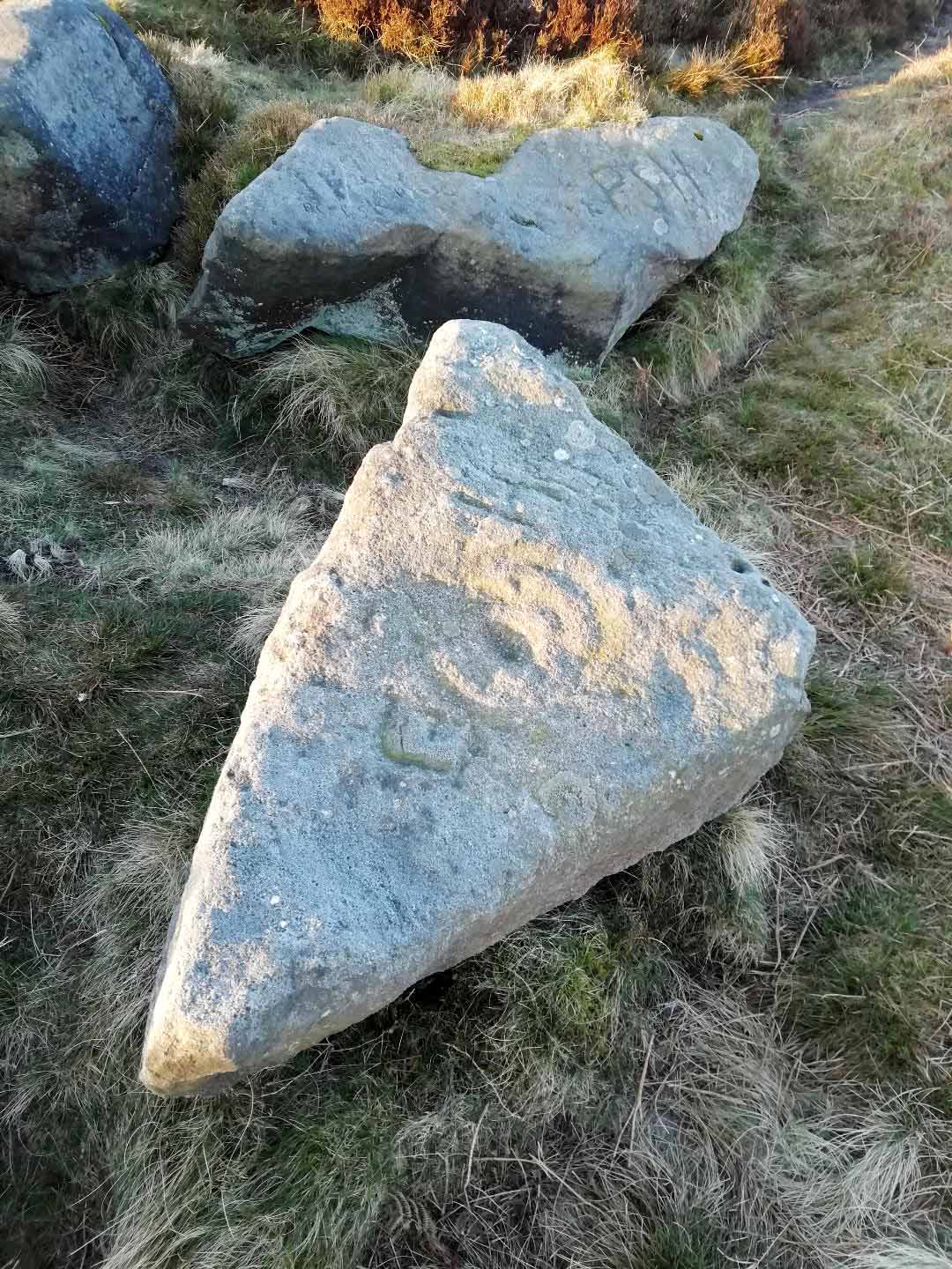
Not previously recorded, this simple cup-marked stone will probably only be of interest to petroglyph aficionados, or those folk who are into ‘energies’ at sites. This latter aspect is due entirely to the carving being etched onto a huge rock, much of which is composed of quartz—which isn’t too unusual in this part of the world. But that aside…
Looking down at the cupsThe cupmarks highlighted
It is one in a group of carvings within a few hundred yards of each other, with its nearest neighbour 20 yards to the north. That one’s covered in cups—but on this large Quartz Stone, only two of them exist, on the top near the centre. Just a couple of inches across and half-an-inch deep, they’re pretty clear once you see them. The raised piece of ground behind the stone is artificial and has variously been described by antiquarians and archaeologist alike, as either a prehistoric dun, or a stone circle. Whatever it may be, some of it is certainly man-made. Check it out – and mebbe ask the friendly fat fella who lives nearby and what he thinks.
Out of Aberfeldy, take the A826 road as if you’re going up Glen Cochill. Not far up, just where the housing of Aberfeldy itself ends and the green fields open up either side of you, keep on the road for a half-mile where you meet a small copse of trees on your left, with a dirt-track that runs down the slope. Go down the track, bending to the right, then the left and then on for a quarter of a mile until the lines of trees appear either side of you. Barely 200 yards along, the track swerves slowly to your right, and the field above you slopes uphill. Keep your eyes peeled at the fencing on your right and you’ll see a stone sloping towards you right by the fence with faint cup-marks on it. You’ll find it!
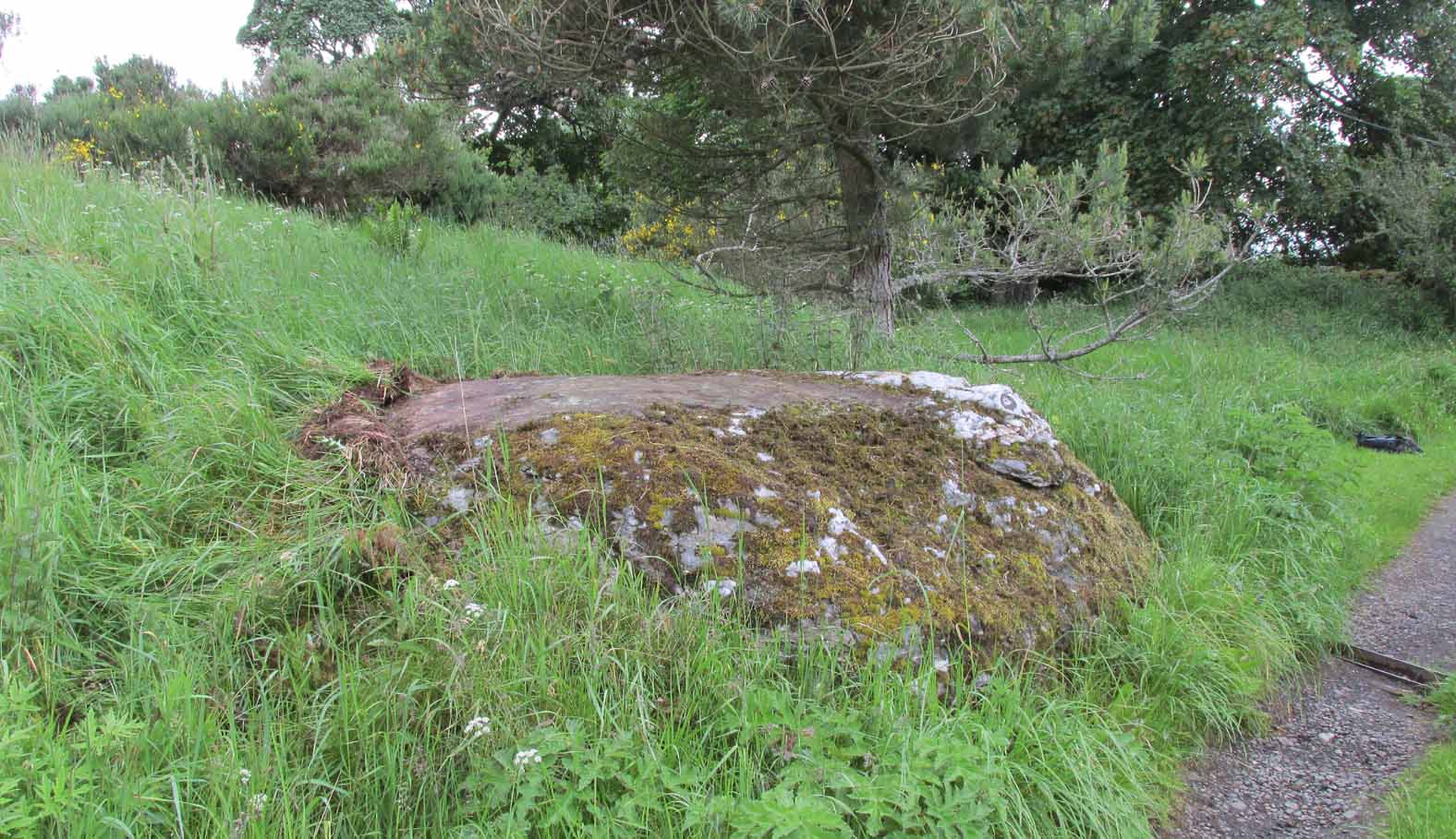
Archaeology & History
A truly fascinating cup-marked stone recently uncovered by Paul Hornby on another one of our TNA meanderings. Fascinating because of the curious arrangement of the cups on the stone. Often, cup-marked stones have little to interest the causal visitor – but this one’s different. As can be seen quite clearly, the cups are arranged in the shape of the constellation of the Great Bear, or Ursa Major – albeit with an extra ‘star’ in this design. But it’s damn close! In all likelihood (he says with his sceptical head on 😉 ), the design is fortuitous when it comes to the Ursa Major. I know from many years experience how easy it is to see meaningful shapes and designs in the almost entirely abstract British petroglyphs, but the design is very close to the constellation we all got to know when we were kids.
Looking along the stoneGazing down at Ursa Major
The stone itself slopes upwards at an angle of about 60º, before starting to level out as it rises. All of the cup-marks have been pecked onto this sloping surface (the vast majority of carvings are found on top of stones). Altogether, at least twelve faint and shallow cups were exposed when we looked at it—measuring the usual inch to inch-and-half across—but it is likely that more of them are hidden beneath the turf at the top of the stone. We could discern no rings or other features in the design.
This is just one carving amidst a good cluster of petroglyphs within a few hundred yards of each other (the Quartz Stone being one of the nearest) that are well worth checking out if you like your rock art. It may also be of interest to astronomy students, or those exploring archaeo-astronomy.
References:
Yellowlees, Sonia, Cupmarked Stones in Strathtay, RCHAMS 2004.