Cup-Marked Stone: OS Grid Reference – NO 54671 66022
Also Known as:
- Canmore ID 35007
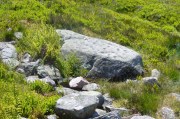
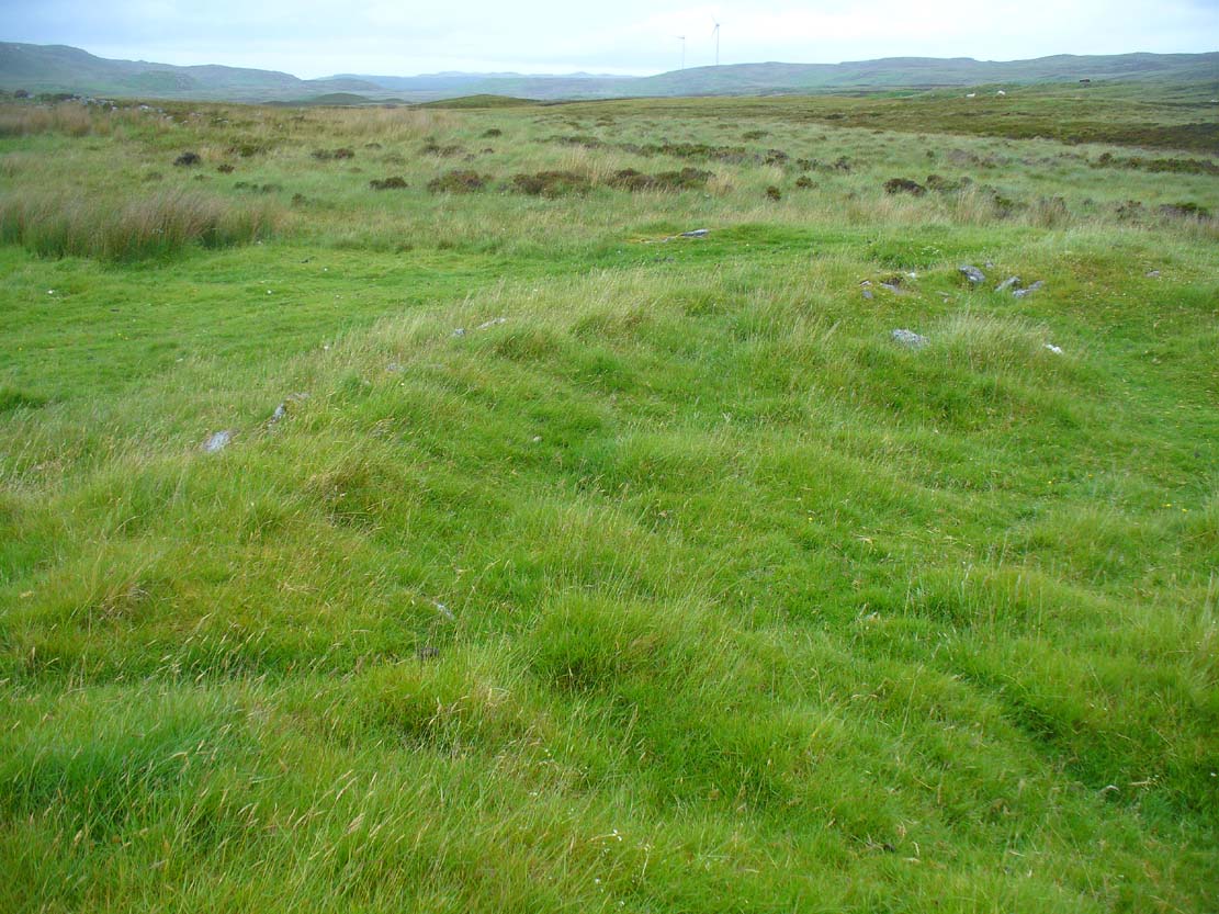
The carving below the walling
Many ways here, but from the nearest town of Brechin, take the minor north road out of town (not the B966) to Little Brechin, heading roughly north to the renowned hillforts of White and Brown Cathertun (ask a local if needs be). Park up and walk up the slope to White Cathertun, following the immense walling around to the right. Near where you reach the opposite side of the hillfort, look down the rocky slopes for a large boulder, just on the edge of the walling. You’ll find it!
Archaeology & History
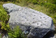
Although Canmore include this cup-marked stone in the site-profile of the incredible White Caterthun hillfort, it should really have an entry of its own, as it’s age and nature very probably pre-date the construction of the giant fortress. But, this aside, if you’re visiting the hillfort (an incredible place!), at least give this heavily cup-marked stone your attention too.
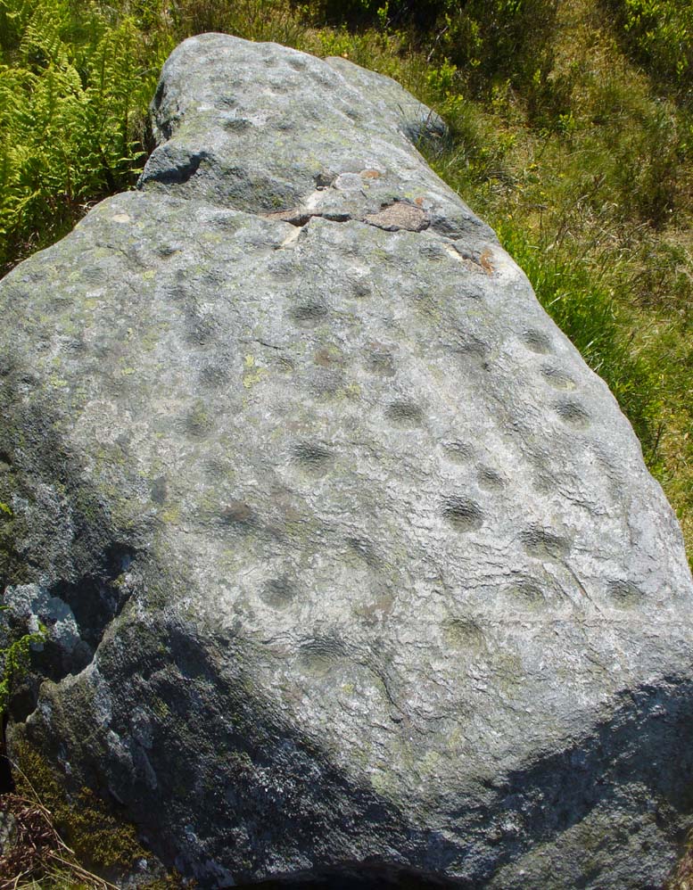
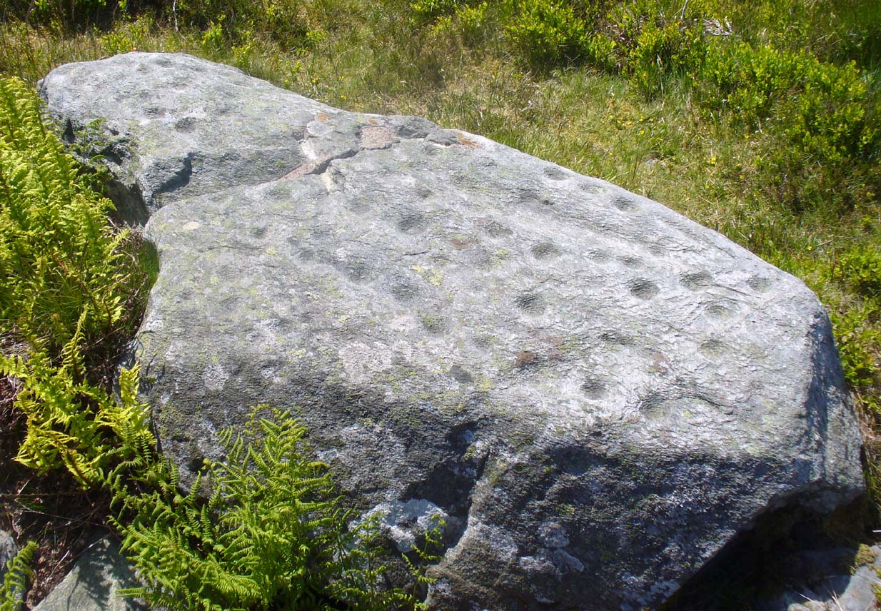
Looking across the carving
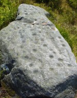
Close-up of the main cups
Probably neolithic in origin, there was a small portable cup-marked companion found 30 yards away, suggesting perhaps that a cairn might once have stood on this hilltop—but tradition is silent on the matter. No other petroglyphs of any note have been located nearby, which is unusual. In all probability other carvings remain undiscovered, particularly in the hills immediately to the north.
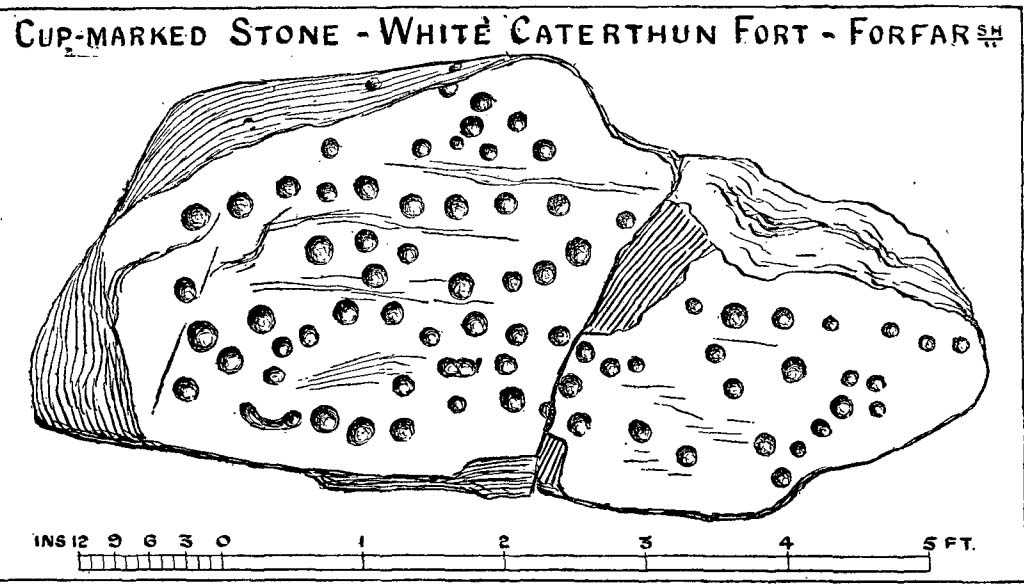
Consisting of around 80 cup-marks, several of which appear linked by carved lines, the stone has been bound together with concrete and metal bolts after some idiot damaged it in the 19th century. It was first described by Miss Christian Maclagan (1875) in her stunning megalithic survey of the period. She wrote:
“To Sir James Simpson’s list of cup-markings we are able to add the one at the Caterthun, on a large block 6 feet long, which is quite covered with very distinctly cut cup-markings. It is a block of basalt…and the cups are so very clear and sharp in their lines that their freshness can only be accounted for by the stone having lain with the markings buried in the ground. This curious stone has been quite recently broken in two. It is a pity to see it so destroyed, because it is valuable to the antiquary in helping to establish a very remote antiquity for the fortification. It lies on the north side of the fort, among a chaos of stones, having probably once formed the side of a gateway.”
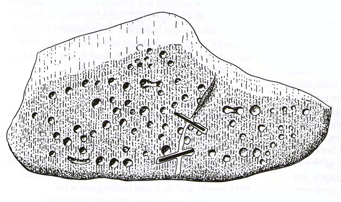
A few years later the late great J. Romilly Allen (1882) visited the site and gave us his description, telling:
“On the west side (of the hillfort), 10 yards north of the boundary of the fir plantation that covers one-half of the hill is a cup-marked boulder… The stone has been broken in two, and one portion of it lies at the foot of the stone rampart just above the first outer ditch, whilst the other half has been rolled down the hill by some mischievous person with more muscles than brains, and is to be found immediately below, where its further progress was arrested by coming in contact with the outermost wall. The two fragments when placed together measure 6 feet 9 inches long by 3 feet wide, and 1 foot 9 inches thick. The stone is greenish quartzose slate, and on its upper surface are carved eighty cups, varying from 1½ to 2½ inches diameter. In two cases two cups are united into one by a connecting groove.”
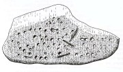
J. Sherriff’s 1995 drawing

J.R. Allen’s 1882 drawing
The most recent description and illustration of the stone is in John Sherriff’s (1995) survey. When we visited the carving recently we noticed three cup-marks etched onto the side of the stone, with a possible carved line running above one of them—but due to the bright sunlight on of the day of our visit, it was difficult to say whether this was a geological in nature or not (bright daylight can hamper good visibility of many carvings). Check it out!
References:
- Allen, J. Romilly, “Notes on some Undescribed Stones with Cup Markings in Scotland,” in Proceedings of the Society of Antiquaries Scotland, volume 16, 1882.
- Kenworthy, J., “White Caterthun: Cup-Marked Stone”, in Discovery & Excavation, Scotland, 1980.
- MacLagan, Christian, The Hill Forts, Stone Circles and other Structural Remains of Ancient Scotland, Edmonston & Douglas: Edinburgh 1875.
- Sherriff, John, “Prehistoric Rock-Carvings in Angus,” in Tayside & Fife Archaeological Journal, volume 1, 1995.
© Paul Bennett, The Northern Antiquarian