Spink Well, Bradford, West Yorkshire

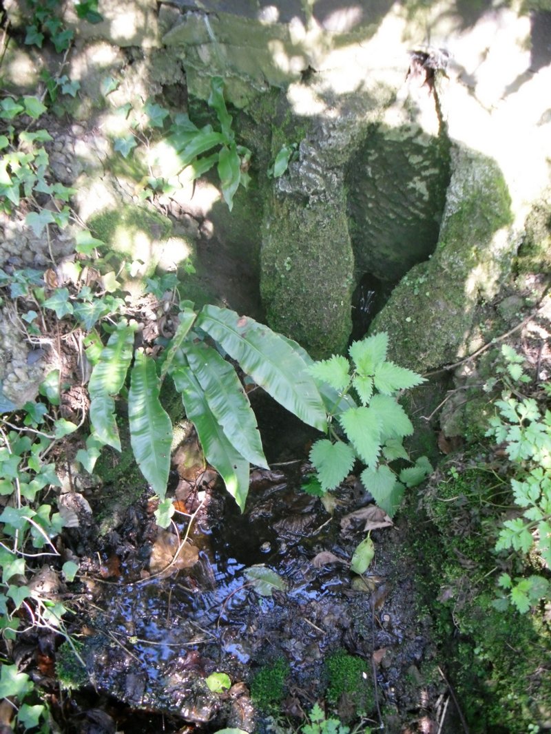
Healing Well:  OS Grid Reference – SE 1653 3410

Getting Here

The Spink Well, Bradford

From Bradford city centre go up Bolton Road (crossing the big A650 dual carriageway) until, a couple of hundred yards further you meet with, at an angle, Wapping Road on the right. Where these roads meet, note a small footpath going down into the trees on the Bolton Road side. Go down here till it bends to the right at the bottom. Walk along here for less than 100 yards, keeping your eyes peeled for the small stone-lined well above the path on your right.

Archaeology & History

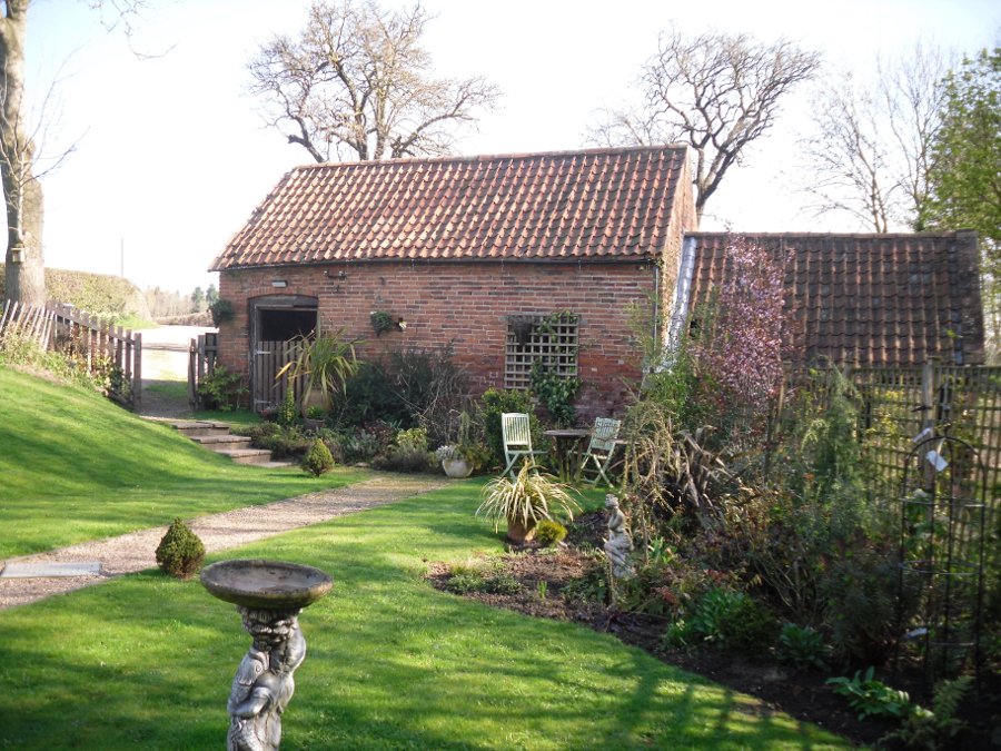
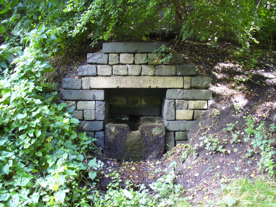
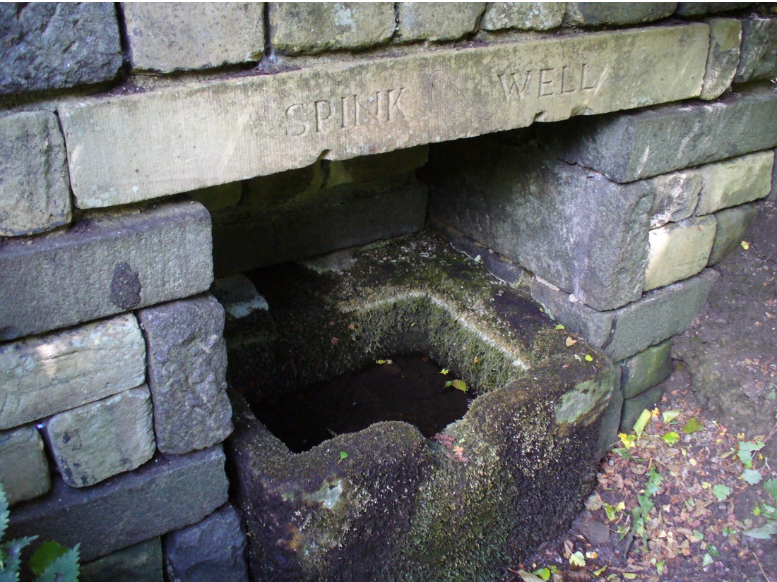
The Spink Well was highlighted on the 1832 boundary commission report map of Bradford; then listed in the 1850 Tithe Awards; and of course featured on the earliest Ordnance Survey map a few years later.  In 1788, below the spring itself, a Spinkwell House was built which advertised health-giving cold baths and used the waters from this well to supply people with its health-giving virtues.  This Spink Well house also had a most curious history: the gravestones of those who died in the plague of 1645 were built into the walls of the well-house here! They were uncovered during the construction of Peel Park in the 19th century, a short distance away.  Then, for a long time thereafter, the waters and the stonework surrounding this well fell into disrepair—especially when the Industrialists appeared in what was, at the time, the world’s centre for such people.

The muddy waters of the well

The name ‘Spink Well’ is the most common of all the wells named after animals in West Yorkshire (and elsewhere in Yorkshire for that matter), with ten examples of them that I’ve come across locally.  The word ‘spink’ is the local dialect word for the finch.  A veritable profusion of them scatter our region, although not much folklore is known about this little bird.  The various types (gold finch, bull finch, etc) are all said to be birds of good fortune and one of its calls is said to tell of the coming of rain.

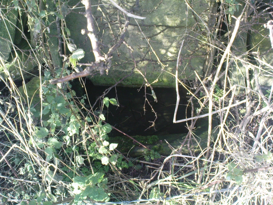
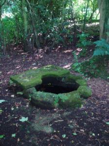
This particular Spink Well is very close to Bradford city centre and although now only a trickle of muddy water fills the trough into which it once ran freely, at least it’s still here!  Many other sites close to the city centre were destroyed without care by the ignorant Industrialists.  The well was evidently a place of some importance in ages past, as the 1852 OS-map shows eight spots hereby named after the place!  The local historian Roger Storrs (1888) wrote that—along with the Holy Well Ash Well a short distance from here—these sites “were long ago famous wells.”  No specific medicinal properties have been remembered for this place.

Folklore

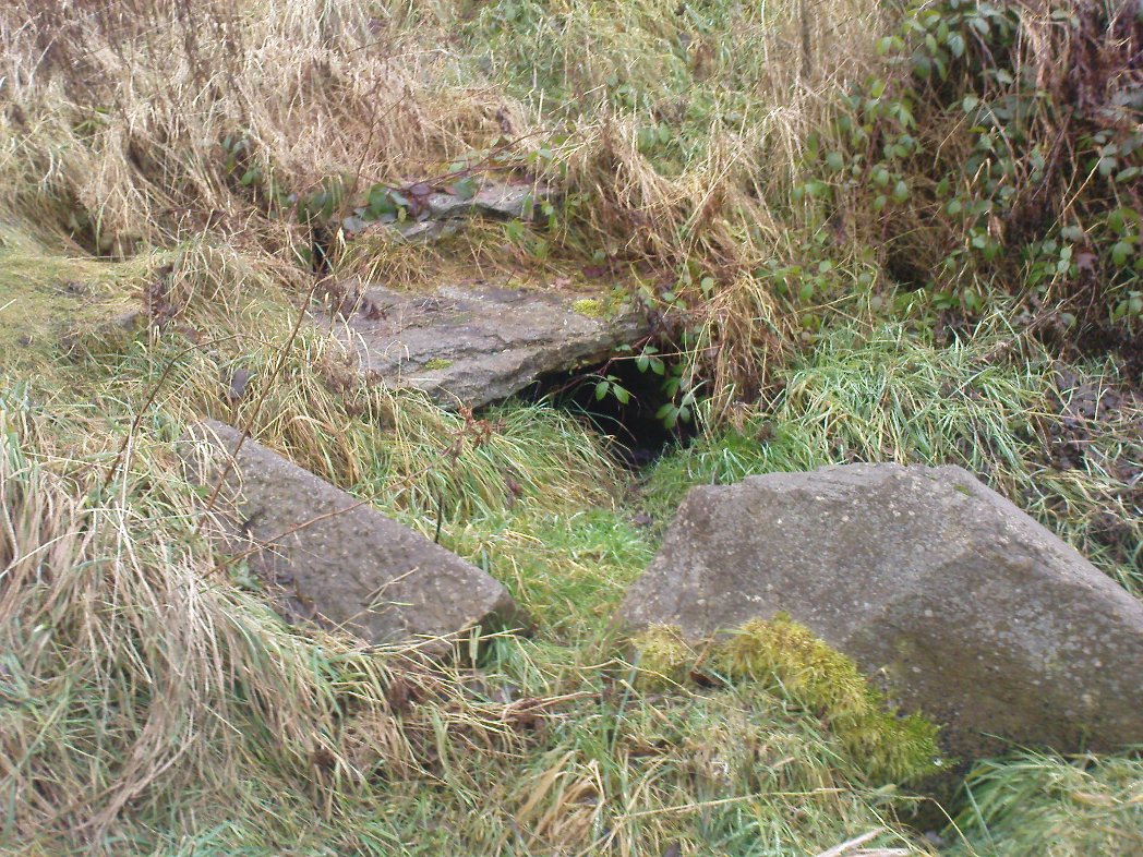
Folklore tells that a huge boar—which gave its name to the Boar Well just 100 yards along the same path from here—also drank the waters here at Spink Well.

References:

  1. Storrs, Roger, ‘Legends and Traditions of Wells,’ in J.H. Turner’s Yorkshire Folklore Journal, 1888.
  2. Whelan, Edna & Taylor, Ian, Yorkshire Holy Wells and Sacred Springs, Northern Lights: Dunnington 1989.

© Paul Bennett, The Northern Antiquarian 


Lady Well, Hartshead, West Yorkshire

Holy Well:  OS Grid Reference – SE 17884 23487

Also Known as:

  1. Ladies Well

Getting Here

Ladies Well on the 1852 map

This can take a little bitta finding if you don’t know the area. So it’s best starting from Hartshead church, right on top of the hill here.  From whichever direction you’re taking to reach Hartshead, ask a local when you get close and they’ll direct you there. From here, walk out of the churchyard and turn left. Walk barely 50 yards and turn left again along Lady Well Lane. Past the old houses and bear right where it becomes a dirt-track. This then turns left, then again right and – with the fields on either side of you – note the single hawthorn tree ahead of you by the walling. Go into the field at the back of the hawthorn and look under its shady bough. Tis there, I assure you!

Archaeology & History

The holy well is beneath this hawthorn tree

Emerging at the edge of the field beneath an old hawthorn tree at the side of the track running to the adjacent church, the waters from here are clean and fresh—though the stone trough into which it flows is constantly clogged up and the ground around it very boggy.  The well has given its name to Lady Well Lane, which leads to the 12th century St. Peter’s Church, with its own ancient and legendary history.  The well is thought to derive its name from ‘Our Lady’, the Virgin Mary, indicating it would have had considerable importance in the religious traditions of the christians who named it, but moreso the original animistic traditions of normal local people who would have used it for much longer…

Close by this old stone trough appears to be another one, covered by moss and the encroaching field.  Whatever medicinal properties the waters may once have had, have long since been forgotten.  Around Lady Well is a healthy abundance of flora: elder, chickweed, nettle, clover, bramble, dandelion, sow thistle, dock and shamanic species.

Folklore

The overgrown Lady Well

Marion Pobjoy (1972), like her predecessors, suggested that this was one of many sites in Calderdale used by St. Paulinus to perform baptisms.  Local folklore tells that Robin Hood stopped here to drink the waters—but then we find an abundance of the pagan outlaw’s activities all round here.  The nearby church of St.Peter is aligned to the equinoxes and may well be an indication of when pre-christian celebrations occurred here.  The yew tree in churchyard was where Robin Hood was supposed to have taken wood to fashion one of his bows.  Modern folklore also ascribes the well to be along a ley line.

References:

  1. Heginbottom, J.A., ‘Early Christian Sites in Calderdale,’ in Proc. Halifax Ant. Soc., 1988.
  2. Pobjoy, Harold N. & Marion, The Story of the Ancient Parish of Hartshead-cum-Clifton, Riding 1972.

© Paul BennettThe Northern Antiquarian


Hermit’s Well, Dale Abbey, Derbyshire

Holy Well:  OS Grid Reference – SK 4378 3861

Getting Here

Dale Abbey is a small and interesting village not far from Ilkeston. It can be found by taking the A6096 from Ilkeston and after passing through Kirk Hallam, take the first turning on the left called Arbour Hill. At the Carpenter’s Arms in the village turn right and park near the church. The well lies within the private garden of Church house, although it can be easily seen in the winter from the field in which the footpath below the church passes through, as well from the church yard.

Archaeology & History

R.C. Hope (1893) gives two versions of the story of how the hermit found the well and cave, taken from the Chronicle of Thomas de Musca quoted in Glover’s History of Derbyshire:

“A hermit once going through Deep Dale being very thirsty, and for a time not able to find any water, at last came upon a stream, which he followed up to the place where it rose; here he dug a well, returned thanks to the Almighty, and blessed it, saying it, should be holy for evermore, and be a cure for all ills. Another version is that the famous Hermit of Deep Dale, who lived in the Hermitage which is close by the well, discovered this spring and dug the well, which never dries up, nor does the water diminish in quantity, however dry the season and blessed it.”

In another version of the story, Hope (1893) notes:

“There was a baker in Derby, in the street which is called after the name of St. Mary. At that period the church of the Blessed Virgin at Derby was at the head of a large parish, and had under its authority a church de onere and a chapel. And this baker, otherwise called Cornelius, was a religious man, fearing God, and, moreover, so wholly occupied in good works and the bestowing of alms, that whatsoever remained to him on every seventh day beyond what had been required for the food and clothing of himself and his, and the needful things of his house, he would on the Sabbath day take to the church of St. Mary, and give to the poor for the love of God, and of the Holy Virgin. It happened on a certain day in autumn, when he had resigned himself to repose at the hour of noon, the Blessed Virgin appeared to him in his sleep, saying, ” Acceptable in the eyes of my Son, and of me are the alms thou hast bestowed. But now, if thou art willing to be made perfect, leave all that thou hast, and go to Depedale where thou shalt serve my Son and me in solitude; and when thou shalt happily have terminated thy course thou shalt inherit the kingdom of love, joy, and eternal bliss which God has prepared for them who love Him. The man, awakening, perceived the divine goodness which had been done for his sake; and, giving thanks to God and the Blessed Virgin, his encourager, he straightway went forth without speaking a word to anyone. Having turned his steps towards the east, it befel him, as he was passing through the middle of the village of Stanley, he heard a woman say to a girl, ”Take our calves with you, drive them as far as Depedale, and make haste back.” Having heard this, the man, admiring the favour of God, and believing that this word had been spoken in grace, a, it were, to bin’, was astonished, and approached near, and said, “Good woman, tell me, where is Depedale?” She replied, “Go with this maiden, and she, if you desire it, will show you the place. When he arrived there, he found that the place was marshy, and of fearful aspect, far distant from any habitation of man. Then directing his steps to the south-east of the place, he cut for himself, in the side of the mountain, in the rock, a very small dwelling, and an altar towards the south, which hath been preserved to this day; and there he served God, day and night, in hunger and thirst, in cold and in meditation.

And it came to pass that the old designing enemy of mankind, beholding this disciple of Christ flourishing with the different flowers of the virtues, began to envy him, as he envies other holy men, sending frequently amidst his cogitations the vanities of the world, the bitterness of his existence, the solitariness of his situation, and the various troubles of the desert. But the aforesaid man of God, conscious of the venom of the crooked serpent, did, by continual prayer, repeated fastings, and holy meditations, cast forth, through the grace of God, all his temptations. Whereupon the enemy rose upon him in all his might, both secretly and openly waging with him a visible conflict. And while the assaults of his foe became day by day more grievous, he had to sustain a very great want of water. Wandering about the neighbouring places, he discovered a spring in a valley not far from his dwelling, towards the west, and near unto it he made for himself a cottage, and built an oratory in honour of God and the Blessed Virgin. There, wearing away the sufferings of his life, laudably, in the service of God, he departed happily to God, from out of the prison-house of the body.”

The well is a delightfully rustic one and certainly contains old stonework if not from the hermit’s time than the period of the Abbey. It is an oval structure with eight stones around the mouth, a three foot rectangular stone covers half of the well and has a semi-circular cut placed in the middle. Mossy steps lead from the higher end of the garden into the little dell where the well arises. The well has been dressed in the early 2000s but has now disappeared into obscurity. Indeed, some believe that it is does not exist in the first place…

 Folklore

First noted in 1350 in association with the legend of the foundation of the Abbey, Hope (1893) notes it was curative and was a wishing well; being visited on Good Friday, between twelve and three o’clock, water being drunk three times.

OLYMPUS DIGITAL CAMERAOLYMPUS DIGITAL CAMERA

References:

  1. Hope, Robert Charles (1893), Legendary Lore of the Holy Wells of England, Elliott Stock: London.
  2. Parish, R.B. (2008), Holy wells and healing springs of Derbyshire.

Copyright © Ross Parish


St. Catherine’s Well, Westhorpe, Southwell, Nottinghamshire

Holy Well:  OS Grid Reference – SK 684 532

Getting Here

St Catherine's Well, Westhorpe
St Catherine’s Well, Westhorpe

To find Westhorpe, take the lane on the left as one leaves Southwell, and then the next left, Bath Lane. The cottage is the only house on this lane and the well arises on the edge of its private garden.  Ask permission to view.

Archaeology and History

The earliest record of a religious institution here is in 1482, when a chapel was erected dedicated to the saint.  Whether this was built to cater for those who sought the well is unclear, but it seems likely.  Little is recorded of its mediaeval history.  Of its post-Reformation history, Dickinson (1819) notes that a Mr. Burton of Norwood Park built a house and bath at the site in 1720.  He appears to have used the saint as support for its properties as:

“Over the head of the fountain was a plate, on which some Latin verses were inscribed, much to the honour of the tutelary saint, and the reputation of the water.”

Stone slab describing the well
The running waters
The running waters

It is thought that the cottage and barn at the site may be the remains of this venture, although, I was informed by the occupant that the barn had mediaeval features.  When Bob Morrell (1988) visited he was also told that a bath-like structure with steps down was located nearby, but an exact location was unknown, and the current occupiers were similarly unaware of it when I visited.  This was probably a relic of Mr Burton’s exploitation.  This appears to have been a brief period, for as Shilton (1818) notes, it

“…would have retained them to this day, had there been the due accompanyments (sic) for luxurious lounge, intrigue and scandal commodiously attached.”

Modern stone wall above well

St. Catherine’s Well itself is found between Bath Cottage and the barn.  It arises in a brick-lined square structure capped with a broken slab.  This sits on an older structure which has the appearance of calcareous rock; although any petrifying properties are not noted by previous authors.  When first visited the well house was dry; however, a more recent visit in spring showed a considerable flow (despite a dry winter). It flowed from a clay pipe within the well house and leaves through a smaller pipe set into the calcified part and then down to the dumble below. In this dumble appear to be some dressed stone which may have been part of the original structure.  Beside the well on the bank above is a small slate monument which records:

“A chapel dedicated to St. Catherine existed here in medieval times but it is thought to have fallen into disuse at the dissolution. A spring and well with reputed healing properties near the chapel was still patronised in the 1800s by those seeking relief from rheumatism. The present bath cottage was erected on the site of the chapel. D.J Hall Southwell.”

Folklore

Not much but its waters were said to be a cure for rheumatism being particularly cold.

References:

  1. Dickinson, W. (1787), A History of the Antiquities of the Town and Church of Southwell, in the County of Nottingham.  Nottingham.
  2. Morrell, R. W. (1988), Nottinghamshire Holy Wells and Springs.  Nottingham
  3. Parish, R.B. (2010), Holy wells and healing springs of Nottinghamshire.  Nottingham
  4. Rattue, James (1995), The Living Stream: Holy Wells in Historical Context, Boydell: Woodbridge.
  5. Shilton, R. P. (1818), The History of Southwell in the county of Nottinghamshire. Nottingham.

© Ross Parish, The Northern Antiquarian 


Sweet Willy Well, Wrose, Shipley, West Yorkshire

Healing Well: OS Grid Reference – SE 16561 36440

Also Known as:

  1. Lin Well
  2. Silver Stream
  3. Sugar Stream

Getting Here

Sweet Willy Well, Eccleshill

Whether you’re coming here from Wrose or Eccleshill, go along Wrose Road and turn down Livingstone Road at the traffic lights. Down here, when the road splits, head to your right until you meet with those stupid road-block marks (where you can only get one car through). Just here, walk down the slope and path on your right, and before you hit the bottom of the slope, walk down the small valley for about 20 yards until you see the small stream appear from beneath some overgrown man-made stone lintels. That’s it!

Archaeology & History

When I was a kid I used to play down this tiny valley when the waters here still had small fish swimming away (we used to call them ‘tiddlers’). The fish seem to have gone, but there are still waterboatmen on the surface, indicating that we still have fresh water here – and on my most recent visit, I cautiously tasted the waters and found them OK (the prevalence of broken bottles and beer cans from locals doesn’t inspire you to drink here though).

Initially located on the local boundary line between Eccleshill and Wrose, the waters used to be found running into a trough about 100 yards further up the small valley, but this has been lost and housing now covers its original site.  You can see how the stream has cut the valley further upstream, but now it bubbles up from beneath the rocks shown in the photo.  Bradford historian Robert Allen (1927) described the site in his survey as originally being between North Spring and South Spring Wood.

Although the name Sweet Willy Well remains a mystery, one of its other titles — the Lin Well — relates to the presence of linnets that used to be found in great numbers here.  The ‘Sugar Stream’ name is one we knew it as locally as children, due to the once sweet taste of the waters.  It is likely to have had medicinal properties, but these have been forgotten.  No archaeological survey has ever been done of this site.

References:

  1. Allen, Robert C. (ed.), The History Of Bolton In Bradford-Dale; with Notes on Bradford, Eccleshill, Idle, Undercliffe, Feather Bros: Bradford 1927.

© Paul Bennett, The Northern Antiquarian


St. Canna’s Stone, Llangan, Carmarthenshire

Legendary Rock:  OS Grid Reference – SN 1770 1874

Also Known as:

  1. Chair of St. Canna
  2. St Canna’s Chair

Archaeology & History

St. Canna’s Chair Stone

This once important healing stone that was moved a short distance (from grid reference SN 1775 1875 to SN 1770 1874 according to officials) to its present spot, around 1925, whilst having a long history according to the folk traditions of Carmarthenshire, was previously questioned as an authentic site by none other than Prof John Rhys (1875), following his visit to the site in the 1870s.  Although Rhys seemed an isolated voice, some modern archaeologists have also questioned its veracity.  It’s difficult to say precisely what the original nature of the stone may have been, but it was certainly accommodated in medieval times as a healing stone and used in conjunction with a pagan well – which was of course, accommodated by the Church.  If the stone itself had a megalithic pedigree, as some have believed, we know not what it may have been…

As Janet & Colin Bord (2006) wrote, the stone “still survives, but to the casual observer it looks like any other abandoned block of stone,” sitting innocuously within the ring of trees surrounding the church.  An early account of the stone was written by E.L. Barnwell (1872), who told:

“The present church of Llangan in Carmarthenshire is a wretched structure, built in 1820, and is about to be removed, as the population has long since migrated to some distance from it, and in a few years even the memory of Canna’s church having once existed here may cease. There is, however, a relic still left, which we trust will not be overlooked by the local authorities, as indeed it seems to have been hitherto ; for no notice occurs of it in the account of the parish in Lewis’s Topographical Dictionary or any other work. This relic is a rude stone, forming a kind of chair, lying in a field adjoining the churchyard, and about thirty or forty yards from it. When it was removed to its present position is unknown. There was also a well below the church called Ffynnon Canna; and there is still a small brook available, if required, for following the rules prescribed to those who wish to avail themselves of the curative powers of the saint’s chair. It appears that the principal maladies which are thus supposed to be cured are ague and intestinal complaints. The prescribed practice was as follows. The patient first threw some pins into the well, a common practice in many other parts of Wales, where wells are still thought to be invested with certain powers. Then he drank a fixed quantity of the water, and sometimes bathed in the well, for the bath was not always resorted to. The third step was to sit down in the chair for a certain length of time; and if the patient could manage to sleep under these circumstances, the curative effects of the operation were considerably increased. This process was continued for some days, even for a fortnight or longer. A man aged seventy-eight, still living near the spot, remembers the well and hundreds of pins in it, as well as patients undergoing the treatment; but, about thirty or thirty- five years ago, the tenant carried off the soil between the well and the watercourse, so as to make the spring level with the well, which soon after partly disappeared, and from that time the medical reputation of the saint and her chair has gradually faded away, and will, in the course of a generation or two, be altogether forgotten.”

Folklore

In Wirt Sykes (1880) classic text, he told us that the field where the original Canna’s Chair may have been, possessed fairy-lore that we find at other sites, usually ascribed as prehistoric.  He wrote:

“In the middle of this parish there is a field called Parc y Fonwent, or the churchyard field, where, according to local tradition, the church was to have been originally built; but the stones brought to the spot during the day were at night removed by invisible hands to the site of the present church.  Watchers in the dark heard the goblins engaged in this work and pronouncing in clear and correct Welsh these words, “Llangan, dyma’r fan,” which means, “Llangan, here is the spot.””

References:

  1. Allen, J. Romilly, The Monumental History of the Early British Church, SPCK: London 1889.
  2. Baring-Gould, S. & Fisher, John, Lives of the British Saints – volume 2, London 1907.
  3. Barnwell, E.L., “Canna’s Chair,” in Archaeologia Cambrensis, volume 3 (4th Series), 1872.
  4. Bord, Janet & Colin, Cures and Curses: Ritual and Cult at Holy Wells, Heart of Albion: Wymeswold 2006.
  5. Breverton, Terry, The Book of Welsh Saints, Bro Morganwg: Glyndwr 2000.
  6. Davies, Jonathan Ceredig, Folk-lore of West and Mid-Wales, Welsh Gazette: Aberystwyth 1911.
  7. “D.M.”, “Canna’s Chair,” in Archaeologia Cambrensis, volume 4 (4th Series), 1875.
  8. Rhys, John, “On Some of Our Inscribed Stones,” in Archaeologia Cambrensis, volume 4 (4th Series), 1875.
  9. Sikes, Wirt, British Goblins, Sampson Low: London 1880.
  10. Sharkey, John (ed.), Ogham Monuments in Wales, Llanerch: Felinfach 1992.
  11. Westwood, J.O., Lapidarium Walliae: The Early Inscribed and Sculptured Stones of Wales, Oxford University Press 1879.

© Paul Bennett, The Northern Antiquarian 


Lady’s Well, Tullibody, Clackmannanshire

Holy Well:  OS Grid Reference – NS 8563 9548

Archaeology & History

Lady Well on 1866 map

My initial thoughts about this holy well, was that it had been destroyed—but thankfully I was wrong.  It had been intruded upon by roadworks along the B9140, with the original water source affected, but it was re-routed and can still be found below the south-side of the main road.  It was highlighted on the 1866 Ordnance Survey map of the area When the Royal Commission (1933) lads visited the site in 1927 they told that,

“It has no features of special interest. It is 4′ in diameter, but is so much filled up with stones and debris that it is now not more than 2′ deep.”

The site was mentioned in Ruth & Frank Morris’ (1982) survey, but with no additional information. I’ve not been able to find out whether the ‘lady’ of this well was a saintly woman of religious importance, or just one of us commoners!  Does anyone know?

References:

  1. Morris, Ruth & Frank, Scottish Healing Wells, Alethea Press: Sandy 1982.
  2. Royal Commission on the Ancient & Historical Monuments, Scotland, Inventory of Monuments and Constructions in the Counties of Fife, Kinross and Clackmannan, HMSO: Edinburgh 1933.

© Paul Bennett, The Northern Antiquarian


St. Serf’s Well, Alva, Clackmannanshire

Holy Well:  OS Grid Reference – NS 8885 9722

Also Known as:

  1. St. Servanus’ Well

Getting Here

St Serfs Well, hidden in deep grasses

Along the main street running through Alva, towards Tillicoultry, watch out for the roman catholic church on your left, then shortly past it the house of St. Serfs.  Just next to this is the small road called Lovers Loan. Walk up here and just before the graveyard, walk right, into the overgrown boggy marshlands.  The first presence of the holy waters here are about 12-15 yards into the grasses, where you’ll walk right into it!

Archaeology & History

A sacred well that was named after the little known character of St. Serf, who was said to have been the hermit and tutor of the more renowned St. Mungo.

Highlighted on the 1866 Ordnance Survey map of the area as St. Servanus’ Well, 100 yards southeast of the church, it was included in MacKinlay’s (1893) fine survey, though without comment.  However it was said by Mr & Mrs Morris (1982) to be “near the south entrance of the churchyard.”   The boggy remains of the spring can indeed be found at the southern edge of the graveyard, up Lovers Loan, just below the edges of a large mound.  In Mrs Drummond’s (1936) survey of Alva, she too told that the “Well of St Servanus”,

“contained healing waters and was still to be seen in St. Serf’s Glebe in 1845, nbut it is now just a marsh on the west wisde of the lower cemetrary gate.”

The original waters have in fact been completely capped and the well is now covered by a modern concrete block, standing right next to the resurrected remains of one of Alva’s remaining standing stones.

References:

  1. Drummond, Mrs A., The History of Alva and District from the Early Christian Period to 1900, in Transactions Stirling Natural History & Antiquarian Society, volume 58, 1936 (reprinted by Clackmannan District Libraries 1981).
  2. MacKinlay, James M., Folklore of Scottish Lochs and Springs, William Hodge: Glasgow 1893.
  3. Morris, Ruth & Frank, Scottish Healing Wells, Alethea Press: Sandy 1982.

© Paul Bennett, The Northern Antiquarian


Calf Hey Well, Briercliffe, Lancashire

Healing Well:  OS Grid Reference – SD 87943 34622

Getting Here

The holy well/spring can be reached by following the Worsthorne road south from Haggate to Cockden Bridge over the River Don, then following the footpath due east beside the river for about a quarter of a mile. At the Ormroyd footbridge where the River Don becomes Thursden brook head in a north-easterly direction up the hillside. The well, or what’s left of it, can be found beside a trackway.

Archaeology & History

Around twenty-five years ago Calf Hey Well was described as being a square-shaped structure made of five stone slabs, one of which makes the roof. The water, which most probably had some form of mineral content, bubbles up into the large square basin which is a little lower than ground level.  Today, the well is still there but I don’t know in what condition it is.

Folklore

According to Clifford Byrne in his book The Holy Wells and Mineral Springs of N.E.Lancashire,

“Calf Hey Well is a strong spring which rises out of the hillside, but in medieval times it was believed that the waters here had special qualities. Some people thought it was a holy well and reputedly many people visited Calf Hey on holy days when jugs of water were sold. A few accounts state that stalls were set up on a flat piece of land to the west of the well, Here vendors not only sold water but other things (food, religious objects and trinkets) and a market atmosphere must have pervaded the site”.

In 1819 the local water company took over the well and began to use its supply of water for the ever growing population of Burnley a few miles west of here. After this the fairie people were never seen again at the well – they were probably feeling very indignant at what had transpired.

Folklore has played its part here too. Fairies are said to have inhabited the well in days gone by – indeed they were often seen dancing around the well in the moonlight. These fairies or “little people” were not just creatures of the night which our ancestors delighted in when they could catch a rare glimpse of them. In fact these little people were quite normally formed although small in stature. Though not human they had the capacity to intervene in our human affairs – usually but not always for the good of it. They were known to steal little children and babies, supplanting them with their own offspring. So the parents of newly born babies had to be very vigilant and get their babies baptised as quickly as possible.

There are a few lesser-known wells in the same area as Calf Hey. These include The Jam Well at Worsthorne, Sweet Well at Holden Clough and Robin Hood’s Well at Black Clough, Thursden.

References:

  1. Byrne, Clifford, The Holy Wells and Mineral Springs of Northeast Lancashire, MS copy in Nelson Public Library (Reference).
  2. Frost, Roger., A Lancashire Township – The History of Briercliffe-with-Extwistle, Rieve Edge Press: Briercliffe 1982.

Links:

  1. Additional info on the TNA Forum

Copyright © Ray Spencer 2011


Rushy Beck Spring, Burley Moor, West Yorkshire

Healing Well:  OS Grid Reference – SE 1403 4544

Getting Here

Source of the Rushy Beck

From Ilkley centre, take the road up to Cow & Calf, going past the hotel and along Hangingstone Road for a half-mile until you meet some walling on the right of the road. Stop and walk up the small beck, veering to the left as you approach the brow of the hill.  Keep walking up the beck onto the moor where you’ll eventually reach its source, as shown in the photo here!

Archaeology & History

This once fast-flowing spring of fresh sparkling water has seen better days.  The site has two openings in the Earth about 10 yards east and west of each other, both discernible by the notable difference in vegetation on the moors here, where richer hues of green created by the waters cut a small channel down the moorland slopes through the usual hues of heather.

The waters taste fine when they’re in flow, but much of the land here has fallen into shallow marsh and with the inevitable falling of the water table thanks to the stupid arrogant Industrialists, very little of the goodness is available.  But it wasn’t always like this.  Certainly when our prehistoric ancestors carved the rock art close by the source of the waters, then later constructed the large ritual enclosure immediately west of the springs, the waters would have been very important—and in much greater profusion—for simple nourishment and for rituals enacted at the site.


© Paul Bennett, The Northern Antiquarian