St. Leonard’s Well, Bonnington, Edinburgh, Midlothian

Holy Well (lost):  OS Grid Reference – NT 257 756

Archaeology & History

This long lost holy well used to be found somewhere on the south-side of the Water of Leith, close to Powderhall, between Warriston and Broughton.  References to it are minimal.  Whilst Ruth & Frank Morris’ (1981) thought it might have been an alternative name of the Bonnington Mineral Spring—aka St. Cuthbert’s Well—a half-mile to the north-east, we know from John Russel’s (1933) article that it was a quite separate site; but all he could tell us was that St. Leonard’s Well was “a now forgotten mineral well”.  The clearest indicator telling of its whereabouts is in John Geddie’s (1896) lovely work on the history of the Leith watercourse, where he described this “forgotten mineral spring” as being below Powderhall “beside the Water”, i.e., the river Leith. A few miles south, a crag at Arthur’s Seat was once dedicated to St. Leonard. (the grid-reference to this site is an approximation).

References:

  1. Bennett, Paul, Ancient and Holy Wells of Edinburgh, TNA 2017.
  2. Geddie. John, The Water of Leith, W.H. White: Edinburgh 1896.
  3. Morris, Ruth & Frank, Scottish Healing Wells, Alethea: Sandy 1982.
  4. Russel, John, “Bonnington: Its Lands and Mansions”, in Book of the Old Edinburgh Club, volume 19, 1933.

© Paul Bennett, The Northern Antiquarian 
Penny Well, Granton, Edinburgh, Midlothian

Healing Well:  OS Grid Reference – NT 2187 7654

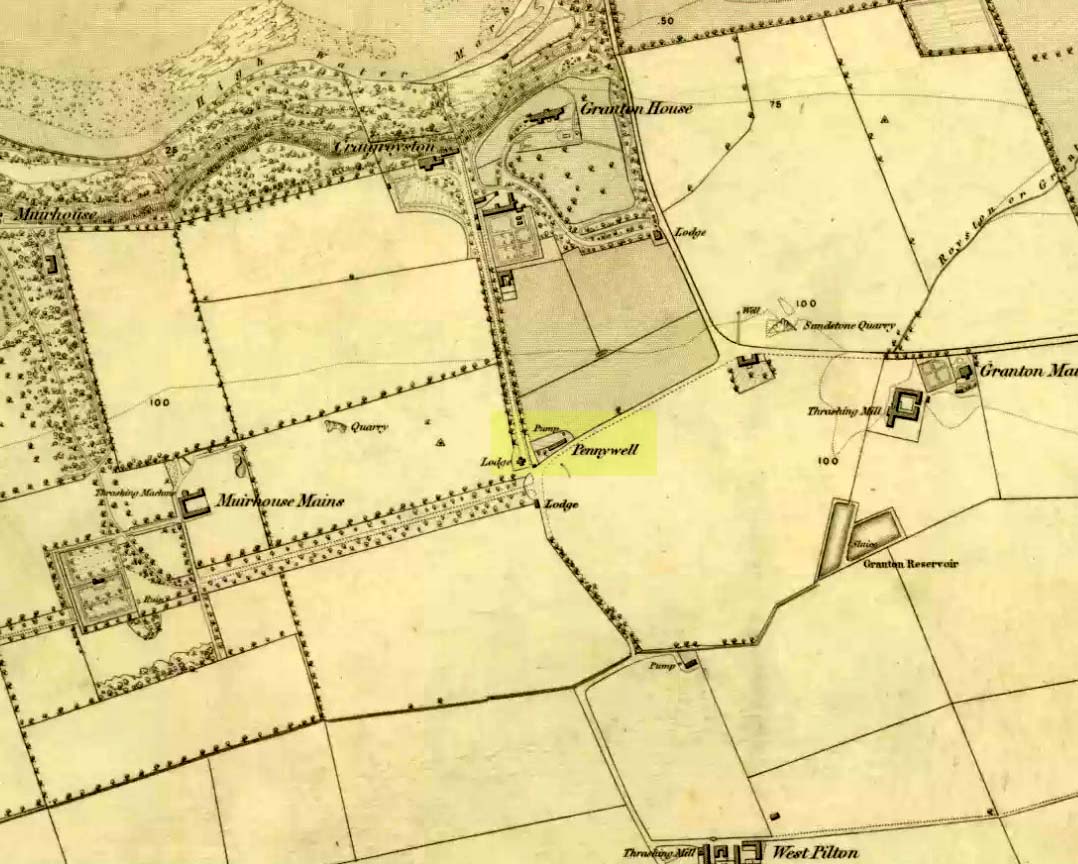
Penny Well on 1853 map

Archaeology & History

On the 1853 Ordnance Survey map of Granton we are show the house and place-name of Pennywell with a ‘pump’ adjacent to it.  Sadly we don’t have as rich a history of the place as its namesake at Newington.  Its earliest written appearance seems to be in 1812.  A few years later, in the  Ordnance Name Book of the area, it was recorded that,

“Two cottages on the property of Sir John McNeil the name appears to be derived from a well which was formerly situated at the North east end of the houses where one Penny was paid for a draught of water.”

Remembered as a watering place for horses, the old Scots word ‘penny’ may be behind this old name, in terms of it giving the animals and locals their water supply.  Stuart Harris (1996) thought that this Penny Well may have been the long lost St. Columba’s Well in the parish of Cramond.

References:

  1. Bennett, Paul, Ancient and Holy Wells of Edinburgh, TNA 2017.
  2. Harris, Stuart, The Place-Names of Edinburgh: Their Origins and History, Gordon Wright: Edinburgh 1996.

© Paul BennettThe Northern Antiquarian


Lady Fife’s Well, Leith, Midlothian

Holy Well? (destroyed):  OS Grid Reference – NT 27534 75794

Archaeology & History

Despite this site having a number of albeit brief literary references, from the early 19th century onwards, the history and traditions of this Well are very scant indeed.  It figures in various texts that detail the historical ‘Battle of Leith’, but there is little additional information in such tomes.  Even local history works pass it by with brevity.

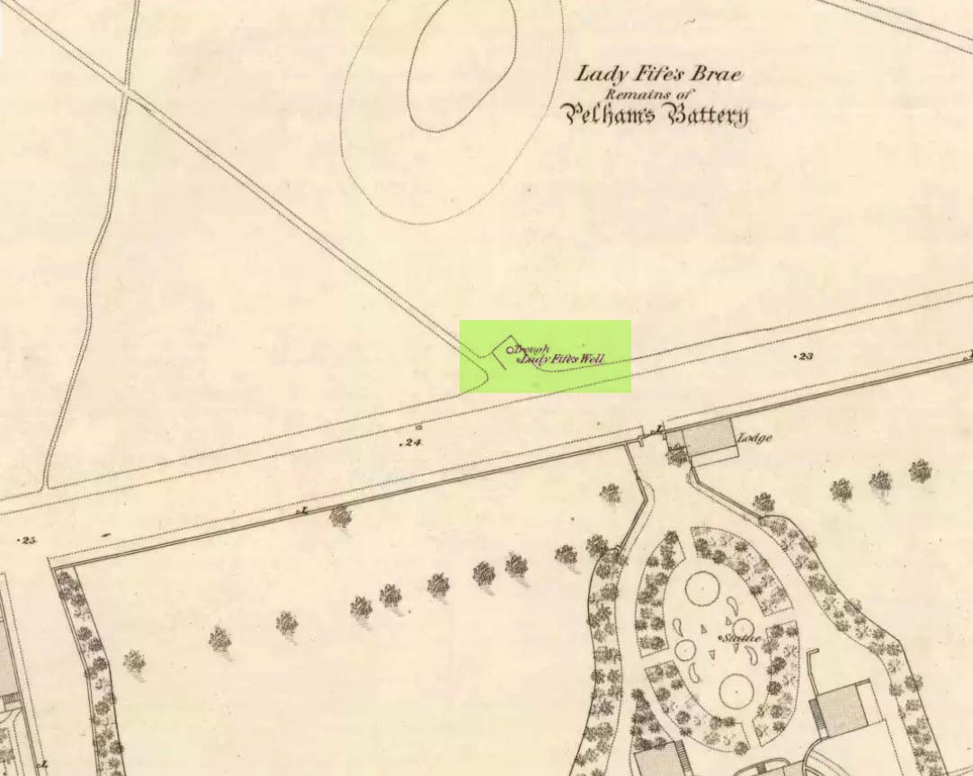
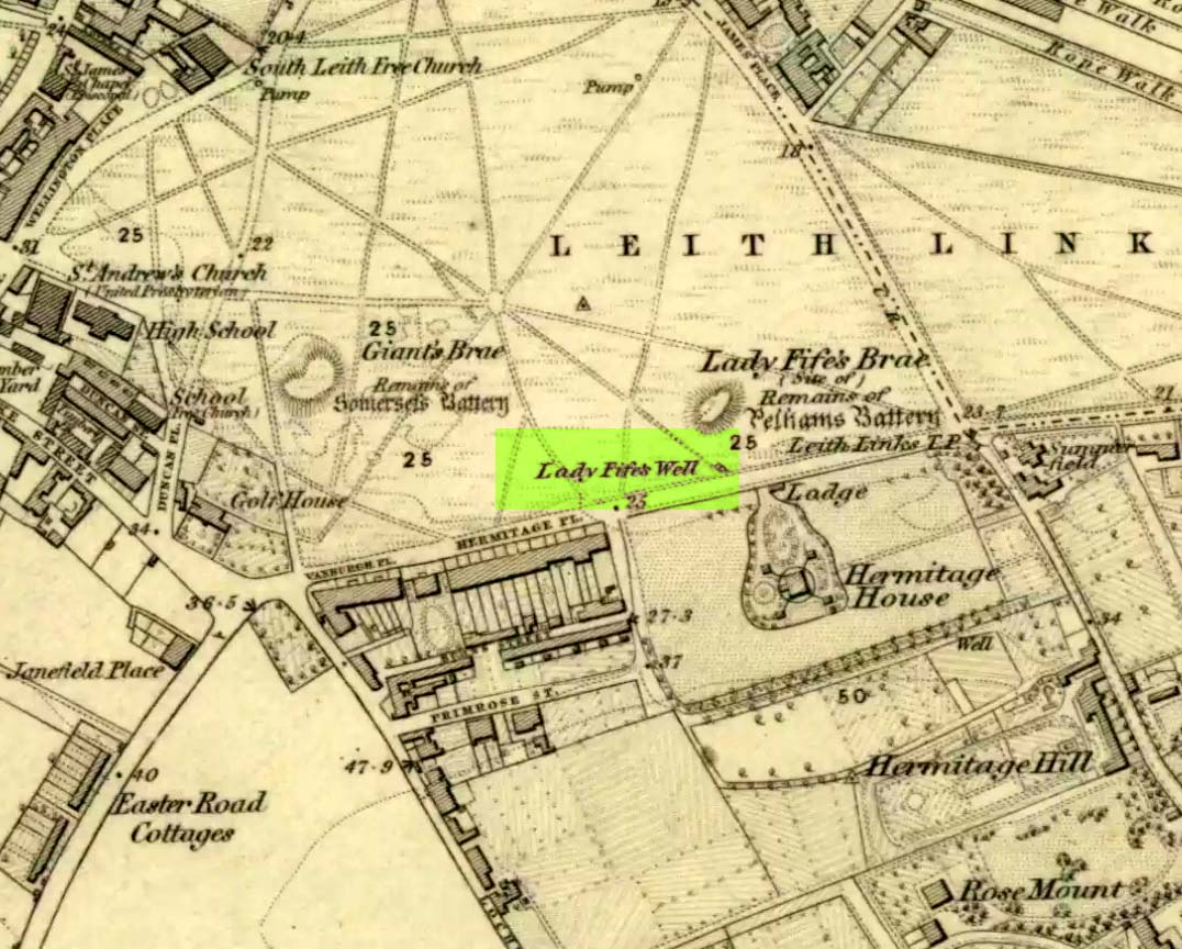
Lady Fifes Well on 1852 map
Lady Fifes Well on 1853 map

Its present name derives from the Countess of Fife who, in the 19th century, lived in the nearby mansion of Hermitage House (and who also grafted her name onto the nearby mound of Lady Fife’s Brae); but this title seems to have been grafted onto the earlier ‘Ladie Well’, implying it had a dedication to St. Mary or more probably an earlier heathen female spirit at the waters. Although it is shown on the OS-maps of 1852 and ’53, and described in Grant’s 1883 work as being there in his time, all subsequent maps after this date seem to indicate that it had gone.

All that we know is that the waters ran into a small stone trough and that Lady Fife enjoyed her evenings here, partaking of the waters.

References:

  1. Bennett, Paul, Ancient and Holy Wells of Edinburgh, TNA 2017.
  2. Campbell, Alexander, The History of Leith from the Earliest Times, William Reid: Leith 1827.
  3. Grant, James, Cassell’s Old and New Edinburgh – volume 3, Cassell, Petter Galpin: London 1883.
  4. Harris, Stuart, “The Fortifications and Siege of Leith,” in Proceedings Society of Antiquaries, Scotland, volume 121, 1991.
  5. Harris, Stuart, The Place-Names of Edinburgh: Their Origins and History, Gordon Wright: Edinburgh 1996.
  6. Hutchison, William, Tales, Traditions and Antiquities of Leith, Leith 1865.
  7. Maxwell, C.A., The Wars of England and Scotland, W.P. Nimmo: Edinburgh 1870.
  8. Russell, John, The Story of Leith, Nelson 1922.

© Paul Bennett, The Northern Antiquarian 

Westport Well, Old Town, Edinburgh, Midlothian

Healing Well (destroyed):  OS Grid Reference – NT 2511 7322

Archaeology & History

Like many others in the city centre, this old well has long since passed into history.  Said by Stuart Harris (1996) to have been “about twenty-five yards east of the eastern corner of Lady Lawson Street”, the Victorian writer Alison Dunlop (1890) told it to be by “a narrow close and an outside stair gave (which) entrance to the Court-house.”  It was the focus of much social activity in ages past; and although a number of public wells could be found in this part of the city, south of the Castle, the Westport Well was the most renowned.  Miss Dunlop told that,

“…its waters (were) of excellent repute (and) had to satisfy the necessities of all the inhabitants of the district.  The early morning never failed to see a long line of water-stoups stretching from it in either direction like the queue at a French theatre door.  Not so quiet, however, for tongues, mostly feminine, wagged freely, and the ‘Waal’ news and gossip were then the equivalent for a racy morning newspaper.”

According to her account, the patience of the people collecting the water was exemplary:

“All crowding-in was fiercely resented; gentle and simple had to stand their turn; only the water-caddies had the abiding right of precedence, and satisfied their customers at the moderate rate of two stoupful for a penny. We have already mentioned these ancient aquarian vessels peculiar to Scotland. In the event of a marriage taking place—in which case the bride was responsible for an amount of house plenishing not considered incumbent or even fashionable now-a-days—the ‘stoups’ were invariably purchased by the intending husband.  Indeed, the Weetin’ o’ the Stoups was the synonym for the last bachelor supper prior to matrimony.  Such festivities are understood to be hilarious, happy, hopeful; and the weetin’ o’ the stoups in Old Portsburgh, as in Old Edinburgh, was sometimes very wet indeed.”

References:

  1. Bennett, Paul, Ancient and Holy Wells of Edinburgh, TNA 2017.
  2. Dunlop, Alison Hay, Anent Old Edinburgh and some of the Worthies Who Walked its Streets, Somerville: Edinburgh 1890.
  3. Harris, Stuart, The Place-Names of Edinburgh: Their Origins and History, Gordon Wright: Edinburgh 1996.

© Paul Bennett, The Northern Antiquarian 
Ing Well, Allerton, Bradford, West Yorkshire

Healing Well (destroyed): OS Grid Reference – SE 1174 3443

Archaeology & History

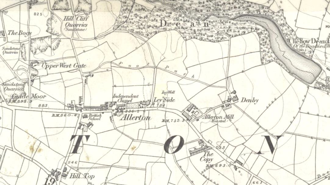
Ing Well on 1852 map

This ‘Well of the Meadow”, or Ing Well, is one of countless springs in and around the Bradford metropolis that have been destroyed by that thing they call ‘development’.  It was one of the main water sources for the villagers of Allerton village in the 19th century and earlier.  Highlighted on the 1852 OS-map of the region, a singular footpath once led to the waters and no further.  There appear to be no antiquarian or historical references detailing its traditions or medicinal qualities—unless of course, you know different.

The name Ing Wells is one of the most common of all titles given to water supplies in England, meaning having the same meaning and general history just about everywhere it occurs.  The place-name itself was given extensive attention in two separate studies by Eilert Ekwall (1962) and Sigurd Karlstrom (1927).

References:

  1. Ekwall, Eilert, English Place-Names in -Ing, Lund: Uppsala 1962.
  2. Karlstrom, Sigurd, Old English Compound Place-Names in -Ing, Lund: Uppsala 1927.

© Paul Bennett, The Northern Antiquarian

Cross Well, Musselburgh, East Lothian

Holy Well:  OS Grid Reference – NT 34629 72739

Archaeology & History

John Small’s 1900 sketch of the Cross

Musselburgh has had an ancient fair—held upon St. James’ Day (July 25)—for many centuries.  It was held along the old High Street by a more ancient Market Cross than the one seen there today.  R.M. Stirling (1894) told us that, “The cross is erected over a draw-well, and in local parlance is known as the Cross Well.”

On the 1853 township map, a water ‘pump’ is shown at the very spot, with the ‘cross’ and water trough shown on subsequent maps.  The Well isn’t mentioned in John Small’s (1900) description of the cross and its authenticity as a ‘holy’ well is questionable.

References:

  1. Bennett, Paul, Ancient and Holy Wells of Edinburgh, TNA 2018.
  2. Small, John W., Scottish Market Crosses, Eneas Mackay: Stirling 1900.
  3. Stirling, R.M., Inveresk Parish Lore from Pagan Times, T.C. Blair: Musselburgh 1894.

© Paul Bennett, The Northern Antiquarian 


Vicar’s Well, Musselburgh, East Lothian

Holy Well (destroyed):  OS Grid-Reference – NT 3452 7264

Archaeology & History

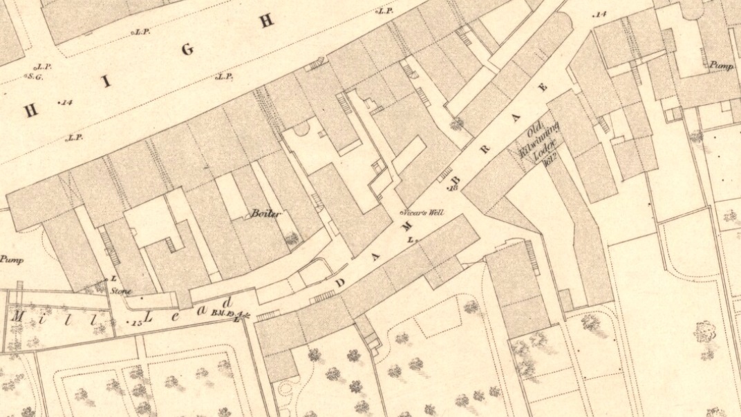
Vicars Well on 1853 map

First mentioned in the Scottish Statistical Account of 1845, its name originates from being attached to the vicarage of nearby St. Michael’s church.  Highlighted on the 1853 township map of Musselburgh, this forgotten holy well was described in the middle of the 19th century by local historian James Paterson (1857).  It was located near the middle of town, along a back-street south of the High Street.  Mr Paterson told us that:

“At the Dam Brae there is still a well, celebrated for the excellence of its water, called ‘the vicar’s well’, from which it is believed the present manse occupies the site of the ancient vicarage.  It lies to the southeast of the Brae, and the wall of the ground approaches pretty close to the mill lead, or damn, as it is called.  It is well surrounded with old trees.”

When it was described by Mr Beveridge in the 1845 Statistical Account, the spring had been covered by a pump.  Local lore told how the waters of this ancient Well was said by housewives to be excellent in the infusion of tea; and although its name was spoke in local dialect as the ‘Bickers Well’, Beveridge told it to mean the “Vicars Well.”  There is the obvious possibility that the ‘bickers’—as in chit-chat and gossip—related to it being where local folk simply met and chatted.

When Mr Stirling (1894) wrote his account of the adjacent Inveresk parish, he told how water from the Vicar’s Well,

“was in much request till a few years ago, when its use was forbidden and its site enclosed (for) sanitary considerations.”

References:

  1. Bennett, Paul, Ancient and Holy Wells of Edinburgh, TNA 2018.
  2. Paterson, James, History of the Regality of Musselburgh, James Gordon: Musselburgh 1857.
  3. Stirling, R.M., Inveresk Parish Lore from Pagan Times, T.C. Blair: Musselburgh 1894.

© Paul Bennett, The Northern Antiquarian 

Cooper’s Well, Partick, Glasgow, Lanarkshire

Healing Well (destroyed):  OS Grid Reference – NS 5619 6654

Archaeology & History

Along the B808, between Beith Street and Byres Road, where it meets the main Dumbarton Road, the memory of Cooper’s Well is preserved in the street-name.  It was one of more than a dozen springs in the area, but was one of the most renowned by local people.

Although not shown on the early OS-maps, thankfully the local historian and folklorist—and early environmentalist, it must be said!—James Napier (1873), gave a good account of it in his excellent work on the traditions of the area:

“Cooper’s Well was situated on the side of the road at the north-west end of Well Street, at the corner of where the Gas-work wall now is.  It was about three feet deep, and had two steps leading down to the water from the road.  Two sides and back were walled up higher than the road, and covered with a stone slab.  It was celebrated in the neighbourhood as a drinking water, being strongly chalybeate, and therefore could not be used for cooking purposes.  Although shallow, it was never frozen during winter (so that it must have come from a considerable depth), and it was cold in summer.  On a warm summer Sunday evening we have seen people, not only from all parts of the village, but from the gentle houses in the neighbourhood, carrying water from the Cooper’s Well to drink.  It is from this well the street has its name.  The Gas-work dried up the well.  There was a story current of some Glasgow people who were visiting at Mr. Sharp’s of Horslethill.  Mrs. Sharp had been baking some oatcakes with butter or dripping in them, which caused them to be very fine and short.  The Glasgow gentlemen were anxious to know how they were baked, and were told that they were baked with the Cooper’s Well water, some of which they had got a drink of.  Shortly after some of the gentlemen sent out their servants to Partick for a supply of the water, but the servants could not succeed in making the cakes so nice as those got from Mrs Sharp.  For long after this, butter-cakes were known in and around Partick as Cooper’s Well bread.”

I have to admit I’ve not visited this site, but presume that all trace of the site has disappeared.

References:

  1. Bennett, Paul, Ancient and Holy Wells of Glasgow, TNA 2017.
  2. Napier, James, Notes and Reminiscences Relating to Partick, Hugh Hopkins: Glasgow 1873.

© Paul BennettThe Northern Antiquarian


Minister’s Well, Cambuslang, Lanarkshire

Holy Well (destroyed):  OS Grid Reference – NS 6451 5981

Archaeology & History

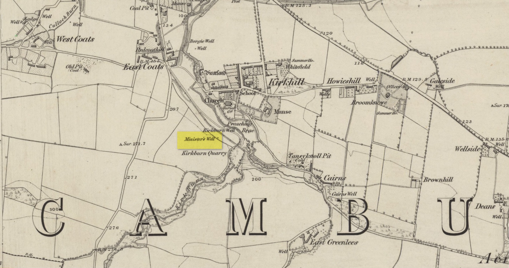
Site shown on 1864 map

Illustrated on the earliest OS-map of the region, this is one of four holy and healing wells within half-a-mile of each other—including the legendary Borgie Well in the Borgie Glen.  The waters from here emerged above the rise, close to the end of Mansefield Avenue, from where you look down onto the wooded burn.  When it was visited by the Ordnance Survey chaps in the 19th century, they told simply that water here “is taken from pipes being laid from it to the Manse to supply the Minister.”

References:

  1. Bennett, Paul, The Ancient and Holy Wells of Glasgow, TNA 2017.

Acknowledgements:  Huge thanks for use of the Ordnance Survey map in this site profile, reproduced with the kind permission of the National Library of Scotland

© Paul BennettThe Northern Antiquarian

Lighthouse Well, Dunnet Head, Caithness

Healing Well:  OS Grid Reference – ND 20422 75807

Getting Here

Lighthouse Well, Dunnet Head
Lighthouse Well, Dunnet

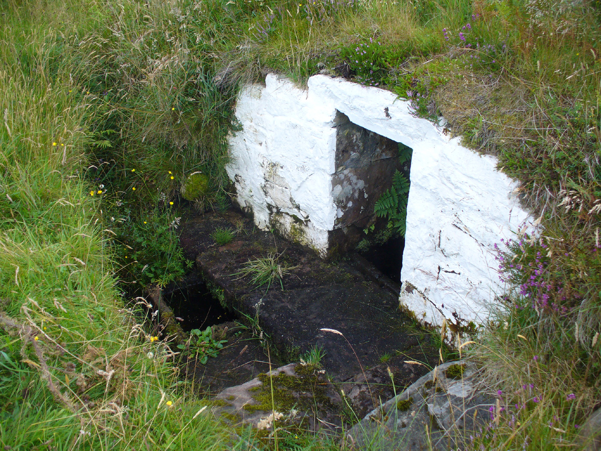
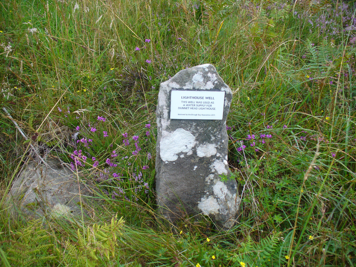
Take the B855 road northwards out of Dunnet village, through Brough and, nearly four miles on, you’ll see the waters of the Long Loch right by the roadside.  Roughly 300 yards along the side of the loch, keep your eyes peeled to left-hand side of the road, where you’ll see a white stone surround just below the roadside just a couple of yards away.  Right by its its side is a small stone with a plaque highlighting its position.  You can’t really miss it.

Archaeology & History

Stone & plaque by its side

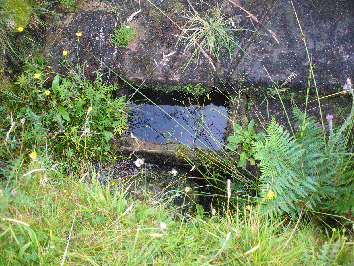
Marked on the earliest OS-map of the region in 1875 (simply as “Well”), this is the most northerly example of a healing well in mainland Scotland, being a good mile further north than John o’ Groats!  Consisting of a standard stone surround, the well has two stone troughs: one inside the surround, and another outside, where the water runs, before being directed back to Earth.

Secondary stone trough
Second stone trough

Although the waters here have long since quenched the thirst of crazy travellers, the well was the main water supply for the men who lived and manned the famous Dunnet Head lighthouse in earlier years, who would carry the water from here more than half-a-mile up to their remote abode, overlooking the great cliffs and out towards megalithic Orkney.  Its healing properties have, sadly, long since been forgotten.  When we visited the site, the waters did not look to be in a healthy state to drink.

© Paul Bennett, The Northern Antiquarian