Cup-and-Ring Stone (lost): OS Grid Reference – NX 68700 44699
Archaeology & History
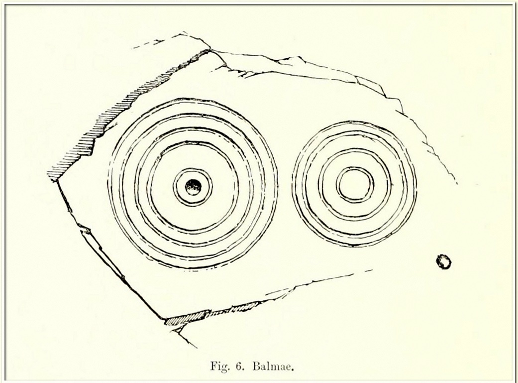
Coles’ 1895 sketch
This impressive-looking carving was rediscovered in the 1880s during one of Fred Coles’ ventures uncovering many of the petroglyphs in this area. It could be found, he said, “some three hundred yards south-east of Balmae House.” When the local historian Malcolm Harper visited Samuel Fletcher who lived in the cottage at Balmae a few years after it had been discovered, he spoke enthusiastically about the carvings and knew much about them, but Harper doesn’t specifically mention whether or not he’d seen this stone (he probably did). Nowadays the carving is covered in thickets of gorse and and, as a result, it hasn’t been seen in many a year. The great Scottish petroglyph hunter Kaledon Naddair may have been one of the last people to visit it.
It’s impressive, as Mr Coles’ (1895) sketch shows, comprising, as he said, of
“two sets of concentric rings, one having four, the other five and a central cup. It is smooth, and slopes to the W. at an angle of 40°. The largest ring is 24 inches in diameter.”
A number of other impressive multiple-ringed carvings exist hereby that have also fallen prey to the cover of gorse. So get some hedge-cutters and decent gardening gloves if you’re gonna look for this one!
Morris, Ronald W.B., “The Cup-and-Ring Marks and Similar Sculptures of South-West Scotland,” in Transactions of the Ancient Monuments Society, volume 14, 1967.
Morris, Ronald W.B., The Prehistoric Rock Art of Galloway and the Isle of Man, Blandford: Poole 1979.
Royal Commission Ancient & Historical Monuments & Constructions of Scotland, Inventory of Monuments and Constructions in Galloway – volume 2: County of the Stewatry of Kirkcudbrightshire , HMSO: Edinburgh 1914.
OK—I’m cheating here, as I’ve not visited this site (bad of me!). The directions given here are from Harper’s 1876 Rambles in this area. He told that the stone “stands about 100 yards to the north of the march dyke betwixt Upper Ervie, now Ken-Ervie and Nether Ervie. There is little to indicate its whereabouts, but the visitor coming from Kenmure Bridge, and leaving the road on the left, opposite Ringour and Bennan farms, on the opposite side of Loch Ken, would come upon it without much trouble by following the march dyke half a mile up.” Basically, along the A713 just over 2 miles north of the bridge at Parton (½ mile before reaching the Galloway Activity Centre), 60 yards from the “Farm Access No Parking” spot, in the trees a long straight line of walling runs uphill. That’d be my route—straight up!
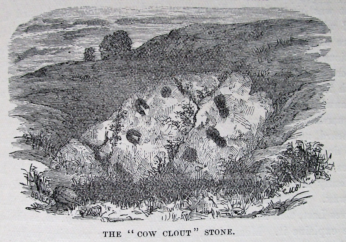
Archaeology & History
This is a curious entry that I’ve added without visiting the site; but as I might never get to see it I thought it should be displayed in the hope that others might check it out. The earliest literary reference to it is from Crosbie’s (1845) entry in the New Statistical Account, where he implies that the markings on the stone are not of Nature’s handiwork. In Malcolm Harper’s (1876) fine work exploring the history and folklore of this region, he gave us the first illustration of the stone, which looks suspiciously like elements that we find on cup-and-ring stones. Many years later when the Royal Commission (1914) lads followed up on Crosbie’s entry, they thought the markings were probably Nature’s handiwork. They told that:
“It is an irregular mass of outcropping rock about 3 feet in diameter, and bears on its surface certain depressed markings supposed to represent a cow’s foot, a horse-shoe, and impressions which might be made by a man’s foot and knee in the act of kneeling. The markings appear to be natural.”
But it’s the animistic elements and traditions here which are important and which gave the stone its very name…
Folklore
When Rev. W.G. Crosbie (1845) first wrote about this stone, he was narrating the tale told of it by local people, whose traditions were greatly neglected by the majority of writers at that time. Such stories should be preserved at all times, as they tell us more about the psychocosms of pre-industrial cultures. Here,
“On the farm of Arvie, there is a flat stone about three feet in diameter, on which are the marks of what might be supposed a cow’s foot, a horse shoe, the four nails on each side being very distinct, and the impression which might be made by a man’s foot and knee while he was in the act of kneeling, the knot of the garter being quite evident. The tradition connected with this remarkable stone, commonly called the ‘Cow Clout,’ is, that the proprietor, in order to get up arrears of rent, “drave the pun,” or in other words, carried off the hypothecated stock, while a fierce resistance was made by the people, and that over this stone, on which a man had just been praying for relief against his enemies, the cattle passed followed by an officer on horseback, and that it remains as a memorial to posterity of the cruel deed.”
If someone in that neck o’ the woods can find out if the stone’s still there and perhaps send us a photo, or stick it on our Facebook group, that’d be great! 🙂
References:
Coles, Fred, “The Recent Cup and Ring Mark Discoveries in Kirkcudbrightshire”, in Proceedings Dumfriesshire & Galloway Natural History and Antiquarian Society, volume 5, 1888.
Crosbie, W.G., “Parish of Parton,” in New Statistical Account of Scotland – volume 4, William Blackwood: Edinburgh 1845.
Harper, Malcolm M., Rambles in Galloway, Edmonston & Douglas: Edinburgh 1876.
Royal Commission Ancient & Historical Monuments & Constructions of Scotland, Inventory of Monuments and Constructions in Galloway – volume 2: County of the Stewatry of Kirkcudbrightshire , HMSO: Edinburgh 1914.
Stone Circle (destroyed): OS Grid Reference – NX 8657 6668
Archaeology & History
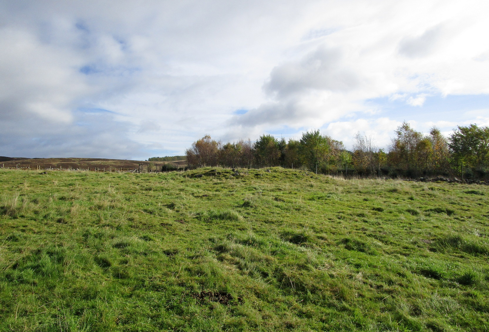
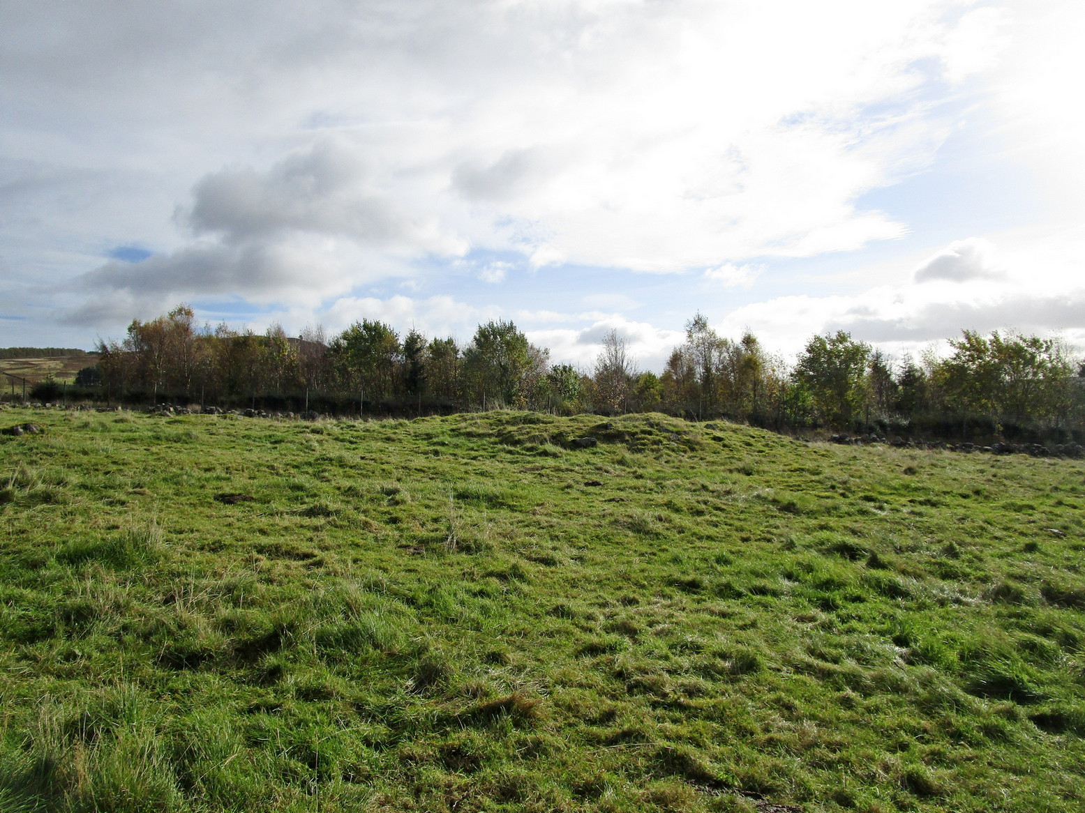
Little is known about this stone circle, which had apparently been destroyed sometime in the first half of the 19th century. The local Rev. J. Gillespie spoke about it with the great Fred Coles (1895), who told that it was “near the manse of Kirkgunzeon.” The site was listed in Burl’s (2000) magnum opus, where he wondered if it might have been a cairn; and interestingly, when the Ordnance Survey lads came here, they spoke with a Mrs J. Moffat, the oldest inhabitant in the area, who told that,
“a circle of stones c.30 ft in diameter with a small mound in the centre stood on flat ground at NX 8657 6668. Over the years successive farmers have removed the larger stones and now only the slight mound, c.4.0 m diam. x 0.3 m high, with several clearance stones on top, survives to mark the site of the stone circle.”
References:
Burl, Aubrey, The Stone Circles of Britain, Ireland and Brittany, Yale University Press 2000.
Coles, Fred, “The Stone Circles of the Stewartry of Kirkcudbright”, in Proceedings Society Antiquaries, Scotland, volume 29, 1895.
Stone Circle (destroyed): OS Grid Reference – NX 681 450
Archaeology & History
In an area that’s littered with prehistoric rock art, this “stone circle” at Knockshinne—listed in Burl’s (2000) magnum opus—is a debatable entry that was described in one of Fred Coles’ (1895) many articles on such matters. When he came here he told how to the west,
“of Balmae House, and near the base of Knockshinnie, four stones in situ, all, I think, granite, and the sites of six others as distinctly observable…. A massive stone lies outside the circle on the south. Diameter 72 feet.”
Subsequent visits to the same spot by the Royal Commission (1914) gave a somewhat different interpretation to that suggested by Coles. They told us that,
“This setting of stones, noted elsewhere as a stone circle, lies on rough pasture some 100 yards below the road passing to the south-west of Knockshinnie, and about ¼ mile west-north-west of Balmae. It consists of four granite blocks, the highest standing about li feet above ground, placed on an arc with a chord of 76 feet and radius at centre of 21 feet. The stones are placed at irregular distances on a sloping bank, so that the lowest stone is at 8 feet lower elevation than the upper one. Other two displaced boulders and a number of smaller stones lie in a heap to the north-west, and the beds of stones which have been removed from the setting are visible. Though the boulders have been placed in position by man’s hand, it is doubtful if they have ever been part of a stone circle, and from their situation on a slope below a plateau it is probable that they represent the line of an old dyke.”
By the 1970s, all that remained here was a line of three stones, but these have subsequently been removed or destroyed. Modern archaeological interpretation goes against Burl (2000) and Coles, suggesting that the stones were more likely part of an ancient dyke.
References:
Burl, Aubrey, The Stone Circles of Britain, Ireland and Brittany, Yale University Press 2000.
Coles, Fred, “The stone circles of the Stewartry of Kirkcudbright”, in Proceedings Society Antiquaries, Scotland, volume 29, 1895.
Royal Commission Ancient & Historical Monuments & Constructions of Scotland, Inventory of Monuments and Constructions in Galloway – volume 2: County of the Stewatry of Kirkcudbrightshire , HMSO: Edinburgh 1914.
Acknowledgements:Huge thanks for use of the Ordnance Survey map in this site profile, reproduced with the kind permission of the National Library of Scotland.
Cup-and-Ring Stone (lost): OS Grid Reference – SE 1347 3882
Also Known as:
Carving no.143 (Boughey & Vickerman)
Archaeology & History
In Johnnie Gray’s (aka Harry Speight) early work on Airedale (1891), he described a number of the prehistoric sites on and around Baildon Moor and Shipley Glen. Almost all of the things he wrote about have been identified, but a cup-and-ring stone at “Glen gate” (as he called it) remains elusive. He wrote:
“After crossing the stream from the Glen gate, and going about thirty paces, we come upon…an incised stone, whereon are a number of circling lines and cup-like cavities — one at each corner, with a long line branching off to the north-east; but this stone unfortunately has got broken, and lying on the main path is much defaced.”
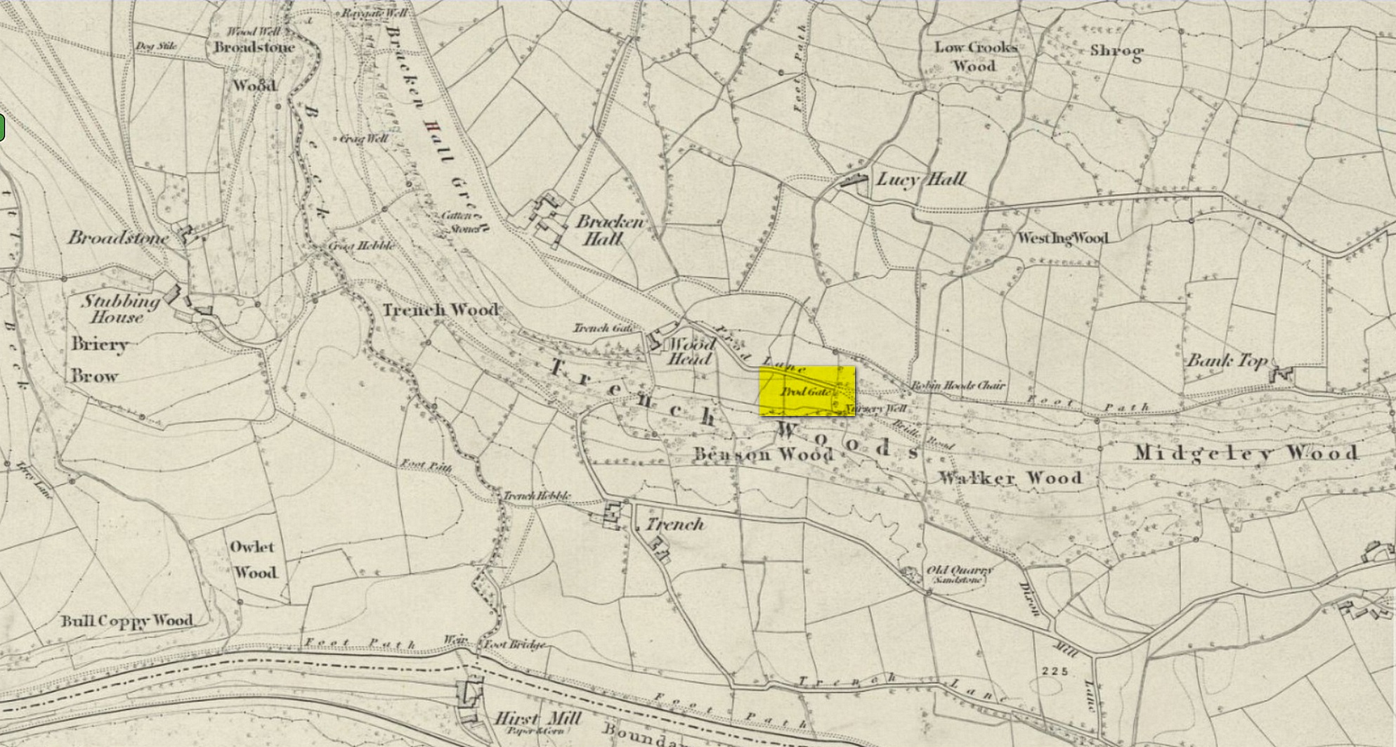
Prod Gate on 1852 map
The exact location of this has proven difficult as the name ‘Glen gate’ was obviously a local one as it wasn’t included on the Ordnance Surveys of the period. There are two named “gates” hereby: one is Prod Gate at the east end of Prod Lane, and the other is Trench Gate a few hundred yards west at the other end of Prod Lane. But the most likely gate of the two would be Prod Gate. When Speight wrote his words, a stream existed that crossed the track about 70 yards west of Prod Gate, whereas no such water-course existed anywhere close to Trench Gate. And so we assume that he was writing about “the stream from the Glen (Prod) Gate.”
Having said all that, there are no known petroglyphs like the one that Speight described anywhere hereby. There are a couple of so-called “carvings” that have been included in so-called official surveys (Boughey & Vickerman 141 and 142; aka ERA- 2445 and ERA-2446) another 150 yards or so on the left-side of the road that could have been regarded as contenders, but these stones have just a mix of modern and natural markings and can be discounted. In all likelihood, this impressive-sounding petroglyph was broken up and destroyed when the proper road was laid in the middle of the 20th century; or perhaps broken up and stuck into one of the garden walls along the roadside. Either way, the carving seems long lost.
References:
Boughey, K.J.S. & Vickerman, E.A., Prehistoric Rock Art of the West Riding, WYAS: Leeds 2003.
Gray, Johnnie, Through Airedale from Goole to Malham, Walker & Laycock: Leeds 1891.
Acknowledgements:Huge thanks for use of the Ordnance Survey map in this site profile, reproduced with the kind permission of the National Library of Scotland.
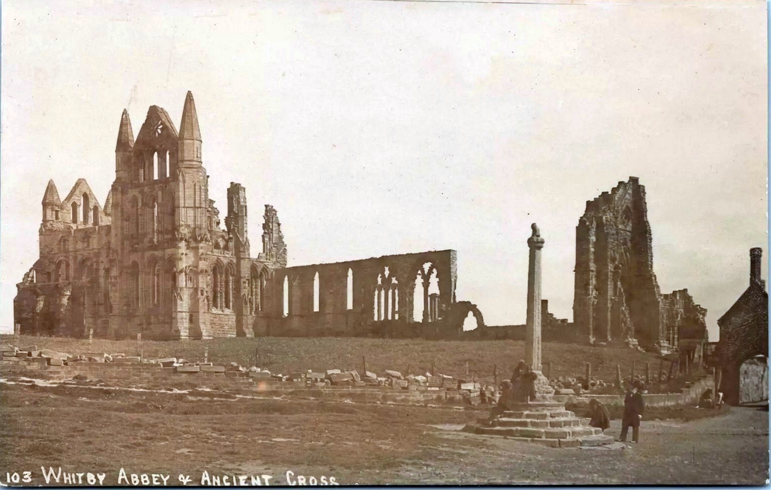
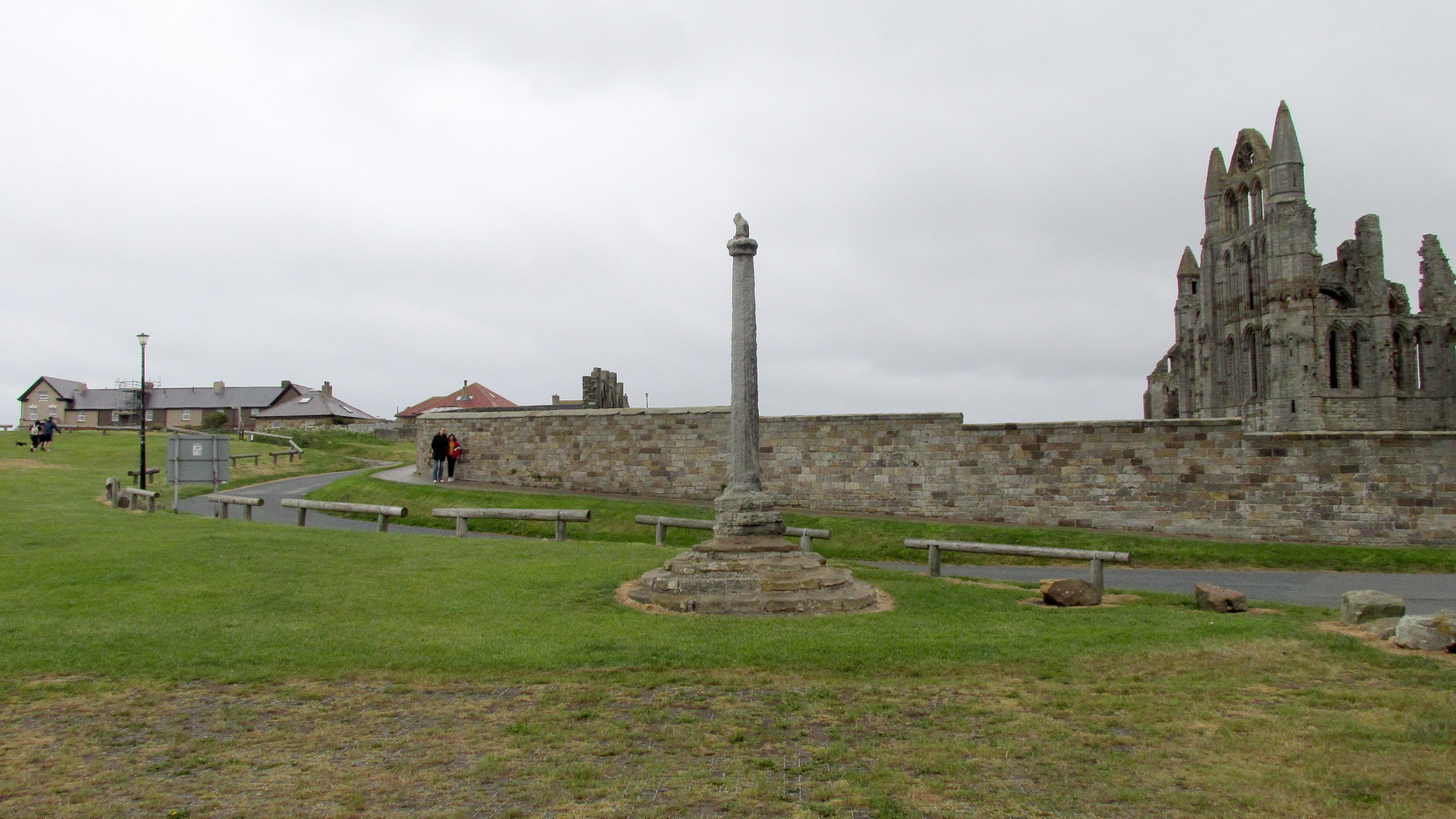
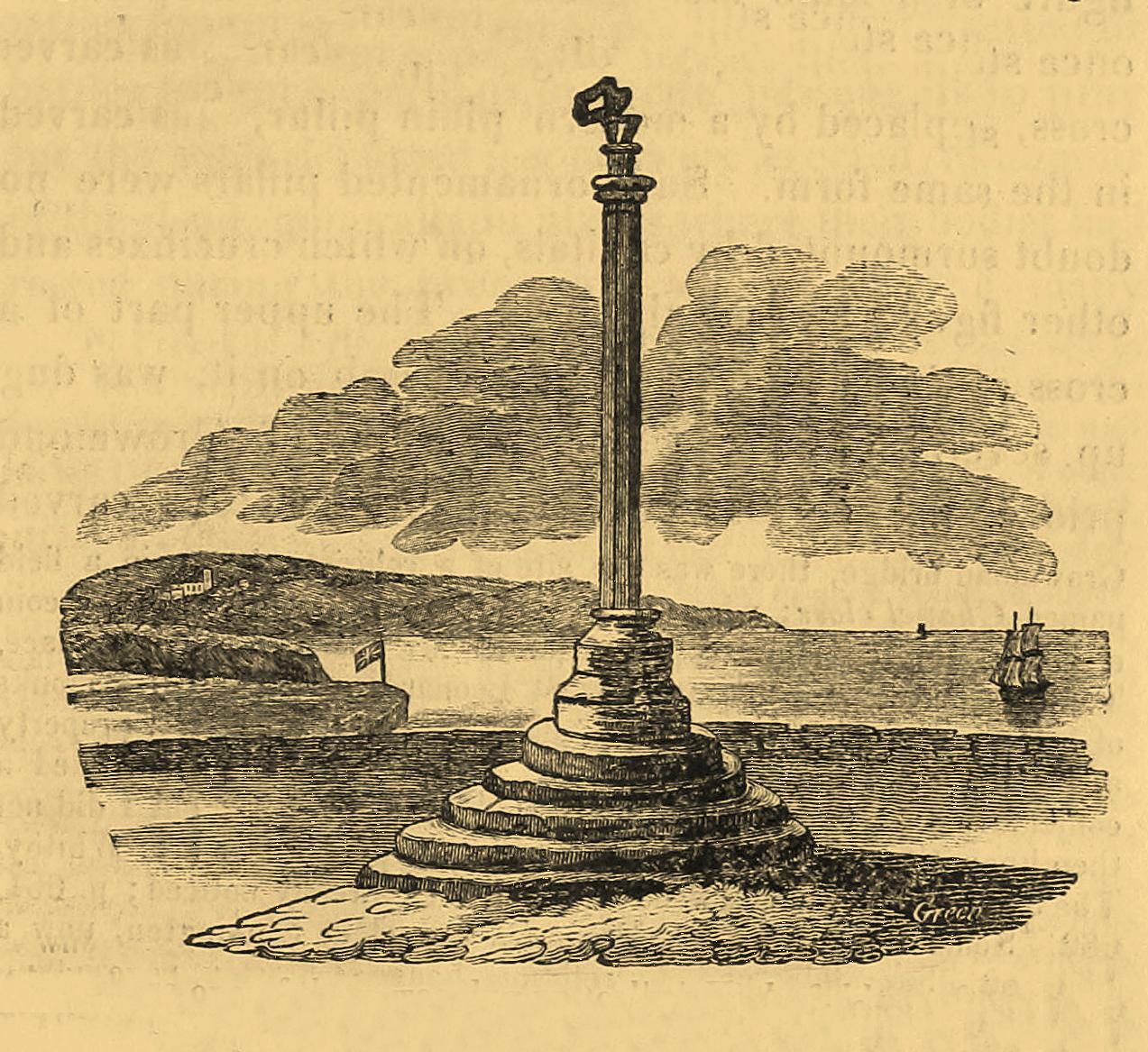
Pretty easy to find: from Whitby town centre, head uphill to the great ruins of Whitby Abbey. You go past Caedmon’s Cross and past the more recent church and graveyard to the car-park at the top, outside the abbey. At the edge of the car-park on the grass, you’ll see this tall hard upright, nice and erect!
Archaeology & History
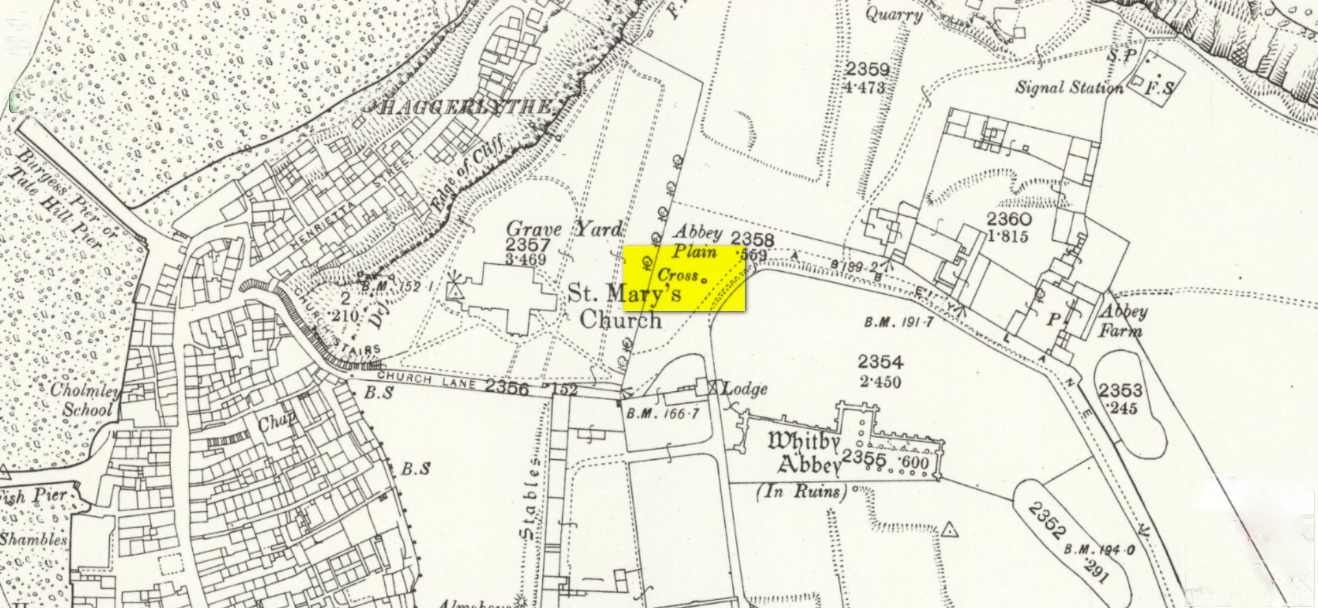
Cross shown on 1894 map
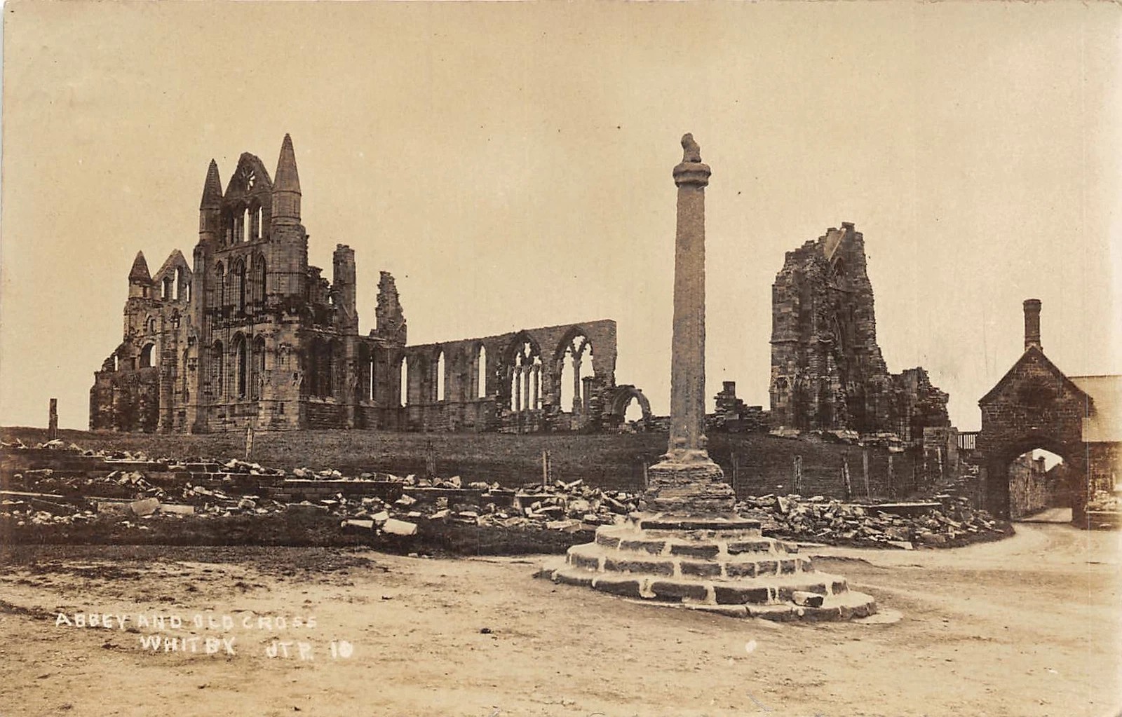
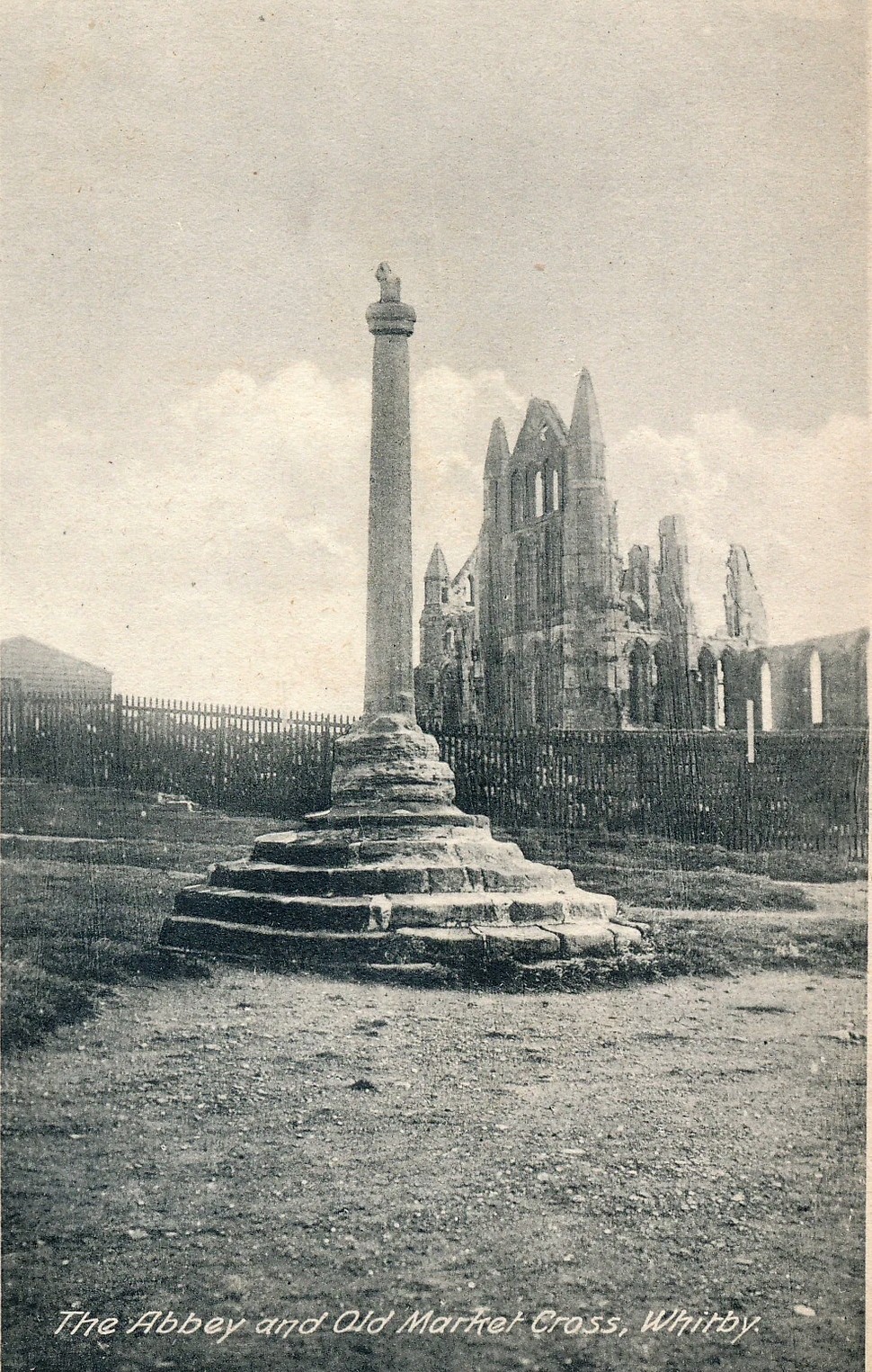
Highlighted on the earliest OS-maps and not to be confused with the nearby and more modern Caedmon’s Cross, this tall large monolith stands upon a stepped plinth comprising of six steps (originally five), about 18 feet high. The top of the cross was knocked off a century or two ago, when it was reported to have been twenty feet! Initially it stood about fifty yards closer to the Abbey, but was removed to its present position following the Dissolution.
The brief history regarding its origin was described in George Young’s (1817) major work, in which he told that in 1474, on John Nightingale, rector of Sneaton parish, in his will “appointed his burial to be on the north side (of the Abbey), before the cross,” which was already standing at that time. Young wrote:
“By this it would appear that the ancient cross, now standing in the abbey plain was then within the cemetery of the abbey.”
Abbey Cross, c.1900Young’s 1817 sketch
This has subsequently been taken as the standard regarding its origin. Tradition also told that it was an old market cross, but this was treated with considerable scepticism by George Young, who believed that the monks here simply wouldn’t have allowed such a thing at the edge the abbey and burial ground. He found evidence to indicate that it “was at the port or harbour of Whitby that corn was bought or sold, that here were kept the standard bushels for measuring corn, and that here the market-clerk had his station.” In spite of this, T.H. Woodwark (1934) reported that fairs had been held at the cross early in the 20th century. In a thoroughly profane way, electrical wiring was wrapped around the bottom of the cross and led to a generator, along with washing-lines running from it to a caravan! Mr Young would have been apoplectic!
References:
Atkinson, J.C., Memorials of Old Whitby, MacMillan: London 1894.
Holt, Robert B., Whitby, Past and Present, Copas: London 1890.
Woodwark. T.H., The Crosses on the North York Moors, Whitby Literary & Philosophical Society 1934.
Young, George, A History of Whitby and Streonshalh Abbey (2 volumes), Clark & Medd: Whitby 1817.
Acknowledgements:Massive thanks to Lindsay (wherefore art thou…?) Mitchell for getting us up here… Huge thanks for use of the Ordnance Survey map in this site profile, reproduced with the kind permission of the National Library of Scotland.
Along the B6265 old road between Keighley and Bingley, at Riddlesden go up Granby Lane, bending left into Banks Lane. About a mile up you’ll reach the moorland road. Turn left at the junction and nearly half-a-mile along there’s a layby on y’ right. From here walk along the footpath on the edge of the ridge, half-mile along bending slightly above Rough Holden Farm until, a coupla hundred yards on, you hit the dirt-track. There’s a long straight stretch of walling on your left: follow this for a few hundred yards, go through the gate and here walk on the other (left) side of the wall (if you’ve reach a derelict farm, you’ve gone too far). Some 60 yards or so down here, keep your eyes peeled on the long earthfast stone right near the walling. An alternative is to start at the steep hairpin bend up Holden Lane and follow the footpath into the woods. Walk along here (parallel with the stream below) for about 600 yards until you hit the bridge crossing the stream. Don’t cross over: instead double-back up the field on your right, go diagonally across and through the gate into the next field, and walk up along the walling to your right. 160 yards up, go through the gate and walk about 30 yards along the side of the walling again. Tis there!
Archaeology & History
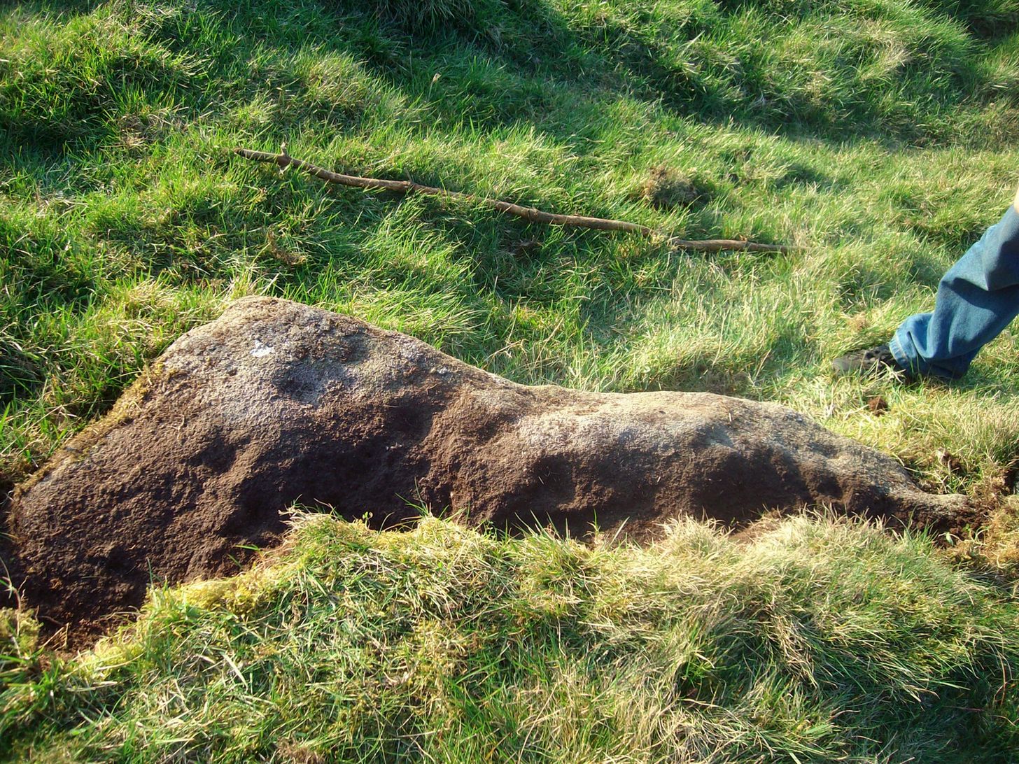
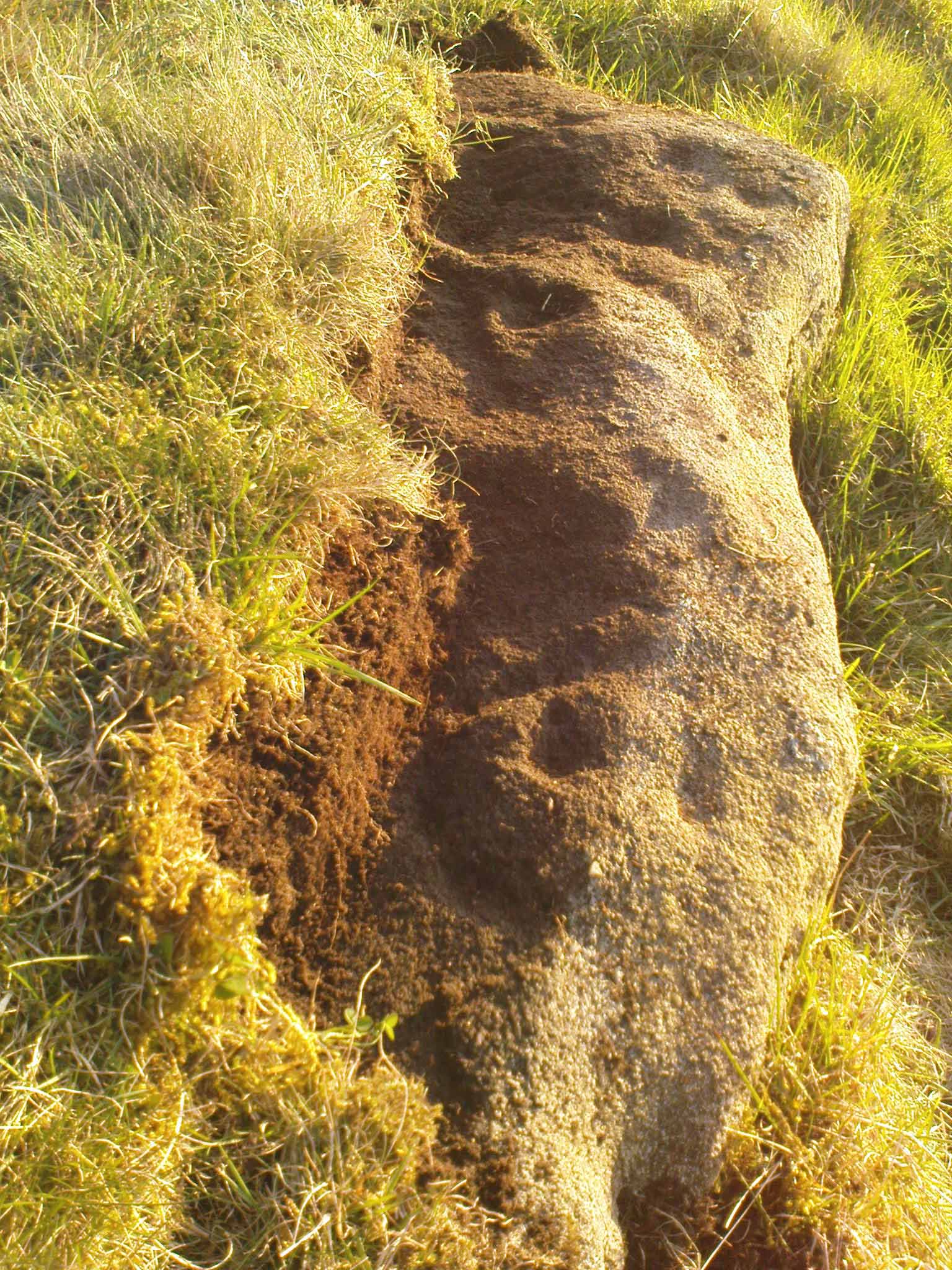
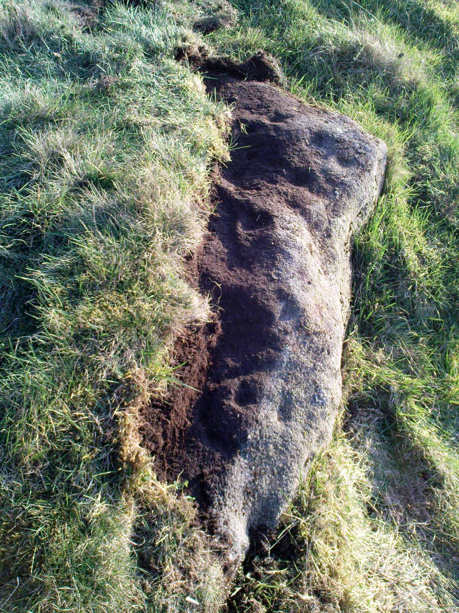
Unveiling the Sunset Stone
This is a fascinating carved stone on the western edge of Rombald’s Moor that I was fortunate to find in 2008. It’s found in association with two other cup-marked stones, north and south of it. I first noticed it when I was walking along the footpath by the side of the wall and saw that on a small exposed part of the rock a single cup-marking carved close to the vertical edge of the stone—and I’m glad that I stopped to give it more attention. The stone was very deeply embedded and the covering soil so tightly packed that I could only shift a small part of it—but the section that I managed to uncover and, importantly, the time of day when I did this, brought about an intriguing visage with subtle mythic overtones.
Carved arc on edge
Early photo in low light
The carving was found near the end of the day just as the sun was setting and touching the far horizon. I noticed there was a cup-and-half-ring to the side of where I’d sat for a rest, near the northern edge of the stone, and the clear but soft light of the evening caught this element and almost brought it to life! As I gazed down at the half-ring, the sun highlighted it even more and I saw that some extended carved lines continued and dropped over the near vertical edge of the stone, becoming an unbroken elongated ‘ring’ that stretched twice the length of the half-ring on the flat surface. Not only that, but a faint cup-mark seemed to be inside this extended vertical ring and, as I saw this, a dreaming epiphany hit me that the symbolism behind this was a representation of the setting sun that I was watching at that very moment. It was quite beautiful and the carving seemed to come to life. The thought, nay feeling, that this part of the carving symbolized a setting sun not only slotted easily into a common animistic ingredient, but hit me as common sense too! However, as my ego and rational sense rose back to the fore (I had to get mi shit together and walk a few miles home before night fell), I saw that this impression may be a completely spurious one; but, as the rock-face inclines west, towards the setting sun, the name of Sunset Stone stuck. As I carefully fondled beneath the heavy overgrowth of vegetation covering the stone, I realised that I needed to come here again and uncover more of it, as additional cups and lines seemed to be reaching out from the mass of soil.
Cups near the S edge
Close-up of ring-edge
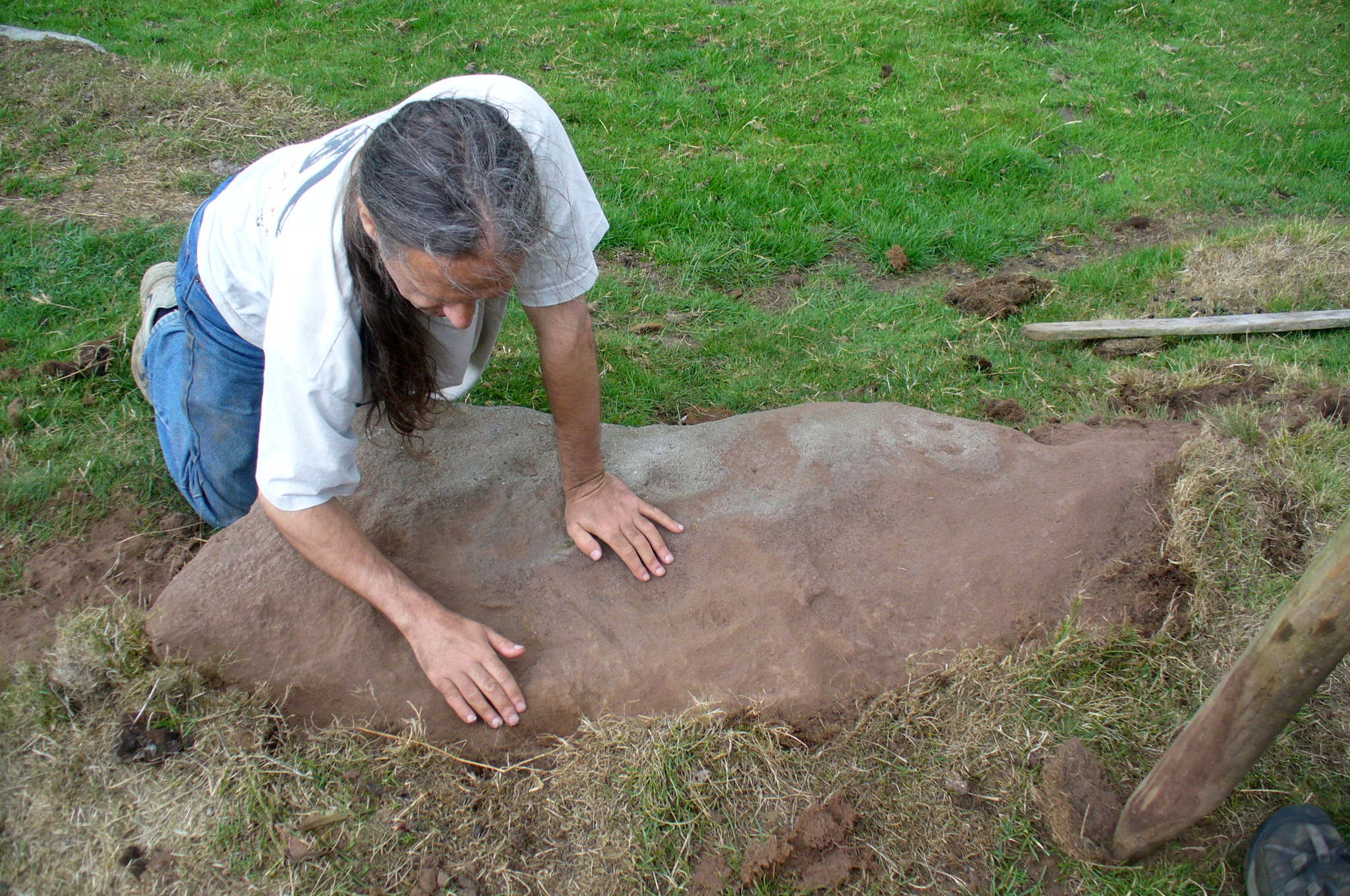
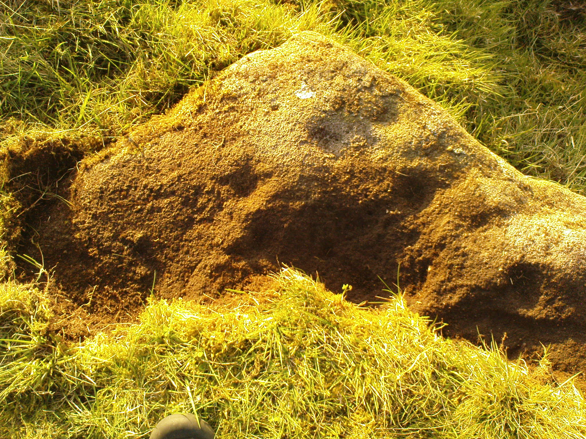
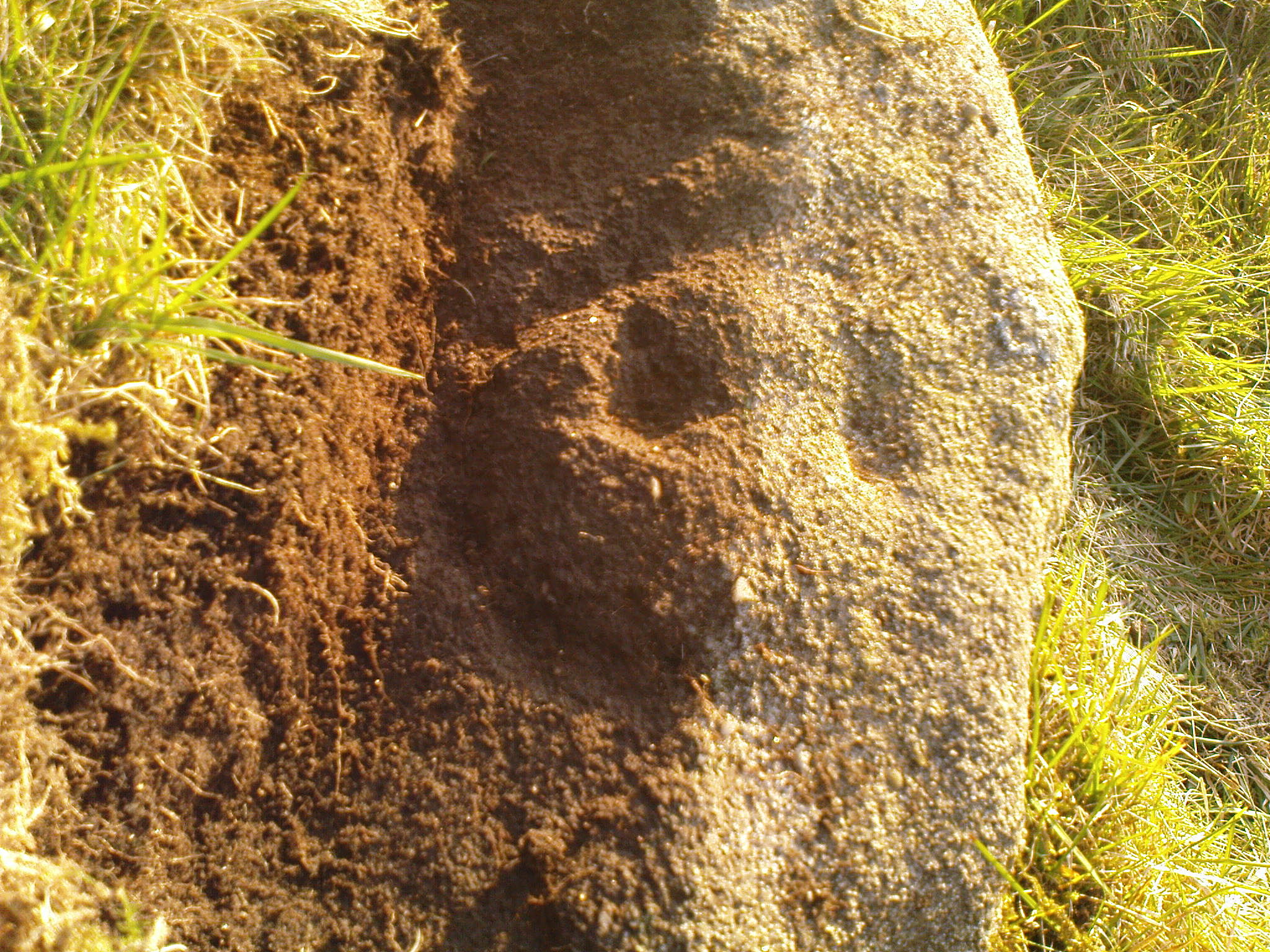
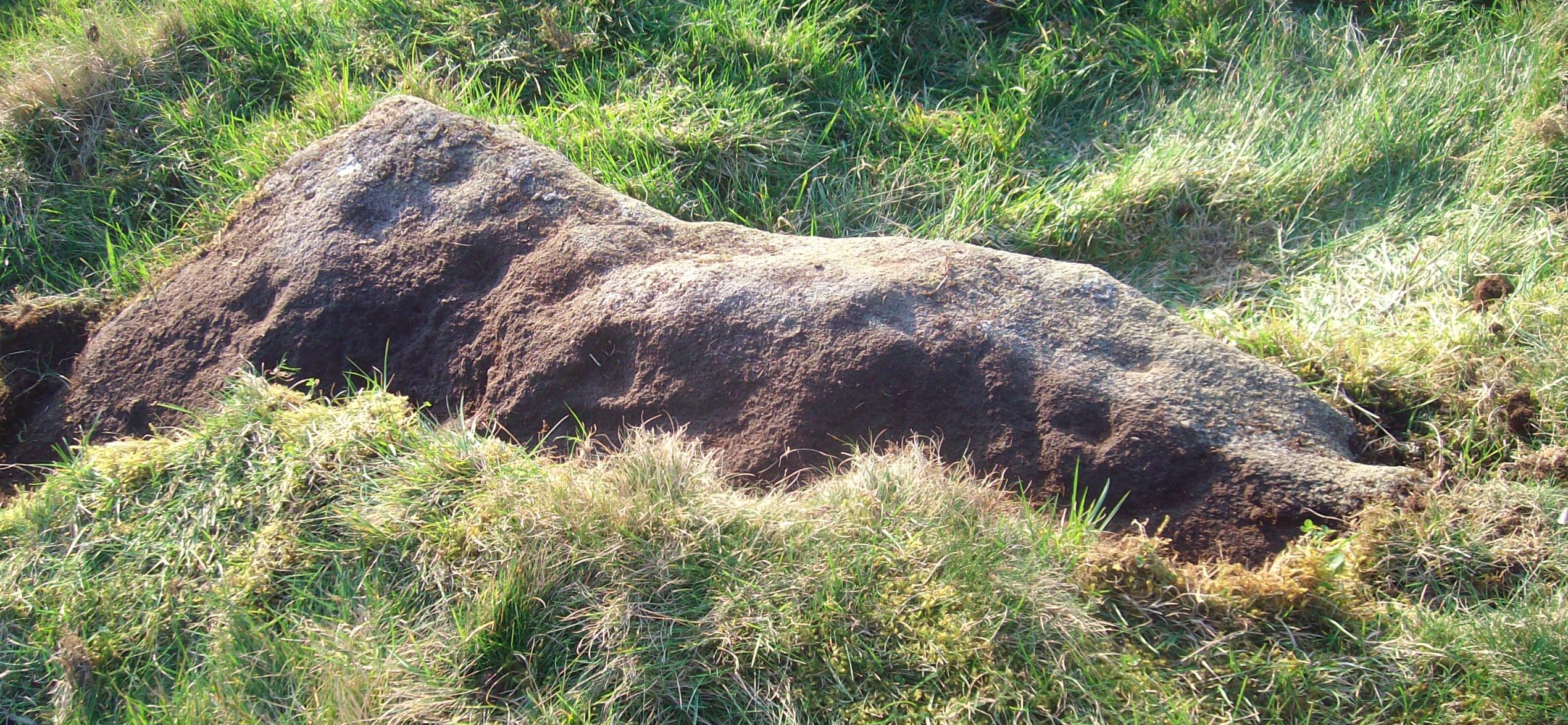
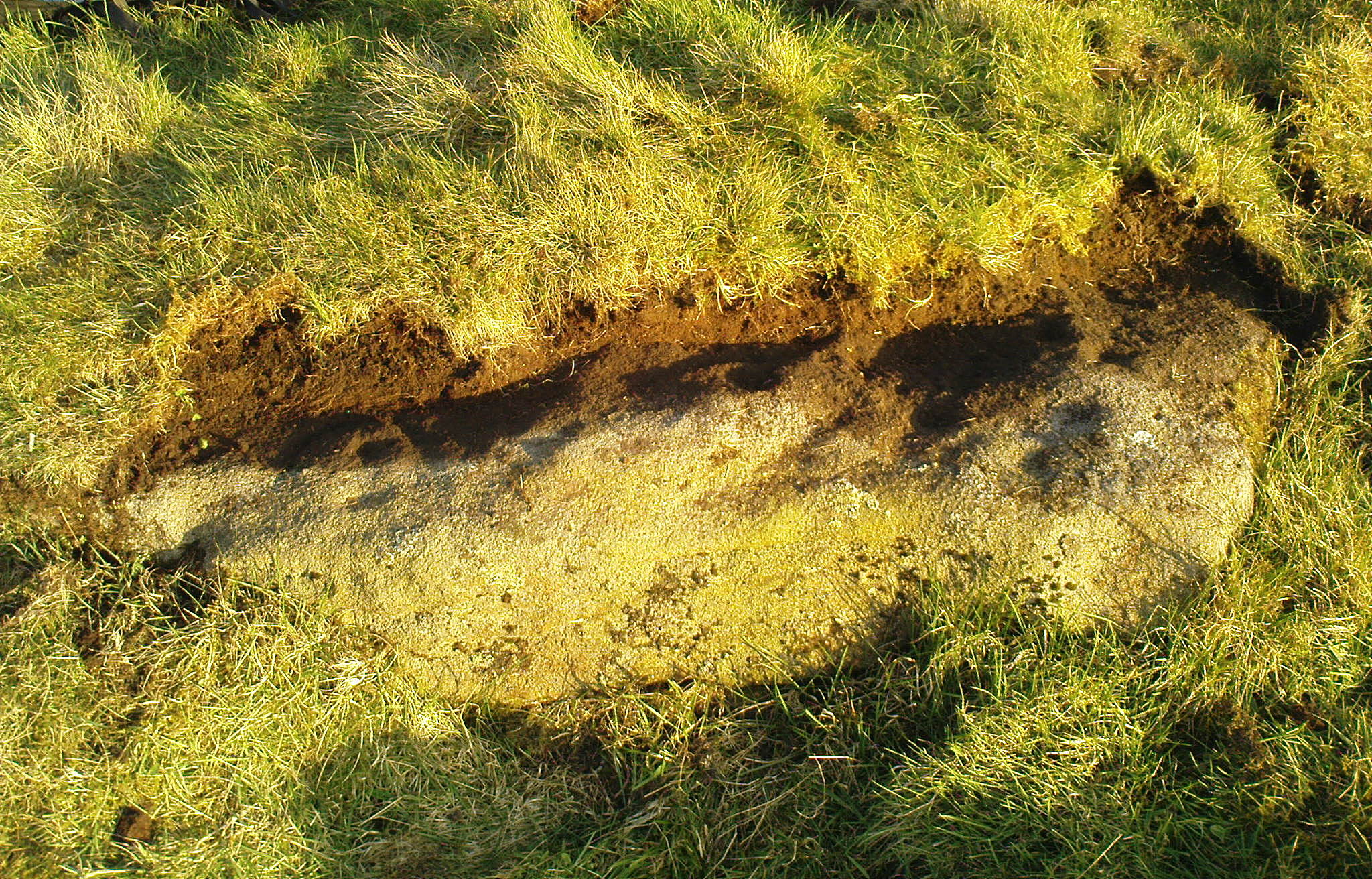
I returned to the stone a few times, but several years passed by before I revisited the site with the intention of uncovering more of the design in the company of Richard Hirst and Paul Hornby on August 4, 2013—and it took considerable effort to roll back the turf that covered the stone. But it was worth it! For it soon became obvious that much of the stone that was covered over had been unexposed for many centuries: as Richard pointed out, the edge of the rock was very smoothed by weathering, whilst the covered section of the stone that we were revealing was still quite rough and misshapen all across the surface, lacking weather and water erosion. Much of this design therefore, highlighted itself to us as it was when the mason first carved the stone. And it turned out to be a pretty curious design!
Faded photo of the carving
Faint proto-ring nr centre
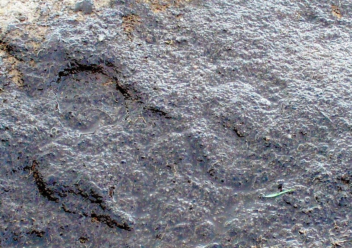
Our first impression was that the design comprised of two cup-and-rings near the middle of the rock, with another cup-and-drooping-ring near the northern edge of the stone, and between ten and twelve typical cup-markings, many on the western exposed side. But curiously near the middle were also a couple of rings whose edges had been defined, but the hollowed-out ‘cup’ in the middle remained uncut or unfinished, being a proto-ring, so to speak. Also, lines leading from these unfinished ‘cups’ were also pecked and laid out, but they were also unfinished. Some sections of the unfinished lines ran onto the western edge of the stone and were very faint, but they were undeniably there. Unfinished cups is an unusual feature for carvings on Rombald’s Moor.
Mr Hirst’s clearance
Cups & curves on edge
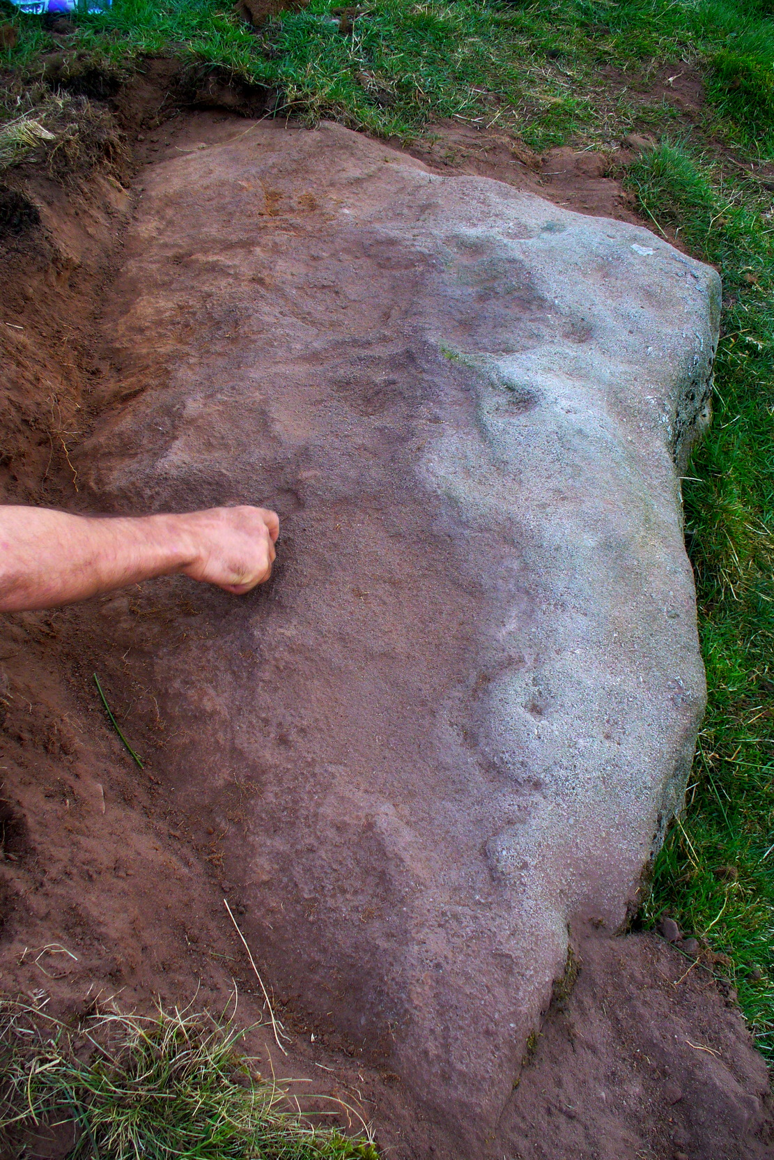
But the most interesting element in the fainter, seemingly unfinished carved lines, was what may be a small spiral that started above the two faint cup-and-rings. This then continued in a sharp arc which doubled-back on itself. In the other direction, the lines curve round and go down to the vertical face of the rock, before bending back up onto the level surface again, then disappearing. The topmost cup-and-half-ring is also a curious feature. When you visit here you’ll see how this aspect of the design looks for all the world like a simply cup-and-half-ring near the edge of the stone. But, as I’ve already mentioned, closer examination shows that this “half-ring” has a larger oval body beneath it on the vertical face of the stone, very worn due to its exposure to the elements and very much in the shape of a bell—and within this large cup-and-ring ‘bell’ is a much fainter complete cup-and-ring, just below the topmost cup-marking. I know that I’ve already mentioned this, but I’m giving it added emphasis as it’s a unique design element for carvings on these moors.
Early photo of the carving
Edge of the carving
The Sunset Stone really requires more attention, when the daylight conditions are just right, so that all of these intriguing aspects can be highlighted with greater lucidity. There is also the potential that more carved ingredients remains hidden beneath the compacted soil.
What seems to be a more trivial single cup-marked stone can be seen roughly 20 yards to the north.
Acknowledgements: Massive thanks to Richard Hirst of Hebden Bridge, and Prof. Paul Hornby, for their help in bringing this carving to light.
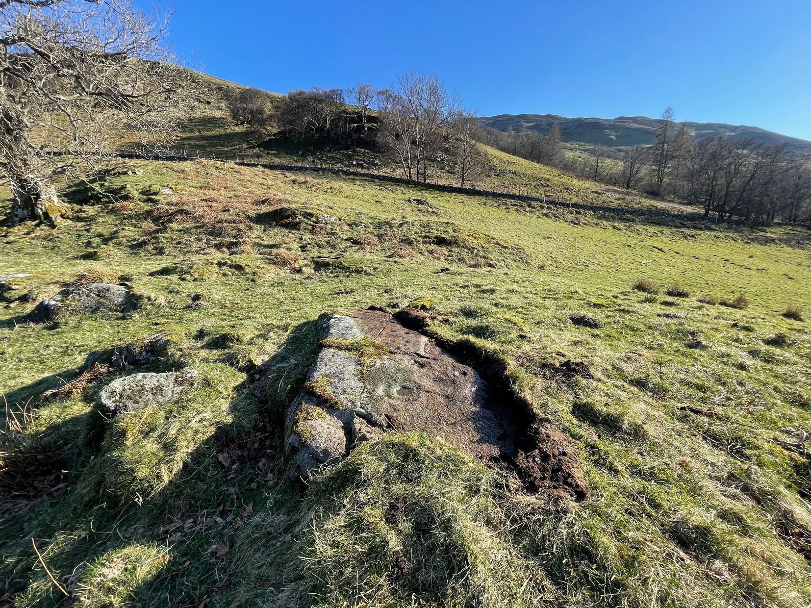
Loch Earn (between the villages of Lochearnhead and St Fillans) has a road running on each side: the north-side is the A85, the south-side is a minor single-track road. You need to be on the south-side. Roughly halfway along the loch, there’s rough parking near Ardvorlich House; and from the track to Ardvorlich, keep on the lochside road, walking east for about 400 yards and then go up the dirt-track on your right. Walk up here for 450 yards until your reach the cottage. There’s a field above you to the left with some small crags near the top: walk uphill (through the gate) for 175 yards and on the topmost crags you’ll see a telegraph pole. The cup-and-ring stone is right next to it!
Archaeology & History
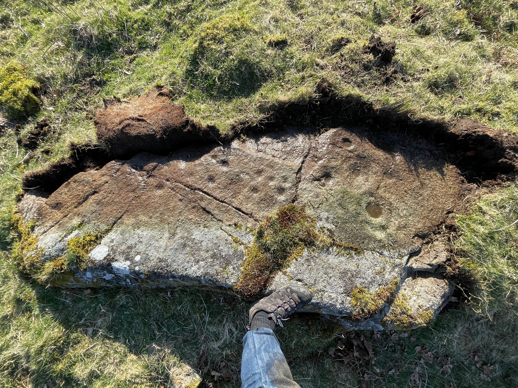
The first and only reference to this stone followed its rediscovery by George Currie (2011) in one of his many bimbling forays seeking out these old carvings. He told, in his usual minimalist manner that,
“A stretch of bedrock adjacent to a telegraph pole on a terrace above Balimeanach farmhouse bears thirteen cup marks, at least two of which have single rings, including the largest at 70 x 25mm.”
Line of cup-and-rings
View from above
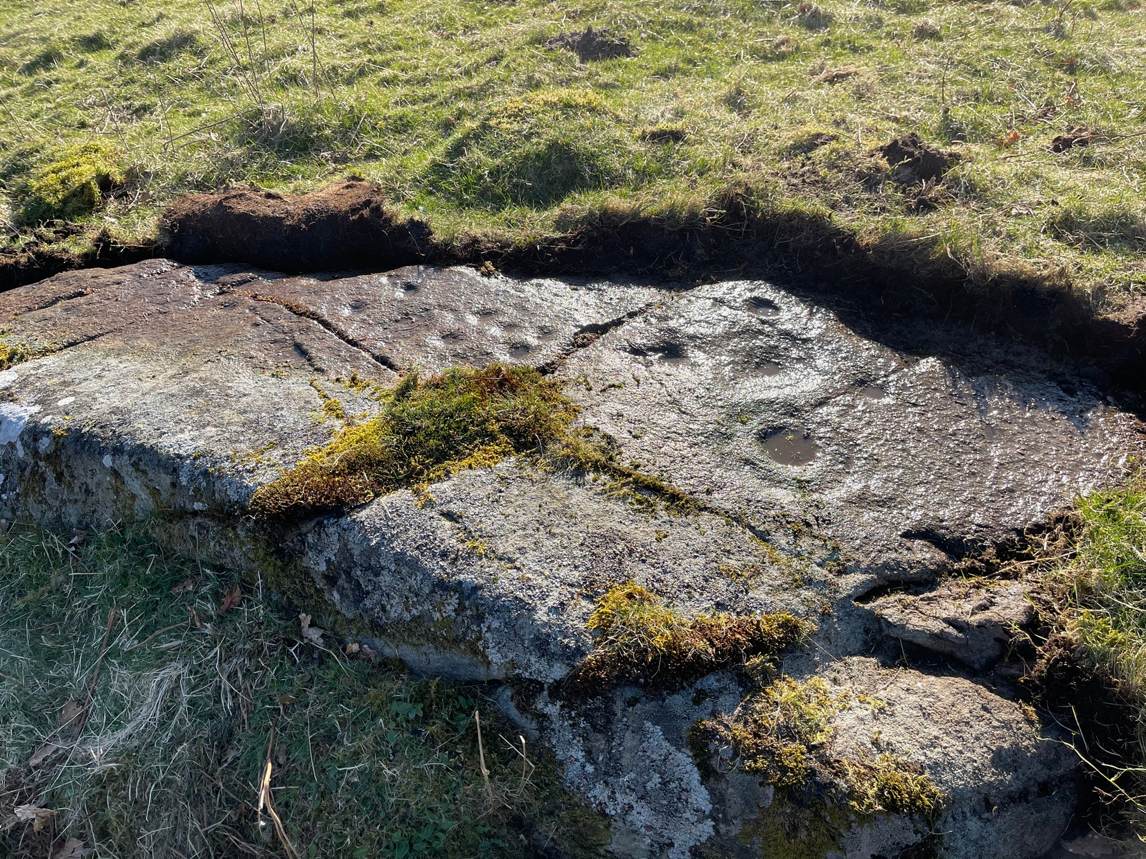
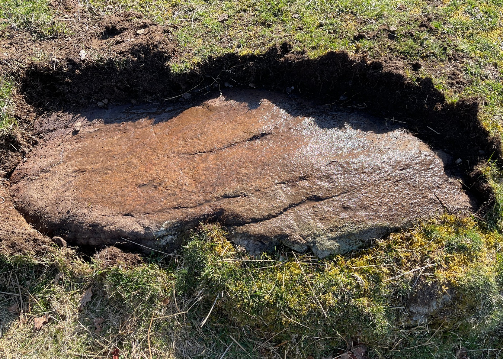
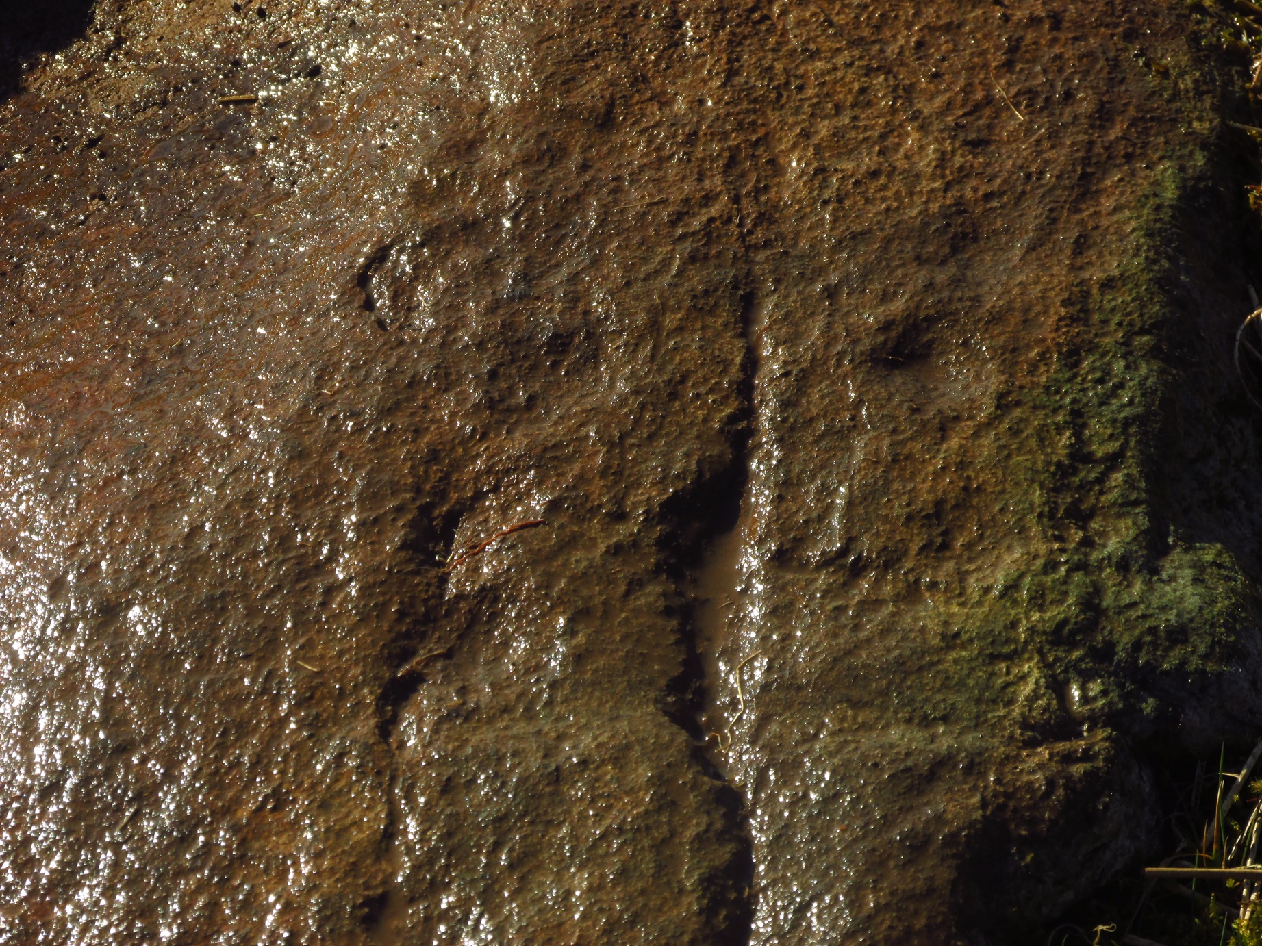
The two cup-and-rings are next to each other on the northen side of the stone, with one based on a small concave depression in the rock itself; but next to this is what seems to be another, third and very faint incomplete cup-and-ring (you can see it in some of the photos here). We walked round and round this and whilst it seems quite obvious, some elements of it appear to be based on natural cracks in the stone, accentuated with minimal pecking by the artist. These three cup-and-rings are next to each other in a veritable Orion’s Belt formation, with a single cup hanging down from the middle.
Carving, looking south
Looking across the design
The other main section of the carving consists of a series of plain cups, scattered in a typically chaotic form and clustering mainly round the centre of the stone; whilst on its southern tip a single cup sits quietly.
When we peeled the turf back to see the entire carving, we found there was a considerable scatter of broken quartz all along the western edge of the stone. This element was also found at the Balimeanach (2) carving less than ten yards away and we’ve found this at a number of other petroglyphs in Perthshire and beyond. Even more intriguing was a large carved stone spearhead covered in soil alongside the quartz scatter! We left this where we found it.
In all probability, there are other carvings that remain undiscovered beneath the turf all along this ridge. Get y’ gardening gloves out!
References:
Currie, George, “Comrie: Balimeanach (BC 3), Cup-marked Rock”, in Discovery & Excavation Scotland, New series – volume 12, 2011.
Less than ten yards south of the Balimeanach (3) petroglyph, this innocuous-looking cup-marked stone can be seen. Paul Hornby and I came across it when looking for the adjacent carving. Comprising of between three and five very faint shallow cups, when we peeled some of the turf over we found a broken hand axe resting on the rock itself. We assumed that this had been the instrument that had been used to knock the cups into being. There were also many small shards of quartz crystal all along the inner edge of the stone: a feature that we and others have found at quite a number of carvings in the Scottish mountains. We left the ruined hand axe where we found it.
4? faint cups in a square
The impression we got here is that the cups are so shallow because the design was never actually completed. Instead, perhaps, they turned to look at the stone ten yards away and thought it was a better choice to cut a more ornate design… Perhaps… It seems pretty likely that other unrecorded carvings will be found close by on the many turf-covered rocks in this area.
Acknowledgements:Huge thanks to Paul Hornby for use of his photo in this site profile.
From Kirkmichael village take the A94 road 2 miles south to the Balnabroich standing stone and another 100 yards past it, on the left (east) take the dirt-track uphill, following the directions to reach the Balnabroich hut circles. You’ll see the large prehistoric rock pile of the Grey Cairn on the near skyline just above the huts and roughly on the same level, 50 yards away to the south, you’ll see this scruffy lumpy dump of a cairn, all overgrown.
Archaeology & History
The cairn, looking S
Amidst the veritable scatter of a thousand clearance cairns (yes, that’s the estimate), there are a few up here that had more funerary functions than the rest. This being one of them. When Allan Stewart (1795) wrote about them all in the Statistical Account, he couldn’t have missed this one—and yet he made no mention of it. We had to wait another seventy years before the outside world became aware of its existence. Then, along with “a band of between twenty and thirty workmen,” John Stuart (1865) set out to see what lay beneath the rocky pile. In truth, much more attention was given to the huge Gray Cairn close by (understandably so), but at least some attention was given here. Stuart described this cairn as,
“about 9 yards across, defined by large boulders, with a raised ridge around, and a cup in the centre. The raised ridges and centre were all formed of small stones and earth. A trench was cut through it from the southeast, which showed that in the centre, at a depth of 2 feet, a deposit had been made, of which the remains were charred wood and fragments of charred bone, with traces of blackish matter, which had filtered into the yellow subsoil, as in the case of the graves at Hartlaw.’ Many fragments of white quartz pebbles appeared near the centre, as in other cairns to the east.”
Indeed, at least one of the “cairns to the east” is made entirely of quartz stones! Since Mr Stuart’s dig into the tomb, it has widened out slightly as rummaging cattle and other damage has been inflicted, and the grasses have coloured the tomb with their life. Check it out when you’re up here!
References:
MacLagan, Christian, The Hill Forts, Stone Circles and other Structural Remains of Ancient Scotland, Edmonston & Douglas: Edinburgh 1875.
Ramsay, John S., Highways and Byways of Strathmore and the Northern Glens, Blairgowrie Advertiser 1927.
Royal Commission on the Ancient & Historical Monuments of Scotland, North-East Perth: An Archaeological Landscape, HMSO: Edinburgh 1990.
Stewart, Allan, “Parish of Kirkmichael,” in Statistical Account of Scotland – volume 15, 1795.
Stuart, John, “Account of Excavations in Groups of Cairns, Stone Circles and Hut Circles on Balnabroch, Parish of Kirkmichael, Perthshire,” in Proceedings Society Antiquaries, Scotland, volume 6, 1865.
Acknowledgements:Huge thanks for use of the Ordnance Survey map in this site profile, reproduced with the kind permission of the National Library of Scotland.