On the northwest side of the Loch of Boardhouse can still be found a spring of water which was, in bygone times, the abode of the supernatural creature known as the troll or trow. The site is described in local place-name records and is located near the foot of a slope near Westerhouse, from where a small channel of water runs down into the Loch of Boardhouse about forty yards away. When it was last described in the 1960s, all folk memory of its heathen inhabitants had seemingly been forgotten and no folk-tales seem to have been recorded. Thankfully, the Well itself is still shown to exist on modern OS-maps.
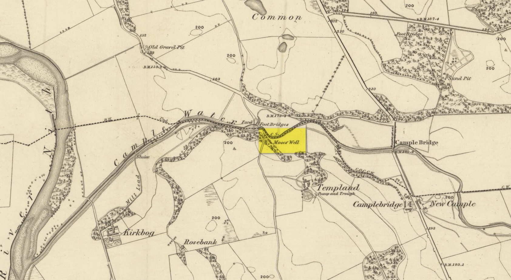
This little-known Biblical-sounding spring has apparently long since fallen back to Earth (perhaps there might be some local folk who could find out for certain). Shown on the 1861 Ordnance Survey map as being at the side of the wall in the small copse of trees—immediately east of kirk- place-names and a half-mile north of St Ninian’s Well—it was briefly described by T.C. Ramage (1876), who seemed to know nothing of its lore, merely telling us that,
“on Templand farm, close to the wooden bridge over the Cample, there is Moses’ Well, an unusual designation, but which some Knight Templar may have given in remembrance of his toils in Palestine.”
The Templar designation was deemed by Ramage to come from the name of the farm. However, a few years prior to this, the early Scottish place-name surveyors were traversing the area and found from local people how it derived “its name from a Tinker named Moses Marshall who with his family lived near it in a Camp during the time they had the small pox.” The Well was also included in the Morris survey (1982), but without comment. Another Moses Well can be found 44½ miles to the northeast, near Galashiels at NT 4046 4306.
Cross / Sacred Tree: OS Grid Reference – NN 581 012
Also Known as:
Law Tree
Archaeology & History
As a folklorist and antiquarian, I find this long lost site more than intriguing. Most ancient crosses are stone; but in early centuries many were made from wood which, obviously, have decayed down the years. But this cross, located on the northeast edge of the Lake of Menteith, was actually a tree: a hawthorn no less. This choice would have been made based on it being one of the few trees that are deemed sacred in both christian and indigenous lore. It was described—albeit briefly—in A.F. Hutchison’s (1899) excellent history book of the area:
“The cross of the burgh is said to have been the trunk of an old hawthorn tree, which stood by the lake side, opposite the manse of Port, and was known as ” the law tree.” Around this tree an annual fair was held in the month of September, and called after St. Michael.”
We’re obviously seeing here the traditional animistic veneration of trees by local people, with the incoming christian symbol being grafted onto it. Hawthorns were one of the potent protections against witchcraft and so the handshake between christian and pre-christian systems obviously worked here. Faerie-lore was also rampant at many places for many miles around this site.
References:
Hutchison, Andrew F., The Lake of Menteith – Its Islands and Vicinity, Eneas Mackay: Stirling 1899.
Cross (destroyed): OS Grid-Reference – SE 3224 4498
Archaeology & History
A Charter in the time of King John allowed for markets to be held in Harewood from 1209 CE onwards, “on the first day of July and the two following days, and also to hold one market there every week on the Monday.” But whether or not a market cross was erected that far back, we don’t quite know. Certainly, the edifice illustrated by John Jones (1859) in his standard work on Harewood didn’t date from such an early period! It stood close to the old road junction to Wetherby in old Harewood village, “a little below the intersection of the roads, and about fifty yards higher up than the market house.” Jones told us:
Harewood Cross (Jones 1859)
“It stood upon a large stone pedestal, and was approached by a quadrangular flight of seven steps, very broad, where the neighbouring farmers used to stand, and dispose of their butter, fowls, eggs, &c. It was re-erected, AD 1703, by John Boulter, Esq., and in the year 1804, when the road was lowered, it was taken down and destroyed. This is to be regretted, it might have been re-erected in another situation, if that was inconvenient, and would have been in the present day, not only an ornament to the village but a relic of the past, of which the villagers might have been justly proud. On the top of this cross there was a knur and spell, a game for which the village was celebrated in old times, while close to the toll booth there was a strong iron ring fastened to a large stone, where the villagers used to enjoy the barbarous amusement of bull baiting.”
References:
Bogg, Edmund, Lower Wharfeland, J. Sampson: York 1904.
Jones, John, The History and Antiquities of Harewood, Simpkin Marshall: London 1859.
Speight, Harry, Lower Wharfedale, Elliott Stock: London 1902.
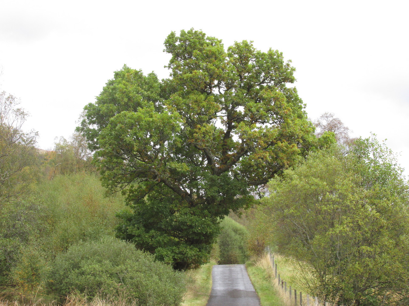
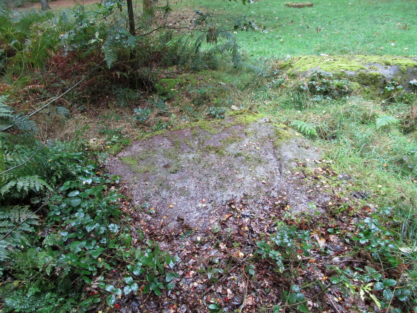
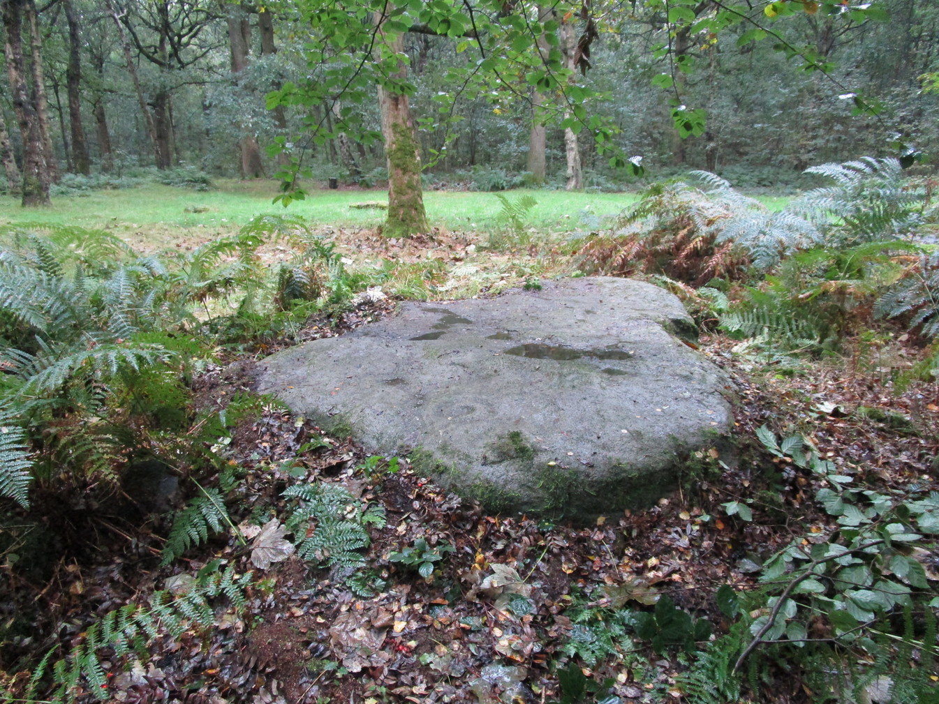
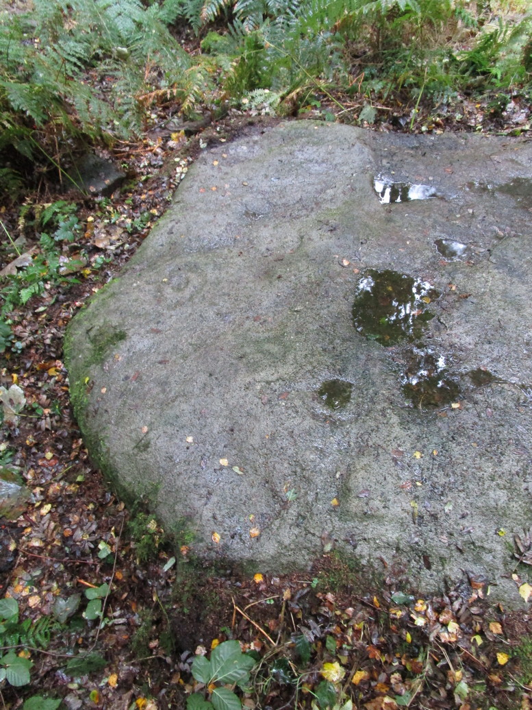
Nothing has previously been written of this site. Its existence came to light during one of umpteen enquiries I’d made with a well-known and very respected local lady, born and bred in Killin (sadly, a dying breed), who is known as a fount of knowledge regarding the history of the area. We were talking about the ancient sites and folklore of the neighbourhood and, amidst being her usual helpful self she asked, “have you been to the Coin Tree? The place where we leave offerings to the spirit of the place?”
I hadn’t.
“No, I’ve never heard of the place.”
“We keep it quiet, ” she said, “for obvious reasons.”
I knew what she meant. The Fairy Tree at Aberfoyle is a case in point: littered with plastic pentagrams, children’s toys and so-called “offerings” of all kinds that have made it little more than a dumping ground for pseudo-pagans and new-age nuts that needs to be cleaned regularly by local folk.
Anyhow, our informant proceeded to give us directions to find the place, going out of the village, but asked that if we were to write about it, to keep its location quiet, “as the place is still used by us”—i.e., old locals. After a slow trek along one of the roads out of the village we saw nothing that stood out. Eventually we came across a fella relaxing in his garden and asked him if he knew anything about an old tree where offerings were made. He gave us that look that olde locals do, to work out whether you’re a tourist or not and, after telling him what we’d been told and who had told us —that seemed to do the trick!
“You’d mean the Fairy Oak I s’ppose? Aye,” he said, “gerrin the car and I’ll drive y’ down to it.”
So we did. A short distance back along the road that we’d come down he stopped and walked along a to large oak tree beside the road. We’d walked straight past it—but in truth it’s not a conspicuous tree and unless you were shown where it was, you’d miss it as easily as we did (and I’m usually damn good at finding such things!). We thanked the fella for taking us to see it and he drove back home to leave us with out thoughts.
More coins as offerings
Coins for the little people
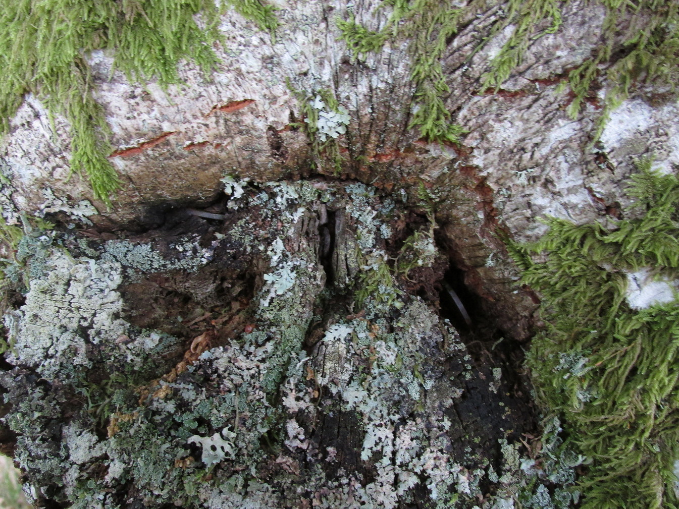
Embedded into the tree—some of them barely visible where the bark had grown over them—were clusters of old coins all around its trunk; some of them very old. These had been inserted into the tree as offerings in the hope that the little people, or the genius loci would bring aid to that which was asked of it.
In a field across the road there’s a large “fairy-mound” hillock, or tom as they’re known in the Gaelic landscape: one of Nature’s creations, but just the sort of place where many little people are said to live in many an old folk-tale. Some such mounds are old tumuli, but this aint one of them. It’s possible that it had some relationship with the tree where the fairy folk are said to reside but, if it did, our informants didn’t seem to know.
The important thing to recognise here is that in some of the small villages and hamlet in our mountains, practices and beliefs of a world long lost in suburbia are still alive here and there… But even these are dying out fast, as most incomers have no real attachment to the landscape that surrounds them. Simply put: they see themselves as apart from the landscape as opposed to being a part of it.
Follow the same directions as if you’re visiting the impressive Fairy Stone carving, then 3 yards east is the Cottingley 2 double cup-and-ring, keep walking past through trees for another 5-6 yards where you’ll come across this reasonably large curved flat stone. Y’ can’t really miss it
Archaeology & History
Cup, with ring faintly visible
This was another carving in the small cluster by the Fairy Stone that I found on my visit here in the 1980s—but it’s a pretty innocuous one to be honest. There’s a faded incomplete “ring” (not really visible on my photos due to pouring rain and very poor light when I was here) with a distinct cup-mark in the middle. Several inches away from the cup-and-ring is a carved line that arcs around it creating an incomplete oval design; and what seems to be a single cup-mark is visible at the top of this oval. Other marks on the stone are both natural as well as recent ‘scratches’.
Some elements of this carving—as with others in this petroglyph cluster—seems to be modern. The cup-and-ring seems to be the real deal, but the ‘oval’ seems to have been added much more recently, perhaps by the scouts who play around in this part of the woods.
Get yerself to the Fairy Stone, then walk east past the adjacent woodland carvings—numbers 2, 3 and 4—from where you should walk about another 10 yards east across the grass, keeping your eyes peeled for a large flat stone measuring about 6ft by 10ft just as you go back into the tree cover north-side. You’ll find it.
Archaeology & History
This large carved rock is the easternmost known petroglyph in this small woodland cluster of five. (a sixth one can be found, but it’s several hundred yards east from here) Consisting of two distinct cup-and-rings in relative proximity to each other on the northern section of the stone, this design—unlike others in this group—has a greater sense of stylistic authenticity to it. Despite this, one of the two cup-and-rings seems to be a more recent addition to the rock, as close inspection shows peck marks that aren’t very well eroded as you’d expect on rock of this type if it was truly ancient. The more faded cup-and-ring on its northwestern section looks to have a greater sense of age about it when we look at its erosion level….perhaps…
The 2 Cup & Rings
The 2 cup-and-rings
We have to take into consideration when looking at this carving and the others nearby that possess some quite peculiar design-elements, that this section of woodland is used extensively by boy scouts who do what boy scouts do in their teenage ventures: from making fires, climbing trees and, perhaps, scribing on stones if/when their elders aint looking. It’s an important ingredient that has to be taken into consideration when looking at the more rash motifs hereby—this carving included. The more faded cup-and-ring on this, however, may be the real deal. And hopefully, next time I visit this site, She’ll not be dark and pouring with rain (much though I love such weather), so I’ll be able to get some better photos!
Follow the same directions as if you’re visiting the impressive Fairy Stone carving, then check out the overgrown rock three yards away, to the east. You might have to rummage under the scrubbage to see it, but you’ll find it if you want to!
Archaeology & History
I first found this stone in the 1980s when I’d been shown the Fairy Stone carving which, at the time, was thought to be all alone. But I used the olde adage: “where’s there’s one cup-and-ring, others tend to be“—and found this and several others closed by.
Large messy cup-and-ring
It’s a relatively small, slightly-domed earthfast rock, upon which we find an unusually large cup-and-double-ring design with a carved line running from the large central cup out to the edge of the stone. However, the carved lines that constitute both the inner and outer rings are ‘crude’ in form and style when compared to the vast majority of other British petroglyphs; and for some reason, this aspect of the design has me casting doubts over its prehistoric authenticity. I hope I’m wrong!
References:
Bennett, Paul, ‘Tales of Yorkshire Faeries,’ in Earth 9, 1988.
Bennett, Paul, The Old Stones of Elmet, Capall Bann: Milverton 2001.
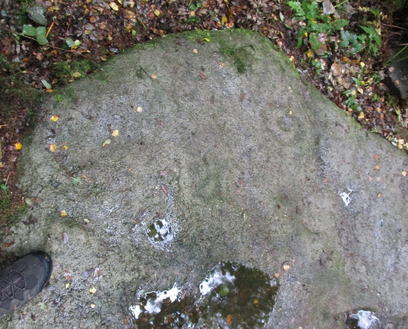
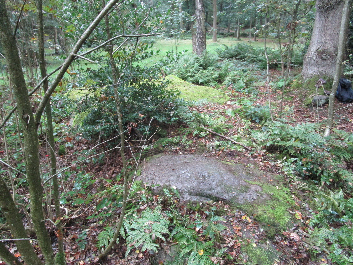
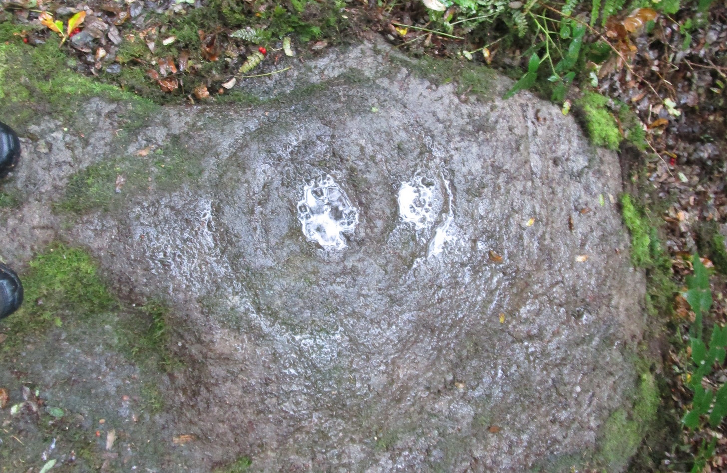
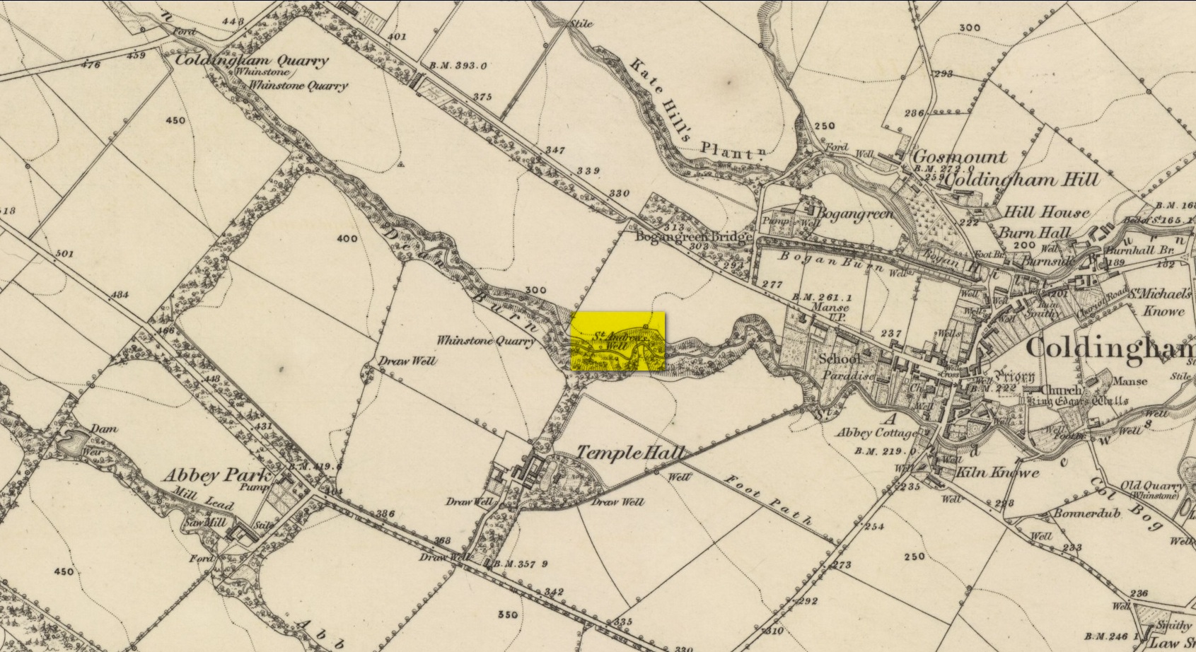
By the side of the stream known as St Andrew’s Burn, in the small wooded glen to the rear (west) of the Crosslaw Caravan Park (right by the side of the A1107 road), you can still find the flowing waters of this all-but-forgotten holy well that was dedicated to Scotland’s patron saint, god knows how long ago! The first description I’ve come across relating to the site is in William King’s (1858) early work on Coldingham Priory, where he told that,
“In a dean a little westward from the village, and on the border of the property of Bogangreen, is a spring of excellent water, called St Andrew’s Well, from which the monastery was supplied by leaden conduits, portions of which are occasionally turning up to view. These pipes are thick and well made.”
Fifty years later when Adam Thomson (1908) penned his magnum opus on Coldingham parish, the well was still in a good state of affairs. Hereby there grew much chamomile which, he thought, “the monks were wont to cultivate for the healing of the sick.”
Folklore
St Andrew’s feast day is November 30 and is known as Anermas.
References:
Hunter, William K., History of the Priory of Coldingham, Sutherland & Knox: Edinburgh 1858.
Holy Well (destroyed): OS Grid Reference – SE 6071 5187
Archaeology & History
At the beginning of the 19th century, William Hargrove (1818) described the scant remains of some old walling along old Haver Lane (renamed as Green Lane and now known as The Stonebow) which were the remains of a building, long gone, and which,
“tradition informs us (was) a religious house, which formerly stood here, called Holy-Priests; and though the site of it is not known, the report is greatly strengthened by the appearance of the walls just mentioned, and by the circumstance of a deep draw-well which now remains, being still called Holy-Priests Well.”
Some suggest that this water source may still exist beneath one of the buildings hereby, but the landscape here has been so badly mutilated over the last two hundred years that it’s very unlikely.
References:
Hargrove, Willliam, History and Description of the Ancient City of York – volume 2, part 2, W. Alexander: York 1818.