Holy Well (destroyed): OS Grid Reference – T 2481 8173
Archaeology & History
Highlighted on the 1838 OS-map, Grogan and Kilfeather (1997) report that there are “no visible remains” to be seen of this holy well. The cult of St Patrick is still celebrated in Ireland every year on 17 March.
References:
Grogan, Eion & Kilfeather, Annaba, Archaeological Inventory of County Wicklow, Stationery Office: Dublin 1997.
Lynch, Geraldine, “The Holy Wells of County Wicklow,” in Wicklow History and Society (edited by K. Hannigan & W. Noland), Dublin 1994.
Round Barrow (destroyed): OS Grid Reference — SU 1510 4330
Also Known as:
Durrington 70
Archaeology & History
Cunnington’s sketch of the barrow remains
This was one of four ploughed-out round barrows (or ‘ring ditches’ in modern archaeo-jargon) that once existed immediately southeast of the well-known Woodhenge and was the closest of the four to the monument, being just 60 yards away. It was first noticed as a faint crop mark in an aerial survey photograph taken in 1926 of the fields hereby. When it was investigated at ground level by Mr & Mrs Cunnington in August 1928, “no trace could be detected on the surface” of any extant monument—which they described as ‘Circle IV’ in their superb survey.
The Cunnington’s (1929) account of the excavation they did here was pretty brief, telling:
“The soil was removed and the chalk brushed over that part of the area enclosed within firm lines. Beyond a few shards of pottery in the soil, nothing whatever was found. As the ditch was comparatively shallow and the filling-in was in patches dark in colour, with much ash and some burnt flints in it, a considerable length was dug out, as shown (in the sketch, above). A few fragments of pottery similar to some of that from Woodhenge were found in and below the old turf line.
“The only find of interest was that of a piece of glass slag on the actual bottom of the ditch. It is true it was at the shallowest point, but there was no evidence of disturbance.
“Conclusion — Like those of the other rings (Woodhenge Circles 1, and 3, PB) this ditch may have originally surrounded a Bronze Age burial, placed on the surface and covered with a mound, both of which were destroyed when the ground was levelled.”
References:
Cunnington, M.E., Woodhenge, George Simpson: Devizes 1929.
Royal Commission Historical Monuments, England, Stonehenge and its Environs, Edinburgh University Press 1979.
Wainwright, G.J. & Longworth, Ian, Durrington Walls: Excavations 1966-1968, Society of Antiquaries: London 1971.
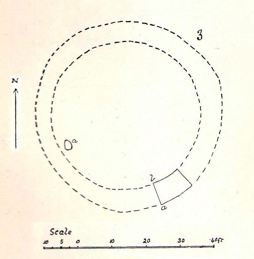
Round Barrow (destroyed): OS Grid Reference — SU 1511 4327
Also Known as:
Durrington 69
Archaeology & History
Cunningham’s sketch of Woodhenge-3 barrow
This was one of four ploughed-out round barrows (or ‘ring ditches’ in modern archaeo-jargon) that once existed immediately southeast of the well-known Woodhenge complex, constructed approximately 95 yards away. As with others in this field, the site was first noticed as a faint crop mark in an aerial survey photograph taken in 1926. When it was subsequently investigated at ground-level by Mr & Mrs Cunnington in August 1928, “no trace could be detected on the surface” of the monument in question—which they described as ‘Circle III’ in their superb survey.
Very little was found in the Cunnington’s (1929) excavation, as their following brief account indicates:
“The soil was removed and the surface of the chalk brushed, over the whole of the area enclosed within this ditch.
“Only one small oval-shaped hole was found, near the edge of the ditch at “a” (above), 33in x 22in, and only 5in deep in the chalk; in it were a number of fragments of bones of a small ox and pig, a piece of burnt clay and a flint scraper weathered white.
“As there was nothing dateable in the circle it was not thought worth while to excavate more than a short section of the ditch. Pottery comparable with that found at Woodhenge came from the old turf line and from the bottom of the ditch.
“Conclusion — Like those of the other circles (Woodhenge circles 1, 2 and 4, PB) it is probable that this ditch was originally made round a Bronze Age burial that had been placed on the surface, and that it was destroyed together with the covering mound when the ground was levelled.”
References:
Cunnington, M.E., Woodhenge, George Simpson: Devizes 1929.
Royal Commission Historical Monuments, England, Stonehenge and its Environs, Edinburgh University Press 1979.
Wainwright, G.J. & Longworth, Ian, Durrington Walls: Excavations 1966-1968, Society of Antiquaries: London 1971.
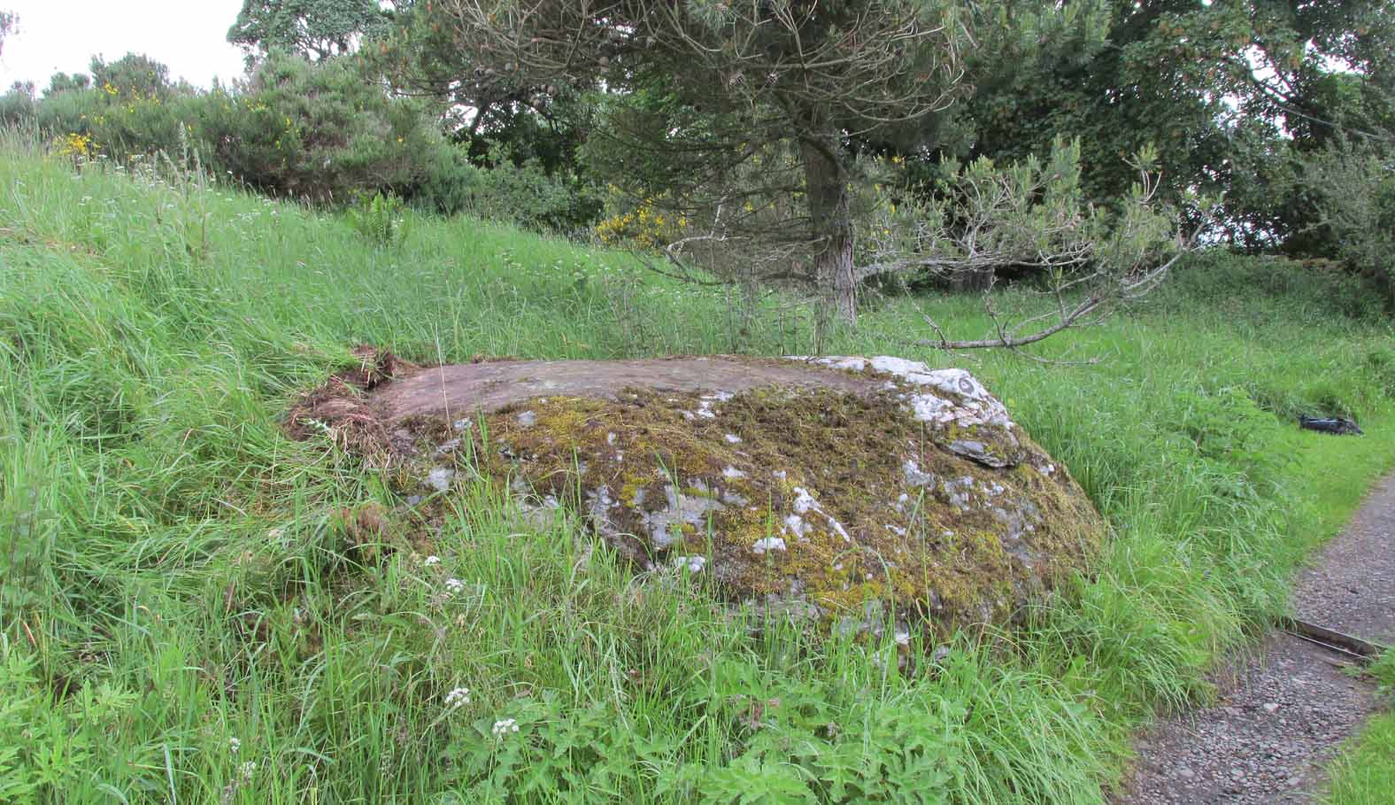
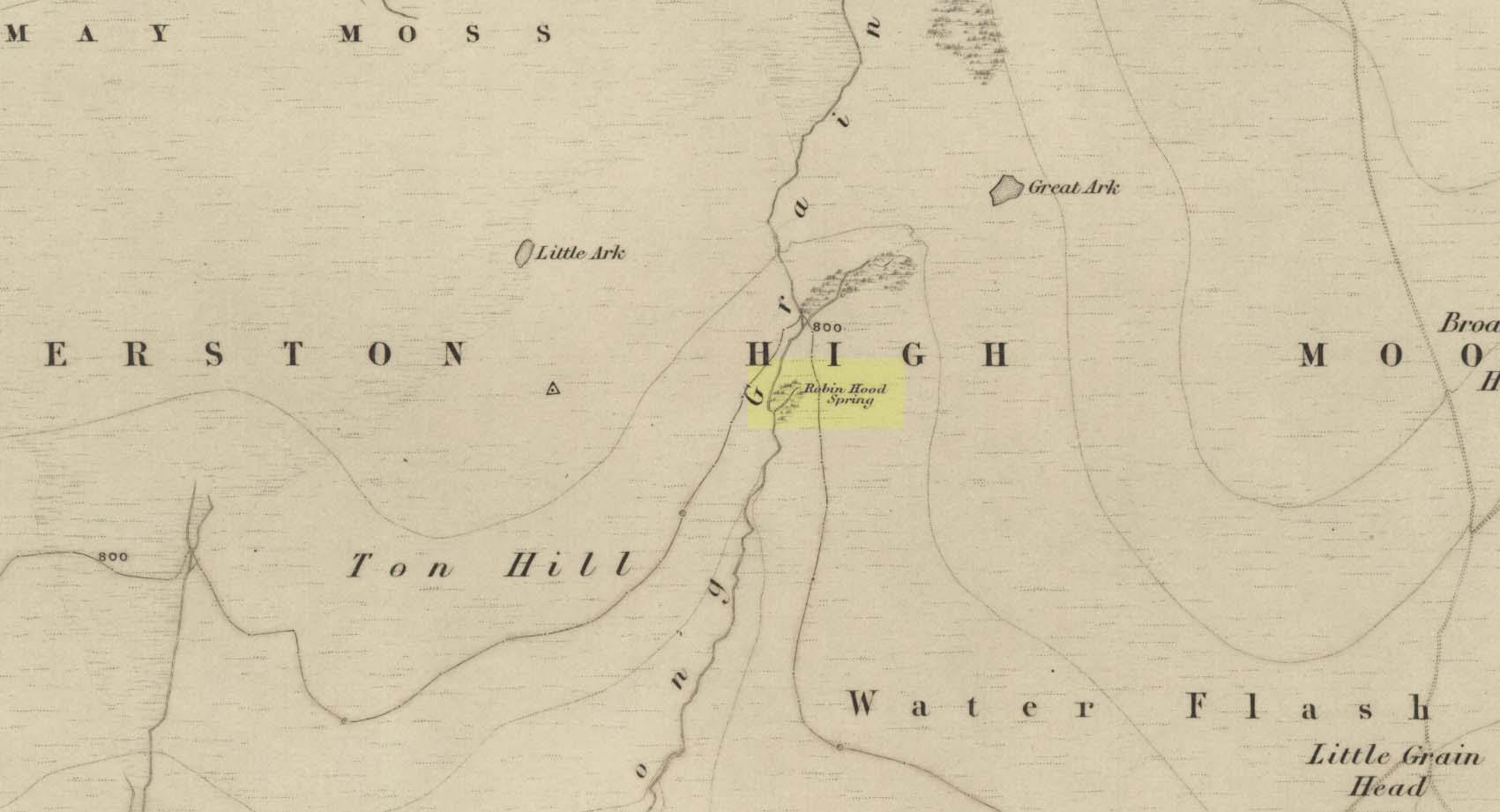
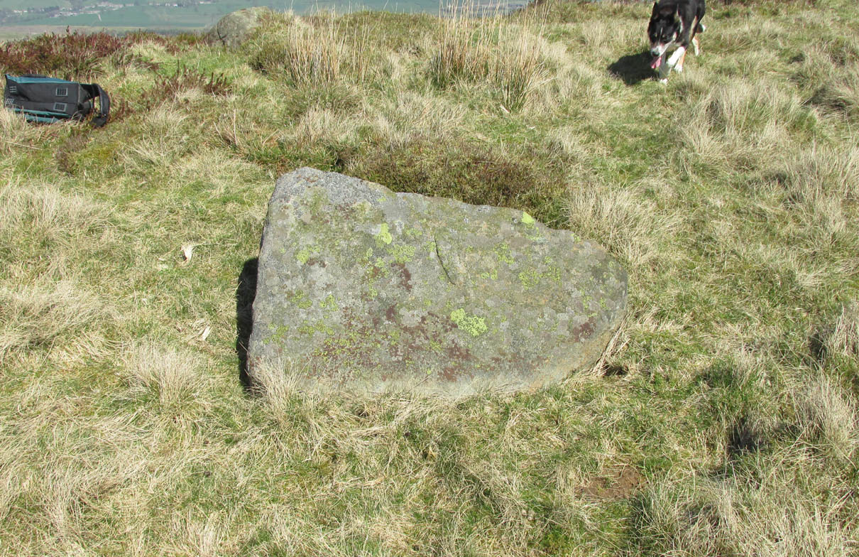
Out of Aberfeldy, take the A826 road as if you’re going up Glen Cochill. Not far up, just where the housing of Aberfeldy itself ends and the green fields open up either side of you, keep on the road for a half-mile where you meet a small copse of trees on your left, with a dirt-track that runs down the slope. Go down here and follow the slightly meandering track for 0.8 miles (1.3km), a short distance past the Ursa Major Stone where the track splits. Take the track to the left and there, less than 100 yards on you’ll hit a large boulder on your left. That’s it!
Archaeology & History
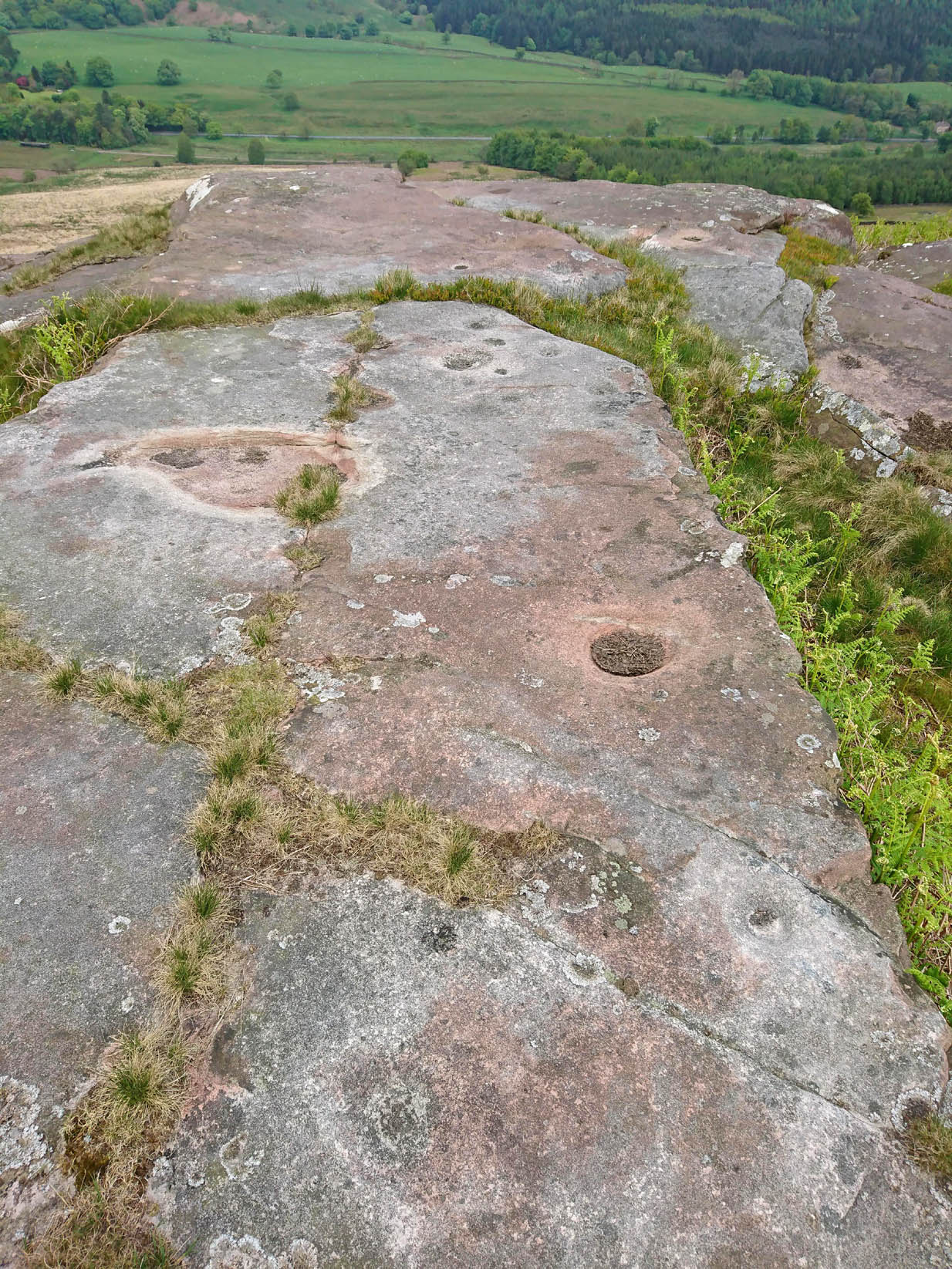
Not previously recorded, this simple cup-marked stone will probably only be of interest to petroglyph aficionados, or those folk who are into ‘energies’ at sites. This latter aspect is due entirely to the carving being etched onto a huge rock, much of which is composed of quartz—which isn’t too unusual in this part of the world. But that aside…
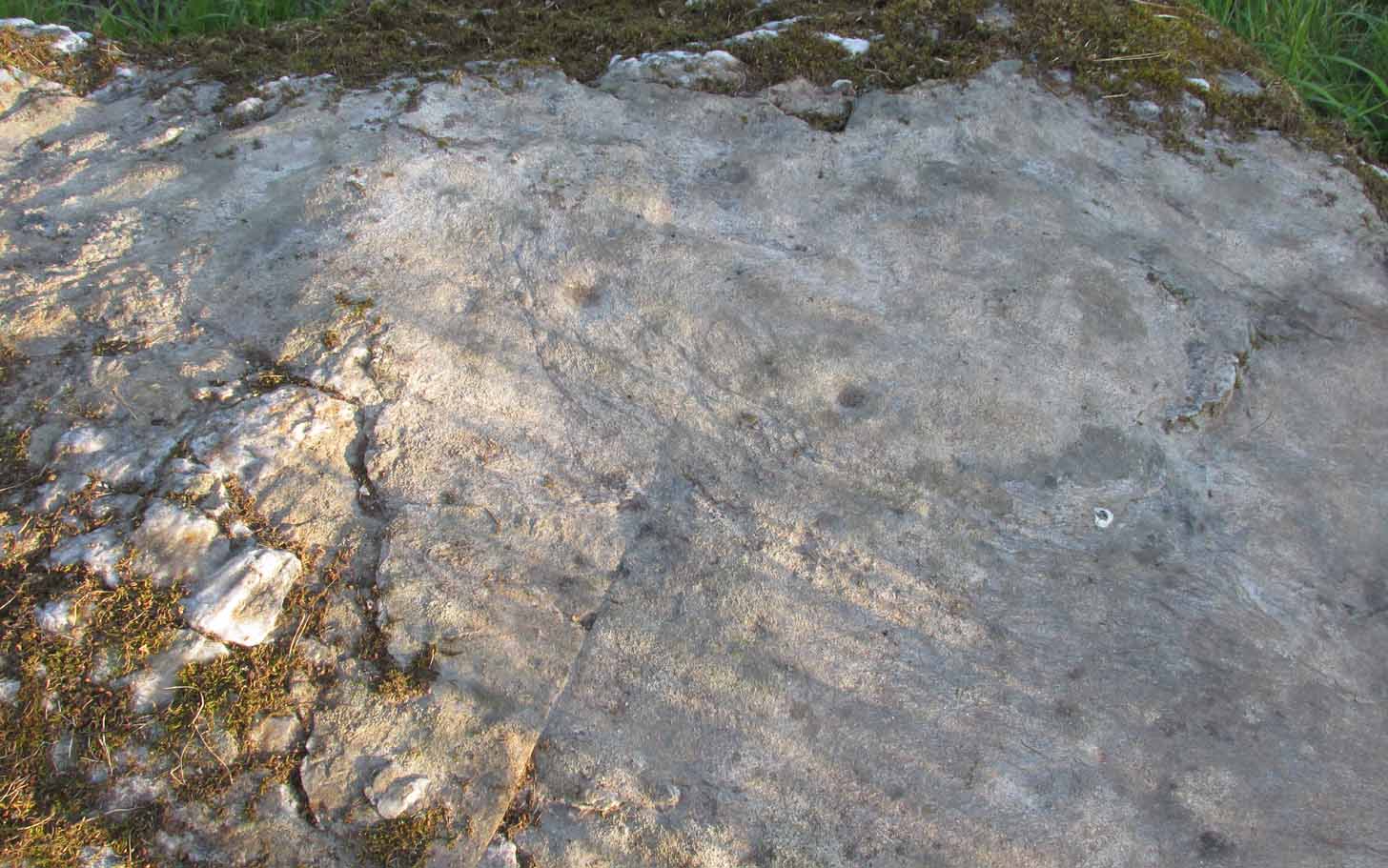
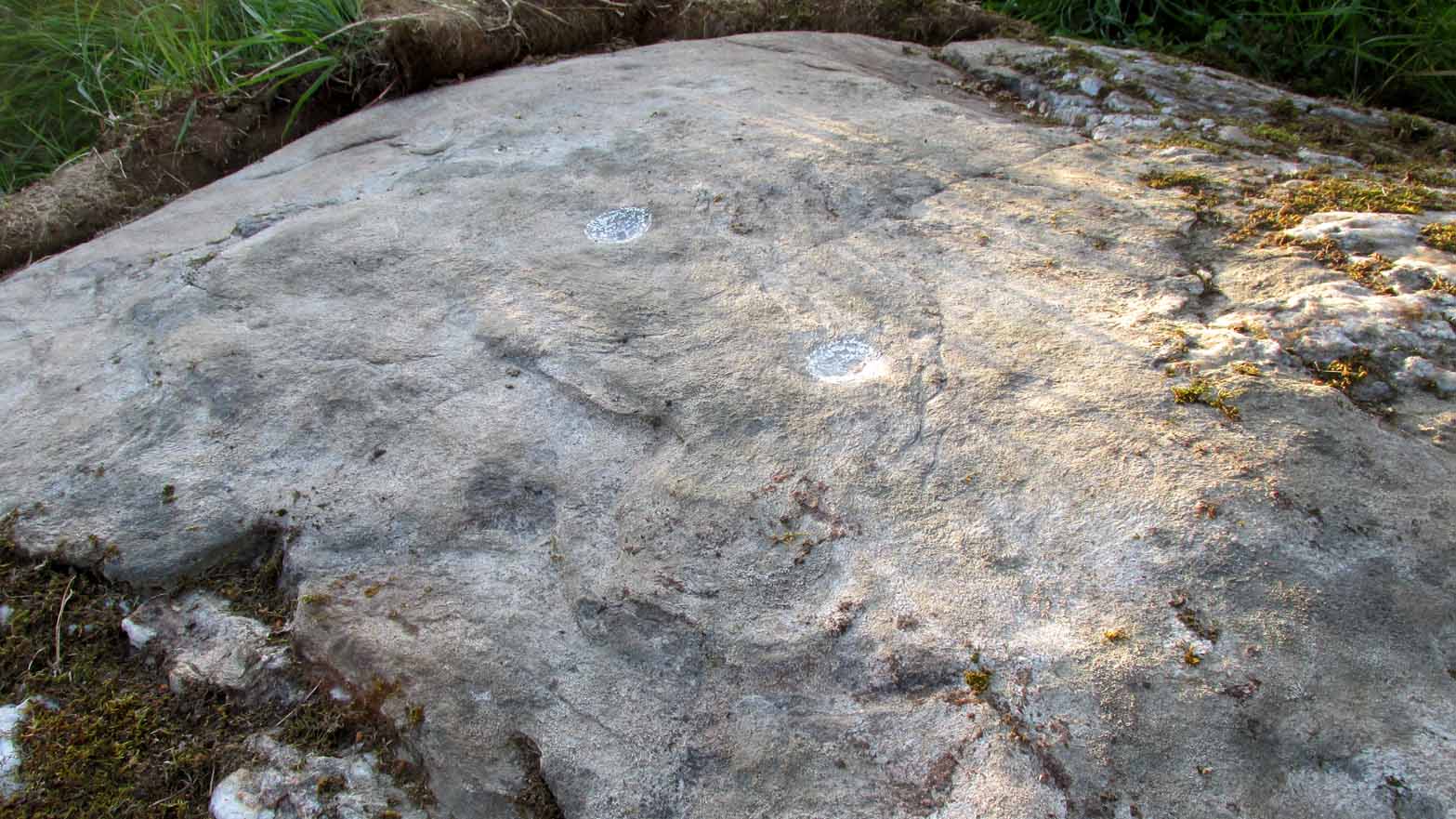
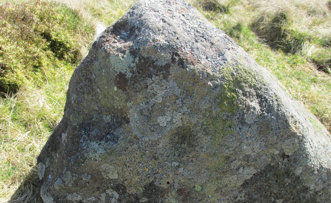
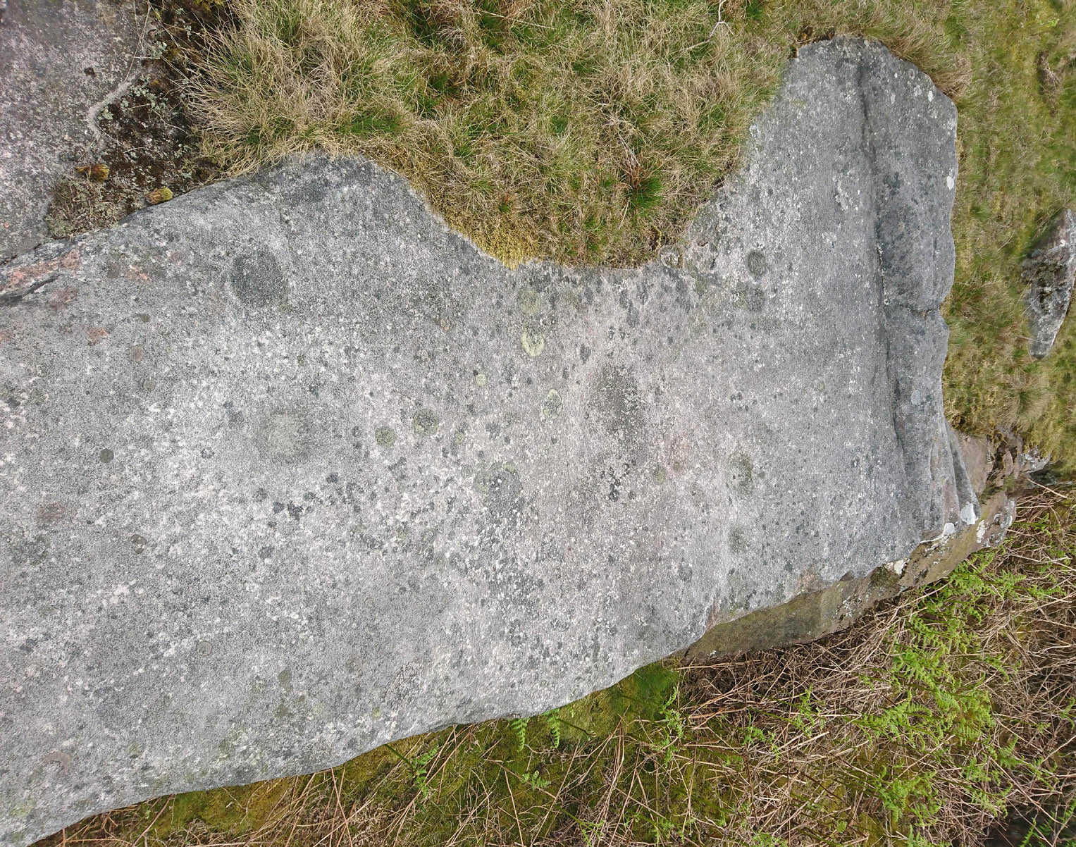
Looking down at the cupsThe cupmarks highlighted
It is one in a group of carvings within a few hundred yards of each other, with its nearest neighbour 20 yards to the north. That one’s covered in cups—but on this large Quartz Stone, only two of them exist, on the top near the centre. Just a couple of inches across and half-an-inch deep, they’re pretty clear once you see them. The raised piece of ground behind the stone is artificial and has variously been described by antiquarians and archaeologist alike, as either a prehistoric dun, or a stone circle. Whatever it may be, some of it is certainly man-made. Check it out – and mebbe ask the friendly fat fella who lives nearby and what he thinks.
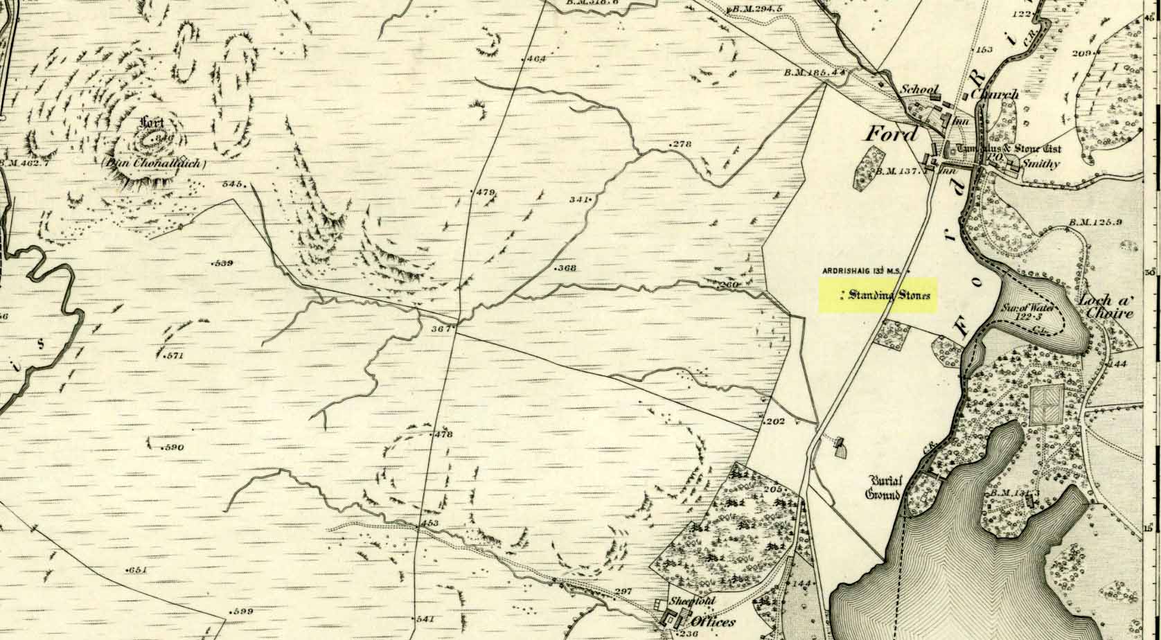
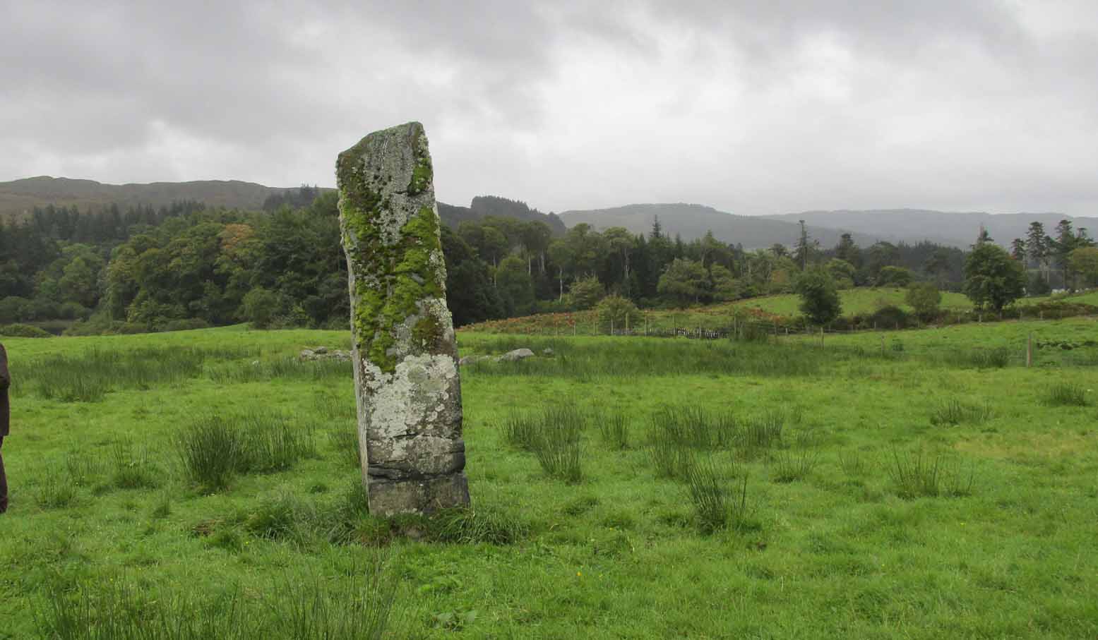
Unless you’re venturing down the tiny Loch Awe roads, the easiest way here is to turn right off the A816 Lochgilphead-Oban road, 1½ miles north of Kilmartin. Go along this winding minor road for literally 2½ miles where, after coming out the tree-lined road, just past the small Loch Ederline, the fields re-appear on both sides of the road. Just here, where the trees end, just a few hundred yards before the hamlet of Ford, in one of the field on the left, you’ll see a tall upright stone. That’s it!
Archaeology & History
I was very fortunate, many years ago, to live in the old farmhouse of Auchinellan in the trees by this ancient stone. It became a companion of mine many-a-time, as I sat with it in rain and mist and darkness sometimes, beneath the bright Moon. It always had a good feeling about it. And so when a small bunch of us visited here again recently, it was almost as if I’d never been away. Tis a magickal part of our landscape.
The old stone looking NThe old stone looking NW
Standing ten-foot-tall on a grassy plain with craggy hills all round, this old fella once had a companion close by its side—a stone one! Accounts of it are curious to say the least, with one telling us that it was only “a few inches high” – which is just daft. The now-lost stone was in fact about six-feet tall and the story of its disappearance was that it was moved into the grounds of Auchinellan House where I used to live, somewhere in the garden. I could never find it, and local folk told me that the old fella who lived in the mansion would have known about it, but died shortly before I moved in. Clive Ruggles (1984) told that it could be found at grid-reference NM 8653 0268, but that would be smack bang on the manor house.
As far as I can tell, the first written testimony of this stone was by the Ordnance Survey lads after they’d visited here in 1871 and, several years later, highlighted it on their maps. (above) On this is clearly shown, just yards apart, the two standing stones. Much later, when the Royal Commission (1988) doods did their survey, they described the stone in their usual brief way:
“Situated on the top of a slight rise in a pasture field 270m SW of the Ford Hotel, there is a standing stone which measures 0.7m by 0.55m at the base and rises with straight sides to a flat top at a height of 3m…”
The site was included in Thom’s (1990) major survey on prehistoric stone rows where, again, only a brief description is given, saying:
“On a terrace near Loch Ederline is a standing stone which leans to the E. It is 9ft 6 (2.9m) high.”
It’s a beautiful place in a beautiful setting and is one of countless prehistoric monuments in this part of Scotland. Well worth having a look at.
Folklore
The Gaelic names for this site—Achnacarra and Achadh nan Carradh—means “the field of the burial stone”, which relates to the folklore of the stones reputedly marking the place of an ancient grave.
Campbell, Marion & Sandeman, M., “Mid Argyll: An Archaeological Survey,” in Proceedings Society of Antiquaries Scotland, volume 95, 1964.
Royal Commission on the Ancient & Historical Monuments of Scotland, Argyll – Volume 6: Mid-Argyll and Cowal, HMSO: Edinburgh 1988.
Ruggles, Clive L.N., Megalithic Astronomy, BAR: Oxford 1984.
Thom, Alexander, Thom, A.S. & Burl, Aubrey, Stone Rows and Standing Stones – volume 1, BAR: Oxford 1990.
Acknowledgements: Big thanks to Neens Harris, Paul Hornby & Frank Mercer. And the stunning resource of Scotland’s 1st edition OS-maps is Reproduced with the kind permission of the National Library of Scotland.
Ladywell Lane is shown on the 1855 OS-map (right).
At present we have no information or images about this site. Be the first person to contribute material by emailing us with info or images to the usual address – megalithix@yandex.com
At present we have no information or images about this site. Be the first person to contribute material by emailing us with info, field notes or photos to the usual address – megalithix@yandex.com
Along the A65 near Draughton, go (south) uphill at Height Lane until it levels out. ¾-mile (1.2km) up, a modernized stone milepost is where the road crosses the ancient Roman Road. From here, walk west for just over a mile (1.8km), past the trees on your right, until you approach another small copse further along on your right. In the field just before the copse, walk uphill until you reach the highest of the two rises and walk about. You’re damn close!
Archaeology & History
Nor Hill cupmarked stoneCupmarks, top & side
This small cup-marked rock was rediscovered by Chris Swales in April 2018. It’s probably only for the purist petroglyph fanatics amongst you, consisting of just a single cup-mark on its vertical west-face, and another near its top western edge. Official records show no other carvings in the immediate vicinity, but local antiquarians may find it profitable in surveying the area for other potential remains.
The quickest way to get here is to follow the directions to the Sharp Haw Trig Stone. From the Trig Stone keep heading down the footpath until you see the gate at the bottom. Go through the gate and Rough Haw is straight in front of you. Head towards Rough Haw and you will see a track going straight up the middle. Go right up that track and over the top till your on the summit, keep walking forward about 50-60 yards and you will see it.
Archaeology & History
Second lot of cups
Some petroglyphs have been found near the top of the prehistoric Iron Age settlement called Rough Haw, a few miles north of Skipton. Not previously recorded, this long flat stone and its companion are littered in cup markings (perhaps a couple of dozen). There could be more cups and other markings than we saw today, but by the time we reached here the sun had disappeared, so poor daylight made it difficult to see if there were any more. Another venture up onto this hillfort might be worthwhile to see if anymore can be found.
Tumulus (destroyed): OS Grid Reference – TQ 1686 4958
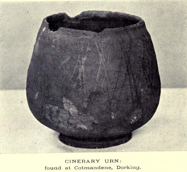
The Cotmandene urn
Archaeology & History
Highlighted on the 1914 OS-map (as ‘Site of’), nothing now remains of the prehistoric structure that either covered or surrounded the ancient burial urn, found fortuitously by a Mr Turner in the garden of Southdown Cottage at the beginning of the 20th century. Believed to be either Iron Age or Romano-British in origin, the find was noted by Mr Malden (1913) in his brief in the Surrey ArchaeologicalCollections, who wrote:
“Early in 1913 it came to my knowledge that some years ago some discoveries had been made in the garden of a house on Cotmandene, Dorking. Mr Turner…was digging for sand in his garden when he found a small cinerary urn (see illustration), with ashes in it. The height is only 5 inches, the diameter across the top about 4 inches, but at the widest part 5⅜. The urn is so small that it probably contained the ashes of a child: it is wheel-made, but badly; the diameter is not precisely the same across the top from every direction: Mr Reginald Smith attributes it to the first century BC. Some fragments of other urns were found. Mr Turner has kindly presented the whole specimen to the Society’s Museum. At a lower depth in the same garden were numerous flints, some implements, many flakes, and traces of a hearth with several burnt stones. These clearly belonged to an earlier date, considerably, than the interments, but as the finds were made about 1906-7, and not investigated till this year, it is impossible to be precise about the depth at which they occurred.”
References:
Malden, H.E., “A Cinerary Urn and other Matters found at Dorking and Betchforth,” in Surrey Archaeological Collections, volume 26, 1913.