St. Serf’s Well, Crieff, Perthshire

Holy Well (lost):  OS Grid Reference – NN 8457 2323

Archaeology & History

St Serfs Well on 1866 map

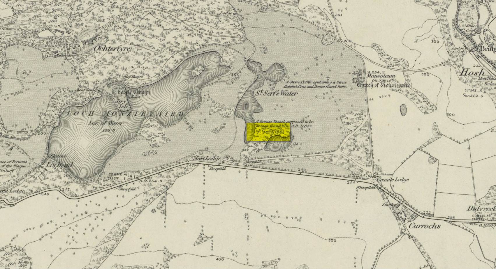
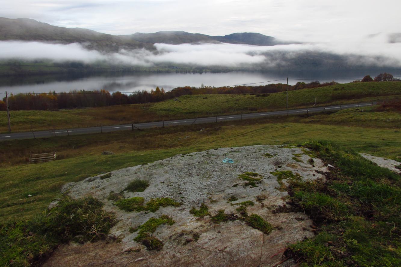
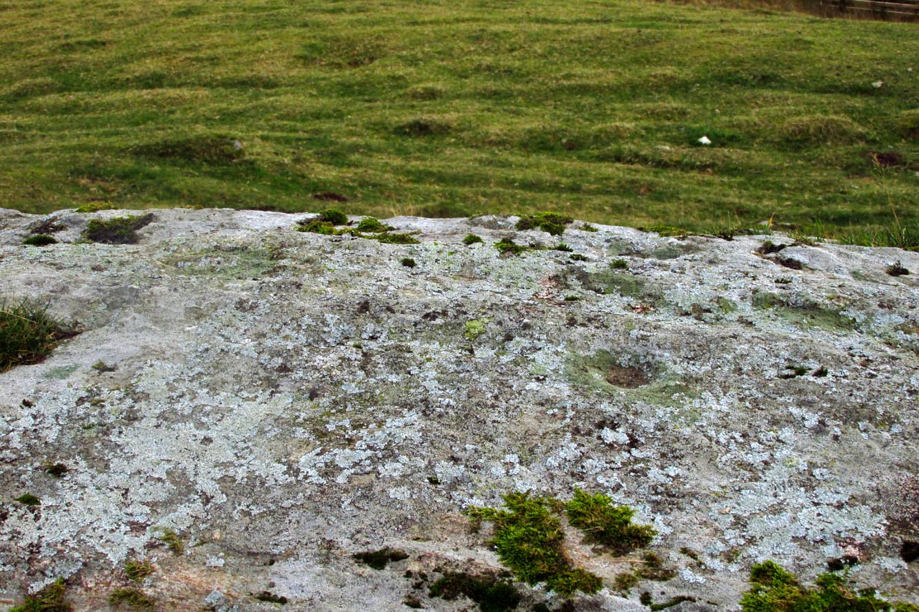
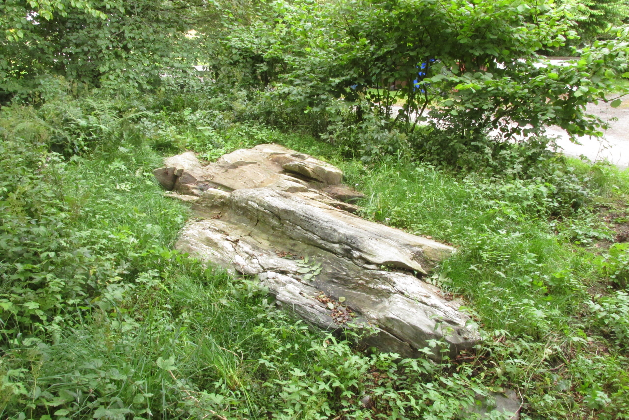
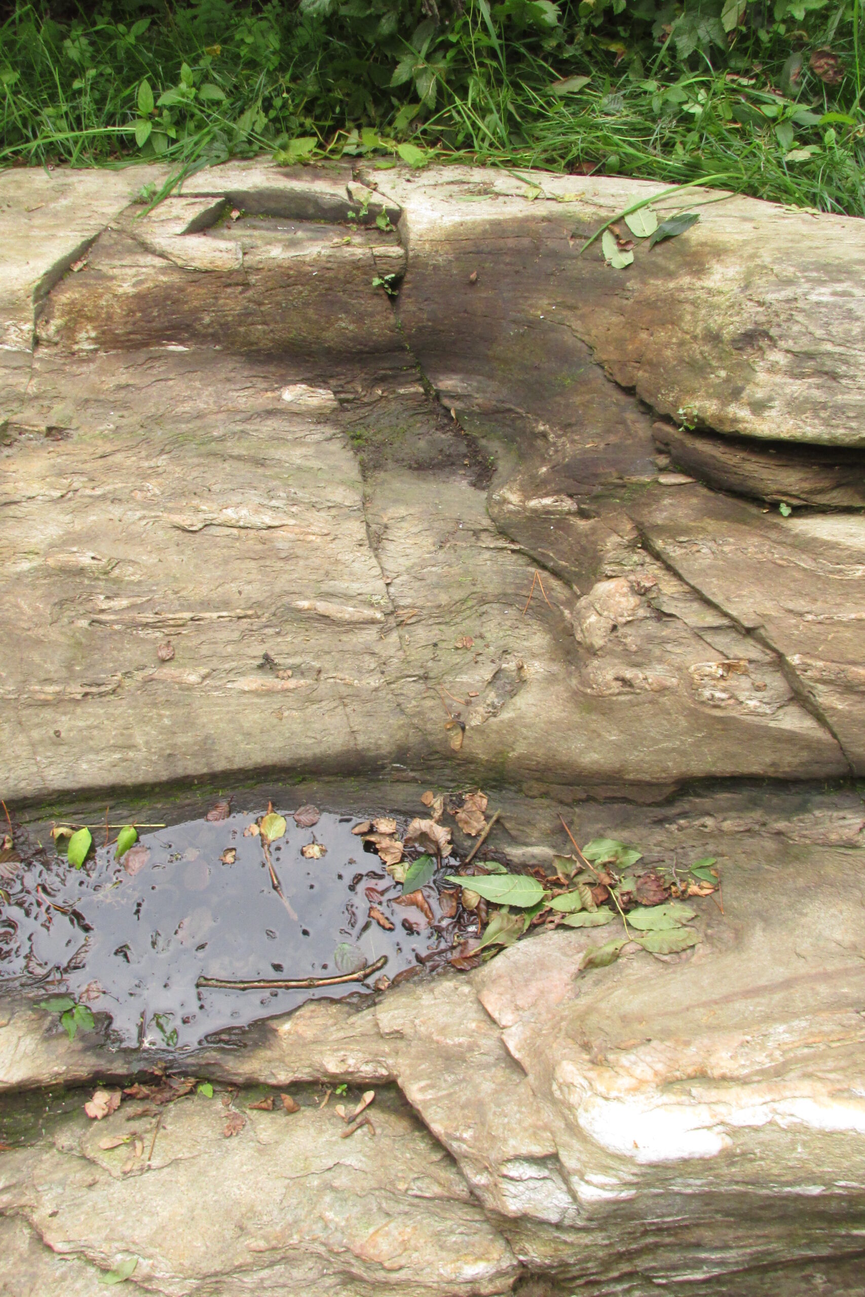
A mile to the west side of Crieff, in the grounds of the 18th century mansion known as Ochtertyre House, could once be seen the little-known sacred well of St Serf.  Sadly its waters seem to have disappeared beneath the rising waters of the loch known as St Serf’s Waters—which is a pity, as the place was of importance in the annual traditions of the local people, who left offerings to the spirit of the place, as was common in days of olde.  It was described in Mr Porteous’ (1822) account of Monzievaird parish, in which he told that,

“Nigh to this place is St Serf’s Well, and the moor whereon St Serf’s market is held.  He was the tutelary saint of the parish of Monivaird.  This well is a plentiful spring of water.  About sixty years ago, our people were wont, on Lammas day, to go and drink it, leaving white stones, spoons, or rags, which they brought with them; but nothing except the white stones now appear, this superstitious practice being quite in oblivion.  It has been useful in a strangury, as any other very cold water would be; for a patient, taking a tub full of it immediately from the well, plunging his arms into it, which were bare to the elbows, was cured.

“St Serf’s fair is still kept on the 11th of July, where Highland horses, linen cloth, etc., both from the south and north, are sold.”

Although the well is deemed to be ‘lost’, it is possible that its waters might be seen after a good drought.  Please let us know if that happens.

Folklore

St. Serf was said to have been a hermit and tutor of the more renowned St. Mungo.

References:

  1. Morris, Ruth & Frank, Scottish Healing Wells, Alethea: Sandy 1982.
  2. Porteous, A., “Extracts from a History of the Parishes of Monivaird and Strowan“, in Archaeologia Scotica, volume 2, 1822.

Acknowledgements:  Big thanks for use of the 1st edition OS-map in this site profile, Reproduced with the kind permission of the National Library of Scotland

© Paul BennettThe Northern Antiquarian


Fairies’ Cradle, Cromarty, Ross & Cromarty

Legendary Rock (destroyed):  OS Grid Reference – NH 792 651

Archaeology & History

In the ruins St Bennet’s Chapel, along with his accompanying holy well (NH 7923 6502), could once be seen a curiously shaped rock which, according to tradition has been destroyed.  In Mr Innes’ (1855) major history work he mentioned this Fairies Cradle in passing.  Not far from here and close to the coast, is a curiously-shaped boulder with several natural cupmarks (at NH 9150 6497).

Folklore

In Hugh Miller’s (1878) definitive local history work, Scenes and Legends, we have our main description of this once important site.  It existed,

“near the chapel itself, which was perched like an eyry on a steep solitary ridge that overlooks the Moray Firth, there was a stone trough, famous, about eighty years before, for virtues derived also from the saint, like those of the well. For if a child was carried away by the fairies, and some mischievous unthriving imp left in its place, the parents had only to lay the changeling in this trough, and, by some invisible process, their child would be immediately restored to them. It was termed the fairies’ cradle; and was destroyed shortly before the rebellion of 1745, by Mr. Gordon, the minister of the parish, and two of his elders.”

The story of children here being carried away by littlepeople and then restored by an impish offering, is a play on the site being a healing stone.  There are numerous other “curing stones” found elsewhere in Scotland, but with their own respective traditions—like the Measles Stone at Fearnan, the Whooping Cough Stone near Killin, and many others.

If anyone knows anything more about this lost “curing stone”, please let us know.

References:

  1. Alston, David, “The Old Parish Church of Cromarty,” Cromarty, May 2005.
  2. Innies, Cosmo, Origines Parochiales – volume 2:2, W.H. Lizars: Edinburgh 1855.
  3. Miller, Hugh, Scenes and Legends of the North of Scotland; the Traditional History of Cromarty, William Nimmo: Edinburgh 1878.

© Paul BennettThe Northern Antiquarian

Cragganester (3), Kenmore, Perthshire

Cup-Marked Stone – NN 65632 38144

Getting Here

The rock in the landscape

From Killin, take the A827 road to Kenmore. 6 miles along, on your right, is the track down to the Big Shed at Tombreck.  Keep on the A827 for exactly ⅓-mile (0.53km), and opposite the driveway to Craggantoul is a small parking spot.  A few yards on the road, over the burn, go thru the gate on your left and walk up the path for less than 100 yards. The stone is just a coupla yards on your right (if you reach the derelict tractor, you’ve gone about 10 yards past the stone).

Archaeology & History

Cupmarks along the top

This is another one of the many simple cup-marked petroglyphs scattering the Cragganester and Tombreck regions beneath the slope of Ben Lawers.  It’s an elongated, smoothly-shaped ‘female’ stone, aligned north-south, possessing four distinct cups along its crown: three in a small line at the south-end of the stone and a single one close to the north end.  However between these is what may be another, shallow fifth cupmark—but this is uncertain.

One notable feature here is that the rock is encrusted with small garnets.  This geological ingredient isn’t uncommon in this area, and we’ve found that quite a proportion of the petroglyphs hereby possess this feature.  It was probably of some importance to the people who carved them.

Acknowledgements:  Thanks to Paul Hornby for use of his photograph.

© Paul BennettThe Northern Antiquarian


Cragganester (19), Kenmore, Perthshire

Cup-Marked Stone:  OS Grid Reference – NN 66627 38647

Getting Here

Cragganester 19 stone

Although you could just as well follow the directions to reach the Cragganester 22 carving (exactly 100 yards away), it’s probably easier to get there from where the track leads down to Balnasuim, but there’s nowhere to park any vehicle here—unless you’re on a bike!  Across the road from the Balnasuim track is a gate.  Go thru this and then follow the fence immediately on your left, running parallel with the road for roughly 250 yards (218m), until you reach a denuded wall that runs onto the hillside above you.  Follow this up for roughly 200 yards (96m) until you reach a grass-lined track.  Walk to your left and keep your eyes peeled for a reasonably large rounded boulder next to the track 40 yards on.  That’s it!

Archaeology & History

2 cupmarks highlighted

This is one of the many simplistic petroglyphs in the Cragganester complex, probably only of interest to the fanatics amongst you!  There are two distinct cup-marks on this nice rounded ‘female’ stone, one near the top and one near the middle, amidst the olde lichen growth.  Loch Tay stretches along the glen below here, but only a portion of it is visible nowadays.  In times gone by, tree growth probably prevented any vision of the waters below…

© Paul BennettThe Northern Antiquarian


Cragganester (22), Kenmore, Perthshire

Cup-Marked Stone:  OS Grid Reference – NN 66585 38564

Getting Here

Looking across Loch Tay

It’s a bittova pain-in-the-arse to reach this and its associated carvings, as there’s little place to park along here.  The easiest is to park 600 yards east of Tombreck at the spot just by the small bridge at Craggantoul.  Keep your eyes truly peeled!  From here, walk along the road for ⅔-mile where you’ll hit a gate taking you onto the boggy hillside.  Go diagonally up here for 150 yards where you’ll hit an overgrown track and small disused quarry.  Some 50 yards along you’ll see a small rock outcrop on your left (as if you’re going back to the road).  That’s the spot!

Archaeology & History

Close-up of cupmark

Not previously recorded, this simple petroglyph on a small rock outcrop—barely 50 yards above the A827 Killin-Kenmore road—comprises of one clear cup-mark prominently etched near the middle of the upper surface; and another possible cup on the left (eastern) section of the rock.  Cragganester carvings 19 and 20 are respectively about 100 yards NE and NW of here but, like other carvings nearby, is only gonna be of interest to the fanatic nutters out there!

© Paul BennettThe Northern Antiquarian

St. Dunstan’s Well, York, North Yorkshire

Holy Well (lost):  OS Grid Reference – SE 607 511

Archaeology & History

An entry in George Benson’s huge work on the history (mainly) of York, describes the holy well of St Dunstan “near the Glass Works”, which used to be at the south-side of the city on Fishergate.  I can find no other reference to this site and it’s not on the early OS-maps, so we must presume it is long gone.

Other wells in his name can be found in Kent, Somerset, Sussex and Tottenham.

Folklore

The fable relating Dunstan to wells was his ability to make springs miraculously appear.  Tradition relates him to have been born in Wessex in the 10th century.  His festival date is May 19.

References:

  1. Benson, George, An Account of the City and County of York – volume 3, Cooper & Swans: Micklegate 1925.

© Paul BennettThe Northern Antiquarian

River Avon Stone, Bulford, Wiltshire

Standing Stone (lost):  OS Grid Reference – SU 161 432

Archaeology & History

In William Stukeley’s Stonehenge, he described a number of monoliths outlying Salisbury Plain that also possessed a prehistoric pedigree.  Most of them have been recorded, but this one seems to have been forgotten about — perhaps by virtue of it having fallen into the River Avon!  Edgar Barclay (1895) described it in his fine survey, saying:

“In the bend of the river below the village, is a large submerged stone; only during drought is any portion of it visible above water; it can, however, in ordinary times, be dimly seen from the bank, which is of chalk, here very steep and overgrown.  The country people assert that a metal ring, “turning always,” is let into its upper end.  Legend relates that when the Devil brought the rocks of Stonehenge from Ireland, tied together with withes, this stone escaped from the bundle and fell into the river.  Its position forbids the belief that it got fixed in the bed of the stream when its passage to Stonehenge was being attempted, for it lies immediately beneath the crest of a very steep bank, and at its most inaccessible point; as the stream sweeps against this, the water must always have been deep at this spot, the open valley would everywhere offer more favourable points for such an operation, especially would this be the case before the Avon was dyked.  A boundary stone would have been placed on the brow of the hill; if the stone be a grey-wether, as report says, and as is probable, it may originally have stood on the bank, and “once upon a time”, a ring having been fixed in it, it may have been dragged into the stream to moor a ferry-boat.  It lies closely midway between the stone on Bulford Down and that in Durrington fields.”

One wonders if any local people might know more about this…

References:

  1. Barclay, Edgar, Stonehenge and its Earth-works, D. Nutt: London 1895.

© Paul BennettThe Northern Antiquarian

St James’ Cross, Barton-upon-Humber, Lincolnshire

Cross (destroyed):  OS Grid reference – TA 0424 2064

Archaeology & History

This long lost wayside cross was described in various local records from 1621 upwards.  In the definitive place-name survey of this area, Kenneth Cameron (1991) told us that this was,

“A medieval cross dedicated to St James, situated at the point where the Thornton and Burnham roads meet… Mr R. Newton comments, “said to have replaced a wayside shrine.  The foundations of the shrine were exposed when the Home Guard dug a defensive trench there at the beginning of the last war.  Foundations destroyed by a bomb.””

References:

  1. Cameron, Kenneth, The Place-Names of Lincolnshire – volume 2, EPNS: Nottingham 1991.

© Paul BennettThe Northern Antiquarian

Dawe’s Cross, Cambridge, Cambridgeshire

Cross (destroyed):  OS Grid Reference – TL 455 578

Archaeology & History

This is one of several medieval stone crosses in Cambridge that were destroyed several centuries ago.  This particular one was erected on a three-stepped stone base at the old crossroads where, today, the modern A1307 of Regent Street meets the A603 Lensfield Road.  It was described in an old Field Book of 1575 as standing being beside an old poplar tree, long gone.  Mr H.P. Stokes (1915) gave us a short account of the site, telling:

“In describing the lane called “Deepway” between the London Road and the Hadstock Way and known as “King’s Lane” from the latter road to Hinton Way, mention was made of a Cross (called Dawe’s Cross) which stood at what is now known as Hyde Park Corner.  Dawe’s Cross is often mentioned in ancient deeds, and in an old Field Book, which formerly belonged to the vestry of the Church of St Andrew the Great, there was a most interesting representation of it.  This is here reproduced…from a copy in the celebrated Bowtell MSS.”

The cross stood along one of Alfred Watkins’ (1932) “archaic tracks”, or leys, in this area—although he wasn’t aware of its existence.

References:

  1. Stokes, H.P., Outside the Barnwell Gate, Cambridge Antiquarian Society 1915.
  2. Watkins, Alfred, Archaic Tracks round Cambridge, Simpkin Marshall: London 1932.

© Paul BennettThe Northern Antiquarian

St Fillan’s Chair, Killin, Perthshire

Sacred Stone: OS Grid Reference – NN 56432 32010

Getting Here

Take the road to Auchlyne from Killin which follows the north side of the River Dochart, and on the edge of the village the stone will be seen on the left hand side behind a hedge, opposite the entrance to ‘Springburn’.

Archaeology & History 

The chair is mentioned in Rev. Gillies’ exemplary work, In Famed Breadalbane (1938):

St. Fillan would appear to have had a great liking for stone seats.  Besides the one already mentioned…there is..a..flat stone on the top of a knoll about a mile to the west of the village, and on the north side of the river, on which he is said to have sat and taught

St Fillan’s Chair, ‘twixt road and river
The ‘seat’, facing the River Dochart

Two local ladies told us that the Chair had recently been uncovered from the vegetation. It is a flattish earth-fast slab of rock, which has on the right hand side a seat indentation, which faces the river bank about 12 feet away. Its proximity to the river bank would seem to limit its use as a preaching pulpit, and yet, well over a millennium after the death of Fillan, his ‘Chair’ is still remembered. Did the Chair serve another purpose, a purpose that long preceded Fillan and Christianity?

Here at Killin we are in an area of Scotland where Christianity was for long a veil worn very lightly over long-held ancient animistic beliefs and customs. Indeed in the early nineteenth century, missionaries were sent in the face of considerable local opposition by the Haldanes into Gaelic speaking Breadalbane to try to convert the locals to Christianity.

St Fillan and other saints had it seems become the named facilitators for healing at ancient places on behalf of the incoming religion from the Middle East.  To the west of Killin, there are the St Fillan’s Pools at Auchtertyre near Tyndrum, where he is reputed to have cured madness but which continued to be used for that purpose until the late eighteenth century at least.  There are stones for preventing measles and whooping cough near Killin that are still known and pointed out.  So what of our chair?

There is a nineteenth century story of a chair of St Fiacre (Irish born like Fillan) at the village church of St Fiacre near Monceaux in France being used to ‘confer fecundity upon women who sit upon it ‘.  The shape and proximity to the river may otherwise suggest St Fillan’s Chair was a birthing Chair?  Maybe some very old locals still know the true story of this Chair, but would they tell it?

References:

  1. Anon., Phallic Worship – a Description of the Mysteries of the Sex Worship of the Ancients, privately Printed: London 1880.
  2. Calder, Walter, Lawers, Lochtayside: A Historical Sketch, Macduff, Cunning & Watson, c.1930.
  3. Gillies, William, In Famed Breadalbane, Munro: Perth 1938.

© Paul T Hornby 2020