Tumulus (destroyed): OS Grid Reference – SE 1676 1504
Archaeology & History
The only thing we know of this long lost site comes from a tradition narrated by the Canon Hulbert (1882) in his definitive history of Almondbury parish. High up the hill near the very top of the village where All Saints Church was built, he told how tradition said,
“that a tumulus or mound existed at the west end where now the Clerk’s house stands; which may have been an ancient British site and led to the erection of the church.”
Sadly, there seems to be no further information about the site.
References:
Hulbert, Charles A., Annals of the Church and Parish of Almondbury, Longmans: London 1882.
Go all the way up and through Heptonstall village until you reach the hamlet of Slack, by the road junction. From here walk down the road as if you’re going back into Hebden for less than 200 yards, then take the footpath on the left downhill and walk along. After a couple of stiles, keep a keen eye on the walling where the holly trees are, above the tree-line of Hardcastle Crags. You’ll see it soon enough!
Archaeology & History
Slack Bottom stone
Arguably the best-named standing stone in Britain, it was first discovered by Absalom Voist in the late 1990s (and first described in my Old Stones of Elmet), hiding away in the more modern walling, beneath a holly tree. But the stone itself is very nicely eroded and seems of good age, aswell as being a good near-six-foot tall specimen of a standing stone, just above the tree-line south of Hebden Dale. The stone gets its name from the fact that it’s at the bottom end of Slack village (which is actually called ‘Slack Bottom’ – with a house-sign there above the door to prove it!). It may be part of what was originally some original Iron Age walling instead of an authentic standing stone — tis hard to say really — but it’s a nice stone nonetheless. David Shepherd (2003) named this stone as ‘Dawson City Field’ in his later survey of megaliths in upper Calderdale.
Not far from here, along the edge of the woodland, is the little-known remains of an old cross-base which I think has eluded all previous surveys. Next time I’m up here, I’ll try remember to get some photos of the place!
References:
Bennett, Paul, The Old Stones of Elmet, Capall Bann: Milverton 2001.
Shepherd, David, ‘Prehistoric Activity in the Central South Pennines,’ in Proc. Halifax Ant. Soc., 2003.
Standing Stone? (destroyed): OS Grid Reference – SE 2428 2329
Archaeology & History
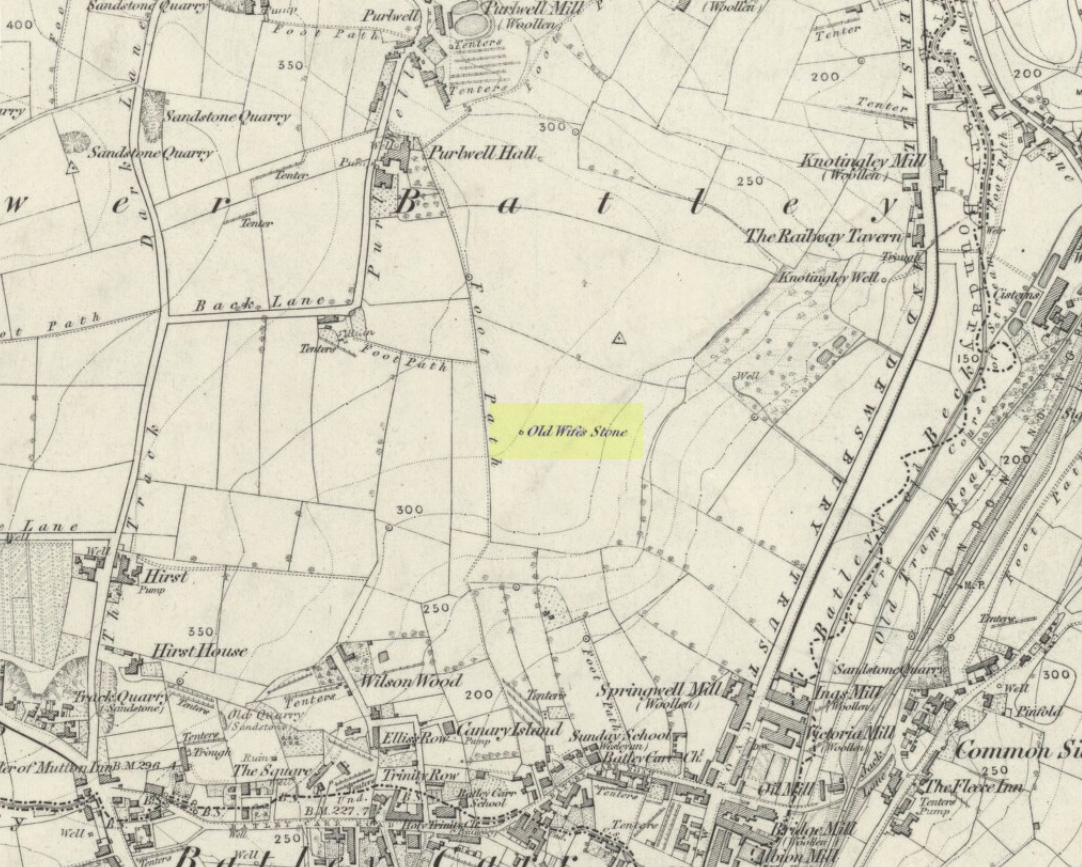
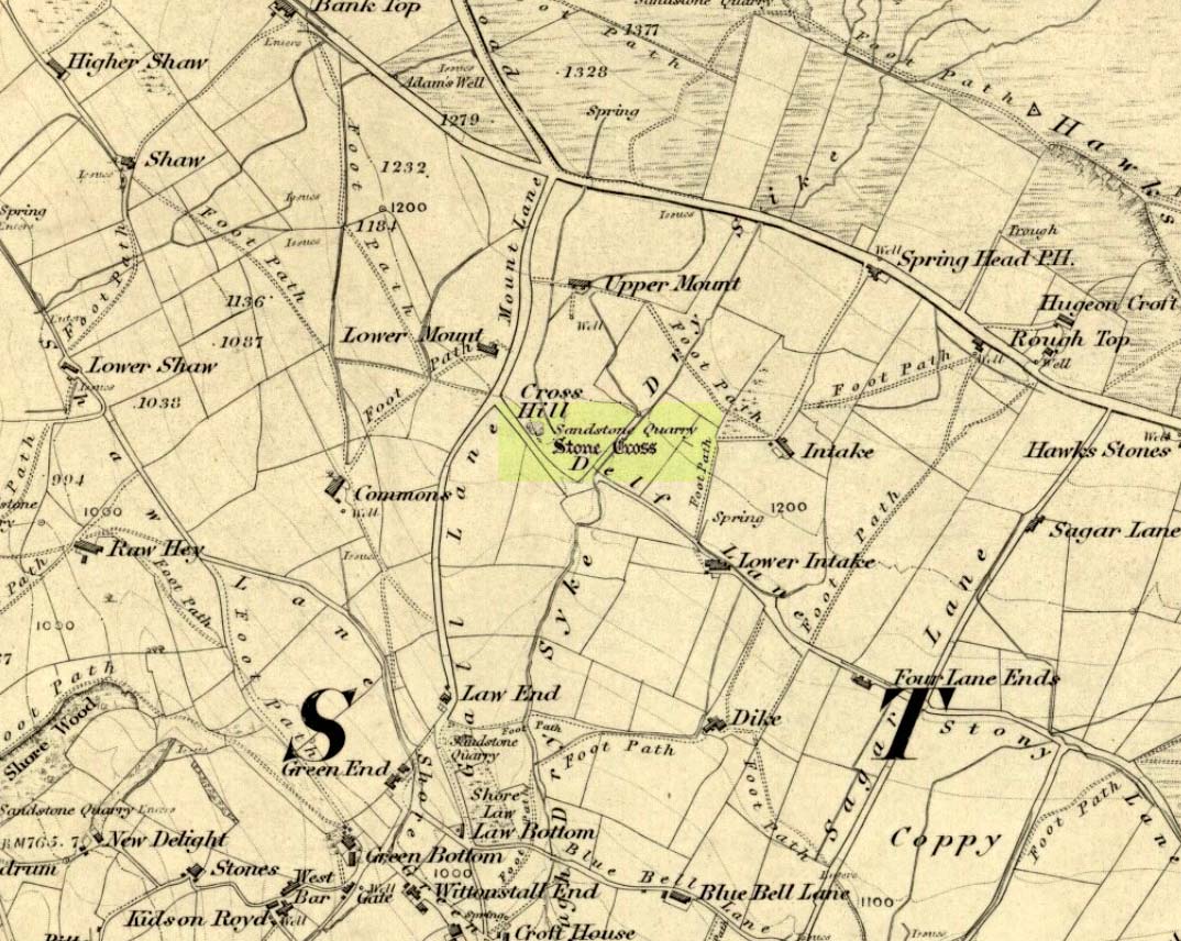
Old Wifes Stone on 1854 map
My first hint at the existence of this once valuable archaeological relic came as a result of me seeking out the history and folklore of some hitherto unknown, forgotten holy wells in the Batley and Dewsbury area. I located the material I was looking for on the old wells, but my fortuitous discovery of this site, the Old Wife’s Stone, blew me away!
It was the place-name of ‘Carlinghow’ about one mile northwest of the grid-reference above that initially caught my attention. From an antiquarian or occultist’s viewpoint, it’s intriguing on two counts: the first is the element ‘how‘ in Carlinghow, which can mean a variety of things, but across the Pennines tends to relate to either an ancient tribal or council meeting place, or a prehistoric burial cairn: an element that wasn’t lost in the giant archaeology survey of West Yorkshire by Faull & Moorhouse (1981). But the first part of this place-name, ‘carling‘, was the exciting element to me; for it means ‘old woman,’ ‘old hag,’ ‘witch’ or cailleach! The cailleach (to those who don’t know) was the prima mater: the Great Mother deity of our pre-christian British ancestors. Meaning that Carlinghow hill was a hugely important sacred site no less—right in the heart of industrial West Yorkshire! What is even more intriguing—or perhaps surprising—is that we have no record of such a powerful mythic creature anywhere in local folklore… Or so it first seemed…
Memory told me that no such prehistoric remains were recorded anywhere in that area—and certainly no prehistoric tombs. I scoured through my library just to triple-check, and found the archaeological records as silent as I first thought. Just to make sure I spent a day at the Central Library, where again I found nothing… So then I explored the region on the modern OS-maps, only to find that much of the area where the Carlinghow place-name existed was, surprisingly, still untouched by housing and similar modern pollutants. This was a great surprise to say the least. And so to check for any potential archaeological sites which might once have been in the Carlinghow area, I turned to the large-scale 1850 OS-maps (6-inch to the mile).
This is when I came across the Old Wife’s Stone, marked in the middle of fields on the outskirts of old Batley. There was no notice of it being a standing stone, or a simple boulder, or archaeological relic—nothing. But its place-name compatriot of ‘Carlinghow’ was the rising hill about a mile to the northwest. In days of olde, if Carlinghow was indeed the ‘burial tomb of the Old Woman’ or ‘meeting place of the cailleach’ (or whatever variants on the theme it may have been), it may have marked the setting sun on the longest day of the year if you had been standing at the Old Wife’s Stone – a midsummer sunset marker no less. (There are other ancient and legendary sites scattering northern England and beyond that are dedicated to the Cailleach, like the Old Woman Stone in Derbyshire, the Old Wife’s Neck in North Yorkshire, the Carlin Stone in Stirlingshire, the Old Woman Stone at Todmorden, Carlin Stone of Loch Elrig and many more.)
As if these curious ingredients weren’t enough to imply something existed in the heathen pantheon of Batley before the Industrialists swept away our indigenous history, we find echoes of the ‘Old Woman’ yet again, immediately east; this time where the animism of water and trees enfolded Her mythos in local rites and traditions, thankfully captured by the pens of several writers, and transmuted into another guise—but undeniably Her! But that, as they say, is for another day and another site profile…
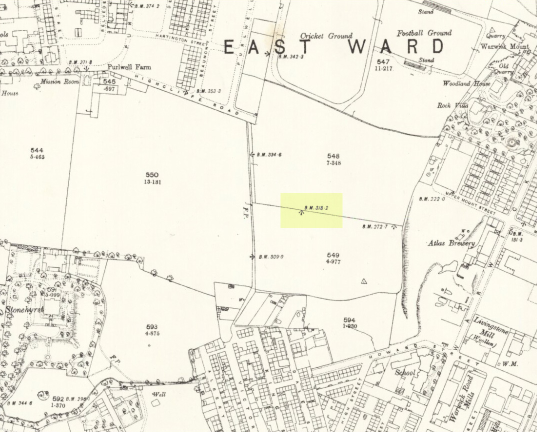
Position of stone in 1894
So is our Old Wife’s Stone (or for that matter, Carlinghow’s old tomb) still in evidence? A school has been built where it was highlighted on the 1854 OS-map and, from the accounts of local people, seems to have long since disappeared. The stone looks to have been incorporated into a length of walling, sometime between 1854 and 1888, and a bench-mark of “BM 318.2” carved onto it. But when the Ordnance Survey lads re-surveyed the area in 1905, this had gone. I have been unable to find any more information about this site and hope that, one day, a fellow antiquarian or occult historian might be able to unravel more of its forgotten mythic history.
References:
Faull, M.L. & Moorhouse, S.A. (eds), West Yorkshire: An Archaeological Survey to 1500 AD – volume 1, WYMCC: Wakefield 1981.
Goodall, Armitage, Place-Names of South-west Yorkshire, Cambridge University Press 1914.
Keighley, J.J., ‘The Prehistoric Period’, in Faull & Moorhouse, 1981.
o’ Crualaoich, Gearoid, The Book of the Cailleach, Cork University Press 2004.
Smith, A.H., English Place-Name Elements – volume 2, Cambridge University Press 1956.
Smith, A.H., The Place-Names of the West Riding of Yorkshire – volume 2, Cambridge University Press 1961.
Wright, Joseph, English Dialect Dictionary – volume 1, Henry Frowde: London 1898.
Acknowledgements: Many thanks for the assistance of Simon Roadnight and Julia King in the Batley History Group.
Near the centre of this photo, the large ‘ring’ can be seen
From Midgley go west along Height Road and take the track up on your right, at the tree-lined bend, up Foster Clough and onto the moor as if you’re gonna go to Churn Milk Joan. As you reach the footpath at the quarries up the hill, go to the top of them and take the small footpath where the land levels-out and head east towards the walling. Just a hundred yards or so before the walling, keep your eyes peeled, cos you’re damn close!
Archaeology & History
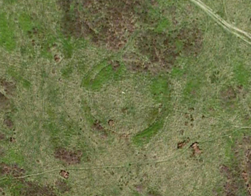
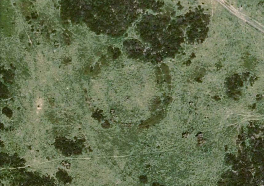
Best seen when looking down from the slopes above, this is a fascinating site that is lucky to still be here! For just a few yards to the west are extensive quarry works that could easily have destroyed the place had they continued. But thankfully we have here a near-perfect circular enclosure: measuring roughly 27 yards in diameter east-west, and about 25 yards north-south, the circumference around the outer-edge is approximately 82 yards (75m). It has all the appearance of an overgrown henge monument, with an outer bank and inner ditch, then a central flat arena—and it may indeed be such a monument—but until we have a decent excavation of the site, we’ll stick to calling it a simple enclosure—which it is!
Eastern arc of bank & ditch
The outer bank is very much overgrown, but as it runs round and defines this site, it measures 1-2 feet high most of the way, except on the westernmost spot, where it seems there may be an ‘entrance’. The inner ditch is only a couple of feet deep, again all the way round the monument. The internal level of the site is pretty flat, like most henges; but there seems to be a small central ‘cairn’ of some sort in the middle. Again, this is very overgrown by our traditional moorland vegetation.
Aerial image, 2009Aerial image, 2006
So what is it exactly? An enclosure, a settlement, or even (as local research student John Billingsley once suggested) a henge? Tis difficult to say for sure without further and more detailed archaeological excavation. My estimate is that the site is either Bronze- or Iron-Age in nature, and is definitely an ‘enclosure’ of some sort. We have located other prehistoric sites on the slopes just above here to the north, like the Crow Hill cairn circle and accompanying tumulus, remains of a neolithic settlement and a number of other small single cairns that are only visible when the heather has been burnt back. If you intend to explore any of the ancient sites sites on this moor, check this one out!
References:
Bennett, Paul, The Old Stones of Elmet, Capall Bann: Milverton 2001.
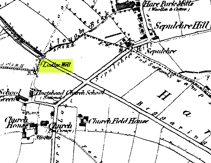
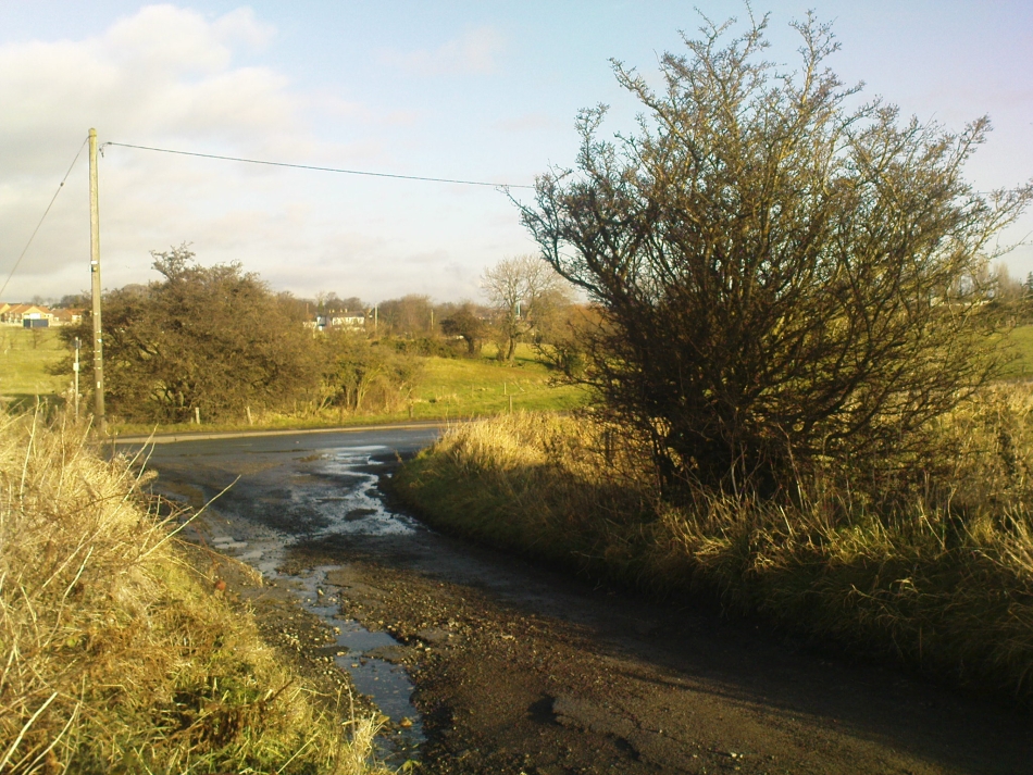
This can take a little bitta finding if you don’t know the area. So it’s best starting from Hartshead church, right on top of the hill here. From whichever direction you’re taking to reach Hartshead, ask a local when you get close and they’ll direct you there. From here, walk out of the churchyard and turn left. Walk barely 50 yards and turn left again along Lady Well Lane. Past the old houses and bear right where it becomes a dirt-track. This then turns left, then again right and – with the fields on either side of you – note the single hawthorn tree ahead of you by the walling. Go into the field at the back of the hawthorn and look under its shady bough. Tis there, I assure you!
Archaeology & History
The holy well is beneath this hawthorn tree
Emerging at the edge of the field beneath an old hawthorn tree at the side of the track running to the adjacent church, the waters from here are clean and fresh—though the stone trough into which it flows is constantly clogged up and the ground around it very boggy. The well has given its name to Lady Well Lane, which leads to the 12th century St. Peter’s Church, with its own ancient and legendary history. The well is thought to derive its name from ‘Our Lady’, the Virgin Mary, indicating it would have had considerable importance in the religious traditions of the christians who named it, but moreso the original animistic traditions of normal local people who would have used it for much longer…
Close by this old stone trough appears to be another one, covered by moss and the encroaching field. Whatever medicinal properties the waters may once have had, have long since been forgotten. Around Lady Well is a healthy abundance of flora: elder, chickweed, nettle, clover, bramble, dandelion, sow thistle, dock and shamanic species.
Folklore
The overgrown Lady Well
Marion Pobjoy (1972), like her predecessors, suggested that this was one of many sites in Calderdale used by St. Paulinus to perform baptisms. Local folklore tells that Robin Hood stopped here to drink the waters—but then we find an abundance of the pagan outlaw’s activities all round here. The nearby church of St.Peter is aligned to the equinoxes and may well be an indication of when pre-christian celebrations occurred here. The yew tree in churchyard was where Robin Hood was supposed to have taken wood to fashion one of his bows. Modern folklore also ascribes the well to be along a ley line.
References:
Heginbottom, J.A., ‘Early Christian Sites in Calderdale,’ in Proc. Halifax Ant. Soc., 1988.
Pobjoy, Harold N. & Marion, The Story of the Ancient Parish of Hartshead-cum-Clifton, Riding 1972.
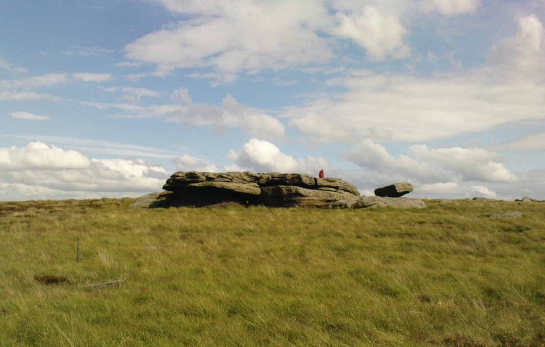
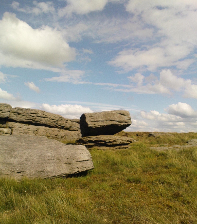
From Denholme, take the A6033 Hebden Bridge road up, but shortly past the great bend turn off right up the steep road towards the moorland windmills until you reach the flat dirt-tracked road, past the reservoir below. A coupla hundred yards past the track to the reservoir, take the footpath south into the tribbly grasslands and moor. A few hundred yards down you’ll note the large rock outcrop ahead of you. The rocking stone is there!
Archaeology & History
The old rocking stone
A small moorland arena with a neglected history. Many lost memories surround this site, with barely legible ruins from medieval and Victorian periods prevailing against scanty snippets of neolithic and Bronze Age rumours and remains. The rocking stone here—which moves slightly with a bit of effort—sits amidst a gathering of other large rocks, some of which have debatable cup-markings on their smoothly eroded surfaces.
Our rocking stone, resting 1350 feet (411m) above seal level, was first mentioned in John Watson’s (1775) magnum opus, who gave a quite lengthy description of the site, telling us that,
“On a common called Saltonstall-moor, is what the country people call the Rocking-stone… The height of this on the west side (which is the highest) is, as I remember, about three yards and a half. It is a large piece of rock, one end of which rests on several stones, between two of which is a pebble of a different grit, seemingly put there for a support, and so placed that it could not possibly be taken out without breaking, or removing the rocks, so that in all probability they have been laid together by art. It ought to be observed, that the stone in question, from the form and position of it, could never be a rocking stone, though it is always distinguished by that name. The true rocking stone appeared to me to lie a small distance from it, thrown off its centre. The other part of this stone is laid upon a kind of pedestal, broad at the bottom, but narrow in the middle; and round this pedestal is a passage which, from every appearance, seems to have been formed by art, but for what purpose is the question.”
Dubious cupsWatson’s 1775 drawing of the Rocking Stone
Watson then goes onto remark about other rocking stones in Cornwall and further afield with attendant “druid basins” on them, noting that there were also “rock basins” found here on Warley Moor, a few of which had been “worked into this rocking stone,” which he thought, “helps to prove that the Druids used it.” And although these rock basins are large and numerous over several of the rocks on this plateau, like the cup-markings that also scatter the surfaces, they would seem to be Nature’s handiwork.
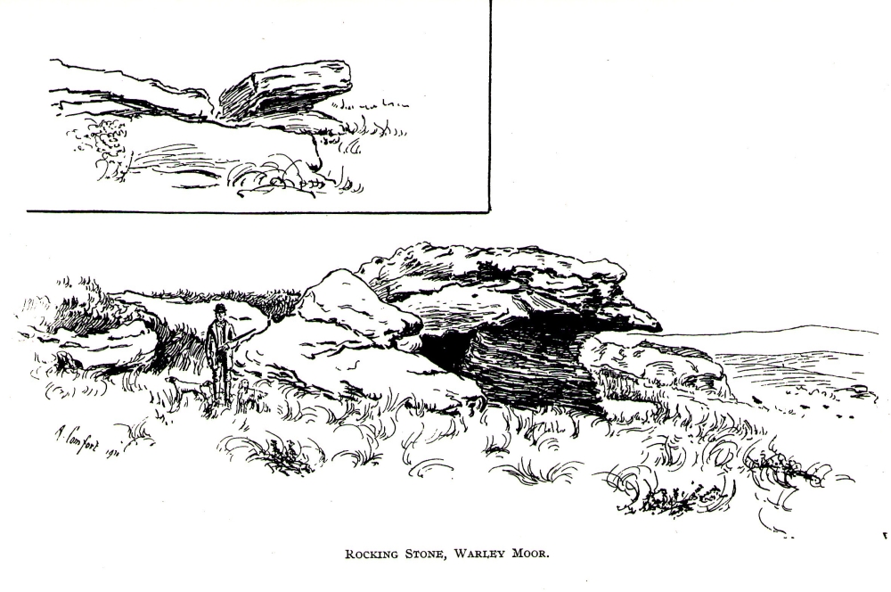
Turner’s 1913 drawing
Some 60 years later when the literary thief John Crabtree (1836) plagiarized Watson’s words verbatim into his much lesser tome, it seemed obvious he’d never ventured to explore the site. But in the much more valuable historical expansion written by John Leyland around 1867, he at least visited the site and found the old stone, “still resting on its shady pedestal.” Later still, when Whiteley Turner (1913) ventured this way on one of his moorland bimbles, he added nothing more to the mythic history of these west-facing megaliths…
Folklore
Still reputed locally to have been a site used by the druids; a local newspaper account in the 1970s also told how local people thought this place to be “haunted by goblins.”
References:
Bennett, Paul, The Old Stones of Elmet, Capall Bann: Milverton 2001.
Crabtree, John, Concise History of the Parish and Vicarage of Halifax, Hartley & Walker: Halifax 1836.
Leyland, F.A., The History and Antiquities of the Parish of Halifax, by the Reverend John Watson, M.A., R.Leyland: Halifax n.d. (c.1867).
Smith, A.H., The Place-Names of the West Riding of Yorkshire – volume 3, Cambridge University Press 1961.
Turner, Whiteley, A Spring-Time Saunter round and about Bronte Lane, Halifax Courier 1913.
Watson, John, The History and Antiquities of the Parish of Halifax, T. Lowndes: London 1775.
The site can be approached by going up the almost hidden long steep winding lane off the A646 in Cornholme; but if you don’t know the area it’s probably best approached from the well known Bride Stones, above Todmorden. From here, go west along the road running 100 yards or so above the Bride Stones, past the old pub, past Hawk Stones farm, and turning left downhill about a quarter-mile on. A coupla 100 yards down, there’s a track to your left. As you start walking along you’ll see a standing stone on the grassy rise in front of you on your left. That’s it!
Archaeology & History
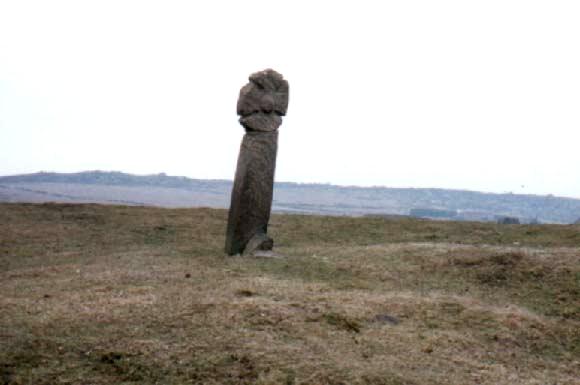
Mount Cross on 1848 map
Said by local writer Geoff Boswell (1986) to be “the oldest religious memorial in Todmorden,” this old stone, more than 4-feet tall, is still in good condition and can be found beside the Old Causeway: a prehistoric trackway running between Lancashire and Yorkshire which is said by archaeologists to have been an old, but established trade route. It was suggested by some to have been erected as a cross as early as the 7th century. Generally known as the Mount Cross, it is also known as the Idol Cross, as legend reputes it to have been the site of pagan practices; hence its repute as being haunted. Its alleged heathen history is probably true (history records describe an old “rude stone” that was once found beneath the legendary Bride Stones nearby, which was moved many centuries back).
The Calderdale Council website tells that,
“Towards the bottom of the shaft on the NE side are what appears to be extremely faint traces of vine-scroll decoration which would suggest a fairly early date for the cross, possibly tenth or eleventh century. The irregularity of the carving overall tends to indicate that the cross is no earlier.”
Folklore
Said to have stood upon or beside a small tumulus until the 20th century. Jessica Lofthouse (1976) reported that a local farmer said of this stone. “Queer things happened here long since. They worshipped idols here.” Locally attributed to be haunted, the old stone was said to have a history of “uncanny happenings.”
References:
Bennett, P., The Old Stone Crosses of West Yorkshire, unpublished MS, 1995.
Boswell, Geoff, On the Tops around Todmorden, Delta G: Todmorden 1986.
Lofthouse, Jessica, North Country Folklore, Hale: London 1976.
The site is usually invisible, being under the waters of Walshaw Dean Middle Reservoir. But in good droughts you can catch a glimpse of the place. So take the Widdop road as it’s known locally, from either Hebden Bridge up past Heptonstall, or from Burnley, Nelson & Colne side, and park-up by the pub a few hundred yards east of Widdop Reservoir. Walk a few hundred yards back down the road (east) and take the dirt-track on the other side of the road on the Calder-Aire link leading to the Pennine Way. Walk up past the first reservoir, keeping to its west-side, until you reach the Lodge house where the second lake appears. Now, if the water’s down, walk along its western-edge for about 50 yards, looking into the dried flat ahead of you and you’ll see the loose ring of small stones. That’s it! Or as Mr Roth described the place in 1906, “The position of the circle is on the left-hand side of the valley going up, a few yards above the dam of the second reservoir.”
Archaeology & History
Earliest photo of the circle
This is a somewhat bizarre archaeological site, whose nature we may never fully recover. Although listed and scheduled as a plain stone circle by Aubrey Burl (2000) and others, both the placement and structure of the site implies a more funerary aspect to it. This was suggested by Ling Roth (1906) when he first wrote about it. But for me, the position of the site in the landscape calls into question the archetypal ‘stone circle’ category, as it is somewhat hemmed-in both east and west, with limited views north, and only a good view of open lands to the south (summer). It’s just a bit odd when compared to other megalithic rings in the Pennines. But perhaps this ‘privacy’ was intended — as there is only scattered evidence of other human activity in this valley and on the moors above. Perhaps this site was meant to be ‘cut off’ from the rest of the world. We might never know…
There is also the peculiar addition inside this stone circle of an arc of walling facing southeast, which is unique in this part of Britain. But this walling seems to have been a later addition and has the hallmarks of being some small shelter, or even an early grouse-shooting butt (there’s tons of game-birds here, and this would be an excellent spot to shoot from) This internal wall may have been constructed from stone that came from the circle itself: perhaps in a rubble wall, perhaps an internal cairn. It seems likely. Mr H. Ling Roth (1906) also mentions this feature in what was the first description of the site, where he told:
“The stone circle at Walshaw Dean Reservoir…was discovered by Mr W. Patteson, the resident engineer, in July 1902. The circle consists of ten irregular stones apparently local rock, varying considerably in size, one measured 6ft 3in (1.9m) long and stood about 30 inches (76cm) above the clay when the peat surface was removed. Whether the stones are deeply embedded has not been ascertained, but where they were covered by the peat a clear white band is apparent. The circle is 36 feet (11 metres) is diameter and of very fair exactitude. Inside the circle as shewn on the plan and in the view there was a rouhg carved wall which measured across the ends 12ft (3.7m). The wall had been partly pulled down and reset immediately before examination by a party of visitors soon after the discovery. Its presence in the circle may be fortuitous, but after the two unsystematic disturbances to which the ground had been subjected, it is not possible to form an opinion about it. That something had been buried in the centre of the circle is probable when we bear in mind the circumstances of stone circles elsewhere, but an examination shewed only that the ground had been disturbed and Mr Patteson explained to me that such disturbance was not of recent date.”
To my knowledge, no subsequent excavation of the site has ever been done, but it would appear that the waters have washed part of the site away and any remains that may once have been found within the ring have been discarded by more than a century of erosion. Traces of small walled structures have also been noted close to the circle in recent years, suggestive of settlement remains. On a TNA outing last year, we also found previously unrecorded prehistoric remains on this hills above here. When Geoffrey Watson (1952) wrote his survey on prehistoric Calderdale, he suggested that the Walshaw Circle may have been placed alongside the branch of an early trade route running along the northern edge of the valley. Not so sure misself…
References:
Bennett, Paul, The Old Stones of Elmet, Capall Bann: Milverton 2001.
Burl, Aubrey, The Stone Circles of Britain, Ireland and Brittany, Yale University Press 2000.
Roth, H. Ling, The Yorkshire Coiners, 1767-1783; and Notes on Old and Prehistoric Halifax, F.King: Halifax 1906.
Watson, Geoffrey G., Early Man in the Halifax District, HSS: Halifax 1952.
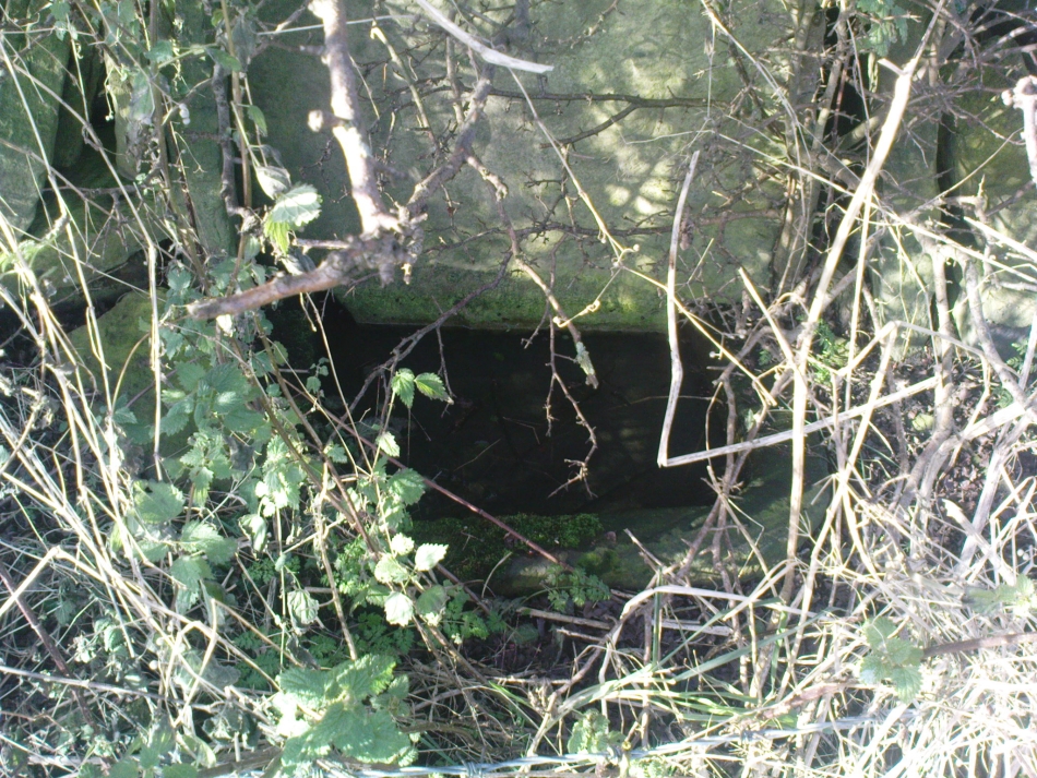
Take the Heptonstall road up from Hebden Bridge, going round the village (not into it) and head through Slack and onto Colden. Just as the road begins to go downhill to Colden, note the small single-track road on your right called Edge Road. Go on here for a good mile until it becomes a dirt-track and there, on your left, is the half-run-down old farmhouse called New Edge. Just yards past it, off to the right by the trackside, you’ll see this large copper-coloured stone basin oozing with the same-coloured liquid.
Archaeology & History
New Edge Chalybeate, above Colden
This is one of what Thomas Short (1724) called “the ten thousand chalybeats”, or iron-bearing springs, inhabiting the Yorkshire uplands — but he didn’t include this site in his huge survey. But it’s a beauty amongst chalybeates, as a visit here clearly shows! The well is one of two found on either side of the old building known as New Edge (as contrasted with Old Edge, a little further along the lane), and its waters trickle gently from the old stone trough.
The waters are undoubtedly enriched with large amounts of iron, as the photo here shows, giving the waters clear medicinal value. In tasting them, not only do the waters give you that copper-coloured hue, but you can clearly taste the minerals in the water. As with other iron-bearing springs, the water from the New Edge spring is good for the blood, good for anæmia, loss of energy and a low immune system.
References:
Short, Thomas, The Natural, Experimental and Medicinal History of the Mineral Waters of Derbyshire, Lincolnshire and Yorkshire, privately printed: London 1734.
Follow the directions to reach Churn Milk Joan, the head 100 yards east till reaching the crossing of footpaths, beneath Crow Hill. Take the northern (left) route and keep walking. Half a mile along you’ll see the tall upright stone to your left. You can’t really miss it!
Archaeology & History
The Greenwood Stone is an old boundary stone and is not prehistoric. It stands more than four feet tall. I first visited the site in 1988 in the company of several folklore and antiquarian writers, including Andy Roberts, Edna Whelan and Graeme Chappell. Twas a good day and coincided with a small collection of Psilocybes being gathered!
The tall upright is a boundary stone that was erected in 1775, as evidenced by the date carved on its southern face. I must emphasize however that this was not when the stone came to acquire its name: this was defined in 1594 as evidenced by a boundary perambulation written that year where it is described as being recumbent: “thence to one lying stone, newly named Greenwood Stone.” About 10-15 yards away is what may have been that very “lying stone,” the original Greenwood Stone, half-buried in the heather some six or seven feet long. It is possible this may have stood upright in the distant past.
Greenwood Stone, looking south
Moving about 75 yards south we come across another small standing stone at 1360 feet (412m) above sea level. This I’ve called the ‘Greenwood B stone’. It was marked on an old map as a boundary stone and is distinctly shaped to stand upright, marking a point separating the moors of Midgley and Wadsworth. When stood upright it is just visible on the horizon when looking from the Miller’s Grave prehistoric tomb several hundred yards east of here and is close to being an equinox indicator.
References:
Bennett, Paul, The Old Stones of Elmet, Capall Bann: Milverton 2001.