To get here, take the same direction as to reach the Bleara Lowe tumulus, stopping a short distance away when you reach the large heap just by the walling where the moorland levels out. Y’ can’t really miss it!
Archaeology & History
Bleara Moor tumulus
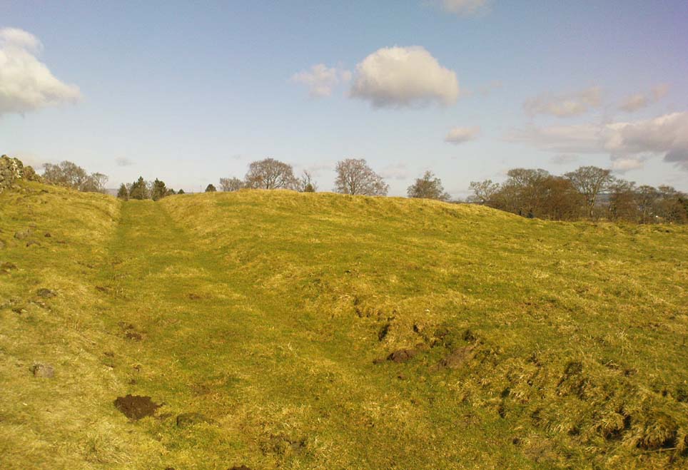
Found on the top of the slope above the Bleara Moor Cairnfield, this is quite a large burial mound that seems to have been forgotten on the small moorland heights above Earby and Lothersdale. No archaeological excavation has been done here and there seem to be no accounts of any finds in local antiquarian records. When we visited the place it was very overgrown and covered in heather, but it stood out in the open landscape. Slightly larger than its more famous companion to the east, this tomb stands three- to four-feet high on average, with a diameter of around 25 yards on its longest northeast/southwest axis. Consistent in structure with the larger cairns on Burley Moor like the Little Skirtful, this tomb was probably built in the Bronze Age. It also seems that a lot of stone has been robbed from this cairn for use in the local walling. The site was given a minimal description on the Pastscape website, where it was described as:
“Round cairn 230m W of Bleara Howe (sic). Scheduled RSM No 23718. A partly mutilated slightly oval mound of peat and heather-covered stones up to 1.2m high with max dimensions of 23m NNE-SSW x 21m WNW-ESE.”
The views from here are considerable and this probably had some relevance when it was first built, but I’m not aware if an assessment of this aspect of the site has been made. More information about the Bleara Moor tumulus (and its companions!) would be hugely appreciated!
There’s no footpath to this site, but we came to it via the car park on Coolham Lane on the southeast side of Earby. Walking uphill, we got over the wooden stile on the moorside and walked up the side of the walling, all the way upwards till we reached the top of the moor. You’ll pass the large Bleara Moor tumulus just by the walling, then head towards the rounded hillock on the top of the moor a coupla hundred yards away. Y’ can’t really miss it!
Archaeology & History
As with many sites in this area, very little has been said of this usually overgrown Bronze Age burial mound. Although no known recorded excavation of the tomb has ever been done, someone dug into the top of the mound in the 1960s, but we have no record of any finds. The tomb stands on the local boundary line between Earby and Lothersdale to the east and was known as ‘Bleara Haugh’ in the 1819 Enclosure Act. But little else has ever been said of it.
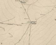
Bleara LoweOS-map of site
When we visited the place a few months ago, we were fortunate in that the heather had been burnt back, so allowing a much better view of the site than normally afforded when it’s covered in heather. The rounded mound was between 4 and 5 feet high and measured approximately 20 yards across. The pit which had been dug into the top of the mound was still visible, though much overgrown. The view from the tomb itself was very impressive — which would have been of some importance in the construction of the place. The Pastscape website describes Bleara Lowe as:
“A slightly oval mound of peat and heather-covered stones up to 1.4m high with max dimensions of 21m E-W x 19m N-S. There is a rectangular hollow 3m x 1.5m x 0.4m deep on the cairn’s summit.”
Another larger tumulus or overgrown cairn can be found over 200 yards west of here; plus a number of small singular prehistoric cairns have been located further down the western slope of the moor, known as the Bleara Moor Cairnfield. None of these sites have ever been excavated.
Lilla Cross is situated on Fylingdales Moor, north Yorkshire, between Pickering and Whitby at the junction of two major moorland footpaths. It is located close to the Fylingdales Ballistic Missile Early Warning Station – which resemble giant golf balls on the horizon.
Archaeology & History
Woodwark’s 1930s photo of Lilla Cross
The ancient cross is 10 foot high and free-standing but it sits upon what is probably a ruined Bronze-Age bowl barrow called Lilla Howe; the recumbent stones that lie around the base of the cross may form part of that. It is a sturdy, stocky cross that has some letters carved onto it, one in particular being a large letter “C” possibly meaning Christos (Christ) and with that a small thin cross; there are a few other faint letters but these are difficult to decipher now. A plaque on a nearby stone gives information about the cross. I think Lilla Cross was used as a sort of Medieval milestone or way-marker – hence the lettering on the cross.
In 1952 the cross was moved to Sil Howe near Goathland but 10 years later in 1962 it was returned to its original site on top of Lilla Howe. In the 1920s excavations on the barrow revealed some artefacts of jewellery, but no remains of Edwin’s trusty chief minister were found; the jewellery was, in fact, said to date from the mid 9th century. Lilla Cross has been referred to by historians as the oldest christian cross on the north York Moors.
Folklore
Lilla Cross on 1854 Map
According to the legend, in AD 625 or 626 King Edwin of Northumbria was travelling with his entourage across the moors, but an assassin had been dispatched by the king of the west Saxons to kill Edwin. The assassin lunged forward with his poison tipped sword, but Lilla his chief minister at the king’s court, leapt in between his sovereign and the swordsman. Poor Lilla took the full thrust of the sword and died on the spot thus saving the king from being murdered. King Edwin, who was greatly impressed by this selfless act of devotion, ordered that Lilla being a newly converted christian be buried here in a christian way though he asked that a number of articles be placed with the body including gold and silver. The king then had a cross erected in memory at the spot where Lilla died. But it seems likely that the cross dates from the 10th century, though there may have been an earlier Saxon cross here. References:
Ogilvie, Elizabeth & Sleightholme, Audrey, An Illustrated Guide to the Crosses on the North Yorkshire Moors, Village Green Press: Thorganby 1994.
White, Stanhope, Standing Stones and Earthworks on the North Yorkshire Moors, Fretwell & Cox: Keighley 1987.
Woodwark, T.H., The Crosses on the North York Moors, Whitby Literary & Philosophical Society 1934.
Various ways to get here. Probably the easiest is via the golf course itself, walking up towards the top where the trees reach the hills, but keeping your eyes peeled for the large archetypal tumulus or fairy mound near the top of the slope. Alternatively, come up through the wooded slopes from Bridge of Allan and onto the golf course, keeping your eyes ready for the self same mound sat in the corner by the walls. You can’t really miss it to be honest!
Archaeology & History
This is an impressive-looking burial mound sat, intact, on the edge of those painful golf courses that keep growing over our landscape — and you can see for miles from here! It would seem to have been placed with quite deliberate views across the landscape, reaching for countless miles into the Grampian mountains north and west across the moors of Gargunnock and Flanders towards Lomond and beyond…
Fairy Knowe, facing westSir Armstrong’s old drawing
The Fairy Knowe was first excavated in 1868 by Sir J.E. Alexander and his team, when their measurements found it to be some 80 yards in circumference, 78 feet across and 21 feet high — compared to less than 60 feet across and only 8 feet tall today. The findings were recorded in one of the early PSAS reports, and more recently a synopsis of the account was made of it by the Royal Commission (1963) lads who summarized his early findings and told:
“The excavation revealed a cist in the centre of the cairn, laid on the original surface of the ground and measuring 2ft 6in in length, 1ft 6in in breadth and 3ft in depth. Its walls were formed partly of upright slabs and partly of small stones laid horizontally, while the floor and the roof each consisted of a single slab. Within it there was a deposit, 6in in depth, of black earth, charcoal and fragments of human bone among which pieces of a skull were conspicuous. The cist was covered by a heap of large stones, 8ft in diameter and 13ft in height, and this in turn was covered with earth, in which there were charcoal, blackened stones, fragments of human and animal bones and unctuous black earth. Among these remains were found six flint arrowheads, a fragment of what was once thought to be a stone spear-head, and a piece of pine which, it was suggested, might have formed part of a spear-shaft.”
Also, near the top of the cairn in the fairy mound, Sir Alexander’s team located a prehistoric beaker vessel and fragments of what they thought were other beakers pots. Archaeologist Richard Feachem (1977) also mentioned this site in his gazetteer, simply copying the words of previous researchers.
Other prehistoric cairns can be found nearby: one in Cuparlaw Woods less a mile north; plus the Pendreich cairns on the edge of the moors just over 1 mile to the northeast.
Folklore
Obviously an abode of the faerie folk in bygone times, the tales of the place are sadly fading from local memory… Mr Alexander (1868) thought this place may have been an important site for the Pictish folk, and he may well have been correct, as the legendary hill of Dumyat (correctly known as Dun Myat) 2 miles east of here has long been regarded as an outpost of one Pictish tribe.
The main piece of folklore attached to this place relates to its very name and how it came about. In R.M. Menzies (1912) rare work on the folklore of the Ochils, he narrates the local tale that used to be spoken, which describes a procession here from the Fairy Well, just over a mile to the east. Whether this folktale relates to some long lost actual procession between the two sites, we don’t know for sure. Mr Menzies told:
“Once upon a time, when people took life more leisurely, and when the wee folk frequented the glens and hills of Scotland, there was one little fairy whose duty it was to look after certain wells renowned for their curative properties. This fairy was called Blue Jacket, and his favourite haunt was the Fairy Well on the Sheriffmuir Road, where the water was so pure and cool that nobody could pass along without taking a drink of the magic spring. A draught of this water would have such a refreshing effect that the drinker could go on his journey without feeling either thirsty or hungry. Many travellers who had refreshed themselves at the Fairy Well would bless the good little man who kept guard over its purity, and proceed upon their way dreaming of pleasant things all the day long.
“One warm day in June, a Highland drover from the Braes of Rannoch came along with a drove of Highland cattle, which he was taking to Falkirk Tryst, and feeling tired and thirsty he stopped at the Fairy Well, took a good drink of its limpid water, and sat down beside it to rest, while his cattle browsed nearby. The heat was very overpowering, and he fell into a dreamy sleep.
“As he lay enjoying his noonday siesta, Blue Jacket stepped out from among the brackens and approaching the wearied drover, asked him whence he came. The drover said:
“‘I come from the Highland hills beside the Moor of Rannoch; but I have never seen such a wee man as you before. Wha’ may you be?’
“‘Oh,’ said the fairy, ‘I am Blue Jacket, one of the wee folk!’
“‘Ay, ay man, ye have got a blue jacket, right enough; but I’ve never met ony o’ your kind before. Do ye bide here?’
“‘Sometimes; but I am the guardian of the spring from which you have just been drinking.’
“‘Weel, a’ I can say is that it is grand water; there is no’ the likes o’t frae this to Rannoch.’
“‘What’s your name?’ asked the fairy.
“‘They ca’ me Sandy Sinclair, the Piper o’ Rannoch,’ was the reply.
“‘Have you got your pipes?’ asked Blue Jacket.
“‘Aye, my mannie, here they are. Wad ye like a tune? Ye see there’s no’ a piper like me in a’ Perthshire.’
“‘Play away then,’ said Blue Jacket.
“Sandy Sinclair took up his pipes and, blowing up the bag, played a merry Highland reel. When he finished, he was greatly surprised to see above the well a crowd of little folk, like Blue Jacket, dancing to the music he had been playing. As he stopped they clapped their little hands and exclaimed, ‘Well done Sandy! You’re the piper we need.’
“Thereupon Blue Jacket blew a silver whistle, which he took from his belt, and all the wee folk formed themselves into a double row. Blue Jacket then took the Highland piper by the hand, led him to the front of the procession, and told him to play a march. Sandy felt himself unable to resist the command of the fairy, and, putting the chanter into his mouth, blew his hardest and played his best, marching at the head of the long line of little people, who tripped along, keeping time to the strains of the bagpipes. Blue Jacket walked in front of the piper, leading the way in the direction of the Fairy Knowe.
“Sandy Sinclair never marched so proudly as he did that day, and the road, though fairly long, seemed to be no distance at all; the music of the pibroch fired his blood and made him feel as if he was leading his clansmen to battle. When the Fairy Knowe was reached, the wee folk formed themselves into a circle round the little hill, and sang a song the sweetest that ever fell upon the ears of the Highlandman. Blue Jacket once more took his whistle and, blowing three times upon it, held up his hand, and immediately the side of the knoll opened. Bidding the piper to play on, Blue Jacket led the procession into the interior; and when all were inside, the fairies formed themselves into sets, and the piper playing a strathspey, they began dancing with might and main.
“One dance succeeded another, and still Sandy played on, the wee folk tripping it as merrily as ever. All thoughts of Sandy’s drove had gone quite out of his head, and all he thought of now was how best to keep the fairies dancing: he had never seen such nimble dancers, and every motion was so graceful and becoming as made him play his very best to keep the fun going. Sandy Sinclair was in Fairyland, and every other consideration was forgotten.
“Meanwhile his cattle and sheep were following their own sweet will, the only guardian left to take care of them being his collie dog. This faithful animal kept watch as well as he could, and wondered what had become of his master. Towards evening another drover came along with his cattle for the same tryst. He knew the dog at once, and began to pet the animal, saying at the same time, ‘Where’s your master, Oscar? What’s become o’ Sandy?’
“All the dog would do was to wag his bushy tail, and look up with a pleading air, as if to say, ‘I don’t know; will you not find him?’
“‘My puir wee doggie, I wonder what’s come over Sandy? It’s no like him to leave his cattle stravaiging by the roadside. Ay ay man; and at the Fairy Well too! Indeed, this looks unco bad.’
“The newcomer, who was also a Highlander, made up his mind to spend the night with his own drove and that of Sandy Sinclair, thinking that the missing man would turn up in the morning. But when the morning came there was no sign of Sandy.
“Taking Sandy’s collie and leaving his own dog in charge of the combined droves, he said, ‘Find master, Oscar!’ The wise beast sniffed around for a little and then trotted off in the direction taken the day before by Sandy Sinclair and the fairies. By and by they reached the Fairy Knowe; but there was nobody there as far as the drover could see. The dog ran round and round the knoll, barking vigorously all the time, and looking up into the face of the drover as if to say, ‘This is where he is; this is where he is.’ The drover examined every bit of the Fairy Knowe, but there was no trace of Sandy Sinclair. As the drover sat upon the top of the Fairy Knowe, wondering what he should do next, he seemed to hear the sound of distant music. Telling the faithful dog to keep quiet, he listened attentively, and by-and-by made out the sound of the pibroch; but whether it was at a long distance or not, he could not be certain. In the meantime, the dog began to scrape at the side of the mound and whimper in a plaintive manner. Noticing this, the drover put his ear to the ground and listened. There could be no mistake this time: the music of the pibroch came from the centre of the Fairy Knowe.
“‘Bless my soul!’ exclaimed Sandy’s friend. ‘He’s been enticed by the fairies to pipe at their dances. We’ll ne’er see Sandy Sinclair again.’
“It was as true as he said. The Piper of Rannoch never returned to the friends he knew, and the lads and lasses had to get another piper to play their dance music when they wished to spend a happy evening by the shore of the loch. Long, long afterwards, the passers-by often heard the sound of pipe music, muffled and far away, coming from the Fairy Knowe; but the hidden piper was never seen. When long absent friends returned to Rannoch and enquired about Sandy Sinclair, they were told that he had gone to be piper to the wee folk and had never come home again.”
There is some confusion as to whether this mound of earth, barely four feet high but some 50 feet across, is actually prehistoric. But the folklore has that common ring to it, found at olde sites from Cornwall to northern Scotland, speaking of old tombs and ancient ways…
Folklore
In modern times apparently, earthlights have been reported flitting about around this earthen ridge, but the old mound has older, more familiar tales spoken of it. In Rev. Williams’ (1901) article on the folklore of Stirlingshire, he made a considerable detour to tell of some old faerie-lore he’d heard when he was younger, from the prehistoric tomb on the northern side of Elphillock, a few miles south of Kildrummy. In talking with some of the local people about old beliefs, one local man told him:
“The fairies of my native parish made their abode in a round knoll, known as Elfhillock. My friend, James Smith, now no more, was ploughman at Cairncoullie, in the neighbourhood. Passing the hillock one evening, he heard the sound of music and dancing. James drew near to the spot and saw the revels. He waited and enjoyed himself for a short space and then returned to Cairncoullie and went to bed. He found to his amazement that he had been away a year and a day! Every field on the farm and the new ploughmen bore evidence to the fact; and Jamie believed till his dying day that he was a year older than he was aware of, and all because he had given heed to matters he had no business with.”
Not only were the little people said to live within this small tomb, but the hillock must also be cared for and never damaged. Rev. Williams also narrated that the grandfather of the same local man told him that he had,
“pulled some heather from this elf hillock. He was compelled by the women to replace it, otherwise he would have to encounter the wrath of the fairies.”
Thankfully the old hillock is still here, just off the roadside. Not far from here are a number of other prehistoric sites with faerie and ghost-lore and mythological place-names, long since fallen into memories old…soon to be lost perhaps…
References:
Williams, George, “Local Superstitions,” in Transactions of the Stirling Natural History and Archaeological Society, 1901.
The Hades hill cairn/barrow is located high on the moors some 3 miles north-east of Whitworth and the smaller village of Facit, near Rochdale. Its exact location is close to a footpath halfway between Hades hill and Rough hill, though it is not mentioned on modern OS maps. It is quite difficult to get to so be ready for a long hard walk.
Archaeology & History
This small, low barrow or cairn — a couple of miles north of the little-known Man Stone — measures 15 metres north to south, 13 metres east to west and is 0.9 metres high (about 3 feet in height). But not a great deal can be seen today.
It was excavated in 1898 when a number of artefacts were discovered near the centre of the barrow. The most famous of these ancient artefacts was a Celtic two-tiered urn (of the Pennine type) which had rope imprints and chevrons; inside this urn were the burnt bones of a female, flints, a scraper and a fine pointed borer. Other stuff that came out of the barrow included animal bones, charcoal, flint implements and an arrow head. The urn was placed in the hands of The March Collection at The Rochdale Free Library (now known as Touchstones). A more recent excavation was carried out in 1982 but nothing was recorded at this time. In Dr Whitaker’s History of Whalley, he described there being “the remains of a large beacon, with the foundations of a large circular enclosure” on Hades Hill.
Take the road up to Brimham Rocks from Summerbridge; crossing the little crossroads, then keep your eyes peeled for the singular farmhouse on your right. Just beyond this, on your right, you’ll notice some small moorland opens up and reaches gently down the slope for some distance. Go along the footpath for 100 yards or so, then into the heather to your right, for 60 yards or so (as if you walking towards the farmhouse and small crags). This is where the following sites could be found. (when we visited Brimham recently, unfortunately sunfall stopped us having a proper wander here, so the status of the site/s remains unknown to us)
Archaeology & History
This little-known and possibly destroyed prehistoric site — less than a mile north of Standing Stone Hill and just a coupla hundred yards south of the legendary Brimham Rocks — has been described by several antiquarians from the early 19th century onwards. It’s an intriguing place, deserving of much greater antiquarian attention. Ely Hargrove (1809) appears to be the first who mentions prehistoric tombs here, though his sense of direction implies another site (unless he just got that part of it wrong?). Along with “several small tumuli or carns” near another section of Brimham Rocks themselves, he told there to be,
“Several large tumuli; one of which about 80 yards west of the great Cannon, measures 150 feet in circumference. It is worth remarking that the place where most of these tumuli are found is, at this day, called Graffa Plain, i.e., the Plain of Graves.”
These ‘tumuli’ were again mentioned briefly in passing by one ‘D.N.H.’ in the Gentleman’s Magazine of November 1823. The great Knaresborough historian William Grainge also described cairns here. They were then highlighted on the very first Ordnance Survey of the region in the 1850s and shown as “Supposed tumuli.” Eventually, at the turn of the 20th Century, they were explored at the behest of the local land-owner by Mr L.A. Armstrong. His description of what they found here is intriguing and well worth reproducing in full:
“By permission of the Right Hon. Lord Grantley, I was enabled to make a careful examination of two of the ancient burial mounds of ‘ Graff a Plain,’ Brimham Moor, on Tuesday, August 4th, 1908.
“Mound No. 1, of circular form, and about 12′ o” in diameter, is situated about 150 yards north-west of the first large group of rocks, upon the south-eastern boundary of the moor, and about 50 yards south-east of the trackway leading to ‘ Riva Hill Farm,’ and it occupies the summit of a slight hillock, upon a comparatively level portion of the heath, which rises rapidly to the south of it in a bold sweep, terminating in the outstanding rocks of Graffa Crags and Brimham Beacon.
“The entire absence of any heather upon the mound, and the profusion of bright green bilberry plants which covered it and at the same time rendered its outline more noticeable, told plainly of a different character of subsoil from that of the surrounding moor ; but prominent as the mound appeared, its actual elevation was deceptive, being barely two feet above the natural level, and the uneven character of the upper surface suggested previous disturbance to be more than probable. A few attempts to pierce the crown, however, proved it to be a cairn, constructed of large stones, and accounted for the prolific growth of the rock-loving bilberry which overspread it, as well as for the uneven character of the surface.
“The thick green covering was carefully stripped off in lengths and placed on one side, and the few inches of vegetable earth removed, revealing the cairn in an almost perfect state, formed of a series of large stones placed methodically in concentric rings, each stone slightly inclined towards the centre, and the whole mass interlocked together by their own weight. Large stones were placed around the outside forming the enclosing circle, which is almost invariably found in the case of earth-built tumuli, and a few of these had been visible before the covering was stripped.
“The construction of the cairn rendered it necessary to remove the stones from the outer ring first, and to work gradually towards the centre where the burial, if such existed, might be expected to lie. This proved no easy task, as the stones were so tightly wedged, and had each apparently been specially selected for the purpose. Almost without exception, they were about a foot in diameter, oblong or oval in form, and three to five inches in thickness, with flat surfaces and rounded edges. No marks of tools were visible on any, but all alike were either water-worn, or had been especially rubbed to their present form. The stone itself was the Millstone Grit of the surrounding moor, but fragments of stone of the form composing the cairn are not now to be found thereon readily, although a careful search might reveal such. Personally I am inclined to think that they have been transported from a considerable distance; that great care has been exercised in their selection is indisputable.
“When nearing the inner radius of the cairn, small fragments of charcoal were noticeable, but they were by no means in large quantities. There was also a layer of fine grey sand an inch or two in depth, which had apparently been spread over the natural surface of the ground, and the stones bedded therein. Sand of this kind is abundant in the vicinity of the rocks upon the moor.
“In the centre, large pieces of stone were piled around a rough circle of about 3′ 6” extreme diameter, and within these, large and small stones, all of the form previously noticed, were laid more or less upon their flat surfaces, and amongst them the grey sand and charcoal were very evident; pieces of the latter up to an inch square, being found.
“Upon the gradual removal of this central mass of stones, the presence of the unmistakable black ‘barrow earth’ became evident in a slight layer, perhaps an inch or an inch and a half in thickness, and spread over the whole area within the inner ring, the bottom of which had been paved with large flat stones. Amongst this earth very slight traces of a greyish white paste-like substance were”] visible, probably the decomposed remains of the bones after calcination. The deposit was carefully gathered together. Its removal bared the large stones forming the bottom of the grave, and these proved to be two in number, the largest being about 2′ o” across, and of a somewhat angular form ; strikingly different to those composing the cairn itself, for the edges were rough fractures, not rounded in any way. Apparently the surface soil had been removed from the ground upon which the cairn was built, for the upper face of the two stones forming the bottom was level with the natural ground surface adjoining, so far as could be ascertained, and these had apparently been laid down for the reception of the deposited remains.
“As there was every reason to believe that some portion of the ashes might have been placed in an urn, efforts were made to raise the stones above mentioned in hopes of a discovery. This was by no means easy, but by care and perseverance, it was at last accomplished, but only to meet with disappointment. Immediately beneath was a slight layer of ashes upon the natural ground surface, which latter showed very evident signs of fire, the bright yellow sand composing the substratum being calcined to a dark red colour for quite 2” in depth. This sand was very stiff and compact. The most diligent search failed to reveal any trace of a hole or other disturbance at any point, or of any implements which might have accompanied the body, either upon the surface or amidst the cairn.
“One stone found amidst those immediately covering the deposit, was remarkable because entirely different from all the remainder composing the cairn, and appeared to have been shaped with some definite object in view. It was a fragment of hard sandstone, in the form of a truncated pyramid, the sides and top being roughly fractured to shape, but the base was quite smooth, and bore marks of friction. The base measured 6″ x 5″, and the height about 4½”. This might have been used as a crushing and grinding stone for grain, or for rubbing purposes, but careful search failed to reveal its companion slab. With this exception, nothing was found that could be considered as having been fashioned for use, and there was nothing to throw any light upon the probable period of the cairn’s erection.
“The second tumulus examined is situated about 100 yards south-west of the first. It was of rather irregular shape, and appeared to have been somewhat disturbed, but the original diameter had probably been about 9′ o”. Upon examination, it also proved to be of the cairn type, and apparently similar to that previously opened, but it had been disturbed throughout at some distant period, and no trace of the deposit could be found, although the yellow sand forming the subtratum was noticeable, calcined over the whole area as before. There were also traces of charcoal. It is remarkable that amidst the smaller stones of this cairn another ‘ rubbing stone ‘ was found, almost identical with that in the former one, and similarly, this proved to be the only ‘ find ‘ of any description bearing certain traces of man’s handiwork.
“Although somewhat disappointing not to be able to assign the erection of these cairns to any definite period, yet their examination proves valuable for two reasons. First it places beyond any question the nature of the mounds scattered over this portion of Brimham Moor, which is known by the name of ‘ Graffa Plain,’ a name which the late Mr. William Grange translates as ‘ the place of graves ‘ — significant in itself, though he at the same time casts a doubt upon the formation of the mounds in question being anything other than natural. The identity of the grave mounds being established, they prove that a settlement of primitive man of no small magnitude must have been located somewhere in the vicinity.”
The word ‘graffa’ seems to be the plural for ‘graff’, which the english dialect magus, Joseph Wright (1900), convincingly assures us to derive from the old english, “græf, a grave, trench.” This seems confirmed by the common finding of ‘graff’ in regional dialects from Yorkshire, Lancashire and other northern counties, where it relates specifically to ‘graves.’ A variation on the word, as cited above, finds ‘graff’ occasionally relating to “a ditch or trench; a channel, cutting; a hole, pit or hollow.” The usually helpful A.H. Smith (1961-63) was curiously silent on this place-name; but local historians Grainge, Walbran and others tell us that Graffa Plain is simply “the plain of the graves.”
I know of no other accounts that have explored this site. Does anyone have any further information about this place?
References:
Armstrong, A. Leslie, “Two Ancient Burial Cairns on Brimham Moor, Yorkshire,” in The Naturalist, March 1909.
Hargrove, Ely, The History of the Castle, Town and Forest of Knaresborough, Hargrove & Sons: Knaresborough 1809.
Smith, William, “Yorkshire Place-Names,” in W. Smith’s Old Yorkshire – volume 1 (Longmans, Green & Co.: London 1881).
Wright, Joseph (ed.), English Dialect Dictionary – volume 2, Henry Frowde: London 1900.
One of the four (known) cursus monuments around Rudston: this one stretches between the Ordnance Survey coordinates TA 081669 near Kilham Grange on the southwestern edge of Rudston, then heads northeast towards the village itself at TA 094675. Described briefly in D.P.Dymond’s essay on (mainly) Cursus A, he said how Cursus B was part of,
Early ground-plan (after D.P. Dymond)Early photo of Rudston B (after J.K.St Joseph)
“a large complex of crop marks. The largest feature is the squared, tapering end of Cursus B, which can be traced for 700 yards in a north-easterly direction. No surface remains seem to survive in an area intensively ploughed, except for a swelling under a hedge on the line of the south-eastern bank (at TA 0834 6703). West of the square end and partly overlying it, are several small rectangular enclosures, which are probably part of a later (?Romano-British) settlement and field-system. Also in this tangle of crop-marks there are four roughly circular shapes, which may well be barrow circles associated with the end of the cursus. On certain barrow just south of the end of the cursus has an inner ring of pits. Where the cursus is lat visible to the north-east, it is headed roughly for the monolith ¾-mile away. The width of Cursus B is approximately 90 yards between ditch centres. It has its square end on the forward slope of a ridge (like Cursus A) at a height of 180 feet OD, and descends towards the village, which is visible from the end, through a shallow valley.”
Dymond’s note about the alignment feature of this cursus, towards the gigantic Rudston monolith, was one echoed in the Hedges & Buckley (1981) survey. They noted:
“At Rudston, the B cursus extended eastwards aligns upon the Rudston monolith in Rudston churchyard. Destruction of standing stones elsewhere may have removed similar associations between the stones and cursuses.”
This alignment feature was also confirmed by cognitive archaeologist and alignment specialist, Paul Devereux (Pennick & Devereux 1989) in his survey of cursus monuments.
Typical of these fascinating antiquities, nothing of any worth has been found along the length of the cursus that can give us any clues to its nature and function. However, the presence of this and three others close by indicates that the region was an exceptionally important one in the cosmology of our prehistoric ancestors. Four of these giant linear cursus monuments occur in relative proximity, and there was an excess of ancient tombs and, of course, we have the largest standing stone in the British Isles stood in the middle of it all. A full multidisciplinary analysis of the antiquities in this region is long overdue. To our ancestors, the mythic terrain and emergent monuments hereby related to each other symbiotically, as both primary aspects (natural) and epiphenomena (man-made) of terra mater: a phenomenon long known to comparative religious students and anthropologists exploring the animistic natural relationship of landscape, tribal groups and monuments.
References:
Dymond, D.P., “Ritual Monuments at Rudston, E. Yorkshire, England,” in Proceedings of the Prehistoric Society, volume 32, 1966.
Eliade, Mircea, The Sacred and the Profane, Harvest: New York 1959.
Hedges, John & Buckley, David G., The Springfield Cursus and the Cursus Problem, Essex County Council 1981.
Pennick, Nigel & Devereux, Paul, Lines on the Landscape, Hale: London 1989.
Go west outta Stirling along the Cambusbarron road and along the Main Street until it meets up with Touch Road. Go along here for a couple of miles, past Touch House and Seton Lodge until you reach the small West Lodge cottage where the road bends. From here go left up the footpath onto the fields immediately south. About 200 yards on, where the field rises to the crest of the hill, you’ll note the small mound right next to the track. If you start walking back down the slope again, you’ve walked past it!
Archaeology & History
Possible peristalith ruins
There’s not too much to see here as the site is very much overgrown, but it’s in a lovely spot looking across to the Ochil Hills eastwards. And if records are anything to go by, it’s a pretty isolated prehistoric site with no companions close by — though a prehistoric food vessel was located a short distance to the east on the Touch House Estate grounds many years ago. It’s quite a large, roughly circular mound. Several long stones are visible, laid down, on top of its western side, which archaeologists believe may represent the remains of an encircling stone ring that was built to define the cairn. As far as I’m aware the site remains unexcavated and its condition is still much as it was when the Scottish Royal Commission fellas visited the place in 1956. Following their brief excursion, they later (1963) wrote the following notes:
“It is circular on plan, measures 65ft in diameter at the base and stands to a height of 2ft 6in. Now covered with fine pasture, it appears to have been formerly under cultivation, and the flat top measures 50ft in diameter. The mound may represent a denuded cairn and three earthfast boulders which protrude through the turf near the W edge may be the remains of a peristalith. The largest stone has a bench-mark carved on it (125.9).”
A later brief report by the Royal Commission (1979) commented that the site was a cairn measuring 20m across and 0.7m high.
References:
Royal Commission on the Ancient & Historical Monuments Scotland, Stirling – volume 1, HMSO: Edinburgh 1963.
Royal Commission on the Ancient & Historical Monuments of Scotland, Archaeological Sites and Monuments of Stirling District, Central Region, Society of Antiquaries of Scotland 1979.
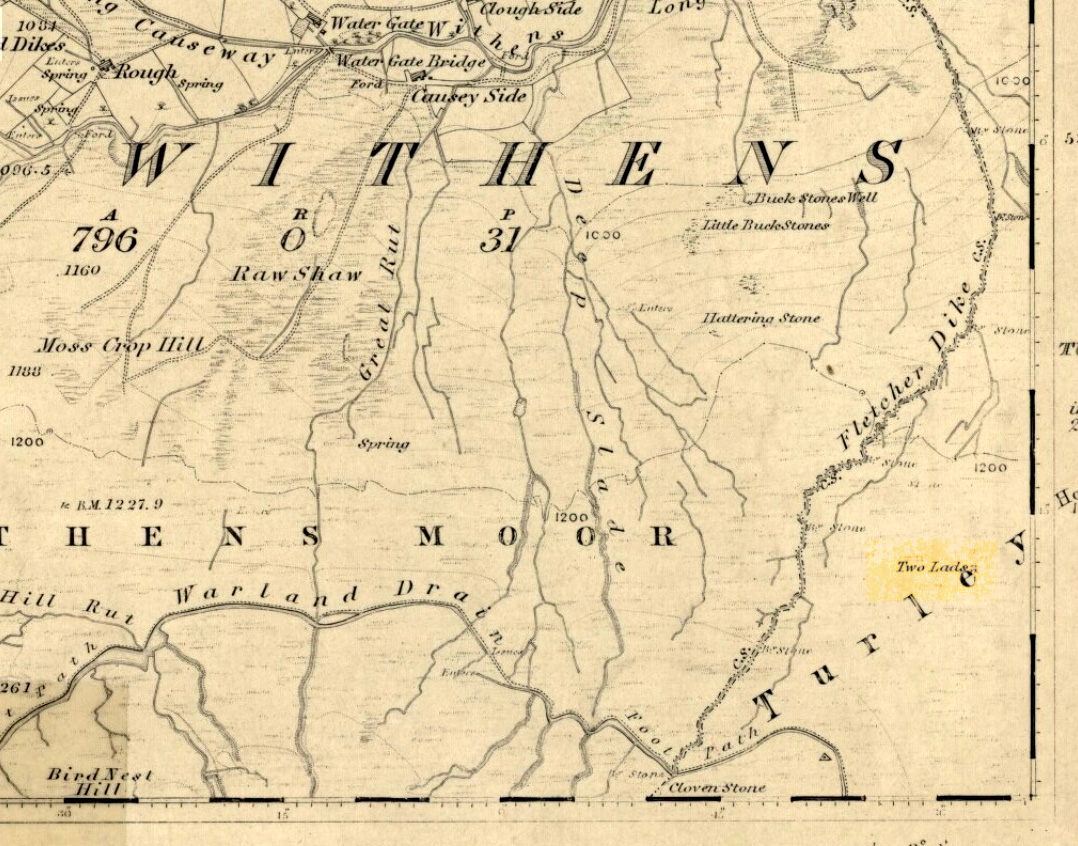
Best way here is, from Mytholmroyd go up the Cragg Vale road for a coupla miles, then turn right and heading down, then up, towards Withens Clough reservoir. Once there, walk onto the moor to your left (south) until you’re on the ridge above you. Keep walking until y’ see the rocky cairn-like creatures stood in isolation on a flat moorland plain.
Archaeology & History
Two Lads – on a dark, rainy, windy day
Truly weird spot this one, but I love it! Seemingly miles from anywhere, it’s one helluva walk to most folk, but utterly worthwhile when your arrive. On a clear day you can see for miles and the landscape is adorable! On a cloudy rainy day, the feel of the place changes if you take care to stay with the site, saturated, meditating (as no other people ever turn up when She’s like that – so you and the place get the best from each other!).
The site comprises of two boulders, each crowned with a cairn of stones. The westernmost one of the two (SD 98392 22111) is intriguing as it has, carved upon the rock beneath the stone cairn on the northwestern edge of the stone, what looks like a singular cup-marking, plus a large water-worn bowl on its northern edge, and a very distinct deeply-cut cross-base, several inches deep, near the northeastern corner of the rock. This cross-base seems slightly more rectangular in form than square; although the large covering of stones makes an accurate ascription difficult. If this cross-base and cup-markings are authentic, we would have here a clear example of the christianization of a previously heathen site.
A cursory examination of the easternmost of the Two Lads (SD 98397 22117) doesn’t indicate any artificial workings on the rock surface.
Two Lads on 1853 OS-map
Although the two ‘cairns’ on top of these two rocks are not prehistoric in nature, about 20 yards behind the Two Lads (south) may once have been the severely denuded remains of a once large prehistoric cairn. Although the position in the landscape is perfect for such a construction, this is somewhat tentative, it’s gotta be said! Further examinations are obviously necessary here.
The studious A.H. Smith (1961-63) believes that a field-name record from 1624, describing some ‘Lad Stones’ in the parish of Heptonstall relates to this site. We know with certainty however, that this site was first illustrated on Greenwood’s 1771 map of Yorkshire, then highlighted on more recent 19th century Ordnance Survey maps as ‘cairns.’
Folklore
Drawing of the Lads in 1877
The creation myth behind this place is that two lads were walking over the moor in midwinter and got caught in a blizzard. Losing all sense of visibility they tried to shelter from the wind and snow by hiding behind these rocks, but perished. Sometime later their bodies were found and the curious “cairn” of rocks were mounted onto the boulders to mark where they’d died. This is a folktale we find at many other old stone remains on the hilltops of northern England and Scotland.
The Two Lads seems to be very close to a midwinter alignment (or izzit a lunar standstill line?), linking it with the huge Rudstoop Standing Stone and, eventually, Robin Hood’s Penny Stone on Midgley Moor – which might be the root of the folktale. (i.e. midwinter, snow, death) Any archaeoastronomy buffs out there wanna check this one out? Then we can confirm or dismiss it.
References:
Anonymous, “The ‘Two Lads’, Withens Moor,” in Todmorden & Hebden Bridge Historical Almanack, T. Dawson: Todmorden 1877.
Bennett, Paul, The Old Stones of Elmet, Capall Bann: Milverton 2001.
Smith, A.H., The Place-Names of the West Riding of Yorkshire, Cambridge University Press 1961-63.


")