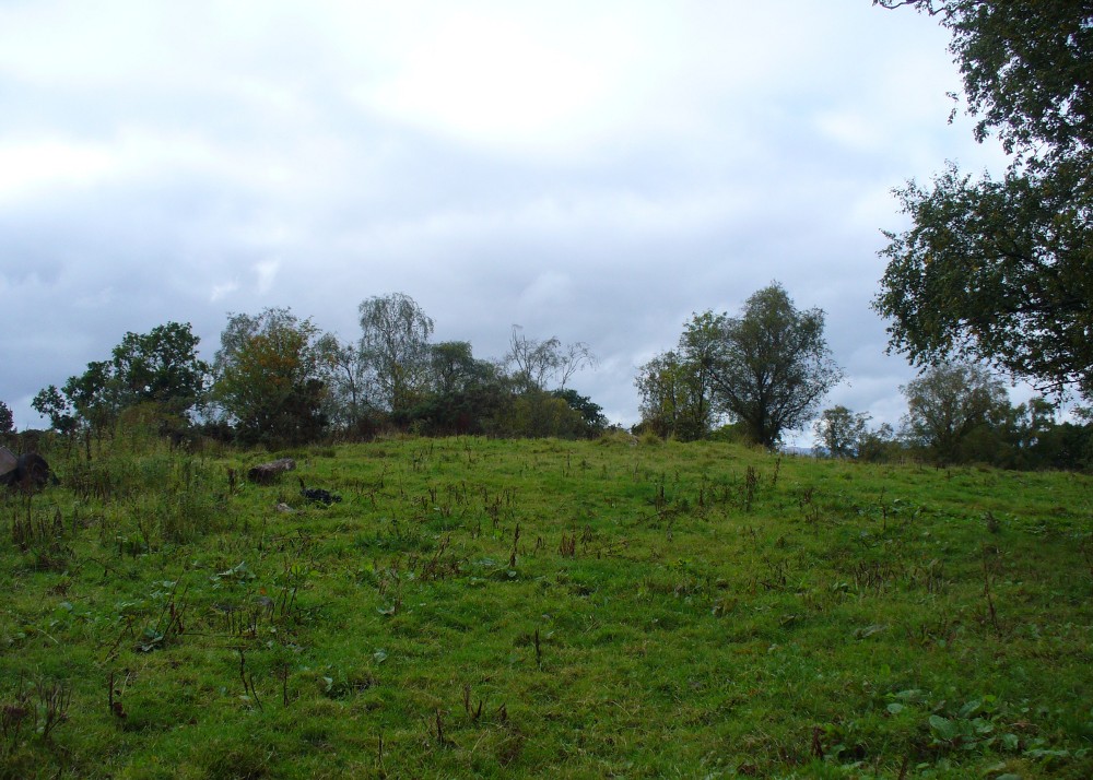
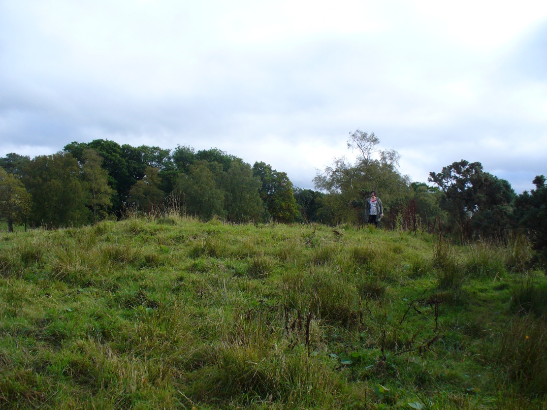
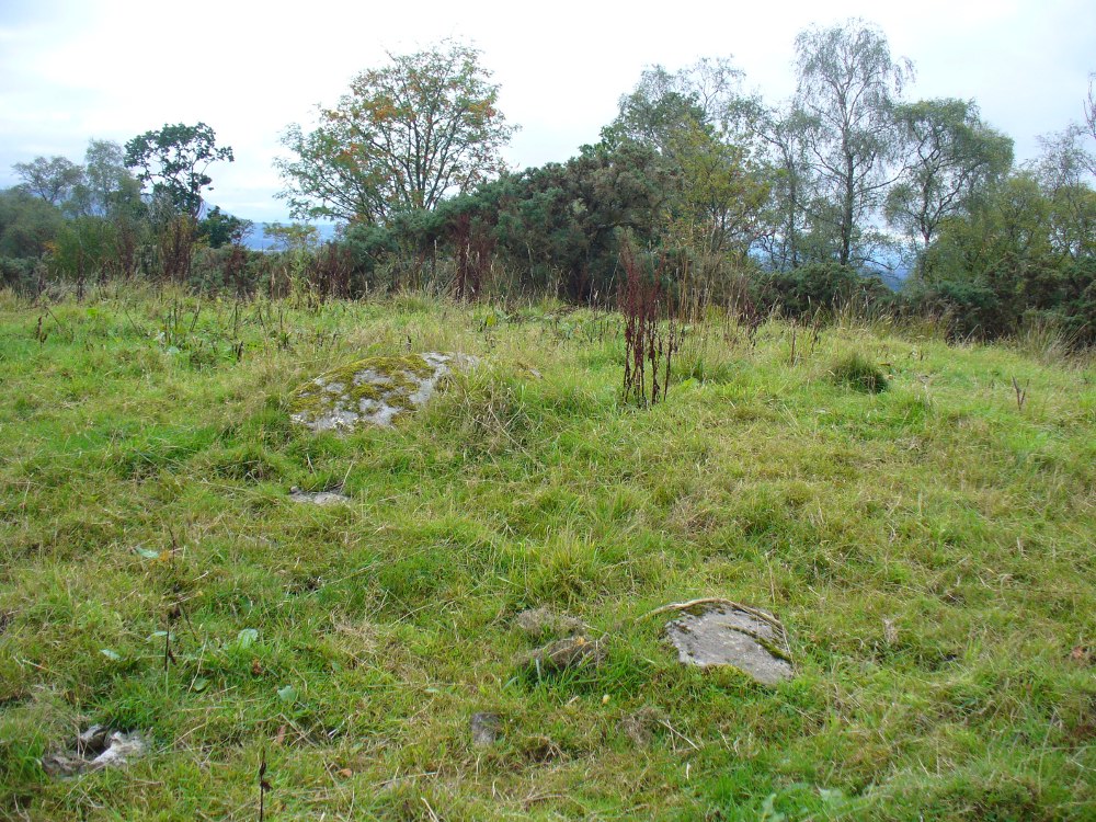
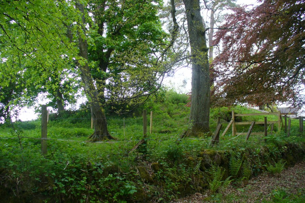
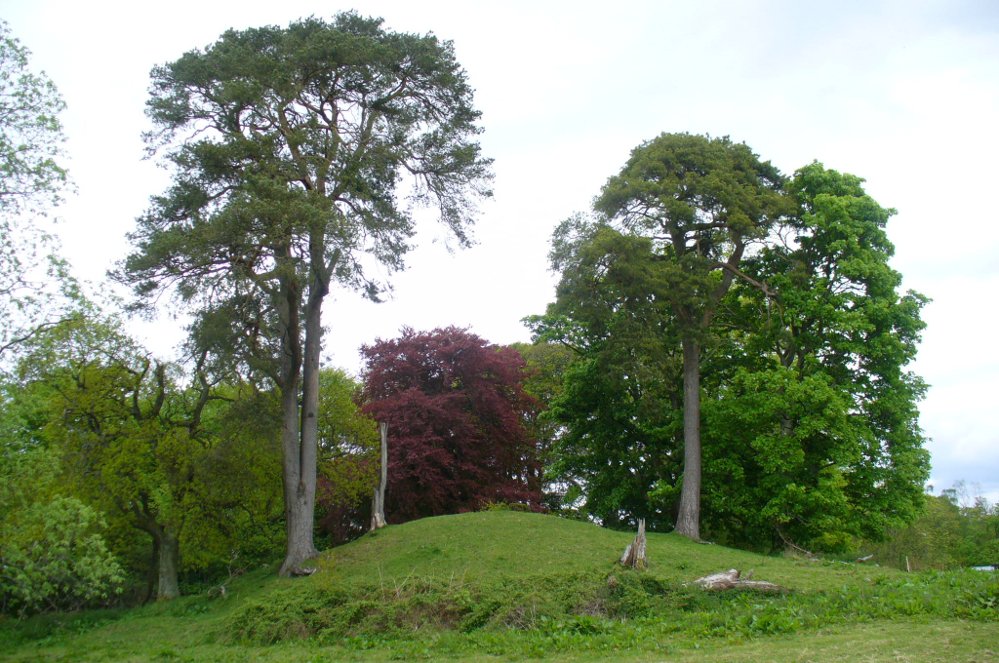
Head out of Doune village and take the A84 to Stirling. Just a few hundred yards along, over the old river bridge, take the first right along the B8032 (don’t head into Deanston). Barely 500 yards along on the left-hand side, between the farmhouse and a small group of houses, note the large tree-lined mound in the middle, just over the fence. It’s quite a big fella – you can’t really miss it.
Archaeology & History
The mound and its trees
This is an almost archetypal fairy mound of a monument—and a mighty one at that!—living quietly in the field with its olde trees for company. Despite its size, it has brought little by way of archaeological attention and has, to my knowledge, never been excavated. Probably a Bronze Age burial mound, the tomb stands more than 15 feet high and is some 30 yards across east-west and 35 yards north-south. The Royal Commission (1979) listing of the mound says simply that “this large cairn measures 34m in diameter and up to 5m high.”
References:
Royal Commission on the Ancient & Historical Monuments of Scotland, Archaeological Sites and Monuments of Stirling District, Central Region, Society of Antiquaries of Scotland 1979.
The best way to get here (when we went anyway, quite a few years back now), was via the old church . At the entrance to the church there was a signpost to the tumuli. Take the footpath to the left of the building and walk about 200 yards. Once you go under the railway bridge and into the trees, walk left and the overgrown mounds appear in front of you!
Archaeology & History
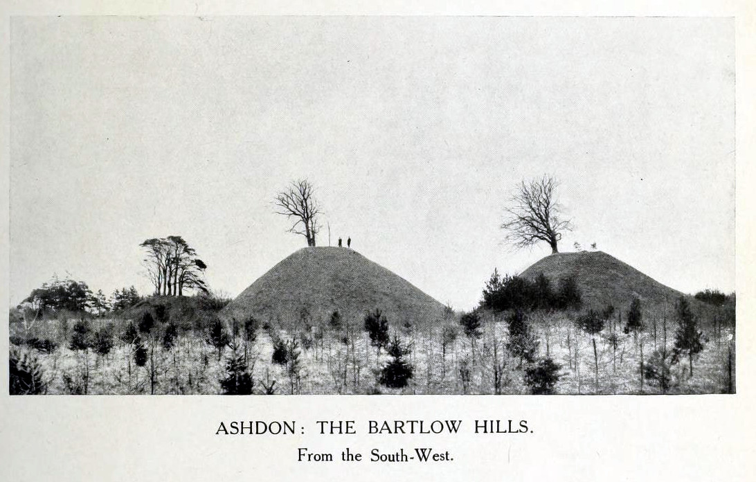
Thought to the largest Romano-British barrows in England, this was an incredible clump of giant burial mounds which, in more recent years, have been allowed to fall into neglect. Although a railway was built through this clump, it bypassed the main tumuli—and in doing so uncovered another cemetery! Four large barrows still remain and access, though alleged by some of those southern-types to be on private land, didn’t stop our foray here. The usual “private” signs showing just how unwelcoming some of them are, just made us Northerners more determined to find ’em! But that aside…
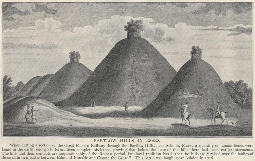
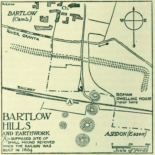
18th century drawing of the hills1916 map & plan
Although nowadays classed as being in Cambridgeshire, when the Royal Commission lads visited the site and described it in their Inventory (1916), the mounds were in the parish of Ashdon on the northern edge of Essex. But now it comes under the parish of Bartlow in Cambridgeshire—which seem sensible, as the word ‘bartlow’ itself stems from these very monuments. As the regional place-name expert P.H. Reaney (1943) told, Bartlow means,
“‘(At) the mounds of the birch trees,’ OE (æt) beorca-hlãwum, (from the verb) beorc, hlaw, i.e., the great Bartlow Hills tumuli which dominate the church and village.”
Described as early as 1232 CE as Berkelawe, these hills were opened in the middle of the 19th century and found to possess a mass of Roman remains. A number of articles in the journals of the period gave extensive descriptions of what was uncovered, but they are summed up nicely in the Essex Royal Commission (1916) report, which told:
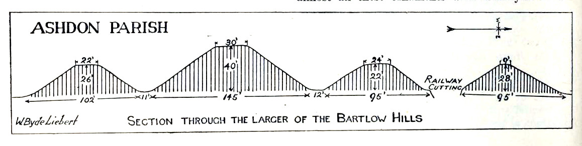
“The principal monuments are the Bartlow Hills, which lie…at the extreme N.E. of the parish. They form (or formed) two parallel rows, running nearly N. and S. The eastern row consists of four large steep-sided mounds, in shape truncated cones, the largest 40 ft. high and 145 ft. in diameter; since 1760 three of the mounds have been planted with trees. The western row is now less clear: originally, it consisted of at least three small mounds, as was proved by digging in 1832; only two can now be faintly traced. Excavations, chiefly in 1832-40, have shown that all seven mounds contained at the centre regularly walled graves, within which was very costly grave-furniture of glass, decorated bronze, and enamel; almost all these ornaments were destroyed in a fire at Easton Lodge in 1847. The graves seem to belong to the end of the first and beginning of the second century and were doubtless built for Romanized British nobles of the district. The particular method of burial occurs especially in eastern England and in Belgium, and is native, not Roman, by origin.
“…Other burials have been noticed near the Hills — one with a flint axe and knife, presumably prehistoric. A small dwelling-house was found in 1852 about 100 yards E. of the Hills — mainly, if not wholly, within the Cambridgeshire border — but nothing of it is now visible on the surface.”
Section & sizes of the tumuli, 1916
The sites are very impressive indeed, though as we can see from the old images, when they were clear of trees they stood out much clearer.
Folklore
Old fairs used to be held at the Bartlow Hills, whose origin goes way back. There is also a curious custom which probably originated in some way from traditional beating of the bounds of the local township boundaries, narrated by folklorist Enid Porter. (1969) Throughout the region she reported how “skipping was performed on Good Friday”. It commenced at 10am and would continue into the evening. Porter wrote:
“An eighty year old woman of Linton recalled in the 1930s that in her youth the villagers of Linton and Hadstock used to skip on Good Friday to Bartlow Hills to join in the fun of the fair held there.”
An early legend uncovered from archives by Leslie Grinsell told that here could be found a “treasure chest said to have been concealed by Oliver Cromwell in the barrows known as the Three Hills, or in pits near them.”
…to be continued…
References:
Porter, Enid, Cambridgeshire Customs and Folklore, RKP: London 1969.
Reaney, P.H., The Place-Names of Cambridgeshire and the Isle of Ely, Cambridge University Press 1943.
Royal Commission on Historical Monuments, England, An Inventory into the Historical Monuments in Essex – volume 1, HMSO: London 1916.
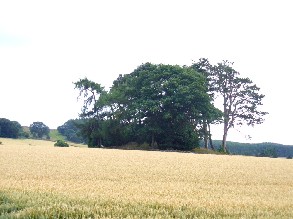
From the large village of Newtyle, take the straight road west as if heading to Kettins. About half-a-mile along, 100 yards or so past the turn-off to Kinpurnie Castle on your left – stop! In the second field after the turn-off, halfway up the slope you’ll see a large circular rise in the land with a crown of large trees sitting thereon. That’s the cairn!
Archaeology & History
Not far from the impressive Keillor standing stone is this huge prehistoric tomb. Measuring about 90 feet across and more than 7 feet high in places, the mass of rocks making up the site is now crowned by a healthy ring of trees. Near the middle of it you can see a collapsed tomb or cist, but there may be more than one inside this giant fella. Its size implies that it was a tomb or burial centre for tribal elders, leaders or shamans. When we visited the site last week, the field was still in full crop, so we couldn’t take a close look at it and must return again at a later date. Apart from a brief note of the site in the Royal Commission (1983) archaeology listing for the county, no details have been made of this huge cairn—which is incredible in itself!
References:
Royal Commission on the Ancient and Historical Monuments of Scotland, The Archaeological Sites & Monuments of Central Angus, Angus District, Tayside Region, HMSO: Edinburgh 1983.
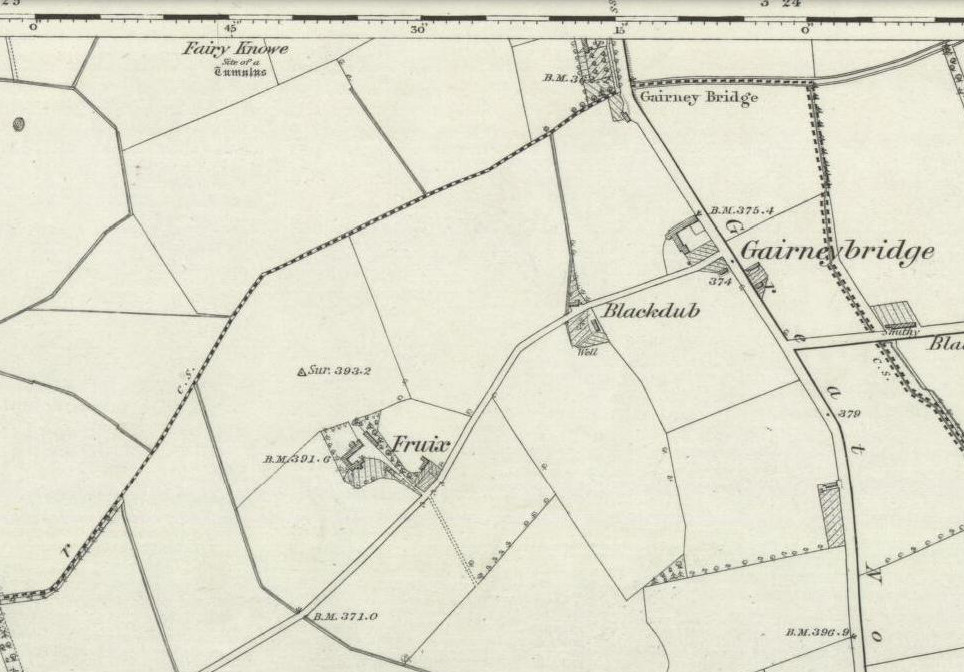
This is one of two sites in the county of Kinross-shire that were known as the ‘Fairy Knowe’, both of which have been destroyed through uncaring agriculture practices. Very little is known about it. The place was described in a lengthy footnote in the Old Statistical Account of Scotland (volume 6), which told us that,
Site shown on 1856 OS-map
“a tumulus or mound, composed mostly of earth, with some stones intermixed, on the east of Annofreuch, was opened a few years ago and a coffin found therein formed of rough flat stones, set on edge at the sides and ends, and a large one above; within which were some bones and many pieces of burnt wood interspersed. In the memory of some old people, it was called the Elf-hillock, but is now known by the name of the Fairyknow.”
The site was listed in the Royal Commission (1933) archaeological county survey, but with no further details.
Folklore
Although the site was a resort of the little people, or faerie-folk, we have no extant tales telling us anything more.
References:
Royal Commission on the Ancient & Historical Monuments, Scotland, Inventory of Monuments and Constructions in the Counties of Fife, Kinross and Clackmannan, HMSO: Edinburgh 1933.
Get to Pubil at the top of Glen Lyon, then walk on the track on the north side of Loch Lyon. Several miles along you turn up Glen Meurain. When you reach the crossing of the stream, follow the waters up Allt Meurain for about 3-400 yards until you find a small flat section of marshland right by the streamside. You’ll notice rocky undulations of human remains here, and a distinct small cairn of rocks near the top of this section. Have a good rest here (and I’d advise avoiding the place in the summer months).
Archaeology & History
Remote indeed is this small cairn—less than 3 feet high and 4 feet across—sitting by the burn-side in a place many miles from any human habitation. It is found amidst a small cluster of other archaeological remains close to each other, as if indicating a settlement of sorts, abandoned probably around the time of the Highland Clearances. Although it is highlighted on modern OS-maps in antiquated lettering, the cairn here looks like it is only a few centuries old. A larger mass of rubble stone is found adjacent to the small pile of rocks, from which it may originally have been taken. Without archaeological analysis we will not know for certain the real age of this old tomb.
MacRee’s Cairn & adjacent rubble
Folklore
The small grassy hillside immediately across the trout stream here is known as Sith Trom’aidh – the Sad Fairy mound, whose history appears to have been lost. Alexander Stewart (1928) told that this cairn was the burial place of one of Colin Campbell’s dairymaids, found and slain here during a skirmish with cattle raiders in the 16th century.
References:
Stewart, Alexander, A Highland Parish; or, The History of Fortingall, Alex MacLaren & Sons: Glasgow 1928.
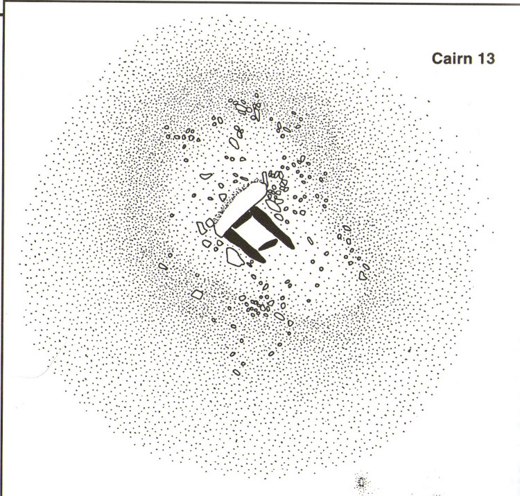
A very well-preserved prehistoric cist and cairn (grave), sat amidst a valuable prehistoric landscape full of megaliths and other important prehistoric remains. Megalith enthusiast and antiquarian, Nik Megalithic, told that:
“The cairn is about 12 m diameter and 1 metre high, and has a large Kist in the middle. The cist has side slabs about 2 metres long and spaced 1 metre apart, and it is about 0.7m deep. The large capstone is tipped off to the west, and can be seen protruding above the cairn from quite some distance away.”
Described in association with the rich mass of other tombs and megalithic stone rows here, author Jeremy Butler told that,
“Cairn 13 is also in line with (cairns) 1-4, but just out of sight around the hillside 150m to the northwest. The mound contains a well-preserved cist, “a very fine example”, according to Worth, who cleared it out about 1900 but with “no result from excavation.” The displaced cover and massive side-slabs project well beyond its ends.”
Both Butler and Worth mention how cairn 13 is part of an alignment with two other cairns very close by.
Folklore
Spike Milligan in his tomb
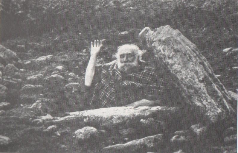
Although legends of giants and pixy folk are well known round here, there is nothing specific I can find to this one site. One of the most important finds in recent years—as the photo above shows quite clearly—was the fact that before joining The Goons, the British comedian Spike Milligan used to live in this prehistoric tomb. When asked why he didn’t live in a house like other normal people, he invited us in for a cup of tea. Some historians believe that the person in the photo is in fact Mr R.H. Worth—author of Worth’s Dartmoor—but Mr Milligan insisted that Worth was an imposter!
Nothing seems to known of the whereabouts of an old prehistoric cairn, positioned on one of the hills in Aberdour parish. It was described in the Old Statistical Account of the region around 1791, and may have been on the place known as White Law on the northern edge of the town, now built over. The account told:
“Not far from the village of Aberdour, on a flat on the top of a hill, there is one of those cairns or tumuli so frequently met with in Scotland. The farmer on whose farm it is situated, when carrying away stones some years ago, discovered a stone coffin in which were found the skeleton of a man, the head of a spear made of copper, with the copper nails by which it had been fixed to the shaft, and a piece of clear substance, like amber, supposed to have been an amulet. The coffin, with a great part of the cairn still remain. The tumulus has been conical, the coffin being exactly in the centre of the base, from which to the circumference, it measures 20 paces. The height cannot now be ascertained. There have been found in the same cairn several earthen vessels containing human bones. The vessels were flat, narrower at the bottom than top, and without any covering. The farmer digging in the same field, in another place, found such a quantity of human bones that he was obliged to desist.”
The finding of ‘copper’ spearheads in the tomb indicates either a Bronze Age or Iron Age period. The brilliant Audrey Henshall (1965) thought the metal remains were more probably bronze. An exploration of the field-names of the area might prove useful in helping to locate the whereabouts of this cairn.
References:
Henshall, A.S. & Wallace, J.C., “A Bronze Age cist burial at Masterton, Pitreavie, Fife”, in Proceedings of the Society Antiquaries, Scotland, volume 96, 1965.
Royal Commission on the Ancient & Historical Monuments of Scotland, Inventory of Monuments and Constructions in the Counties of Fife, Kinross, and Clackmannan, HMSO: Edinburgh 1933.
A number of very large prehistoric burial mounds, or tumuli, were destroyed in this part of Dorset in the 19th century, including “three on the Came estate, near Dorchester, the property of the Hon Col. Damer.” This one—listed as a “bowl barrow” and known today as the Winterborne Came 18b tumulus in Grinsell’s (1959:148) brilliant survey—was found to house examples of petroglyphs, which are very rare in this part of Britain. Thankfully before its destruction, the local antiquarian Charles Warne (1848) was present and has left us with a good description of its structure and contents. After first telling of the demise of two other large tumuli close by, the biggest of them drew his attention:
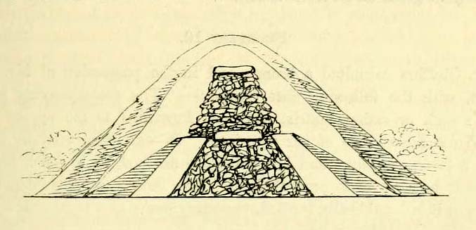
“The last of these mighty mounds (and well do they merit the appellation from their vastness), measured rather more than ninety feet in diameter, and sixteen feet in height; this from the peculiarity of its contents was the most interesting of the three. The annexed rough sketch (above), shewing a central section of the tumulus, may serve to give some idea of the singularity of its composition. About the centre, at a depth of some three feet from the surface, was found lying flat a rough unhewn stone, with a series of concentric circles incised; this, on being removed, was seen to have covered a mass of flints from six to seven feet in thickness, which being also removed we came to another unhewn irregular stone, with similar circles inscribed, and as in the preceding case, covering another cairn of flints, in quantity about the same as beneath the first stone. It was in this lower mass that the deposits were found, consisting of all the fragments of an urn of coarse fabric, and apparently as if placed in its situation without either care or attention, no arrangement of the flints being made (as we have elsewhere seen) for its protection; the want of which observance had completed its destruction. Under the flints, lying at the base, were the remains of six skeletons, and some few bones of the ox. The skeletons had apparently been placed without order or regularity: with the exception of a few bits of charcoal with the urn, there was no evidence of cremation.”
Nearly twenty years later, Sir James Simpson (1867) also described the tumulus and its carved rocks in his 19th century magnum opus, repeating much of Warne’s earlier description, saying:
“In his antiquarian researches in this county (Dorset), Mr Warne opened , at Came Down on the Ridgeway, a tumulus of rather unusual form. At its base…were found the remains of six unburnt human skeletons…and some few bones of the ox. Above them, and in the centre of the tumulus, was built up a cairn or heap of flints around a coarse and broken urn, which contained calcined bones. This mass of flints was surrounded and covered by a horizontal rough slab. Above and upon this slab was built another large heap of flints, six or seven feet in thickness. This second heap was capped with another rough slab, lying two or three feet below the surface of the tumulus. Both these flat unhewn covering slabs had a group of concentric circles cut upon them.”
We don’t know for sure the exact whereabouts of the tumulus, nor the age of the tomb and its remains. But the size of it may indicate an early Bronze Age and perhaps even neolithic status. The finding of the rock art in the tomb is also an indicator that could push the date back into late neolithic period—but we may never know for sure…
References:
Grinsell, Leslie V., Dorset Barrows, Dorset Natural History & Archaeological Society 1959.
Royal Commission on Historical Monuments (England), An Inventory of Historical Monuments in the County of Dorset – Volume 2: South-East, HMSO: London 1970.
Simpson, James, Archaic Sculpturings of Cups, Circles, etc., Upon Stones and Rocks in Scotland, England and other Countries, Edmonston & Douglas: Edinburgh 1867.
Warne, Charles, “Removal of Three of the Large Tumuli on the Came Estate, near Dorchester,” in Journal of the British Archaeological Association, volume 3, 1848.
Warne, Charles, The Celtic tumuli of Dorset: An Account of Personal and other Researches in the Sepulchral Mounds of the Durotriges, J.R. Smith: London 1866.
This really take a lot of effort to find. From Alva, go up through the graveyard past St. Serf’s Well, turning left and across cross the lane. A gate into the field takes you past Rhodders Farm then up the zigzagging track up the steep hill called The Nebit and into the Ochils. Where the track stops zigzagging, keep your eyes peeled for a left turn (west) about 1000ft up. Go along this, parallel above Alva Glen, for about 2 miles till you reach the sheep fanks. Naathen – go straight uphill towards Bengengie peak, steering to the right (north) side, avoiding the cliffs and onto the level moorland. Once there, you’ll see a rounded hillock a coupla hundred yards ahead. That’s the spot!
Archaeology & History
Southeastern corner of the ditch & bank
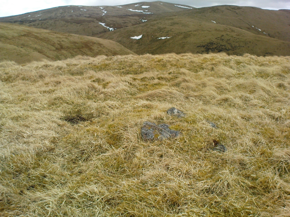
This is a bittova long hike to see a very overgrown site – but if you really enjoy the hills, it’s a good little side-track to visit. I came across it recently on a long bimble over the Ochils, on my way back home after travelling to three of the Ochil peaks. Walking carefully across the swampy heights of the Menstrie Moss, a rounded hillock north of Bengengie seemed to have the pimple of a cairn on its top—so I veered over to have a look.
The cairn was small and overgrown, with just a half-dozen rocks visible above ground, and a collection of others in the same pile beneath the heathland grasses. It was obviously a man-made assemblage, but I couldn’t say for sure whether this was the grave of a person or someone’s favourite sheep a few centuries back!
Small cairn inside the enclosure
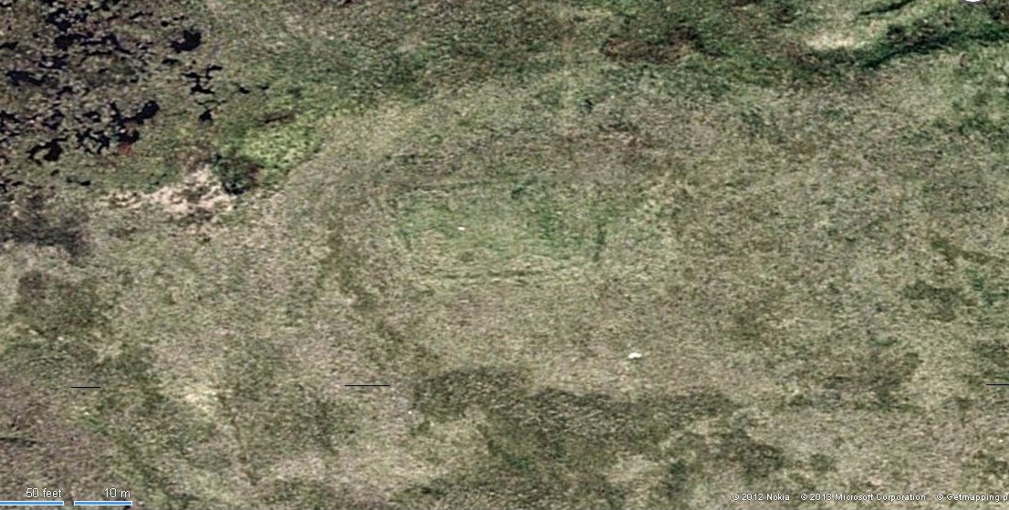
It was when I walked around the cairn to try and get some photos of it, that another very distinct feature—not immediately visible—stood out and gave this single cairn a series of additional ingredients that really brought this site to life! For just a few yards east of the cairn I noticed an obvious ditch and outer embankment, running roughly north-south, which may have relevance to the pile of stones. And so I walked along the edge of the embankment, for about 10 yards, only to find that it turned to the right and continued onwards, east-west, for some distance. This then turned at a similar angle again about 30-35 yards along, and then again, and again, until I returned to where I had stood initially a few minutes earlier!
There was no doubt about it: this was a man-made, roughly rectangular-shaped enclosure, whose bank and ditch averaged 1-2 yards across. The maximum height of the outer embankment is less than 3 feet. Its eastern and western lengths measured roughly 17-18 yards long, and the longer lengths north and south were between 30 and 35 yards at the most. The cairn feature that I’d initially noticed is found at the near-eastern edge of the enclosure. Apart from that, my initial ramble here indicated few other internal features that were visible, except several small stones.
Southern line of bank & ditch, running left to rightEastern section of ditch & bank, looking north
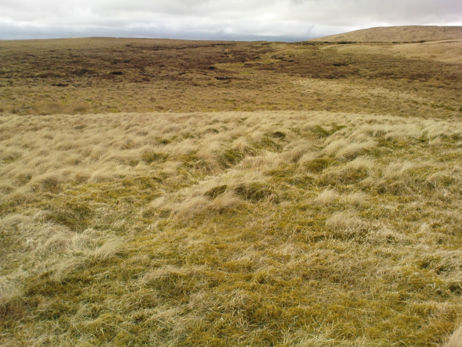
The great majority of the site is very overgrown and, as you can see, the photos of the ditch and bank constituting the enclosure are sadly not that easy to make out. You can see it mostly by the colour changes of the vegetation, running in lines either across or up through the middle of the photos. I need to get up there again and try get some better images sometime soon—and also to see if there are other features hiding away on the heights of these old hills, long since said to have been the abode of one of the great Pictish tribes (there is also a considerable mass of old faerie-lore in these hills, indicating considerable ancient activity of people whose cosmos was inhabited by spirits and forms long since forgotten in the consensus trance of most moderns).
As for the age of the enclosure: it’s difficult to say on first impression and I’m not keen on making a guess on this one. It’s certainly old, as the overgrown vegetation clearly shows, both on the photos and when you see it first-hand. It’s already been suggested by one graduate as possibly neolithic, but I’m a little sceptical about that, as its linearity isn’t consistent with neolithic features we know about in the mid-Pennines. However, this geographical arena is new landscape for me and so the possibility remains open until better, more competent investigation gives us a clearer time period.
Landscape of Giants Knowe (photo by Marion Woolley)
Amidst the colourful and nurturing landscape close to the gigantic Dunruchan standing stones and just along the road from the solitary Craigneich stone, in the field across the road above Straid farmhouse could once be seen a fascinating-sounding prehistoric site that has sadly been destroyed. Some of the remains of this old monument can be found in the field-clearance of stones just over the fence, above the top of the field (many fields round here have scatterings of large stone clearings at the field edges), but we have no detailed accounts of the site. It was mentioned in early notes by the Ordnance Survey to have been,
“A large circular heap of small stone and gravel entirely removed in 1831. An urn filled with ashes and several stone coffins were found under it.”
The local historian John Shearer (1883) later told us that,
“A small mound of earth on the farm of Strayd, called Crock-nafion or the Giant’s Knowe, or the Fingalian’s Knowe, was cleared away several years ago. An urn containing burnt bones was discovered.”
Any additional information about this site and its folklore, would be greatly appreciated.
Folklore
To the west along Glen Artney whence our view takes us from here, old legend told that the valley was once the abode of a great giant who lived in a cave in one of the mountains thereby. In mythic lore, giants were the creation deities of hills, mountains and other geological forms, whose narratives were overturned and demonized by the incoming christian cult many centuries ago. It is likely that this once great tomb was deemed as the burial-place of our local giant – which would make this prehistoric site neolithic in age. But — logical though it is — this idea is pure speculation…
References:
Hunter, John, Chronicles of Strathearn, David Philips: Crieff 1896.
Shearer, John, Antiquities of Strathearn, David Philips: Crieff, 1883.