Healing Well (destroyed): OS Grid Reference – NS 5805 6728
Archaeology & History
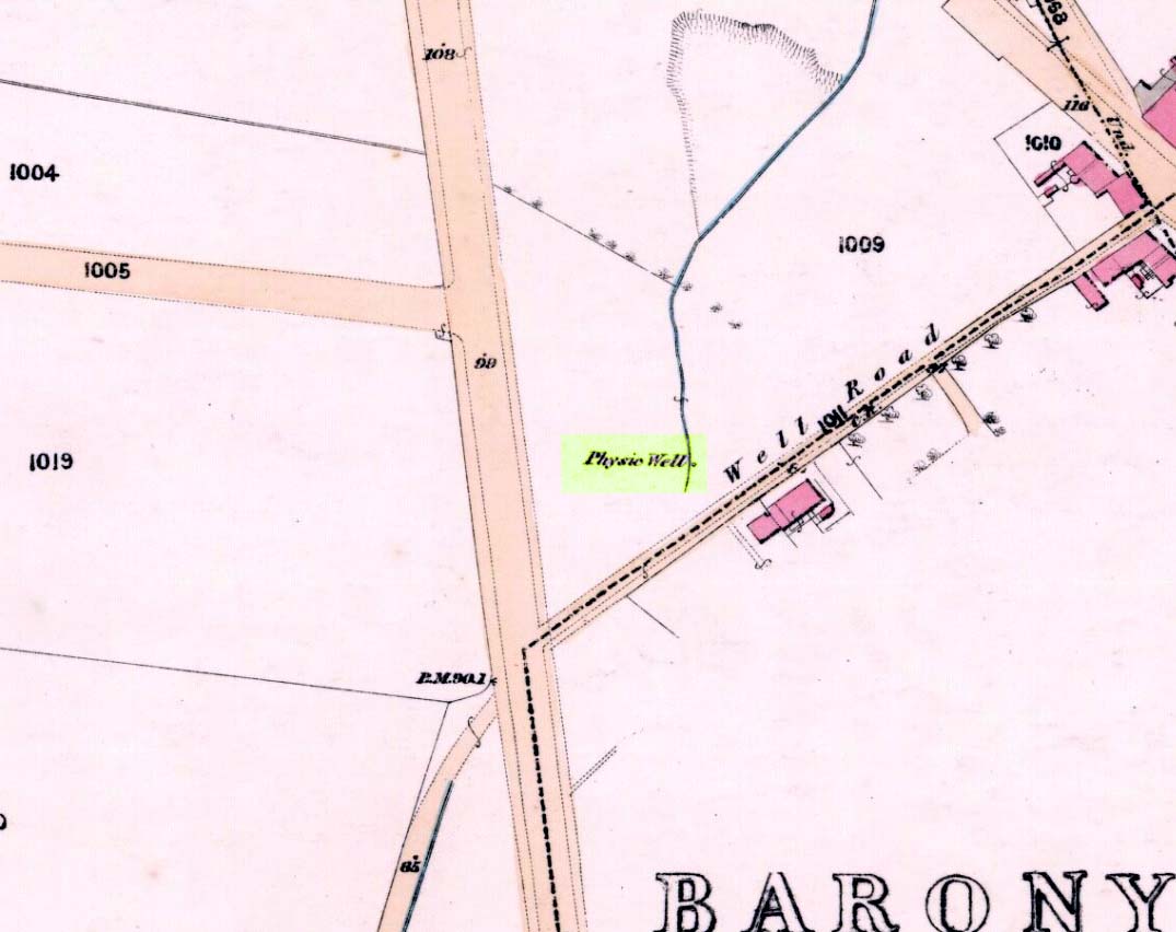
Physic Well on 1865 map
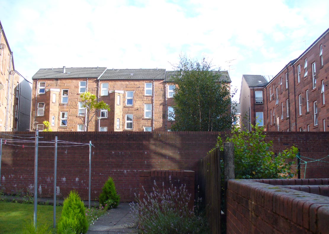
Any site named as a ‘Physic Well’ anywhere in Britain is, by definition, a spring of water renowned for its medicinal properties. Nowadays however, at this and other sites with the same name, local people aren’t even aware that such places exist. A sad state of affairs indeed… This Physic Well was once found just off Trossach Street in Maryhill—which was once called ‘Well Street’, after the medicinal spring itself—in fields just above the road. Today a small housing estate has been built on top of the site and the only sign of it ever being here appears to be marked by a birch tree in the gardens at the middle of the enclosing buildings.
Birch tree marks the spot!
The site was listed in several early 19th century municipal surveys of Glasgow, but the greater references to it seem to be from local people who described it as a place that was visited annually along the perambulation of the old Barony parish, despite it being just over the edge and into Maryhill. In an extensive footnote in Renwick’s Glasgow Memorials he gives us a fascinating insight into the gatherings at the Well, and the popular customs and social activities of the period:
“William Graham, of Lambhill, aged 69, recollected in his school days, “drinking at a well a very little to the north of the Barony glebe, which was called the Physic Well, and there was then a Royalty stone a little to the west of the glebe.” The Physic Well, perhaps all that effective drainage had left of the former loch, otherwise called ‘Plommaris Hole,’ was utilised at the periodic perambulation of marches for impressing on the memory recollection of this part of the boundary. The means taken for this end may be gathered from the evidence of John Alston, weaver, aged 54, who says that, when he was an apprentice, his master told him that it was a custom, “when the magistrates rode the marches to duck some of the last-made burgesses in the Physic Well”; and, on the same topic, James Bryce, victualler, aged 70, depones that, forty years ago, it was commonly reported in the town that at the marches-riding it was the custom “to duck the youngest town-officer in a well called the Physic Well, which is now filled up, but which was near the Barony glebe.” Janet Paterson, widow of William Paterson, labourer, aged 78, recollects of another well, called the Loanhead Well, in the Barony Glebe, from which she carried water when a young girl. ”About 57 yean ago she saw two ploughs going in the Barony Glebe on the Fast Day of the town Sacrament. In general people wrought the Physic Well Park on the town’s Fast Day, but she never saw them working on the Barony Glebe except on the occasion mentioned.” William M’Culloch, farmer, Lightbum, aged 57, says that when Mr. Hill was minister of the Barony parish, the deponent’s father was employed by him, for a good many years, to plough the Barony Glebe, and on one occasion he recollects the glebe being sown and harrowed upon a Fast Day preceding the town Sacrament. Mr. Hill told his father that the glebe was not within the town’s bounds, that the sowing and harrowing it on the Fast Day could disturb nobody, and that his father could have the sowing finished in time to go to church. Peter Ferguson, weaver, aged 5$, had resided in the neighbourhood of the Barony Glebe from his infancy. When he was a boy he heard it very frequently mentioned by old people, as a common report, that when delinquents or debtors, prosecuted before the town courts of Glasgow, were pursued by the town officers, for the purpose of being apprehended, they were in the practice of endeavouring to get across the Howgate Strand; and if they accomplished this they set the officer at defiance and pointed their fingers at them in derision, as being then without the city’s jurisdiction. Howgate Strand was a small run of water which crossed Castle Street, at the south end of the glebe, then passed through the infirmary grounds and joined the Molendinar Burn a little to the north of the High Church. Another witness, Thomas Alston, manucturer, aged 55, places the fugitives’ point of escape at the north end of the glebe. In his young days it was the practice for the town officers to apprehend boys who were playing on the streets upon the Sabbath and the Fast Days preceding town Sacraments; and he remembered well that it was a common opinion with him and his companions that they were safe from the town officers when they got beyond the Physic Well, on the Glasgowfield road, or beyond the spot marked on Mr. Fleming’s plan ‘Toll-house’, on the Kirkintilloch road, as they considered themselves to be then without the town’s jurisdiction.”
The Well was close to a series of old boundary or ‘merche’ stones, but no ancient ones seem to remain.
The medicinal potential for the water was examined in 1771 by a Dr William Irvine, who found it to be a chalybeate or iron-bearing spring, and to possess “a little muriatic acid”, giving the well both tonic and fortifying properties.
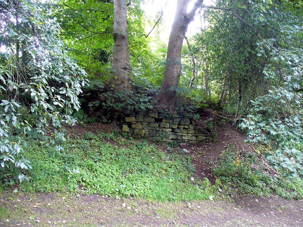
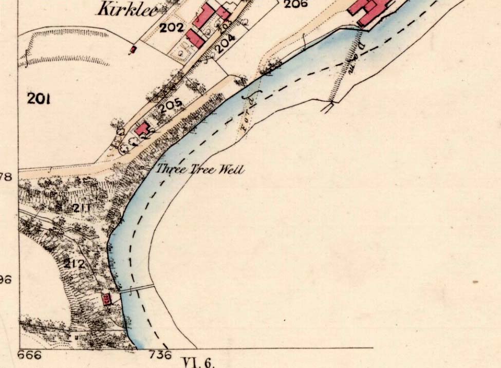
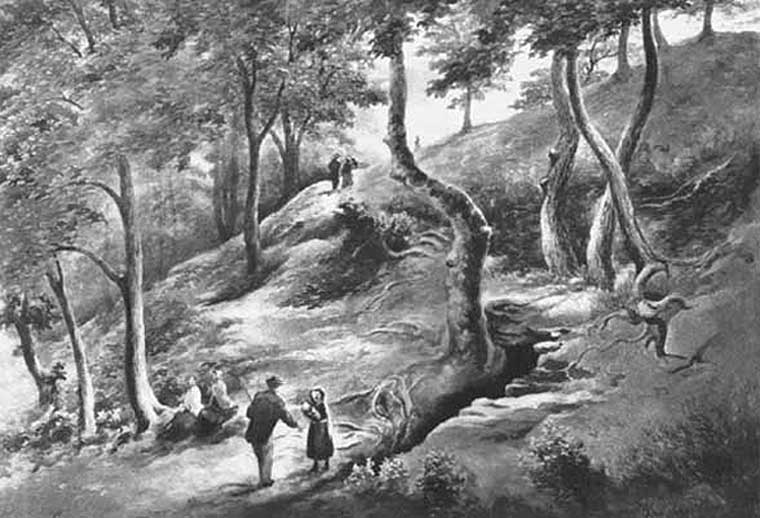
The demise of this old healing spring of water occurred a few generations ago by the look of things. Marked on the earliest Ordnance Survey maps—erroneously as the ‘Three Tree Well’, as Mr McDonald (1860) will soon explain—it was located on the west side of the River Kelvin, halfway between the Kirklee footbridge and the ancient ford, but the only remains we can see of it now appears to be the brick-walling above which a pair of sycamoretrees rise, or perhaps beneath the man-hole cover on the path lower down.
Three Tree Well on 1865 map
…But it wasn’t always this way… Known to be a chalybeate, or iron-bearing spring (which are always regarded as tonics in local lore, fortifying the blood general health), when the local writer Hugh McDonald (1860) wrote about it in his wonderful Rambles round Glasgow in the middle of the 19th century, he cast a picture of the area that few Glaswegians would recognise today—and a damn good swipe at the incomers trying to alter the names of traditional places:
“At the western extremity of the Botanic Gardens a narrow passage, in popular parlance called “the Kyber Pass,” leads over a green knoll to the volley of the Kelvin at the famous “Pear-tree Well.” …The scenery of the Kelvin in the vicinity of the Pear-tree Well is of the most romantic and beautiful description. The banks are bold, and in many places fringed with masses of foliage to the water-lip; while the rustic bridge, the lonely cottage, and the picturesque mill, seem planted by the very hand of taste, along the meanderings of the rippled and murmuring stream, wherever they are likely to produce a telling effect… Altogether the scene and its accessories present the very choicest of those harmonious combinations of colour and form which the landscape limner loves to gaze upon, and fondly endeavours, in the pride of his skill, to transfer to the living canvas. No wonder it is that Kelvin Grove has long been the favourite haunt of our City lovers, and the favourite theme of our local poets; for Nature has, indeed, strewn its recesses with charms as fresh and beautiful as though it were situated far from the dwellings of men, instead of almost under the wing of our most dinsome and dusky of towns.
“The Pear-tree Well issues from the bottom of a steep and thickly-wooded bank, which, at this point, rises gracefully from the rocky bed of the streamlet. The crystalline and deliciously cool water is collected into a considerable cavity in the earth; immediately over which three large trees—a plane and two handsome ashes—raise on high their umbrageous heads, while their sturdy roots, in serpent-like convolutions, twine around the watery hollow beneath, as if to defend it from the intrusion of the penetrating noonday sun. Some suppose that it is from this trio of sylvan guardians that the fountain has received its name — and that the ‘Three-tree’ and not the ‘Pear-tree’ Well is its proper denomination. The advocates of the latter theory further remark, that there is no pear-tree in the vicinity, and that consequently the popular name is probably but a corruption of “Three-tree.” There is high authority for saying that names are things of slight consequence; but however that may be, we are inclined, in the present instance, to be conservative of the old name for this favourite well, and to retain it in spite of all attempts at innovation. Whether from langsyne associations or not, we shall not attempt to discover, but Pear-tree Well sounds most musically on our ear — and we should be loath to have it suppressed by the word-coinage of any crotchety theorist; and besides, who can tell what kind of trees may have formerly graced the locality? A perfect orchard of the pear tribe may, at some past period, have clothed the banks of Kelvin for anything that these violators of a time-honoured name—”these men who are given to change”—know to the contrary. No, no! Pear-tree Well it has been, and Pear-tree Well to us, at least, it must remain. We had as lief meet an old friend with a new face, as an old haunt with a new name.
“Having done our devoirs to the spirit of the fountain, by draining a bicker of the translucent water, which, by the way, is slightly impregnated with iron, we sit ourselves down on the bank above, under the ashen tree, when one of two friends with whose company we have been honoured, inspired by the half-gelid beverage, bursts suddenly out with—
“Let us haste to Kelvin Grove, bonnie lassie, O.”
“We of course join heartily in the measure, which has for many years been highly popular in the west of Scotland, and which we naturally enjoy with double zest, amid the scenery to which it refers…”
Pear Tree Well in 1896
The great historian and romantic, J.A. Hammerton (1920) even passed here, telling how sufferers of disease relied upon its curing waters to heal them. It is just such a pity that this picturesque medicinal spring and its rivulet are with us no more…
References:
Brotchie, T.C.F., Glasgow Rivers and Streams: Their Legend and Lore, John Maclehose: Glasgow 1914.
This curiously-named and long lost well would almost have us believe that the Greek poet and philosopher himself was a-wandering in this neck of the woods. But that sadly wasn’t the case. It seems to have been mentioned just once in Looe’s early Town Books:
“In 1621 that part of West Looe Down which lieth on the West part of the Homer Well, was let to rent, for two crops, at 6s.8d. per acre”
In Courtney & Couch’s (1880) Cornish dialect work, the word homer is said to mean “homeward”; this is also echoed in Wright’s (1905) magnum opus. It seems to imply that it was a drinking well used by folk traveling the short distance from Looe village, across the river and onto or over West Looe Down towards their cottage or farmhouse; akin to a refreshing resting place halfway home, so to speak. Sometimes the word homeward can be taken to simply mean “at home,” in which case it would suggest that the Well was simply next to someone’s house. We may never know…
References:
Bond, Thomas, Topographical and Historical Sketches of the Boroughs of East and West Looe, J. Nichols: London 1823.
Courtney M.A. & Couch, T.Q., Glossary of Words of Use in Cornwall, English Dialect Society: London 1880.
Wright, Joseph, English Dialect Dictionary – volume 3, Henry Frowde: London 1905.
Follow the same directions as if you’re going to the Black Burn (2) carving (which you’ll obviously be looking at if you’re checking this one out!); and from there, walk two or three steps southwards down the slope – and you’re just about stood on it!
Archaeology & History
This, at first sight, seems little more than two cup-marks: one rather small, and the other somewhat larger than usual. I walked round it, crouched down and fondled it, poured water on it and heightened the carving… and noticed what seemed to be a carved arc around the western side of the large cup. But I couldn’t make my mind up whether this was natural or not. And then as laid down and looked across the stone, it seemed as if a very faint triangle completely enclosed the large cup! I crawled round it at ground level and the shape appeared and disappeared as the light altered. So I took a few more photos and wondered whether or not the shape would become obvious in them. And it did!
An eye in the triangle?Cup and faint triangle, or a trick of the mind?
It’s unusual – and I’m still not sure whether it’s natural or not. The carving needs more attention, in better daylight. Or perhaps the computer-tech kids might have a look at it and see if this really is an eye-in-the-triangle style design we’ve got here. It would be damn good! Anyhow, the carving was first mentioned by George Currie (2005), who told of it being two metres south of the Black Burn (2) cup-and-ring and, plainly, that it “has two cups: 60 x 15mm and 25 x 8mm.” It overlooks the urisk-haunted Urlar Burn, a creature known in some places for having milk and other offerings poured into cup-marks to appease it and gain good fortune.
References:
Currie, George, “Perthshire: Black Burn (Dull Parish) – Cup and Ring Marked Rocks”, in Discovery & Excavation Scotland, volume 6 (new series), 2005.
Take the A826 Crieff Road uphill for 275 yards then turn right up the Urlar Road. It’s a long uphill walk from here, up the private road, through and past Urlar Farm and along the track, making sure to go right where the track splits, keeping to the west-side of the burn. (don’t cross over it!) From here, the fields open up ahead of you into the distant hills. Keep along the track until, after a few hundred yards a small copse of trees is on your right. Walk past the bottom of this and then walk immediately up to the top of the large rounded knoll, or Tom, on your right. Once at the top, look for the triangular stone on its southwestern edge.
Archaeology & History
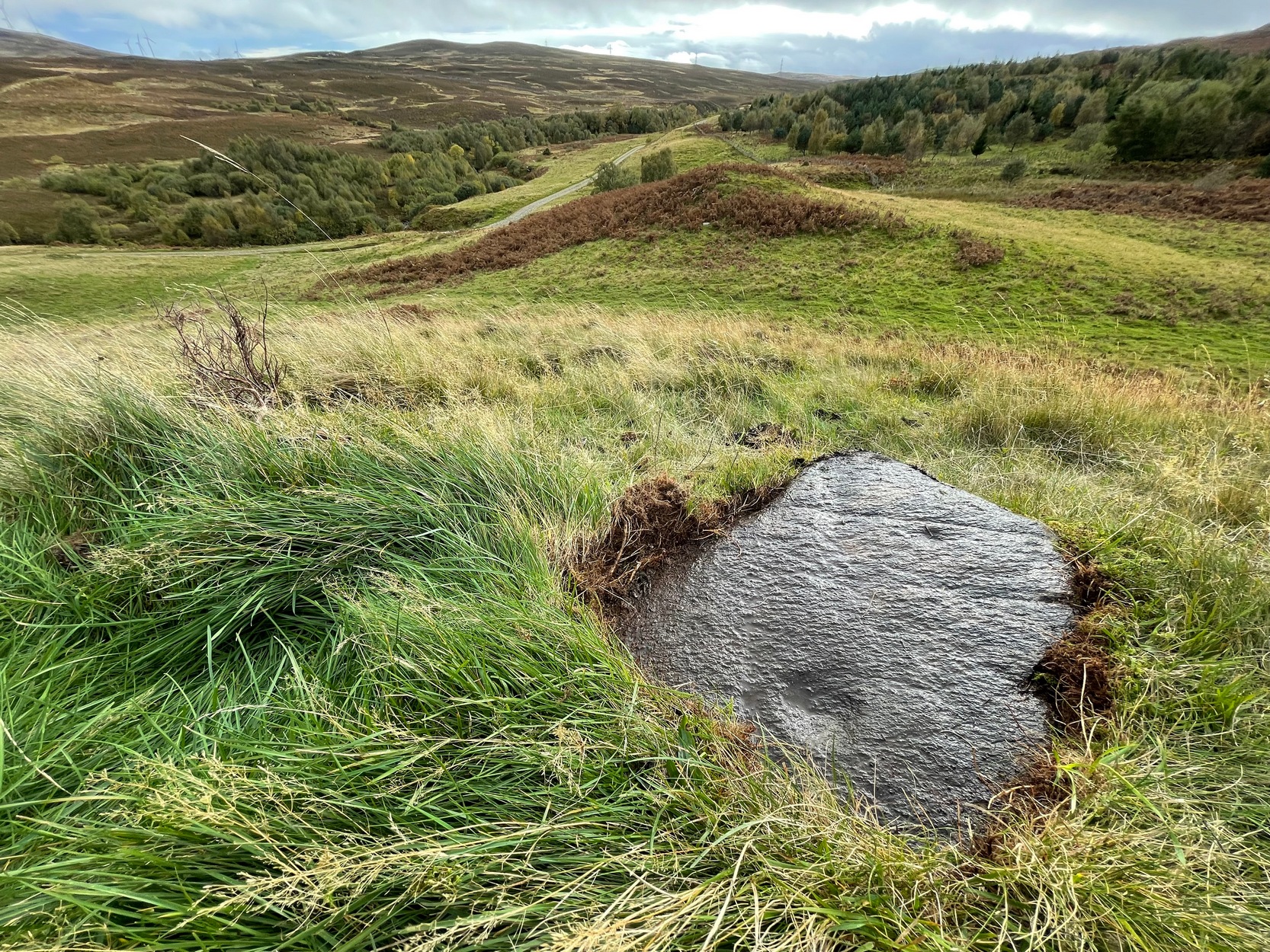
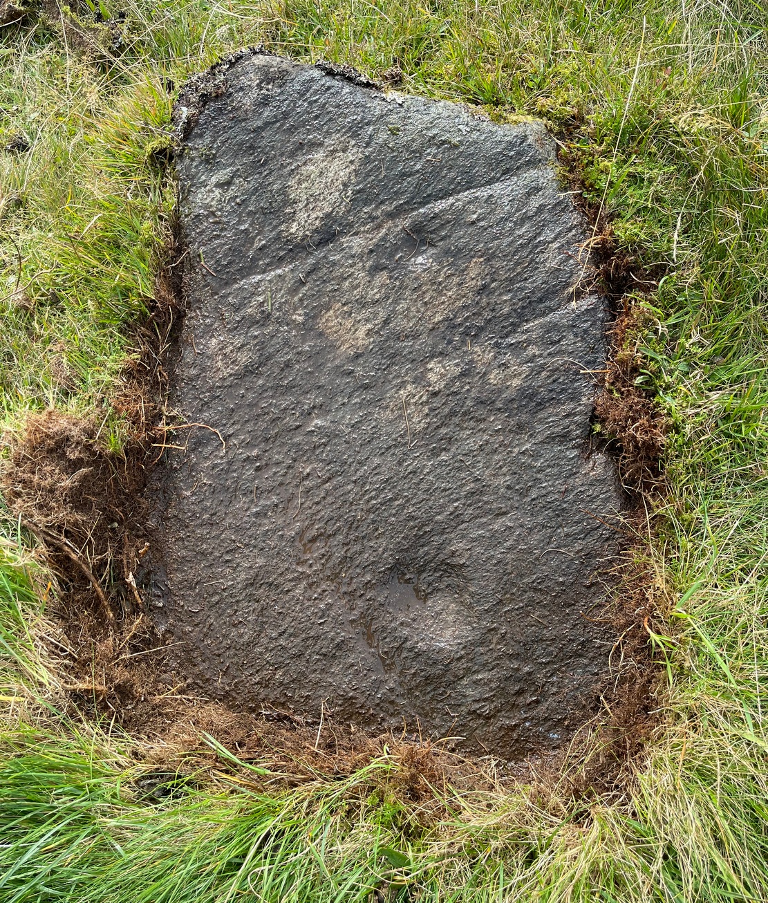
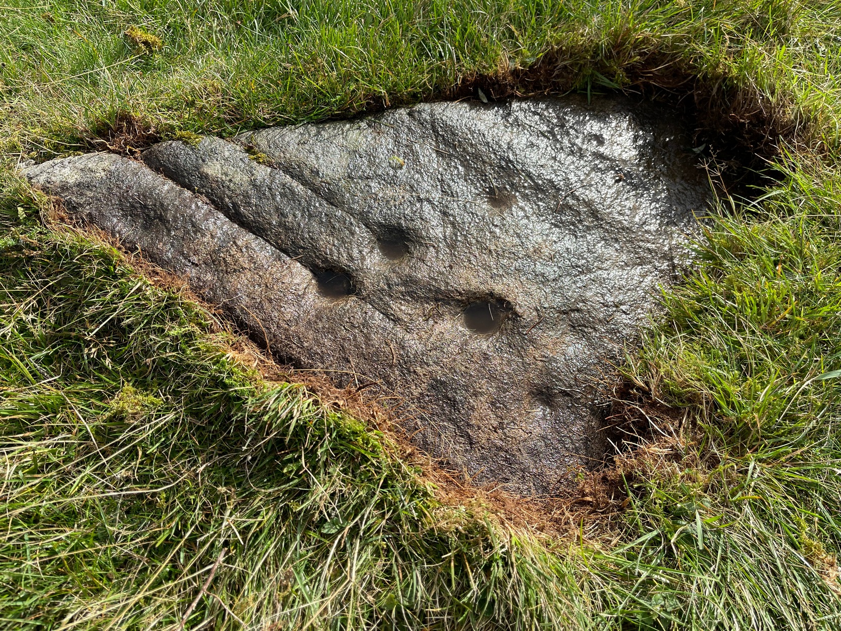
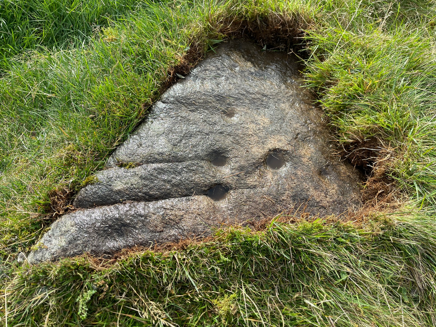
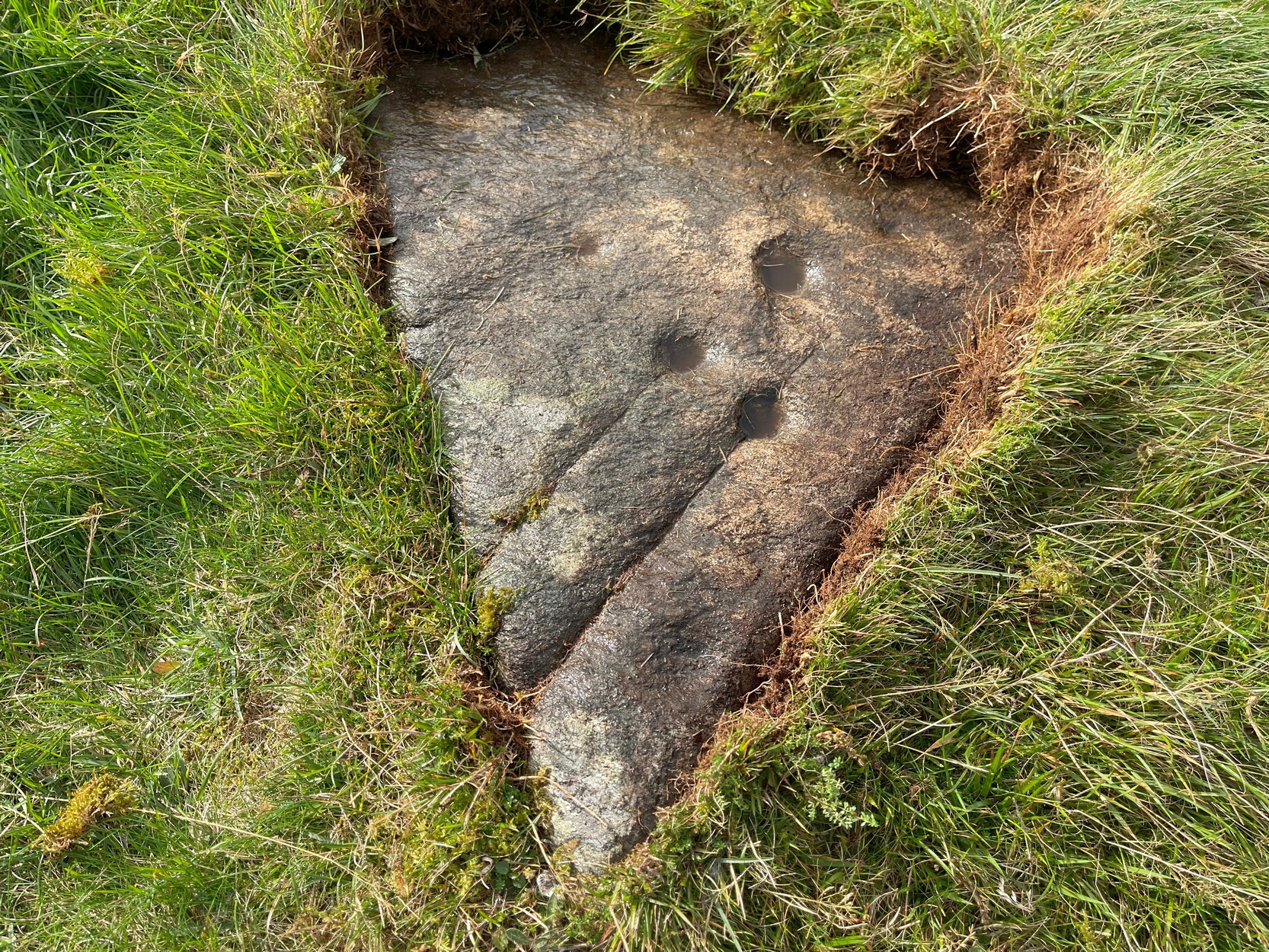
Upon this rounded tom, beloved of faerie folk and overlooking the urisk-haunted Urlar Burn, is this small flat triangular-shaped stone, embedded in the ground, possessing an unusual set of seven, possibly eight cup-markings (not five as Currie [2005] initially described) of varying depths and age, carved into straight geological fissures in the rock which, I hasten to add, were probably intended as part of the original design. Such elements are not unusual in carvings in other parts of the world, tending to relate to some spirit or ancestral ingredient. Whether that was important here, we might never know.
Black Burn (2) carvingBlack Burn (2) carving
But in addition to the cups on their geological cracks, a large faint wonky incomplete ring has been carved around the centre-most cup-mark, seemingly stopping where it meets the natural crack. You can just make it out in the photos. One side of this ring may continue onto the top of the longer crack, but it was difficult to see in the cloudy daylight and another visit is necessary.
The carving was first described by George Currie (2005), who told, in his usual minimalist manner:
“On W side of large knoll, triangular-shaped rock, 0.7 x 0.7m, flush with ground; five cups, largest being 50 x 20mm and smallest, 25 x 8mm.”
Two or three yards away, just slightly down the slope to your south, is another cup-marked stone: the Black Burn (3) carving.
References:
Currie, George, “Perthshire: Black Burn (Dull Parish) – Cup and Ring Marked Rocks”, in Discovery & Excavation Scotland, volume 6 (new series), 2005.
Acknowledgements:Huge thanks for use of the Ordnance Survey map in this site profile, reproduced with the kind permission of the National Library of Scotland.
The location of what was, in all likelihood, a small Bronze Age burial on the edge of old Shotley Bridge (as it was in the mid-19th century) remains a mystery. It’s likely that the position of the site is now beneath someone’s house in the town. Its existence was thankfully recorded in correspondence between a “Mr. John Dixon, of the Engineer’s Office, Consett Ironworks,” and the great John Collingwood Bruce. Dixon’s letter dated October 13, 1856, told:
“I take the liberty of informing you of the discovery of a coffin, of some description or other, in a field near ShotleyBridge. I have visited the place and enclose a sketch² made on the spot as it appeared when I saw it. Some workmen were excavating sand and came upon it about a foot beneath the surface. The only remains that we can ascertain to have been in it, are a few pieces of bone, barely recognizable as such, and now in the hands of Dr.Renton. I have not yet seen them. He tells me that one fragment resembles a portion of a skull, but that they are in such small pieces it is difficult to say what they are. I shall endeavour to get a piece — as, if the surface remains, I apprehend we shall be able to say whether they are human or not. Possibly it may never have been a human coffin —though from the paved bottom and the appearance of great age the stones possess, and also the bearing NW and SE, I am inclined to think it must be one. The dry situation — a sloping hillside — would tend to preserve the remains of bones. I cannot hear of any urns, or the fragments of any, having been found in it. They may, if ever there were any, have been destroyed. The coffin may have been opened before, and rifled — say hundreds of years ago. It seems unaccountably short — as I believe the older ones are generally distinguished by their great size; but it may have been, and probably was, merely a receptacle for burnt remains, either in urns or not. The paving I mentioned had all disappeared when I saw it. As it consisted of small stones, they had doubtfully been carried away. Not being an antiquarian, or skilled in antiquarian lore, I cannot do more than form an idea about it, but shall be glad to hear your opinion at any time you may find it convenient.”
In a second letter, replying to Mr Bruce’s enquiries, Dixon added that a piece of flint had been found amongst the debris which, he thought,
“might possibly turn out to be part of an ancient weapon; and if so, might lead to some solution of the question.”
As Dr. Bruce pointed out: many ancient British graves were not uncommonly as short as three feet. In so called “rude times it would seem that a grave was made much shorter than the body—which was doubled up, and thrust in.” It was his opinion that the grave here was prehistoric. We have to agree with him. But where exactly was this place? Does anyone know…?
References:
Anon., “Discovery at Shotley Bridge,” in Proceedings Society of Antiquaries Newcastle-upon-Tyne, volume 1, no.22, 1856.
The spring is in the trees. The roof of the church is visible past the tree
Take the B8062 North from Auchterarder, and turn right immediately after crossing Kinkell Bridge. Continue through the hamlet of Trinity Gask, and take the next turn left. The Well is situated in the wooded area of land to your left, before you reach the church on the right. I tried visiting in summer but was beaten back by the boscage of man high nettles, goose grass and brambles. An autumn visit was made, and access was readily available to the wooded area over a barbed wire fence from the field behind the wood.
Archeology & History
The Canmore description quotes from an August 1967 report by an Ordnance Survey inspector:
“Trinity Well is now dry, and all that remains is an overgrown hollow. A manhole cover nearby suggests the spring is now piped.”
On the day of my 2014 visit, the water was flowing from an issue on the field side of the woodland. There was some low walling on the field side of the enclosure, otherwise no masonry or paving was visible. Any there may have been is now either buried or robbed for building material.
The waters still flow despite a 1967 report to the contrary
The 1796 Statistical Account has this to say: ‘ The most noted well in the parish is at Trinity Gask. It is remarkable for the purity and lightness of its water; the spring is copious and perennial. Superstition, aided by the interested artifices of popish priests, raised, in times of ignorance and bigotry, this well to no small degree of celebrity. It was affirmed, that every person who was baptised with the water of this well, would never be seized with the plague….. But the extraordinary virtue of Trinity Gask well has perished with the downfall of superstition, and the introduction of a free and rational enquiry into nature and religion.’
Walling is visible behind the spring issue
The 1837 New Statistical Account goes on to say: ‘….the Trinity Well, a little to the South of the manse, of great renown in Popish days for the performing of miraculous cures, fortifying against plague, witchcraft and such other evils. The right of bleaching at this well is one of the privileges of the minister’.
The Rev. John Wilson writes, in The Gazetteer of Scotland: ‘…a noticeable object is a well famous in Roman times for alleged thaumaturgic properties…’.
Processions to the Well were made on Trinity Sunday and the first Sunday in June
References:
The (First) Statistical Account of Scotland, 1796, Volume 18, page 487
The New (Second) Statistical Account of Scotland, 1837, Volume 10, page 335
Take the A675 road to Bolton from Abbey Village, going up the track opposite Piccadily farmhouse until you reach the ruins in the woods. The site can also be reached by going south down the Tockholes Road car park following the sign for Hollinshead Hall on your right.
Archaeology & History
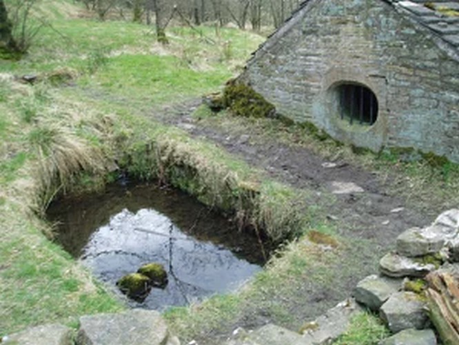
Hollinshead Hall
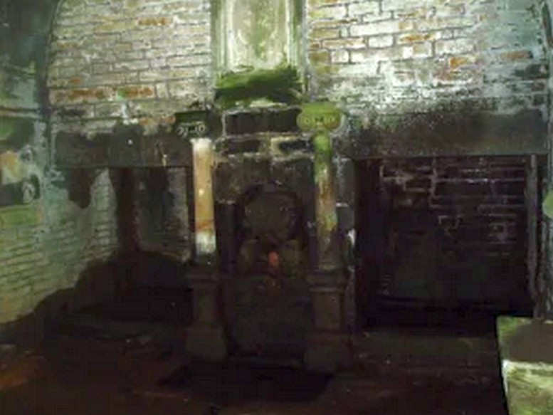
Associated with Hollinshead Hall, which is now a ruin, the well is made of the same sandstone rubble as the hall with a stone slate roof. The building a single cell is built into a slope from which the spring arises and is encapsulated by it. Either side a high walls creating a sort of forecourt with side benches with inward-facing chamfered piers with ball finials at the ends. The well house itself is quite an attractive building and is certainly not thrown up, having a symmetrical facade with chamfered unglazed widows which are fitted with spear-headed iron bars and clearly the building has never been glazed. The gable end has a large oval opening with a matching one at the rear. In the centre is a heavy board door with a chamfered doorway. This doorway unfortunately is locked baring any entrance to the well house.
Peering in through the windows one can see how strong the vaulted roof is, adorned by a pendent ball in its centre. The spring’s water flows from a crudely carved lion’s head, either side of a reredo of Ionic colonnettes, with a sunken stone tank beneath or each side a rectangular recess which enclose rectangular pools. There is a diamond-paved floor with a central gutter draining from this well or trough at centre of rear wall.
Local tradition accounts that there was a site here from Medieval times and indeed, that the name Hollinshead was derived from a version of holy well although O.E hol, for hollow is more likely although there is a Halliwell Fold Farm nearby being derived from O.E halig for healing. The pool with steps down above the well house may be the original well of course. The discovery of a hoard of medieval coins in 1970s would support the date and perhaps they were an offering.
Folklore
Abram’s Blackburn (1877) is perhaps the first to state that the water was curative. However, anonymous quote in Nightingales History of Tockholes describes the well as:
“Here no less than five different springs of water, after uniting together and passing through a very old carved stone representing a lion’s head, flow into a well. To this Well pilgrimages were formerly made and the water which is of a peculiar quality, is remarkable as an efficacious remedy for ophthalmic complaints.”
Another tradition is that the site was a resting place for pilgrims to Whalley Abbey and that the trough was used as baptistery, however, this would be more likely to be the spring above the well house. It is probably a spring house, a structure built over a natural source of water for the storage of dairy products and other foods that needed to be kept fresh.
Reculsancy was very prevalent in Lancashire and the well house does the bear the coat of arms of the Radcliffes. It would suggest why the structure is so ornate and suggest a 1600s date—although many authorities suggest an 18th century origin. The site would be a secret baptistery and its design as a dairy would also help as well as being still function, certainly the presence of benches suggest this functionality. It appears to be too close to the house to be a garden folly such as a grotto! The suggestion of stained glass in the windows suggests something more significant discovered during the present stone roof’s construction. Indeed, the choice of the lion’s head is possibly that of the ‘Lion of Judah’, meaning Jesus providing rich and valuable water, although this is a common motif on many drinking fountains of course! Interesting, Cramshaw (1994) tells us that the site was in the 1980s the site of a well dressing, although what type is unclear and no other author has mentioned it as far as I am aware. Perhaps we shall never know the real origin of this delightful building.
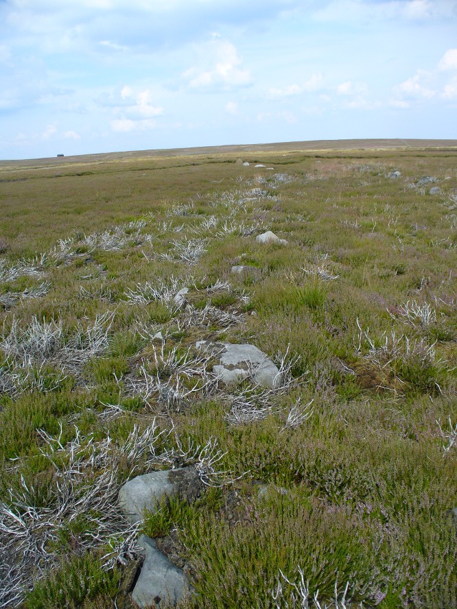
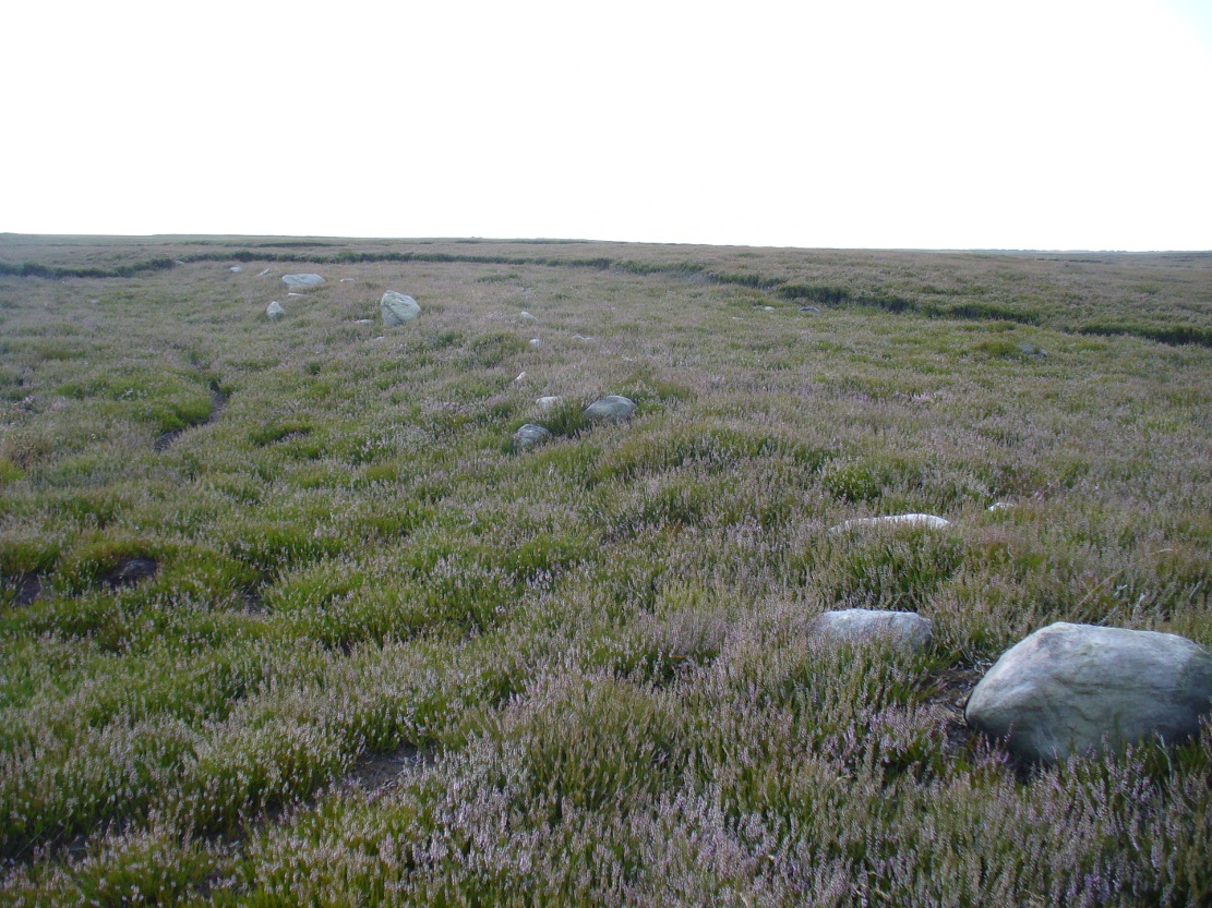
Get yourself to the Roms Law circle, by hook or by crook. Then take the long almost straight footpath south, as if you’re heading to the very damaged Horncliffe Well (thanks to Yorkshire Water). You’ll notice the fencing that runs parallel to the path eventually. Nearly 400 yards along the parallel fenced line you reach the first decent-sized stream. From here, walk upstream, keeping to its northern edges for another 300 yards—then walk 10-20 yards into the heather. You’re damn close!
Archaeology & History
The site is named after Mr James Elkington who recently rediscovered this previously unmapped prehistoric trackway, close to where Burley Moor meets the western edge of Hawksworth Moor, on the greater Rombald’s complex. And it’s a bloody good find if I might say so myself! But, like so many sites covering the Rombald’s complex, it begs more questions than it answers.
2014 aerial view showing outline of trackway2002 aerial view of trackway
The trackway is consistent in architectural design and dimensions with at least six of the eight prehistoric trackways that I’m aware of on these moors — none of which have ever been adequately mapped nor investigated by regional archaeologists (thankfully, there are folk like us around!). This ninth trackway, upon initial investigation, may be the shortest of them all up here.
Section of large stones marking the trackOvergrown section of track-edge
Elkington’s Track seems to begin its route about 10-20 yards north of the once large, fast-flowing stream of the Middle Beck—which in itself seems curious. No trace of any trackway seems evident on the other side of this stream and there are no other prehistoric remains accounting for why it should begin or end here…
Walking along the track, it heads northeast for 80 yards, with low lines of raised parallel walling 4-5 yards apart defining the avenue, before it begins to gradually bend round in a more easterly direction. Thirty yards along this more easterly alignment, in the southern walled section, lays an eroded stone (SE 13255 44165) that seems to have stood upright in the not-too-distant past. It seems to mark an opening or gap in the walled trackway and a large scatter of small stones, akin to the denuded remains of a cairn is evident just below the track at this point. The raised embankment of the trackway keeps heading east, towards the line of Hawksworth Moor boundary stones.
More long line of walled edgesLooking NE up the track
Upon initial investigation, the trackway was visible for a minimum of 185 yards (169.4m) in length, whereafter any immediate trace of it disappeared into the ancient peat. However, aerial views of it on GoogleEarth indicate a faint extension of the track, but these are difficult to apprehend at ground-level. There is every possibility that this trackway eventually meets up with one of the four other prehistoric trackways near the Great Skirtful of Stones giant tomb, or even the North Road running past Roms Law—but until this can be ascertained, the trackway must be defined on its own merits. Further heather-burning on the moors at either end would obviously enable a great examination of the remains.
In the event that the southernmost point of this trackway does begin above the Middle Beck stream, as seems apparent, we may be looking at a ceremonial trackway and not just a ‘road’ as we define them in the modern parlance of homo-profanus culture. Think of it as a small version of The Avenue trackway that runs from Stonehenge outwards, past the Heel Stone and eventually bending down to the River Avon. (Burl 2006) Y’ just never know…..
References:
Burl, Aubrey, A Brief History of Stonehenge, Constable: London 2006.
Cowling, Eric T., Rombald’s Way, William Walker: Otley 1946.
Raistrick, Arthur, Green Tracks on the Pennines, Dalesman: Clapham 1962.
Wright, Geoffrey N., Roads and Trackways of the Yorkshire Dales, Moorland: 1985.
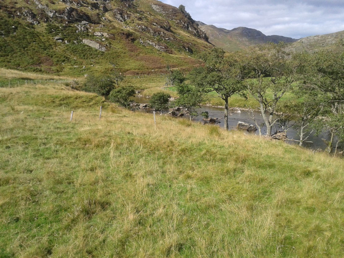
There are two ways into this glen by road. Whichever route you take (from Crieff side, or via the long Dunkeld route), when you hit the flat bottom of it, where the green fields are right by the roadside, walk along till you find the road meets the river’s edge. On the south-side of this small roadside section of the river, you’ll see a single large boulder 10-20 yards away. That’s the spot!
Archaeology & History
Described in some of the archaeology texts as just a ‘cist’, this giant stone is obviously the remains of much more. For a start, as the 1834 drawing illustrates here (coupled with several other early descriptions of the place), other visible antiquarian remains were very much apparent at Ossian’s Stone before a destructive 18th century road-laying operation tore up much of this ancient site. A marauding General Wade of the English establishment was cutting through the Scottish landscape a “military road”, to enable the English to do the usual “civilize the savages”, as they liked to put it. This curious “Giant’s Grave” was very lucky to survive.
Skene’s 1834 sketch, showing surrounding ringOssian’s Stone in the Sma’ Glen
The earliest description of events surrounding the site, as well as the attitude of the Highlanders when they saw the disrespectful English impose their usual disregard, is most insightful. In a series of letters written by a Captain Edward Burt (1759) in the first-half of the 18th century to the english monarch of the period, we read a quite fascinating account which must have been very intriguing to witness first-hand.
General Wade and his band of marauders had reached the Sma’ Glen at the end of Glen Almond and were about to continue the construction of their road. Burt (1759) wrote:
“A small part of the way through this glen having been marked out by two rows of camp colours, placed at a good distance one from another, whereby to describe the line of the intended breadth and regularity of the road by the eye, there happened to lie directly in the way an exceedingly large stone; and, as it had been made a rule from the beginning, to carry on the roads in straight lines as far as the way would permit, not only to give them a better air, but to shorten the passenger’s journey, it was resolved the stone should be removed, if possible, though otherwise the work might have been carried along on either side of it.
“The soldiers, by vast labour, with their levers and jacks, or hand-screws, tumbled it over and over till they got it quite out of the way, although it was of such an enormous size that it might be matter of great wonder how it could ever be removed by human strength and art, especially to such who had never seen an operation of that kind: and, upon their digging a little way into that part of the ground where the centre of the base had stood, there was found a small cavity, about two feet square, which was guarded from the outward earth at the bottom, top, and sides, by square flat stones.
“This hollow contained some ashes, scraps of bones, and half-burnt ends of stalks of heath; which last we concluded to be a small remnant of a funeral pile. Upon the whole, I think there is no room to doubt but it was the urn of some considerable Roman officer, and the best of the kind that could be provided in their military circumstances; and that it was so seems plainly to appear from its vicinity to the Roman camp, the engines that must have been employed to remove that vast piece of a rock, and the unlikeliness it should, or could, have ever been done by the natives of the country. But certainly the design was, to preserve those remains from the injuries of rains and melting snows, and to prevent their being profaned by the sacrilegious hands of those they call Barbarians, for that reproachful name, you know, they gave to the people of almost all nations but their own.
“…As I returned the same way from the Lowlands, I found the officer, with his party of working soldiers, not far from the stone, and asked him what was become of the urn? To this he answered, that he had intended to preserve it in the condition I left it, till the commander-in-chief had seen it, as a curiosity, but that it was not in his power so to do; for soon after the discovery was known to the Highlanders, they assembled from distant parts, and having formed themselves into a body, they carefully gathered up the relics, and marched with them, in solemn procession, to a new place of burial, and there discharged their fire-arms over the grave, as supposing the deceased had been a military officer.
“You will believe the recital of all this ceremony led me to ask the reason of such homage done to the ashes of a person supposed to have been dead almost two thousand years. It did so; and the officer, who was himself a native of the Hills, told me that they (the Highlanders) firmly believe that if a dead body should be known to lie above ground, or be disinterred by malice, or the accidents of torrents of water, &c. and care was not immediately taken to perform to it the proper rites, then there would arise such storms and tempests as would destroy their corn, blow away their huts, and all sorts of other mis-fortunes would follow till that duty was performed. You may here recollect what I told you so long ago, of the great regard the Highlanders have for the remains of their dead…”
Ossian’s Stone in his landscape
We can rest assured that the ‘Roman officer’ idea proclaimed by our early narrator is most probably wrong and that the nature of this site, when seen at ground-level even today and moreso by referencing Skene’s 1834 drawing of the place, above (which shows a more complete low surrounding ring of stones) indicate this to be of prehistoric provenance. Of intrigue to me, is the ritual of the incoming Highlanders, who took the relics onto another place and re-interred them in their own customary manner. We do not know where the Highlanders moved these (probable) prehistoric relics and I can find no supporting folklore to show precisely where they went—but a likely site would be the prehistoric cairn on the mountaintop southwest of here (at NN 8899 3018), or a site that has sometimes been confused with Ossian’s Stone a short distance to the south in the Sma’ Glen, known as the Giant’s Grave (at NN 9050 2956). This latter site would seem more probable.
Anyway…. many years after Edward Burt’s initial Letters defined the site for outsiders, one Thomas Newte (1791) came a-wandering hereby. He found that the account of General Wade’s intrusion was still on the tongues of local people, along with additions of further giant-lore and Fingalian tales, typical of the Creation myths of our early ancestors. In typically depreciative English manner Newte told:
“In that awful part of Glen Almon, already mentioned, where lofty and impending cliffs on either hand make a solemn and almost perpetual gloom, is found Clachan-Of-Fian, or monumental Stone of Ossian. It is of uncommon size, measuring seven feet and an half in length, and five feet in breadth. About fifty years ago, certain soldiers, employed under General Wade in making the Military Road from Stirling to Inverness, through the Highlands, raised the stone by large engines, and discovered under it a coffin full of burntbones. This coffin consisted of four gray stones, which still remain, such as are mentioned in Ossian’s Poems. Ossian’s Stone, with the four gray stones in which his bones are said to have been deposited, are surrounded by a circular dyke, two hundred feet in circumference, and three feet in height. The Military Road passes through its centre.”
Cole’s 1911 plan of stone & surrounding ringOssian Stone by Fred Cole
From hereon, many other writers and travellers came to see this great legendary stone within the depleted remains of its embanked circle—and thankfully it hasn’t been disturbed any further, still being visible to this day. The greatest ‘archaeological’ attention the site has received was from the early pen of great antiquarian Fred Coles (1911). On his journey here, after travelling past a large white stone which was mistakenly named as Ossian’s Stone by the usual contenders, he and his friend reached the right place:
“close to a strip of ground where the river and road almost touch each other, and immediately below the steepest of the crags of Dun More on the eastern side and the debris slopes of Meall Tarsuinn on the west, a most impressive environment, be the stone a prehistoric monument or not! The spot is interesting for itself, apart from all legend; and the remains consist of a mighty monolith…and a narrow grassy mound…to its east, with a few earthfast blocks set edgewise near its eastern extremity. Close to the roadside, but at the same level of 690 feet above the sea, there is a slab-like stone set up, measuring 3 feet in width, 1 foot 3 inches in thickness, and about 2 feet 6 inches in height. A space of 63 feet separates this block…from the huge rhomboidal mass called Ossian’s Stone. Five feet east of the latter is the base of the grassy mound which measures about 12 feet in length, 4 feet in greatest breadth, and 3 feet 10 inches in height. To the north and the south in a slightly curving line are set the six small slabs shown. There seems also to be a vague continuation of this strange alignment in both directions. All over the ground between A and B, are many strangle low parallel ridges of smallish stones having a general direction of nearly north and south. The rest of the ground is grassy, and here and there a little stony. In the plan all the stones are drawn larger than exactly to scale.
“The great stone is 8 feet high and has a basal girth of 27 feet. Several small stones lie near it. Such are the facts as at present to be observed on the ground.”
Section of outlying grass-covered low ring, just visibleGeological cup-marks?
There are two small conjoined cup-marks on top of the stone, but these seem to be geological in nature. The precise nature of the site is difficult to ascertain without excavation; but the Royal Commission lads reckon it to be a prehistoric ‘cist’ or grave in their own analysis, based mainly on the quoted literary texts. The surrounding ‘ring’ of small stones doesn’t seem to have captured their attention too much; but the site needs contextualizing within this damaged circular enclosure, which appears to have been a cairn circle initially, of some sort, with Ossian’s huge stone resting over the grave of one late great ancestral character, probably placed here thousands of years back in the Bronze Age… A truly fascinating place in truly gorgeous landscape.
Folklore
The glen itself has a scattering of giant lore associated with Finn and/or Ossian. A nearby cave was one of the places where this legendary character, and subsequent bards, were said to have spent time.
There are a small number of heavy rocks presently placed on top of Ossian’s Stone. These may be due to the site being used as a “lifting stone”: a sort of rite of passage found at a number of sites in the Perthshire mountains and across the Highlands to indicate a boy’s strength before entering manhood. Not until they have lifted and deposited a very heavy rock onto the boulder can they rightly become chief or leader, etc.
The poet William Wordsworth wrote about Ossian’s Stone, calling it “Glen Almein, or The Narrow Glen”:
In this still place, remote from men,
Sleeps Ossian, in the Narrow Glen;
In this still place, where murmurs on
But one meek streamlet, only one:
He sang of battles, and the breath
Of stormy war, and violent death;
And should, methinks, when all was past,
Have rightfully been laid at last
Where rocks were rudely heaped, and rent
As by a spirit turbulent;
Where sights were rough, and sounds were wild,
And everything unreconciled;
In some complaining, dim retreat,
For fear and melancholy meet;
But this is calm; there cannot be
A more entire tranquillity.
Does then the Bard sleep here indeed?
Or is it but a groundless creed?
What matters it? I blame them not
Whose Fancy in this lonely Spot
Was moved; and in such way expressed
Their notion of its perfect rest.
A convent, even a hermit’s cell,
Would break the silence of this Dell:
It is not quiet, is not ease;
But something deeper far than these:
The separation that is here
Is of the grave; and of austere
Yet happy feelings of the dead:
And, therefore, was it rightly said
That Ossian, last of all his race!
Lies buried in this lonely place.
References:
Anonymous, Tourists Guide to Crieff, Comrie and the Vale of Strathearn, Crieff
1874.