Prehistoric Trackway: OS Grid Reference – SE 13169 44111 to SE 13321 44172

Get yourself to the Roms Law circle, by hook or by crook. Then take the long almost straight footpath south, as if you’re heading to the very damaged Horncliffe Well (thanks to Yorkshire Water). You’ll notice the fencing that runs parallel to the path eventually. Nearly 400 yards along the parallel fenced line you reach the first decent-sized stream. From here, walk upstream, keeping to its northern edges for another 300 yards—then walk 10-20 yards into the heather. You’re damn close!
Archaeology & History
The site is named after Mr James Elkington who recently rediscovered this previously unmapped prehistoric trackway, close to where Burley Moor meets the western edge of Hawksworth Moor, on the greater Rombald’s complex. And it’s a bloody good find if I might say so myself! But, like so many sites covering the Rombald’s complex, it begs more questions than it answers.


The trackway is consistent in architectural design and dimensions with at least six of the eight prehistoric trackways that I’m aware of on these moors — none of which have ever been adequately mapped nor investigated by regional archaeologists (thankfully, there are folk like us around!). This ninth trackway, upon initial investigation, may be the shortest of them all up here.

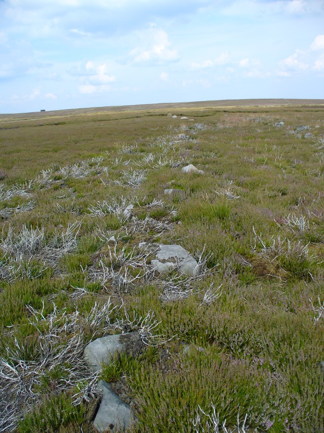
Elkington’s Track seems to begin its route about 10-20 yards north of the once large, fast-flowing stream of the Middle Beck—which in itself seems curious. No trace of any trackway seems evident on the other side of this stream and there are no other prehistoric remains accounting for why it should begin or end here…
Walking along the track, it heads northeast for 80 yards, with low lines of raised parallel walling 4-5 yards apart defining the avenue, before it begins to gradually bend round in a more easterly direction. Thirty yards along this more easterly alignment, in the southern walled section, lays an eroded stone (SE 13255 44165) that seems to have stood upright in the not-too-distant past. It seems to mark an opening or gap in the walled trackway and a large scatter of small stones, akin to the denuded remains of a cairn is evident just below the track at this point. The raised embankment of the trackway keeps heading east, towards the line of Hawksworth Moor boundary stones.
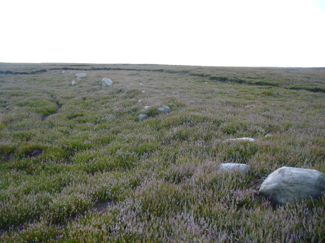

Upon initial investigation, the trackway was visible for a minimum of 185 yards (169.4m) in length, whereafter any immediate trace of it disappeared into the ancient peat. However, aerial views of it on GoogleEarth indicate a faint extension of the track, but these are difficult to apprehend at ground-level. There is every possibility that this trackway eventually meets up with one of the four other prehistoric trackways near the Great Skirtful of Stones giant tomb, or even the North Road running past Roms Law—but until this can be ascertained, the trackway must be defined on its own merits. Further heather-burning on the moors at either end would obviously enable a great examination of the remains.
In the event that the southernmost point of this trackway does begin above the Middle Beck stream, as seems apparent, we may be looking at a ceremonial trackway and not just a ‘road’ as we define them in the modern parlance of homo-profanus culture. Think of it as a small version of The Avenue trackway that runs from Stonehenge outwards, past the Heel Stone and eventually bending down to the River Avon. (Burl 2006) Y’ just never know…..
References:
- Burl, Aubrey, A Brief History of Stonehenge, Constable: London 2006.
- Cowling, Eric T., Rombald’s Way, William Walker: Otley 1946.
- Raistrick, Arthur, Green Tracks on the Pennines, Dalesman: Clapham 1962.
- Wright, Geoffrey N., Roads and Trackways of the Yorkshire Dales, Moorland: 1985.
© Paul Bennett, The Northern Antiquarian
I do wonder if the “trackway” isn’t more akin to the Wheeldale Moor “trackway”. That one was always attributed to the Romans, and indeed the Ministry of Works restoration of it assumed that it was a Roman road. However, up on the moors there it runs from one stream, over a section of moor, then down to another stream, and there’s no evidence of any road anywhere else along the presumed line, nor any reason to suppose that the “missing” bits were robbed out whilst the extant bit wasn’t robbed.
The current hypothesis is that this was not a road of any vintage at all, but a Neolithic/Bronze Age land division that was intended to be a very long-term, low maintainance sort of thing. The vegetation back then was a shrubbery (it would be now, were it not for sheep and heather burning), and to make a lasting division people would have had to prevent this shrubbery from growing. Elsewhere they used pit alignments; dig a series of pits in a line, and you end up with mini-ponds that trees won’t grow in (if you dig ditches, then unless the ground is dead flat, the water runs away instead of pooling and preventing tree growth) and hence a lasting statement in the landscape. On the stony Wheeldale moor, pits were too much trouble so what amounts to a long, linear cairn was made.
I therefore wonder if these ancient trackways were more of the same sort of thing; not so much trackways as ways of creating a marker in the landscape that would endure for a very long time.