Dwarf’s Tomb, Alva, Clackmannanshire

Tomb:  OS Grid Reference – NS 8848 9754

Also Known as:

  1. Canmore ID 47076

Getting Here

Quarry of the Dwarf's Tomb
Quarry of the Dwarf’s Tomb

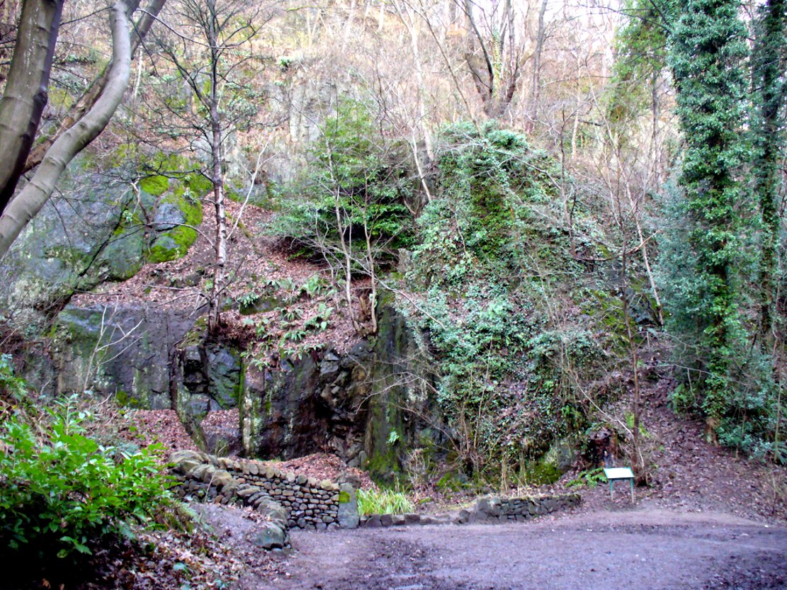
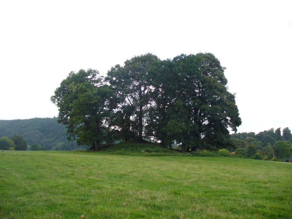
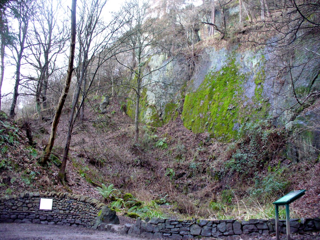
From the main street through Alva, between the Co-op and the corner shop, go up the small road at the side of the Johnstone Arms Hotel (Brook Street) and, at the small crossroads, straight across as if following the sign to the golf course. Stay along the track parallel with the Alva Burn waters and as you go into the trees a hundred yards or so along, to your left is a disused quarry, with a couple of plaques telling you its brief history. This is the spot!

Archaeology & History

This is a truly fascinating site for a number of reasons.  Sadly, we can no longer see what had been here for oh so many thousands of years thanks, as usual, to the industrialists destroying the land here.  Although in this case, without them we’d be unaware of its very existence.  Additionally, there is a twist to the industrial’s find, which seems to have stopped further quarrying by some local people….

The tomb was somewhere in the left-middle

Listed in the relative Royal Commission accounts (1933; 1978), without comments, the tale is a simple one, but was narrated in some detail by J.G. Callander (1914) in Scotland’s prodigious Society of Antiquaries journal.  During some quarrying operations over the Christmas period of 1912, James Murdoch “uncovered the remains of a human skeleton which had been buried in a natural cavity in the rock.”  Three weeks later, local police officer George Donald and Dr W.L. Cunningham of Alva, accompanied Mr Callander to the site and made a detailed assessment of what had been found.  He wrote:

“The quarry in which the grave was found is situated at the mouth of Alva Glen, a few yards distant from the right bank of the burn which flows through it.  The body had been placed in a cavity or rock shelter in the face of the cliff, about 40 feet from the base, and about 200 feet above sea-level, and a rough, curved wall of dry-stone building, about 1 foot in thickness, had been built across the opening, which faced the east, the ends of the wall being still in situ when I visited the site. The space enclosed measured about 4 feet 6 inches from north to south, and about 5 feet from east to west.  Subsequent to the burial the whole face of the rock and the walling had been covered, to a thickness of probably some 6 feet, by soil and detritus washed down from the hill face above.  The greater part of the floor of the cavity was formed of clean, broken, angular stones, but the space on which the body was placed had been covered with a thin layer of soil preparatory to the burial.  No charcoal or charred wood, which is so often seen in prehistoric graves, was found in this deposit.  The skull lay in the north end of the grave, on its right side, facing the rock to the west, the vertebrae and ribs followed a line to the south, and the nether limbs were inclined towards the interior of the cavity.  The whole  face, including all the teeth and the lower jaw, was a-wanting.  Apparently the body had been placed in a flexed position, half on its side and half on its back.  Nothing else was found in the grave but a quantity of snail shells, probably twenty or thirty, which were nearly all broken, the few complete examples being in a very fragile condition.

“Elsewhere it has been stated that these formed a necklace, but while they were strewn out in front of the skeleton for a distance of over 3 feet, none of them showed any signs of artificial perforation.  The species of Helixis is probably hortensis, the common garden snail.”

Mr Callander then included a lengthy description of the body itself, some of whose bones were fractured.  He told that a certain

“Professor Bryce states that the skeleton is that of a dwarf of about 4 feet 2 inches in stature.  The epiphyses are all fully united, although the line of union is visible on the surface at some points.  Growth must therefore have been completed, and the person must have been, if the union of the epiphyses of the long bones had pursued its normal course, over twenty-one years of age…”

Regarding the sex of the dwarf, Mr Bryce wasn’t 100% certain, but told:

“The calvaria shows the general characters of a female skull, but it cannot be stated definitely that the individual was a woman, because the cranial characters are such as might have been present in a dwarf of the male sex.  The calvaria is of moderate size, and is well formed.”

Bryce concluded as a whole that this person was in reasonably good health and, from the condition of the bones, showed “there was no evidence of the disease known as rickets.”  In his final remarks he told:

“The general conclusions to which a careful examination of the skeleton leads, is that we have here to do, not with a representative of a dwarfish race, but with an individual who from premature union of the epiphyses was to a remarkable degree stunted in growth.  The condition is a well-known one, and the class of dwarfs, in which this individual must be included, is well recognised.”

Probable spot of the lost tomb

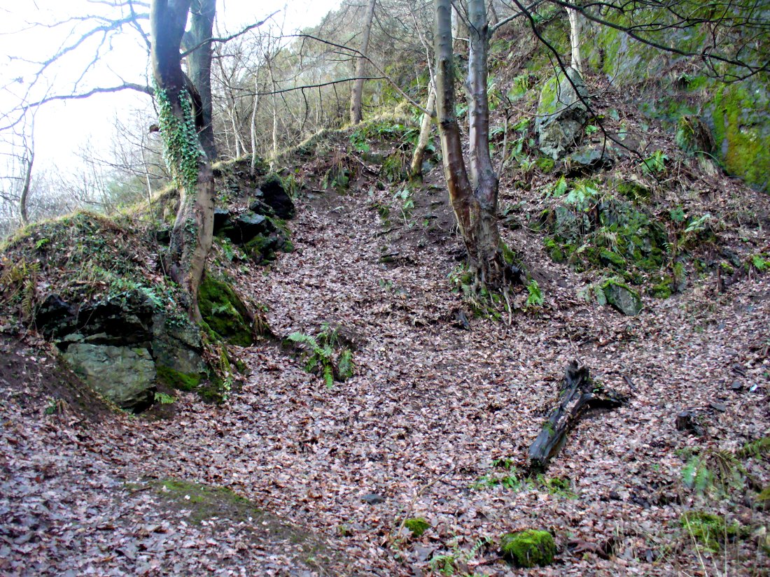
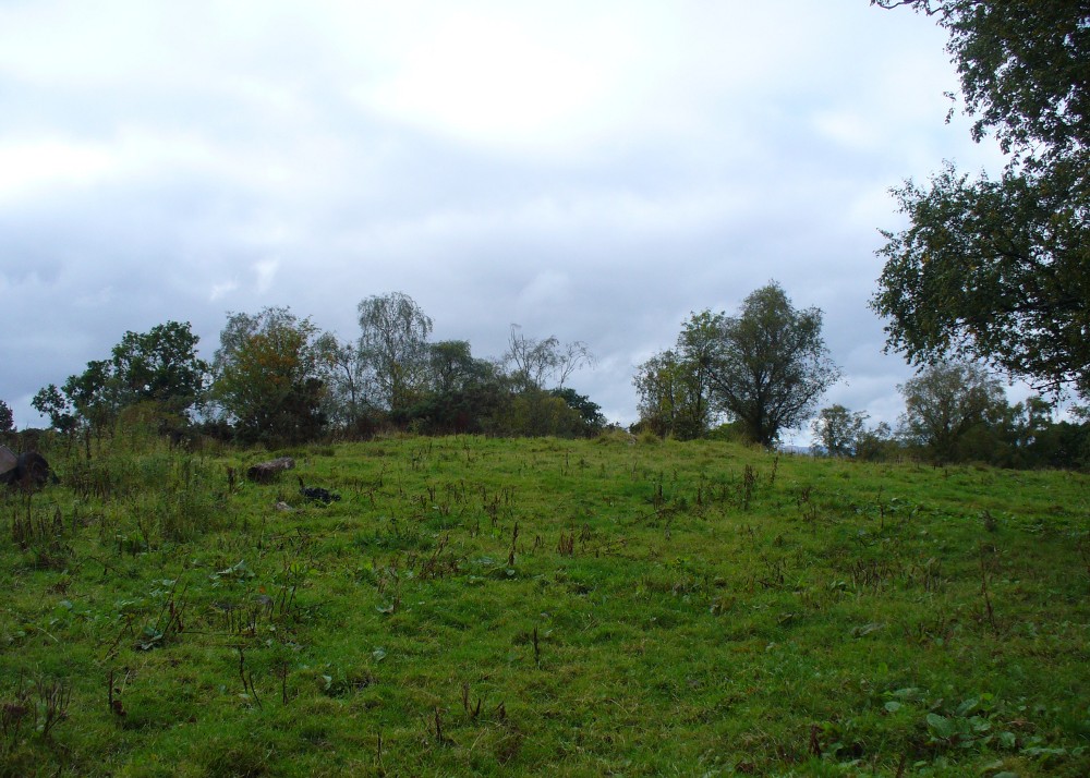
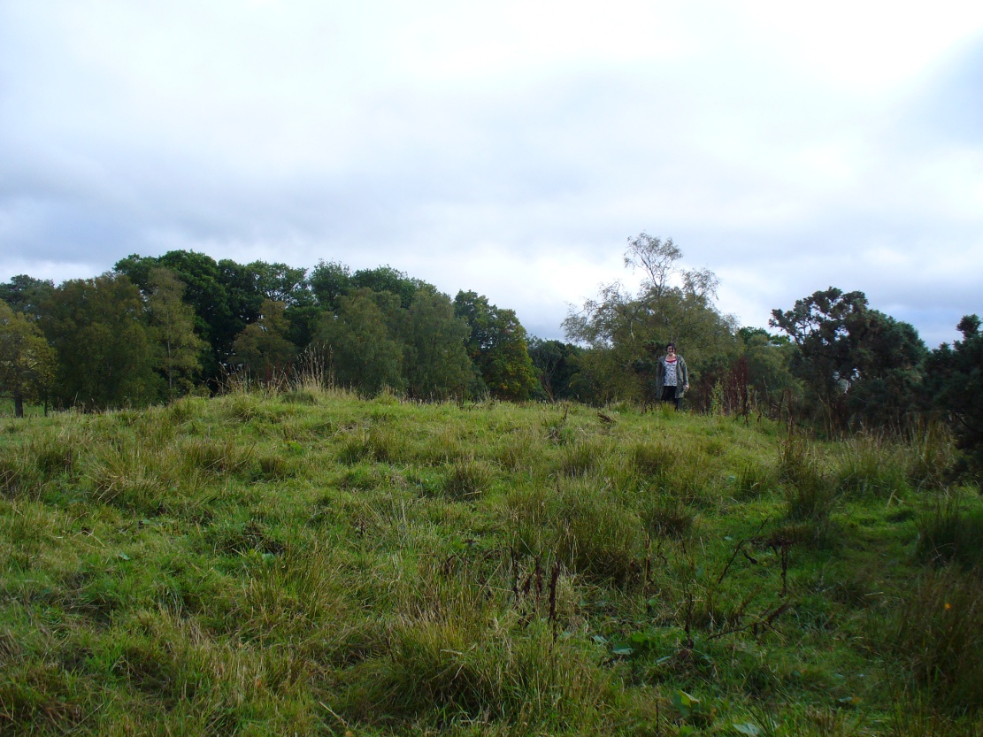
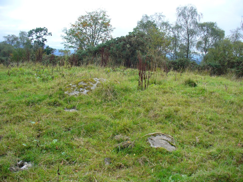
The exact spot of the tomb appears to have been destroyed, or at the very least is certainly covered over and no longer visible.  The section of the quarry looking east, into which the tomb was built, is all-but gone and no initial evidence prevails to show its exact location.  However, it would seem from the description to have been close to the tops of the tree-line, perhaps giving a clear view to the rising sun in the east.  Perhaps… 

The position of this tomb, enclosed high up in the cliffs, hidden away at the entrance to the deeply cut ravine of the Alva Glen, is intriguing in that it is a rarity.  Ravines like this are always peopled by olde spirits in animistic tribal traditions — and this dangerous glen with its fast waters and high falls would have been no different, especially to the Pictish people who we know were still here even after the Romans had buggered off.  Is it possible that this figure was a guardian to the Glen itself, a medicine woman or shaman, whose very Glen was her home?  We know from traditional accounts in many of the North American tribes that dwarves were accessories to the spirit worlds, and some were shamans. (Park 1938)  In northern and central European lore, these small people are “the mysterious craftsmen-priests of early civilizations.” (Motz 1987)  Whilst in Scottish lowland lore, the ‘Brown Man of the Muirs’ was a dwarfish creature described by Briggs (1979) as “a guardian spirit of wild beasts”, or watered-down shaman figure. There is more to this burial than meets the eye of dry academia…

Folklore

The Alva Glen—in addition to being beautiful and home to the Ladies Well—was long known to be one of many places in the Ochils that were peopled by the faerie folk. (Fergusson 1912)  Local people still say this place is haunted by the spirit of a dangerous witch called Jenny Mutton.

It’s worth reiterating the words of Mr Callander (1914) regarding the finding and subsequent death of the man who uncovered this fascinating tomb, as some folk (then as now) think his demise was as inevitable as the man who planned on building turbines in Glen Cailleach:

“On the 24th December last, while quarrying stone for road metal in a quarry at the foot of the Ochils, at Alva, James Murdoch uncovered the remains of a human skeleton which had been buried in a natural cavity in the rock.  Two days later he was killed at the same spot by the fall of a mass of overhanging rock, a tragic sequel, which not long ago would have been considered a judgement on him for disturbing the dead.”

References:

  1. Briggs, Katherine M., A Dictionary of Fairies, Penguin: Harmondsworth 1979.
  2. Callander, J. Graham, “Of a Prehistoric Burial at Alva, Clackmannanshire,” in Proceedings of the Society of Antiquaries, Scotland, volume 48, 1914.
  3. Corbett, L., et al., The Ochil Hills, Forth Naturalist & Historian 1994.
  4. Drummond, A.L., “The Prehistory and Prehistoric Remains of the Hillfoots and Neighbouring District”, in Transactions Stirling Natural History & Antiquarian Society, volume 59, 1937.
  5. Fergusson, R. Menzies, The Ochil Fairy Tales, David Nutt: London 1912.
  6. Gimbutas, Marija, “Slavic Religion,” in Encyclopedia of Religion – volume 13 (editor M. Eliade), MacMillan: New York 1987.
  7. Motz, Lotte, “Dvergar,” in Encyclopedia of Religion – volume 4 (editor M. Eliade), MacMillan: New York 1987.
  8. Park, Willard Z., Shamanism in Western North America: A Study in Cultural Relationships, Evanston: Chicago 1938.
  9. Royal Commission on the Ancient & Historical Monuments, Scotland, Inventory of Monuments and Constructions in the Counties of Fife, Kinross and Clackmannan, HMSO: Edinburgh 1933.
  10. Royal Commission on the Ancient & Historical Monuments, Scotland, The Archaeological Sites and Monuments of Clackmannan District and Falkirk District, Society of Antiquaries of Scotland 1978.

© Paul Bennett, The Northern Antiquarian


Firtholme, Easington, East Yorkshire

Tumulus (destroyed):  OS Grid Reference – TA 4160 1748

Archaeology & History

In and around East Yorkshire, the fabled Yorkshire antiquarians William Greenwell and J.R. Mortimer uncovered and excavated many now-lost prehistoric tombs—some of which, beneath the rounded tumulus of earth, were constructed out of wood instead of stone.  A little-known site, now long gone, once existed in what is now the North Sea, just a few hundred yards off the Easington coast.  Other sites close by are soon to be completely swallowed back into Earth’s body, right on the water-line, but the site described here has long gone.  What little was known of it was described in Mortimer’s (1905) magnum opus, where he told:

“On the beach at Easington, in Holderness, under a tide-demolished barrow, Dr Hewetson and the writer on April 21st, 1894, discovered a double cist made of broad slabs split from the outer shell of the decayed trunk of a willow tree.  This barrow had been swept away by the waves, and its site was at about half-tide-line, and a considerable way from the very low cliffs.  Lining the grave with wood (the branches of trees) would not be difficult to accomplish and would be practised as a protection to the body.”

A henge monument and several other prehistoric barrows have been located in and around Easington, but they’re fading fast!

References:

  1. Mortimer, J.R., Forty Years Researches in British and Saxon Burial Mounds of East Yorkshire, A. Brown: London n.d. (1905).

© Paul Bennett, The Northern Antiquarian


Strowan, Crieff, Perthshire

Tumulus:  OS Grid Reference – NN 81998 20832

Also Known as:

  1. Canmore ID 25510

Getting Here

The faerie mound of Strowan

If you’re coming southwest out of Crieff on the A822, as you cross the river take the right-turn just before leaving the town along the country lane onto Strowan and Dalginross.  Nearly 2½ miles along there’s the small junction on your right to Strowan House and church. Just past this turning, the next field on by the roadside, has a large rounded tree-covered mound living quietly. That’s the fella!

Archaeology & Folklore

Found halfway between Crieff and Comrie in the field on the north-side of the road, this large oak-covered tumulus was, seemingly, first described in notes made by the old archaeologist O.G.S. Crawford following a quick visit he made here in 1936.  The place has, since then, never been excavated to find out exactly what might be hiding therein!  It’s quite a big fella too: about 10 feet high and 40 yards across (east-west)—similar in size and design to the prehistoric burial mounds at Tulloch and Kinpurnie.  Some large rocks make up the sides and edges of the mound, with smaller ones scattered here and there, giving the distinct impression of a very overgrown cairn of sorts.

Tis a quiet and tranquil arena, amidst fervent colours of meadows and old trees. Another 2 miles further down the same road is the equally tranquil (though ruined) megalithic ring of Dunmoid

© Paul Bennett, The Northern Antiquarian


Cuparlaw Wood, Bridge of Allan, Stirlingshire

Cairn:  OS Grid Reference – NS 8046 9916

Also Known as:

  1. Canmore ID 47128
  2. Pendreich

Getting Here

The rise of Cuparlaw cairn

From Bridge of Allan go down the main A9 road towards the University, but turn left up the Sheriffmuir road, 100 yards up turning right to keep you on track up the steep narrow dark lane, turning left at the next split in the road. Follow this for a mile or two all the way to the very end where the tell-tale signs of the unwelcoming english incomers of ‘Private’ now adorns the Pendreich farm buildings.  There’s a dirt-track veering uphill diagonally right from here. Go up here and as it bends slightly left, look into the open copse of trees to the highest point here less than 100 yards to you right. That’s it!

Archaeology & History

Lisa gives an idea of scale

The remains of this prehistoric tomb sits right on the very crown of the hill round the back of Pendreich, covered on its western edges by old gorse bushes.  Its eye speaks with the nearby sites of the Fairy Knowe to the south, the fallen standing stone of Pendreich Muir to the northeast, the associated cairns to the east, and the Pictish fortress of Dumyat behind them.  When I came up here for the first time last week with local archaeologist Lisa Samson, we found that the land upon which the cairn now lives is fertile with a variety of edible (Boletus, Amanita, etc) and sacred mushrooms (Panaeolina, Psilocybes, etc).  And, despite being told by locals and the archaeology record as a place where very little can be seen, I have to beg to differ.

Fallen stone at the cairn edge

The crowning cairn is of course much overgrown and has been dug into in earlier years, but just beneath the grassy surface you can feel and see much of the stone that constitutes this buried site.  The cairn itself rises a couple of feet beneath the grass and is clearly visible as you walk towards it.  At its edges there seems to be the fallen remains of a surrounding ring of stones.  Inside of this ring we can see and feel the overgrown rocky mass and open cists sleeping quietly, awaiting a more modern analysis to tell us of its ancient past.  When the site was visited by the Royal Commission lads in the 1960s, they went on to tell us the following about the place:

“This cairn is situated on the summit of a low knoll within a felled wood, 170 yards ENE of Pendreich farmhouse at a height of 600ft OD. It consists of a low, grass-covered mound which measures 40ft in diameter and stands to a maximum height of 1ft 6in.  The surface is disfigured by pits caused in 1926 when the cairn was opened and three cists were uncovered. Two of these contained no relics; in the third there were fragments of bones and a broken beaker, some sherds of which are preserved in the Smith Institute, Stirling.”

Although we find the scattered remains of old farm equipment lying round the edge of this tomb, it’s still a good site to visit and, I’d say, worthy of further archaeological attention.

References:

  1. Royal Commission on the Ancient & Historical Monuments Scotland, Stirling – 2 volumes, HMSO: Edinburgh 1963.
  2. Royal Commission on the Ancient & Historical Monuments of Scotland, Archaeological Sites and Monuments of Stirling District, Central Region, Society of Antiquaries of Scotland 1979.
  3. Watson, Angus, The Ochils – Placenames, History, Tradition, Perth & Kinross District Libraries 1995.

© Paul Bennett, The Northern Antiquarian


Tulloch, Doune, Perthshire

Tumulus:  OS Grid Reference – NN 71782 01194

Also Known as:

  1. Canmore ID 24771

Getting Here

Tulloch Knowe from the road

Head out of Doune village and take the A84 to Stirling. Just a few hundred yards along, over the old river bridge, take the first right along the B8032 (don’t head into Deanston).  Barely 500 yards along on the left-hand side, between the farmhouse and a small group of houses, note the large tree-lined mound in the middle, just over the fence.  It’s quite a big fella – you can’t really miss it.

Archaeology & History

The mound and its trees

This is an almost archetypal fairy mound of a monument—and a mighty one at that!—living quietly in the field with its olde trees for company.  Despite its size, it has brought little by way of archaeological attention and has, to my knowledge, never been excavated.  Probably a Bronze Age burial mound, the tomb stands more than 15 feet high and is some 30 yards across east-west and 35 yards north-south.  The Royal Commission (1979) listing of the mound says simply that “this large cairn measures 34m in diameter and up to 5m high.”

References:

  1. Royal Commission on the Ancient & Historical Monuments of Scotland, Archaeological Sites and Monuments of Stirling District, Central Region, Society of Antiquaries of Scotland 1979.

© Paul Bennett, The Northern Antiquarian


Craigton, Cleish, Kinross, Kinross-shire

Tumulus (destroyed):  OS Grid Reference – NT 090 993

Also Known as:

  1. Canmore ID 49622

Archaeology & History

A prehistoric tomb of unknown size was opened and robbed of its contents shortly before its total destruction sometime in the middle of the 19th century.  There were no remains seen of the site when Ordnance Survey came here in 1854, and it is unlikely to have been confused with the large Thorn Knowe tumulus a half-mile to the northwest.  A certain Prof. Duns (1876) described in an early article that the only remaining artefact from this tomb was an elaborate early Bronze Age spear-head, found in 1855, which he described at some length in the PSAS journal of the time.  Neither he nor any other colleagues told us anything further about the tumulus.

References:

  1. Duns, J., “Notes on some articles exhibited to the meeting: A bronze spear-head, a small unlooped socketed celt, a sword-shaped stone from Shetland, and a tripod bronze pot,” in Proceedings of the Society of Antiquaries, Scotland, volume 11, 1876.
  2. Royal Commission on the Ancient & Historical Monuments, Scotland, Inventory of Monuments and Constructions in the Counties of Fife, Kinross and Clackmannan, HMSO: Edinburgh 1933.

© Paul Bennett, The Northern Antiquarian


Bartlow Hills, Bartlow, Cambridgeshire

Tumuli:  OS Grid Reference – TL 586 449

Also Known as:

  1. The Three Hills

Getting Here

1916 photo of Bartlow Hills

The best way to get here (when we went anyway, quite a few years back now), was via the old church . At the entrance to the church there was a signpost to the tumuli. Take the footpath to the left of the building and walk about 200 yards. Once you go under the railway bridge and into the trees, walk left and the overgrown mounds appear in front of you!

Archaeology & History

Thought to the largest Romano-British barrows in England, this was an incredible clump of giant burial mounds which, in more recent years, have been allowed to fall into neglect.  Although a railway was built through this clump, it bypassed the main tumuli—and in doing so uncovered another cemetery!  Four large barrows still remain and access, though alleged by some of those southern-types to be on private land, didn’t stop our foray here.  The usual “private” signs showing just how unwelcoming some of them are, just made us Northerners more determined to find ’em!  But that aside…

18th century drawing of the hills
1916 map & plan
1916 map & plan

Although nowadays classed as being in Cambridgeshire, when the Royal Commission lads visited the site and described it in their Inventory (1916), the mounds were in the parish of Ashdon on the northern edge of Essex. But now it comes under the parish of Bartlow in Cambridgeshire—which seem sensible, as the word ‘bartlow’ itself stems from these very monuments. As the regional place-name expert P.H. Reaney (1943) told, Bartlow means,

“‘(At) the mounds of the birch trees,’ OE (æt) beorca-hlãwum, (from the verb) beorc, hlaw, i.e., the great Bartlow Hills tumuli which dominate the church and village.”

Described as early as 1232 CE as Berkelawe, these hills were opened in the middle of the 19th century and found to possess a mass of Roman remains.  A number of articles in the journals of the period gave extensive descriptions of what was uncovered, but they are summed up nicely in the Essex Royal Commission (1916) report, which told:

“The principal monuments are the Bartlow Hills, which lie…at the extreme N.E. of the parish. They form (or formed) two parallel rows, running nearly N. and S.  The eastern row consists of four large steep-sided mounds, in shape truncated cones, the largest 40 ft. high and 145 ft. in diameter; since 1760 three of the mounds have been planted with trees.  The western row is now less clear: originally, it consisted of at least three small mounds, as was proved by digging in 1832; only two can now be faintly traced. Excavations, chiefly in 1832-40, have shown that all seven mounds contained at the centre regularly walled graves, within which was very costly grave-furniture of glass, decorated bronze, and enamel; almost all these ornaments were destroyed in a fire at Easton Lodge in 1847.  The graves seem to belong to the end of the first and beginning of the second century and were doubtless built for Romanized British nobles of the district. The particular method of burial occurs especially in eastern England and in Belgium, and is native, not Roman, by origin.

“…Other burials have been noticed near the Hills — one with a flint axe and knife, presumably prehistoric.  A small dwelling-house was found in 1852 about 100 yards E. of the Hills — mainly, if not wholly, within the Cambridgeshire border — but nothing of it is now visible on the surface.”

Section & sizes of the tumuli, 1916

The sites are very impressive indeed, though as we can see from the old images, when they were clear of trees they stood out much clearer.

Folklore

Old fairs used to be held at the Bartlow Hills, whose origin goes way back.  There is also a curious custom which probably originated in some way from traditional beating of the bounds of the local township boundaries, narrated by folklorist Enid Porter. (1969)  Throughout the region she reported how “skipping was performed on Good Friday”.  It commenced at 10am and would continue into the evening. Porter wrote:

“An eighty year old woman of Linton recalled in the 1930s that in her youth the villagers of Linton and Hadstock used to skip on Good Friday to Bartlow Hills to join in the fun of the fair held there.”

An early legend uncovered from archives by Leslie Grinsell told that here could be found a “treasure chest said to have been concealed by Oliver Cromwell in the barrows known as the Three Hills, or in pits near them.”

…to be continued…

References:

  1. Porter, Enid, Cambridgeshire Customs and Folklore, RKP: London 1969.
  2. Reaney, P.H., The Place-Names of Cambridgeshire and the Isle of Ely, Cambridge University Press 1943.
  3. Royal Commission on Historical Monuments, England, An Inventory into the Historical Monuments in Essex – volume 1, HMSO: London 1916.

© Paul Bennett, The Northern Antiquarian


Kinpurnie, Newtyle, Angus

Cairn:  OS Grid Reference – NO 2808 4069

Also Known as:

  1. Canmore ID 30914

Getting Here

The giant Kinpurnie cairn

From the large village of Newtyle, take the straight road west as if heading to Kettins.  About half-a-mile along, 100 yards or so past the turn-off to Kinpurnie Castle on your left – stop!  In the second field after the turn-off, halfway up the slope you’ll see a large circular rise in the land with a crown of large trees sitting thereon. That’s the cairn!

Archaeology & History

Not far from the impressive Keillor standing stone is this huge prehistoric tomb.  Measuring about 90 feet across and more than 7 feet high in places, the mass of rocks making up the site is now crowned by a healthy ring of trees.  Near the middle of it you can see a collapsed tomb or cist, but there may be more than one inside this giant fella.  Its size implies that it was a tomb or burial centre for tribal elders, leaders or shamans.  When we visited the site last week, the field was still in full crop, so we couldn’t take a close look at it and must return again at a later date.  Apart from a brief note of the site in the Royal Commission (1983) archaeology listing for the county, no details have been made of this huge cairn—which is incredible in itself!

References:

  1. Royal Commission on the Ancient and Historical Monuments of Scotland, The Archaeological Sites & Monuments of Central Angus, Angus District, Tayside Region, HMSO: Edinburgh 1983.

© Paul Bennett, The Northern Antiquarian


Batty Wife Hole, Ribblehead, North Yorkshire

Ring Cairn (lost):  OS Grid Reference – SD 7622 7895

Getting Here

Old circle near Ribblehead (after Harry Speight)

The great Yorkshire historian Harry Speight (1892) gave the directions for this place, which I’ve not located.  On his walk down the southern side off Whernside, he told us to “follow the road which runs between Gunnerfleet and the white house at Winterscales, going under the long viaduct and round by Batty Wife Hole onto the main road at Ribblehead….” About 100 yards or so down the road, look over the walling into the field on the left-hand side. It’s there…..somewhere!

Archaeology & History

In an area that is pretty rich in prehistoric sites, one of our great Yorkshire antiquarians, Harry Speight (1892) seems to have described a site which our archaeologists have yet to get round to finding.  He told that,

“nearer the wall there are indications of a rude, double circle, artificially formed of these dark weathered grits.  The inner circle is about 20 yards in diameter and the outer one forms a narrow aisle surrounding it, with an outlet to the north; but some of the stones have been removed, probably to build and repair the adjoining fences.  The situation is open and commands the country on all sides between the lofty moors and summits that hem in the dale-head.  On the opposite side of the road are the remains of a couple of large cairns.  They are presumably Danish.  One was opened about a century ago (c.1790), and found to cover a rude stone coffin containing an entire human skeleton.  The other large pile does not ever appear to have been examined. It is more than probable that many a furious battel has been waged here, as the possession of this prominent ridge, which dominates so many particular outlets, must have been of capital importance to every hostile tribe.”

Although the Victorian christian beliefs of ‘rudeness’ in everything and rampant hostile tribes, has long since subsided in the view of our ancestors.  This area described by Speight does sound like an old burial ground.  But from which age – and where now are the sites he described?

References:

  1. Speight, Harry, The Craven and Northwest Yorkshire Highlands, Elliot Stock: London 1892.

© Paul BennettThe Northern Antiquarian


Ninewells, Caputh, Perthshire

Ring Cairn:  OS Grid Reference – NO 0757 4360

Also Known as:

  1. Canmore ID 27115
  2. Nine Wells

Getting Here

Outer edge of the overgrown Ninewells circle

From Dunkeld, head out for a mile or so on the long and winding A923 road, taking your first road right along the Craigie and Caputh road, south of the Loch of Lowes.  Go along here for about 2 miles, watching out for the little road to Black Hill on your left, where you can park up (if you hit a road junction, you’ve gone too far). Across the road, note the copse of trees.  Go in there along the walling for about 50-70 yards, past the curious gathering of rounded stones, then walk into the trees where the giant fir trees stand. You’re damn close!

Archaeology & History

This is an excellent site, hiding away in a scattered copse of woodland, with young trees inside and very old ones in close proximity to its outer edge.  We visited the place for the first time in the middle of summer, not knowing anything about it, and found Nature had covered much of the place in Her usual clothes of fern, bramble, gorse and other vegetation.  Yet despite this, the site was superb!  In a very good state of preservation this ring of small stones is more than 30 feet across, though the stones making up the ring are only small.  Within the ring itself you’ll find many young birch trees growing over a mass of small rounded rocks, typical of cairn material such as found at other prehistoric sites of this nature up and down our northern counties, from the overgrown Roms Law, to Temple Wood and many others.  No evidence of internal burial or cist of any form was noted on our visit, nor mentioned in the Canmore survey.

Section of the Ninewells ring
Plan of the Ninewells ring (after RCAHMS)

Although rightly classed as a cairn circle or ring-cairn, I’ve seen sites like this labelled as ‘stone circles’ in the past — and it’s easy to see why once you’re inside this!  If the internal scatter of cairn-material had been cleared in earlier centuries—as with many others—this site would be classed as a typical stone circle.  Curiously it hasn’t fared too well in archaeological surveys, but thankfully the Scottish Royal Commission (1994) lads included the site in theirs, telling us,

“This cairn measures 10m in diameter and 0.75m in height and has a near-complete kerb of large contiguous boulders and slabs set on edge.  The kerb is graded so that the largest, though not the tallest stones are situated in the southwestern quadrant, and one of the stones on the west bears four cupmarks.  Today the cairn material is roughly level with the top of the kerbstones, but there is no evidence to suggest that it has been heavily robbed and it was probably never much higher.  Concentric with the kerb there is an external platform about 0.2m high.  This type of feature is more usually associated with Clava ring-cairns and passage graves around Inverness, which are believed to be of late Neolithic date; but, despite the disturbance of the centre of the Ninewells cairn, there is no evidence of stones defining an internal court.”

Two of the largest stones

Some broken quartz stones were also found inside this ring.  The cup-marked stone on the west side of the circle has an entry of its own.  Whether or not the ‘opening’ or lack of stones in the north of the ring was intentional can only be known with certainty if an excavation happens here; suffice to say that North is the airt or direction most commonly representative of the Land of the Dead in many early northern cultures, which may explain this. A truly fascinating site…

The name ‘Ninewells’ derives from a cluster of healing springs of water that once flowed nearby.  Several legendary waters with this name can be found in this part of southern Perthshire.

References:

  1. Royal Commission on the Ancient & Historical Monuments of Scotland, South-East Perth: An Archaeological Landscape, HMSO: Edinburgh 1994.

© Paul Bennett, The Northern Antiquarian