Riffa Wood, Leathley, North Yorkshire

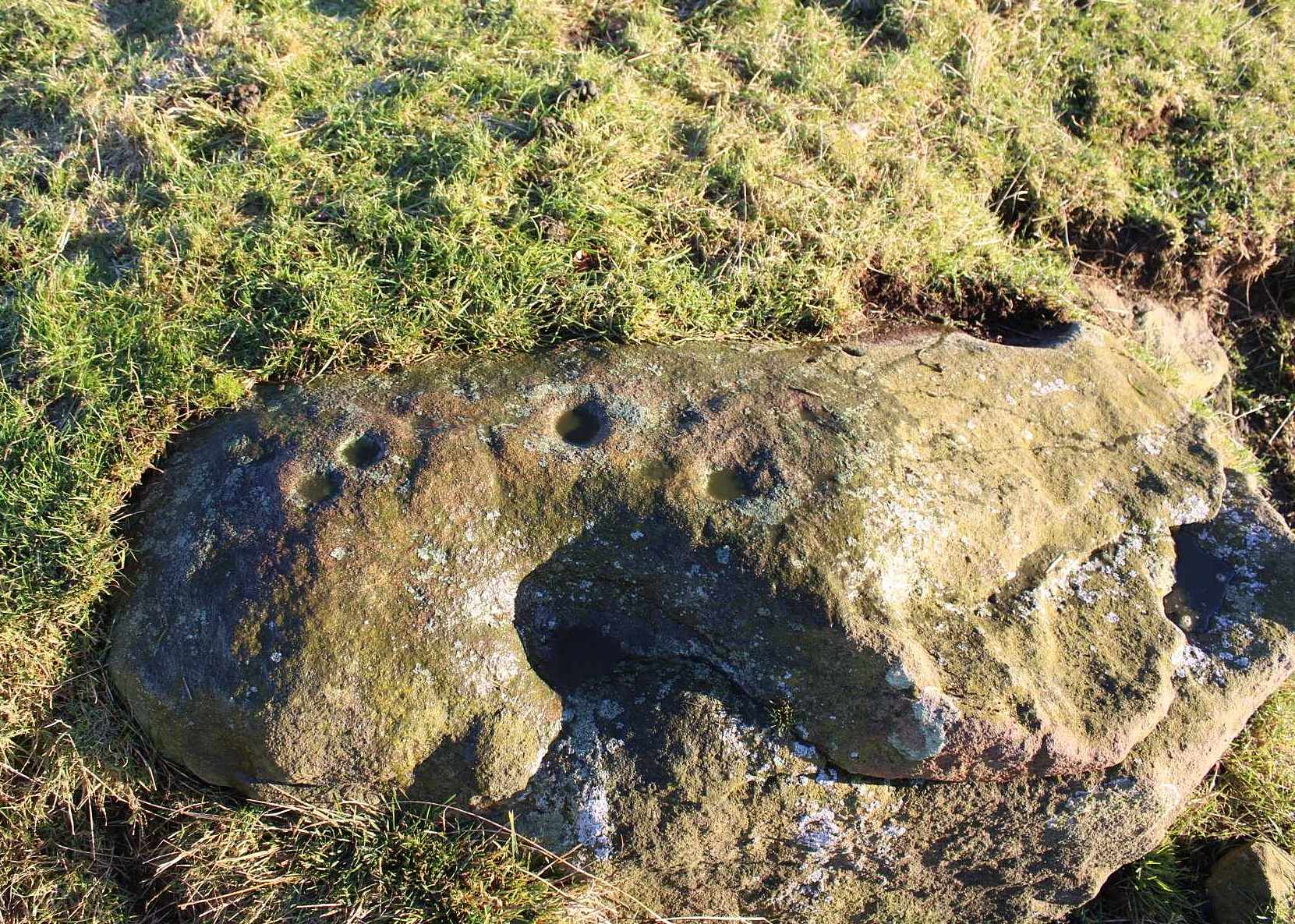
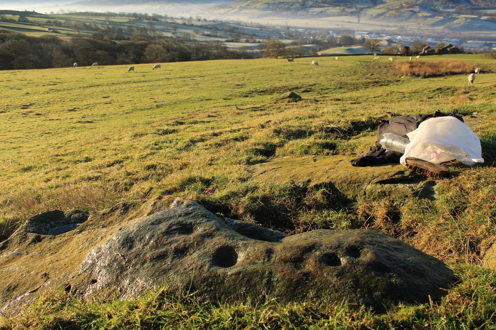
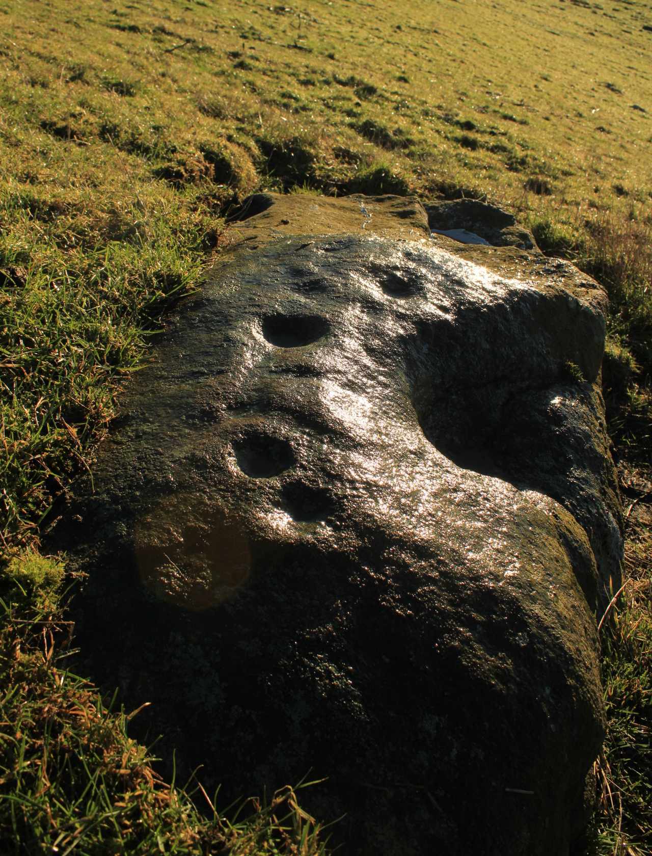
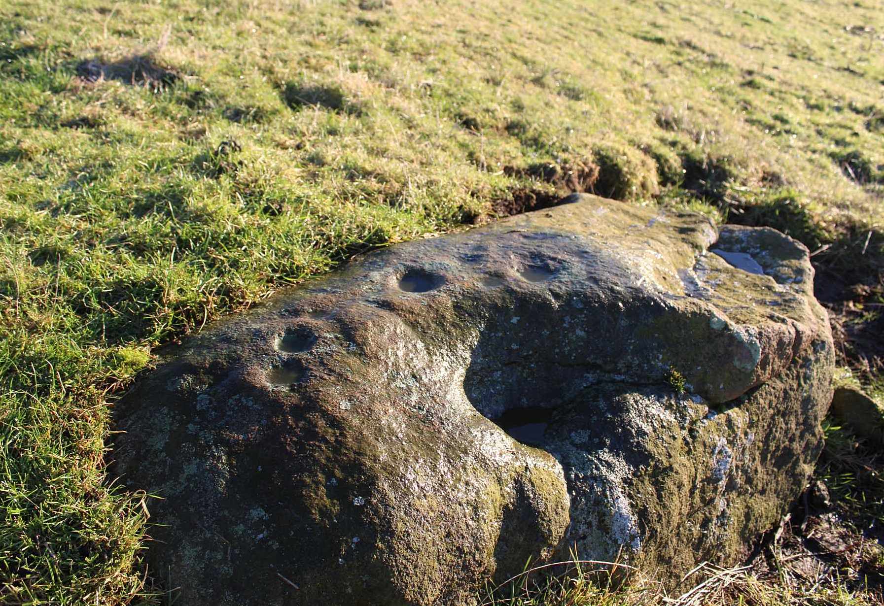
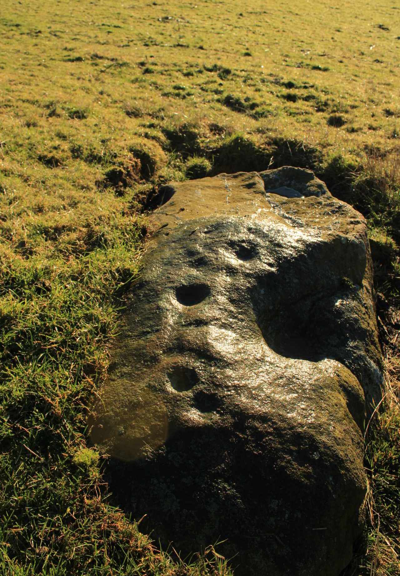
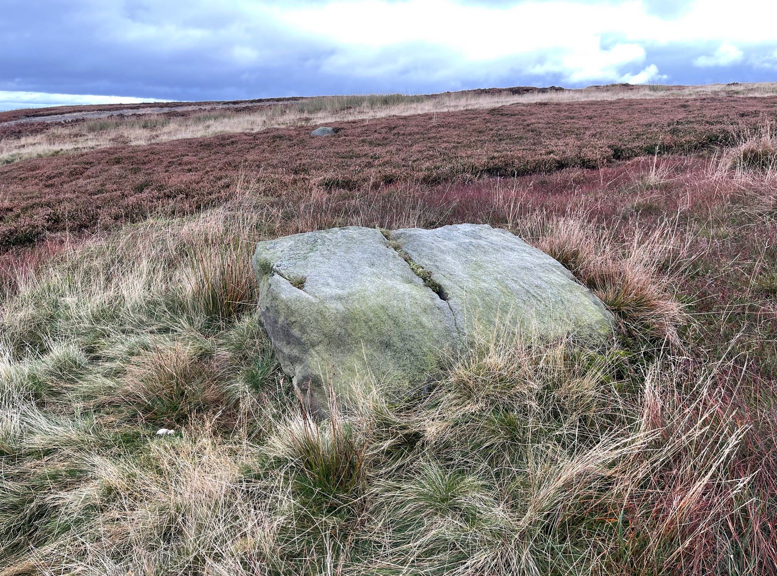
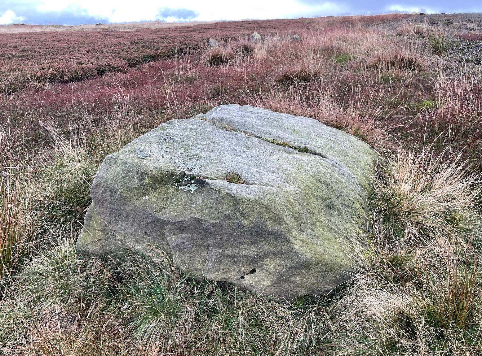
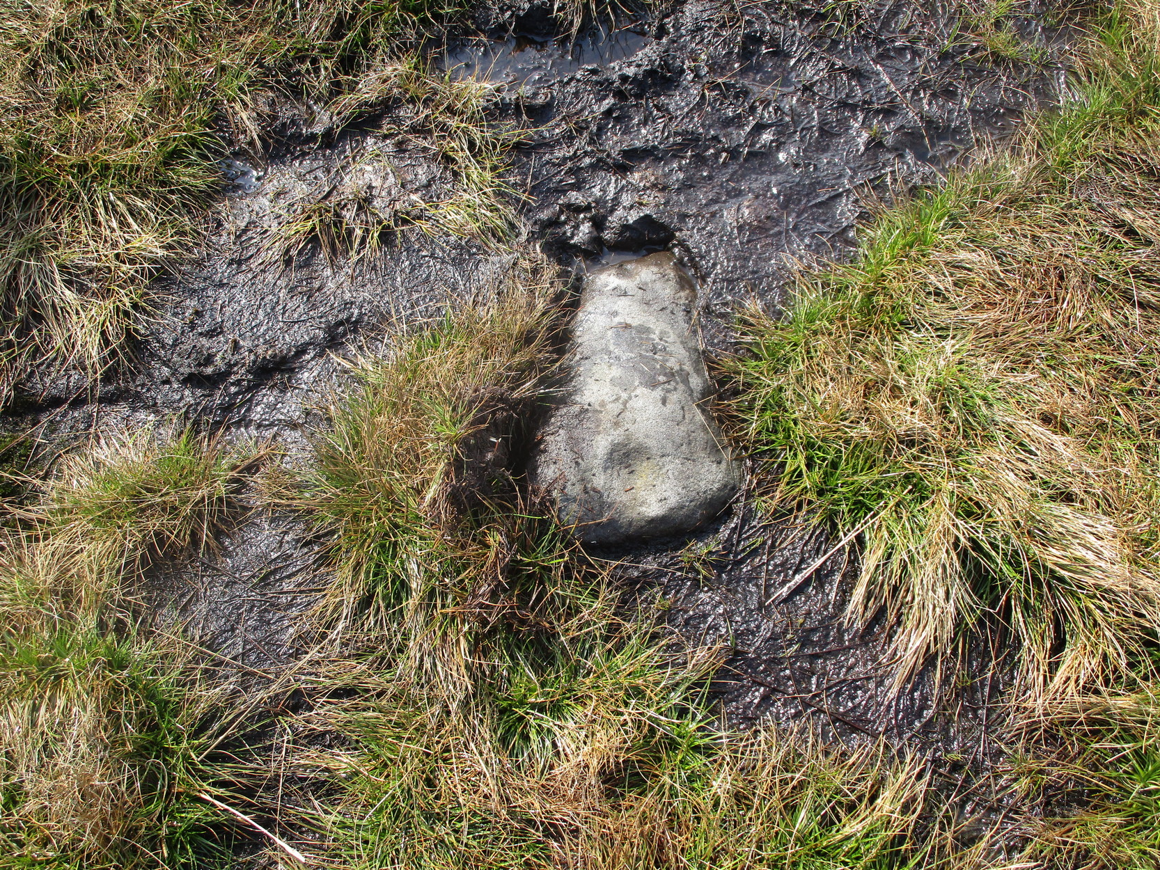
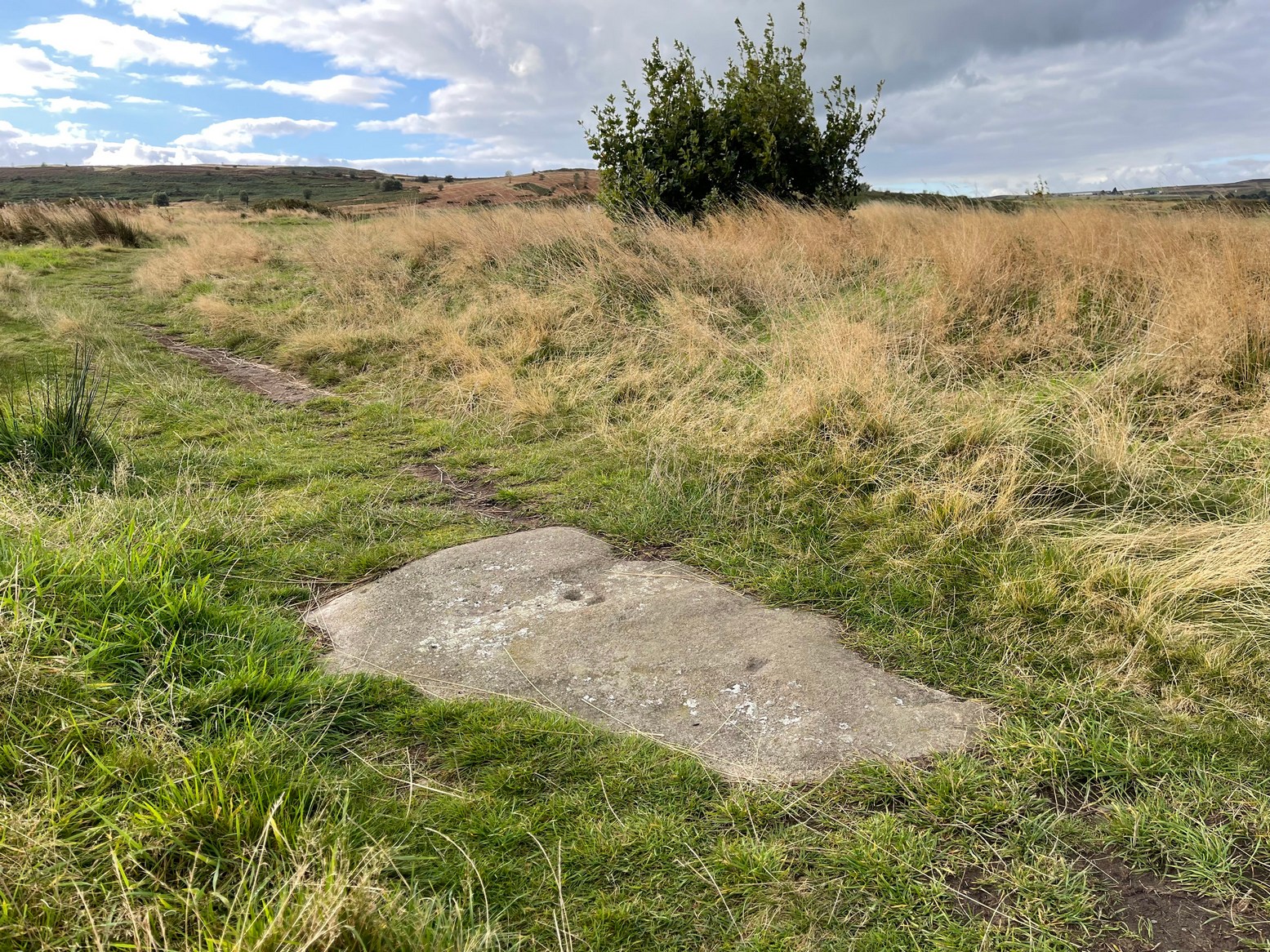
Cup-Marked Stone (lost):  OS Grid Reference – SE 2556 4687

Also Known as:

  1. Carving no.556 (Boughey & Vickerman)

Archaeology & History

We know very little about this carving, which was first highlighted on Eric Cowling’s (1940) map of Wharfedale petroglyphs.  Described simply as one of the “cup-marked rocks”, he mentioned it briefly in Rombald’s Way (1946) as being “the most easterly carving” in mid-Wharfedale—which it was at the time (a very recent find by Benn Potts of a cup-marked stone at Weeton has pushed the boundary further eastwards).  Oddly for Cowling, he left no further notes nor sketch of the carving and when Stuart Feather (1961) came to write of it, he merely copied Cowling’s earlier words.  It’s not been seen since.  In Boughey & Vickerman’s (2003) survey, they could find no cup-marked stone in the wood but thought instead that,

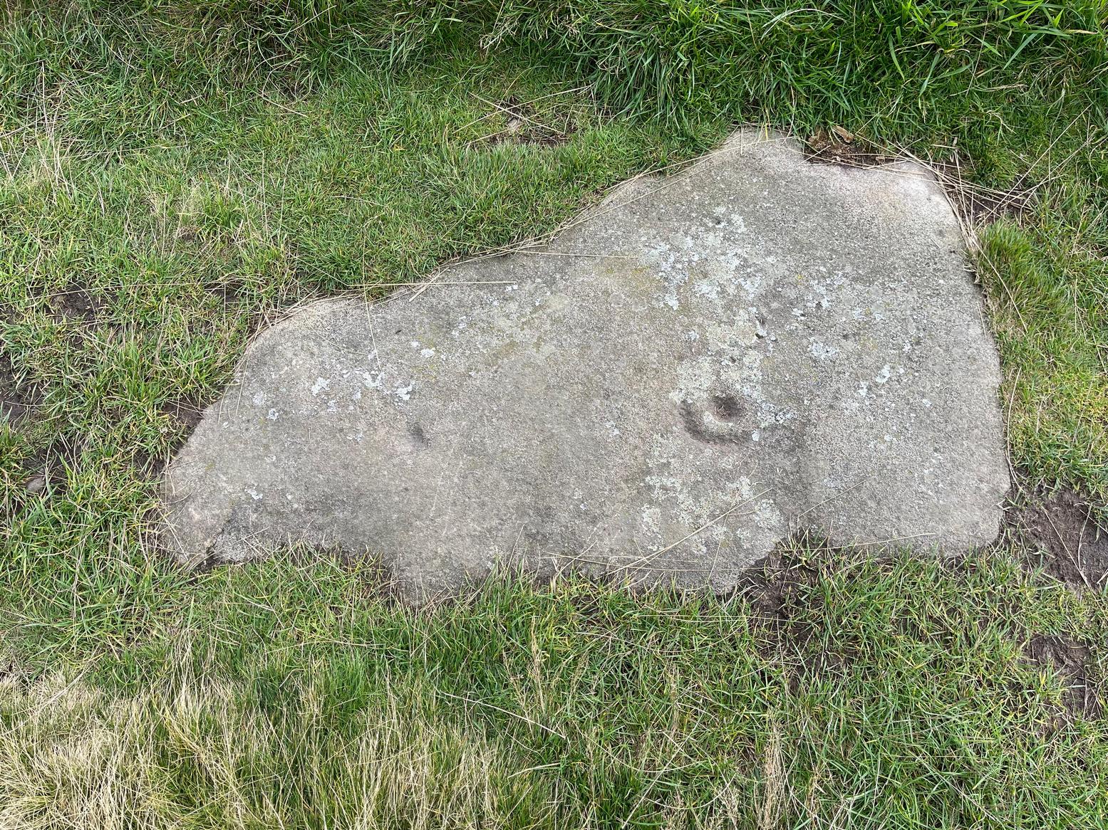
“this may be due more to confusion than to loss of the carving.  Riffa Wood does contain a carving: of a Native American on a conspicuous rock alongside one of the many woodland paths. Furthermore, one or two local residents recall a German prisoner carving something on a rock in Riffa Wood during the Second World War.  Presumably, this is the origin of the Native American carving.  Could it be that this man added something of his own to what was already a carved rock, in which case the Native American as he now appears is the site noted by Cowling before the War?”

No cup-marks exist on this Native American carving, and it’s highly unlikely that Cowling would have made such an elementary mistake.  The carving no doubt lies covered in woodland vegetation waiting, once more, for the day that someone comes along and exposes its visage to the world again.  Let us know if you manage to find it…

References:

  1. Boughey, Keith & Vickerman, E.A., Prehistoric Rock Art of the West Riding, WYAS: Wakefield 2003.
  2. Cowling, E.T., ‘A Classification of West Yorkshire Cup and Ring Stones,’ in Archaeological Journal, volume 97, 1940.
  3. Cowling, E.T., Rombald’s Way: A Prehistory of Mid-Wharfedale, William Walker: Otley 1946.
  4. Feather, Stuart, “Mid-Wharfedale Cup-and-Ring Markings,” in Cartwright Hall Archaeology Group Bulletin, volume 6, no.3, March 1961.

Acknowledgements:  Huge thanks for use of the Ordnance Survey map in this site profile, reproduced with the kind permission of the National Library of Scotland

© Paul BennettThe Northern Antiquarian

Wilson Scar, Shap, Cumbria

Stone Circle (destroyed):  OS Grid Reference – NY 549 182

Archaeology & History

This site has been completely destroyed by the huge eyesore of a quarry that we all see when we’re travelling up the M6 north, above Shap.  John Waterhouse (1985) told that “a rescue excavation” was carried out here with help from the kids at Penrith Queen Elizabeth School, shortly before its destruction in 1952, but now there is no trace left of it.  When it was first described by J.E. Spence (1935), the circle had already been damaged by a wall that cut right through its centre.  He told:

Spence’s 1935 plan

“The circle, which is 6o feet in diameter, is composed of 35 stones, 20 being on the west and 15 on the east side of the boundary wall running through the circle from north to south.  The stones of which the circle is composed are Borrowdale erratics, a large number of which are scattered over the adjoining ground on both sides of the wall but more thickly in Sweet Holme Pasture. The  stones, which vary up to 5 feet 9 inches by 3 feet, are larger and more numerous in the north-west quadrant where the tallest stands 1 foot 8 inches above the level of the turf.  The ground within the circle is level, but to the south and west it slopes gently down from the edge of the circle in such a manner as to suggest that the area within the circle has been levelled.”

1952 plan laid over Spence’s 1935 plan

Spence told that an ancient “sunken trackway” led outwards from the circle to the south-west in the direction of Rosgill, but when the 1952 excavation occurred, no remains of such a track were found; nor was the wall that had cut through it; and the north-easterly section of the circle had been cut into and re-laid, presumably by the quarrymen.  It was quite plain, wrote G.G. Sieveking (1984), “that this portion of the monument was encroached upon in the summer of 1952, and hastily reconstructed for the benefit of the archaeologists.”

Their excavation found that some internal sections of this ring had been paved with thin limestone slabs and they also uncovered two small cairns, neither of which possessed anything.  However, they did find four funerary deposits within the monument: one at the northeastern section of the circle (no.1); another near the centre (no.4); and remains of a cremation west of centre (no.3); but the most complete find was at the western side of the ring, where a “disarticulated inhumation burial was lying immediately beneath the turf line in a shallow grave 1.35 m long, surrounded by a setting of small boulders.”  It was a near complete human skeleton.  This place was obviously, at times, used in ceremonies for the dead.

Shortly after the archaeological examination of the site, it was blasted away by quarrying.  Gone!

References:

  1. Barnatt, John, Stone Circles of Britain – volume 2, BAR: Oxford 1989.
  2. Burl, Aubrey, The Stone Circles of Britain, Ireland and Brittany, Yale University Press 2000.
  3. Farrah, Robert W.E., A Guide to the Stone Circles of Cumbria, Hayloft: Kirkby Stephen 2008.
  4. Seton, Ray, The Reason for the Stone Circles in Cumbria, privately published: Morecambe 1995
  5. Sieveking, G.G., “Excavation of a Stone Circle at Wilson Scar, Shap North 1952,” in Transactions Cumberland & Westmorland Antiquarian & Archaeological Society, volume 84, 1984.
  6. Spence, J.E., “A Stone Circle in Shap Rural Parish,” in Transactions Cumberland & Westmorland Antiquarian & Archaeological Society, volume 35, 1935.
  7. Waterhouse, John, The Stone Circles of Cumbria, Phillimore: Chichester 1985.

© Paul BennettThe Northern Antiquarian

Holy Well, Blaston, Leicestershire

Holy Well (destroyed):  OS Grid Reference – SP 8234 9542

Also Known as:

  1. Our Lady’s Well

Archaeology & History

Site shown on 1885 map

There seems to be very little known about this site.  It was located in fields just above the site of the Augustinian Priory of St Mary, founded in 1220 CE, where now is Priory Farm, but there seems to be no trace left of it.  The great Leicestershire antiquarian John Nichols said the well had been dedicated to Our Lady, the Virgin Mary. This was echoed in John Curtis’ (1831) survey, who told that, “where the Priory formerly stood, a Dwelling House has been erected; and near it is a Well called Our Lady’s Well.” He told that it was deep and “walled below the surface.”

References:

  1. Curtis, John, A Topographical History of the County of Leicester, W. Hextall: Ashby-de-la-Zouch 1831.
  2. Rattue, James, ‘An Inventory of Ancient, Holy and Healing Wells in Leicestershire’, in Transactions Leicestershire Archaeological & Historical Society, volume 67, 1993.
  3. Trubshaw, Bob, Leicestershire and Rutland’s Holy Wells, Heart of Albion: Nottingham 2024.

Acknowledgements:  Huge thanks for use of the Ordnance Survey map in this site profile, reproduced with the kind permission of the National Library of Scotland

© Paul BennettThe Northern Antiquarian

Cleland Stone, Skipton, North Yorkshire

Cup-and-Ring Stone:  OS Grid Reference – SE 00076 50540

Getting Here

Cleland Stone, Skipton

From near Skipton town centre, at the Cross Keys Inn along Otley Road, go up Short Bank Road all the way to the very top and then into the trees onto the Dales High Way footpath.  Walk up for literally ¼-mile (0.4km) and where the path bends and heads ENE, notice here a footpath that takes you over the wall.  Once on the other side, the path splits with one heading SE and the other roughly alongside the walling to the SW, which is where you need to go.  About 200 yard on, go through the gate into the field and then another 375 yards on you’re into another field (copse of trees in front of you).  Just as you’ve gone into this field, walk immediately left, uphill, by the walling for about 100 yards, over the marshy dip, then head into the field where, about 75 yards in, you’ll see some rocks scattered about…

Archaeology & History

Cleland Stone, looking S

In an area that’s had some considerable quarrying done to it, we’re lucky to find that this carving still exists.  It was rediscovered by Thomas Cleland (hence its name!) in the summer of 2024.  It consists of four distinct cups, with a possible fifth (and maybe more?) on its smooth elongated surface.  The cups, as we can see, are quite deep and unmistakable.  An incomplete ring seems to be around at least one of the cups; and there seems to be a carved straight line running between another two of them.  A simple but distinct design and in a lovely setting gazing cross the Airedale valley from here.

There are very few other carvings in this neck o’ the woods (the Great Laithe Wood carving aint too far away), but the fact that this has been found would suggest that others are probably hiding away in the undergrowth.  Check out the Iron Age Horse Close Hill enclosure while you’re up here too.

Acknowledgements:  A huge thanks to Thomas Cleland, not only for finding the carving, but also for allowing use of his photos in this site profile.

© Paul BennettThe Northern Antiquarian

Cairnfauld Field, Lilburn, Wooler, Northumberland

Cup-and-Ring Stone (lost):  OS Grid Reference – NU 013 264

Also Known as:

  1. Cairnfold Field

Archaeology & History

In James Hardy’s (1889) essay describing new archaeological finds from the Lilburn area, he told of seeing a triple-ringed petroglyph that seems to have been cast up from one of the cairns in the adjacent field.  I can find no other reference to this.  He wrote:

“On a wall top, near a gate not far from the Cairn-fauld’s field, lies a detached stone, supposed to have come from a cairn, with three circles and a hollow central cup incised on it, which no one  seems to care for.”

Does anyone know what has become of it?  Mr Hardy also described a series of other carvings a few fields away to the east, some with quite ornate cup-and-ring designs.  These have never subsequently been seen and remain hidden.

References:

  1. Hardy, James, “Further Discoveries of Pre-Historic Graves, Urns and other Antiquities, on Lilburn Hill Farm,” in Archaeoogia Aeliana, volume 13, 1889.

Acknowledgements:  Huge thanks for use of the Ordnance Survey map in this site profile, reproduced with the kind permission of the National Library of Scotland

© Paul BennettThe Northern Antiquarian

Villa Real, Jesmond, Newcastle-upon-Tyne, Northumberland

Cist (destroyed):  OS Grid Reference – NZ 260 656

Archaeology & History

Urn of Villa Real

All remains of this prehistoric burial site have obviously long since fallen into only the vaguest of memory, but its incidence deserves reviving for those who may live nearby and seek for a place where our truly ancient ancestors once faired.  Here, beneath the modern buildings of homo-profanus, less than a mile north-east of Newcastle city centre, a small prehistoric burial chamber, or cist, was uncovered quite accidentally by a Mr Russell Blackbird (1832) in the first-half of the 19th century.  In a letter to the newly-formed (as it was back then) Society of Antiquaries of Newcastle in April of that year he told,

“In trenching some ground for planting, this morning, we discovered a stone vault, 4 feet long by 2 feet wide, and 20 inches deep, deposited in a dry hard marl below the soil, which we were  taking out for making the walks in the garden. It contained the bones of a man, the head, in particular, quite perfect, with all the teeth in it.  Also a small urn (was found)… There was some red-coloured earth in the urn which the labourers threw out.”

Mr Blackbird sent the antiquarian society a sketch of the urn that he and his colleagues discovered, reproduced here.

References:

  1. Blackbird, Russell, “Account of the Discovery of a Stone Vault and Urn, at Villa Real, Jesmond,” in Archaeologia Aeliana, volume 2, 1832.

Acknowledgements:  Huge thanks for use of the Ordnance Survey map in this site profile, reproduced with the kind permission of the National Library of Scotland

© Paul BennettThe Northern Antiquarian

Reva Hill (8), Hawksworth, West Yorkshire

Cup-Marked Stone:  OS Grid Reference – SE 152 434

Getting Here

Naathen… I’d give you the directions of how to find this stone, but I’m not sure of its precise location.  Just get to the top of Reva Hill, on its more westerly side, and it’s somewhere on its upper slopes.  I was up here again recently and hoped to find it, but the grasses might have grown back over it.  If one of you petroglyph fans manages to locate it, please can you send me its exact grid-reference, so I can update the site profile.

Archaeology & History

This was one in a cluster of carvings that were rediscovered in 2011 and which I’ve not managed to re-locate (bad boy).  It’s very plain and simple, as you can see.  Indeed, I was lucky to even notice it, as the central photograph above shows how faint and eroded the cup-marks are in normal light.  Thankfully with a bit of water, what I initially thought may have been two cup-marks, turned into three or four of them.  So the next time you’re having a look at the Fraggle Rock carving and its companions, remember that this little fella is hiding somewhere close by…

© Paul BennettThe Northern Antiquarian

Green Crag Slack (356a), Ilkley Moor, West Yorkshire

Cup-Marked Stone:  OS Grid Reference – SE 13665 46014

Getting Here

Carving 356a, Green Crag

From Cow & Calf Rocks, walk up the steep footpath and turn left (southeast) when it levels out on the edge of the moor.  Walk 250 yards along and, where the main path veers down to the road, just keep walking along in the same direction along the footpath that runs gradually uphill until, after 650 yards (595m) you’ll eventually meet up with the footpath that runs along the moorland proper.  Where these two paths meet-up, then head upwards (south) into the heather for 55 yards (50m) until you see a good-size sloping block of stone with a crack roughly down the middle.  If you hit the Little Haystack Rock (a big conspicuous stone) you’ve gon too far!

Archaeology & History

Shallow cupmarks visible

This is one of the many basic cup-marked stones you’ll find scattered all over these moors possessing (as it does) only two distinct cup-marks on its more northern half, although a possible faint third one needs looking at in better light.  When we were kids exploring this and other areas, single and double cup-marked stones like this seemed ten-a-penny and we’d flippantly pass them by after quick perusal, looking for more impressive designs.

The carving here seems to have been missed in the surveys of Hedges (1986) and Boughey & Vickerman (2003), despite the rock standing out quite distinctly.  I can only assume that they checked it out when the skies were grey and dull, making the cup-marks difficult to see.  A number of other prehistoric remains can be found close to this carving, including cairns and sections of enclosure walling.

Folklore

Tradition tells that the indigenous Britons had a battle with the Romans on the plain where this carving is found.

© Paul BennettThe Northern Antiquarian

Castle Gate, Burley Moor, West Yorkshire

Cup-Marked Stone:  OS Grid Reference – SE 134 440

Archaeology & History

During a walk I did with a small group of people in the Spring of 2024, after a series of heavy rainfalls we ended up having to veer on and off the footpath to ensure we didn’t get swallowed in one of the bogs!  In doing so, one of the group, Sarah Walker, noticed a small, almost portable-sized stone sticking up out of the edge of a peat-bog with a very distinct single cup-marking on it. (it may have been on its way as an offering stone to the Little Skirtful cairn)  Sarah twizzzled it round a few times in the mud so we could get some good photos of it before we went on our way to the circle at Horncliffe.  We didn’t get an exact position for the stone, but it can be found somewhere roughly over halfway between Roms Law and Horncliffe, not far off the path.  Good luck!

Acknowledgements:  Big thanks to Sarah Walker for stumbling across and uncovering this cup-marking, deep in the moorland mud.

© Paul BennettThe Northern Antiquarian

Eaves Crag, Baildon Moor, West Yorkshire

Cup-and-Ring Stone:  OS Grid Reference – SE 15073 40440

Also Known as:

  1. Carving no.50 (Hedges)
  2. Carving no.194 (Boughey & Vickerman)

Getting Here

Eaves Crag carving

Take the road up through Baildon village, across at the roundabout up Northgate and up onto the moor, then after a few hundred yards turn left on the Bingley Road.  About five hundred yards along, keep your eyes peeled for where the ruined reservoirs are to the left-side of the road.  Straight across the road from here (north) you’ll see the small cliffs of Eaves Crag.  Walk along the footpath that runs above the cliffs and, about 80 yards past them, keep your eyes peeled on the ground right in the middle of the path.  You can’t really miss it!

Archaeology & History

Basic cup-and half-ring

First mentioned in passing in the magnum opus of W. Paley Baildon (1913) and subsequently in one of Sidney Jackson’s (1955) series of profiles on the Baildon Moor carvings, this all but insignificant carving comprises of a simple cup-and-half-ring and another singular cup-mark a little further along the stone.  John Hedges (1986) described this carving as being a “well marked cup surrounded by horseshoe groove – also well marked.  Possible small cup and incomplete ring.”  Whilst the minimalists Boughey & Vickerman (2003) told it to be simply, “two cups, one with incomplete ring.”  A peculiarity with this design is that it might have been cut by a metal implement, perhaps in the Bronze Age, perhaps even in the Iron Age.  We might never know…

References:

  1. Baildon, W. Paley, Baildon and the Baildons – volume 1, St. Catherines: Adelphi 1913.
  2. Boughey, Keith & Vickerman, E.A., Prehistoric Rock Art of the West Riding, WYAS: Wakefield 2003.
  3. Hedges, John (ed.), The Carved Rocks of Rombald’s Moor, WYMCC: Wakefield 1986.
  4. Jackson, Sidney, ‘Cup and Ring Boulders of Baildon Moor,’ in Bradford’s Cartwright Hall Archaeology Group Bulletin, 1:10, 1955.

Acknowledgements:  Huge thanks for use of the Ordnance Survey map in this site profile, reproduced with the kind permission of the National Library of Scotland

© Paul BennettThe Northern Antiquarian