Rosette Stone, Ilkley Moor, West Yorkshire

Cup-and-Ring Stone:  OS Grid Reference – SE 12822 46190

Also Known as:

  1. Carving no.128 (Hedges)
  2. Carving no.285 (Boughey & Vickerman)

Getting Here

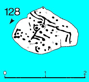
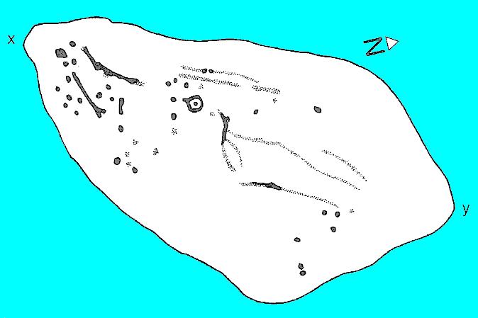
Rosette Carving (after Hedges 1986)

Follow the directions to reach the giant Haystack Rock, then follow the footpath west along the moor-edge, round where it bends keeping along the edge of the stream (Backstone Beck) below.  A couple of hundred yards after the bend, right by the side of the path.  You’ll see it! (if you hit the clearly defined ‘enclosure’ walling, you’ve gone too far)

Archaeology & History

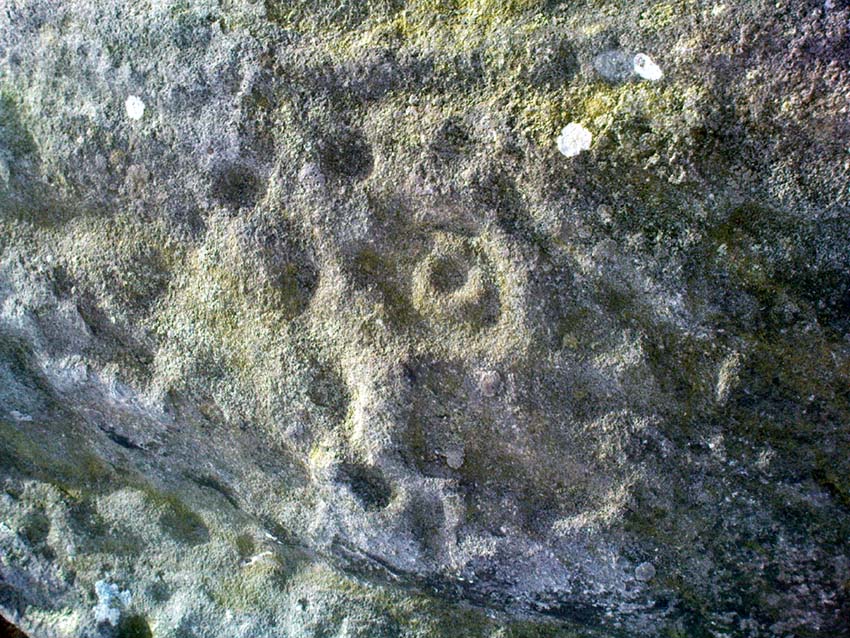
No — not the Rosetta Stone; but it is a lovely carved rock this one.  Best seen (as usual) when the rock’s wet and the sun’s heading for (or just emerged from) the horizon — but much of this image is visible even when She’s cloudy.
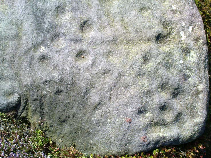
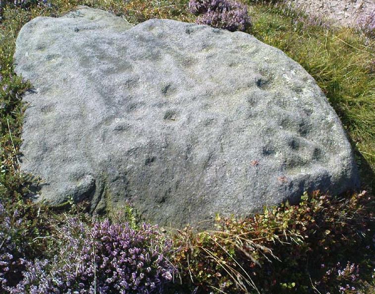
Close-up of 'rosette' and other CnRs
Close-up of ‘rosette’ design & and other CnRs
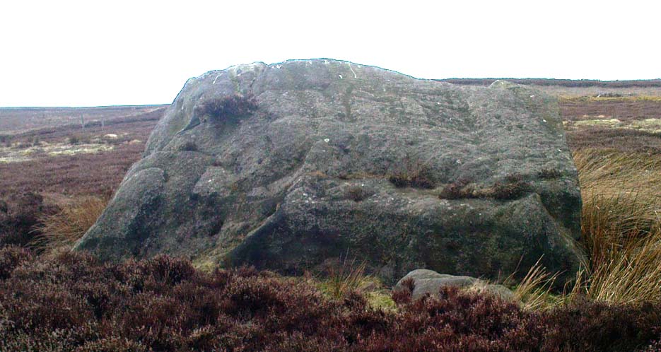
The Rosette Stone
The Rosette Stone carving

First mentioned in literary terms (surprisingly) by M.J. Walker (1956), in a short write-up following one of the Bradford Archaeology Group’s moorland walks up here.  Nearly six-feet along its longest axis, there are more than 30 cup-marks on this stone, at least three with rings; plus a variety of lines linking some cups to others.  At its northern tip is the lovely little ‘rosette’ design, as archaeologists have called it.  Others have seen this part of the design as a solar image; a flower; the Pleiades; a ring — take your pick!  It is a lovely carving though (if you’re a sad person like me, who’s into these sorta things!).  What relevance – if any – it may have had to the ‘enclosure’ within whose edges it sits, is anyone’s guess!

Excavations done close by (focusing mainly on the prehistoric ‘enclosure’ within whose domain this and other carvings occur) uncovered remains of old grooved ware pottery and the remains of flints. (Edwards & Bradley 1999)

The one thing we realise from looking at this design is the difference seen between the ‘accurate’ illustration drawn by archaeologists, and the flesh and blood of the stone itself, in situ.  The living rock has much greater form and expression than anything which our desire for accuracy possesses.  This aint knocking any attempt to portray the cups, rings and lines on paper correctly to show what the design originally looked like; merely that there’s a world of difference between the experiential vision of the carving and that done with graphic accuracy.  But we all know that anyway – so please forgive my little sojourn into speaking the bleedin’ obvious!

References:

  1. Boughey, Keith & Vickerman, E.A., Prehistoric Rock Art of the West Riding, WYAS 2003.
  2. Edwards, Gavin & Bradley, Richard, ‘Rock Carvings and Neolithic Artefacts on Ilkley Moor, West Yorkshire,’ in Grooved Ware in Britain and Ireland (edited by Cleal, R. & MacSween, A.), Oxbow: Oxford 1999.
  3. Hedges, John (ed.), The Carved Rocks on Rombald’s Moor, WYMCC: Wakefield 1986.
  4. Walker, M.J., ‘Ilkley Boulders Tour,’ in Bradford’s Cartwright Hall Archaeology Group Bulletin, 2, 1956.

© Paul Bennett, The Northern Antiquarian

Gill Head Boulder, Ilkley Moor, West Yorkshire

Cup-and-Ring Stone:  OS Grid Reference – SE 1256 4602

Also Known as:

  1. Carving no.117 (Hedges)
  2. Carving no.274 (Boughey & Vickerman)

Getting Here

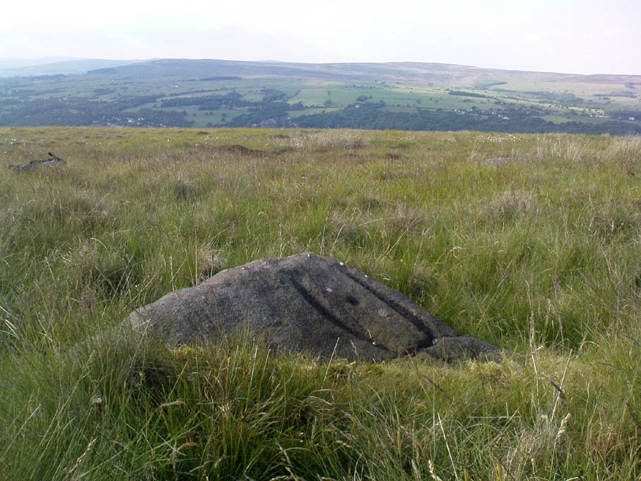
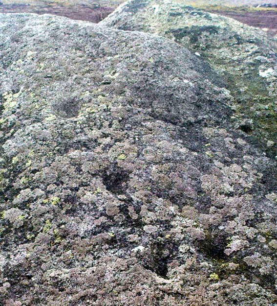
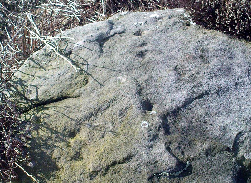
Line of cups on the Gill Head boulder

Pretty easy to find.  Follow directions to reach the great cup-and-ring marked Haystack Rock, then follow the footpath west and drop down the slope, crossing the stream of the Backstone Beck below you, the up the steepish slope and turn sharp left when you hit the footpath before the top of this slope.  Walk onto the moor!  You’ll walk right past the cup-and-ring marked ‘carving 283’ on this path, then the ruinous Backstone Circle a bit further along (50 yds to your right), but keep walking for another 100 yards until you see a large boulder a few yeards to the left of the footpath.  That’s it!

Archaeology & History

I first came across this as a kid, sometime in my early to mid-teens, pottering about, looking at any old rock that caught my eye.  And this one isn’t hard to miss really.  One of the best memories I’ve got of this stone was when a bunch of us came walkabout up here, sometime in the autumn, when the heavens poured all day long to saturation-point — even for those in all their protective gear, such good as it was in the late ’80s to early ’90s.  There started out a fair bunch of us—between 20-30 folk—with numbers dwindling sharply when we reached the Apostles.  But this stone was visited way before that!  Along with Bob Trubshaw, Graeme Chappell, Kaledon Naddair, Edna Whelan and a troop of other mad-folk, we stopped for a while to consider this old rock, with only three cups really visible that day.  The others (those cited by the archaeo’s) weren’t picked out, as I remember.  But She was pissing-it-down and the wind was really giving-it-some, so we didn’t stop here for long!  We all agreed though: it was a nice, worn cup-marked stone.

Gill Head rock carving
Gill Head carving (after Hedges 1986)

John Hedges and the Ilkley Archaeology bunch had cited it as ‘cup-and-ring’ in their fine work — the first time this old carving had been in print since it was first etched!  A few years later when Messrs Boughey & Vickerman (2003) checked it for their survey, no new features had been noted and they just copied Hedge’s earlier notes.  Indeed, it’s just a large boulder with a few archetypal cupmarks on it when it first greets the eyes.  Nowt special—and with no companions either.

This is another one mainly for the mad-folk and purists amongst us.

References:

  1. Boughey, Keith & Vickerman, E.A., Prehistoric Rock Art of the West Riding, WYAS 2003.
  2. Hedges, John (ed.), The Carved Rocks on Rombald’s Moor, WYMCC: Wakefield 1986.

© Paul Bennett, The Northern Antiquarian


Skyreholme Wall Stone, Appletreewick, North Yorkshire

Cup-and-Ring Stone:  OS Grid Reference – SE 0772 6231

Also Known as:

  1. Carving no.413 (Boughey & Vickerman)

Getting Here

Skyreholme Wall Carving
Skyreholme Wall Carving (after Boughey & Vickerman)

Various ways here, but for the sake of newcomers I’d say it was best following directions from Burnsall.  From here, take the Appletreewick road thru the village, past the left turn a few hundred yards along, and another 500 yards or so there’s a split in the road: take the one on your right!  Follow this up, keeping right (don’t turn into Perceval Hall, tempting though it may be!) and park-up where the road turns into a track.  Walk up the track, past the haunted junction, bearing left uphill up Black Hill Road until you reach the very peak of the track where, in the walling on your left, you’ll see this big boulder.  If you can’t see it, you’re bloody close!

Archaeology & History

This is at the very peak of Black Hill Road, with excellent views of Simon’s Seat climbing to the immediate south, the prominent and rounded Nursery Knot Hill immediately north, and grand views to peaks east and west. It is very likely this position had something to do with it being deemed worthy of relevance.  The rock itself defines a point along the old boundary line.

Skyreholme Wall Boundary carving

One peculiarity on this boulder is the deep cup-mark with a strange ‘lip’ to it, which has been mentioned by others in the past.  This is surrounded by at least five others cups — not dissimilar to some of the ‘rosary-designs’ of cup-and-rings further north.

The rock art student’s Boughey & Vickerman’s (2003) drawing of this design is pretty accurate — where they call it stone 413 — though it doesn’t actually give this carving the justice it deserves.  They also erroneously tell that some of the cups here are doubtful.

Check it out for y’self.  This is an excellent stone for cup-and-ring lovers! (with plenty of other sites scattered about all round here)

References:

  1. Boughey, Keith & Vickerman, E.A., Prehistoric Rock Art of the West Riding, WYAS 2003.

© Paul Bennett, The Northern Antiquarian

Hollin Tree Hill, Askwith Moor, North Yorkshire

Standing Stone:  OS Grid Reference – SE 16611 50818

Getting Here

Follow the directions to reach the Man Stone carving.  Walk up the sloping hillside from there until you reach the top.  From there, walk down the slope heading slightly to your left.  You’ll find it!

Archaeology & History

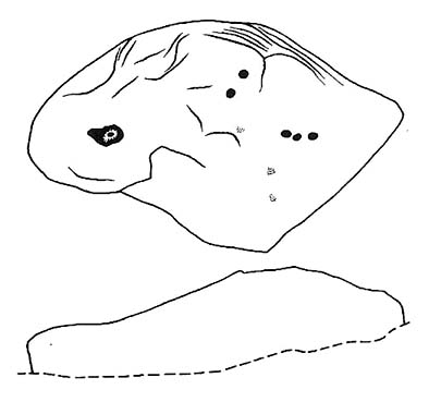
A small upright stone, less than three feet tall, but once a little taller as you’ll see that it’s head has been knocked off in the not-too-distant future and lies on the ground by its side.  A small scatter of what seems like possible cairn-material lies around its base, but not enough to imply that a tomb of any sort was ever here (aswell as that, the position on the slope seems wrong).

A curious little thing, without archaeological companions.  When we came here the other day, we explored the ground all round the stone as all the heather had been burnt back; but there was nothing anywhere near it to give a hint as to why it stands here, alone, at what seems like a strange spot two-thirds the way up a moorland slope. It’s been speculated that in the middle of its more north-facing side there is a cup-mark on it, but this is very dubious and, in my opinion, should be discounted as such.  The marking is a gun-shot wound – and more recent ones have just been added, as seen  in the photo.

© Paul Bennett, The Northern Antiquarian

Enclosure Carving, Ilkley Moor, West Yorkshire

Cup-and-Ring Stone:  OS Grid Reference – SE 12836 46147

Also Known as:

  1. Carving no.129 (Hedges)
  2. Carving no.288 (Boughey & Vickerman)

Getting Here

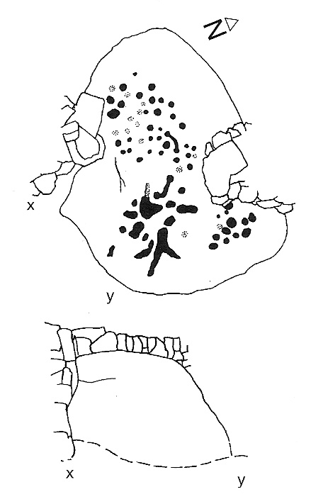
Enclosure Stone design (after Hedges 1986)

Nice n’ easy.  Get to the Haystack Rock and walk on the path west (past the Three Cups Stone) and where the path swings round following the edge of the small Backstone valley, keep going for 150 yards or so.  Keep your eyes out for the remains of walling in the Green Crag Settlement on your left.  This flat stone is amidst the heather in and amongst the enclosure (hence the name).  If you walk back and forth hereabouts for a short period, checking for flat stones amidst the heather about 20 yards off the path, you’ll find it!

Archaeology & History

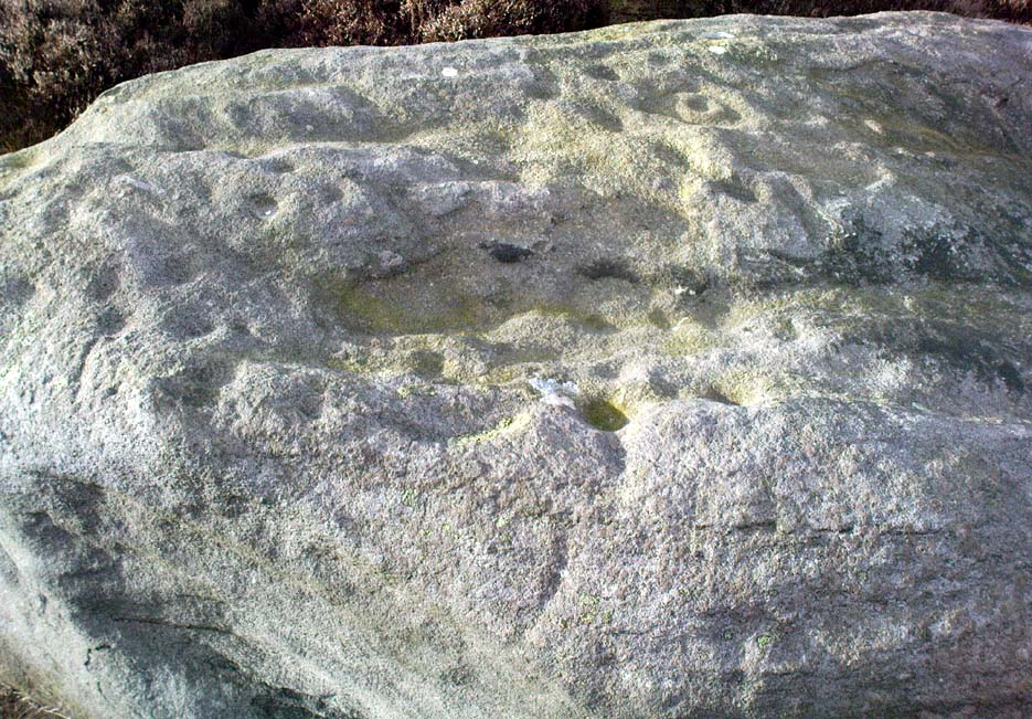
Top-left section of CR-288 - note the carved line 'enclosing' the cups which aint on the archaeo-drawings
Top-left section of CR-288

This is another one of those carvings which had been seen by a number of people, bimbling about across this part of the moor, before it saw the literary light of day in Hedges Carved Rocks book (1986).  It’s a nicely-preserved design, usually covered over by much heather growth, but is worth the exploration if you like your cup&rings.  The drawing of this stone however (in both Hedges and Boughey & Vickerman) does not convey the actuality of the carving, as we can see here.  But that’s the case with many cup-and-rings: linear precision and the artisty of the carving are two very different things.  As we can see here, one section of the stone has a defined ‘enclosure’ of cups etched upon the rock surface: something that is clearly missed in the archaeologist’s drawing.  Check it out y’self and see what you think!

References:

  1. Boughey, Keith & Vickerman, E.A., Prehistoric Rock Art of the West Riding, WYAS 2003.
  2. Hedges, John (ed.), The Carved Rocks on Rombalds Moor, WYMCC: Wakefield 1986.

© Paul Bennett, The Northern Antiquarian

Pitchfork Stone, Ilkley Moor, West Yorkshire

Cup-and-Ring Stone:  OS Grid Reference – SE 11496 46039

Also Known as:

  1. Carving no. 102 (Hedges)
  2. Carving no. 256 (Boughey & Vickerman)

Getting Here

Pitchfork Stone, Ilkley Moor

Follow the directions for getting to the great Badger Stone carving.  From here, walk eastwards on the footpath for about 400 yards.  Hereabouts walk off the path and down the slope just a few yards and amble back and forth, checking the various stones. Keep doing this until you find it! (luckily, this stone’s marked on the OS-map)  There are several other reasonable carvings nearby on the same plain…the Green Gates Stone (or carving no.257) for one!

Archaeology & History

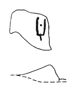
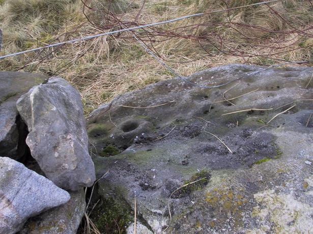
The Pitchfork Stone (after Hedges, 1986)

First found (or rather, recorded) by our old friend Stuart Feather and described in Bradford’s Cartwright Hall Archaeology Group’s Bulletin in 1961.  It’s status was all-but-secret until Hedges edited the Ilkley Archaeology Group’s Carved Rocks work in 1986.  The stone’s a simple design as the illustration shows: an urn-like vessel with a cup in the middle; but the attached groove at the bottom gave one anonymous chap (who dared to use the modern name of RombaldII!) the idea of it looking like a pitchfork – so the name sticks!

The enclosing “lines” that make up the pitchfork aspect of the carving are pretty enhanced (as we can see in the photograph here) and may, just may, be the result of a more recent petroglyphic artist.

References:

  1. Boughey, Keith & Vickerman, E.A., Prehistoric Rock Art of the West Riding, WYAS 2003.
  2. Feather, Stuart, ‘Mid-Wharfedale Cup-and-Ring Markings – Nos. 2 & 3, Ilkley Moor,’ in Bradford Cartwright Hall Archaeology Group Bulletin, 6, 1961.
  3. Hedges, John (ed.), The Carved Rocks on Rombalds Moor, WYMCC: Wakefield 1986.

© Paul Bennett, The Northern Antiquarian 

Old Man of Snowden, Askwith, North Yorkshire

Standing Stone (destroyed?):  OS Grid Reference – SE 1765 5032

Archaeology & History

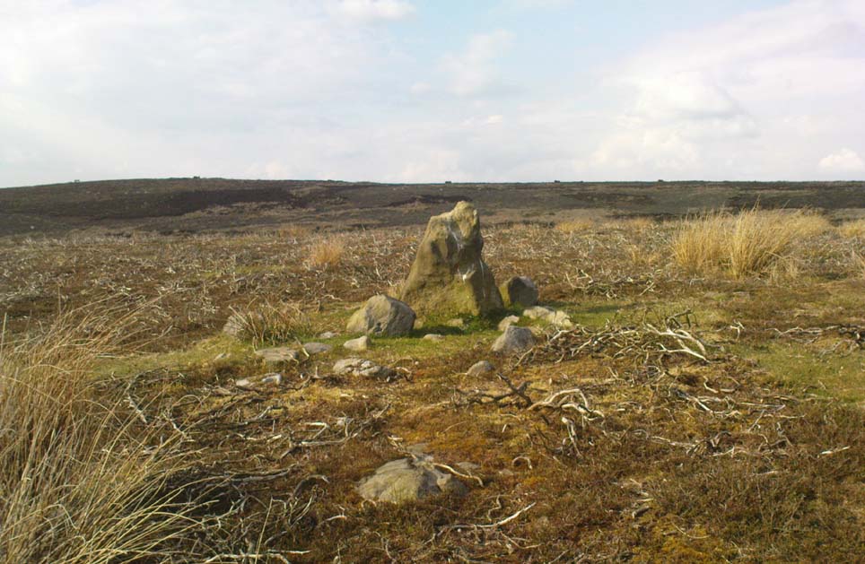
Eric Cowling (1946) described this lost or destroyed stone as “a squat standing stone at junction of the Askwith bridge-path with the Otley-Timble highway, saying how it gave its name to Stoop Hill, “which it surmounts.” But in several ambles here in search of this old stone, we’ve yet to locate it; though we did find the Stoup Hill cup-marking and possible neighbour on the southern edge of the hilltop.

Folklore

In days of olde, the ‘Old Man’ was the fabled companion of the legendary ‘Old Woman,’ or great cailleach (the christian cult stupidly, somehow, turned this mythic figure into their ‘devil’ – to which it has no relationship whatsoever).  Although no specific folktale remains here, the name of this lost stone tells that it had some mythic tale underscoring it; perhaps simply that it marked the burial of some forgotten chief or elder.

References:

  1. Bennett, Paul, The Old Stones of Elmet, Capall Bann: Chieveley 2001.
  2. Cowling, E.T., Rombald’s Way: A Prehistory of Mid-Wharfedale, William Walker: Otley 1946.

© Paul Bennett, The Northern Antiquarian
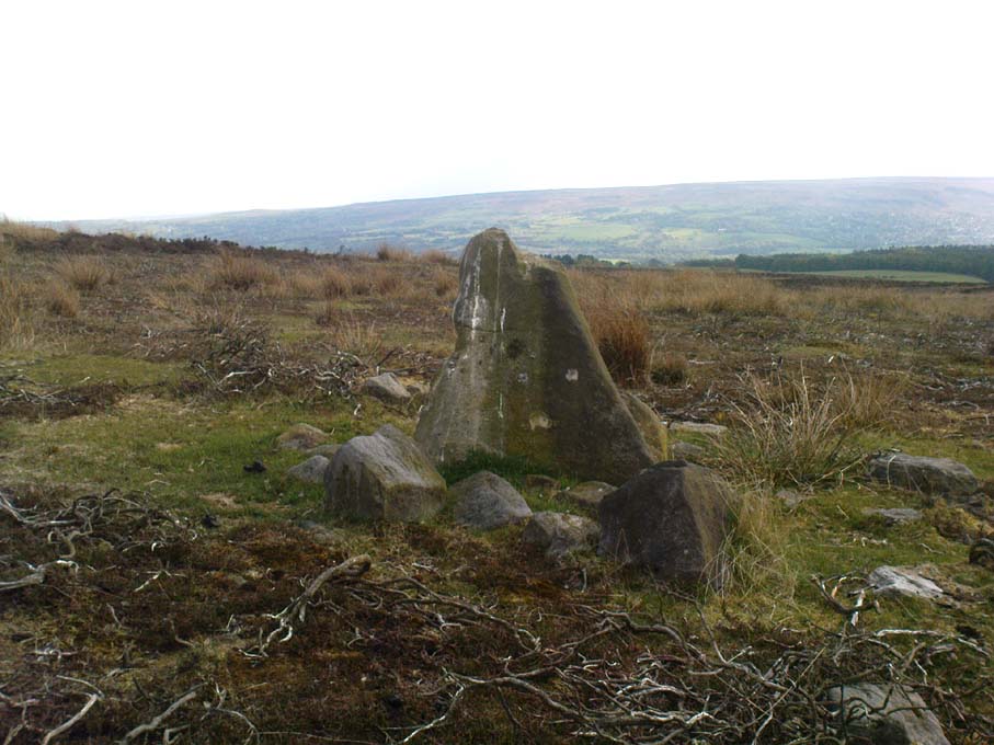

Cluster Stone, Ilkley Moor, West Yorkshire

Cup-and-Ring Stone:  OS Grid Reference – SE 13283 45920

Also Known as:

  1. Carving no.160 (Hedges)
  2. Carving no.325 (Boughey & Vickerman)

Getting Here

Follow the same directions for getting to the Idol Stone, then walk just 30 yards further up the path and it’s the big rock on your left-hand side.  Y’ can’t miss it!

Archaeology & History

Main section of cup-marks

This nice big boulder can be quite a temperamental chap, depending on how the light plays with the rock surface.  I’ve got some photos of this old stone where you can see next to nowt on it; where as others show clearly aspects of the design that aren’t on the archaeo-images.  But such is the nature of cup-and-rings I s’ppose!

Unlike its rather linear companion a few yards away, this great boulder has the more typical scattering of faded cups, lines and at least one cup-and-ring, etched with seemingly little purpose or structural design.  But as we know, the very notion of structural design in forms consistent to modern mind-sets were anathema to the neolithic people who were etching these patterns on rocks.  Indeed, even the notions of these images as ‘art’ as defined in modern times, has no relationship to the intrinsic reality of either cup-and-rings or reality per se, as experienced by our ancestors.  And I think we find an explicit affirmation of this in the Cluster Stone here.

Close-up of cup-and-ring

Natural cuts in the rock have been heightened, for whatever reason, so that today the division between Nature’s marks and the mark of humans have become ambiguous as time has worn the features.  The clustering of cup-marks on certain parts of the rock was surely indicative of (what we would term) separate events/forms, whose mythic relationship were, however, intrinscially related.  This may be representative of a landscape map, or a series of events – but each would relate to one and other.  But, of course, we truly don’t know, so think I’d best shut up!

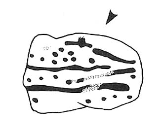
Cluster Stone design (after Hedges 1986)

The carving itself, as we can see today, has perhaps as many as 40 cup-marks on it (Boughey & Vickerman safely vouch for 26), with five or six lines running across the surface, some of which have been modified by ancient peoples.  The cup-and-ring on the stone is quite distinct.  Neolithic or Bronze Age walling runs just a few yards away from here, but the precise line it takes has not been accurately assessed.

References:

  1. Boughey, Keith & Vickerman, E.A., Prehistoric Rock Art of the West Riding, West Yorkshire Archaeology Service 2003.
  2. Hedges, John (ed.), The Carved Rocks on Rombald’s Moor, WYMCC: Wakefield 1986.

© Paul Bennett, The Northern Antiquarian

Little Haystack Rock, Ilkley Moor, West Yorkshire

Cup-and-Ring Stone: OS Grid Reference – SE 13654 45936

Also Known as:

  1. Carving no.184 (Hedges)
  2. Carving no.355 (Boughey & Vickerman)
  3. Haystack 2

The Little Haystack - looking west

Getting Here

Follow the same directions to reach the Pancake Stone.  Then walk eastwards along the footpath on the moorland edge.  After about 400 yards, keep your eye out to your right on the moorland proper where you’ll see this large boulder, seemingly isolated, of similar shape to the Haystack Rock, but a bit smaller.  That’s it! If you end up near the stream (Rushy Beck) you’ve gone way past it.

Archaeology & History

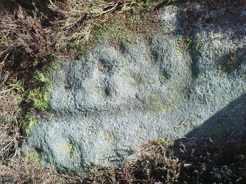
Four of the cups
Four of the cups on this lichen-rich surface
Little Haystack (after Hedges 1986)

Found in the middle of the Green Crag Slack Plain, this large Haystack-Rock-shaped boulder stands out.  It sits amidst a cairn-field with other neolithic remains nearby.  The carving itself aint that impressive, and some parts of it seem almost dubious.  But both Hedges, Boughey and Vickerman include it in their surveys, describing the cup-marks and curious lines on its northeastern surface.  It’s nowt special to be honest.  You’d expect a bit more from the size of this old stone; but as those folk who know their rock art well will tell you, size aint everything when it comes the splattering of cups on a rock’s surface. We have four distinct cups pretty close to each other (as the photo shows), with another possible cup-and-ring and accompanying lines nearby.

The stone’s worth looking at though.  It stands out amidst the mass of single- and double-tombs scattered across the moorland plain — sitting amidst a veritable necropolis no less.

References:

  1. Boughey, Keith & Vickerman, E.A., Prehistoric Rock Art of the West Riding, West Yorkshire Archaeology Service 2003.
  2. Hedges, John (ed.), The Carved Rocks on Rombald’s Moor, WYMCC: Wakefield 1986.

© Paul Bennett, The Northern Antiquarian

Druid’s Altar, Bordley, North Yorkshire

Ring Cairn:  OS Grid Reference – SD 94945 65270

Also Known as:

  1. Bordley Circle

Getting Here

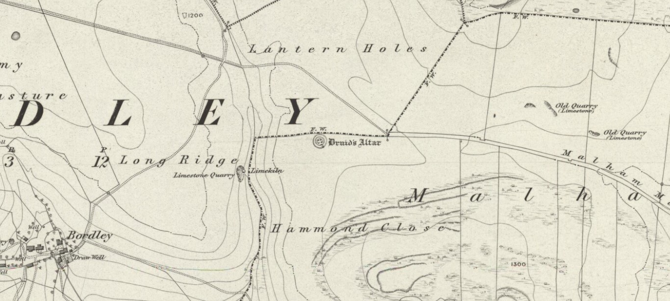
Druids Altar on 1852 map

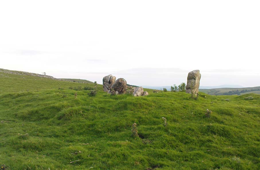
From Threshfield, go up Skirethorns Lane for about 1/2 mile, where the lane takes a sharp right. Continue uphill for nearly 2 miles to a metal gate. Go through the gate, where you’ll see a pair of curious standing stones ahead of you, but instead walk about 250 yards along the line of the old field wall running to the west.  You’ll see on the modern OS-map that a ‘cairn’ is shown: this is where you’re heading!

Archaeology & History

First highlighted on the 1852 OS-map of Bordley and district, this is a lovely site in a beautiful setting, surrounded by a veritable mass of other prehistoric remains at all quarters, including the large settlement of Hammond Close immediately south, the little-known settlement at Kealcup to the west, the Lantern Holes settlement up the hill immediately north, some standing stones due east, and much more.  Although it was described in Aubrey Burl’s Four Posters (1988) as just such a type of megalithic relic (a “four-poster stone circle”), an earlier description of the site from the mighty pen of Harry Speight (1892) told of a much more complete ring of stones, with trilithon to boot. He wrote:

“This prehistoric relic consists of a round stone and earthen mound, about 150 feet in circumference and 3 feet high, and was formerly surrounded by a circle of upright stones, only three of which are now left standing. On one side was a large flat stone resting upon two others, and known as the Druid’s Altar. On the adjoining land an ancient iron spear-head was found some years ago, and fragments of rudely-fashioned pottery have also from time to time turned up in the same neighbourhood.”

Edmund Bogg’s (1904) description following his own visit a few years later described this “remains of Druidical sacrifice” as consisting of,

“a mound some four feet high, and fifty yards round the outer rim. In the centre are two upright stones about four feet in length; and others nearly buried in the mound. Numerous stones from this circle have been used in building the adjoining walls.”

Bordley Circle, looking SE
Bordley Hill, looking south to Pendle Hill

A decade later another writer (Lewis 1914) merely copied what Speight and Bogg had recited previously. And whatever the modern books might tell of its status, I think we can safely assert that this was originally a much more substantial monument than the humble four-poster stone circle that meets our eye nowadays.  Our megalithic magus, Aubrey Burl (1988), wrote the following on Bordley’s druidical stones:

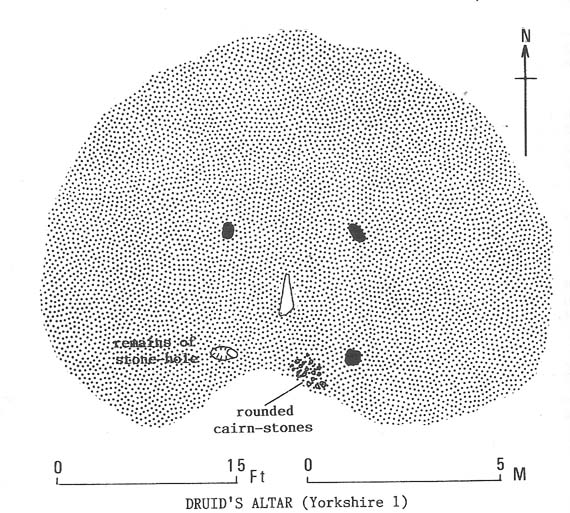
“On a circular mound 41ft (12.5m) across and 3ft (1m) high, three stones of local limestone form the corners of a rectangle 11ft 6in (3.5m) square, from which the SW stone is missing.  At its corner is ‘a stump, possibly the base of a prostrate stone,’ 5ft 10in (1.8m) long, now lying near the centre.  The tallest stone, 3ft 7in (1.1m) high is at the south-east.  The sides of the square are close to the cardinal points.  Between the SW and SE stones is a scatter of round cairnstones… Characteristically, the 4-Poster stands at the edge of a terrace from which the lands falls steeply to the west.”

Plan of the Druid's Altar (after Burl, 1988)
Plan of the Druid’s Altar (after Burl, 1988)

The Druid’s Altar seems to have originally been a large prehistoric tomb, perhaps even a chambered cairn.  Its situation in the landscape where it holds a circle of many outlying hills to attention, almost in the centre of them all, was evidently of some importance.  The only geographical ‘opening’ from here is to the south, where a long open valley widens to capture the grandeur of Pendle Hill, many miles away.  This would not have been insignificant.

We must also draw attention to what may be a secondary tumulus of similar size and form to the mound that the Druid’s Altar sits upon only some 25 yards to the west of the “circle”.  The shape and form of this second mound is similar to that of our Druid’s Circle — though to date, it seems that no archaeologist has paid attention to this secondary feature.  It measures some 21 yards (east-west) x 19 yards (north-south) in diameter and has the appearance of a tumulus or buried cairn.  The mound may be of a purely geological nature, but this cannot safely be asserted until the attention of the spade has been brought here.

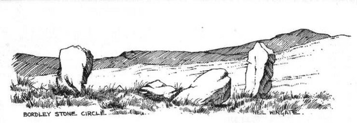
Druid's Altar, Bordley (drawing by Neil Wingate, 1976)
Druid’s Altar, Bordley (drawing by Neil Wingate, 1976)

Folklore

Although we have nothing directly associated with the circle, the surrounding hills here have long been known as the abode of faerie-folk.  Threshfield — in whose parish this circle lies — is renowned for it.  There have been accounts of curious light phenomena here too.  Modern alignment lore tells the site to be related to the peaked tomb above Seaty Hill, equinox west of here.

References:

  1. Bogg, Edmund, Higher Wharfeland, James Miles: Otley 1904.
  2. Burl, Aubrey, Four Posters: Bronze Age Stone Circles of Western Europe, BAR 195: Oxford 1988.
  3. Feather, S.W. & Manby, T.G., ‘Prehistoric Chambered Tombs of the Pennines,’ in Yorkshire Archaeological Journal, Vol 42, 1970.
  4. Lewis, A.L., ‘Standing Stones and Stone Circles in Yorkshire,’ in Man, no.83, 1914.
  5. Raistrick, Arthur, ‘The Bronze Age in West Yorkshire,’ in Yorkshire Archaeological Journal, Vol 29, 1929.
  6. Speight, Harry, The Craven and Northwest Yorkshire Highlands, Elliott Stock: London 1892.
  7. Wingate, Neil, Grassington and Wharfedale, Grassington 1977.

© Paul Bennett, The Northern Antiquarian