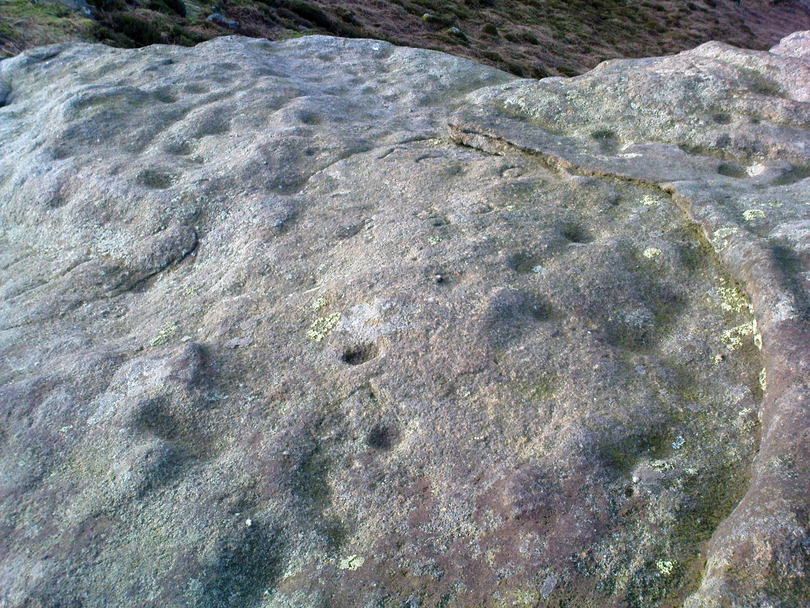
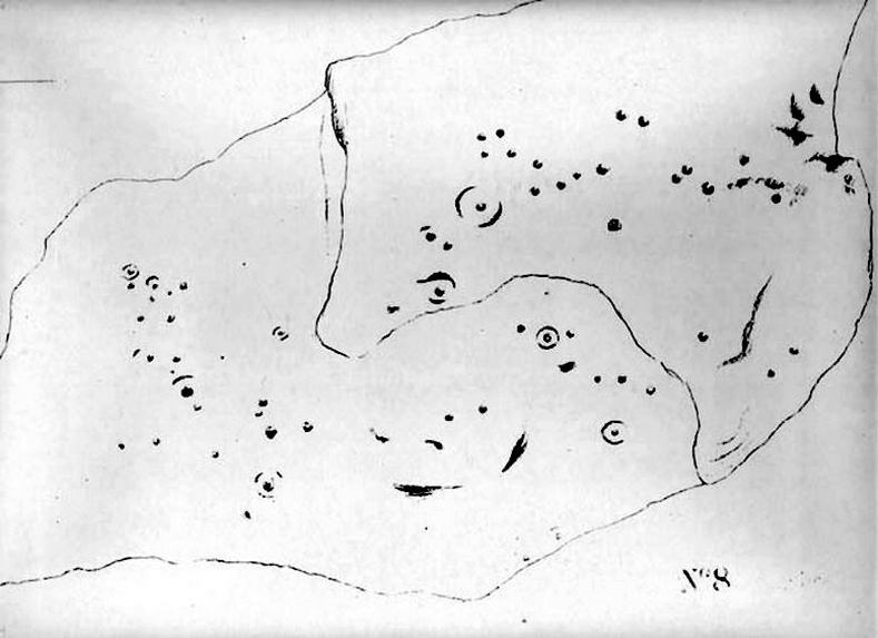
Little Skirtful of Stones, Burley Moor, West Yorkshire

Cairn:  OS Grid Reference – SE 13829 45186

Also Known as:

  1. Little Apronful of Stones

Getting Here

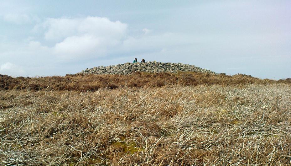
Little Skirtful of Stones, looking north

Probably the easiest way to get here is by starting on the Moor Road above Burley Woodhead, where the road crosses the Rushy Beck stream.  Looking upstream, follow the footpath up the right-hand side of the waters, nearly all the way to the top.  Where it crosses a footpath near where the moor begins to level out, look up to your right and you’ll see the raised crown of stones a coupla hundred yards off path, NNW.  That’s it!

Archaeology & History

This very large Bronze Age cairn was reported by Faull & Moorhouse (1981) to have been surrounded by a multiple stone circle, citing it to have been shown as such on an estate map of Hawksworth Common in 1734. When I contacted the Yorkshire Archaeology Society to enquire about this map, it could not be located. (This needs to be found!) No evidence of such a stone circle presently remains, though there were at least two standing stones once to be seen at the edge of this tomb, though only one of them — now laid more than five-feet long in the heather — is still evident on the western side of this giant tomb.  But anyone who might know anything about the 1734 Estate Map – pleeeeez gerrit copied or take a photo of it! Then stick it on TNA so everyone can see whether the circle surrounded this, or the Great Skirtful of Stones, 500 yards to the south.
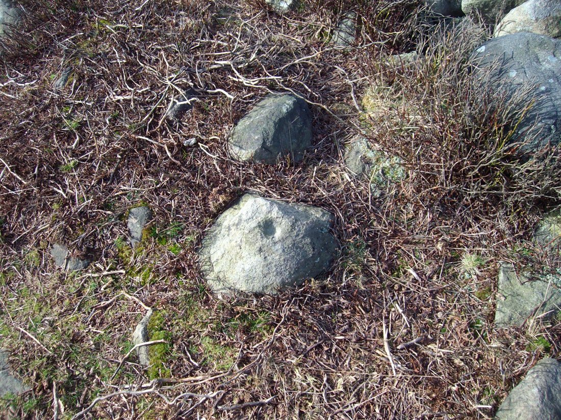
Single cup-marked stone on outer edge of Little Skirtful

The Little Skirtful is in better condition than its big brother on the hill to the south and — unlike the Great Skirtful — there are said to be at least five cup-marked stones amidst the great mass or rocks constituting this site.  There could be more.  The carvings are just single cup-markings etched onto small portable stones, typical of sites like this.  They are found near the centre above a small cist and outwardly towards the northern edges of the cairn (for more info about them, see the main entry for the Little Skirtful Carvings).

It’s been said by Stan Beckensall (1999, 2002) that no cup-marked rocks “are known near…the really large cairns” on the moor—meaning the Little Skirtful and her allies—but this isn’t true as there are at least 4 definite carvings (a possible fifth seems likely) on the moorland immediately around the Little Skirtful.  Though to give Beckensall his due, if he got his data from the Ilkley archaeologists, his information isn’t gonna be too accurate, as they’re quite unaware of many sites on these moors!  A good number of local people have a much greater knowledge-base on such matters than those in paid offices, as this and other websites clearly shows.  The times they are a-changin’, as one dood said, not so long ago…!

Folklore

Paul Bowers & Mikki on top for scale!

The creation myth of this place tells that the giant Rombald (who gives his name to the moor) was in trouble with his wife and when he stepped over to Almscliffe Crags from here, his giant wife – who is never named – dropped a small bundle of stones she was carrying in her apron. (In traditional societies elsewhere in the world where this motif is also found, it tends to relate to the site being created by women.) Harry Speight (1900) tells us of a variation of the tale,

“which tradition says was let fall by the aforementioned giant Rumbalds, while hastening to build a bridge over the Wharfe.”

Variations on this story have said it was the devil who made the site, but this is a denigrated christian variant on the earlier, and probably healthier, creation tale. Similar tales are told of the Great Skirtful of Stones, 500 yards south.

References:

  1. Beckensall, Stan, British Prehistoric Rock Art, Tempus: Stroud 1999.
  2. Beckensall, Stan, “British Prehistoric Rock Art in the Landscape,” in G. Nash & C. Chippindale’s European Landscapes of Rock Art, Routledge: London 2002.
  3. Bennett, Paul, The Old Stones of Elmet, Capall Bann: Chieveley 2001.
  4. Boughey, Keith & Vickerman, E.A., Prehistoric Rock Art of the West Riding, WYAA 2003.
  5. Collyer, Robert & Turner, J. Horsfall, Ilkley: Ancient and Modern, William Walker: Otley 1885.
  6. Colls, J.N.M., ‘Letter upon some Early Remains Discovered in Yorkshire,’ in Archaeologia 31, 1846.
  7. Cowling, E.T., Rombald’s Way, William Walker: Otley 1946.
  8. Faull & Moorhouse, West Yorkshire: An Archaeological Survey – volume 3, WYMCC: Wakefield 1981.
  9. Hedges, John (ed.), The Carved Rocks on Rombalds Moor, WYMCC: Wakefield 1986.
  10. Speight, Harry, Upper Wharfedale, Elliott Stock: London 1900.
  11. Wood, Butler, ‘Prehistoric Antiquities of the Bradford District,’ in Bradford Antiquary, volume 2, 1901.

© Paul Bennett, The Northern Antiquarian
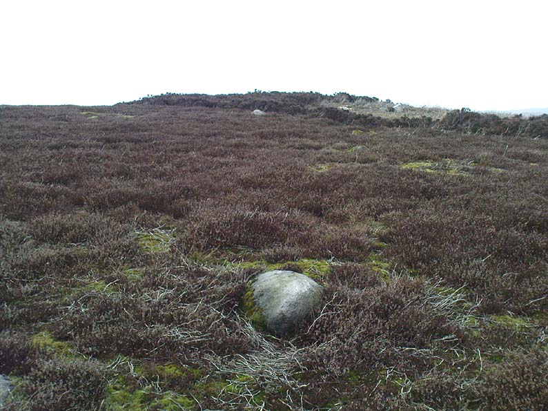

Mini-Skirtful of Stones, Ilkley Moor, West Yorkshire

Cairn:  OS Grid Reference – SE 1346 4606

Getting Here

Follow directions to get to the Pancake Stone.  From here walk SE on the footpath that runs on the edge of the moor.  After about 200 yards you’ll hit a small footpath which heads into the moor (south).  Walk on here for about 200 yards and notice the small rise in the land to your right (if you cross the small stream where the land dips into a very small valley, you’ve gone past).  That’s it!  The Little Haystack Rock is less than 100 yards away down the slope from here.

Mini-Skirtful of Stones, looking north

Archaeology & History

Of approximately eighty prehistoric cairns that have been alleged to exist along the Green Crag Slack ridge on Ilkley Moor, this site in particular is worthy of note, due mainly to its size. As independent archaeological researcher Paul Bowers said of it when he first saw this cairn-spoil, “it seemed too big to have not been discovered in the past.”  Too right!

Mini-Skirtful, looking west

When we tracked across Green Crag Plain a few days ago, it was Michala Potts that called our attention to it.  Half-covered in full heather growth, only the eastern edge was exposed.  At first it seemed that it was loose prehistoric walling, but then I realised it was on the edge of small knoll and the stone work was deeper and wider than walling.  As we explored through the heather atop of the knoll, it was obvious that there was a more extensive gathering of stones scattered all over the top of this small rise, and it seemed that we were looking at the remains of a reasonable sized cairn. Its extent carries about ten yards down the slope from the small hillock, but only a few yards either side of it.  It seems likely that the extended loose stones have, over the centuries, simply slipped further down the slope.  However, not until a decent excavation occurs will we know anything certain.  It is possibile that this is simply the scattered remains of damaged neolithic or Bronze Age walling, but only a more detailed exploration of the site will tell us for sure.

Cowling (1946) mentioned the numerous cairns and scattered walling reaching across this part of Ilkley Moor, but gave no specific information relating to this mini-skirt full of stones! (blame Mikki for the title!)

References:

  1. Cowling, E.T., Rombald’s Way, William Walker: Otley 1946.

© Paul Bennett, The Northern Antiquarian


Green Crag Top Cairns, Ilkley Moor, West Yorkshire

Cairns:  OS Grid Reference – SE 131 458

green-crag-top-cairn02-sm
Larger of the Green Crag Top cairns – with blizzard in background!

Getting Here

Follow directions for getting to the Haystack Rock.  Once here, walk dead straight south onto the moor and go up the slope you see a few hundred yards ahead of you.  Once you’re at the top of the slope, a few yards onto the ridge itself, look around!  If there’s deep heather growth when you arrive, you’ve no chance!

Archaeology & History

To my limited knowledge, it appears there’s no previous references to the cairns here.  We found at least two of them, with a probable third not far away; but we were lucky inasmuch that the heather had all been burnt away, allowing a clearer inspection of the sites.  The larger of the two is nearly four yards across and nearly a yard high.  It’s somewhat larger than the majority of what are thought to be single-person cairns along Green Crag Slack ridge, down the slope.

Much denuded cairn
Much denuded cairn

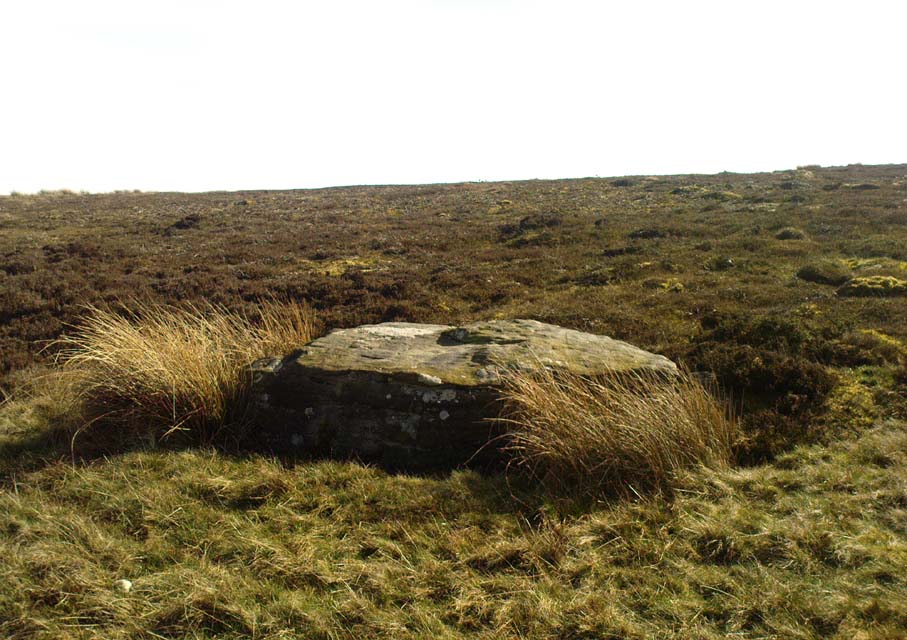
A smaller cairn less than 100 yards west on the same ridge (near the large boulder with a couple of cup-markings on top) looks as if it was robbed of stone sometime in the past.  About six-feet across, this one is more typical of the cairns found on the Ridge below.

There are what seems to be other remains along this ridge, including a very distinct thin, six-foot-long stone, which looks very much as if it could have stood upright in the not-too-distant past.  We could do with more heather-burning on this part of the moor to help us out!

© Paul Bennett, The Northern Antiquarian


Three Cups Stone, Ilkley Moor, West Yorkshire

Cup-Marked Stone:  OS Grid Reference – SE 12998 46314

Also Known as:

  1. Carving no.138 (Hedges)
  2. Carving no.298 (Boughey & Vickerman)

Getting Here

Dead easy!  Follow the directions to the unmissable Haystack Rock, then look at the small upright stone about 40 yards west, just off the footpath.

The Three Cup Stone

Archaeology & History

This is another one of the many carvings I first saw when I was a small lad, about 12 years old, in one of my countless walkabouts over these moors.  It’s thought by some to be a small cup-marked standing stone (it’s possible I s’ppose, but improbable); whether that’s the case or not, it certainly has three distinct cup-markings on its east-facing vertical face.  There are also what appears to be lines cutting through the cups and running out to near the edge of the stone which may or may not be natural.  A small, cute little thing!  Boughey and Vickerman (2003) make a note that this carving may be recent — but if so, it was done some considerable time before 1975, when I first clapped eyes on it!

References:

  1. Boughey, Keith & Vickerman, E.A., Prehistoric Rock art of the West Riding, WYAS: Wakefield 2003.
  2. Hedges, John, The Carved Rocks on Rombalds Moor, WYMCC: Wakefield 1986.

© Paul Bennett, The Northern Antiquarian


Urn Stone, Green Crag, Ilkley Moor, West Yorkshire

Cup-and-Ring Stone: OS Grid Reference – SE 12832 46163

Also Known as:

  1. Carving no.130 (Hedges)
  2. Carving no.287 (Boughey & Vickerman)

Getting Here

Drawing of the Urn Stone (after Hedges 1986)

Follow the directions for getting to the Haystack Rock, then bear right (west) along the footpath, past the little Three Cups Stone, until the path bends and goes up onto the moor.  A hundred yards or so, walk left into the heather (you’re straddling the remains of considerable prehistoric walling and enclosure remains by now) and look around.  You’ll find it!

Archaeology & History

I was only about 12-years old when I first saw this and the nearby prehistoric carvings — but when I came to look for any references to it as a boy, there were none I could find at the time.  Then, ten years later when John Hedges (1986) brought out his fine work on the cup-and-ring art of Ilkley Moor, its presence was shown in pen-and-ink at last.  Found amidst the remains of an extensive settlement or series of walled enclosures, the carving’s name comes from the curious urn-like element that Hedges showed faintly.   There is also an additional ring around one of the cups above the ‘urn’.

Excavations that were done on the prehistoric ‘enclosure’ close to this petroglyph in the 1990s, uncovered the remains of a decent amount of ‘grooved ware’ pottery and worked flint (Edwards & Bradley 1999), dated between 2900 and 2600 BC.  As such pottery has been found elsewhere in Britain within and/or near earthworks and other prehistoric remains (obviously!), its incidence here isn’t really too much of a surprise.  However, Edwards & Bradley (1999) speculate — albeit vaguely — that there may be a link between the cup-and-rings here and the pottery, saying, “if so, the rock carvings (here) might be indicating a place of special significance.”

This may be so: considering the prevalence of rock-art along the geological ridge and its close association with the large number of burial cairns.  If it can be ascertained that the charred remains of humans were kept inside the pottery or vases, the relationship between death and the carvings (well established on this part of Ilkley Moor) would be reinforced.

References:

  1. Boughey, Keith & Vickerman, E.A., Prehistoric Rock Art of the West Riding, West Yorkshire Archaeology Service 2003.
  2. Edwards, Gavin & Bradley, Richard, ‘Rock Carvings and Neolithic Artefacts on Ilkley Moor, West Yorkshire,’ in Grooved Ware in Britain and Ireland (edited by Cleal, R. & MacSween, A.), Oxbow: Oxford 1999.
  3. Hedges, John, The Carved Rocks on Rombald’s Moor, WYMCC: Wakefield 1986.

© Paul Bennett, The Northern Antiquarian

Young Idol Stone, Ilkley Moor, West Yorkshire

Cup-Marked Stone:  OS Grid Reference – SE 13264 45943

Also Known as:

  1. Carving no.158 (Hedges)
  2. Carving no.323 (Boughey & Vickerman)

Getting Here

The Young Idol Stone (bottom) & parental Idol Stone above

Take the directions to reach the Haystack Rock, then head onto the moor following the south-east footpath for a few hundred yards, towards where the moor slopes uphill.  20-30 yards before the uphill slope, a yard to the right of the path, a couple of yards below the well-known Idol Stone carving – you’ll find it!

Archaeology & History

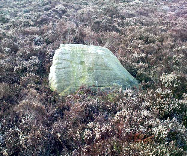
Described simply as a “small, rounded, smooth grit rock,” this long-tooth-shaped stone has just two cup-markings on its upper face: one on the more southern tip, and the second smaller cup several inches below it – as shown on the photo.  The adjacent carving seen at the top of the photo is the parent guardian, Idol Stone!  If you visit this, or any adjacent carvings here, please remember that all along this moorland plain are numerous unexcavated prehistoric tombs. You’re effectively stood at the edge of, or within, a huge prehistoric cemetery.

References:

  1. Boughey, Keith & Vickerman, E.A., Prehistoric Rock Art of the West Riding, WYAS 2003.
  2. Hedges, John, The Carved Rocks on Rombalds Moor, WYMCC: Wakefield 1986.

© Paul Bennett, The Northern Antiquarian

Green Crag Top Stone, Ilkley Moor, West Yorkshire

Cup-Marked Stone:  OS Grid Reference – SE 1304 4582

Getting Here

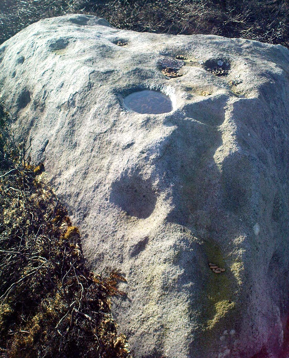
Green Crag Top stone - from above
Green Crag Top stone – from above

Head for the binary-like Idol Stone carving and keep walking on the footpath, up the hill.  Once on top of the ridge, walk along it to your right (west) for about 300 yards, then walk south (left) into the flat heathland plain.  Look around!

Archaeology & History

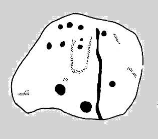
I’m probably not reading it right – but it seems this large stone with several distinct cup-marks on its vertical south-face, isn’t in the surveys of either Hedges (1986) or Boughey & Vickerman (2003).  If someone can correct me on this one – please do!

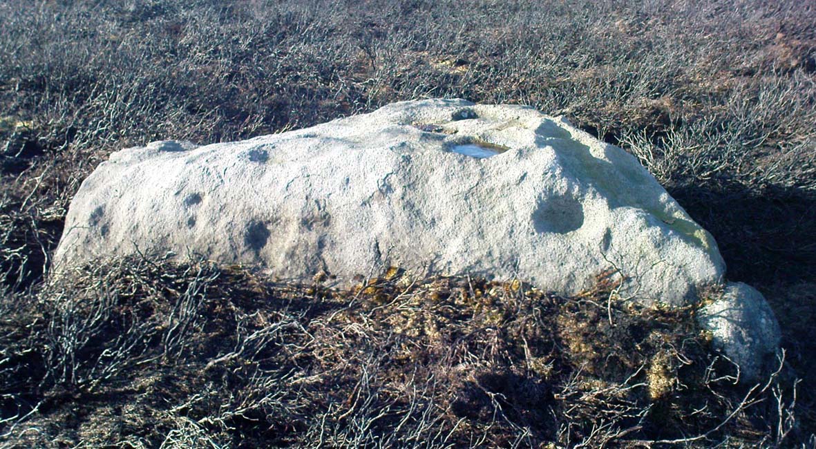
Green Crag Top Stone, looking north

This is quite a large boulder, as the photos here show.  At least two average-sized cup-markings have been etched onto the south face, and two larger ones accompany them on the same edge.  There’s another larger cup-mark on the northeast side of the stone, and a possible companion, which may or may not be artificial.  Then on top of the stone we have several large cups and a ‘bowl’ — though some of these upper markings may be natural, or just well-eroded cup-marks.  It’s hard to tell for sure!

Now I’m gonna have another look in the Hedges, Boughey & Vickerman surveys.  They surely can’t have missed this!

© Paul Bennett, The Northern Antiquarian

Dymond Stone, Burley Moor, West Yorkshire

Cup-Marked Stone:  OS Grid Reference – SE 12629 45206

Also known as:

  1. Carving no.118
  2. Carving no. 275

Getting Here

Dymond Stone, Ilkley Moor

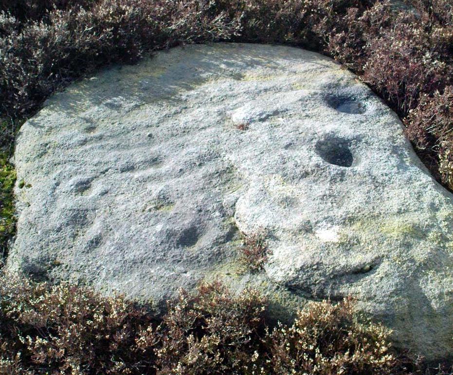
It’s not too far from the main footpath from Ilkley to the Twelve Apostles stone circle.  As its discoverer C.W. Dymond (1880) said, “It lies alone, on and near the foot of a steep slope, about a furlong, or less than five minutes’ walk, north from the ruins of a small stone-circle (Twelve Apostles) which crowns the crest of the pass leading south-south-east from Ilkley to Eldwick, and just one mile and three-quarters from the former place.  If approached therefrom, it will be easily found about two hundred yards to the east of the point where the road surmounts the steep, to enter upon the upper plain.”  Otherwise, walk through the Twelve Apostles from the main footpath and out the other side, following the land where it slopes down and, near the bottom, you’ll see this large stone sitting quietly on its own…

1880 image of Dymond's carving
Dymond’s 1880 sketch

Archaeology & History

Not too sure about the veracity of this one to be honest.  It was first described by archaeologist C.W. Dymond (1880) as “a stone marked with a striking group of cups” – but these are small and untypical of the usual markings.  “The stone is 9 ft. 6 ins. in length, 6 ft. 3 ins. in breadth, and about 2 ft. in thickness; its upper surface dipping a little, with the ground, toward the north. Upon it may be seen a group of small cups, for the most part about half an inch in diameter,” he said.

Dymond thought that the design on the rock may have represented parts of the night sky, saying, “here we may have a rude attempt to portray the starry heavens spanned by the galaxy ; and that the outlying groups may have been intended to represent two of the constellations perhaps Orion, and another not so easily identified.”  But I think we can take this with a pinch of salt.

Included in Hedge’s (1986) survey without comment, Boughey and Vickerman (2003) correctly thought that the “small peck marks which are not typical cup-marks” might be “doubtful”.

References:

  1. Boughey, Keith & Vickerman, E.A., Prehistoric Rock Art of the West Riding, West Yorks Archaeology Service 2003.
  2. Dymond, C.W., ‘Cup Marks on Burley Moor,’ in Journal of the British Archaeological Association, volume 36, 1880.
  3. Hedges, John, The Carved Rocks of Rombalds Moor, WYMCC: Wakefield 1986.

© Paul Bennett, The Northern Antiquarian

Idol Stone, Ilkley Moor, West Yorkshire

Cup-and-Ring Stone:  OS Grid Reference – SE 13265 45943

Also Known as:

  1. Carving no.322 (Boughey & Vickerman)
  2. Carving no.157 (Hedges)

Getting Here

Idol Stone carving (Allen 1882)

Take the directions to reach the Haystack Rock, then head onto the moor following the southeast footpath for a few hundred yards, towards where the moor slopes uphill.  20-30 yards before the uphill slope, a yard to the right of the path.  It accompanies the Young Idol Stone with its two small cups, just a few yards away.  Keep your eyes peeled and y’ can’t really miss it! If you hit the large slightly-pyramidal-shaped boulder with its well-worn lines running from its top (the Idol Rock), you’ve gone past it.

Archaeology & History

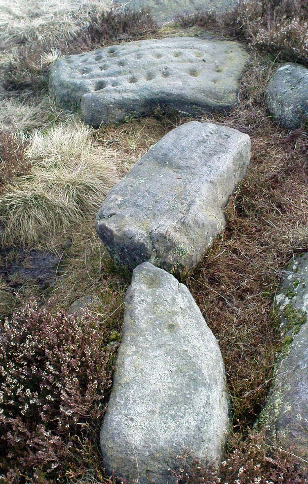
An intriguing carving this, and one which has always had me edging towards a manifest linear or logical myth underscoring its form.  It’s the almost binary or primal numeric system in the lay-out of the cups which seems to do it.  Few other carvings in the region exhibit this tendency.*  If you aint seen it ‘in the flesh,’ check it out.

First described by that old Victorian J. Romilly Allen (1882), he seemed equally impressed by it, calling it “the most beautiful specimen of prehistoric sculpture,” continuing:

“The stone is of grit, and measure 3ft 2ins, by 2ft 6ins.  Its upper surface is nearly horizontal, and has carved upon it cups varying in diameter from 2ins to 3ins.  A row of cups in the middle of the stone are entirely surrounded by a groove.  There is also a channel running round the outside.  Single cups are often found encircled by one or more concentric rings; but it is very exceptional indeed to find several cups surrounded by a single groove, or to find the cups so symmetrically arranged as in the present instance.”

Idol Stone - looking SW
Idol Stone – looking SW

Prehistoric walling runs very close to this and the adjacent rock carvings, with the well-known ‘enclosure’ just a short distance to the east on the same moorland plain.  This carving is very much on the edge of, or within, Green Crag Plain’s ‘Land of the Dead.’

This carving was one of several that Alan Davis (1983) measured in his exploratory survey on the validity of Alexander Thom’s ‘megalithic inch’ unit.  This issue absolutely fascinated me as a boy, as it brought the attention of these curious non-linear images into the domain of mathematics and the higher sciences, instead of the lowly social sciences within whose domain archaeology is embedded, with its many inaccuracies and falsehoods.  A number of astronomers and other academics did a great number of papers exploring potential units-of-length, surveying the carvings (and megalithic rings) in much greater detail than any previous archaeologist.  Much of it was excellent work.  However, the mythos of our ancient ancestors possessing great technical knowledge and mathematical ability was unfounded.  In Davis’ (1983) paper — edited and expanded a few years later (1988) — he found no evidence of mathematical units of measurement here; though left the option ‘open’ for further discussion and analysis on several others, where multiple units of megalithic inches were measured.  These findings however, are more likely the result of mere chance.

Idol Stone with “21st century informal unauthorised” art added

In 2011 some unnamed people visited the Idol Stone carving and vandalized it (this sadly happens more and more up here); but this form of vandalism is now being termed “twenty-first century informal unauthorised carvings” and is actually sanctioned by Ilkley Parish Council members, local businessman Tom Lonsdale and his affiliates as artistic “tradition”!  Indeed, the damage done here and vandalism done on some other ancient carved stones that have been redesignated by Tom Lonsdale and friends as “twenty-first century informal unauthorised carvings”, legitimizes and encourages others to follow in their shallow-minded ignorance, enabling others to add their own form of ‘art’ on these supposedly protected monuments, on a region with an alleged SSSI status. They even encourage supposedly ‘nice’ people — y’ know the sort — to etch poems and such things onto the stones on the moors, in violation of regulations that apply to the general public.  As a result, expect more vandalism — sorry…arty “twenty-first century informal unauthorised carvings” both here and elsewhere.  This same appalling debacle — sorry, “tradition” — has been encouraged on the Haystack Rock, Hanging Stones and other prehistoric carvings on the moor.

Folklore

The name ‘Idol Stone’ was an invention of one of the Victorian romanticists, who saw heathen idolatry and perversion all over these moors (you’ve gotta ask y’self, what the hell were these people up to!?).  Our old friend Nicholas Size (1934) told there to have been ghostly figures and druidic activities occurring at this site.

References:

  1. Allen, J. Romilly, ‘Notice of Sculptured Rocks near Ilkley, with some Remarks on Rocking Stones,’ in Journal of the British Archaeological Association, volume 38, 1882.
  2. Boughey, Keith & Vickerman, E.A., Prehistoric Rock Art of the West Riding, West Yorkshire Archaeology Service 2003.
  3. Cowling, Eric T., Rombald’s Way, William Walker: Otley 1946.
  4. Davis, Alan, ‘The Metrology of Cup and Ring Carvings near Ilkley in Yorkshire,’ in Science and Archaeology, 25, 1983.
  5. Hedges, John, The Carved Rocks on Rombalds Moor, WYMCC: Wakefield 1986.
  6. Hotham, John Paul, Halos and Horizons, Hotham Publishing: Leeds 2021.
  7. Jennings, Hargrave, Archaic Rock Inscriptions, A. Reader: London 1891.
  8. Size, Nicholas, The Haunted Moor, William Walker: Otley 1934.
  9. Speight, Harry, Upper Wharfedale, Elliott Stock: London 1900.

© Paul Bennett, The Northern Antiquarian 


Pancake Stone, Ilkley Moor, West Yorkshire

Cup-and-Ring Stone:  OS Grid Reference – SE 13404 46228

Also Known as:

  1. Carving no.167 (Hedges)
  2. Carving no.332 (Boughey & Vickerman)
  3. Pancake Rock

Getting Here

Pancake Stone, Ilkley Moor

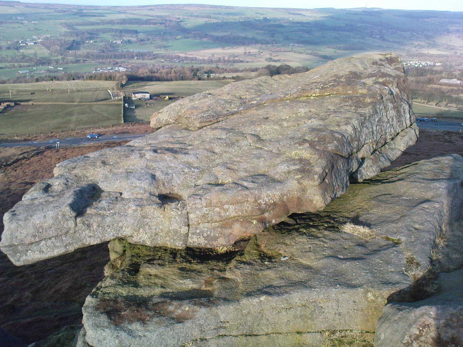
We were up here again the other week: wind, hail and snow blowing like hell, thankfully keeping the place to ourselves! To get here, head up Cow Pasture Road from the train station and up to the Cow & Calf Hotel near the famous rocks.  Go past it a 100 yards or so and then look uphill onto the moors ahead of you.  You’ll see a great over-hanging rock on the slope above you which looks as though its may fall down at any moment. That’s the Pancake Stone!  Either walk up the steep path to get there quickly, or the longer route by taking the sloping diagonal path that runs eastwards until you’re on the same level.

Archaeology & History

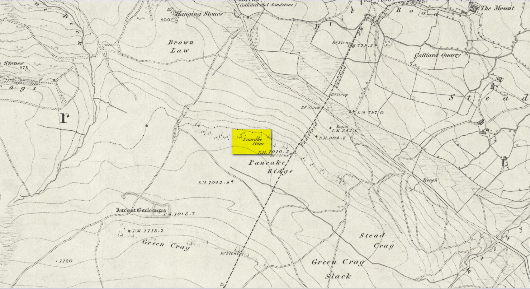
Site shown  on 1851 map

Highlighted on the first Ordnance Survey map of the region in 1851, this prehistoric carved stone had been known as the Pancake Stone by local people long before any antiquarians gave it their literary attention to the place.  It would have had tales told of it, no doubt, but they were never written down.  It’s an impressive, some would say precarious piece of rock: an elongated thin wedge of stone resting gently on the cliff edge, much like a rocking stone to be honest, seemingly hanging onto the edge of the geological ridge awaiting its fall down the slope; but that’s not gonna happen for many more centuries yet.

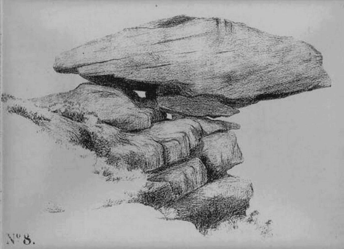
J. Thornton Dale’s 1879 drawing

Much has been written about the petroglyph on the this wedge of stone, which covers much of its surface.  Although a Mr J. Thornton Dale did a fine series of quite accurate drawings of this stone (and others on the moors) between 1878 and 1880, the first literary description of the Pancake rock carving appears to have been by the renowned J. Romilly Allen in 1882 (who evidently visited the stone on a cloudy or overcast day), saying that:

“On its upper surface are several cup-markings much obliterated by the actions of the weather, but some of them sufficiently distinct to prove their origin artificial, and to show that this rock was noticed in ancient times, and very possibly considered an object either of worship or superstition.”

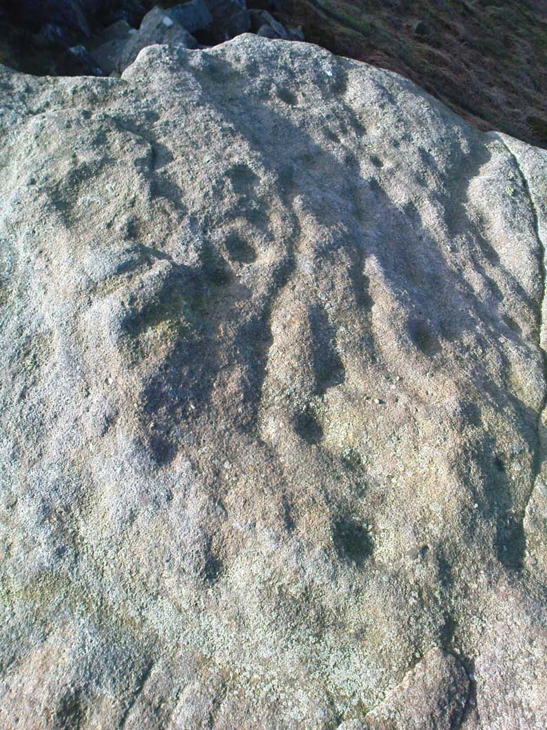
Close-up of cups & rings
Close-up of CnRs
Looking across the stone

This latter assumption is highly probable.  Strong animistic notions (moreso than usual) would be very evident here.  Its position on the land with its outward focus from here towards other notable points in the landscape (Almscliffe Crags is one obvious focus); as well as looking at the rock itself from other viewpoints, give the stone considerable ritual importance.  Sections of the moorland plain behind it—known as Green Crag—was the Land of the Dead in ancient times, and it is more than likely that death rites would have been enacted here — though we may never know what form they took.

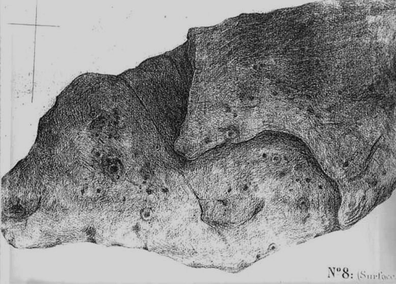
Dale’s 1879 sketch

The stone has what seems to be at least 54 cup-markings on its upper face, with numerous grooves meandering and connecting other points.  In J. Thornton Dale’s 1879 drawing of the upper surface, you will note that a couple of the rings he included have all-but faded away and are not included in the more recent surveys.  Of the primary design, rock art students Boughey & Vickerman (2003) described there being “six complete and five partial rings” amidst the morass, but much of the design is very worn and, originally, there was probably a bit more to it all.  The rock upon which the main Pancake Stone rests also has some worn cup-marks etched on its surface, a couple of which can be made out in the top photo.

Folklore

Good old Nicholas Size (1934) added this site to his list as a place where he had visions of the old christian cult, upon whose bare face were enacted blood rites and sacrifice.  One Beltane Eve when he decided to amble up onto the moor edge, he could see a strange glow coming from behind the rock.  He continues:

“Then suddenly I noticed there was a figure dancing upon it.  The figure seemed to swirl round and round with floating draperies, grey or white, and I can only say that it looked very uncanny.  Stupidly, I wondered that anybody could be such a fool as to dance in the darkness upon that precarious footing…”

But such activities on these moors, at certain times of the year, have been enacted for many centuries.  It’s just kept quiet and, as more modern pagans (as they like to call ’emselves) keep coming up here and to other places, so the original folk move to their older and increasingly more secluded spots…  In the latter half of the 20th century the site was used as a focus by chaos magickians, shortly after the inception of that Current.

References:

  1. Allen, J. Romilly, ‘The Prehistoric Rock Sculptures of Ilkley,’ in Journal of the British Archaeological Association, volume 35, 1879.
  2. Allen, J. Romilly, ‘Notice of Sculptured Rocks near Ilkley, with some Remarks on Rocking Stones,’ in Journal of the British Archaeological Association, volume 38, 1882.
  3. Boughey, Keith & Vickerman, E.A., Prehistoric Rock Art of the West Riding, West Yorkshire Archaeology Service 2003.
  4. Cowling, Eric T., Rombald’s Way, William Walker: Otley 1946.
  5. Hedges, John, The Carved Rocks on Rombalds Moor, WYMCC: Wakefield 1986.
  6. Jennings, Hargrave, Archaic Rock Inscriptions, A. Reader: London 1891.
  7. Size, Nicholas, The Haunted Moor, William Walker: Otley 1934.
  8. Speight, Harry, Upper Wharfedale, Elliott Stock: London 1900.

© Paul Bennett, The Northern Antiquarian