Wells o’ Wearie, Duddingston, Edinburgh, Midlothian

Sacred Wells (destroyed):  OS Grid Reference – NT 2741 7241

Also Known as:

  1. Wells o’ Weary
  2. Well of Wery

Archaeology & History

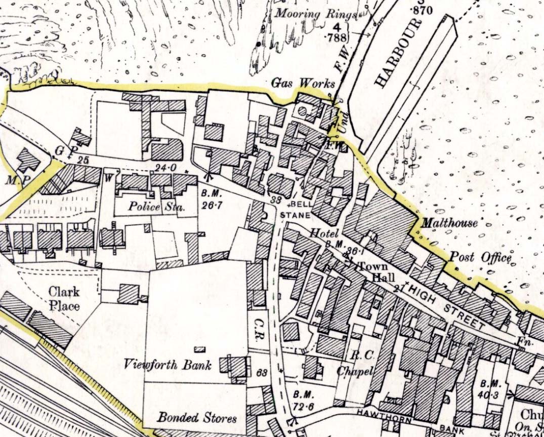
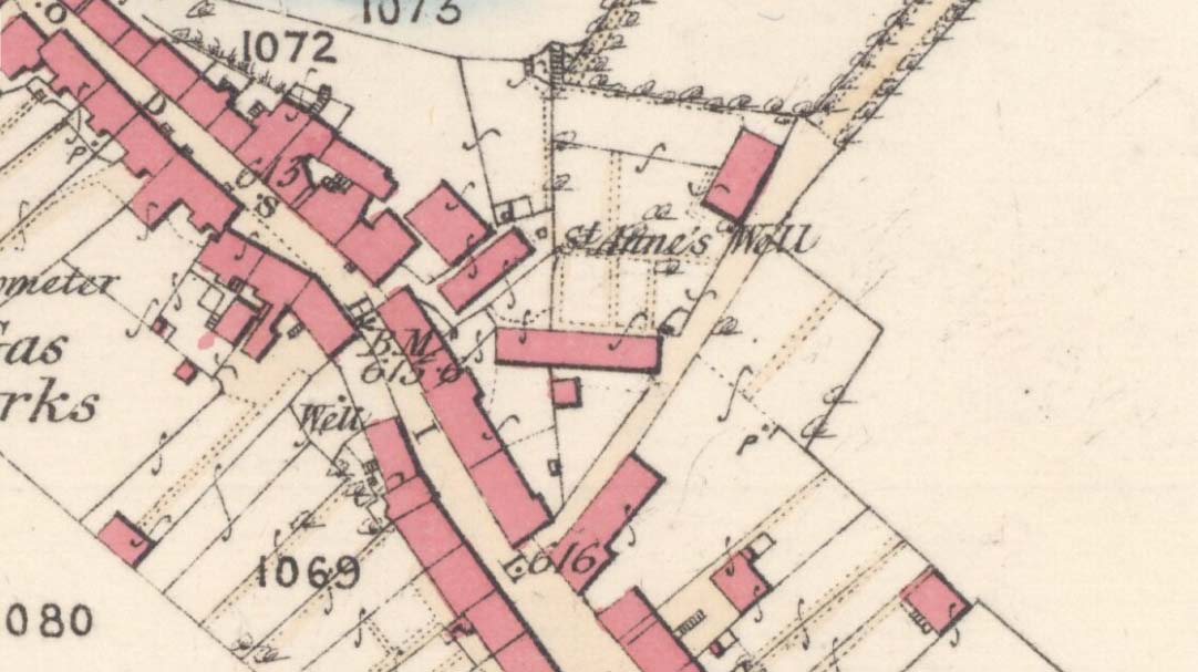
The precise spot for these “wells” is difficult to say today with any certainty, which is unfortunate as it was a renowned spot for a variety of reasons.  The wells were apparently disrupted and fell back into the Earth when the Industrialists dug their train-line into the south-side of Arthur’s Seat.  On the early maps, we can see several ‘troughs’, ‘pumps’ and ‘wells’—one or more of which are said to be the site (and which we base the OS grid-reference on, above).

Site on 1821 Kirkwood map
Wells o’ Wearie ponds

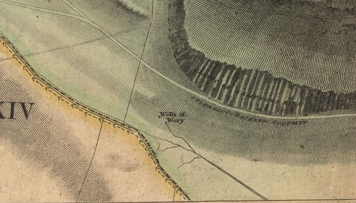
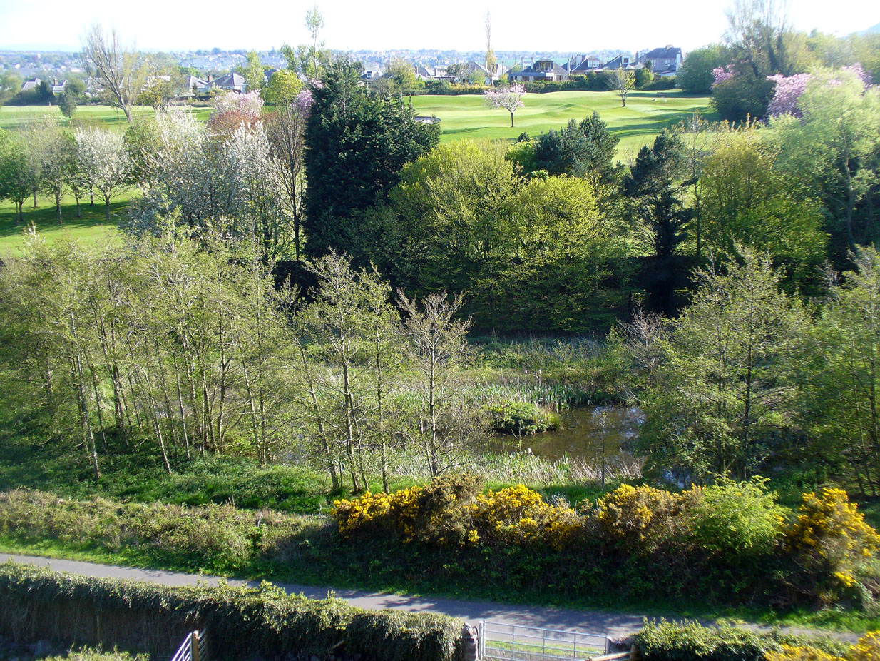
The Wells of Wearie were one of nearly a dozen sacred and healing wells surrounding legendary Arthur’s Seat at the edge of Edinburgh, and whose waters were also said to have supernatural properties.  Shown on James Kirkwood’s 1821 map of Edinburgh (left) as the ‘Well of Wery’, this curiously named site was renowned in earlier centuries as an excellent water supply for the local people — “to cure the weary traveller” for one.  Today, all we have left of them are the small ponds immediately below the road, next to the converted railway line path, just as you come out of the long tunnel.

Folklore

In Henderson & Cowan’s (2007) fine work on Scottish fairy lore, they outline the witchcraft trial of a local woman, Janet Boyman, who was said to have performed ritual magick at the Wells of Wearie.  They told:

“Jonet Boyman of Canongate, Edinburgh, accused in 1572 of witchcraft and diabolic incantation, the first Scottish trial for which a detailed indictment has so far been found. Indeed, it is one of the richest accounts hitherto uncovered for both fairy belief and charming, suggesting an intriguing tradition which associated, in some way, the fairies with the legendary King Arthur.  At an ‘elrich well’ on the south side of Arthur’s Seat, Jonet uttered incantations and invocations of the ‘evill spreits quhome she callit upon for to come to show and declair’ what would happen to a sick man named Allan Anderson, her patient.  She allegedly first conjured ‘ane grit blast’ like a whirlwind, and thereafter appeared the shape of a man who stood on the other side of the well, and interesting hint of liminality.  She charged this conjured presence, in the name of the father, the son, King Arthur and Queen Elspeth, to cure Anderson.  She then received elaborate instructions about washing the ill man’s shirt, which were communicated to Allan’s wife.  That night the patient’s house shook in the midst of a huge and incomprehensible ruckus involving winds, horses and hammering, apparently because the man’s wife did not follow the instructions to the letter.  On the following night the house was plagued by a mighty din again, caused, this time, by a great company of women.’”

The Wells were, in earlier centuries, a site where lovers and wanderers came to relax and dream. It was a traditional gathering spot — not just for witches! — and poetry was written of them – including this by A.A. Ritchie:

“The Wells o’ Wearie — 

Sweetly shines the sun on auld Edinbro’ toun.
And mak’s her look young and cheerie;
Yet I maun awa’ to spend the afternoon
At the lanesome Wells o’ Wearie.

And you maun gang wi’ me, my winsome Mary Grieve,
There’s nought in the world to fear ye;
For I hae ask’d your minnie, and she has gien ye leave
To gang to the Wells o’ Wearie.

O the sun w-inna blink in thy bonny blue een.
Nor tinge the white brow o’ my dearie.
For I’ll shade a bower wi’ rashes lang and green,
By the lanesome Wells o’ Wearie.

But Mary, my love, beware ye dinna glower
At your form in the water sae clearly,
Or the fairy will change ye into a wee wee flower,
And you’ll grow by the Wells o’ Wearie.

Yestreen, as I wander’d there a’ alane,
I felt unco douf and drearie,
For wanting my Mary a’ around me was but pain
At the lanesome Wells o’ Wearie.

Let fortune or fame their minions deceive,
Let fate look gruesome and eerie ;
True glory and wealth are mine wi’ Mary Grieve,
When we meet by the Wells o’ Wearie.

Then gang wi’ me, my bonny Mary Grieve,
Nae danger will daur to come near ye.
For I hae ask’d your minnie, and she has gien ye leave
To gang to the Wells o’ Wearie.”

References:

  1. Baird, William, Annals of Duddingston and Portobello, Andrew Elliot: Edinburgh 1898.
  2. Bennett, Paul, Ancient and Holy Wells of Edinburgh, TNA: Alva 2017.
  3. Carrick, John D. (ed.), Whistle-Binkie, or the Piper of the Party – volume 2, David Robertson: Glasgow 1878.
  4. Colston, James, The Edinburgh and District Water Supply, Edinburgh 1890.
  5. Henderson, Lizanne & Cowan, Edward J., Scottish Fairy Belief: A History, John Donald: Edinburgh 2007.
  6. Ramsay, Alexander, On the Water Supply of Edinburgh, Neill & Co.: Edinburgh 1853.

© Paul BennettThe Northern Antiquarian


Bell Stane, Queensferry, Midlothian

Legendary Stone (destroyed):  OS Grid Reference – NT 1292 7840

Bell Stane on 1896 map

Bell Stane on 1896 map

Archaeology & History

An intriguing site that needs adding to the Northern Antiquarian due to the foraging research of the Edinburgh historian Stuart Harris (1996).  Although the Bell Stane has been ascribed by the Canmore researchers to be just,

“a stone near the Mercat Cross on which the hand bell was set (rung to herald the opening of the weekly market or annual fair),”

Mr Harris dug deeper and found other references which led him to think that the site was “a conspicuous boulder or standing stone.”  I have to agree with him.  In his outstanding work on the historical place-names of Edinburgh and district, Harris wrote:

“The Bellstane…is noted on Ordnance Survey 1854 as the name of an object just outwith the burgh boundary and in the southwest corner of the little square that now bears the name.  Whilst it has been surmised that it was a stone named for a handbell rung beside it on market days, in point of fact a burgh council meeting of 1642 (quoted in Morison’s Queensferry, p.131) records that a piece of ground hitherto waste and unused, within the burgh but near the bellstane, was to be set aside for markets and fairs in times coming; and the clear inference is that the name belonged to the stone before any markets were held near it.  In absence of a reliable description of the stone or of early forms of its name, the origin of the name can only be guessed at.  Similar names (of sites) in Kirknewton and Whitburn are no better documented, but the early forms of Belstane in Lanarkshire (BellitstaneBellistaneBelstane and Bellstane prior to 1329 and Beldstanein 1452) suggest that its first part may be Anglian ballede or early Scots bellit (from a Celtic root, ball, white), making the name ‘the stone with a white or pale patch or stripe on it’ — such as one with a band of quartz running through it.  A conspicuous boulder or standing stone of this sort on this spur of higher ground above the shore would have been a useful meith or landing mark for boats making for the narrow landing place at the Binks.”

If anyone uncovers additional evidence about this Bell Stane that can affirm it as a standing stone (or otherwise), we will amend its status.

References:

  1. Harris, Stuart, The Place-Names of Edinburgh: Their Origins and History, Gordon Wright: Edinburgh 1996.
  2. Morison, Alexander, Historical Notes on the Ancient and Royal Burgh of Queensferry, West Lothian Courier: Bathgate 1927.
  3. Orrock, Thomas, Fortha’s Lyrics and other Poems, privately printed: Edinburgh 1880.

© Paul Bennett,  The Northern Antiquarian 2016


St. Anne’s Well, Strathaven, Lanarkshire

Holy Well:  OS Grid Reference – NS 7039 4438

Archaeology & History

St Anne's Well on 1865 map

St Anne’s Well on 1865 map

Long since lost it would seem, in a search for this legendary site over the weekend with Gordon, Aisha and Lara, I’m still not certain of the actual status of the site.  Although we found a very fresh water supply still running not far from where the old OS-map showed the original holy well to be, it may be a completely different water source.

There are hardly any references to the spring and those that exist are scant.  In the early 1860s, St. Ane’s Well was mentioned briefly in the Object Name Book of the area:

“This is a good spring well in the southern part of the town of Strathaven.  It is commonly called Tun’s (Tan’s?) Well, but this is an abbreviation of the name.”

Lara plays at a nearby well

Lara plays at a nearby well

Looking down on the waters

Looking down on the waters

More recently, thanks to a communication from the local historian Robert Currie, more information has come to light about the well.  It was described in the local history work by Mary Gebbie (1880).  Mr Currie told me:

“In her Sketches of Avondale and Strathaven…we read: “In a lane off Tod’s Hill was the famous Tann’s Well – obviously a corruption of the celebrated water saint, St. Anne. This spring has within a few years completely dried up. Access was easily had from the castle to it, over the draw-bridge, which is said to have rested on the ledge of the ground and rock on which the fifth house is built south of the bridge. Before this aperture was built up, the inhabitants around took advantage of the pathway for drawing water from the Pomillion, at a place called the Fairy Pool. A little above this comes the Dove Castle; and a half a mile further out is the Gallow Hill.”

He continued:

“That said, the current siting of St. Anne’s Well is located on Lesmahagow Road with (the) site being almost opposite the Council houses bordering on Station Road (there is currently a mini-roundabout near the locus). In recent years the site has become obscured but in my own living memory there was once a plaque authenticating the site and with a garden seat thereby.”

In searching through their own library, Mr Currie and his wife came across more about the site in William Downie’s (1979) book on Strathaven, in which he wrote:

“A small lane off Todshill went down to a cluster of houses called St. Anne’s Well nestling on the sloping ground beside the mill dam. In 1911 these houses were acquired and demolished by the Town Improvement Committee. A row of houses backing backing on to Powmillon Burn were also demolished at the same time and a retaining wall with railings erected, so opening up a very fine view of the castle and burn etc.”

The dedication here to the mythic figure of St. Anne (mother of the Virgin Mary and grandmother of Jesus) is isolated and mysterious.  No church is dedicated to her in the area, nor other relative christian remains.  Her appearance in Strathaven is something of an oddity.  There was a Duchess ‘Ann’ Hamilton of Strathaven Castle who lived 200 yards away at Strathaven Castle on the other side of the river that might have given her name to the well, but this is very unlikely.  More probable is that St. Anne was used as the mythic figure who covered an earlier dedication to the prima mater, or Cailleach—although there are no remains that relate to Her either.  However, the existence of St Mary’s church and an associated well to the north, along with a burn dedicated to a “maiden” in the same parish to the northwest add to the cailleach’s potential…..but all tales of Her have seemingly been forgotten.

…So it seems that the spring of water that Lara, Aisha, Gordon and I came across was obviously not the same place, but exists just below the roadside where the disused railway line is.  It’s close to St Anne’s Well – but is not the same water source.

References:

  1. Downie, Fleming, A History of Avondale and Strathaven, Eric Moore: Glasgow 1979.
  2. Gebbie, Mary, Sketches of the Town of Strathavon and Parish of Avondale: Historical & Traditional, John Menzies: Edinburgh 1880.

Links:

  1. Strathaven Past & Present

Acknowledgements:  Considerable thanks must be given to Robert Currie, BA Hons, who sent us additional information enabling a more informative and accurate site profile for this holy well.  Thanks Bob! Also huge thanks again to Aisha Domleo, Lara Domleo, Unabel Gordon and their frobbling Leonidus!

© Paul BennettThe Northern Antiquarian


Orwell, Milnathort, Kinross

Standing Stones:  OS Grid Reference – NO 1494 0432

Also Known as:

  1. Canmore ID 27912
  2. Mawcloych

Getting Here

The Orwell standing stones

The Orwell standing stones

Drive from Milnathort SE down the A911 road towards Balgedie and Scotlandwell.  About a mile out of the village, keep your eyes peeled on the farmed fields on your left.  You’ll notice the standing stones a few hundred yards ahead and, if you, see them in time, will be able to park up by the track on your left a coupla hundred yards before Orwell Farm. Ensure you visit this site between October and March – otherwise the fields are in full crop.

Archaeology & History

Stones marked on the 1857 map

Stones marked on the 1857 map

These are impressive standing stones by anybody’s standards.  Although we have two impressive uprights today on the highest point in the potato fields, in the 19th century the place-name writer Liddall (1896) told that “in this district are still three large pillar stones known as the Standing Stones of Orwell.” (my italics)  Their existence was recorded, he said, in early topographical accounts in an obsolete place-name Mawcloych, or “place of the stones.”  But if there were three standing stones here, they must have stood prior to the article written by the pseudonymous “W.H.”, who described them in the October edition of The Scottish Journal in 1847, saying:

“About half-a-mile above the old (Orwell) churchyard, in a field by the roadside, are two large upright stones, known as “the Standing Stones of Orwell.”  They are placed east and west of each other about fifteen yards apart—that to the west is flat, and about six feet in height—the one to the east is of a round form, tapering slightly to the ground, and stands nine feet high.  The latter, although still of considerable size, has lost somewhat of its circumference within the last ten years, and, at the present moment, there is a large crack down one side, which, by the action of the weather, will lead to a further diminution of its bulk. It has not been ascertained to what depth these stones are embedded in the earth, but it must be considerable, in order to retain them in the position they occupy.

“The common belief is, that these stones are of Danish origin, erected in commemoration of a victory, or to mark the spot where those who had fallen in battle were interred. This supposition is so far countenanced by the fact that a stone coffin, of large size, was found on digging up the space between the stones. Similar coffins have also been turned up in the same field, and, ten or twelve years ago, the ground was dug up in several places by a neighbouring proprietor, when large quantities of bones, much decomposed and mixed with charcoal, were discovered.”

Fred Coles 1906 ground-plan

Fred Coles 1906 ground-plan

Orwell Stones, looking north

Orwell Stones, looking north

This early description telling of the poor condition of one of the stones presaged its eventual fall in the late 1960s; but this thankfully led to an archaeological evaluation which gave us more information about the site.  Before this however, the great northern antiquarian Fred Coles (1906) visited the stones in August 1904, describing them with his usual meritorious detail, telling:

“They stand on a very gently rising ground, the space between them and for some distance to the south being somewhat higher than the surrounding field.  In ground plan they are related as shown (attached).  The east stone is the higher, standing 9 feet 8 inches clear of theground, smooth-sided and hexagonal. At the base its girth is 9 feet 9 inches, swelling up at the 5-foot level into 10 feet 8 inches. The West Stone, very rugged and angular, is 7 feet 5 inches in height, girths at the base 11 feet 1 inch, and at about 3 feet upwards, 10 feet 5 inches, its broadest side facing the East Stone. Both are of whinstone. The shortest distance between the two Stones is in a line nearly north-west, and measures 46 feet 10 inches.

“Mr R. Kilgour, one of the oldest residents of Kinross, showed me a fine partially flattened oval pebble of dark reddish quartzite, measuring 5 inches by 2⅞ inches, which he found in the ground between these two Stones. The abrasion at each end clearly shows that this pebble has been used as a pounder.

“In a book which to some extent deals with local antiquities, occurs the following passage with reference to these two Standing Stones: ‘In the same field stone coffins have occasionally been turned up by the plough; and, about the beginning of the 19th century, the ground was in many places dug up by the neighbouring proprietor, when quantities of bones much decomposed and mixed with charcoal were discovered.’”

But after the west stone fell down, J.N.G. Ritchie (1972) and his team turned up to resurrect it—and also check out what might be underneath it.  His initial notes of the findings were published in Discovery & Excavation Scotland, which said:

“Excavation at the bases of these two standing stones…was undertaken prior to the re-erection of the W stone and to the embedding of both stones in cement.  The original position of the fallen stone could be detected only as a slight hollow in the natural gravel, but as this corresponded with the position of the stone on Coles’ plan…the stone could be re-positioned comparatively accurately.

“A cremation deposit was found in an insubstantial stone setting in a scoop in the natural gravel some 0.5m S of the stone.  The E stone, which is an impressive whinstone 3.8m in total height, had been set up in a hole 1.5m x 1.4m and 0.75m in depth.  Within the pit on the SW side of the stone there was an unusual two-storeyed cremation deposit; the lower cremation was contained within a rough setting of stones with one side formed by the standing stone itself, and was covered by a flat slab.  On this slab and again surrounded by a setting of small stones was the upper cremation.  It seems most likely that these were inserted into the stone hole at the time of the erection of the stone. Another cremation was found at the lip of the stone hole on the SE side.  The discovery of cists and cremation patches in the same field in the early 19th century suggests that the stones have acted as a focus for such burials.”

The southeasterly stone

The southeasterly stone

The northwesterly stone

The northwesterly stone

Ritchie (1982) later wrote how they had found “burnt dog and pig bones with the lower cremation deposit,” implying “rituals” at the site.  He even posited how such deposits at standing stones “may have a bearing on their postulated use  as astonomical markers,” although Alexander Thom’s (1990) exploration of the Orwell stones indicated no archaeoastronomy here.  So it seems very obvious that these giant monoliths were markers for a neolithic and/or Bronze Age cemetery or necropolis in prehistoric times.  Aubrey Burl (1993) defined the stones here as having “an Irish setting, with the east emphasized, as alway, by the taller stone.”

Fred Coles' 1906 drawing

Fred Coles’ 1906 drawing

Unmentioned by the archaeologists in all of the references I have at hand, is the probable relationship the Orwell stones had with the rising background of the Lomond Hills to the east, with its archaic legends of cailleach, neolithic tomb creations and other geomantic indicators.  These elements (and more) need to be explored more diligently by forthcoming students.  It’s a remarkable setting as far as I’m concerned!

References:

  1. Burl, Aubrey, “Pi in the Sky”, in Douglas C. Heggie’s Archaeoastronomy in the Old World, Cambridge University Press 1982.
  2. Burl, Aubrey, From Carnac to Callanish, Yale University Press 1993.
  3. Coles, Fred, “Notices of Standing Stones, Cists and Hitherto Unrecorded Cup-and-Ring Marks in Various Localities,” in Proceedings of the Society of Antiquaries, Scotland, volume 40, Edinburgh 1906.
  4. Day, J.P., Clackmannan and Kinross, Cambridge University Press 1915.
  5. Feacham, Richard, Guide to Prehistoric Scotland, Batsford: London 1977.
  6. Jack, James W., Glenfarg and District – Past and Present, Miller & Smail: Perth 1903.
  7. Liddall, W.J.N., The Place Names of Fife and Kinross, William Green: Edinburgh 1896.
  8. Ritchie, J.N.G.,”Orwell Standing Stones,” in Discovery & Excavation in Scotland, 1972.
  9. Ritchie, J.N.G., “Archaeology and Astronomy: An Archaeological View”, in Douglas C. Heggie’s Archaeoastronomy in the Old World, Cambridge University Press 1982.
  10. Royal Commission on the Ancient & Historical Monuments of Scotland, Fife, Kinross and Clackmannan, HMSO: Edinburgh 1933.
  11. Simpkins, John Ewart, County Folklore – volume VII: Examples of Printed Folk-Lore Concerning Fife, with some Notes on Clackmannan and Kinross-Shires, Folk-Lore Society: London 1914.
  12. Thom, A., Thom, A.S. & Burl, Aubrey, Stone Rows and Standing Stones – volume 2, BAR: Oxford 1990.
  13. “W.H.”, “A Ramble in Kinross-shire,” in The Scottish Journal of Topography, Antiquities, Traditions, volume 1, 1848.

© Paul BennettThe Northern Antiquarian


Carra Bhroin, Lochboisdale, South Uist

Standing Stone:  OS Grid Reference – NF 8117 2248

Also Known as:

  1. Canmore ID 10138
  2. Carragh broin

Archaeology & History

The nature of this site seems a little disputed.  Shown on modern OS-maps and cited as being visited and seen in April 1967, the Canmore website also describes it in the present tense — but when I.A. Crawford (1965) wrote of this site he told that, “this standing stone…has been destroyed in fencing operations” — i.e., building a fence or wall, not some doods having a fencing fight!

Equally curious would be the stature of the site; as in the Royal Commission report (1928), the stone was told to be only 2-feet tall — which would mean that if this site is included as an authentic archaeological site, then we’re gonna have to double or treble the number of standing stone sites nationally!  There are masses of ‘monoliths’ two-feet tall and above which are in the ‘natural’ category.  But this stone, for whatever reason (the folklore probably), has been granted the providence as an authentic standing stone.

Folklore

Tradition told that this old stone was “alleged to mark a battle site” in ancient days.  The variation on this theme tells that the stone marked the grave of a man who was slewn in battle here.  Seems likely that there will be prehistoric tombs nearby…

References:

  1. Crawford, I.A., ‘Carra Bhroin, S.Uist,’ in Discovery & Excavation in Scotland, 1965, SRG & CBA 1965.
  2. Royal Commission on the Ancient & Historical Monuments & Constructions of Scotland, Inventory of Monuments and Constructions in the Outer Hebrides, Skye and the Small Isles, HMSO: Edinburgh 1928.

© Paul BennettThe Northern Antiquarian


Dun Osdale, Dunvegan, Skye

Broch:  OS Grid Reference – NG 24162 46424

Also Known as:

  1. Canmore ID 10832

Getting Here

Dun Osdale, by the roadside

From the A863 Dunvegan road, a mile south of the village turn onto the B884 road at Lonmore, making sure you veer right after a few hundred yards and head towards Glendale.  About a mile along, on the left-hand side of the road, note the small rocky crag that begins to grow just above the roadside.  At the end of this crag you’ll see a huge pile of rocks, seemingly tumbling down, just by a small T-junction to Uiginish.  You can’t really miss it.

Archaeology & History

Listed as one of the duns, or fortified prehistoric structures in Skye by the old writer J.A. MacCulloch (1905), the rediscovery of this broch was, said A.A. MacGregor (1930), one that “became historical only within living memory.”  I find that hard to believe!  The Gaelic speakers hereby merely kept their tongues still when asked, as was common in days of olde—and it was a faerie abode….

Looking at the SW walling

Looking at the SE walls

Once you go through the gate below the broch, the large boggy area you have to circumnavigate is the overflow from an ancient well, known as Tobar na Maor, where Anne Ross said, “tradition that the stewards of three adjacent properties met there.”  This well was covered by an ancient Pictish stone (now in Dunvegan Castle), which may originally have been associated with the broch just above it.  When I visited the site with Aisha and Her clan, we passed the overgrown well and walked straight up to the broch.

Despite being ruinous it is still most impressive.  The massive walling on its southwestern side is still intact in places; but you don’t get a real impression of the work that went into building these structures until you’re on top.  The walls themselves are so thick and well-built that you puzzle over the energy required to build so massive a monument.  And Scotland has masses of them!

Aisha in the broch

Small internal chamber

The site was surveyed briefly when the Ordnance Survey lads came here in 1877, subsequently highlighting it on the first OS-map of the area.  But it didn’t receive any archaeocentric assessment until the Royal Commission (1928) lads explored the area some fifty years later.  In their outstanding Inventory of the region they described Dun Osdale in considerable detail, although kept their description purely architectural in nature, betraying any real sense of meaning and history which local folk must have told them.  They wrote:

“The outer face of the wall of the broch for a great part is reduced to the lower courses, but on the west-southwest a section still maintains a height of about 7 feet; on the south-side, although hidden by fallen stones, it is about 4 to 5 feet high, and on the northeast there is a very short section 3 feet in height.  The stones are of considerable size and laid in regular courses.  In the interior a mass of tumbled stone obscures the most of the inner face of the wall, but on the south and northwest it stands about 8 feet above the debris.  The broch is circular with an internal diameter of 35 feet to 35 feet 6 inches, and the wall thickens from 10 feet on the north to 13 feet 7 inches on the south. The entrance, which is one the east, is badly broken down, but near the inside has a width of 3 feet 2 inches, and appears to have been 2 feet 10 inches on the outside; it has run straight through the wall without checks.  In the thickness of the wall to the south of the entrance is an oval chamber measuring 10 feet long by 4 feet 9 inches broad above the debris with which it is half-filled.  The roof has fallen in, but the internal corbelling of the walls is well displayed.  The fallen stones no doubt still cover the entrance, which has probably been from the interior.  Within the western arc of the wall, nearly opposite the main doorway, is another oval cell 12 feet in length and 4 feet 6 inches in breadth over debris, with a doorway 2 feet 9 inches wide; its outer and inner walls are 5 feet 9 inches, and 2 feet 6 inches respectively.  The roof od this chamber has also collapsed, but from the masonry which remains in position it must have been over 6 feet in height.  Immediately to the west of the cell near the entrance are exposed the left jamb of a door and a short length of a gallery 3 feet 6 inches wide in the thickness of the southern wall, which probably contained the stairs, as traces of a gallery at a higher level than the oval chambers are seen here, the inner wall being about 3 feet and the outer 8 feet thick. Parts of a scarcement 9 inches wide can be detected on the northwestern and southeastern arcs.”

Dun Osdale plan (RCAHMS 1928)

Dun Osdale on 1881 map

Measurements and architectural tedium aside, the broch is worthwhile for anyone interested in our ancient mythic past, not least because of its position in the landscape and its visual relationship with other sites of the same period nearby.  As well as that, there are unrecorded ancient sites still hiding in these olde moors…

Folklore

Tradition tells that Dun Osdale was used as a watch-tower by the tribal folk—which seems quite credible.  But the original inhabitants of Duirinish, the sith or fairy folk, were also said to live here.  It’s one of several places in Duirinish where the legendary Fairy Cup of Dunvegan was said to have come from.  Otta Swire (1961) told its tale:

“One midsummer night a MacLeod, searching for strayed cattle, stayed late on the moor.  In the moonlight he saw the door of Dun Osdale open and the little people come out, a long train of them, and began to dance on the green grass knoll nearby.  Fascinated, he watched, forgetting everything but the wonderful dance. Suddenly he sneezed.  The spell was broke.  The dance stopped.  MacLeod sprang up to fly, but the fairies were upon him and he was dragged, willy-nilly, into the dun.  Inside, as soon as his eyes grew accustomed to that strange green light associated with fairyland, he beheld a pleasing sight.  A great banquet was spread on a large table carved from a single tree: on it were vessels of gold and silver, many of them set with jewels or chased in strange designs.  His fairy ‘hosts’ led him to the table, poured wine into one of the beautiful cups and, giving it to him, invited him to toast their chief.  Now this man’s mother was a witch, so he knew well that if he ate or drank in the dun he was in the Daoine Sithe’s power for ever.  He lifted the cup and appeared to drink the required toast, but in fact skilfully let the wine run down inside his coat.  As soon as his neighbours saw the cup was half empty, they ceased to bother about him but went off on their own affairs or to attend the banquet.  Thereafter MacLeod watched for a chance of escape and, when one offered, slipped quietly through the door of the dun and away, carrying the cup with him.

“The fairies soon realised what had happened and started in pursuit, but he was already across the Osdale river and in safety.  He hurried home, told his mother the story, and showed her the cup.  Being a wise woman she realised the peril in which he undoubtedly stood and at once put her most powerful spell upon him to protect him from the arts of the Daoine Sithe, warning him seriously never to leave the house for a moment without getting the spell renewed.  But she forgot to put a protecting spell upon the cup also.  The fairies soon discovered the exact state of affairs and immediately laid their own spell upon the cup, a spell so powerful that all who saw the cup or even heard of it, were seized with an overmastering desire to possess it, even if such possession involved the murder of the holder.

“For a year, all went well and thanks to his mother’s care the young man went unharmed.  Then he grew careless and one day ventured out without the protecting spell.  A one-time friend, bewitched by the cup, had been awaiting just such a chance and immediately murdered him and went off with the prize.  The fairies, their revenge achieved, took no further interest in the matter, but MacLeod of MacLeod did.  The boy’s mother hurried to him with her story, and he at once gave orders that the murderer be found and brought to justice.  He was duly hanged and the trouble-making cup, now free of enchantment, passed into the possession of the chief and can still be seen in (Dunvegan) castle.”

References:

  1. Donaldson-Blyth, Ian, In Search of Prehistoric Skye, Thistle: Insch 1995.
  2. MacCulloch, J.A.,  The Misty Isle of Skye, Oliphant, Anderson & Ferrier: Edinburgh 1905.
  3. MacGregor, Alasdair Alpin, Over the Sea to Skye, Chambers: Edinburgh 1930.
  4. Royal Commission on Ancient & Historical Monuments of Scotland, Inventory of Monuments and Constructions in the Outer Hebrides, Skye and the Small Isles, HMSO: Edinburgh 1928.
  5. Swire, Otta F., Skye: The Island its Legends, Blackie & Sons: Glasgow 1961.

Acknowledgements:  Eternally grateful to the awesome Aisha Domleo and Her little clan for getting us to this ancient haven on Skye’s endless domain of natural beauty.  Without Her, this would not have been written.  Also, accreditation of early OS-map usage, reproduced with the permission of the National Library of Scotland.

© Paul BennettThe Northern Antiquarian


Beinn na Caillich cairn, Broadford, Skye

Chambered Cairn:  OS Grid Reference – NG 6291 2377

Getting Here

Henshall’s plan of Beinn na Caillich tomb

From Broadford town, head northwest outta town up the A87 for a mile, turning left and stopping by the electricity station just 100 yards along.  Follow the line of cables down, SE, through the trees, dead straight for about 600 yards (crossing the large stream about halfway) till you notice an open gap through the trees on your right where, 40 yards in, there’s a large circular arena which has been kept aside amidst which a scattered mound is clearly visible.  In this opening in the trees…this is where the tomb/s rest…

Archaeology & History

Sited a mile east on lowlands beneath the shadow of Beinn na Cailleach mountain, with its host of heathen legends and lore, is reputed to be the prehistoric remains of an important ancestral burial site, under dominion of the cailleach’s eye.  In Audrey Henshall’s (1972-2) magnum opus she describes the remains of what may be two separate tombs here as “difficult to interpret”; even “questioning whether they do in fact represent the ruins of a chambered cairn” as has been ascribed.  The site is still included in the Canmore survey, where they cite the same reference as I do here, but add no additional data to Henshall’s query.  There is obviously something to be seen here, but until excavation of the site has been done, the exact nature of what lies here cannot be clarified.  Miss Henshall wrote:

“There is a setting of stones forming about a third of the west side of a circle which would have a diameter of about 30ft if complete; its greatest N to S measurement is 23ft. The stones are thin slabs 4 to 5in thick, up to 3ft 6in long, set on their long sides and projecting up to 2ft above the turf.  The stones have probably been reduced in size due to natural fracturing as the stone readily flakes away. Within this setting, which might be interpreted as the kerb of a cairn, there is a rise of about 1ft above ground level and the grass grows greener, but except for this and a number of boulders lying about the site, there is no sign of cairn material. This is curious as there is no obvious reason for removing it.

“Inside the ‘kerb’ there is a horse-shoe setting of five similar slabs, just visible except for two on the S side which project 1ft 2in due to some peat on their N side having been removed. The enclosed area is 7ft wide by 7ft 6in long, open on the E end.  On this side, 14ft from the W end of the setting, is a larger stone, set on end, 2ft 8in high.  This might be regarded as a portal stone except that it is set opposite the centre of the open end of the horse-shoe setting, and there is a low thin slab projecting westwards from the middle of its W face.  E of this there lie a number of flat slabs and boulders, the larger (some measuring 3ft 8in by 3ft and 4 by 2ft) marked on the plan, but they do not suggest the form of the original structure.

“A stone is set radially to the kerb, 15ft 8in to the N.  It is on its long edge, 4ft 11in long and 2ft 2in high.  Twenty eight feet S of the kerb there is a circular setting of small boulders, 6ft 6in across inside, and part of another concentric setting can be traced 6ft outside these.”

References:

  1. Henshall, Audrey, The Chambered Tombs of Scotland – volume 2, Edinburgh University Press 1972.

© Paul BennettThe Northern Antiquarian


Beinn na Cailleach, Kylerhea, Skye

Sacred Mountain:  OS Grid Reference – NG 770 229

Also Known as:

  1. Beinn na Caillich

Getting Here

As you drive down the A87 road towards Broadford from the Kyle, just before Breakish there’s a small road on the left that runs down to Glen Arroch, where the forest lines the hill.  A couple of miles beyond the end of the forest, watch out for the TV mast on the slopes on the right-hand side of the road.  Stop here and go up the slopes on the left-side of the road (north), to the peak of Sgurr na Coinnich; and once here you’ll see the high rocky peak of Beinn na Cailleach a half-mile to your northeast.  

Folklore

The legend of this sacred mountain was described at some length in Otta Swire’s (1961) excellent work on the Isle of Syke.  She wrote:

“”As you drive down the road towards Broadford, three peaks can be seen to the north; the first two are Beinn na Greine (2,000 feet) and Scurr na Coinnich (2,401 feet); the third and most northerly is Beinn na Caillich (2, 396 feet). This last must not be confused with the Beinn na Caillich near Broadford, which is one of the Red Cuchullins although, just to make it more confusing, on the summit of our Beinn na Caillich, as on that of her larger sister, tradition has placed a woman’s grave. This time it is that of a giantess, one of the Fiennes: beneath her body is a large crock filled with gold and jewels, for she was a great lady, no less than Grainnhe herself, wife of Fionn, and at her burial every man of the Fiennes, for love of her and of their leader, cast their rarest jewels into the earthenware crock to do her honour. Her story, as is so usual in Celtic legend, is a sad one. Grainne is the daughter of the King of Morven and is reputed the fairest and truest princess in all Alban, so the Grey Magician, who hates all that is good, carries her off. One day, as Fionn and his men rest after hunting, an old, old woman, wrapped in the red mantle that denoted royal blood, comes to him, tells him of the theft of Grainnhe and begs him to rescue her. He agrees, whereupon she gives him a fir twig and three small pebbles, all highly magic; she then goes out of sight ‘on an eddy of the western wind, growing smaller as she went until she seemed no bigger than a butterfly, a honey bee, a red spider on a thin rope of its web, and a speck of dust in the sun’. Fionn sets out and after many adventures, during which he is assisted by several talking animals, he finds the Grey Magician’s palace and escapes with Grainnhe. Thanks to the old woman’s gifts, forests and mountains rise behind the fugitives, but before they can reach the Red river, to cross which is safety, the Magician overcomes the old woman’s charms. They reach the river bank only to find they cannot cross, and Fionn’s magic is exhausted. But Grainnhe has a jewel, a charm against death; as long as she wears it in her hair no evil can harm her; alternatively it will give her one wish and vanish. She takes it from her hair to wish for a boat and immediately sees, as in a vision, the fate to which she will condemn herself if she gives up her talisman. But Fionn is in peril through his efforts to save her, and already she loves him, so she lays the jewel on the water. A boat at once appears and takes them to safety.

Fionn and Grainnhe are married and live in great happiness until Grainnhe’s son is about to be born. Then come messengers to Fionn to tell him that sea-pirates are attacking his small dark-skinned allies, the Sons of Morna, who have sent to remind him of his pledge to assist them. Fionn longs to remain with Grainnhe but will not break his vow. He and his men spend three days defeating the sea-pirates and when he returns Grainnhe and her baby are gone, carried off by the Grey Magician. Fionn learns from his ‘tooth’ that she has been turned into a hind. He searches for her for many years, but she has been sent to run with the deer in lone Glen Affaric and he never finds her. Twelve years later, when the Fiennes are hunting, their hounds pick up a scent and follow it to a small copse; Bran, who is leading, is the first to enter it, whereupon, to the surprise of all, he turns at bay, teeth bared against the Fiennes and his fellow hounds of the pack and will allow no one but Fionn to pass him. Fionn finds him guarding a wild boy, with long hair and wild, beautiful, frightened eyes, who can make only such sounds as deer make. Fionn adopts him and teaches him human speech. Needless to say, he is Grainnhe’s son, but Grainnhe, the beautiful white hind of whom her son talks, is never found. After her death the Grey Magician permits her son to take her body, once more that of a woman, for burial, and the Fiennes make her grave on the summit of Beinn na Caillich, where she once ran as a hind.

It is recounted of this boy that he had in the centre of his forehead a tuft of deer’s fur where his mother’s tongue had licked him, and that it was from her that he got his gift of poetry. Once he was shipwrecked on Fladda and a party of hunters on the island offered him a share of their venison stew, to whom he made indignant reply: ‘When everyone picks his mother’s shank-bone, I will pick my mother’s slender shank-bone.’  The boy was Ossian.”

References:

  1. Bernbaum, Edwin, Sacred Mountains of the World, Sierra Club: San Francisco 1990.
  2. Swire, Otta F., Skye: The Island and its Legends, Blackie & Sons: Glasgow 1961.

© Paul BennettThe Northern Antiquarian 


Gough’s Barrow, Long Compton, Warwickshire

Tumulus (destroyed):  OS Grid Reference – SP 2946 3090

Archaeology & History

Only known drawing of Gough’s Barrow

In days of olde there were heathen sites around the edges of the beautiful Rollright Stones complex that have sadly fallen prey to the intensive agriculture of more modern ‘civilized’ times.  It’s become the way of things….. One site of importance in this geomythic  pantheon was the ‘Gough’s Barrow’—so named after a drawing was done of the site by Richard Gough, editor of the 1789 edition of Camden’s Britannia.  As far as I’m aware, it is the only one ever done of this monument.  The Oxford archaeologist George Lambrick (1988) saw “every reason to accept the position and details of the barrow”, upon which stood at least two large stones—one of which gained the description of a ‘druidical pillar.’

Stukeley's 1743 drawing

Stukeley’s 1743 drawing

The same barrow may have been recorded in one of drawings of the great William Stukeley, who visited the Rollright Stones in 1710 and then again in 1723.  On the left-side of the adjacent drawing you can see a denuded mound close to the edge of the picture, similar in shape and form to that drawn by Richard Gough.  It is probably the same tumulus or barrow.  Trial excavations at the site in 1983 looked for any remains of the old tomb, but nothing significant was uncovered.  Lambrick estimated that the site probably measured “about 18m wide and 20m long east-west,” and “was a megalithic barrow and was therefore probably Neolithic in origin.” 

References:

  1. Bennett, Paul & Chanter, James, The Complete Rollright Stones, forthcoming
  2. Bennett, Paul & Wilson, Tom, The Old Stones of Rollright and District, Cockley Press: Chipping Norton 1999.
  3. Burl, Aubrey, Great Stone Circles, Yale University Press 1999.
  4. Lambrick, George, The Rollright Stones, English Heritage 1988.
  5. Peters, Frances, “An Antiquarian Visit to the Rollright Stones,” in Wiltshire Archaeological & Natural History Magazine, volume 94, 2001.
  6. Stukeley, Willliam, Abury – A Temple to the British Druids, London 1743.

© Paul Bennett, The Northern Antiquarian


Priest’s Well, Tullibody, Clackmannanshire

Holy Well:  OS Grid Reference – NS 86069 95324

Also Known as:

  1. Canmore ID 47056

Getting Here

Priest Well on 1866 map

Priest Well on 1866 map

Along the A907 Stirling to Alloa road, turn onto the B9096 through Tullibody, turning up Menstrie Road until, on your right, you reach the old graveyard.  Walk along the track past the old section and go into the new graveyard. The second pathway down, keep your eyes peeled on the floor and you’ll see it.

Archaeology & History

Just a flat carved stone laid in the expanded graveyard is all that remains to mark the site of this once sacred well.  On it, the inscribed slab reads, “Site of the old Priest’s Well – 1905.”

In the 19th century when the waters were still used by local villagers, Robert Kirk (1890) wrote the following,

Site of the Priests Well

Site of the old well

Carved commemorative stone

Carved commemorative stone

“Like the trees, we will now keep outside the dyke (round the old graveyard) and come to the Priest’s Well.  This well, an adjunct of the ancient building, appears to be coeval with the Old Church, and lay a few yards south of the Parsonage, which was demolished at the Reformation.  A small piece of ground in the immediate vicinity is known as the ‘Priest’s Croft’, and the adjacent field, tradition imagines to be the site of the original hamlet. When this well, from its proximity to the Churchyard, was condemned as unfit for human use, one old wife was heard to exclaim, “Na, na, I aye like a drink o’ the guid sweet priest.”

Despite being cited in the various Scottish holy wells reports, all mythic history of the site seems to have been forgotten.

References:

  1. Morris, Ruth & Frank, Scottish Healing Wells, Alethea Press: Sandy 1982.
  2. Kirk, Robert, Historical Sketch of Tullibody, Alloa 1890.
  3. Royal Commission on the Ancient & Historical Monuments, Scotland, Inventory of Monuments and Constructions in the Counties of Fife, Kinross and Clackmannan, HMSO: Edinburgh 1933.
  4. Simpkins, John Ewart, County Folklore – volume VII: Examples of Printed Folk-Lore Concerning Fife, with some Notes on Clackmannan and Kinross-Shires, Folk-Lore Society: London 1914.
  5. Walker, J. Russel, “Holy Wells in Scotland,” in Proceedings Society Antiquaries Scotland, volume 17, 1883.

© Paul BennettThe Northern Antiquarian