Mentioned only in passing in the Becca and Aberford Enclosure Act of 1825, all remains of this site have gone. It was subsequently referred to by Edmund Bogg (1904) in his journey through Elmet as previously standing where the Roman road veered off to the northeast from the “new road”, as it was then. Bogg’s brief description told that from Nut Hill,
“A little distance south, where the old and new roads part, formerly stood a cross; Highcross Cottage keeps its memory green.”
References:
Bogg, Edmund, The Old Kingdom of Elmet, James Miles: Leeds 1904.
Holy Well (destroyed): OS Grid-Reference – SE 100 254
Archaeology & History
This sacred site seems to have been destroyed sometime at the end of the 19th century. It was located on the great slopes heading up to Beacon Hill. In 1787, a property survey showed six houses here called Holy Well Cottages and on the 1852 OS-map a “Well” is highlighted at the bend in the pathway of the Old Bank as you’re going uphill, which is the place in question. On my last visit here about thirty years ago, its position was preserved under a large manhole.
References:
Heginbottom, J.A., “Early Christian Sites in Calderdale”, in Proceedings Halifax Antiquarian Society 1988.
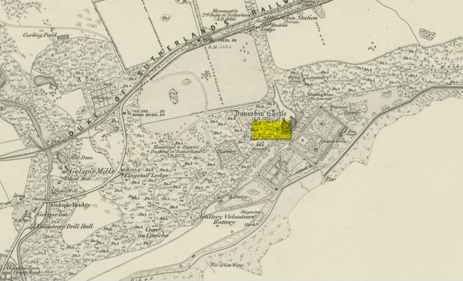
Very little has been written of this site due to the fact that little seems to known about it. A few of the usual ‘official’ on-line catalogues mention it but information on the site is truly scant. It is shown on the earliest Ordnance Survey map of the region and the same cartographers describe it in the Ordnance Name Book (1873), saying briefly how St John’s Well,
“Applied to a very deep pump well situated in the court of the ancient portion of “Dunrobin Castle”. No information respecting the dedication or origin of this name can be obtained in the District.”
But an earlier reference than this is cited in Fraser’s (1892) work, telling us that,
“In the midst of the court within the castle there is one of the deepest draw-wells in Scotland, all lined with ashlar-work, which was built and finished before the house was begun. The well was known as that of St. John. In the year 1512 sasine (i.e. delivery of feudal property) of the earldom and castle was taken at the well. At other times sasine was taken at the castle, at its gates, or near the well.”
Subsequent to this, we read in Cumming’s (1897) definitive folklore work of the region how,
“(it) looks as if there had been a chapel of St. John on Drumrabyn. In that case it may have been one dependent upon Kileain (=Kirk of John) on Loch Brora, which was only ½ a mile further than Kilmalin.”
Having not visited the castle, I’m unsure whether or not the well can still be seen. Does anyone know…?
Fraser, William, The Sutherland Book – volume 1, Edinburgh 1892.
Acknowledgements: Big thanks for use of the 1st edition OS-map in this site profile, Reproduced with the kind permission of the National Library of Scotland.
Take the Glenfarg road out of Bridge of Earn, cross the motorway and park at the layby past the bend. Go through the gate opposite and follow the track up to the telecoms mast, you can’t miss it..
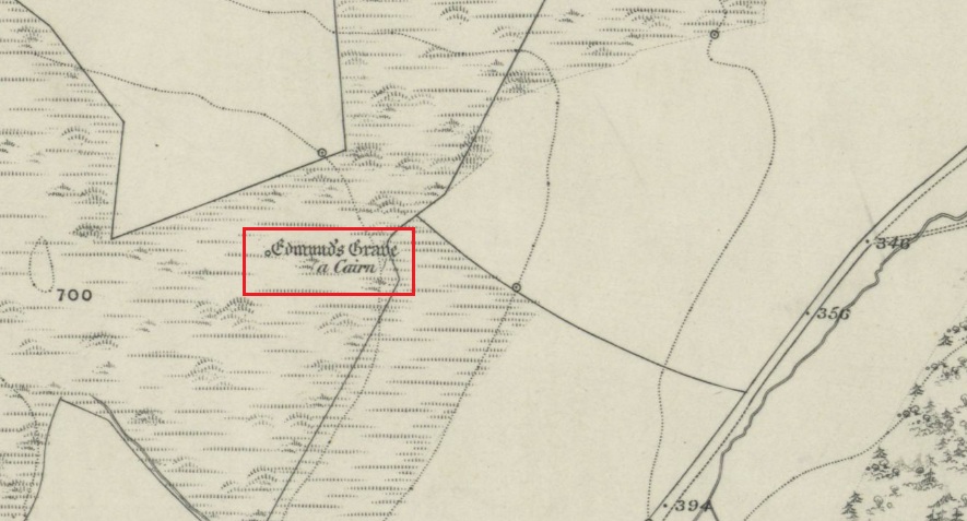
Archaeology & History
Shown on the 1866 OS Map
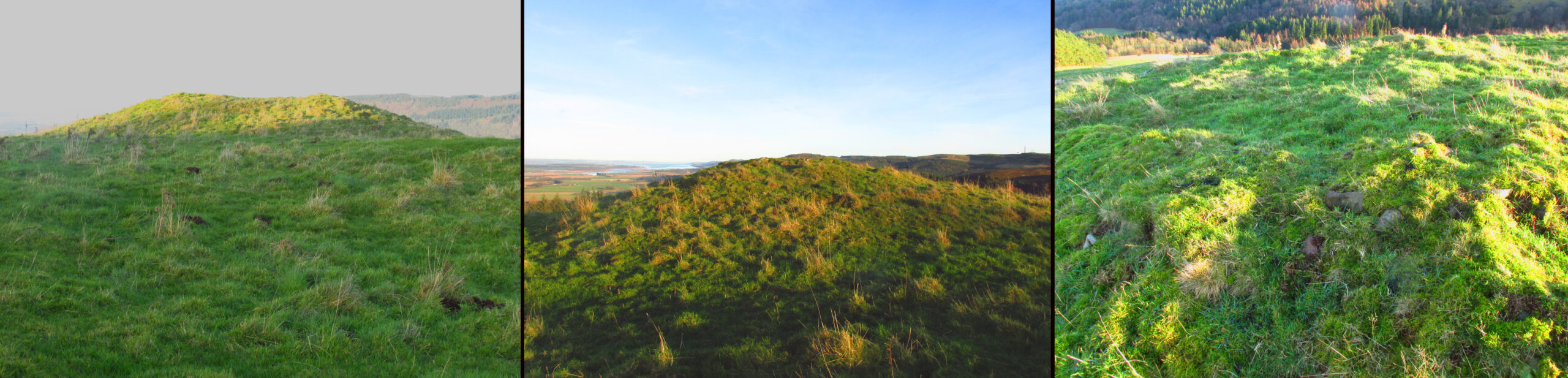
Visible from the lowlands below, it is described in the official listing as a cairn of prehistoric date, a funerary monument dating to the late neolithic to early Bronze Age. It is a broadly round stony mound, partially overgrown with turf on the north eastern (mid-summer sunrise) slope of Balmanno Hill, where it has extensive views over the surrounding country. It is 1.8m (6′) high, 17m (56′) across on the N-S axis and 16m (52′ ) on the E-W axis.
The top of the cairn has a depression in it: possibly the result of treasure-seeking long ago, but there is no evidence of any burial cist.
So who was ‘Edmund’? Was this a place of heathen ritual Christianised with the designation of St Edmund during the Anglo-Saxon incursions of the early middle ages, or the name of a local landowner? It is lost to history. The name ‘Balmanno’ can be interpreted as ‘Place of the Big Man’ – so have we an echo of a lost giant legend here in an area of Scotland where such legends abound, and long pre-date the construction of the cairn? Did later people name their local mythic giant ‘Edmund’?
An alternative meaning of ‘Balmanno’ is given by David Dow in the Old Statistical Account – the ‘Town of the Monk’.
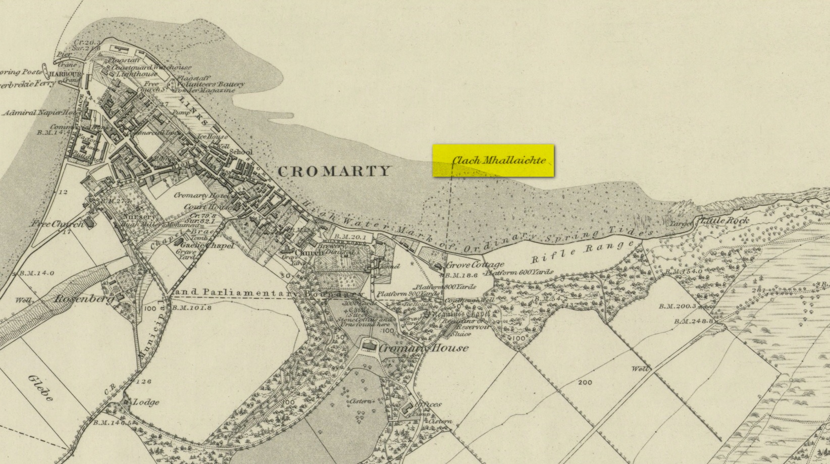
This large boulder found off the Cromarty coast, was highlighted on the 1880 OS-map of the region. It is one of the ancient boundary stones of the township.
Folklore
We know from the vast array on the folklore of stones that many were imbued with magickal abilities, some of which were witnesses to vows and others to make curses from. This large boulder off the coast of Cromarty was, according to Donald MacKenzie (1935), a place where the latter used to be done. He told us:
“At Cromarty there is a big boulder known as the Clach na Mallachd (‘Stone of Cursing’). Curses were delivered when an individual stood or knelt bare-kneed upon it.”
In an earlier account by the Ordnance Survey lads in one of their Name Books, they gave the following tale that had been narrated to them:
“A large stone Situate at the Low Water, and forming one of the boundary Stones of the burgh, the reason of its having this name is, that a young lad while Sitting on it was overwhelmed by the advancing tide and drowned, his mother when told of it, cursed the stone, hence the name Clach Mallach (Accursed Stone)”
References:
MacKenzie, Donald A., Scottish Folk-lore and Folk Life, Blackie: Glasgow 1935.
Maypole (destroyed): OS Grid reference – SD 5161 9212
Archaeology & History
Long since gone, it’s existence was recorded by, amongst others, the Kendal historian Cornelius Nicholson. (1861) He described it in relation to one of the town crosses, that was removed due to it being “an obstruction in the street.” The maypole too, he said,
“was another incumbrance, but indispensable, according to the custom of our forefathers. It stood in Kirkland, opposite the house of the late Thomas Reveley, Esq., and was suffered to remain till within eighty years ago. In the time of our good Queen Katherine, who may fairly be supposed to have partaken of the amusements, countenanced by her royal consort, the original festivity of maying and morris-dancing would be here celebrated, by the annual ceremony of “maying” when, immediately after sunrise, on the 1st of May, processions, entering the town at various inlets, streamed through the streets, with music of horns and flutes; boys with their May-gads (willow-wands twined with cowslips), and girls with their “brats” full of flowers — young and old alike joining in merry laughter, and song, and the customary chorus, “We have brought the summer home.” When the above-named ceremonies became less fashionable, the May Pole was made the rendezvous of all the milkmaids in the neighbourhood, who came and paraded round it on Easter Mondays. On other occasions of rejoicing, afterwards, such for instance, as terminating an apprenticeship, and the like, it became customary for young men to go and dance around it.”
The author then told that this annual village ceremony was still being performed at the beginning of the 19th century, “in the assemblage of young people in the Vicar’s Fields, on Easter Tuesday. After spending the afternoon there, they returned in procession through the streets, threading grandy needles.”
References:
Nicholson, Cornelius, The Annals of Kendal, Whitaker & Co.: London 1861.
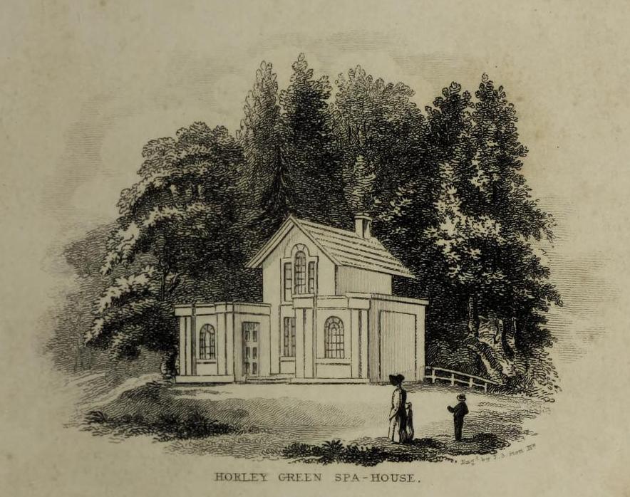
The historian William Addison (1951), in his history on the subject, told how “the spas began as holy wells”; and although no direct accounts are left of early dedications here, the remnants of Mayday traditions tell us there were more archaic goings-on before the waters were taken by the aristocrats. Once it had been designated as a spa, the waters were covered and a typical Spa House constructed over them. From hereon, for more than a century, the waters were accessible only to those with money who wished their ailments to be treated.
Between the end of the 18th to the end of the 19th century, the Horley Green Spa was a very prominent ingredient in the history of Calderdale. A chalybeate or iron-bearing spring, its waters were directed into a large underground cistern covered by metal. Thomas Garnett (1790) was the first to write about it, telling us:
“The Horley Green water is quite pellucid—sparkles when poured out of one glass into another—and has a sharp, aluminous, styptic taste, not unlike ink. The taste is not unpleasant when the water is taken from the springhead and drank immediately.”
He went on to espouse the waters to be good in healing bone and rheumatic diseases, giving many first-hand accounts from people in Yorkshire and beyond who used the waters here with apparent success, including one case of curing diabetes! Its reputation was later reinforced in a book by William Alexander (1840), who told us how,
“I unhesitatingly affirm that the Horley Green Spa possesses a very strong claim to be regarded as a powerful tonic and chalybeate.”
By the time those words were written, it had already gained a considerable reputation and many were those who’d received treatment.
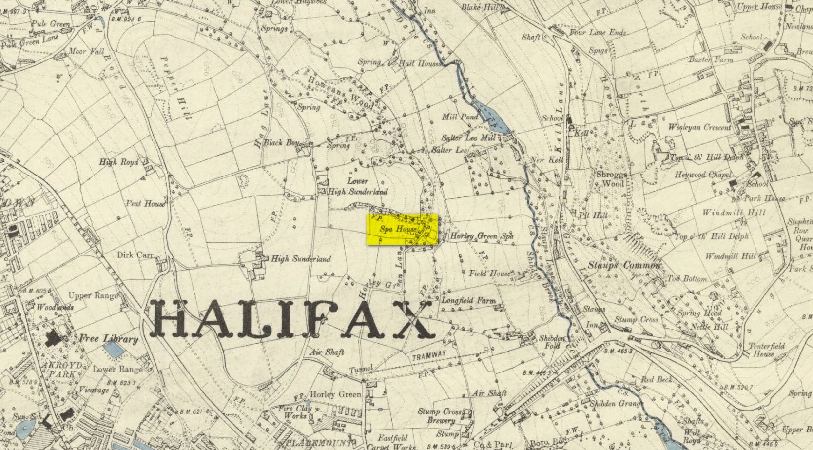
Spa House on 1894 map
A years after Alexander, the roving doctor A.B. Granville (1841) visited Horley Green—who described it as “a renowned steel-water Spa”. But at the same time he reported how its popularity had started to decline. But, via one Mr West, he did leave us with a greater chemical analysis of the Horley Green waters in an attempt, once more, to certify and prove its curative properties. Their results found the waters to possess, in varying quantities, lime, magnesia, silica, iron oxide, sulphur and silica—all of which further attributed the science of its medicinal actions. A number of case histories of the people cured here can be found in the works of Granville, Garnett and Alexander.
The well-house that stood here eventually fell into disuse. When it was eventually restored as someone’s home in the the late 20th century, the disused spring was found beneath the foundations, filled with stones.
Folklore
Horley Green’s spa well came about as a result of local people visiting the site around Beltane, probably for centuries before the aristocrats and early pharmacists took their hand to the place. But once the spa became renowned, people could only gather here “on the first Sundays in the month of May,” with Sunday being that legendary ‘day of the lord’ crap, to which the people would abide to save them from prosecution. It is obvious though that it had been used as a place of magick thanks to the snippets of lore which have found their way into local history books. We read how, at 6am, people gathered here, to such an extent that the roads were completely crowded. Those who arrived first were given bags of nuts: an archaic traditional motif found at many pre-christian wells in Britain. Occultists and ritual magickians amongst you will note the time when folk frequented the well, at 6am: the time when many nature-spirits are invoked for full effects. We find this time echoed in the ritual gatherings at Lady or St. Anne’s Well in Morley, just a few miles to the east.
References:
Addison, William, English Spas, Batsford: London 1951.
Alderson, Frederick, The Inland Resorts and Spas of Britain, David & Charles: Newton Abbot 1973.
Alexander, William, “On the Mineral Springs of the Parish of Halifax,” in Proceedings Geological & Polytechnic Society, West Riding, Yorkshire, volume 1, Edward Baines: Leeds 1849.
Crabtree, John, Concise History of the Parish and Vicarage of Halifax, Hartley & Walker: Halifax 1836.
Granville, A.B., Spas of England, Henry Colburn: London 1841.
Hembry, Phyllis, The English Spa 1560-1815, Athlone Press: London 1990.
Short, Thomas, The Natural, Experimental and Medicinal History of the Mineral Waters of Derbyshire, Lincolnshire and Yorkshire, privately printed: London 1724.
Short, Thomas, A General Treatise on Various Cold Mineral Waters in England, privately printed: London 1765.
An old church dedicated to St Bennet once existed on the hill above where this spring of water emerges, but little is now left of the building. Thankfully the holy well hasn’t quite followed in the footsteps of the church. Miss Riley (1935) told us that it can be found “near the high-water mark…situated at the foot of a beautiful little glen which runs inland from the coast” – and from all accounts it is still there.
Shown on the 1880 OS-map of the region, the dedication to St Bennet is obscure. Mr Pullan (1927) suggested it derived from the 6th century St Benedict of Nursia, but this is improbable. The Royal Commission lads thought it more likely derived from “a Celtic foundation.”
Folklore
The earliest description I’ve found regarding the traditions surrounding this well are by Hugh Miller (1835). He wrote:
“It is not yet twenty years since a thorn-bush, which formed a little canopy over the spring of St. Bennet, used to be covered anew every season with little pieces of rag, left on it as offerings to the saint, by sick people who came to drink of the water.”
But the tradition didn’t die out, as evidenced by a short article by Miss M.D. Riley (1935) in Antiquity journal where she gave us further valuable information about its folk history, saying:
“In order to insure the fulfilment of the wish it is essential that the wisher should drink the water and leave something of his personal attire. When the writer visited the spot there was a heterogeneous collection of ‘rags’ hanging on the branches.
“Mr Francis Scott tells me that the site is locally supposed to be the place of judgement. It is close to the ruins of St Bennet’s Chapel and the ground is said to be cursed as it was stoeln by the Church. Even at the present day the owner has to provide each year at Christmas-tide 8 cwt of oatmeal free for the poor of the parish. This has been operative since 1630 and though the owner has tested the matter in the highest court of law in Scotland, his appeal was not allowed.”
The tradition of giving offerings to the spirit of this well was still recorded in 1966.
References:
Hiley, M.D., “Rag-Wells,” in Antiquity, volume 9:4, December 1935.
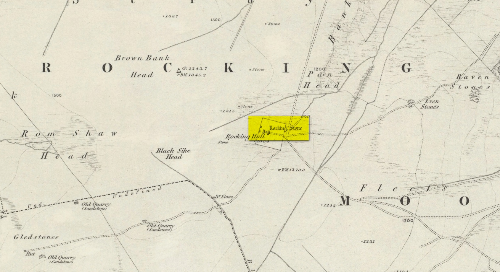
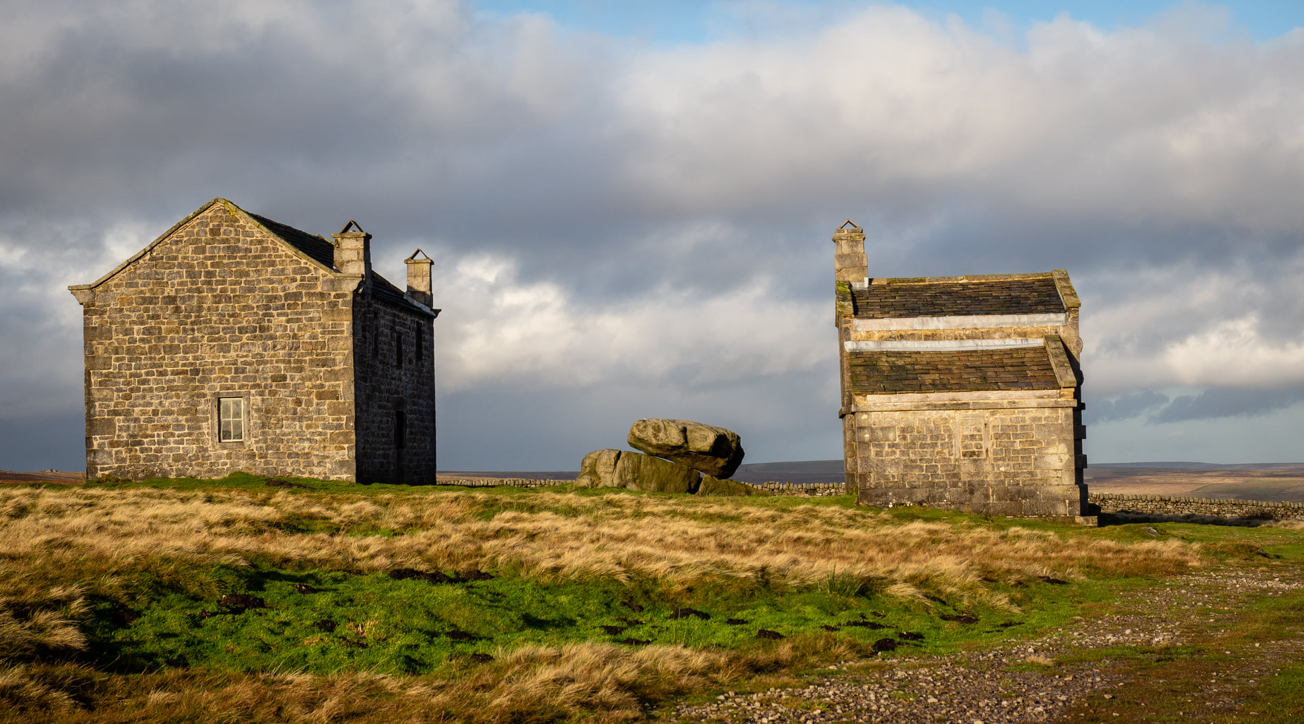
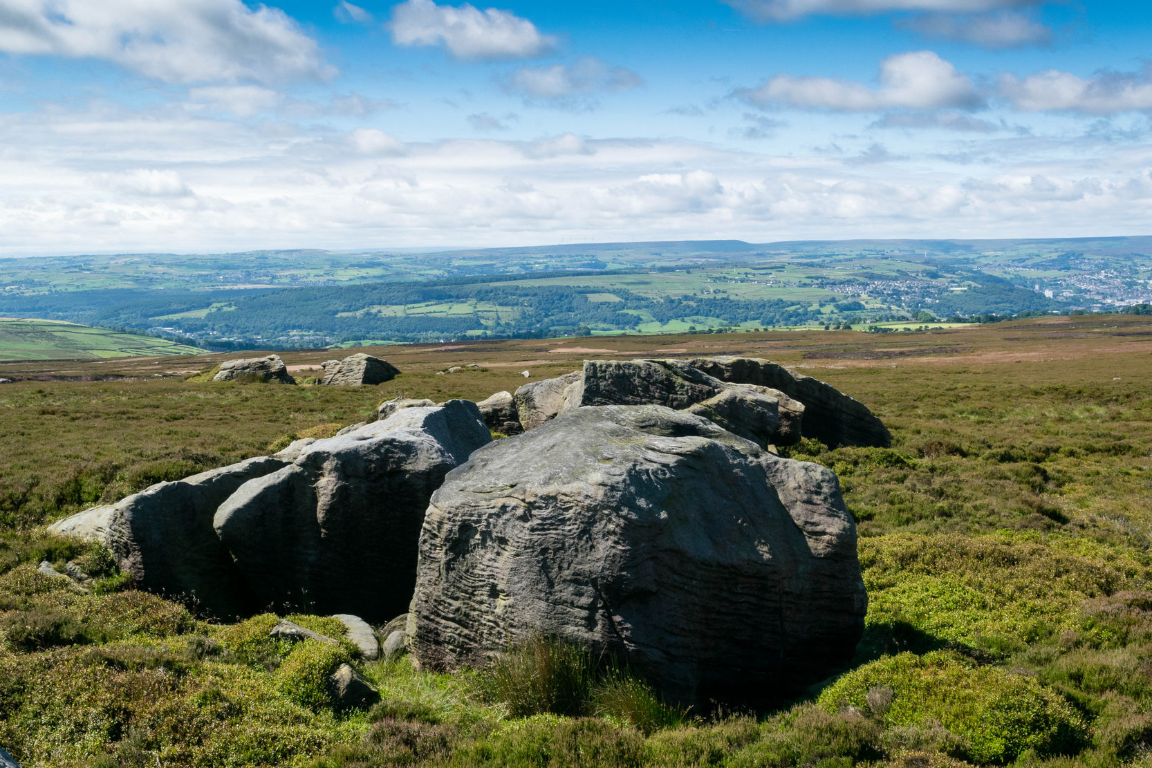
Visiting this site is a bittova walk across the moors, with probably the best route being along one of two footpaths from near the Outdoor Centre following (whichever is your preference) the moorland track or path westward onto the open landscape. Tis a 2½ mile walk before you reach two large buildings stuck high up in the middle of nowhere. Y’ can’t miss them. Equally unmissable is the large blatant rocking stone between the buildings. Gerron top of it!
Archaeology & History
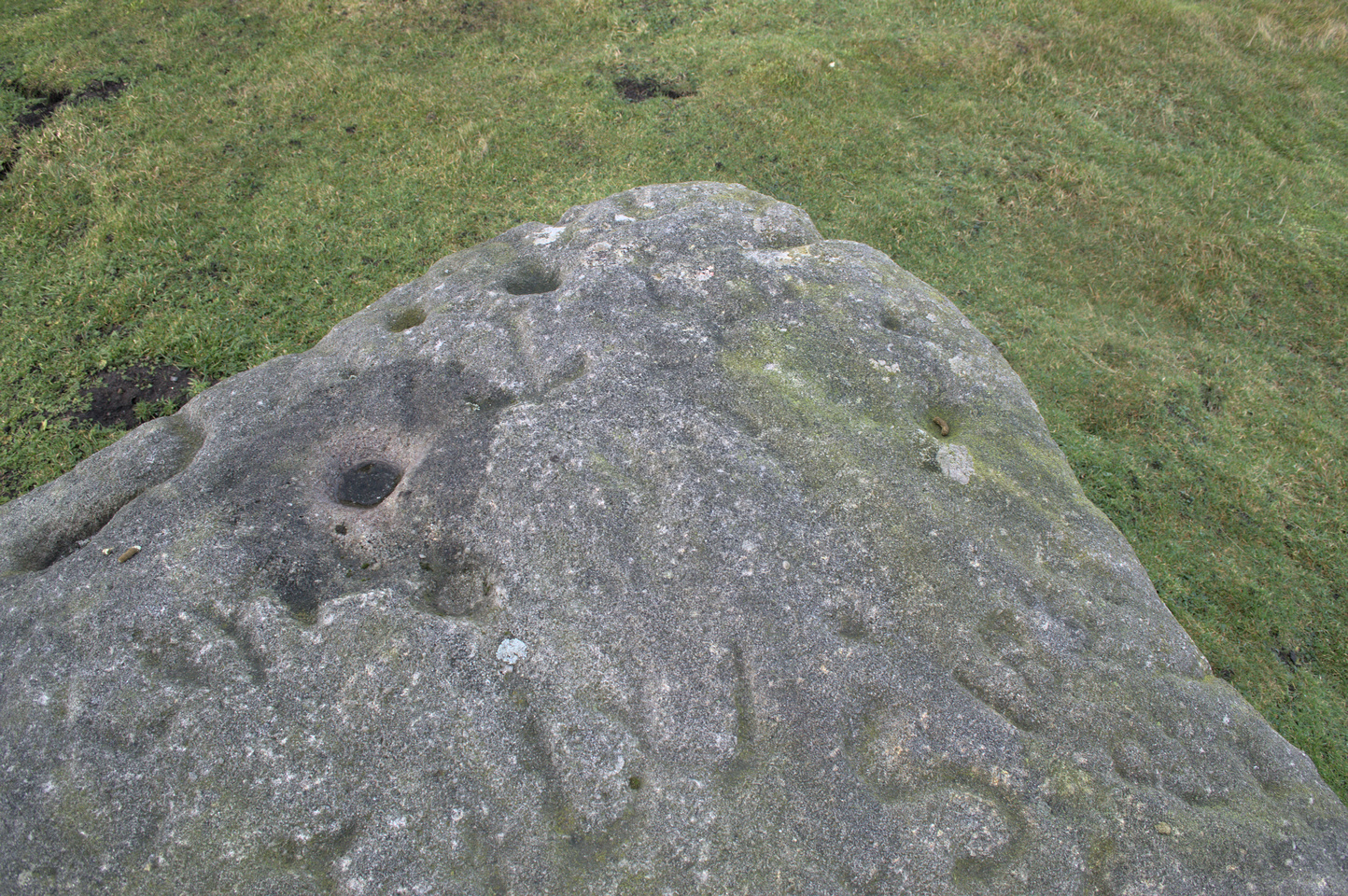
Rocking Stone, in situ
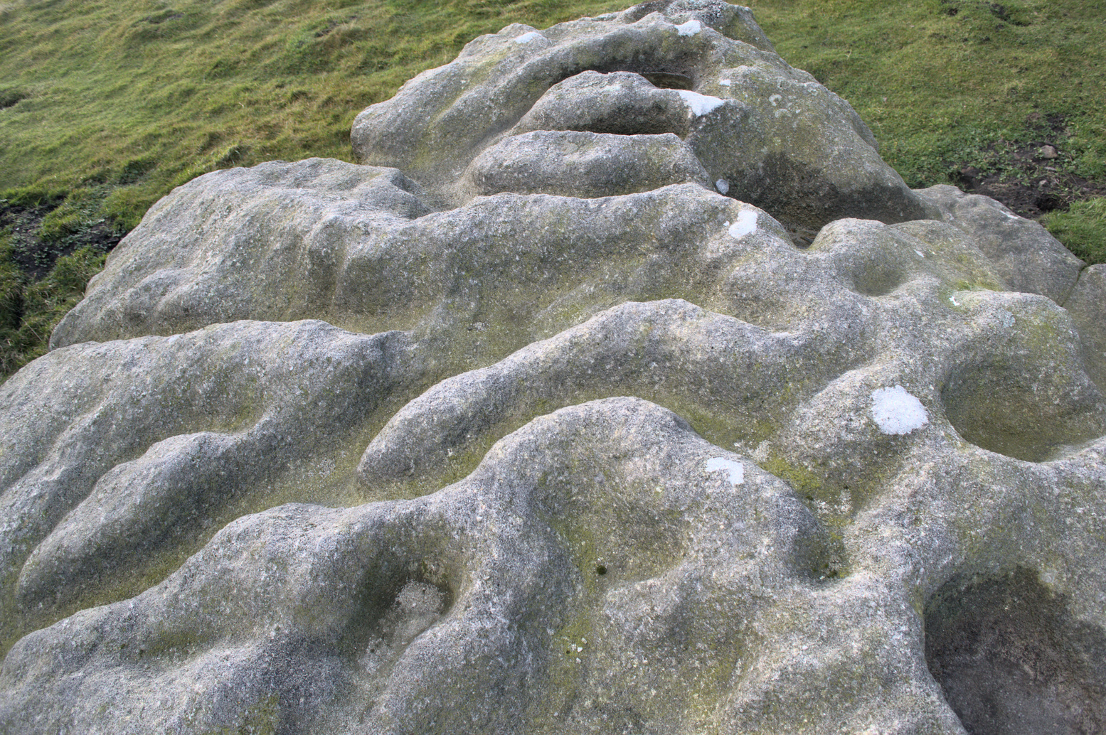
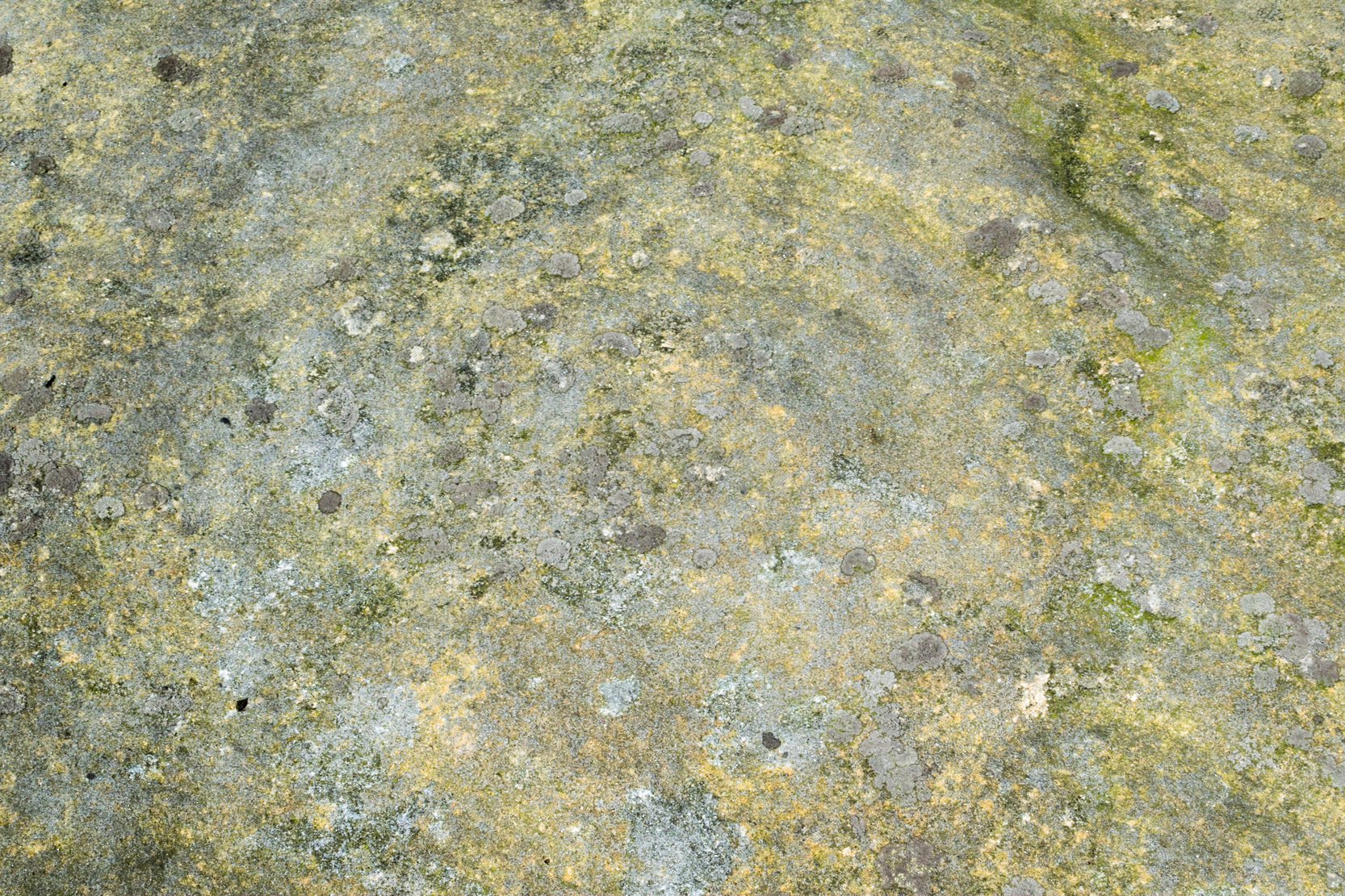
This impressive-looking rock that sits between the two buildings has a number of cup-markings of varying sizes across its topmost surface: some deep and some not-so-deep. There are perhaps as many as 20 of them on different parts of the stone, but some have been intruded on by more recent graffiti. On a recent visit to the site, photographer James Elkington and his young assistant MacKenzie, saw what looked like “a very faint ring around one of the cups” – which doesn’t surprise me. On one section of the stone we see a fascinating series of natural curves and geological undulations, some of which may have been modified a long time ago when the cupmarks were etched. But whether they were added to or not, it’s more than likely they’d have had some significance in the mythic nature of the rock.
The earliest description telling us that this possessed any prehistoric attributes seems to have been written by William Grainge (1871), in his huge work on the history of this region. He told that,
Faint ring highlightedSome of the many cups
“This rock…is eleven feet in length, seven feet six inches in breadth, and two feet six inches in thickness. The whole of the upper surface is thickly indented and grooved with cups and channels; the artificial character of which can be easily seen by anyone. This logan rests upon a lower rock, the upper surface of which is about three feet above the ground, fourteen feet in length, and nearly the same in breadth.”
Folklore
Curvaceous nature & cups
Although this yummy-looking geological sight no longer rocks, it wasn’t always that way. Indeed, according once more to the pen of Mr Grainge, although “it does not rock now, it has done so within living memory” – meaning that it would have been swaying at the beginning of the 19th century. We can only take his word for it. Also, as with many rocking stones the length and breadth of the land this, unsurprisingly it was adjudged to have been a place used by the druids.
References:
Grainge, William, The History and Topography of Harrogate and the Forest of Knaresborough, John Russell Smith: London 1871.
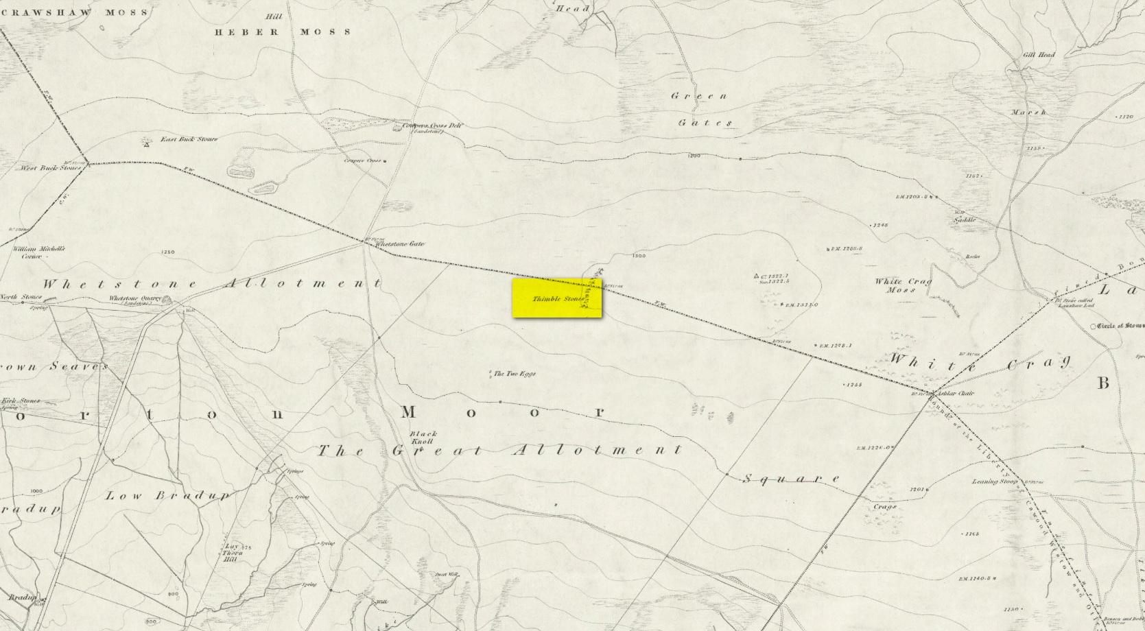
You can either head up to the Twelve Apostles stone circle, then a short distance west to the Ashlar Chair and head just head west along the moorland footpath that runs parallel with the old walling for ¾-mile (1.2km). This is the boggier route, beloved of real walkers! The other route is from the top of the Roman Road that bisects the moor at Whetstone Gate. From here, where the normal ‘road’ meets up with the dirt-track at the very top of the moors, take the footpath east for ½-mile (0.75km) until you reach the large cluster of rocks, just over the wall on your right-hand side. The carving is on top of one of them there stones.
Archaeology & History
Without doubt there’s one helluva spirit to this cluster of large weather-worn rocks whose bodies gaze in every cardinal direction—and it’s a place where me and a number of earlier historians thought cup-and-rings could be found. The first petroglyphic context of the rocks was made in the 1860s by the grand 19th century historians Forrest & Grainge (2012) where they gave it the usual druidic associations, so beloved of academics and antiquarians alike at the time. They wrote:
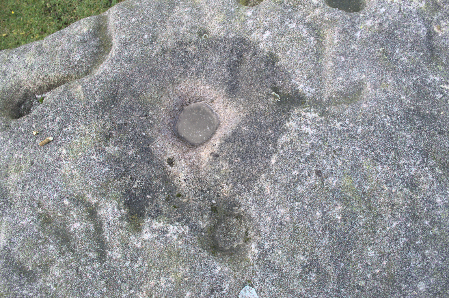
Very faint cup-and-3-ringsThimble Stones gazing south
“The Thimble Stones are a ½-mile north of the Two Eggs, with which they are nearly in line. They are of the same outcrop of stratification and appear as though they had been pushed upwards by some force acting from beneath, breaking them up with a vertical fracture, and separating them so as to leave wide spaces between the blocks. They are about a furlong in length and in front about 10ft in height, diminishing eastward to the level of the ground. Two of them a few feet apart are 7ft high, and bear on their eastern angles the cups and channels which we designate the marks of Druidic consecration.”
Subsequently, in Collyer & Turner’s (1885) work they told that the rocks “bear cups on two margins”; and when the great Harry Speight (1900) came here, he found they were “bearing cups and grooves.” Yet no-one reported any rings. And in the countless visits I’ve made here—thinking that there must have been cup-and-rings!—no such symbols have ever cried out. The various large ‘bowls’ and lines that Nature has carved here—some of which may have been important in ancient days—are all that the casual eyes can see. Until now…
The local rambler and photographer James Elkington and James Turner were up here a couple of years ago. The light was falling through a clear bright sky and so, as James likes to do at such times, he clicked his camera a few times to catch the landscape. Clambering onto the rocks, Mr Turner unknowingly stood upon the carved rings, and when he moved his foot Mr Elkington spotted them! And as we can see on the image above, only just, there’s a single cup-mark surrounded by a concentric triple ring. Incredibly faint, it is without doubt the real McCoy—and the highest of all petroglyphs on these moors. In the photo it seems that there may be other elements to the carving, but until conditions allow for a further examination, we won’t know for sure.
James is hoping to get back up there when conditions are just right so he can get clearer photos. But if you hardcore antiquarians and petroglyph seekers wanna get up there y’selves to get some photos of your own, please send us whatever you might find.
Folklore
On the esoteric side, the Thimble Stones was a place favoured by the progenitors of the ritual magickal Order, the Illuminates of Thanateros, in years gone by.
References:
Allen, J. Romilly, ‘Cup and Ring Sculptures on Ilkley Moor,’ in Reliquary & Illustrated Archaeology, volume 2, 1896.
Bennett, Paul, The Old Stones of Elmet, Capall Bann: Milverton 2001.
Boughey, Keith & Vickerman, E.A., Prehistoric Rock Art of the West Riding, WYAS: Wakefield 2003.
Collyer, Robert & Turner, J. Horsfall, Ilkley, Ancient and Modern, William Walker: Otley 1885.
Feather, Stuart, “Mid-Wharfedale Cup-and-Ring Markings,” in Bradford Cartwright Hall Archaeology Group Bulletin, 6:3, 1961.
Forrest, Charles & Grainge, William, A Ramble on Rombald’s Moor, Northern Antiquarian: Bradford 2012 (1st published 1867-69).
Hedges, John (ed.), The Carved Rocks on Rombalds Moor, WYMCC: Wakefield 1986.
Speight, Harry, Upper Wharfedale, Elliott Stock: London 1900.
Acknowledgements: Huge thanks as always to James Elkington for use of his photos.