Wallace’s Thorn, Dunfermline, Fife

Legendary Tree:  OS Grid Reference – NT 090 873

Archaeology & History 

This little-known tree, said to have been planted in memory of Sir William Wallace’s mother, is long gone.  The only notice I can find of it, is in the writings of Pete Chalmers (1844), who told us:

“There is a tradition that the mother of Sir William Wallace was buried in the old church-yard, on the spot where the present thorn-tree is growing, but how she came to die here history seems to be silent.  It is added that her son wished afterwards to erect a monument to her memory, but being in pursuit of, or flight from, his enemies, had not time to do so, and, as a substitute, planted a thorn-tree.”

Much of what constitutes “the old church-yard” has long been covered by the new cathedral and so the precise location of this old thorn tree will never be known, which is a pity, for as Chalmers told,

“This tree had reached an immense size, and was seemingly of great age about 60 years ago (c.1784), when it was blown down by a storm and replaced by a stem from the old tree, now advanced to a considerable height and magnitude—the only living and remaining memorial of the filial affection of the Scottish Patriot.”

Due to a lack of writings from the viewpoint of Wallace and the Scottish people, we are only left with fragments regarding the why’s and wherefores of Wallace and his mum being in Dunfermline.  Chalmers thought,

“Possibly the occasion of their being here is referred to in the following lines of the poet, an account of a pretended pilgrimage of Wallace and his mother to St Margaret’s shrine.”

He then cites a more assured account of Sir William being in the area, saying:

“It is recorded of this renowned person, that, on one occasion, in 1808, when he was surrounded by his enemies, he came from the fastnesses where he had taken refuge, to the Forest of Dunfermline, and by the mediation of his friends, proposed, on certain conditions, yiz., the assurance of safety in life, limbs, sad estate, to surrender himself.  These conditions were indignantly refused by the haughty and infuriated Edward (the Tosser), who cursed him, by the fiend, for a traitor, and even set a price on his head. On hearing this, the Patriot ” betook himself again to the wilds and mountains, and subsisted on plunder.”

References:

  1. Chalmers, Peter, Historical and Statistical Account of Dunfermline, William Blackwood: Edinburgh 1844.

© Paul BennettThe Northern Antiquarian

St. Andrew’s Cross, Dunfermline, Fife

Cross (destroyed):  OS Grid Reference – NT 1017 8630

Also Known as:

  1. Canmore ID 50858

Archaeology & History

In Pete Chalmers (1844) historical brief about the long lost chapel and hospital of St. Leonard (and its associated holy well), mention is made of this long forgotten relic.  Its memory was preserved in an old place-name, and was to be found less than half-a-mile southeast of St. Leonard’s sites on,

“the high part of the road, about a quarter of a mile to the south, the Spital-Crosshead, (named) from a pillar which, according to tradition, was erected there, decorated on the top by a St Andrew’s Cross, and removed probably towards the close of the 16th or 17th century.”

The cross is believed to have been erected in the 15th century.

References:

  1. Chalmers, Peter, Historical and Statistical Account of Dunfermline, William Blackwood: Edinburgh 1844.

© Paul BennettThe Northern Antiquarian

St. Leonard’s Well, Dunfermline, Fife

Holy Well (destroyed):  OS Grid Reference – NT 0976 8666

Archaeology & History

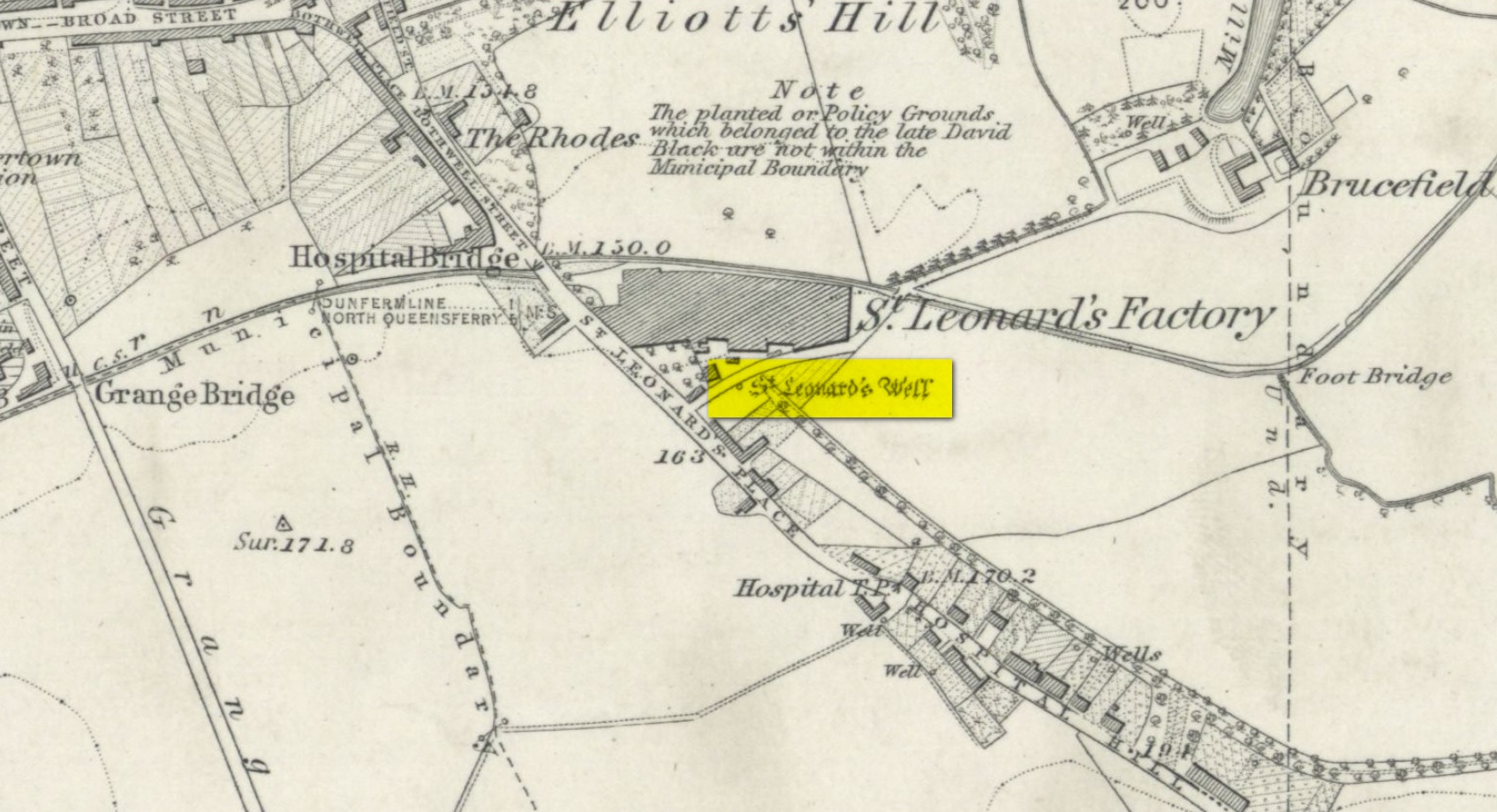
Site shown on 1856 map

There seems to be very little information available about this holy well, lost long ago and now hidden beneath the foundations of a food superstore!  It was found in close association with both a chapel and a hospital in St. Leonard’s name—both of which have also been destroyed.  The water from here may have been used by the monks for patients in the hospital, but that’s purely speculative.  St. Leonard was known to be connected with lepers, which may be something that the waters here were used to treat.  But again, I’m speculating…

When the Ordnance Survey lads came here in 1853, the waters were still running and they subsequently added it to their map a few years later.  The site was still visible when Erskine Beveridge (1917) came here, telling us briefly that,

“St. Leonard’s Well still remains a little to the south-east, and, though now built up, is recognisable.”

But a few years later it had been destroyed and its position was shown on the updated OS-map of 1926 as “Site of.”  The old well had gone…

References:

  1. Beveridge, Erskine, The Burgh Records of Dunfermline, William Brown: Edinburgh 1917.
  2. Simpkins, John Ewart, Examples of Printed Folk-lore Concerning Fife, with some Notes on Clackmannan and Kinross-shires, Sidgwick & Jackson: London 1914.
  3. Walker, J. Russel, “‘Holy Wells’ in Scotland,” in Proceedings of the Society of Antiquaries of Scotland, vol.17 (New Series, volume 5), 1883.

Acknowledgements:  Big thanks for use of the 1st edition OS-map in this site profile, Reproduced with the kind permission of the National Library of Scotland

© Paul BennettThe Northern Antiquarian

Wallace’s Well, Dunfermline, Fife

Healing Well:  OS Grid Reference – NT 08782 87275

Also Known as:

  1. Spa Well
  2. Wallace Spa

Archaeology & History

The ruins of this little-known site, dedicated to the legendary Sir William Wallace, can still be seen in the form of an overgrown stone ruin just off the footpath that runs through the Pittencrieff Glen out of the town centre.  In earlier times the waters were evidently of some repute, as a Council meeting in May 1773 reported with some disdain the closure of the waters by a Mr Chalmers:

“This Day the Council considering that the entry from the Town to the Well of Spaw is now shut up by Mr. Chalmers, which was a particular privilege to ye Inhabitants of the Burgh, Do hereby appoint the Provost to intimate to Mr. Chalmers that the Town will not give up that privilege, and to require him to oppen an entry thereto as formerly.”

We don’t know whether the miserable Mr Chalmers gave access to the well, as there seem to be no Council meeting notes telling us the outcome.  My guess would be that the local people got their way, hopefully at Chalmers expense!  More than 70 years later, another Mr Chalmers (1844) wrote about the well in a more respectful light:

“On the north edge of the rivulet, a little below this bridge, at the foot of the Tower Hill, there is a famous well, named the Wallace Spa, or well of Spa, which was formerly much resorted to by the inhabitants of the town for its excellent water, but which has been long since disused. It is noticed here simply on account of the traditionary antiquity of its name, Sir William Wallace, it is said, having once, in the haste of a flight, drank a little of it, out of the palm of his hand.”

In spite of there being local folklore of William Wallace, the local historian Ebeneezer Henderson (1879), in his giant work on Dunfermline, thought there was a more prosaic origin to the well’s name. He told,

“This well is still in existence, about fifty yards south of the ruins of Malcolm Canmore’s Tower — Tower Hill.  The water is reported as being “very cold at all times.” The water should be analysed.  The well during the period of its being used was known as the “Spaw Well,” and the ” Well of Spaw,” and, by and by an easy, natural transition, ” Wallace Spa;” and thus the name of the well has sometime been connected with that of the great Scottish hero.”

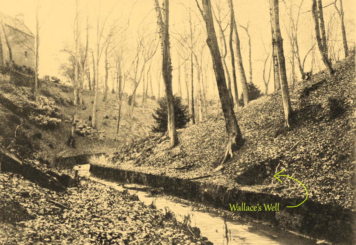
The Well after 1900
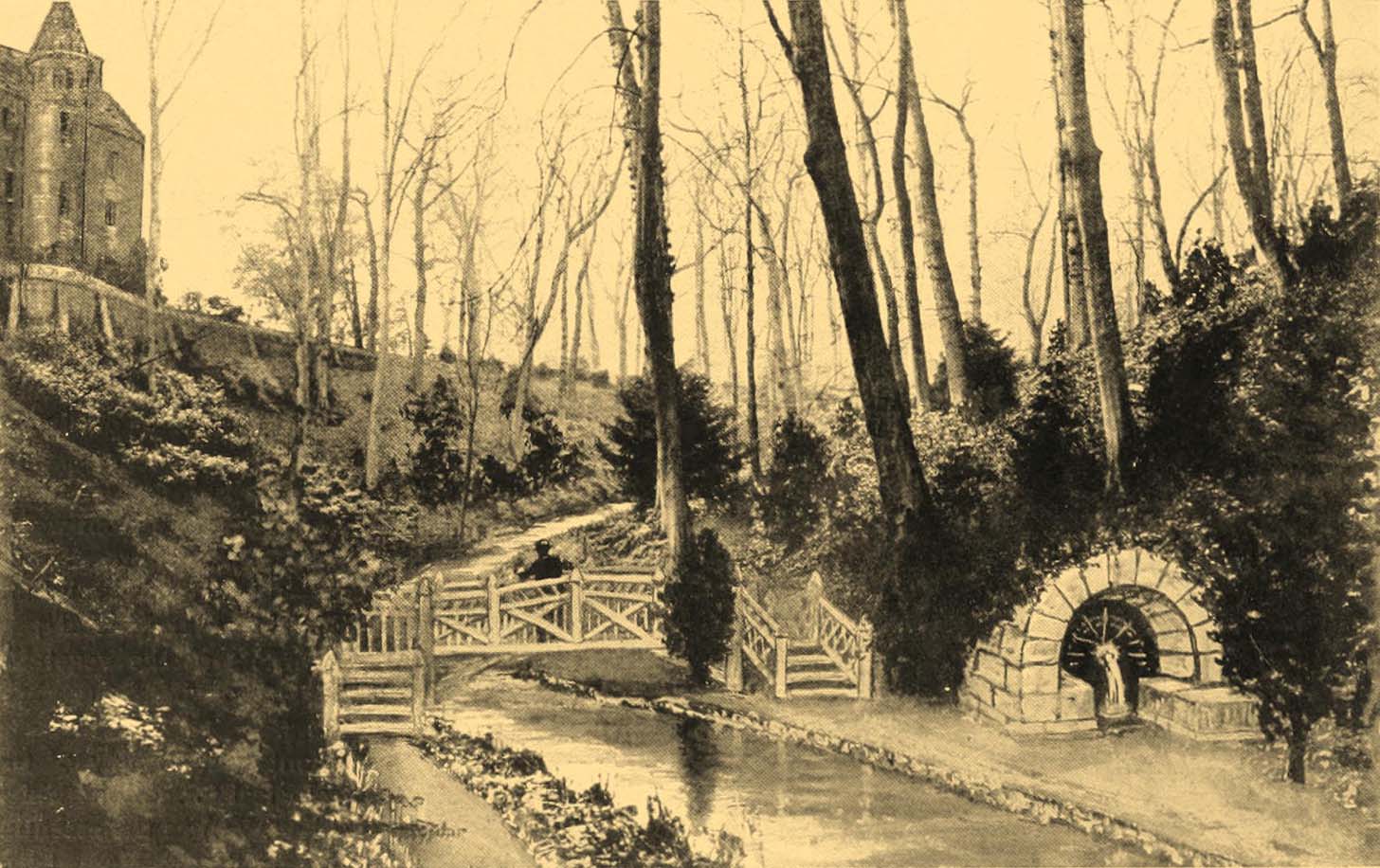
pre-1900 image

By the end of the 19th century, the well had become almost buried by earth and foliage, but was subsequently brought back to life following architectural improvements of the glen around the turn of the 20th century.  In Patrick Geddes’ (1904) work he gives us “before and after” portraits (attached here) showing how it had been restored.  He also mentioned “its tradition of medicinal value”, but could give no further information regardings the ailments it was reputed to cure…

References:

  1. Chalmers, Peter, Historical and Statistical Account of Dunfermline, William Blackwood: Edinburgh 1844.
  2. Geddes, Patrick, City Development: A Study of Parks, Gardens and Culture-Institutes, St George Press: Birmingham 1904.
  3. Henderson, Ebenezer, The Annals of Dunfermline, John Tweed: Glasgow 1879.

© Paul BennettThe Northern Antiquarian

St. Brendan’s Well, Abernethy, Perthshire

Holy Well (lost):  OS Grid Reference – NO 191 161

Also Known as:

  1. Brendan’s Well
  2. Brendi’s Well

Archaeology & History

In 1897, when Butler wrote his history of the village, he told that a certain well, “adjacent to the Gattaway stream” (thought to be the Nethy Burn which passes Gattaway farm) was known to old locals as Brendan’s Well, with the name still surviving as ‘Bredni Well’.  There were a number of large boulders around it that had been scattered by blasting, but which Butler thought were, “in all probability placed originally near the wall as a guide for pilgrims.”

The site was included in Ruth & Frank Morris’ (1982) survey, adding simply that the site was named “after the saint who lived here in the seventh century.”  In the christian calendar, St. Brendan’s day was May 16.

When the local antiquarian Paul Hornby looked for the well, a local lady told him that she thought an occasional but regular boggy patch that appeared in her garden was due to the underground waters from St Brendan’s Well.

References:

  1. Butler, D., The Ancient Church and Parish of Abernethy, Edinburgh 1897. Page(s): 102
  2. Morris, Ruth & Frank, Scottish Healing Wells, Alethea: Sandy 1982.

© Paul BennettThe Northern Antiquarian

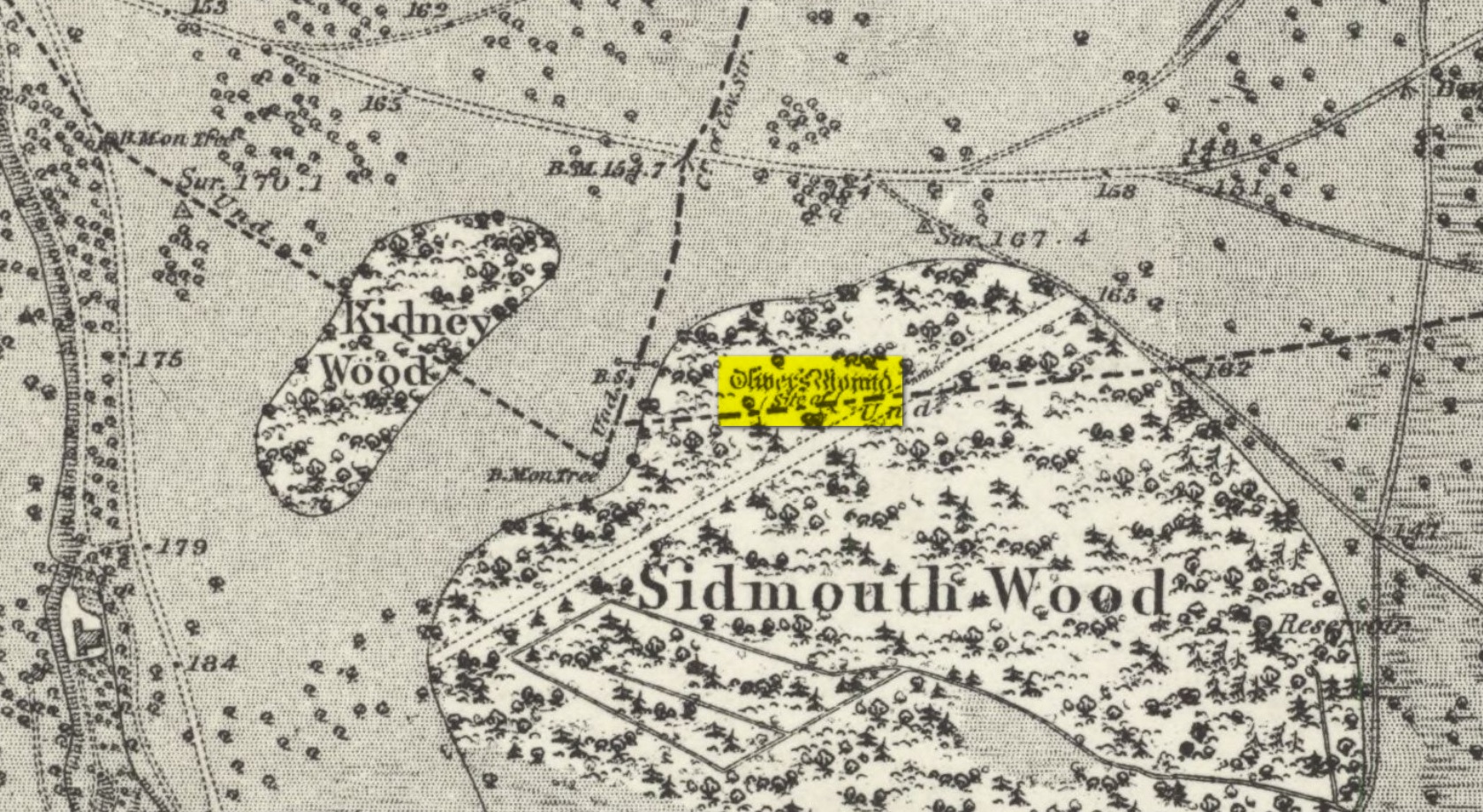
Oliver’s Mound, Richmond Park, Surrey

Tumulus (destroyed):  OS Grid Reference – TQ 192 735

Also Known as:

  1. Oliver’s Mount

Archaeology & History

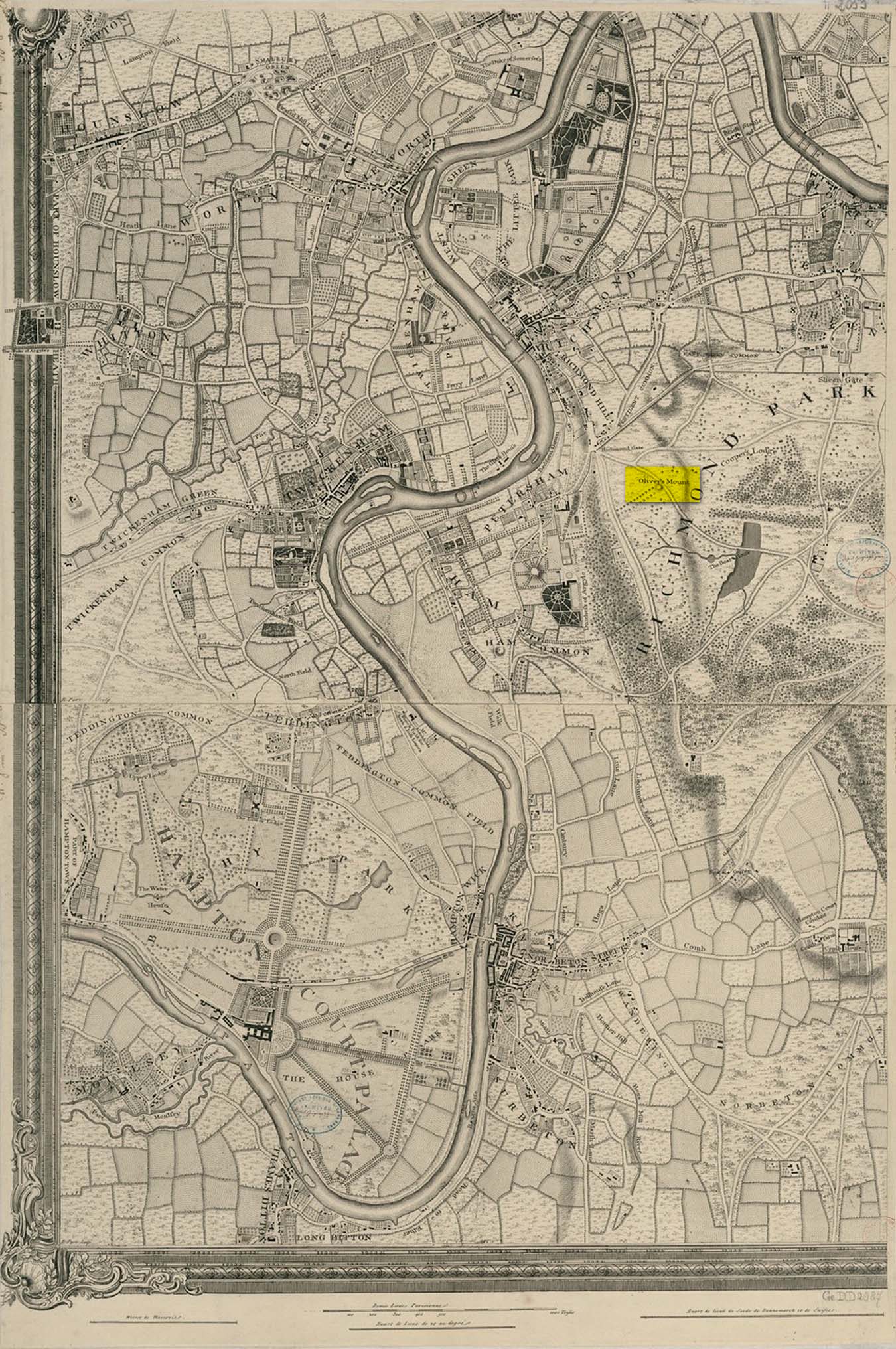
Roque’s 1746 map

Oliver’s Mound was highlighted as early as 1746 on John Roque’s map of the Country Near Ten Miles Round (London) as still standing.  One hundred and fifty years later, when the Ordnance Survey lads came to map the area, it had gone.  We don’t know exactly when it was demolished, so Historic England (not necessarily a good measure of accuracy) tell us its demise occurred “between 1760 and 1868”, so giving themselves at least some degree of safety!

As we can see in Mr Roque’s old map, an avenue of trees led up to the barrow.  This avenue will have been created when Richmond Park and its gardens were laid out.

The round barrow was most likely Bronze Age in origin.  The historian and folklorist Walter John (1093) reported that in 1834, three skeletons were found at a  depth of a yard beneath the surface.

Folklore

Site shown on 1873 map

Traditional tells that the name of this barrow comes from when the religious extremist, Oliver Cromwell, and his men, set up camp here.  A slight variant tells that Cromwell stood here to watch a skirmish.

References:

  1. Cundall, H.M., Bygone Richmond, Bodley Head: London, 1925
  2. Grinsell, Leslie V., The Ancient Burial Mounds of England, Metheun: London 1936.
  3. Johnson, Walter, Neolithic Man in North-East Surrey, Elliot Stock: London 1903.
  4. Johnson, Walter, Folk Memory, Clarendon: Oxford 1908.

© Paul BennettThe Northern Antiquarian

Caesar’s Camp Barrow, Wimbledon, Surrey

Tumulus (destroyed):  OS Grid Reference – TQ 222 709

Archaeology & History

It seems that a great number of prehistoric remains used to exist in and around the Wimbledon Common area.  This one is mentioned only briefly in Thomas Stackhouse’s (1833) rare work on early British remains, where he wrote:

“Near an old single-trenched Camp at the South West comer of Wimbledon Common, is a very small flat Barrow cut into the form of a cross: I don’t know that it has been noticed by any writer.”

The “single-trenched Camp” he described is today known as Caesar’s Camp hillfort.  By the time the Wimbledon historian William Bartlett (1865) came to write his survey, the site had been destroyed.  In Mr Johnson’s (1903) survey, he seems to confuse this site with the large barrow cemetery that used to exist on the northern edges of Wimbledon Common described by William Stukeley and others.

(the grid-reference to this site is an approximation).

References:

  1. Bartlett, William A., The History and Antiquities of Wimbledon, Surrey, J. & S. Richards: Wimbledon 1865.
  2. Johnson, Walter, Neolithic Man in North-East Surrey, Elliot Stock: London 1903.
  3. Stackhouse, Thomas, Two Lectures on the Remains of Ancient Pagan Britain, privately printed: London 1833.

© Paul BennettThe Northern Antiquarian

Cedars Road, Clapham, Surrey

Tumulus (possible):  OS Grid Reference – TQ 2856 7555

Also Known as:

  1. Mount Nod

Archaeology & History

Located on the old boundary line between Clapham and Battersea, what might have been a forgotten tumulus, whose memory was thankfully preserved by the renowned folklorist and historian Walter Johnson (1903), was described in his work on prehistoric Surrey.  He seemed to think it serious enough to add to his survey, where he told us that,

“there still exists, near Cedars Road, Clapham, what may possibly be a round barrow.  It is in the garden of a house opposite St. Saviour’s Church, and is visible to anyone passing along the old, narrow passage called Wix’s Lane.  Mr. J.W. Grover, who brought the matter before the Archaeological Association in 1884, had been struck by the discovery that old maps marked the spot ‘Mount Nod Fields.’  …The mound must originally have been 70 or 80 feet across, but had been tampered with on one side for the construction of an ice-house.  Mr. Grover suggested that the mound may be of Celtic date.  To us, the height—some 12 feet or more—together with marked signs of reconstruction at a comparatively modern date, indicate the necessity of withholding judgment. The original tumulus may simply have been increased in height, but…digging alone could settle the question.”

Local historian Michael Green (2010) has found that there were prehistoric tombs on Clapham Common only 500 yards away, so this one along Cedar Road was not in isolation.  Is the site named on the boundary perambulation records?  Has it been explored since Johnson wrote about it and, if so, has its veracity as a prehistoric tomb been ascertained, or is it merely the remains of some post-medieval creation?

References:

  1. Green, Michael, “Mount Pond, Clapham Common: Archaeology and History“, Clapham Society Local History Series, 2010.
  2. Grover, J.W., “Mount Nod, Clapham,” in Journal of the Archaeological Association, volume 40, 1884.
  3. Johnson, Walter, Neolithic Man in North-East Surrey, Elliot Stock: London 1903.

© Paul BennettThe Northern Antiquarian

Lambeth Wells, Lambeth, London, Surrey

Healing Wells (destroyed):  OS Grid Reference – TQ 3094 7889

Also Known as:

  1. Lambeth Spa
  2. Near Well and Far Well

Archaeology & History

This once famous healing or spa well has long gone.  It was located where the buildings that now constitute 104-105 Lambeth Walk presently stand: an area which the great London historian William Thornbury (1878) told was already “a favourite resort of Londoners, and celebrated for the variety of sweet-smelling flowers and medicinal herbs growing there,” complementing the healing waters before and during the spa craze.  The great herbalist John Gerard did his collections here.

I can find no information regarding its early use by our peasant ancestors, so its written history simply begins when it had been appropriated by those well-to-do up-market types who took this medicinal spring for their commercial gain in the early days of the trendy spas.  Supplied by two separate springs known as the Nearer and Farther Wells respectively, the Well House built here was “formally opened in April 1696” and subsequently had almost daily accompaniments of music, including French and country dancing!  But as the popularity of the Lambeth Spa increased, so did its problems.  Phyllis Hembry (1990) told that by July 1715, one visitor to the spa,

“was so depressed to find that the many people there were mostly rakes, whores and drunkards, idlers such as Guard officers, or young pleasure-seeker like attorneys’ clerks, mingling with loose women of the the meanest sort.  The Lambeth Wells also became a public nuisance, so a dancing license was refused in 1755.”

The so-called Great Room which had been the place of great occasions by spa users ended up being the meeting place “for Methodist meetings.” Oh how the winter nights must have flown by…..

There was a decided improvement in the years that followed and social events at the spa increased again.  It became what Thornbury said “was another place of amusement.”  The Lambeth Wells, he wrote,

“were held for a time in high repute, on account of their mineral waters, which were advertised as to be sold, according to John Timbs, at “a penny a quart, the same price paid by St. Thomas’s Hospital.” About 1750, we learn from the same authority, there was a musical society held here, and lectures, with experiments in natural philosophy, were delivered by Dr. Erasmus King and others. Malcolm tells us that the Wells opened for the season regularly on Easter Monday, being closed during the winter. They had “public days” on Mondays, Thursdays, and Saturdays, with “music from seven in the morning till sunset; on other days till two!” The price of admission was threepence. The water was sold at a penny a quart to the “quality” and to those who could pay for it; being given gratis to the poor.  We incidentally learn that there were grand gala and dancing days here in 1747 and 1752, when “a penny wedding, in the Scotch manner, was celebrated for the benefit of a young couple.”

By this time, a rival St. George’s Spa of had been created a short distance away on the parish boundary and with it, the popularity and attendance at Lambeth Wells began to decline.  By the end of the 18th century, the rot had truly set in and its days were finally numbered.

As for the medicinal properties of these wells, little seems to have been recorded.  Aside from repeating the common description of them being mineral waters, William Addison (1951) simply added that they were also purgative.

References:

  1. Addison, William, English Spas, Batsford: London 1951.
  2. Allen, Thomas, The History and Antiquities of the Parish of Lambeth, J. Allen: London 1827.
  3. Allen, Thomas, A History of the County of Surrey – volume 1, Isaac Taylor: London 1831.
  4. Foord, Alfred Stanley, Springs, Streams and Spas of London: History and Association, T. Fisher Unwin: London 1910.
  5. Hembry, Phyllis, The English Spa 1560-1815, Athlone Press: London 1990.
  6. Nichols, John, The History and Antiquities of the Parish of Lambeth, J. Nichols: London 1786.
  7. Rattue, James, The Holy Wells of Surrey, Umbra: Weybridge 2008.
  8. Sunderland, Septimus, Old London Spas, Baths and Wells, John Bale: London 1915.
  9. Thornbury, William, History of Old and New London – volume 6, Cassell: London 1878.

Links:

  1. Lambeth Wells on the Vauxhall History website

© Paul BennettThe Northern Antiquarian

St. Fillan’s Tree, Killin, Perthshire

Sacred Tree:  OS Grid Reference – NN 5708 3249

  1. St Fillan’s Ash

Archaeology & History

Long since gone, this great olde ash tree could once be found on the south side of Killin’s Mill building, close to the bridge at the Falls of Dochart.  It was deemed to be ‘sacred’ by local people – just as all trees were, once upon a long time ago.

In John Shearer’s (1883) wonderful book on the ancient ways of the Perthshire people, he described the tree as being adjacent to the earthfast rock known as St. Fillan’s Seat:

“At the side of it grows a large ash tree which is held sacred by the natives as no person will burn any of the branches although fallen to the ground nor destroy them in any manner.  However, there was one who had the hardihood to take one of the branches for a caber to repair his house.  Strange to tell the first fire that was kindled burned it to the ground as a punishment for this impious sacrilege.  Of course no person since has troubled it or taken any of the wood.  The branches that fall lie till they rot.”

The brilliant Killin historian, W.G. Gillies (1938) reported that the tree was still standing until it was “blown down by a gale in 1893″—but it didn’t quite kill it off for good; for in September 1911, C.G. Cash visited Killin and this was one of the many places he looked for and, despite local folk telling him about the more famous St Fillan Stones (still in existence and found at the Mill), he saw the last remnants of this great Ash, telling simply that,

“the mere dead stump of St Fillan’s Ash-tree still stands against the south post of the mill gate.  And quite near it is a young ash, said to be its descendant.  This younger tree has an out-curving branch that was said to have been the gallows-branch in olden days; but it is obviously too young and too weak.”

…So, does anyone know precisely which is the “descendant” of St. Fillan’s Ash and where happens it to be growing?

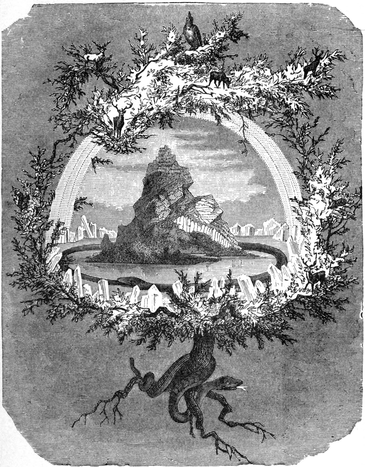
In Norse myth, the ash tree Yggdrasil was the tree of Odin and was one of the primal ingredients in their Creation myths.  It stood at the centre of the cosmos: an axis mundi no less, linking the many worlds and was the abode of the gods.  Its mythologies are extensive.  In Scotland, the myths of the ash are not so well known, but there’s little doubt that it possessed a sanctity and certainly has many traditions of it own, which are unfortunately outside the remit of this site profile.

References:

  1. Cash, C.G., “Archaeological Gleanings from Killin,” in Proceedings of the Society of Antiquaries of Scotland, volume 46, 1912.
  2. Elders, E A., “Saintly stones in a Perthshire village,” in Country Life, December 1962.
  3. Gillies, William A., In Famed Breadalbane, Munro Press: Perth 1938.
  4. Shearer, John, Antiquities of Strathearn, D. Phillips: Crieff 1883.

© Paul BennettThe Northern Antiquarian