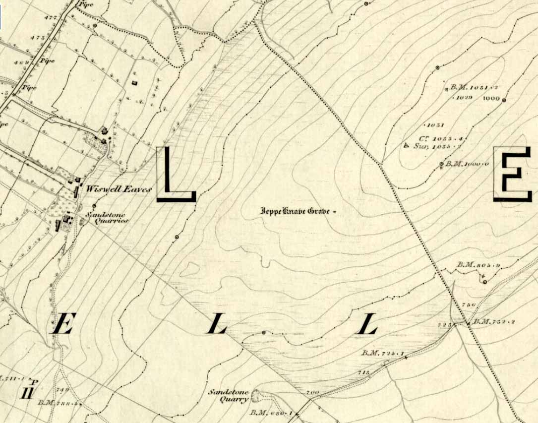
Elf Howe, Folkton, East Yorkshire

Tumulus (destroyed):  OS Grid Reference – TA 0422 7726

Archaeology & History

A once-impressive haunted burial mound on the southern edge of Folkton parish, all that remains of the place now are aerial images showing the ghostly ring of its former site.  Commenting on the destruction of this burial mound  before he had chance to give it his full attention, in William Greenwell’s (1877) magnum opus he wrote the following:

“Elf Howe had been removed to a great extent, and the grave had been dug out before I had an opportunity of examining it.  I however got an account of what was discovered from the foreman on the farm, and I was able personally to inspect a small portion which had not been disturbed.  The barrow had been 60ft in diameter and 6ft high, and was made of earth and chalk.  Near the centre a deposit of burnt bones was met with, over which some large flints were placed; this was at a depth of 4ft, and as a great quantity of burnt earth was observed immediately round the bones, it is probable that the body had been burnt on the spot where the bones were placed.  Two unburnt bodies were found on the south side of the mound, with one of which a vessel of pottery was associated.  At a distance of 17ft south-south-east of the centre I found the body of a strongly-made man, laid on the right side, with the head to the south and the hands to the knees; he body was placed about 6in above the natural surface.  Immediately below the head was the body of a very young child, the bones of which were too much decayed to admit of anything being made out beyond the fact that it was a child’s body which was laid there.  Still lower, and on the natural surface, was a patella, a radius, and some other bones of a body, which had been disturbed, probably in the interring of the person who was found buried above.  At the centre was a grave, lying northwest and southeast, 7ft by 6½ft and 2½ft deep.  On the bottom at the north side was the body of a strongly-made man in the middle period of life, whose head…was to the south, but my informant could not remember on which side the body was laid; at the head was a ‘food vessel’, which, from the fragments that have been preserved, must have been a rudely-made one with unusually thick walls.”

Folklore

Although antiquarians and archaeologists such as Elgee, Grinsell, Gutch, Johnson and others each tell (in their own respective ways) that Elf Howe “testifies to a widespread belief in goblin-haunted barrows” — albeit in the linguistic ‘elven’ of the Scandinavian invaders — we appear to have lost the original tale behind this fairy-haunted site.

References:

  1. Greenwell, William, British Barrows, Clarendon Press: Oxford 1877.

© Paul Bennett, The Northern Antiquarian


Spell Howe, Folkton, East Yorkshire

Tumulus:  OS Grid Reference – TA 0657 7878

Archaeology & History

This once impressive tumulus a half-mile east of the village was first mentioned in the Bardney Cartulary in the early 13th century, where is was written as Spelhou.  Suggested by Olof Anderson (1934) to have been an early moot site — “the meeting place of the Torbar Hundred” — this appears to be confirmed in Smith’s (1937) etymological analysis where he ascribes Spell Howe to be literally, “‘Speech mound’, from OE spell, speech and haugr” (burial mound).  Rising about four-feet above ground level, this is a traditional ’round barrow’ type of tumulus.  In recent years, reports tell that it has been built onto with some fencing.  Hopefully the present land-owners now look after the place!

References:

  1. Anderson, O.S., The English Hundred-Names, Lunds Universitets Arsskrift 1934.
  2. Mortimer, J.R., Forty Years Researches in British and Saxon Burial Mounds of East Yorkshire, Brown & Sons: Hull 1905.
  3. Smith, A.H., The Place-Names of the East Riding of Yorkshire and York, Cambridge University Press 1937.

© Paul Bennett, The Northern Antiquarian


Higher Town Bay, St. Martin’s, Scilly Isles

Cist:  OS Grid Reference – SV 934 153

Also Known as:

  1. Monument no.303793

Archaeology & History

The remains of this old tomb were first noted by Mr Alexander Gibson, whose photograph of the site is here reproduced.  Thought by Paul Ashbee (1974) to date from between the Iron Age and Romano-British period, the site was first described in O.G.S. Crawford’s (1928) essay in Antiquity journal.  It was just one of several such sites in relative proximity to each other and which, due to them being so close to the sea, have been all-but washed over by Nature’s advance.  Mr Crawford told that this,

“cist on the shore…is on St. Martin’s, between Crethus Hill and English Island Point, about 20 yards from the edge of the rushy bank, and at approximately high water-mark.  It is oriented north and south and is 3 feet long by 2 (feet) wide.  It has now no capstone.  The cist when found was full of coarse, gravelly sand and stones, which were cleared out; amongst this were parts of leg bones (the joint-ends missing) and smaller fragments; then a piece of a human jaw, without teeth, and finally the skull.  The facial portion was missing.  The skull fell to pieces on removal but it and all the other pieces were preserved and the cist filled in again.”

In the same article, Crawford notes that,

“nearby, to the west, were two or three other cists of the same type, and many years ago yet others were observed, both round this bay and at Lawrence’s, to the west of Crethus Hill.”

References:

  1. Ashbee, Paul, Ancient Scilly, David & Charles: Newton Abbot 1974.
  2. Crawford, O.G.S., “Stone Cists,” in Antiquity Journal, volume 2, no.8, December 1928.
  3. Weatherhill, Craig, Cornovia, Halsgrove 2009.

Links:

  1. Pastscape Notes on Monument no.303793

© Paul Bennett, The Northern Antiquarian


Town Lane, St. Mary’s, Scilly Isles

Cist:  OS Grid Reference – SV 9157 1175

Also Known as:

  1. Monument no.304025

Archaeology & History

Town Lane cist

In Crawford’s (1928) article on stone-lined burials, or cists, this was one site that he described from the Scilly Isles, though little can be seen of the site nowadays as a road was built on top of it.  It was first discovered by a Mr Alexander Gibson (who took the photo, here reproduced) and was described as “the cist in the road”, due to its position in the middle of the old lane.  A number of flints and other Crawford told that it,

“is in Town Lane, about midway between Holy Vale and the Marconi Station, St. Mary’s (lat. 49° 55′ 35.2″ N, long. 6° 17′ 52.5″ W).  Nothing is known about it, but presumably it was found when the road was made by Mr Augustus Smith more than 80 years ago.  It measures about 3 feet in length by 2 feet in width, and is oriented approximately NE-SW.  There is said to have been another near it, but Mr Gibson has searched without success.”

In Paul Ashbee’s (1974) fine archaeological survey, he describes there being several other small prehistoric burials found in fields a little further down the same lane.

References:

  1. Ashbee, Paul, Ancient Scilly, David & Charles: Newton Abbot 1974.
  2. Crawford, O.G.S., “Stone Cists,” in Antiquity Journal, volume 2, no.8, December 1928.

© Paul Bennett, The Northern Antiquarian


Merlin’s Mount, Marlborough, Wiltshire

Tumulus:  OS Grid Reference – SU 1836 6867

Also Known as:

  1. Marlborough Mount
  2. Merlin’s Barrow
  3. Merlin’s Mound

Getting Here

Pretty simple.  Get to the chapel in front of Marlborough College, and look at the stepped hill in the grounds thereof (with a big hole cut into the top where a water tower once stood).  That’s it!  Please be aware that this monument is on college ground, so it might be worthwhile telephoning them if you wanna wander upon the hill.

Archaeology & History

Merlin’s Mount (from Colt-Hoare’s Ancient Wiltshire)

This curious rounded, pyramidal hill is thought by some to have given the town of Marlborough its very name.  Described in Domesday as ‘Merleberge’, which is reckoned to derive from “the hill or barrow of Maerla”: Maerla in this case being a lost olde English name, said in local folklore and tradition to have been our old heathen magickian, Merlin, of Arthurian fame and legend.  Long ago his bones were laid to rest here and this great ‘tomb’ built over him.  We might never know…

The exact nature and date of this mound has yet to be satisfactorily explained.  Commonly ascribed as Norman in origin (based mainly on the notion that it wasn’t mentioned before Domesday and there being motte and bailey ruins here), the finding of Roman remains near its base then led some to think they had built the hill; but when “antler picks used by its prehistoric builders were unearthed in the late nineteenth century and again in 1912 when a trench was cut for the flue of a new engine-house chimney” (Burl 2002), the dates for its origin went a lot further back!

One of the earlier commentators on this archaeological curiosity was Sir Richard Colt-Hoare (1812) in the days when much more of this and other sites were visible in the landscape, saying:

“The Mount within the gardens of the Castle Inn is a remarkable earthwork: it is a huge pile of earth, and inferior in proportions only to Silbury Hill.  Each is situated on the River Kennet; the one near its source, the other near its margin; and I have no doubt but that in ancient times each had some corresponding connection with each other.”

A sentiment echoed by our modern megalithic scholar, Aubrey Burl. (2002)  But as Burl points out, the distance between Silbury and Merlin’s Mount would have been measured not in distance by those who constructed these giant mounds, but in time.  And the focus of our ancestors here in relation to these two great artificial mounds, would not be esteemed as much by engineering or measurement — for both mounds are gigantic — but a wholly mythic one.  Colt-Hoare continued:

“This mound has been so mutilated, as well as lowered in its height, that it is impossible to calculate an exact measurement of either its circumference or height; but as nearly as we could guess with our chains, we found the base to be about 1000 feet in circumference, and the diameter of the summit 100 feet.”

A piece of Merlin’s Mount!

When the reverend A.C. Smith (1885) described Merlin’s Mount — or ‘Marlborough Hill’ as he preferred it named — more than seventy years later as, “an artificial tumulus which deserves careful examination”, it seems little further investigation had been done.  And despite Smith’s wish for such care and attention, even today no detailed archaeological investigation has been undertaken.  Astonishing!  This fascinating-looking pyramidal “barrow” was thought by several early writers to have been constructed along similar architectural designs as that of Silbury Hill.  In Massingham’s (1926) fascinating Egyptian-origin hypothesis, he tells us the following:

“Merlin’s Mount encompasses only an acre-and-a-half of ground in comparison with Silbury’s five-and-a-half, and reaches a trifle more than half its height (60 feet).  In every other respect the twain are alike.  Both were raised at the foot of a gentle slope, both were made of chalk resting on a thin layer of clay, both were trenched around the bases, and in both were buried the antlered picks of the builders.  Both were built near the banks of the (River) Kennet within five miles of one and other.”

It certainly is impressive!  When Michala Potts and I came here last year in the fine company of Pete Glastonbury and others, we were somewhat in awe of the fact that so little has been said of this site in modern archaeological terms.  Indeed, the fact that the jury is still out as to the age of its construction we found quite surprising at the time.  Though another quick reading of Mr Burl’s Avebury work, combining the Roman finds and the antler picks here, makes him think that “a prehistoric origin for the mound likely.”

The name of Marlborough itself has been given a number of interpretations, most notably the attempt to derive it from the great shaman-poet Merlin.  But on a down-to-earth peasant level we find, in John Aubrey’s Monumenta Britannica there’s a note in the margin concerning the ‘marl’ element in the place-name that was told to him by a local man called Edward Leigh, which said,

“Marga, marle, we use instead of dung to manure our ground. It (Marlborough) lieth near a chalky hill, which our ancestors knew.  They borrowed this name ‘chaulk’ of the Latin, calx, named marle.”

More recently Margaret Gelling (1984) thought that the name of this hill or mound “is variously interpreted as a plant-name or a personal name.”  Which for some brings us back to Merlin!  We might never know…

References:

  1. Best, J., “The Marlborough Mound,” in A. Whittle’s Sacred Mound, Holy Rings (Oxford 1997).
  2. Burl, Aubrey, Prehistoric Avebury, Yale University Press 2002.
  3. Field, David, Brown, Graham & Crockett, Andrew, “The Marlborough Mound Revisited,” in Wiltshire Archaeologial & Natural History Magazine, 94, 2001.
  4. Gelling, Margaret, Place-Names in the Landscape, Phoenix: London 1984.
  5. Hoare, Richard Colt, The Ancient History of South Wiltshire and the Ancient History of North Wiltshire, London 1812.
  6. Massingham, H.J., Downland Man, Jonathon Cape: London 1926.
  7. Smith, A.C., Guide to the British and Roman Antiquities of the North Wiltshire Downs, WANHS 1885.

Links:

  1. Merlin’s Mount on Press TV

Acknowledgements:

With many thanks to Pete Glastonbury and Brian Edwards for their hints and corrections.

© Paul Bennett, The Northern Antiquarian


Larkfield, Maidstone, Kent

Cairnfield (destroyed):  OS Grid Reference – TQ 702 590

Archaeology & History

Ground-plan

In recent years it seems that very little has been written about this seemingly lost site, long since destroyed by the self-righteous advance of the Industrialists.  It seems to have been an important place, as there were many cremated remains here in more than a dozen individual burial urns, some with flints deposited in them.  The site was first described in a meeting of members of the Society of Antiquaries in 1898 by a Mr Frederick James.  He talked about the site and some brief digging work around the area, thus:

“The site of the urnfield is on land belonging to Mr William Wigan, of Clare House, East Malling, and it was owing to his kind permission and active cooperation that I was enabled to visit the spot, which is on a small plateau above the River Medway, 350 yards to the southwest of New Hythe church, and between the river and the road leading  from Rochester to Town Malling…

“The immediate neighbourhood…has been from time to time highly productive of archaeological remains dating from the Palaeolithic times and extended down to the Roman occupation… (But at) the Larkfield urnfield, the first indication that was afforded of the uses to which the area had been put in Romano-British times was the accidental discovery, whilst planting fruit trees, of some fragments of pottery (including portion of a Samian patera) found at the point marked A on the plan.  A flat tile was found covering the fragments.”

Much more was found hereby, with the majority of the finds being “a group of urns containing cremated interments found in the urn-pits.”  Although James (1898) described them as dating from the Romano-British period, from his description and illustrations it would seem that the remains here were probably of an earlier date, perhaps Iron- or even Bronze Age.  But we may never know for sure.

Reference:

  1. James, Frederick, “Discovery of a Romano-British Urnfield at Larkfield, near Maidstone,” in Proceedings of the Society of Antiquaries, 17:1, 1898.

© Paul Bennett, The Northern Antiquarian 


Pool Farm, Priddy, Somerset

Cup-and-Ring Stone / Tomb:  OS Grid Reference – ST 5375 5417

Getting Here

Dead easy this! (though a bittova cheat) Get to the Bristol City Museum and look inside.  This Google map should help those of you who don’t know Bristol too well.

Archaeology & History

Grinsell’s drawing of the carved slab (PPS 1957)

Found amidst a large cluster of other neolithic and Bronze Age remains—with the amazing line of the Priddy henges just a few hundred yards to the southeast—this is one helluva rare relic this thing: a carved stone, with seeming cup-marks and engraved “feet” no less, which was found when dug out of a prehistoric tomb way down South.  Obviously a buncha northern lads and lasses must’ve been on one helluva piss-up! (y’ never know…)  Although the tomb — a round barrow by all accounts — was well-known and excavated in 1930, the carving was somehow not noticed by the archaeologists when they dug here!  But it has to be said, at that period many archaeologists thought rock art to be insignificant and unworthy of study, so perhaps their ignorance stemmed from  the academic myopia of the time.

But at least they gave a reasonable description of the tomb itself.  It was due to be destroyed and the considerable mass of material from it was used for widening the nearby road!!!  Thankfully, for some reason, “the chamber or cist was left in situ” under the ground.  Leslie V. Grinsell (1957) takes up the tale:

“The barrow appeared to be about 100 feet in diameter and 3¾ feet high, but it had been spread and its height reduced by many ploughings. Excavation showed that the barrow, which was of the bowl type, was composed of fine mould throughout, and had never been enclosed by a ditch.  In the centre of the barrow, there was a stone chamber or cist, the external dimensions of which were 5½ feet long, 4½ feet wide, and 2½ feet high.  The floor, which was ‘crazy-paved’, was approximately on the ground-level.  The cist was placed with its long axis SE-NW.  The late Father Ethelbert Horne, who wrote the excavation report, stated that the south-eastern slab, which was inserted 6 inches deep into the floor, had the character of a ‘closing-slab’, and outside it were several packing stones.  There was a large cover slab of Dolomitic Conglomerate.  The small northwestern slab is of Carboniferous Limestone, and the south-eastern slab is of Liassic Chert, but the large south-western and north-eastern slabs are of sandstone derived from the vicinity.  The essential characteristics of this structure are therefore that is was abnormally large for a stone cist, had a strong suspicion of a ‘closing slab’ (implying some kind of entrance?) at the south-eastern end, and was above ground level, with its floor on that level.

“On the floor of this chamber or cist, at the foot of the approximate centre of the south-western slab, was a heap of burnt human bones, free from any admixture of charcoal.  As these bones had been broken small after being cremated, their determination was by no means easy.  Prof E. Fawcett…expressed the belief that they may have comprised the remains of an adult and a young person.”

But it was in 1956 that the carvings were noticed on the cist remains — by Mr Grinsell and his friend, C.S. Taylor.  At first they thought that some of the etchings were of human hands, but they later realised they were of human feet.  Grinsell wrote:

The Foot carvings: The feet shown are all single feet, no two forming a left-and-right pair of the same individual.  Nos. 1,2 and 3, in a row, are large, medium and small; no.4 is oblique in form; no.5 is on a slightly recessed portion of the slab; and no.6 represents the foot of a child between about 3 and 4 years old.  No.3 represents the foot of a child about 10-12 years of age.  Nos. 1,2,4 and 5 appear to represent the feet of adults.  No.7 is the symbol of uncertain meaning.  All these foot carvings show rounded heels and toes, in contrast to those on the Calderstones which are nearly all rectangular.  The toes are all splayed, and this carving is likely to be due partly to the nature of the stone and the tools with which they are carved, and partly to the fact that the feet represented are probably those of a people who did not wear shoes, or wore footwear that did not constrict the toes.

The Cup-marks: There are nine (possibly ten) cup-marks; their diameter ranges between 0.9 inches and 1.9 inches, and their depth between 0.1 inch and 0.3 inches… They are on the average about twice as deep as the foot-carvings.  The smallest cup-mark (no.17) is beside the smallest foot-carving; but there is no noticeable relationship between the other cup-marks and foot-carvings…”

Earliest known photo of the carving by R.A. Whiteford

An intriguing carved slab at the very least!  We can say with some certainty that this old tomb was of considerable importance to the people who built and lived around it in the centuries that followed (ancestral spirits and all that).  It may have been a tomb of an important tribal elder, shaman or queen — though we may never truly know.  But one thing which local archaeologists and antiquarians need to keep their eyes open for when opening any more burial sites in and around this region, are other examples of rock art, for the rule tends to be: where there’s one carving, others are close by!  So wherefore art the others…?

References:

  1. Coles, J., Gestsdottir, H. & Minnitt, S., “A Bronze Age Decorated Cist from Pool Farm, West Harptree: New Analyses,” in Proceedings of the Somerset Archaeological and Natural History Society, 144, 2000.
  2. Grinsell, Leslie V., “A Decorated Cist-Slab from Mendip,” in Proceedings of the Prehistoric Society, volume 23, 1957.

© Paul Bennett, The Northern Antiquarian


Lyneham Barrow, Ascot-under-Wychwood, Oxfordshire

Long Barrow:  OS Grid Reference – SP 2975 2107

Getting Here

Lyneham Barrow stone

Pretty easy really.  From Shipton-under-Wychwood take the A361 road north (to Chipping Norton) for just over 2 miles.  You’ll pass the TV mast on your right and then a small country lane sign-posted to Ascott-under-Wychwood.  Go past this and then stop at the next right-turn a half-mile further up the road.  The barrow is about 100 yards before this turning, in the hedgerow, on the left-hand side of the road!

Archaeology & History

This once great and proud neolithic monument is today but a shadow of its former self.  Described by various antiquarians and archaeologists over the years, O.G.S. Crawford (1925) included it in his fine survey, telling:

“The barrow is between 160 and 170 feet long and stands in two fields on the west side of the Chipping Norton and Burford main road… In the northern field, at the NE end of the barrow, stands a single upright stone, 6 feet high, 5 feet broad and 1 foot 6 inches thick.  This stone is stated to be buried three feet deep in the ground and its height is given by Conder as 10 feet 6 inches.  When visited October 18, 1922, a large piece of the top had been broken off, but replaced in position.”

This damage was reported around the same time and described in the early “Notes” of The Antiquaries Journal by a Mr A.D. Passmore (1925), who wrote:

“About 30ft from the north-east end of this long barrow stands a large monolith now nearly 6ft above ground…and roughly 6ft wide and just under 2ft thick, of local stone.  At the top is an ancient and natural fissure extending right across the stone and penetrating some way downwards obliquely.  Early in 1923, either by foul play or natural decay, another crack appeared spreading towards the first about a right-angle, the result being that a large piece at the top of the monolith became detached.  Such an opportunity of mischief was speedily taken advantage of and the piece of stone, weighing over 4 cwt, was pushed off and fell to the ground.  In August 1924 the owner of the land, his man, and the writer spread a bed of cement and hoisted up the large broken mass and relaid it in its bed.”

But even in their day, the tomb had already been opened up and checked out, by a Lord Moreton and a Mr Edward Conder, in 1894 no less!  Conder’s account (1895) of the inside of this ancient tomb told:

“There were found (1) a chamber at right angles to the long axis of the barrow; on the south-eastern side of the barrow were two uprights, 4 feet 2 inches by 2 feet 1o inches, and 1 foot 9 inches by 2 feet 8 inches.  At the north-western end of the chamber were two uprights set with their long faces (edges?) abutting.  On the surface-line at the level of the base of the barrow were traces of paving and fragments of bone, pottery and charcoal.  (2) Chamber, a little south of the south-east corner of No.1,  slightly above the ground level.  It was formed of three uprights, on the north, east and west sides respectively, and a paving slab with a perforation 4 inches in diameter.  At the north-eastern end of the barrow was a ridge of large ‘rug’ stones up to 8 feet long, 5 feet wide, and 2½ feet thick, terminating in a standing stone…10 feet 6 inches high…buried 3 feet below ground level.  At the southwest end was a standing stone, 4½ feet by 3 feet by 11 inches thick, in a horizontal position lying east and west, 2 feet below the surface. At various points were found skulls and human and animal bones and hearths, with no indications of date, and (as secondary interments) two Saxon graves.”

Today, poor old Lyneham Barrow is much overgrown and could do with a bittova face-lift to bring it back to life.  But I wouldn’t hold y’ breath…..

Folklore

At the crossroads just above this old tomb, the ghost of a white lady is said to roam.  And at the old quarry on the other side of the road a decidedly shamanistic tale speaks of an old lady who lived in a cave and guarded great treasure!  Her spirit is sometimes seen wandering about in and around the fields hereby.

References:

  1. Bennett, Paul & Wilson, Tom, The Old Stones of Rollright and District, Cockley: London 1999.
  2. Brooks, J.A., Ghosts and Witches of the Cotswolds, Jarrold: Norwich 1992.
  3. Conder, Edward, “An Account of the Exploration of Lyneham Barrow, Oxon,” in Proceedings of the Society of Antiquaries, volume 15, 1895.
  4. Crawford, O.G.S., Long Barrows of the Cotswolds, John Bellows: Oxford 1925.
  5. Dyer, James, Discovering Regional Archaeology: The Cotswolds and the Upper Thames, Shire: Tring 1970.
  6. L.V. Grinsell’s Ancient Burial Mounds of England, Methuen: London 1936.
  7. James, Dave, “A Brief Foray into Oxfordshire,” in Gloucestershire Earth Mysteries 14, 1992.
  8. Passmore, A.D., “Lyneham Barrow, Oxfordshire,” in Antiquaries Journal, 5:2, April 1925.
  9. Turner, Mark, Folklore and mysteries of the Cotswolds, Hale: London 1993.

© Paul Bennett, The Northern Antiquarian


Snowden Carr Carving (582), Askwith, North Yorkshire

Cup-and-Ring Stone:  OS Grid Reference – SE 17803 51012

Getting Here

Cowling’s 1937 sketch

Not too difficult to locate if you don’t mind wandering to and fro in deep heather.  From the Askwith Moor Road parking spot, walk up the road (north) 300 yards until you see the disused quarry on the moor to your right.  From here, head onto the moor, straight down past the quarry for about 200 yards, angling slightly to your right.  You’ll notice some overgrown ‘lumps’ in the heather — deemed as a cairnfield by archaeologists — go just below these and watch out for some rocks emerging from the heather.  This carving (and its neighbours) is on one of ’em!

Archaeology & History

This curiously-shaped large rock has several worn cup-and-rings on its upper surface, with several cup-marks aswell.  Two deeply etched lines running down the edge of the rock have also been pecked away as part of the carving, in contrast to the distinguishing natural water-worn line that runs diagonally along and down to the bottom of the stone.

The site was first described by Eric Cowling (1937), who labelled it as Carving no.9 in his survey, saying:

Carving 582, looking SW
Carving from above

“At the eastern and lower end of the barrow group on Snowden Carr is a cluster of angular boulders, one of which has several markings cut on the upper surface.  There is a cup and ring on the highest, and alongside two rings are joined together and enclose separate cups. One corner of the area is isolated by a groove running from edge to edge, and within this enclosure are three cups.”

Catalogued as ‘stone 582’ in Boughey & Vickerman’s (2003) survey, their description of the carving was one with “fourteen possible cups, several with indications of a ring, some of which intersect; grooves.”

References:

  1. Boughey, Keith & Vickerman, E.A., Prehistoric Rock Art of the West Riding, WYAS 2003.
  2. Cowling, Eric T., “Cup and Ring Markings to the North of Otley,” in Yorkshire Archaeological Journal, part 131, 33:3, 1937.
  3. Cowling, Eric T., Rombald’s Way: A Prehistory of Mid-Wharfedale, William Walker: Otley 1946.

© Paul Bennett, The Northern Antiquarian


Snowden Crags Necropolis, Askwith Moor, North Yorkshire

Cairnfield:  OS Grid Reference – SE 176 514

Also Known as:

  1. Snowden Moor Cairnfield

Getting Here

From the Askwith Moor Road parking spot and walk up the road for about 500 yards an head to your right (east) onto he moor, above the rocky ridge known as Snowden Crags.  After 100 yards or so of walking through the heather, the entire cairnfield is under your very feet!  If the heather’s grown, you probably won’t see a thing.

Archaeology & History

First described in Eric Cowling Rombald’s Way (1946), where he mentions around 30 cairns on the moorland plain immediately west of the Snowden Moor settlement. These were plainly visible when Richard Stroud and I visited here in 2005, thanks mainly to the fact that the heather had been burnt away.  Once it’s grown back, virtually all of these tombs will be hard to find.  I first had fortune to see some of these tombs on a visit here with Graeme Chappell about 15 years ago, but only a little of the cemetery was then visible.  Following another visit to the site this week, a great deal more has become visible, thanks again to heather-burning on the moors.

One of around 30 cairns on the ridge
…and another one!

Curiously omitted from the Nidderdale Archaeological survey report of sites in this region (anyone know why?), the cemetery itself stretches from the western edge of the Snowden Moor settlement, several hundred yards west along the flat moorland plain towards the moorland road, stopping a short distance before the line of old grouse butts.  It is highly likely that some of the stones in the grouse-butts originated in some of the prehistoric cairns along the ridge.  And if summat aint done about it, there’s a likelihood this could easily happen again in the near future.

…and another!

The easternmost cairn touches the very edge of the D-shaped settlement; and another of them is right next to a cup-marked stone.  Whilst a number of the cairns along this ridge are much like those found on the moors above Ilkley, Bingley, Middleton, Askwith Moor, Earby, etc — averaging 2-3 yards in diameter and less than 2 feet high amidst the peat and decaying herbage — one notable feature to many of these tombs is the inclusion of a rather large, singular boulder, against which or around are propped the smaller stones, typical of cairns found elsewhere in the region.  This ‘large boulder’ characteristic is not common at other tombs in the mid-Pennines, but seems specific to this graveyard.   Neither do the large boulders seem set in any particularly consistent fashion.  There is the possibility that they were originally above the smaller cairn of stones, but this is purely hypothetical and non-verifiable without excavations.

The important Snowden Crags cairn circle, discovered by the hardworking Keighley volunteer Michala Potts on Thursday, 20 May, 2010, can be found on the northern part of this cairnfield.

References:

Cowling, Eric T., Rombald’s Way: A Prehistory of Mid-Wharfedale, William Walker: Otley 1946.

© Paul Bennett, The Northern Antiquarian