Various ways to get here (being in the middle of the moor n’ all). I s’ppose the best way is to go from Langbar village, up hill to The Old Pike giant cairn, then follow the footpath on about 100 yards before dropping down the slope to your right, south (NOT the other way!). You’ll notice some walling and an old path near the bottom of the slope SE from you – head in that direction, but before you get there, a coupla hundred yards before, stop and look around. Good luck!
Archaeology & History
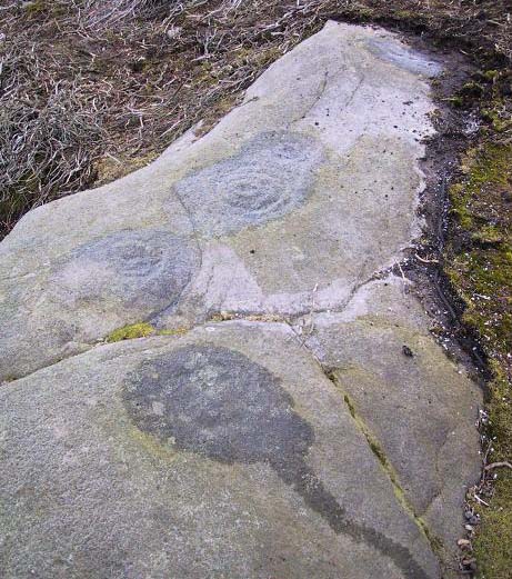
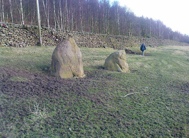
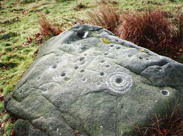
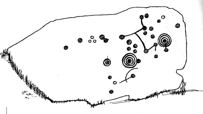
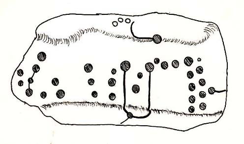
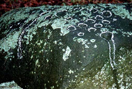
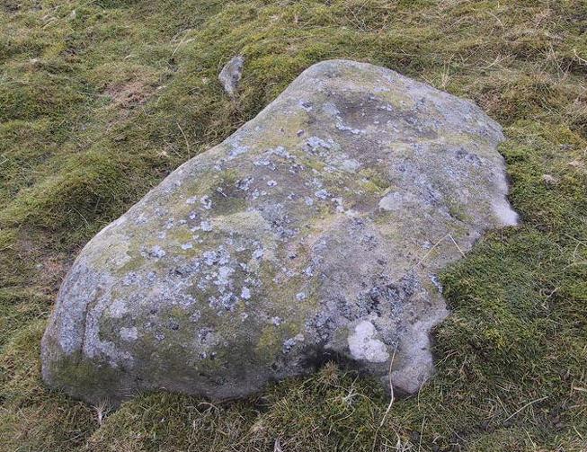
Found halfway up the southern slope beneath The Old Pike giant cairn, we find this large, flat earthfast stone, on which are the very faded remains of archetypal cup-and-ring motifs. At the top-end of the stone are slightly more pronounced cup-markings – seemingly more than is shown on the drawing, with the multiple-rings halfway along the stone. On the southeastern part of the stone, Richard Stroud found another previously unseen aspect of the carving, consisting of one large ring, with perhaps a line running out to the east. This can be seen in the water-highlighted photo.
Langbar Stone, with extra single ring not previously noted
If you visit this carving, try and get to the Middleton Moor CR-482 stone half-a-mile southwest – where I for one got the distinct impression that whoever carved that stone, also carved this one! Barmy p’raps — but if we don’t allow subjective interface here and there, we never learn a damn thing!
Listed as stone 459 in Boughey & Vickerman’s (2003) survey, they erroneously ascribe Eric Cowling to have found it in Rombald’s Way (1946), whereas the first mention of it appears to have been by Stuart Feather in 1966 (though Cowling does mention a ‘Langbar Stone’, but illustrates another one nearby).
References:
Boughey, Keith & Vickerman, E.A., Prehistoric Rock Art of the West Riding, WYAS 2003.
Cowling, Eric T., Rombald’s Way, William Walker: Otley 1946.
Feather, Stuart, ‘Mid-Wharfedale Cup-and-Ring Markings. No.41, Langbar Moor, Ilkley,’ in Bradford Cartwright Hall Archaeology Group Bulletin, 11, 1966.
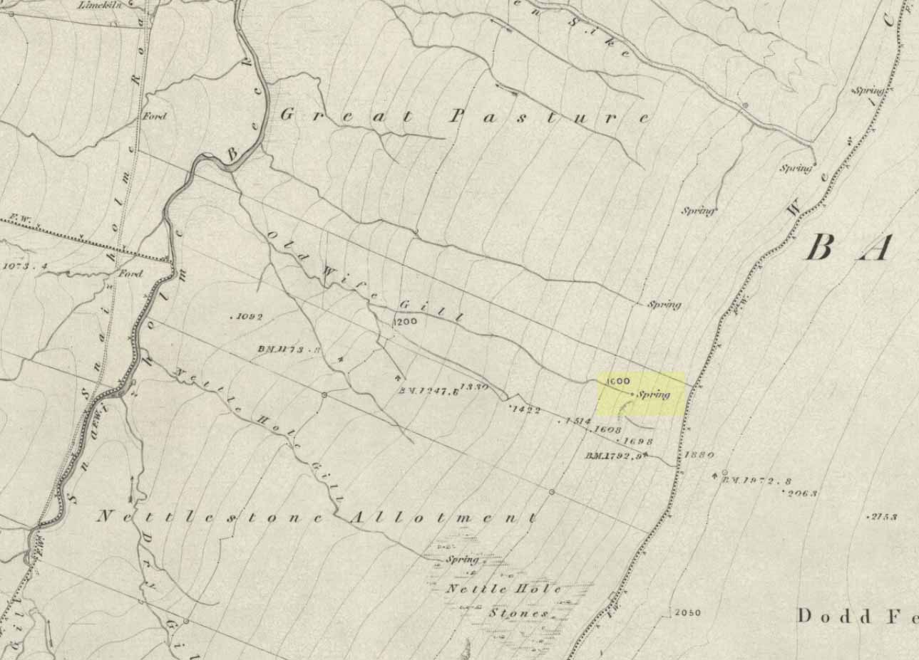
The ‘Spring’ atop of Old Wifes Gill, on 1853 OS-map
From Hawes, take the B6255 road west-ish to Ribblehead, but only for 1km, where there’s the Cam Road track on your left. Walk on here, and keep going till you’re looking down the valley past the very last house (those of you who wanna take the Pennine Way from Hawes will end up in the same place). It’s one of the springs down the steep slope on your right! (check the attached link to the OS-map to work out which one you’re heading for)
Archaeology & History
Apart from a singular mention in place-name records, I have found no historical information (yet!) about this old water supply. It was one of the great sites of the cailleach in our Yorkshire hills: a truly ancient and heathen place, all but forgotten and lost in the mythic landscape of our past. And it’s a bittova dodgy spot getting right up to her down the rather steep hilly slope — but it’s truly well worth the trek!
The Old Wife’s Spring
When I first visited this place, we took off from Cam Fell’s western side and ambled up the tops until the land gave us the beauty of Snaizeholme valley, which had us stopping, dreaming and wanting more as we sought to find this forgotten well. Most of you would probably come from the easier side of Hawes and walk along the path on the southern-side of the valley, or p’raps even wander up Snaizeholme valley itself – but I’d recommend a walk along the tops. Tis much much better!
If you’ve got the 1:25,000-scale OS-map, you’ll see the ‘Old Wife’s Gill’ running down the hillside. Get over the wall by the track-side and stagger down the steep slope. You’ll pass a small spring about 70 yards down – but this aint the one (though I think originally the Old Wife came from much further up Dodd Fell itself). You’ve got another 75 yards to go down before you get to the main spring – but if you’re old and fragile, unfit or fat, you’ll struggle like hell here!
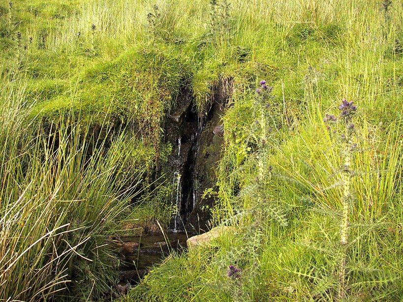
The waters emerge from this very steep slope, surrounded by plenty of thorns and thistles, on a part of the hill where the land itself is slowly coming away. After a long dry-spell no doubt, this might be a little more secure; but when we came here She’d been raining on-and-off like hell and the waters were a-plenty. It’s difficult to actually locate the exact spot where the water first appears – but like I said, it seems to have, long ago, come from much further up the hill. As the photos show, the water’s nice n’ clear, good-tasting, and then continues along its downward stream – known as the Old Wife’s Gill – until hitting the small river at the valley bottom.
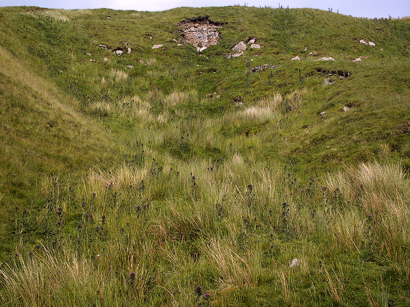
The Old Wife’s Spring from below
The other site in this valley which assures us of the cailleach’s validity comes from the place-name a few hundred yards further up the valley, seemingly giving source to the valley river herself: a Lady Spring or well, whose form once emerged close to the gate of the Cold Well close by. The third part of the cailleach’s form – the maiden or virginal – has been lost as far as local myth and literary records go. But I’ve gotta come here a few more times to get an idea as to where this ‘lost’ water-source originally appeared. A number of streams run off the hills here into the curiously-named Snaizeholme valley (which etymologists assign to nowt more than a “place where twigs are” – which seems nonsensical), and as there’s been very little by way of human habitation screwing the land up, there’s a damn good chance we’ll find and recover the mythic history of the landscape here after a few more treks and dreams…
Other sites of similar mythic relevance which need checking include Carlow Hill (SD 770 858)at Stonehouse, Dentdale; and the great valley of Carlin Gill on the North Yorkshire/Cumbria border (SD 634 993 – Gambles 1995:39).
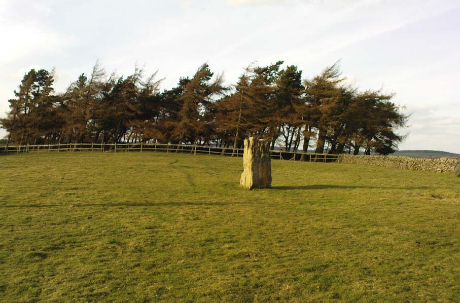
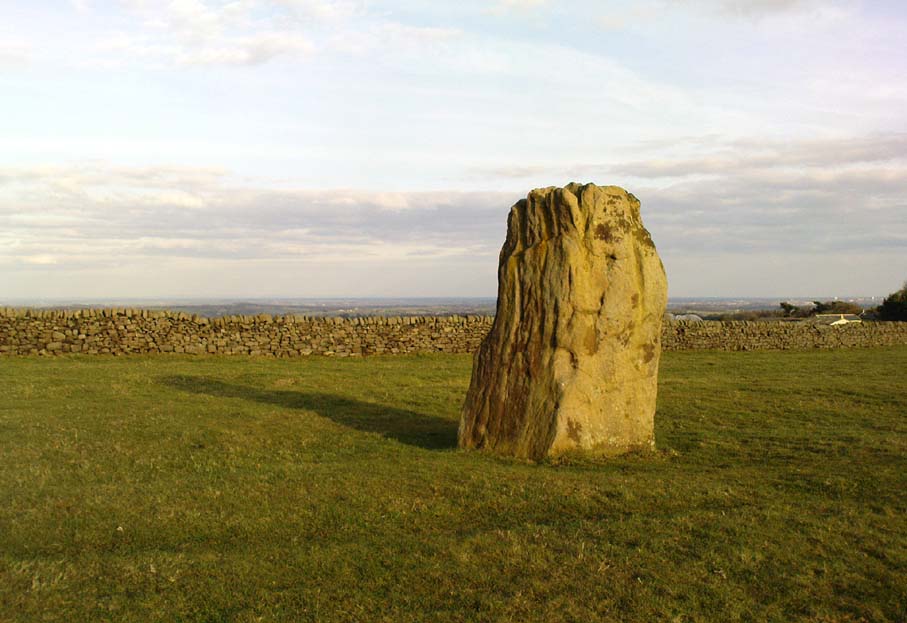
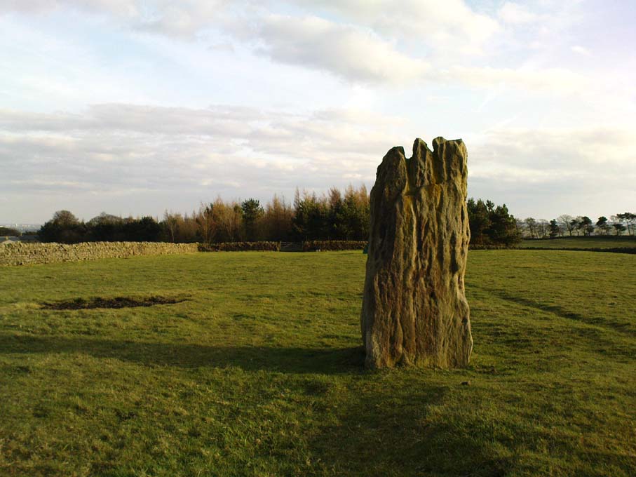
Take the single-track country lane between Farnhill and Low Bradley until you reach Hamblethorpe farmhouse. Where the birch woodland is on the slope going uphill, the field on the other side of the road, protected by walling, is where the stones are, just south of the farmhouse. There’s nowhere to park any car hereabouts, so it’s best walking here.
Archaeology & History
It seems that nothing has previously been written of this place. Hidden away at the top of the field we find two curious-looking standing stones: one nearly six-feet tall, and its companion about four-feet. They’re near the bottom of the slope from the giant Round Cairn and Long Cairn tombs of Low Bradley Moor, several hundred yards to the east— and were it not for the fact that they have a distinctive Castlerigg-like appearance about them, perhaps I wouldn’t have given them a second chance. Curious earthworks are in the same field, to which written records also appear silent. Tis a lovely little spot…
Although cited as being on Weston Moor, it is closer to Askwith village. From the village, take the north road and shortly before reaching the T-junction, park-up (somewhere!). There’s a small copse of trees on your right and fields above them – that’s where you’re heading. You might have to bimble about a bit before the rock catches your attention, but it’s worth the wandering. Look around!
Archaeology & History
Sketch of the design c.1985
This is an excellent, archetypal cup-and-ring stone that’ll be loved by any real rock art student! Cups-and-multiple rings are the main visual feature to this stone, along with another 20 single cups and another primary cup-and-ring, all on a medium-sized sloping rock face. The carving was first described by Cowling & Hartley (1937). Since their initial discovery, several other writers have mentioned it with little further comment. The smaller but impressive double cup-and-ring carving 543 can be seen at the bottom left of the woodland in front of you – well worth seeing if you’re visiting here!
References:
Boughey, Keith & Vickerman, E.A., Prehistoric Rock Art of the West Riding, West Yorkshire Archaeology Service 2003.
Cowling, Eric T., Rombald’s Way, William Walker: Otley 1946.
Cowling, E.T. & Hartley, ‘Cup-and-Ring Markings to the North of Otley,’ in Yorkshire Archaeological Journal, 33, 1937.
Hotham, John Paul, Halos and Horizons, Hotham Publishing: Leeds 2021.
Easy enough to get to – and a lovely place to behold for an amble! From Settle, take the B6479 road up to Horton-in-Ribblesdale (ask a local if you’re too dumb to find it!), turning right at Stainforth and up the single-track road towards Pen-y-Ghent. Keep yer eyes peeled for Rainscar – you’ve about a mile to go. If you end up at Pen-y-Ghent House you’ve gone past ’em. Turn back for 2-300 yards. It’s on the right-hand side of the road as you’re coming up, about 100 yards up the footpath.
Archaeology & History
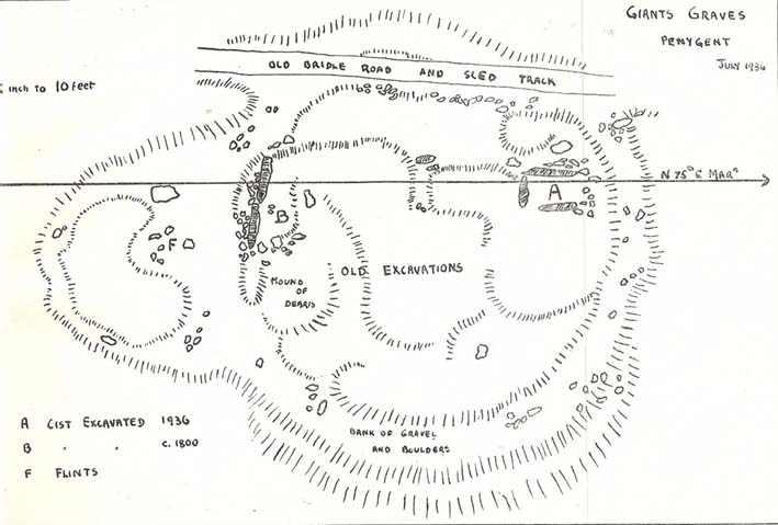
The Giants’ Graves (after W. Bennett, YAJ 1937)
The earliest description I’ve found of this is in Terence Dunham Whitaker’s History and Antiquities of Craven (1878), where he reckoned the remains here to be of Danish origin. The same thing was professed by the southerner, archdeacon W. Boyd, who said as such to the local people hereabouts more than 100 years ago, but they thought him a bit stupid and laughed at his notions! (though it does seem that Boyd wasn’t liked locally, tending to think himself better than the local people, who told him very little of local lore and legend) Describing the remains, Whitaker said there were skeletons found in the tombs:
“The bodies have been inclosed in a sort of rude Kist vaen, consisting of limestone pitched on edge, within which they appear to have been artificially bedded in peat earth.”
But Harry Speight (1892) doubted this, saying that Whitaker never even visited the site! When he went here he told us that,
“What is left at present are a few mounds of earth, the largest, which is divided into two, and lies north and south, measures about 28 feet by 25 feet. There is another apparent grave-mound on the east side of it, and again to the north is an oblong excavation or trench, 7 feet wide and nearly 30 feet long, in which several bodies or coffins may have been deposited. Several large oblong stones lay flay upon the ground beside the graves, but these were removed a few years ago and degraded to the service of gate-posts.”
The site was excavated in June 1936 by Arthur Raistrick and W. Bennett (1937) after they had been badly damaged and the stones robbed for walling and other profane building operations. Herein were found two burial cists with fragments of human bones in each tomb. In Bennett’s short account he told:
“The site consists of a nearly circular bank, about eight feet wide, and in parts two feet high, surrounding a much disturbed area. Within the area are the remains of two cists and a number of hollows that certainly represent other similar structures. The farmer tells of the removal of more than twenty large stones from these hollows, for use as gateposts, wall throughs and drain covers.* The bank encloses an area fifty-four feet east to west…and fifty feet north to south. At the west end there is a smaller bank, roughly in form of a circular apse, extending a further thirty feet. Many large boulders and vast quantities of smaller stone are incorporated in the bank.
“Near the east end, with its axis bearing N75E, is a cist — three stones in position. This was cleared to a depth of eighteen inches, and though no floor stone was present, among the sifted soil were found (i) broken bones, including parts of humourus, axis, vertebrae, ulna, ribs and cranium, all human; (ii) five teeth — two molars, one wisdom tooth, and two incisors, which appear to represent tow individuals. Sir Arthur Keith reports that the bones submitted to his examination may represent more than one adult person, and there is also a fragment of a child’s tibia. Most of the limb bones belong to a man of medium stature… He suggests from the condition of the bones a person of the Iron Age. While this is possible with a secondary interment in the area, it is rather unlikely, as all the bones came from within the built cists, and not from the earthen part of the mound, where secondary burials would be expected.
“At the west end are two large stones, the side stones of cists or of a chamber. The ground in front of them has been excavated many years ago…and partially refilled with boulders… Within the small extension on the west a trial excavation showed eighteen inches to two feet of random boulders, and beneath them, on the old sub-soil surface, two inches of fine grey sand, with two small flints — one of them a well-worked blade. These probably pre-date the construction of the circle.
“The whole site is suggestive of a multiple cist burial mound, or even a “passage grave” type. The obvious hollows, from which many of the larger stones have been lifted, are aligned in a parallel series, along an axis N75E, directed towards the two remaining large stones at the west, which may be part of a chamber wall and not part of a cist.”
Recent archaeological analysis has suggested these may be the remains of an old chambered cairn, although there is today far too much damage that’s been done to give us an accurate portrayal of what this originally looked like. The Dawson Close prehistoric settlement is less than half-a-mile further up the ridge.
Folklore
The folklore here is simple: these are the graves of giants who lived in the valley of Littondale in ancient times.
References:
Bennett, Walter, ‘Giants’ Graves, Penyghent,’ in Yorkshire Archaeological Journal, part 131, 1937.
Boyd, W. & Shuffrey, W.A., Littondale Past and Present, Richard Jackson: Leeds 1893.
Feather, Stuart & Manby, T.G., ‘Prehistoric Chambered Tombs of the Pennines,’ in YAJ 42, 1970.
Speight, Harry, The Craven and North-West Yorkshire Highlands, Elliott Stock: London 1892.
Whitaker, Thomas Dunham, History and Antiquities of the Deanery of Craven, Joseph Dodgson: Leeds 1878 (3rd edition).
* It might be worthwhile exploring the local gateposts and walls to see if any of these covering stones had cup-and-rings carved on them, as was traditional in many parts of Yorkshire and northern England.
A half-mile south of the superb Brimham Rocks complex, take the straight road south until you hit the second farmhouse (and accompanying caravans). Go up the public footpath past Highfield Farm and just check with the landowner’s permission to wander his land if you want to see the stone. They’re OK about it if you ask. The lady there is very amiable and will tell you what’s what, giving directions right to it, telling us it was off the footpath in the middle of one of his fields.
Archaeology & History
Archaeology texts are, once more, silent about this stone (and other monuments in the region), making you wonder just what the hell some of them are paid for! The stone appears to have given its name to the land upon which it stands which, as the locals tell, “has always been known as standing stone hill.” And no wonder — it’s a bloody decent standing stone! On its northern face we find well-eroded lines running down the stone, similar to the weathering found on the Devil’s Arrows a few miles to the east.
Standing Stone Hill stoneLooking south
Although just over 6-feet tall, this is a solid bulky old fella. But the spot he presently occupies isn’t his original standing place. He was found knocked over and lying on the ground in the middle of the 20th century, slightly out of position. But he was thankfully stood back upright by the local land-owners sometime in the 1960s, where he’s been stood ever since. It must have been one helluva job! And making it more difficult was the intriguing geological nature of the Earth right beneath this field. As the lady who now own the land told us,
“When the fields were tilled we found that all of them were easy to turn over, except the one with the stone in it! There’s virtually no soil of any depth to write home about,” she said. “It stands on only a few inches of soil and then you hit solid rock right underneath it. All the other fields are OK – but this one’s the odd one out.”
And before the fields were farmed, just over a hundred years ago, all this land was covered in moorland heather. Then the land was enclosed, the Earth’s heathland stripped out of existence and turned over to agriculture. But thankfully the standing stone was left here. It makes you wonder what else was destroyed when the moorlands were industrialised…
The stone does get a brief mention in Boughey & Vickerman’s (2003) Prehistoric Rock Art of the West Riding, where they mention there being “three possible cups in (a) line on one side” of the standing stone, but these are little more than Nature’s handiwork and nowt else. There are a couple of other cup-and-rings nearby which are the real thing – but the ‘cups’ on this stone aint man-made.
Ellers Wood is at the very northern edge of the beautiful parish of Askwith and has a very particular ambience of its own. The small cluster of at least 5 cup-and-ring stones in this lovely little woodland gives you the impression that they stood out on their own, living here representing the genius loci of this luscious watery vale, all-but-hidden from all but the lucky few. It’s very likely that there are still more carvings hidden away nearby.
The best way to check them out is simply to walk down past the haunted Dobpark Lodge, where it turns into a footpath and where it crosses the lovely old packhorse bridge at the valley bottom, walk a few hundred yards up the river-side (at the bottom of the fields) until you reach Ellers Wood. Once there, look around. This one’s on the west side of the main stream, close by where it meets up with another small burn coming down from the western wooded slopes.
Archaeology & History
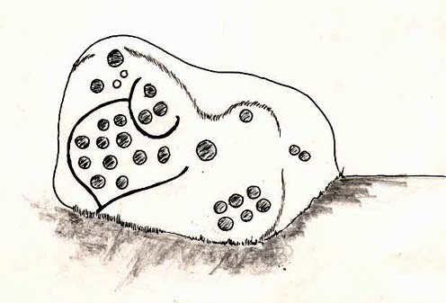
First sketch of the carving, c.1994
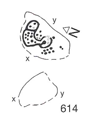
In the same region as the Ellers Wood 618 and other carvings and very close to the river, somehow this heavily cup-marked stone evaded the prying eyes of such notaries as Cowling, Stuart Feather and Sidney Jackson – all of whom ventured to look at the other petroglyphs in Ellers Wood. But with good fortune, Graeme Chappell and I re-discovered this fine-looking carving in our explorations in 1993-94 and gave it back the attention it truly deserves.
The main feature here is the clustering of cups into sections, as the drawing indicates. It is listed as “stone 614” in Boughey & Vickerman’s (2003) survey.
References:
Boughey, K.J.S. & Vickerman, E.A., Prehistoric Rock Art of the West Riding, WYAS: Exeter 2003.
Cowling, E.T., ‘A Classification of West Yorkshire Cup and Ring Stones,’ in Yorks. Arch. Journal 1940.
Cowling, Eric T., Rombald’s Way, William Walker: Otley 1946.
Cowling, E.T. & Hartley, C.A., ‘Cup and Ring Markings to the North of Otley,’ in Yorks. Arch. Journal 33, 1937.
Grainge, William, The History and Topography of the Forest of Knareborough, J.R. Smith: London 1871.
Grainge, William, History and Topography of the Townships of Little Timble, Great Timble and the Hamlet of Snowden, William Walker: Otley 1895.
Follow the same directions for the Ellers Wood 614 and 618 carvings, as it’s nearby. The best way to check them out is simply to walk down past the haunted Dobpark Lodge, where it turns into a footpath and then when you reach the lovely old packhorse bridge at the valley bottom, walk upstream for 3-400 yards until you reach the next small wooded region. Once there, look around…..
Archaeology & History
Ellers Wood is at the very northern edge of the beautiful parish of Askwith and has a very particular ambience of its own. The small cluster of at least 5 cup-and-ring stones in this lovely little woodland gives you the impression that they stood out on their own, living here respresenting the genius loci of this luscious watery vale, all-but-hidden from all but the lucky few.
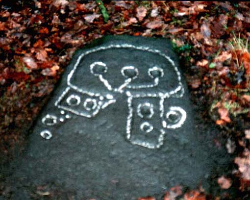
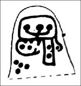
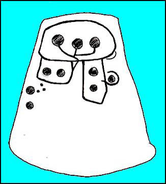
Cowling’s 1937 sketch1991 sketch of CR-619
Beautifully preserved, this carving was first described in an article by Cowling & Hartley (1937), then included in Cowling’s Rombald’s Way (1946). As with the other cup-and-rings close by, the characteristic grouping of certain cups is here focused into three sections by enclosing rings. This was something I used to call ‘central design’ features, which occur in different locales with their own individual geographical patterns/structures. These central designs are non-numeric in nature, though have a tendency to cluster in patterns of 2, 3 and 4. (I need to write a decent essay on this to outline what I’m on about with greater clarity!)
References:
Boughey, K.J.S. & Vickerman, E.A., Prehistoric Rock Art of the West Riding, WYAS: Exeter 2003.
Cowling, E.T., ‘A Classification of West Yorkshire Cup and Ring Stones,’ in Yorks. Arch. Journal 1940.
Cowling, Eric T., Rombald’s Way, William Walker: Otley 1946.
Cowling, E.T. & Hartley, C.A., ‘Cup and Ring Markings to the North of Otley,’ in Yorks. Arch. Journal 33, 1937.
Grainge, William, The History and Topography of the Forest of Knareborough, J.R. Smith: London 1871.
Grainge, William, History and Topography of the Townships of Little Timble, Great Timble and the Hamlet of Snowden, William Walker: Otley 1895.
Follow the same directions to reach the other Ellers Woods carvings, staying on the western-side of the river close to where it meets with Snowden Beck, just north of the footpath. Check it out in winter and early Spring — any later in the year and it might be a little overgrown.
Archaeology & History
A truly lovely, lichen enriched carved rock in a lovely little part of the Fewston valley. The place has a distinct genius loci that’s very different from its carved rock companions on the moorland hills a short distance away. As I’ve said elsewhere: the surroundings of trees and richer fertile growth is something we must remember to ascribe to these carvings when we encounter them, as the landscape in places such as Ellers Wood is much closer to the scattered forested landscape that profused when first these stones were inscribed.
Section of CR-618
First described by Cowling & Hartley in 1937, it was later included in Cowling’s (1946) more extensive prehistoric survey of mid-Wharfedale. There may be as many as 38 cup-markings cut onto the rock here, along with several lines and grooves. A meditative dreaming site indeed…
References:
Boughey, K.J.S. & Vickerman, E.A., Prehistoric Rock Art of the West Riding, WYAS: Exeter 2003.
Cowling, E.T., ‘A Classification of West Yorkshire Cup and Ring Stones,’ in Yorks. Arch. Journal 1940.
Cowling, Eric T., Rombald’s Way, William Walker: Otley 1946.
Cowling, E.T. & Hartley, C.A., ‘Cup and Ring Markings to the North of Otley,’ in Yorks. Arch. Journal 33, 1937.
Grainge, William, The History and Topography of the Forest of Knareborough, J.R. Smith: London 1871.
Grainge, William, History and Topography of the Townships of Little Timble, Great Timble and the Hamlet of Snowden, William Walker: Otley 1895
Takes a bitta finding and aint too accessible for those of you who need footpaths! Below the eastern slopes of Addlebrough Hill, by the present source of the Gill Beck right beneath the Dove Stones (the water tastes gorgeous), are the ruinous remains of an old sheepfold. In the field immediately behind (south) of here are a number of small rocks. Look around and you’ll find the stone in question!
Archaeology & History
Unless you’re a real rock-art-freak, I can’t imagine too many of you checking this one out! When Richard Stroud and I visited this spot a few years back (2006), it was a mixture of love and madness that brought us here!
Dove Stones Carving
Amidst the many stones scattered hereabouts, one of them possesses two clear cup-marks on a stone measuring roughly 3ft by 2ft, along the line of a much ruined ancient wall. This might be the one that Beckensall and Laurie (1998) described in their Prehistoric Rock Art of County Durham, Swaledale and Wensleydale, as “a rock with several cups (which) has recently been noticed on Thornton Rust Moor, near the Dovestones” — though it seemed blatantly apparent to us that there were only two cups here, not “several”. However, Brown (2008) appears to list the site, citing it as having “two cups”, just like the one we found, and being “found in prehistoric low field settlement wall,” which fits the picture perfectly — although Brown gives a slight difference in grid-reference to the one Richard Stroud took. It looks a good area to scout around and, I reckon, find previously unrecorded sites.
References:
Beckensall, Stan & Laurie, T., The Prehistoric Rock Art of County Durham, Swaledale and Wensleydale, County Durham Books 1998.
Brown, Paul & Barbara, Prehistoric Rock Art in the Northern Dales, Tempus: Stroud 2008.