Drizzlecombe 13, Ditsworthy Warren, Sheepstor, Devon

Cairn:  OS Grid Reference – SX 592 675

Archaeology & History

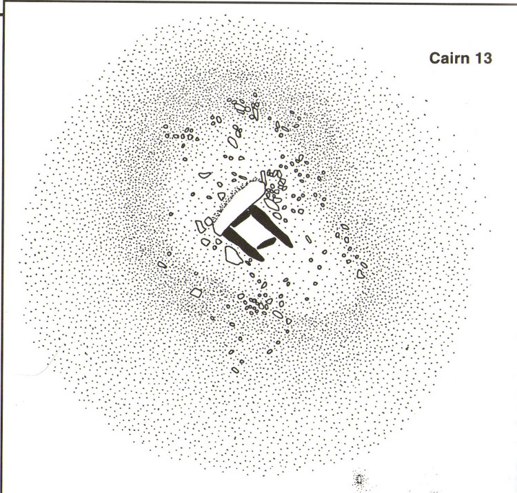
Drizzlecombe Cairn 13 (after Butler 1994)

A very well-preserved prehistoric cist and cairn (grave), sat amidst a valuable prehistoric landscape full of megaliths and other important prehistoric remains.  Megalith enthusiast and antiquarian, Nik Megalithic, told that:

“The cairn is about 12 m diameter and 1 metre high, and has a large Kist in the middle.  The cist has side slabs about 2 metres long and spaced 1 metre apart, and it is about 0.7m deep. The large capstone is tipped off to the west, and can be seen protruding above the cairn from quite some distance away.”

Described in association with the rich mass of other tombs and megalithic stone rows here, author Jeremy Butler told that,

“Cairn 13 is also in line with (cairns) 1-4, but just out of sight around the hillside 150m to the northwest.  The mound contains a well-preserved cist, “a very fine example”, according to Worth, who cleared it out about 1900 but with “no result from excavation.”  The displaced cover and massive side-slabs project well beyond its ends.”

Both Butler and Worth mention how cairn 13 is part of an alignment with two other cairns very close by.

Folklore

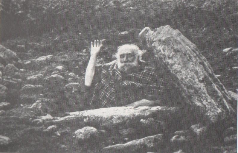
Spike Milligan in his tomb

Although legends of giants and pixy folk are well known round here, there is nothing specific I can find to this one site. One of the most important finds in recent years—as the photo above shows quite clearly—was the fact that before joining The Goons, the British comedian Spike Milligan used to live in this prehistoric tomb. When asked why he didn’t live in a house like other normal people, he invited us in for a cup of tea.  Some historians believe that the person in the photo is in fact Mr R.H. Worth—author of Worth’s Dartmoor—but Mr Milligan insisted that Worth was an imposter!

References:

  1. Butler, Jeremy, Dartmoor Atlas of Antiquities – volume 3, Devon Books: Tiverton 1994.
  2. Crossing, William, Tales of the Dartmoor Pixies, W.H. Hook: London 1890.
  3. Grinsell, Leslie V., The Ancient Burial Mounds of England, Methuen: London 1936.
  4. Worth, R. Hansford, Worth’s Dartmoor, David & Charles: Newton Abbot 1988.

Acknowledgements: – Huge thanks to Nik Megalithic for the info and old photo of ‘Spike Milligan’ in his tomb.

©Paul Bennett, The Northern Antiquarian


Lady Well, Hartshead, West Yorkshire

Holy Well:  OS Grid Reference – SE 17884 23487

Also Known as:

  1. Ladies Well

Getting Here

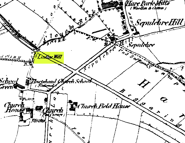
Ladies Well on the 1852 map

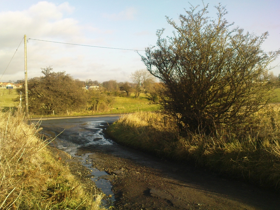
This can take a little bitta finding if you don’t know the area. So it’s best starting from Hartshead church, right on top of the hill here.  From whichever direction you’re taking to reach Hartshead, ask a local when you get close and they’ll direct you there. From here, walk out of the churchyard and turn left. Walk barely 50 yards and turn left again along Lady Well Lane. Past the old houses and bear right where it becomes a dirt-track. This then turns left, then again right and – with the fields on either side of you – note the single hawthorn tree ahead of you by the walling. Go into the field at the back of the hawthorn and look under its shady bough. Tis there, I assure you!

Archaeology & History

The holy well is beneath this hawthorn tree

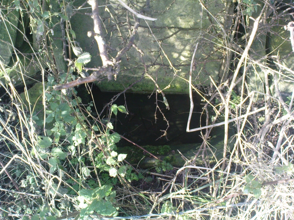
Emerging at the edge of the field beneath an old hawthorn tree at the side of the track running to the adjacent church, the waters from here are clean and fresh—though the stone trough into which it flows is constantly clogged up and the ground around it very boggy.  The well has given its name to Lady Well Lane, which leads to the 12th century St. Peter’s Church, with its own ancient and legendary history.  The well is thought to derive its name from ‘Our Lady’, the Virgin Mary, indicating it would have had considerable importance in the religious traditions of the christians who named it, but moreso the original animistic traditions of normal local people who would have used it for much longer…

Close by this old stone trough appears to be another one, covered by moss and the encroaching field.  Whatever medicinal properties the waters may once have had, have long since been forgotten.  Around Lady Well is a healthy abundance of flora: elder, chickweed, nettle, clover, bramble, dandelion, sow thistle, dock and shamanic species.

Folklore

The overgrown Lady Well

Marion Pobjoy (1972), like her predecessors, suggested that this was one of many sites in Calderdale used by St. Paulinus to perform baptisms.  Local folklore tells that Robin Hood stopped here to drink the waters—but then we find an abundance of the pagan outlaw’s activities all round here.  The nearby church of St.Peter is aligned to the equinoxes and may well be an indication of when pre-christian celebrations occurred here.  The yew tree in churchyard was where Robin Hood was supposed to have taken wood to fashion one of his bows.  Modern folklore also ascribes the well to be along a ley line.

References:

  1. Heginbottom, J.A., ‘Early Christian Sites in Calderdale,’ in Proc. Halifax Ant. Soc., 1988.
  2. Pobjoy, Harold N. & Marion, The Story of the Ancient Parish of Hartshead-cum-Clifton, Riding 1972.

© Paul BennettThe Northern Antiquarian


Winterborne Came 18b, Bincombe, Dorset

Tumulus (destroyed):  OS Grid Reference SY 6800 8600

Also Known as:

  1. Monument No.1300126  (Pastscape)

Archaeology & History

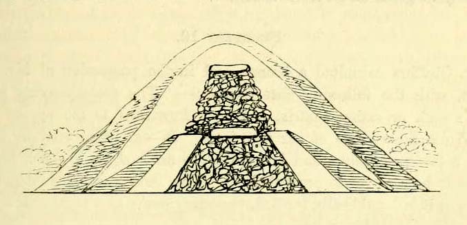
Charles Warne's 1848 drawing of the old tumulus
Charles Warne’s 1848 drawing of the old tumulus

A number of very large prehistoric burial mounds, or tumuli, were destroyed in this part of Dorset in the 19th century, including “three on the Came estate, near Dorchester, the property of the Hon Col. Damer.” This one—listed as a “bowl barrow” and known today as the Winterborne Came 18b tumulus in Grinsell’s (1959:148) brilliant survey—was found to house examples of petroglyphs, which are very rare in this part of Britain.  Thankfully before its destruction, the local antiquarian Charles Warne (1848) was present and has left us with a good description of its structure and contents.  After first telling of the demise of two other large tumuli close by, the biggest of them drew his attention:

“The last of these mighty mounds (and well do they merit the appellation from their vastness), measured rather more than ninety feet in diameter, and sixteen feet in height; this from the peculiarity of its contents was the most interesting of the three. The annexed rough sketch (above), shewing a central section of the tumulus, may serve to give some idea of the singularity of its composition. About the centre, at a depth of some three feet from the surface, was found lying flat a rough unhewn stone, with a series of concentric circles incised; this, on being removed, was seen to have covered a mass of flints from six to seven feet in thickness, which being also removed we came to another unhewn irregular stone, with similar circles inscribed, and as in the preceding case, covering another cairn of flints, in quantity about the same as beneath the first stone. It was in this lower mass that the deposits were found, consisting of all the fragments of an urn of coarse fabric, and apparently as if placed in its situation without either care or attention, no arrangement of the flints being made (as we have elsewhere seen) for its protection; the want of which observance had completed its destruction.  Under the flints, lying at the base, were the remains of six skeletons, and some few bones of the ox. The skeletons had apparently been placed without order or regularity: with the exception of a few bits of charcoal with the urn, there was no evidence of cremation.”

Nearly twenty years later, Sir James Simpson (1867) also described the tumulus and its carved rocks in his 19th century magnum opus, repeating much of Warne’s earlier description, saying:

“In his antiquarian researches in this county (Dorset), Mr Warne opened , at Came Down on the Ridgeway, a tumulus of rather unusual form. At its base…were found the remains of six unburnt human skeletons…and some few bones of the ox.  Above them, and in the centre of the tumulus, was built up a cairn or heap of flints around a coarse and broken urn, which contained calcined bones.  This mass of flints was surrounded and covered by a horizontal rough slab.  Above and upon this slab was built another large heap of flints, six or seven feet in thickness.  This second heap was capped with another rough slab, lying two or three feet below the surface of the tumulus.  Both these flat unhewn covering slabs had a group of concentric circles cut upon them.”

We don’t know for sure the exact whereabouts of the tumulus, nor the age of the tomb and its remains.  But the size of it may indicate an early Bronze Age and perhaps even neolithic status. The finding of the rock art in the tomb is also an indicator that could push the date back into late neolithic period—but we may never know for sure…

References:

  1. Grinsell, Leslie V., Dorset Barrows, Dorset Natural History & Archaeological Society 1959.
  2. Royal Commission on Historical Monuments (England), An Inventory of Historical Monuments in the County of Dorset – Volume 2: South-East, HMSO: London 1970.
  3. Simpson, James, Archaic Sculpturings of Cups, Circles, etc., Upon Stones and Rocks in Scotland, England and other Countries, Edmonston & Douglas: Edinburgh 1867.
  4. Warne, Charles, “Removal of Three of the Large Tumuli on the Came Estate, near Dorchester,” in Journal of the British Archaeological Association, volume 3, 1848.
  5. Warne, Charles, The Celtic tumuli of Dorset: An Account of Personal and other Researches in the Sepulchral Mounds of the Durotriges, J.R. Smith: London 1866

© Paul Bennett, The Northern Antiquarian 


Rocking Stone, Warley Moor, Halifax, West Yorkshire

Legendary Rock:  OS Grid Reference – SE 03399 30199

Also Known as:

  1. Sleepy Lowe

Getting Here

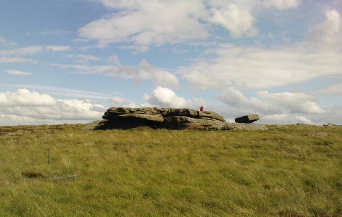
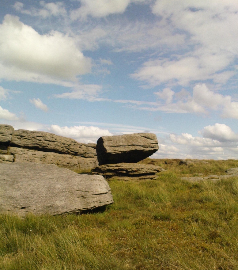
The old rocking stone, on the right
Looking east at the stone

From Denholme, take the A6033 Hebden Bridge road up, but shortly past the great bend turn off right up the steep road towards the moorland windmills until you reach the flat dirt-tracked road, past the reservoir below.  A coupla hundred yards past the track to the reservoir, take the footpath south into the tribbly grasslands and moor.  A few hundred yards down you’ll note the large rock outcrop ahead of you. The rocking stone is there!

Archaeology & History

The old rocking stone

A small moorland arena with a neglected history. Many lost memories surround this site, with barely legible ruins from medieval and Victorian periods prevailing against scanty snippets of neolithic and Bronze Age rumours and remains.  The rocking stone here—which moves slightly with a bit of effort—sits amidst a gathering of other large rocks, some of which have debatable cup-markings on their smoothly eroded surfaces.

Our rocking stone, resting 1350 feet (411m) above seal level, was first mentioned in John Watson’s (1775) magnum opus, who gave a quite lengthy description of the site, telling us that,

“On a common called Saltonstall-moor, is what the country people call the Rocking-stone… The height of this on the west side (which is the highest) is, as I remember, about three yards and a half.  It is a large piece of rock, one end of which rests on several stones, between two of which is a pebble of a different grit, seemingly put there for a support, and so placed that it could not possibly be taken out without breaking, or removing the rocks, so that in all probability they have been laid together by art.  It ought to be observed, that the stone in question, from the form and position of it, could never be a rocking stone, though it is always distinguished by that name.  The true rocking stone appeared to me to lie a small distance from it, thrown off its centre.  The other part of this stone is laid upon a kind of pedestal, broad at the bottom, but narrow in the middle; and round this pedestal is a passage which, from every appearance, seems to have been formed by art, but for what purpose is the question.”

Dubious cupmarks
Dubious cups
Watson's 1775 drawing of the Rocking Stone
Watson’s 1775 drawing of the Rocking Stone

Watson then goes onto remark about other rocking stones in Cornwall and further afield with attendant “druid basins” on them, noting that there were also “rock basins” found here on Warley Moor, a few of which had been “worked into this rocking stone,” which he thought, “helps to prove that the Druids used it.”  And although these rock basins are large and numerous over several of the rocks on this plateau, like the cup-markings that also scatter the surfaces, they would seem to be Nature’s handiwork.

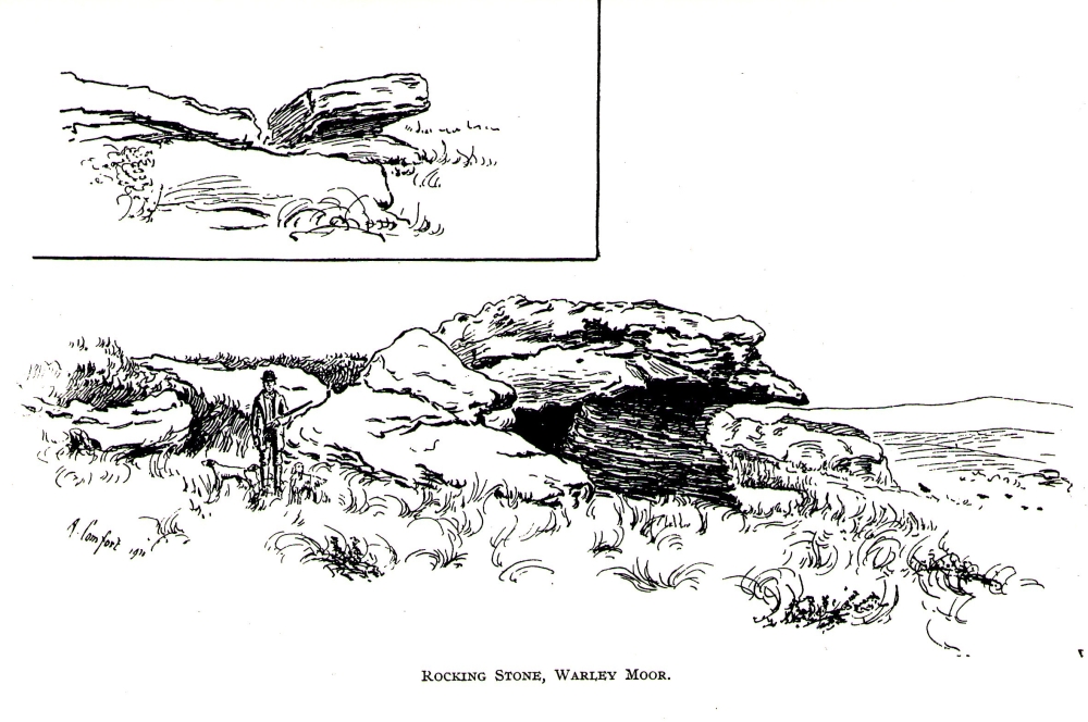
Turner's 1913 drawing
Turner’s 1913 drawing

Some 60 years later when the literary thief John Crabtree (1836) plagiarized Watson’s words verbatim into his much lesser tome, it seemed obvious he’d never ventured to explore the site.  But in the much more valuable historical expansion written by John Leyland around 1867, he at least visited the site and found the old stone, “still resting on its shady pedestal.” Later still, when Whiteley Turner (1913) ventured this way on one of his moorland bimbles, he added nothing more to the mythic history of these west-facing megaliths…

Folklore

Still reputed locally to have been a site used by the druids; a local newspaper account in the 1970s also told how local people thought this place to be “haunted by goblins.”

References:

  1. Bennett, Paul, The Old Stones of Elmet, Capall Bann: Milverton 2001.
  2. Crabtree, John, Concise History of the Parish and Vicarage of Halifax, Hartley & Walker: Halifax 1836.
  3. Leyland, F.A., The History and Antiquities of the Parish of Halifax, by the Reverend John Watson, M.A., R.Leyland: Halifax n.d. (c.1867).
  4. Smith, A.H., The Place-Names of the West Riding of Yorkshire – volume 3, Cambridge University Press 1961.
  5. Turner, Whiteley, A Spring-Time Saunter round and about Bronte Lane, Halifax Courier 1913.
  6. Watson, John, The History and Antiquities of the Parish of Halifax, T. Lowndes: London 1775.

© Paul BennettThe Northern Antiquarian


Mount Cross, Cornholme, Todmorden, West Yorkshire

Cross:  OS Grid Reference – SD 91460 27280

Also Known as:

  1. Idol Cross

Getting Here

Mount Cross, near Cornholme

The site can be approached by going up the almost hidden long steep winding lane off the A646 in Cornholme; but if you don’t know the area it’s probably best approached from the well known Bride Stones, above Todmorden.  From here, go west along the road running 100 yards or so above the Bride Stones, past the old pub, past Hawk Stones farm, and turning left downhill about a quarter-mile on.  A coupla 100 yards down, there’s a track to your left.  As you start walking along you’ll see a standing stone on the grassy rise in front of you on your left.  That’s it!

Archaeology & History

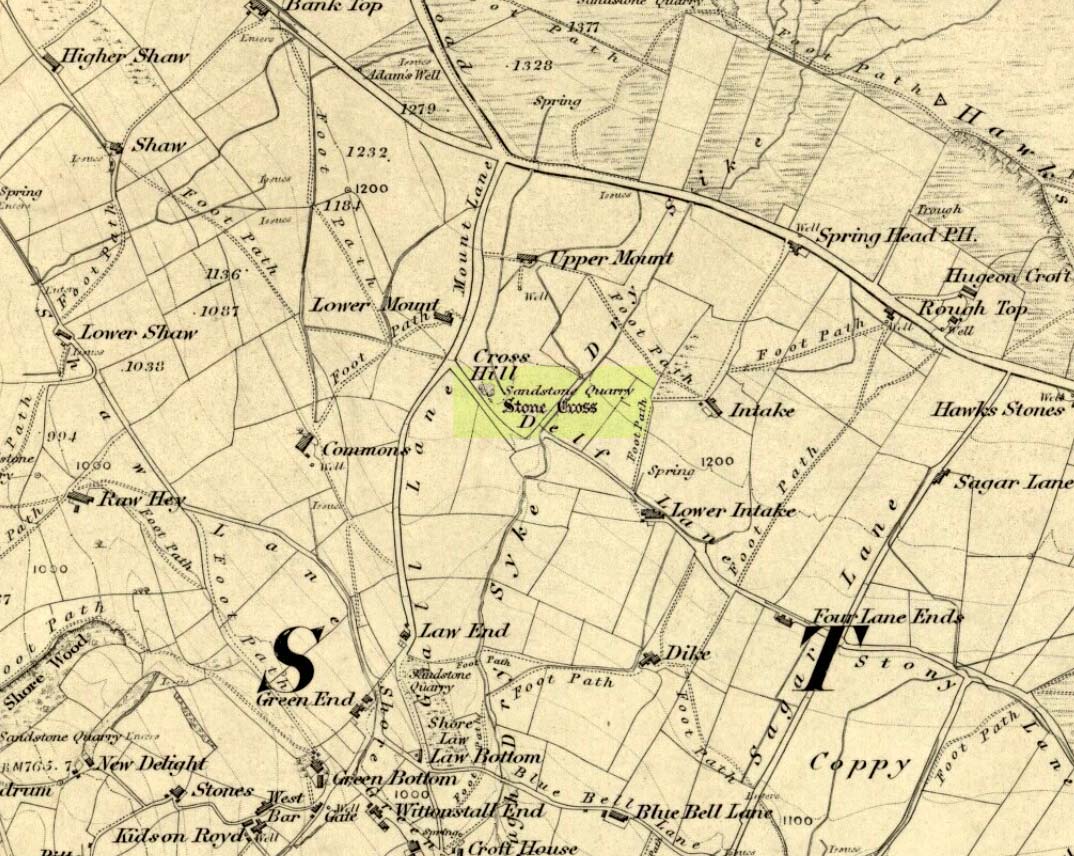
Mount Cross on 1848 map

Said by local writer Geoff Boswell (1986) to be “the oldest religious memorial in Todmorden,” this old stone, more than 4-feet tall, is still in good condition and can be found beside the Old Causeway: a prehistoric trackway running between Lancashire and Yorkshire which is said by archaeologists to have been an old, but established trade route.  It was suggested by some to have been erected as a cross as early as the 7th century.  Generally known as the Mount Cross, it is also known as the Idol Cross, as legend reputes it to have been the site of pagan practices; hence its repute as being haunted. Its alleged heathen history is probably true (history records describe an old “rude stone” that was once found beneath the legendary Bride Stones nearby, which was moved many centuries back).

The Calderdale Council website tells that,

“Towards the bottom of the shaft on the NE side are what appears to be extremely faint traces of vine-scroll decoration which would suggest a fairly early date for the cross, possibly tenth or eleventh century. The irregularity of the carving overall tends to indicate that the cross is no earlier.”

Folklore

Said to have stood upon or beside a small tumulus until the 20th century. Jessica Lofthouse (1976) reported that a local farmer said of this stone. “Queer things happened here long since. They worshipped idols here.” Locally attributed to be haunted, the old stone was said to have a history of “uncanny happenings.”

References:

  1. Bennett, P., The Old Stone Crosses of West Yorkshire, unpublished MS, 1995.
  2. Boswell, Geoff, On the Tops around Todmorden, Delta G: Todmorden 1986.
  3. Lofthouse, Jessica, North Country Folklore, Hale: London 1976.

© Paul Bennett, The Northern Antiquarian


Rivock Enclosure, Riddlesden, Keighley, West Yorkshire

Enclosure:  OS Grid Reference – SE 0768 4414

Getting Here

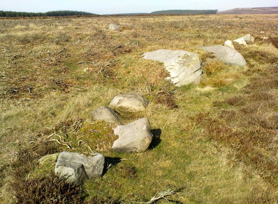
Rivock Enclosure walling, looking north

Follow the directions to reach the small Rivock East Carving just on the level of the small moorland.  From here, walk less than 100 yards east, staying just on the edge of the moor, keeping your eyes peeled for the irregular shaped rocks running in lines roughly parallel with the footpath above the edge of the crags.

Archaeology & History

Recent explorations in and around the Rivock Edge area found, not only a number of undiscovered cup-and-ring stones, but the overgrown remains of an undoubted prehistoric enclosure on the ridge of moorland above the rock escarpment which has not previously been reported in archaeological surveys.  Much of the time the area is covered in deep heather, but thanks to this small section of moor being burnt back a short while ago, the lines of walling that mark the enclosure are there for all to see. It’s obvious that some sections of the old walls have been removed in the not-too-distant past for use in more modern walling and, nearby, old quarries and farming have probably been responsible for other destructive elements.

Easternmost line of Rivock enclosure walling

This enclosure is of a rough, rounded, scalene triangular formation, with the main piece of extant walling running roughly northeast-southwest.  The walling is typical of other settlements and enclosures in the region, probably Bronze Age in nature, Iron Age at the latest, with some natural earthfast boulders marking parts of the outline and many smaller pieces of rock and packing stones being added to build up the structure.  The same layout is found at other nearby prehistoric enclosures at Crow Well, Dumpit Hill, Snowden Moor, Woofa Bank and many others.

Of the larger upright stones in the Rivock Enclosure, several of them stand about three feet high, with some of them having been knocked down.  The longest line of walling, running roughly east-west, is less than 50 yards long; whilst the enclosure wall running roughly north-south on its eastern side is 30 yards long.  Much of the walling along its northern side appears overgrown and sections of it are missing.

For a long time I puzzled as to whether there had been any settlements on this part of Rombald’s Moor, rich in cup-and-rings stones — and at last we find that there was at least one such site.  Forays back and forth across the level ground all around here failed to locate any other similar enclosure remains; but it may be that some have been covered (or were destroyed) in the adjacent forestry plantation to the west.  Further explorations by fellow antiquarians may prove worthwhile when the forest is cut down in the next few years.

© Paul BennettThe Northern Antiquarian


Birley Spa, Birley, Sheffield, South Yorkshire

Healing Well:  OS Grid Reference SK 4090 8361

Getting Here

Birley Spa building
Birley Spa building

Birley Spa is now open for special events and the first Saturday in the summer months; however it is best to check that the site is open as it is open by volunteers. It can be viewed from the outside when closed and can be reached off the A1635 take Occupation Lane then Birley Spa Lane on the left and once passing a school on the left there is a lane going into the woods on the left by a side, down here is the Spa. There is some parking.

Archaeology and history 

The spa bath
The spa bath

Our first record is when it was established as seven baths by Earl Manners. A work by Platt (undated but around 1930s) contains much of the information and it is from this work I have taken most of the notes. The earliest establishment of the spa is thought to be in the early 1700s being built by a Quaker named Sutcliffe. The spa then consisted of a square stone building with a cold bath within with a bolt fixed on the inner side to ensure privacy. This structure appeared to exist until 1793 when the bath was ruined and filled with stones. In 1843, the Earl Manvers who owned the Manor developed this spa for a larger and more upmarket clientele.  An administrative committee was appointed and even a Bath Charity was started so that poor people could benefit and take the waters. Unfortunately the baths did not make profit and by 1895 only one plunge bath remained; the Hotel apparently ceased to function as such about 1878.  It is believed that Earl Manvers removed the marble from the warm bath for his own use. The site then went into a slow decline. In the 1920s and 30s a children’s pleasure ground was established but the grounds were closed in 1939, due to the prohibition of assemblies of crowds, introduced as a safety factor in case of air raids.  The buildings and grounds were allowed to decay and become very dilapidated. Since the building of the Hackenthorpe Housing Estate in the 1950s Sheffield Corporation have become owners of the property.

The spa stream
The spa stream

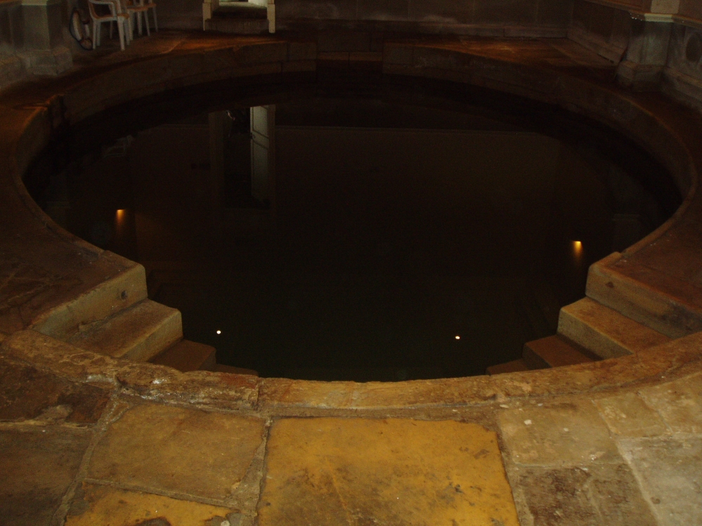
Fortunately unlike other sites, the bath house still exists, probably as a consequence of the first floor being used as community centre. The cold bath was derelict and rubbish strewn, but a splendid restoration has been undertaken. The bath house can be found in a small wooded dell in the housing estate. Despite predations by vandals on the house, the interior reveals an impressive oval stone lined cold bath with steps into the water either side. To the other side are a small collection of artifacts and the history of the site. There is also the store room where coal was stored for the warm bath which no longer exists.

Folklore

Very little folklore is recorded other than the belief that the site has an ancient origin, the spring being located along Neolithic trade routes and indeed implements have been found in the vicinity. Some authorities have noted that there was a Roman bath here supported by the proximity to the Rykneid way. There is however no direct archaeological evidence to support this theory and it may have been spread around by the proprietors to support the quality of the water;  and the Leeds chemist West analysed the waters stating that they were beneficial for those suffering from constipation.

References:

  1. Platts, T. L., The History of Birley Spa 
  2. Parish, R. B., (2010) Holy wells and healing springs of Derbyshire.
  3. www.insearchofholywellsandhealingsprings.wordpress.com

Copyright © Ross Parish


Hermit’s Well, Dale Abbey, Derbyshire

Holy Well:  OS Grid Reference – SK 4378 3861

Getting Here

Dale Abbey is a small and interesting village not far from Ilkeston. It can be found by taking the A6096 from Ilkeston and after passing through Kirk Hallam, take the first turning on the left called Arbour Hill. At the Carpenter’s Arms in the village turn right and park near the church. The well lies within the private garden of Church house, although it can be easily seen in the winter from the field in which the footpath below the church passes through, as well from the church yard.

Archaeology & History

R.C. Hope (1893) gives two versions of the story of how the hermit found the well and cave, taken from the Chronicle of Thomas de Musca quoted in Glover’s History of Derbyshire:

“A hermit once going through Deep Dale being very thirsty, and for a time not able to find any water, at last came upon a stream, which he followed up to the place where it rose; here he dug a well, returned thanks to the Almighty, and blessed it, saying it, should be holy for evermore, and be a cure for all ills. Another version is that the famous Hermit of Deep Dale, who lived in the Hermitage which is close by the well, discovered this spring and dug the well, which never dries up, nor does the water diminish in quantity, however dry the season and blessed it.”

In another version of the story, Hope (1893) notes:

“There was a baker in Derby, in the street which is called after the name of St. Mary. At that period the church of the Blessed Virgin at Derby was at the head of a large parish, and had under its authority a church de onere and a chapel. And this baker, otherwise called Cornelius, was a religious man, fearing God, and, moreover, so wholly occupied in good works and the bestowing of alms, that whatsoever remained to him on every seventh day beyond what had been required for the food and clothing of himself and his, and the needful things of his house, he would on the Sabbath day take to the church of St. Mary, and give to the poor for the love of God, and of the Holy Virgin. It happened on a certain day in autumn, when he had resigned himself to repose at the hour of noon, the Blessed Virgin appeared to him in his sleep, saying, ” Acceptable in the eyes of my Son, and of me are the alms thou hast bestowed. But now, if thou art willing to be made perfect, leave all that thou hast, and go to Depedale where thou shalt serve my Son and me in solitude; and when thou shalt happily have terminated thy course thou shalt inherit the kingdom of love, joy, and eternal bliss which God has prepared for them who love Him. The man, awakening, perceived the divine goodness which had been done for his sake; and, giving thanks to God and the Blessed Virgin, his encourager, he straightway went forth without speaking a word to anyone. Having turned his steps towards the east, it befel him, as he was passing through the middle of the village of Stanley, he heard a woman say to a girl, ”Take our calves with you, drive them as far as Depedale, and make haste back.” Having heard this, the man, admiring the favour of God, and believing that this word had been spoken in grace, a, it were, to bin’, was astonished, and approached near, and said, “Good woman, tell me, where is Depedale?” She replied, “Go with this maiden, and she, if you desire it, will show you the place. When he arrived there, he found that the place was marshy, and of fearful aspect, far distant from any habitation of man. Then directing his steps to the south-east of the place, he cut for himself, in the side of the mountain, in the rock, a very small dwelling, and an altar towards the south, which hath been preserved to this day; and there he served God, day and night, in hunger and thirst, in cold and in meditation.

And it came to pass that the old designing enemy of mankind, beholding this disciple of Christ flourishing with the different flowers of the virtues, began to envy him, as he envies other holy men, sending frequently amidst his cogitations the vanities of the world, the bitterness of his existence, the solitariness of his situation, and the various troubles of the desert. But the aforesaid man of God, conscious of the venom of the crooked serpent, did, by continual prayer, repeated fastings, and holy meditations, cast forth, through the grace of God, all his temptations. Whereupon the enemy rose upon him in all his might, both secretly and openly waging with him a visible conflict. And while the assaults of his foe became day by day more grievous, he had to sustain a very great want of water. Wandering about the neighbouring places, he discovered a spring in a valley not far from his dwelling, towards the west, and near unto it he made for himself a cottage, and built an oratory in honour of God and the Blessed Virgin. There, wearing away the sufferings of his life, laudably, in the service of God, he departed happily to God, from out of the prison-house of the body.”

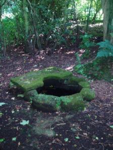
The well is a delightfully rustic one and certainly contains old stonework if not from the hermit’s time than the period of the Abbey. It is an oval structure with eight stones around the mouth, a three foot rectangular stone covers half of the well and has a semi-circular cut placed in the middle. Mossy steps lead from the higher end of the garden into the little dell where the well arises. The well has been dressed in the early 2000s but has now disappeared into obscurity. Indeed, some believe that it is does not exist in the first place…

 Folklore

First noted in 1350 in association with the legend of the foundation of the Abbey, Hope (1893) notes it was curative and was a wishing well; being visited on Good Friday, between twelve and three o’clock, water being drunk three times.
OLYMPUS DIGITAL CAMERAOLYMPUS DIGITAL CAMERA

References:

  1. Hope, Robert Charles (1893), Legendary Lore of the Holy Wells of England, Elliott Stock: London.
  2. Parish, R.B. (2008), Holy wells and healing springs of Derbyshire.

Copyright © Ross Parish

St. Catherine’s Well, Westhorpe, Southwell, Nottinghamshire

Holy Well:  OS Grid Reference – SK 684 532

Getting Here

St Catherine's Well, Westhorpe
St Catherine’s Well, Westhorpe

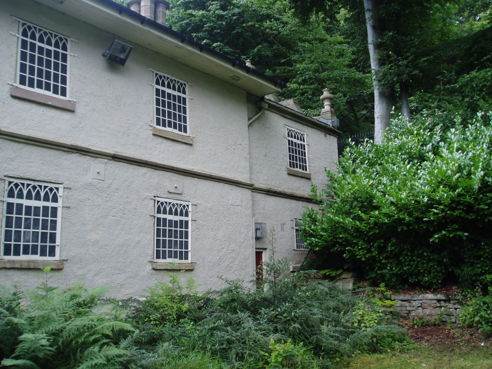
To find Westhorpe, take the lane on the left as one leaves Southwell, and then the next left, Bath Lane. The cottage is the only house on this lane and the well arises on the edge of its private garden.  Ask permission to view.

Archaeology and History

The earliest record of a religious institution here is in 1482, when a chapel was erected dedicated to the saint.  Whether this was built to cater for those who sought the well is unclear, but it seems likely.  Little is recorded of its mediaeval history.  Of its post-Reformation history, Dickinson (1819) notes that a Mr. Burton of Norwood Park built a house and bath at the site in 1720.  He appears to have used the saint as support for its properties as:

“Over the head of the fountain was a plate, on which some Latin verses were inscribed, much to the honour of the tutelary saint, and the reputation of the water.”

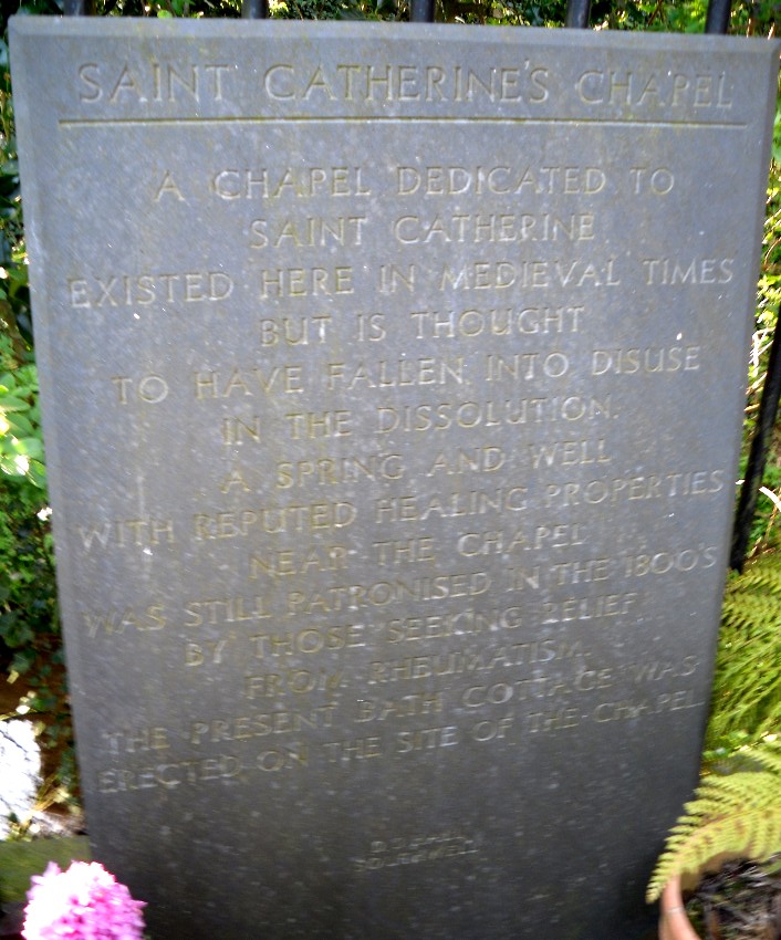
Stone slab describing the well
The running waters
The running waters

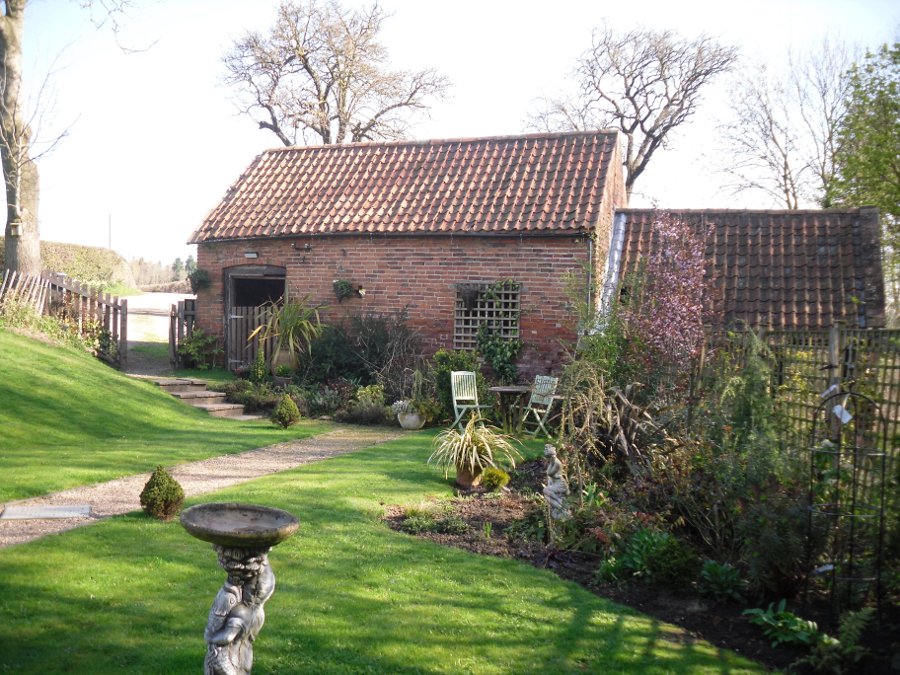
It is thought that the cottage and barn at the site may be the remains of this venture, although, I was informed by the occupant that the barn had mediaeval features.  When Bob Morrell (1988) visited he was also told that a bath-like structure with steps down was located nearby, but an exact location was unknown, and the current occupiers were similarly unaware of it when I visited.  This was probably a relic of Mr Burton’s exploitation.  This appears to have been a brief period, for as Shilton (1818) notes, it

“…would have retained them to this day, had there been the due accompanyments (sic) for luxurious lounge, intrigue and scandal commodiously attached.”

Modern stone wall above well

St. Catherine’s Well itself is found between Bath Cottage and the barn.  It arises in a brick-lined square structure capped with a broken slab.  This sits on an older structure which has the appearance of calcareous rock; although any petrifying properties are not noted by previous authors.  When first visited the well house was dry; however, a more recent visit in spring showed a considerable flow (despite a dry winter). It flowed from a clay pipe within the well house and leaves through a smaller pipe set into the calcified part and then down to the dumble below. In this dumble appear to be some dressed stone which may have been part of the original structure.  Beside the well on the bank above is a small slate monument which records:

“A chapel dedicated to St. Catherine existed here in medieval times but it is thought to have fallen into disuse at the dissolution. A spring and well with reputed healing properties near the chapel was still patronised in the 1800s by those seeking relief from rheumatism. The present bath cottage was erected on the site of the chapel. D.J Hall Southwell.”

Folklore

Not much but its waters were said to be a cure for rheumatism being particularly cold.

References:

  1. Dickinson, W. (1787), A History of the Antiquities of the Town and Church of Southwell, in the County of Nottingham.  Nottingham.
  2. Morrell, R. W. (1988), Nottinghamshire Holy Wells and Springs.  Nottingham
  3. Parish, R.B. (2010), Holy wells and healing springs of Nottinghamshire.  Nottingham
  4. Rattue, James (1995), The Living Stream: Holy Wells in Historical Context, Boydell: Woodbridge.
  5. Shilton, R. P. (1818), The History of Southwell in the county of Nottinghamshire. Nottingham.

© Ross Parish, The Northern Antiquarian 


Fraggle Rock, Hawksworth Moor, West Yorkshire

Cup-and-Ring Stone:  OS Grid Reference — SE 15094 43502

Getting Here

Fraggle Rock, Reva Hill

Probably the easiest (direction wise) is if you’re coming from Dick Hudson’s public house on the southern road surrounding Rombalds Moor. From the pub, head left (east) along Otley Road (passing Weecher reservoir) for 1.9 miles (3.1km) until you reach Reva reservoir where a track leads you to the waters.  A small parking spot is on the left-side of the road. From here, go through the gate and along the footpath across the field for nearly 300 yards to the next gate; go through here and walk to your right for about 60 yards where uyou’ll reach a small straight dyke (keep your eyes peeled!) running NW (to your left): walk along here for nearly 200 yards until it hits another shallow dyke bearing right; follow this dead straight for 35 yards after which it changes direction, but you need to keep walking straight on forward for another 60 yards or so.  Look around!

Archaeology & History

Early photo of the carving
First photo of the carving

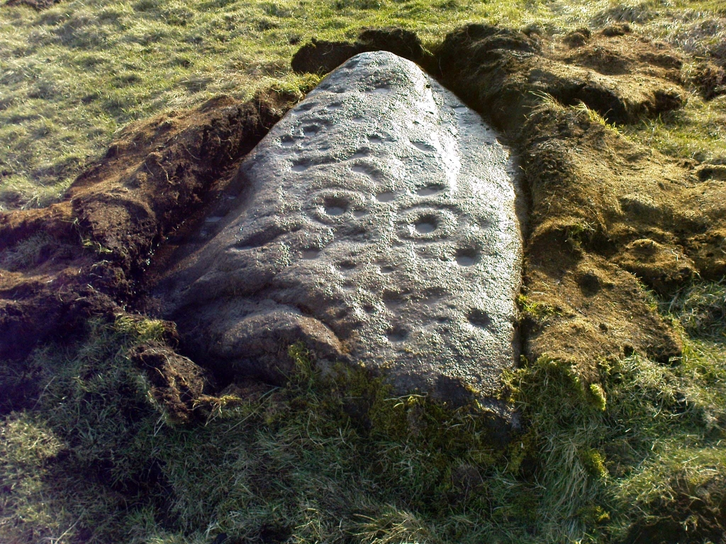
This carving is one in a cluster of previously unrecorded petroglyphs, uncovered in the summer of 2011 during a Northern Antiquarian bimble on the northern edge of Rombald’s Moor.  The carvings were found as a bi-product of uncovering a previously undiscovered cairn circle, close to the Twelve Apostles stone circle.  In assessing and exploring the newly-found circle, it was noticed that a small opening in the near horizon highlighted a rise in the landscape barely a mile away.  This ‘opening’ in the land was not visible if you walked 25 yards either side of the cairn circle – but was very notable at the circle itself.

“We need to have a look at that site,” I said.  “It’s position looks to have been relevant to this circle.” (or words to that effect) And a couple of weeks later we met up and walked to the place in question.

Fraggle Rock carving, looking west
Fraggle Rock carving, looking south

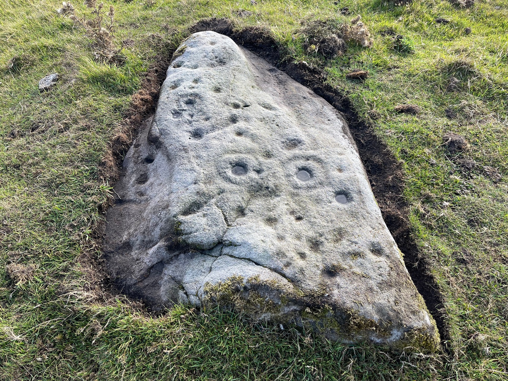
Within five minutes we came across a couple of previously unrecorded cup-marked stones, of simple design, right in line with the cairn circle.  As we walked around this spot, then headed back in the direction of the circle, a cluster of small stones were noticed on the slope.  One had what looked like a single cup-marking near its edge, but the rest of the rock was completely covered in vegetation.  Paul Hornby and Michala Potts had, by now, already found several other previously unrecorded cup-marked stones close by; but as I carefully rolled back the vegetation at the edge of this particular rock, cups-and-rings and carved lines seemed to be covering most of its surface.  It was a good one!

Face on the Fraggle Rock

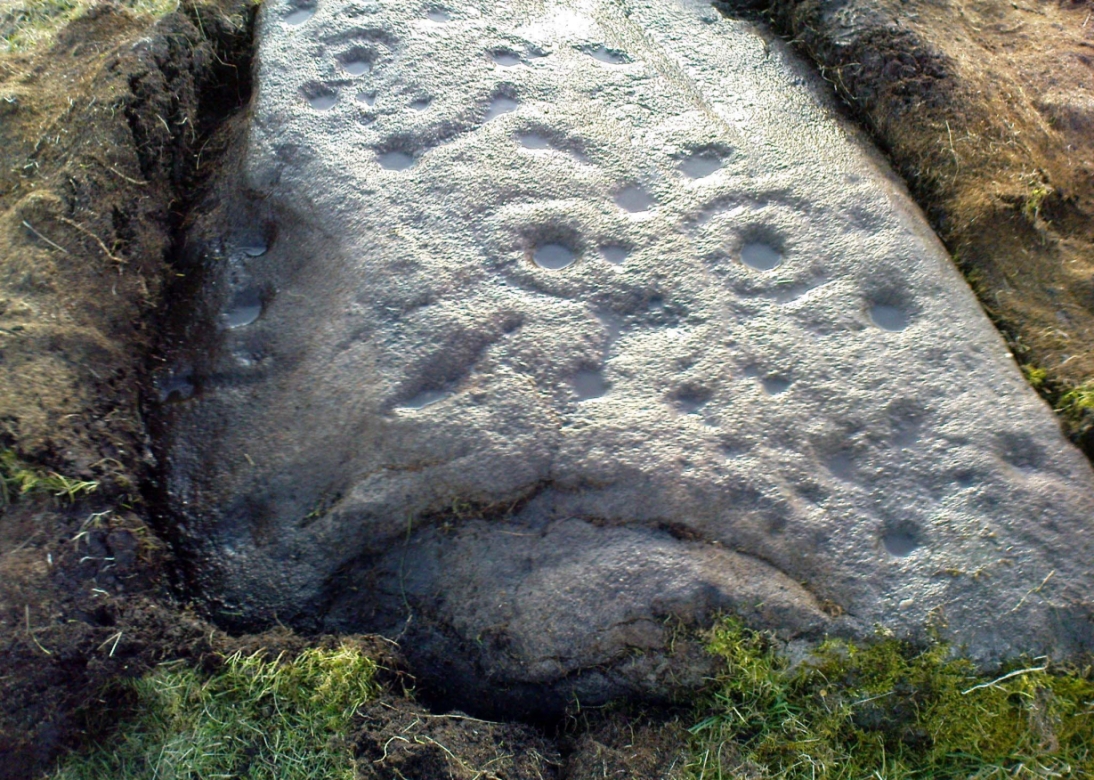
We called it the Fraggle Rock after noticing that when you look at the stone from one end, the two main cup-and-rings are likes two large eyes carved above a large natural down-turning ‘mouth’ feature, similar to some of the creatures’ faces on the muppets or the similar kid’s TV show, Fraggle Rock! (sad aren’t we!?)  The photo here shows you what we mean.

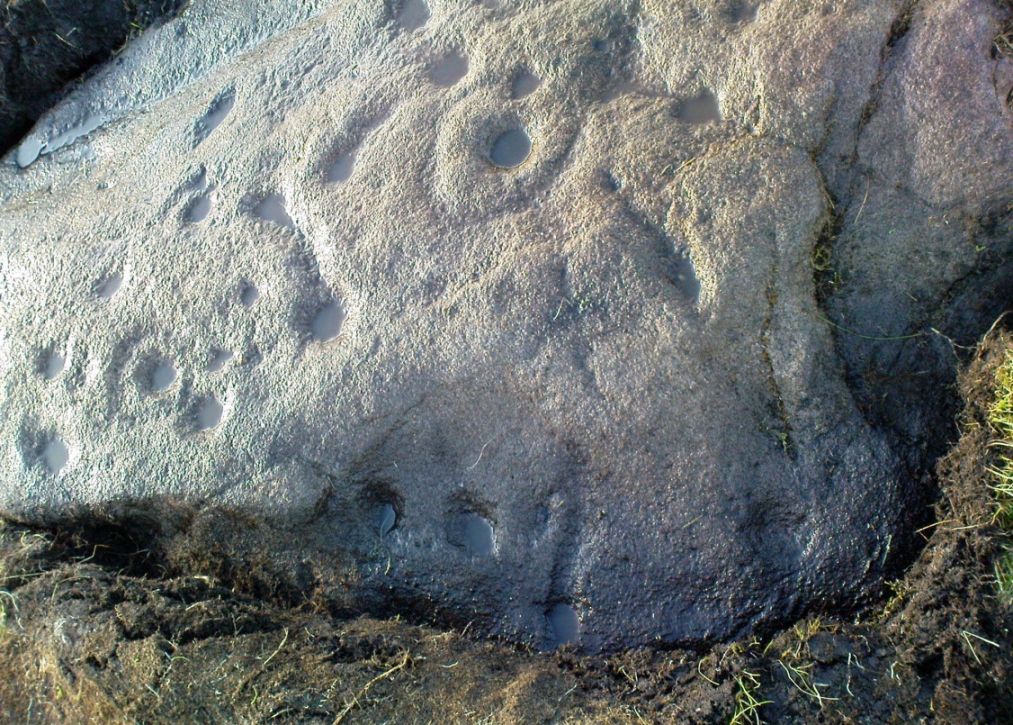
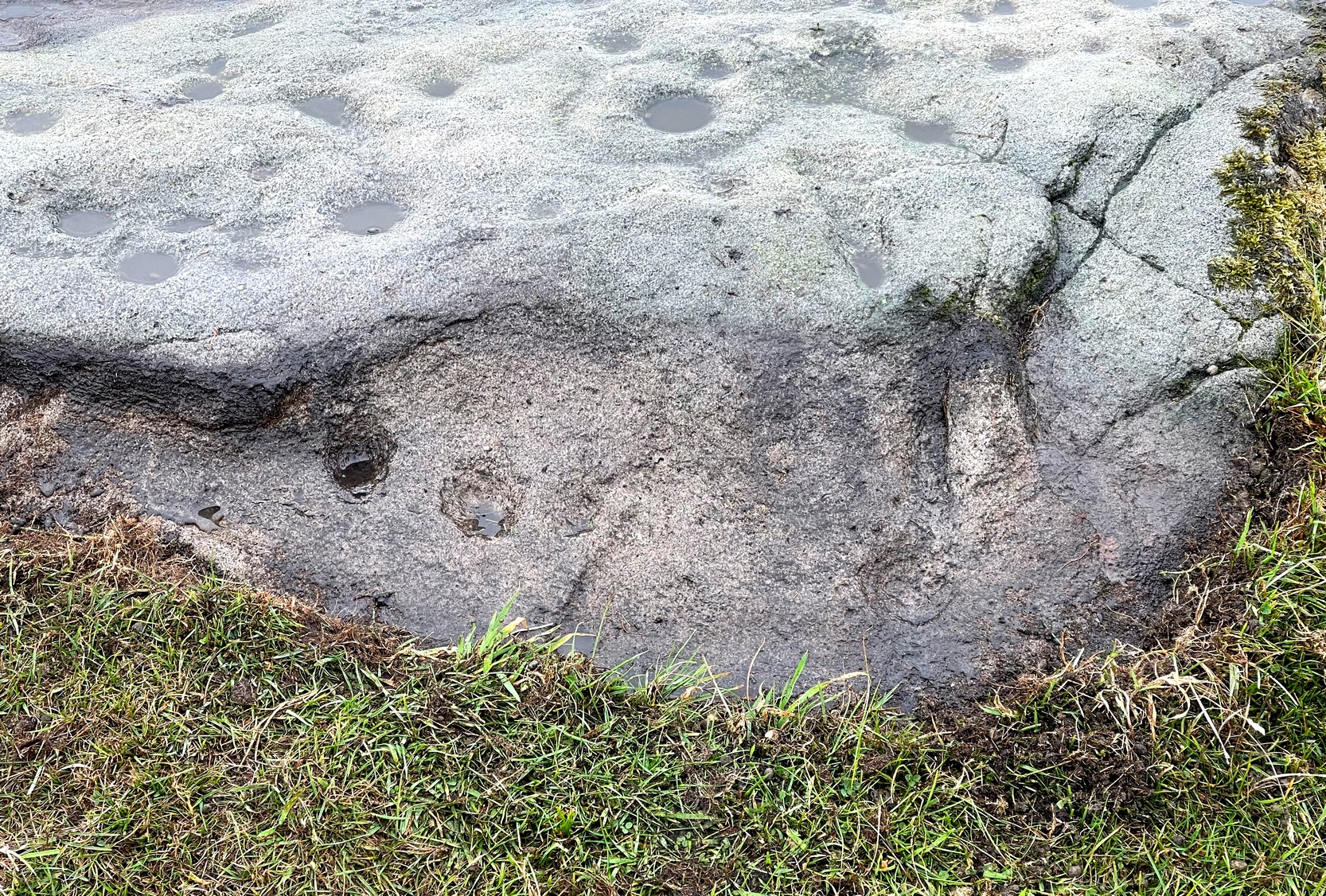
The primary design consists of at least 3 cup-and-rings, 2 partial cup-and-rings, 28 cups and several carved lines along which some cup-markings are linked to others.  The most notable of the carved lines is the longest (barely visible in the photos), running from a single cup-mark at the southernmost rounded end of the stone, almost straight and parallel with a natural ridge or dip along the rock, until it meets the largest of the cup-and-rings (one of the eyes on the Fraggle’s face!).  Don’t ask me why, but for some reason this long faint line seemed the most perplexing element of the carving.

Eastern edge, with cups at ground level
Eastern edge with low cups
Cup-marks on rock edge

Most of the design is carved on the upper face of the stone, but a small part of the rock dips into the ground on its eastern side and a small group of cups and a single carved line, in a very good state of preservation, are etched right at the edge of the stone.  Unusual.  Another faint cup-and-ring is less than 100 yards west; and a fascinating cup-and-lines stone, with at least four long carved ridges running like hair from the top of the stone into the Earth, is a short distance to the north.  A number of others are in this and adjacent fields.

References:

  1. Jack, Jim, “Old Fraggle Rock is Found on Burley Moor,” in Ilkley Gazette, March 4, 2013.

© Paul Bennett, The Northern Antiquarian