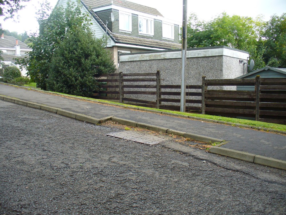
Go up the road alongside the Dollar Burn, turning right, up the steep hill as if heading to the Wizard’s Stone and the impressive Castleton monolith, a mile further along. Before reaching the Wizard’s Stone, keep your eyes peeled on the right for the street-name, ‘Moir’s Well’. From here, walk up the road less than another 100 yards and till you reach the water-cover.
Archaeology & History
Site of the old Muir’s Well
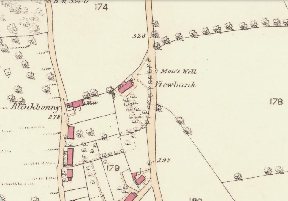
There is little known about any history of this now-covered old well, halfway up the steep slope towards Lochy Launds. It was noted by Ordnance Survey in 1861 and subsequently published on the earliest OS-map a few years later. It was obviously a wayside well for those venturing up the steep hill and used to have an old stone trough into which the waters ran. Although we don’t know for certain, the etymology of the well probably comes from the surname Muir, which according to William Gibson (1883) was common in the old village.
People living in the houses below here, told us that after heavy rains their gardens become very boggy, which is probably due to the sub-surface water from Muir’s Well. Tis good to know that the waters are still finding their way out!
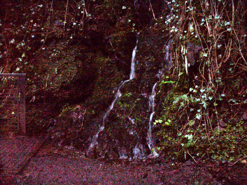
From Alva, take the signs to walk up the gorgeous Alva Glen gorge, past the site of the Dwarf’s Tomb, over the bridge past the first waterfall and up the footpath and into the glen proper. The path runs parallel with the gorge and a few hundred yards along you’ll reach a small footbridge. Immediately before this, on your right, coming down through the crags by the side of the path, the waters fall from the well in question. It’s easy enough to see.
Archaeology & History
Waters of the Lady Well on a dark, grey evening
The history of this site is seemingly hidden. Little has been written of it and its dedication to some ‘Lady’ is an oddity. I can find no specifics telling who the ‘lady’ in question is. The other Lady Well at Tillicoultry, a mile or two east, is equally bereft of historical certitude. Whether it is another dedication to the supposed ‘virgin’ Mary of the christian cult, or a local lady whose name has long since been forgotten, we do not know. Additional info on this site would be most helpful.
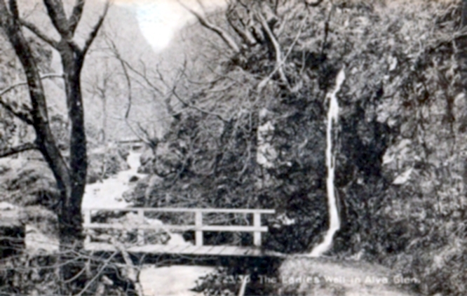
Shown on an early postcard of the Alva Glen and highlighted in Mr Pithie’s (1982) work, the waters here—running down the crag-face from a spring at the top—are fine, fresh and almost sweet-tasting, rich in minerals and healthy nutrients no doubt. Without doubt, I’d recommend a drink of this every time you walk past here! (apologies for the dark photo – I’ll get a better one next time we’re up there)
References:
Corbett, L., et al., The Ochil Hills, Forth Naturalist & Historian 1994.
Pithie, A., Views of Alloa and the Neighbourhood, Clackmannan District Libraries 1982.
Acknowledgements: Grateful thanks to Lisa Samson for help with directions.
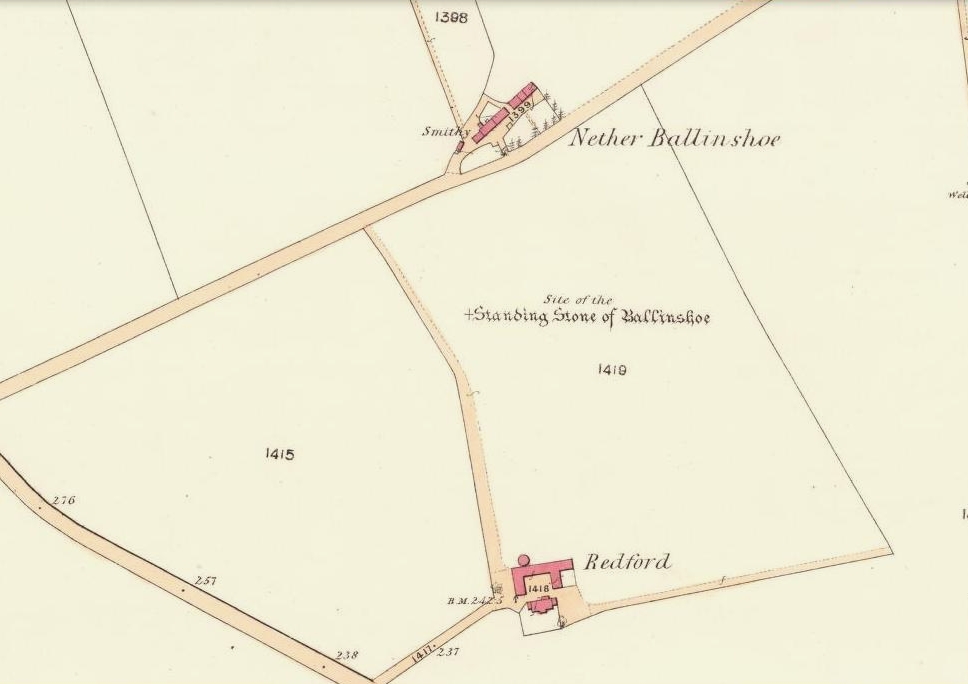
In a region that is full of prehistoric remains, we find here another example of another megalithic site that was sadly destroyed, not too long ago by the scale of things. Found in association with a large prehistoric urn, we are thankful to have a couple of early local history accounts that describe the place. The stone was obviously of some considerable height and bulk, though I can find no specific references to the dimensions of the monolith. It was described effectively in the middle-half of the 19th century by Andrew Jervise (1853), who told us:
“‘The Stannin Stane of Benshie’, which stood for unknown ages…was demolished by gunpowder about half a century ago, and the spot is now covered by luxuriant crops of corn. This rude monument of antiquity is supposed to have been about twenty tons in weight; and at a considerable depth below it, a large clay urn, measuring about three feet in height and of corresponding circumference, was found containing a quantity of human bones and ashes. Like its rude protector, however, the urn was broken to pieces; and, beyond the mere fact of its discovery, nothing authentic, as to either the style of its manufacture, or the precise nature or state of its contents, is preserved.”
More than 30 years later, A.J. Warden (1884) and then J.G. MacPherson (1885) all but copied Mr Jervise’s words, adding no further information.
From some reason, a small chapel dedicated to St. Ninian (NO 41567 51932) was built about 100 yards or so to the southwest of the old standing stone. Its ruins are still to be seen. Whether this was an attempt to divert local people away from their animistic ecocentricism at the stone, into the more ecocidal egocentricism of the incoming christian cult (as was/is their common practice), we may never know for sure.
Folklore
The local name of this stone, ‘The Stannin Stane of Benshie’, indicates simply that this was “the standing stone at the hill of the faerie folk” (or variations thereof) and suggest it stood upon or next to a mound. I can find no immediate reference to stories of the little people here, and their whisper may have faded into unconscious memory. Does anyone know more about this place?
References:
Jervise, Andrew, The History and Traditions of the Land of the Lindsays in Angus and Mearns, Sutherland and Knox: Edinburgh 1853.
MacPherson, J.G., Strathmore: Past and Present, S. Cowan: Perth 1885.
Royal Commission on the Ancient & Historical Monuments of Scotland, The Archaeological Sites and Monuments of Central Angus, Angus District, Tayside Region, Edinburgh 1983.
Warden, Alex J., Angus or Forfarshire: The Land and People – Descriptive and Historical – volume 4, Charles Alexander: Dundee 1884.
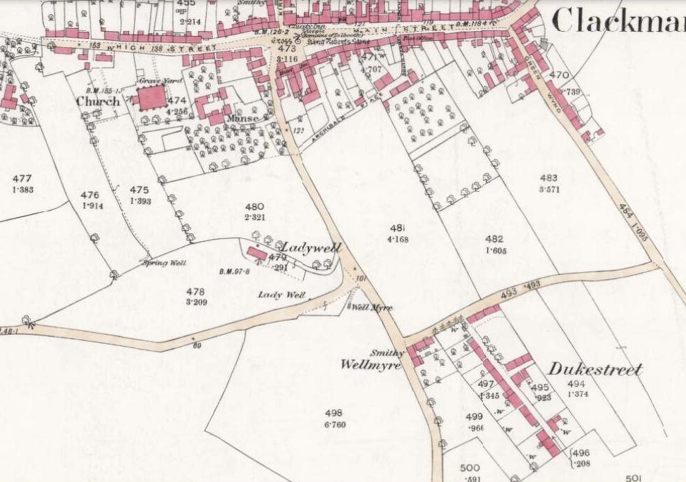
From Clackmannan village centre (with its huge phallic stone), at the crossroads take the south road, Port Street. Walk on here for 100 yards or so and the aptly named Ladywell Grove appears on the right. Walk past there and take the next right down Craigie Road. The original well was barely 50 yards along where the garden edges are today, within yards of the OS-grid ref; but walk another 100 yards down and, by the roadside is a waterworks cover.
Archaeology & History
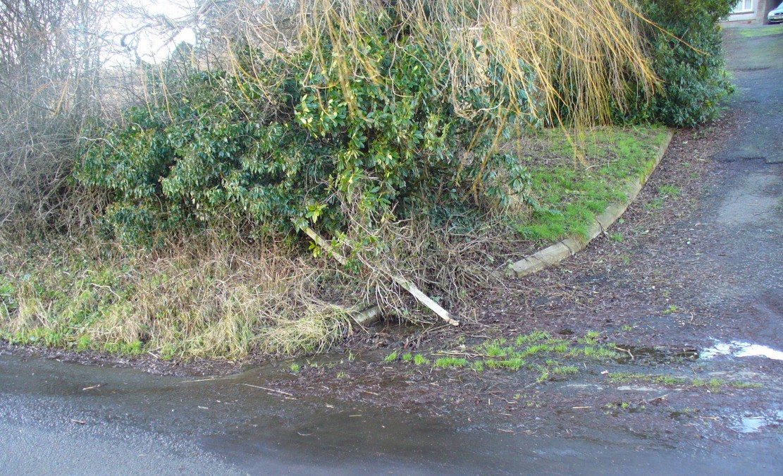
Lady Well overflow?
One of at least three ‘Lady Wells’ that are known in tiny Clackmannanshire—and, like the others, it has not fared well. Not included in either of the major surveys (MacKinlay 1893; Morris 1981), nor referenced in the St. Bartholomew’s Day celebrations once held in the village. It is listed only in passing by Walker (1883) and Simpkins’ (1914) and I can find no references to it in the local history works. Yet it appears in differing place-name forms on the earliest Ordnance Survey maps and its name is still retained in streets-names here.
Whether this old spring of water was dedicated to St. Mary (as the majority of Lady Wells in Britain tend to be), or it was named after a local lady, history records seem quiet on the matter.
The original spot for the well (highlighted on the 1866 OS-map above) is covered in shrubs and seems to be gone. But another 100 yards down the road, a water-cover regularly overflows during heavy rains and this may be where its waters were diverted to.
References:
Simpkins, John Ewart, County Folklore – volume VII: Examples of Printed Folk-Lore Concerning Fife, with some Notes on Clackmannan and Kinross-Shires, Folk-Lore Society: London 1914.
Walker, J. Russel, “‘Holy Wells’ in Scotland,” in Proceedings of the Society of Antiquaries of Scotland, vol.17 (New Series, volume 5), 1883.
Tumulus (destroyed): OS Grid Reference – TA 4160 1748
Archaeology & History
In and around East Yorkshire, the fabled Yorkshire antiquarians William Greenwell and J.R. Mortimer uncovered and excavated many now-lost prehistoric tombs—some of which, beneath the rounded tumulus of earth, were constructed out of wood instead of stone. A little-known site, now long gone, once existed in what is now the North Sea, just a few hundred yards off the Easington coast. Other sites close by are soon to be completely swallowed back into Earth’s body, right on the water-line, but the site described here has long gone. What little was known of it was described in Mortimer’s (1905) magnum opus, where he told:
“On the beach at Easington, in Holderness, under a tide-demolished barrow, Dr Hewetson and the writer on April 21st, 1894, discovered a double cist made of broad slabs split from the outer shell of the decayed trunk of a willow tree. This barrow had been swept away by the waves, and its site was at about half-tide-line, and a considerable way from the very low cliffs. Lining the grave with wood (the branches of trees) would not be difficult to accomplish and would be practised as a protection to the body.”
A henge monument and several other prehistoric barrows have been located in and around Easington, but they’re fading fast!
References:
Mortimer, J.R., Forty Years Researches in British and Saxon Burial Mounds of East Yorkshire, A. Brown: London n.d. (1905).
Stone Circle (destroyed?): OS Grid Reference – SD 892 367
Archaeology & History
Set in good landscape with fine views in most directions, it seems that the only thing that remains of this site is a place-name on a map—but I have to say that our search here was only a short one, and so more may be found hiding away in field walls or beneath the ground. However, if we listen to an early account of the place, it was said to have “completely gone by 1856.” A pity, as it was described as being “a large circle of stones.” The monument was used for repairing the nearby road and, in another account, we are told that the stones were added to the walls. Whether this was a cairn circle or a free standing stone circle isn’t known. The prevalence of tumuli close by at Catlow, Burwains, etc, would suggest a cairn circle, yet we have no accounts of human remains here… A puzzle.
References:
Barnes, Bernard, Man and the Changing Landscape, Liverpool University 1982.
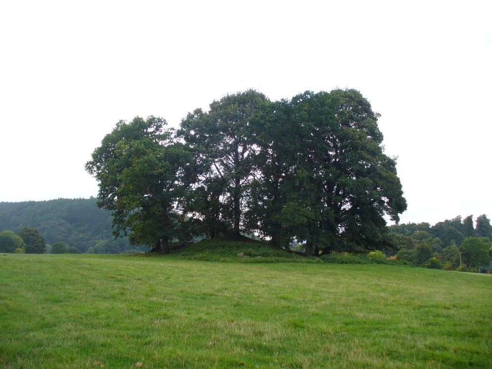
If you’re coming southwest out of Crieff on the A822, as you cross the river take the right-turn just before leaving the town along the country lane onto Strowan and Dalginross. Nearly 2½ miles along there’s the small junction on your right to Strowan House and church. Just past this turning, the next field on by the roadside, has a large rounded tree-covered mound living quietly. That’s the fella!
Archaeology & Folklore
Found halfway between Crieff and Comrie in the field on the north-side of the road, this large oak-covered tumulus was, seemingly, first described in notes made by the old archaeologist O.G.S. Crawford following a quick visit he made here in 1936. The place has, since then, never been excavated to find out exactly what might be hiding therein! It’s quite a big fella too: about 10 feet high and 40 yards across (east-west)—similar in size and design to the prehistoric burial mounds at Tulloch and Kinpurnie. Some large rocks make up the sides and edges of the mound, with smaller ones scattered here and there, giving the distinct impression of a very overgrown cairn of sorts.
Tis a quiet and tranquil arena, amidst fervent colours of meadows and old trees. Another 2 miles further down the same road is the equally tranquil (though ruined) megalithic ring of Dunmoid…
Cup-and-Ring Stone: OS Grid Reference – SK 231 691
Archaeology & History
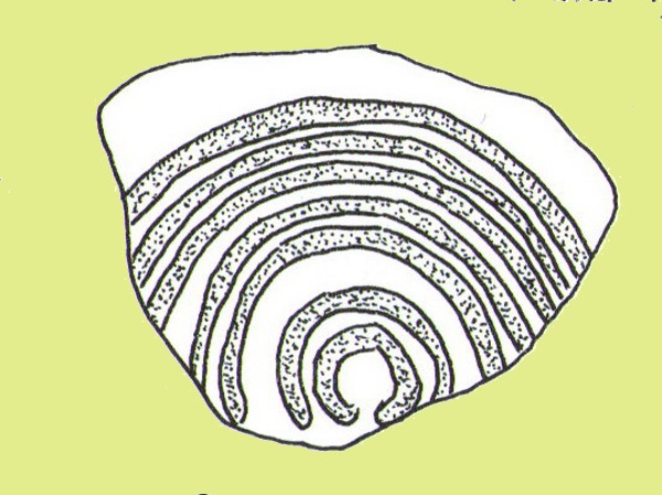
Ball Cross 2 Carving (after Beckensall)
One of three carvings that were located inside the walling of the Ball Cross hillfort during excavations here in the early 1950s by J. Stanley. (1954) Each carving is distinctly unlike the other in design (see Ball Cross 1 and Ball Cross 3) and it’s highly probable that they were incorporated into the Iron Age structure with their original mythic functions—of neolithic or Bronze Age origin—disused. It is not unlikely that this and its compatriots were originally found in association with the nearby prehistoric tombs.
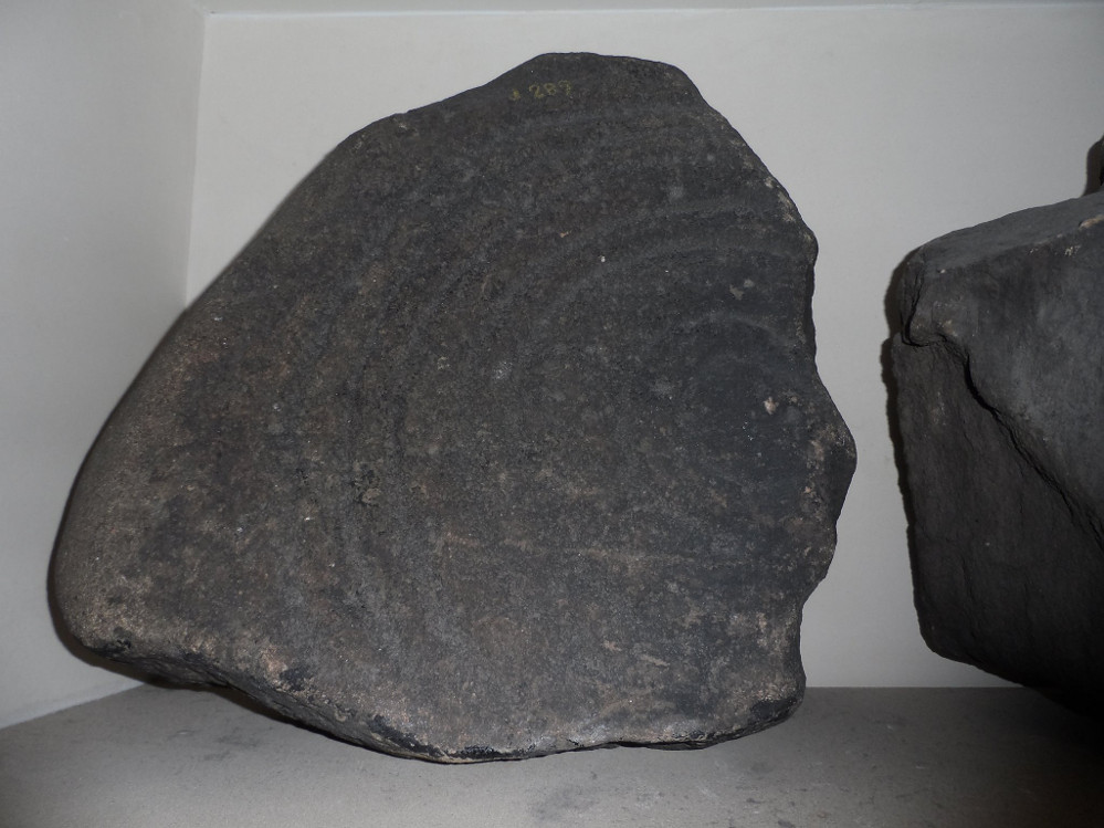
Ball Cross 2 Carving (photo by Dean Thom)
The broken piece of rock consists of a broken section of an almost archetypal ‘cup-and-ring’—although with this design, no central ‘cup’ occurs: a pattern found at several other multiple-ring stones, like the Grey Stone near Leeds. Although Stan Beckensall (1999) described this to have “8 concentric rings”, his drawing and the photo here by Dean Thom, clearly show only seven such ‘rings’. The carving presently lives in a protective box in Sheffield Museum (though beware the listing they give of the designs, as some are incorrect).
References:
Barnatt, John & Reeder, Phil, “Prehistoric Rock Art in the Peak District,” in Derbyshire Archaeological Journal, 102, 1982.
Beckensall, Stan, British Prehistoric Rock Art, Tempus: Stroud 1999.
Beckensall, Stan, Circles in Stone: A British Prehistoric Mystery, Tempus: Stroud 2006.
Cooper, Ali, Archaeology Walks in the Peak District, Sigma: Wilmslow 2010.
Morgan, Victorian & Paul, Rock Around the Peak, Sigma: Wilmslow 2001.
Stanley, J., “An Iron Age fort at Ball Cross Farm, Bakewell,” in Derbyshire Archaeological Journal, volume 74, 1954.
Acknowledgements: HUGE thanks to Dean Thom for the use of his photo, plus helpful references on this site.
This is another carving (one of three here) that was removed from its landscape setting when found during excavations of the Iron Age hillfort of Ball Cross in the 1950s, and then placed into a box in Sheffield Museum, decontextualizing it and leaving future researchers slightly in the dark as to its possible nature. In removing the carving from its site, the stone was left with additional scratches and grooves slightly damaging the stone. Not good!
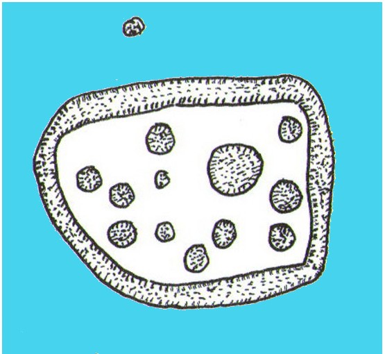
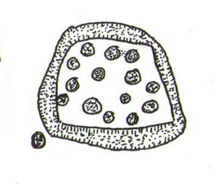
Ball Cross Carving (after Beckensall)Ball Cross Carving (after A. Cooper)
Although unlike the Ball Cross 2 and 3 carvings, the design here is structurally very similar to that found east of Gardoms Edge, with this one comprising of a large unbroken carved oval, with at least twelve cup-marks inside. Or as Beckensall (1999) described, it “has 12 cups inside a flattened ring.” Again, like the Gardoms Edge carving, a single cup-mark was etched outside of the enclosed ring. It was found with its companion carvings built into the main walled structure of the hillfort. It’s unlikely that the stones date from the same age as the hillfort: more probable that they were re-used in the structure, with their mythic nature perhaps already long forgotten…
References:
Barnatt, John & Reeder, Phil, “Prehistoric Rock Art in the Peak District,” in Derbyshire Archaeological Journal, 102, 1982.
Beckensall, Stan, British Prehistoric Rock Art, Tempus: Stroud 1999.
Beckensall, Stan, Circles in Stone: A British Prehistoric Mystery, Tempus: Stroud 2006.
Cooper, Ali, Archaeology Walks in the Peak District, Sigma: Wilmslow 2010.
Morgan, Victorian & Paul, Rock Around the Peak, Sigma: Wilmslow 2001.
Stanley, J., “An Iron Age fort at Ball Cross Farm, Bakewell,” in Derbyshire Archaeological Journal, volume 74, 1954.
Acknowledgements: HUGE thanks to Dean Thom for the use of his photo, plus helpful data on this site.
Cup-and-Ring Stone: OS Grid Reference – SK 2752 7328
Archaeology & History
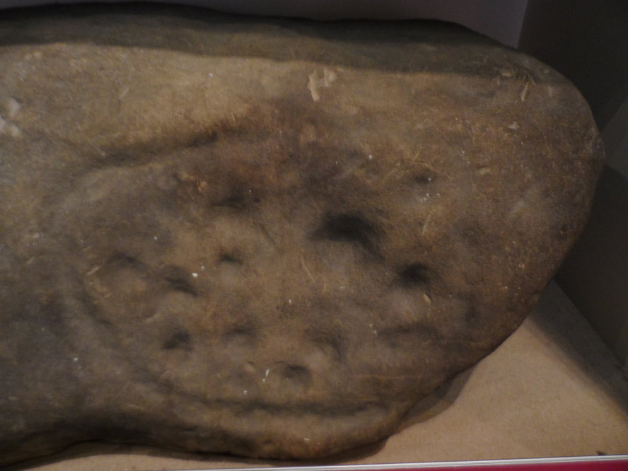
Gardoms Edge 2 carving, in Sheffield Museum (photo – Dean Thom)
This carving is one of two cup-and-ring stones that were removed from this area and transported to Sheffield Museum, decontextualizing them from their landscape presence (this should not be done unless very severe damage is happening, or their destruction is imminent). It’s quite an intriguing carving, similar in design to one found not far away at Great Hucklow, the Middleton Moor 479 carving, etc. Like many Pennine cup-and-ring stones, it was located in a prehistoric cairn field (or necropolis), with hut circles not far away too, and really should have remained in situ for the benefit of future researchers.
Gardoms Edge carving (after Beckensall 1999)
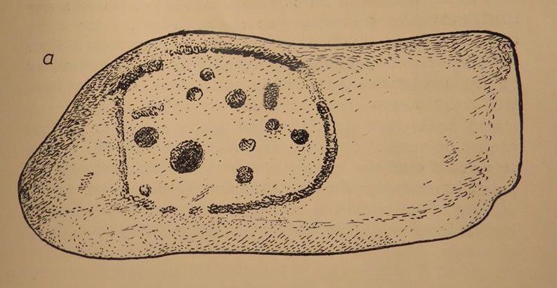
The carving was cut into one end of a small rock and comprises of a singular unbroken, large oval, within which are enclosed thirteen or fourteen cups, plus a single cup on the outside of the ring. Lunar associations may be invoked by the 13 cups, enclosed within one cycle of the year. But I’m speculating of course. It’s probable that other carvings in the area remained undiscovered.
References:
Barnatt, John & Reeder, Phil, “Prehistoric Rock Art in the Peak District,” in Derbyshire Archaeological Journal, 102, 1982.
Barnatt, John & Robinson, F., “Prehistoric Rock Art in Ashover School and Further New Discoveries Elsewhere in the Peak District,” in Derbyshire Archaeological Journal, 123, 2003.
Beckensall, Stan, British Prehistoric Rock Art, Tempus: Stroud 1999.
Beckensall, Stan, Circles in Stone: A British Prehistoric Mystery, Tempus: Stroud 2006.
Acknowledgements: HUGE thanks to Dean Thom for the use of his photo here.