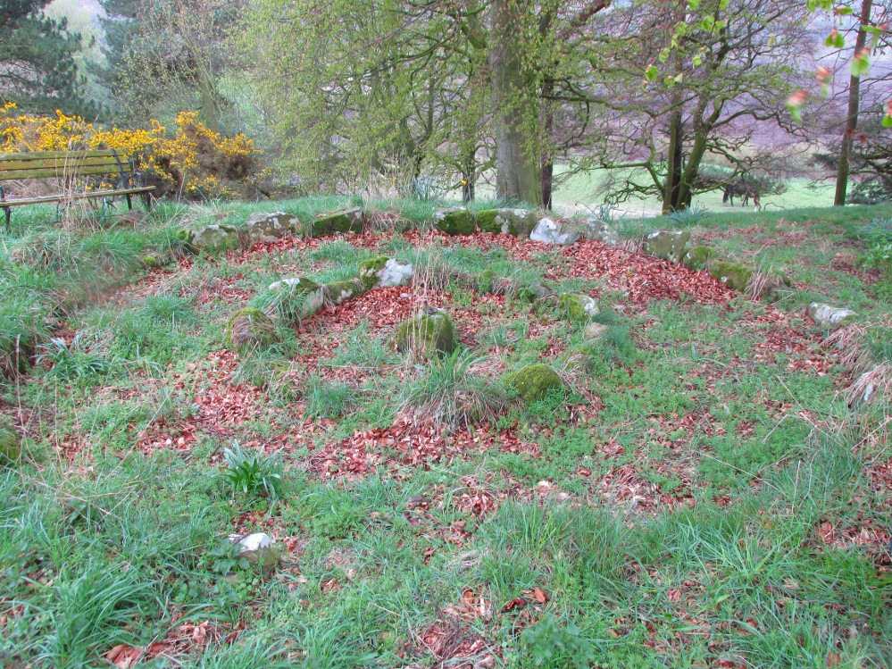
Ring Cairn: OS Grid Reference – NO 31894 21041
Also Known as:
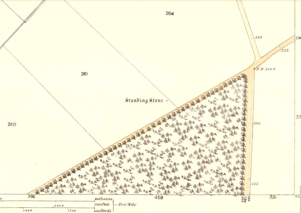
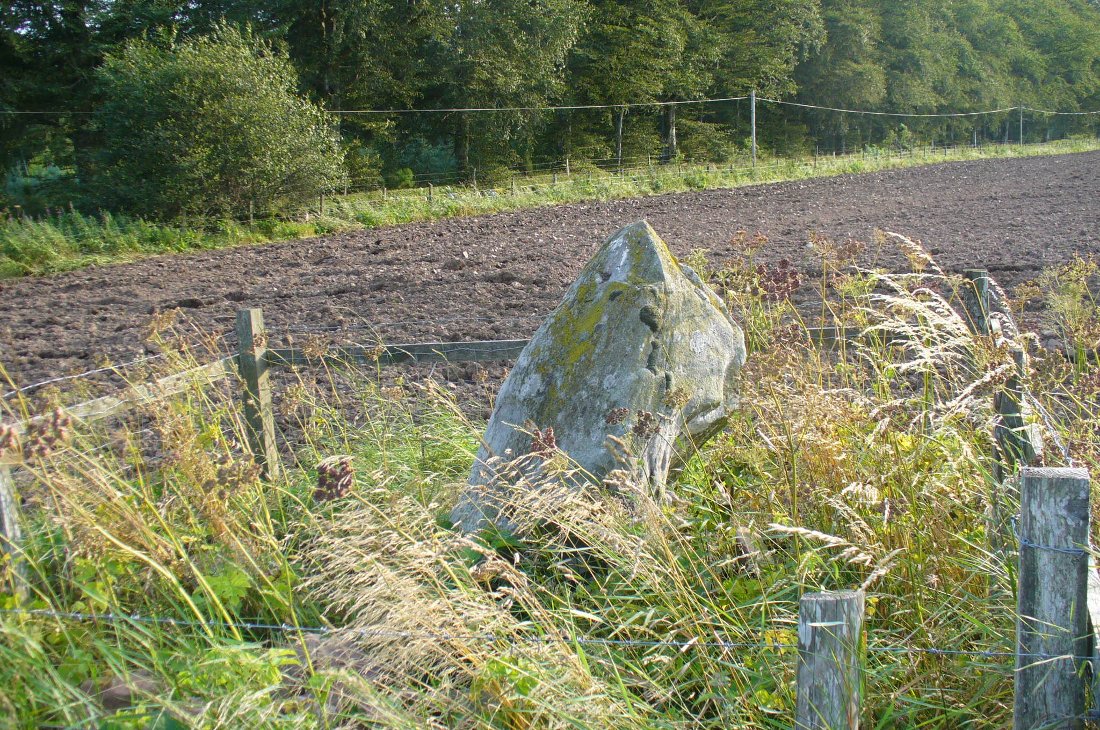
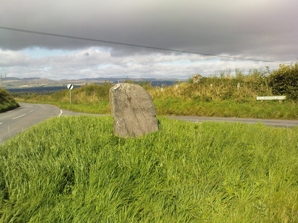
Getting Here
A variety of ways to get here, all depending on which directions you’re coming from, obviously! Simply get to the sleepy old hamlet of Brunton, SW of Creich Castle ruins, and at the north end of the village where the road hits a T-junction, turn left and stop at the next house (hidden amongst trees) a coupla hundred yards along on the right-hand side. Knock on the door of The Manse (marked as such on the OS-maps) and ask. The fella who we met here, Liam, was very helpful and guided us to the site up the far end of his garden.
Archaeology & History
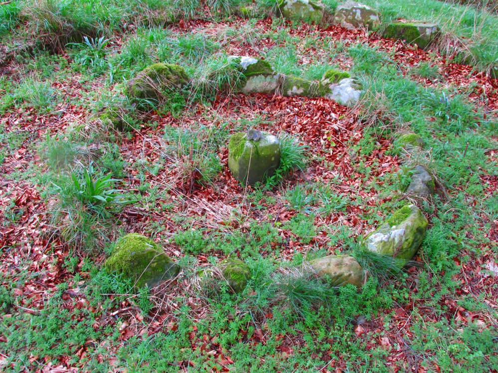
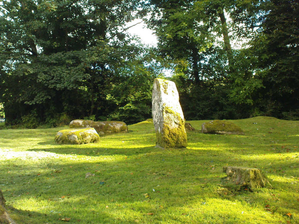
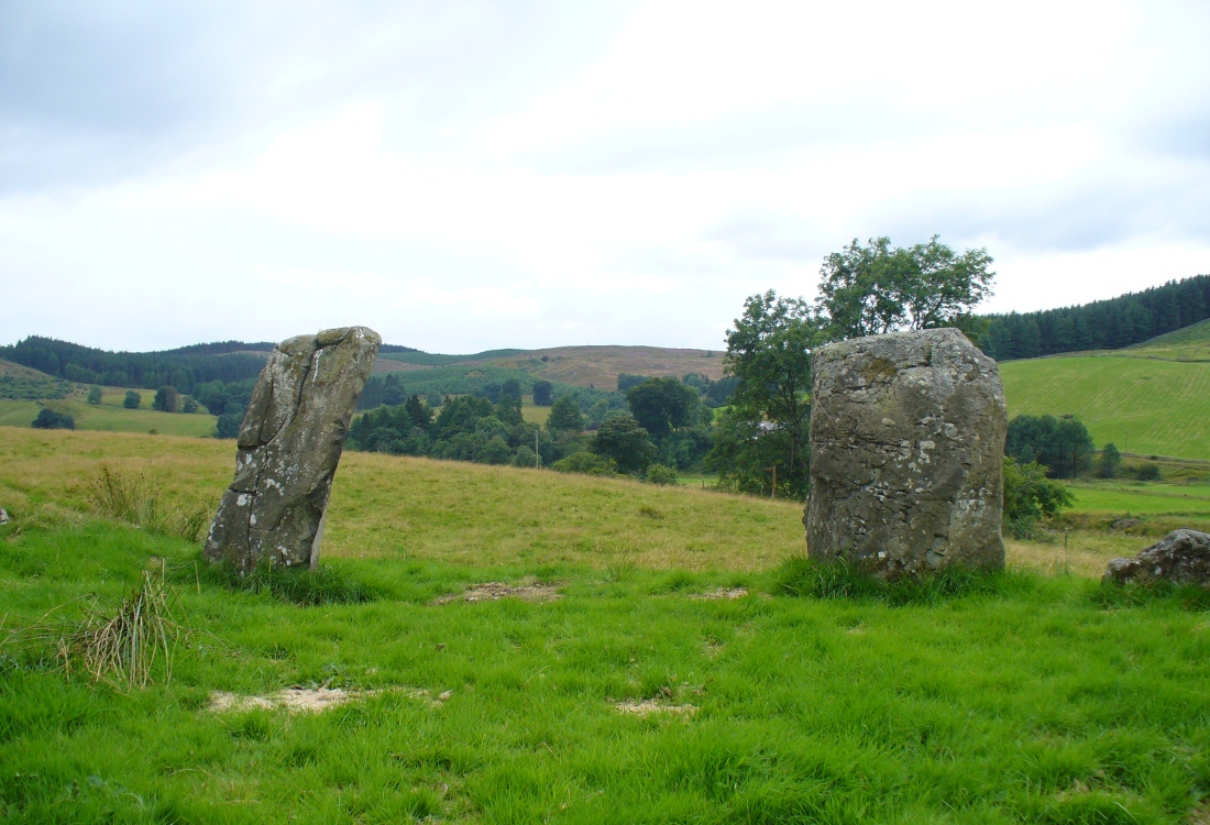
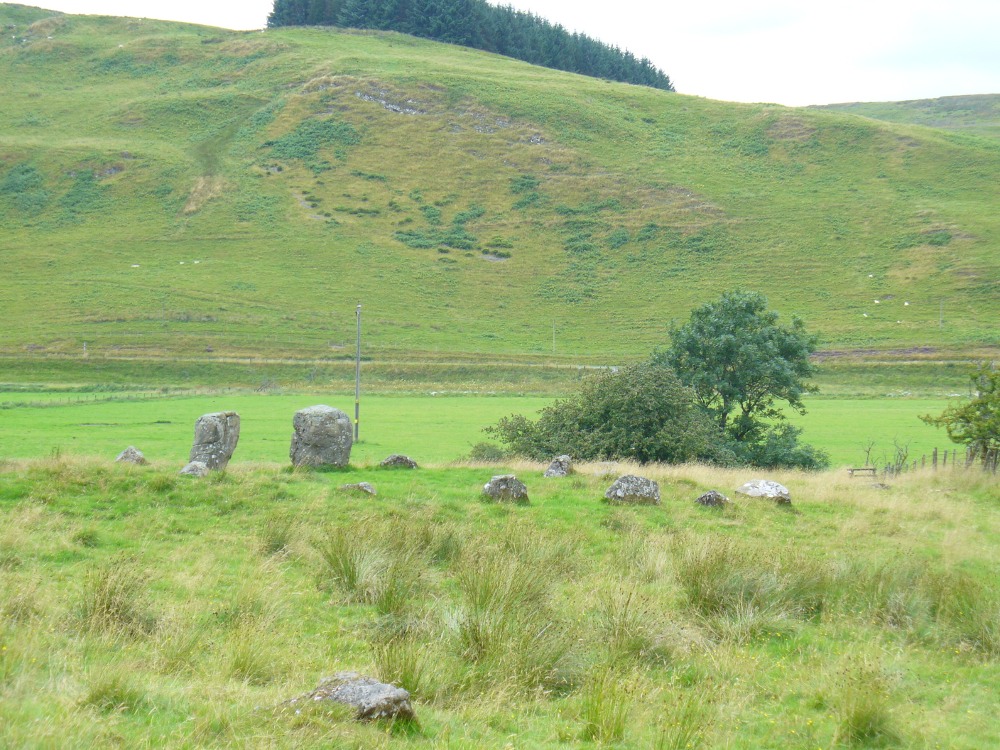
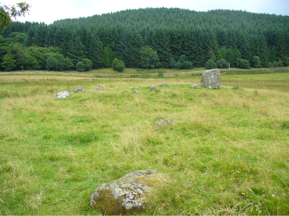
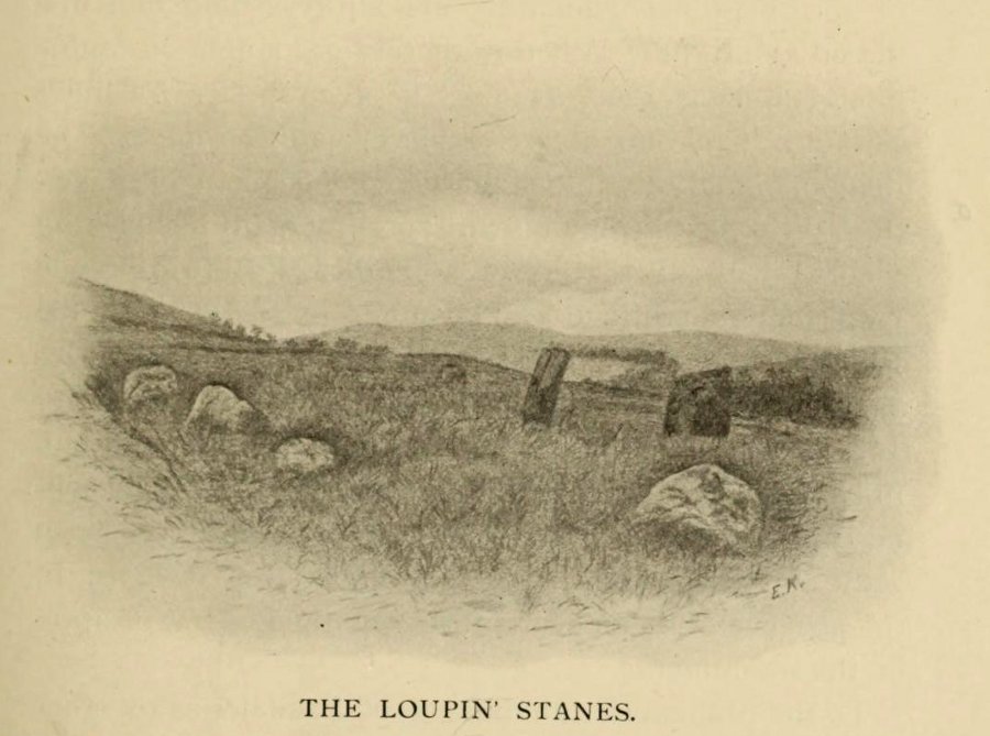
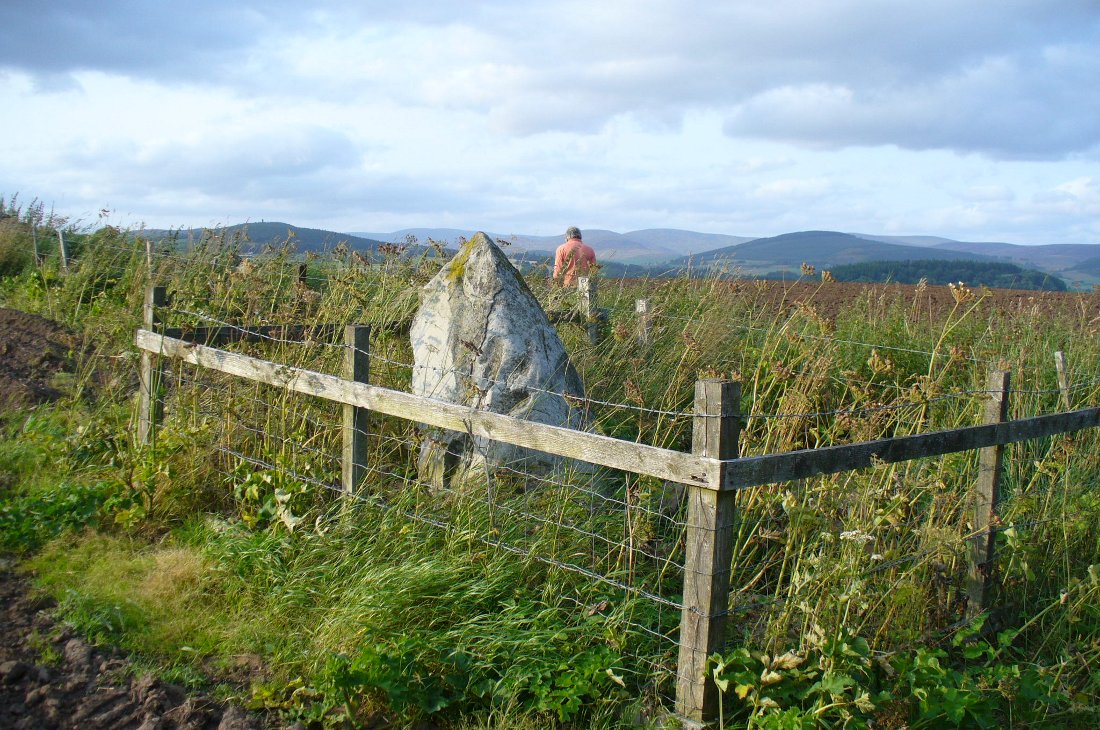
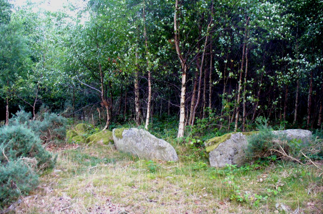
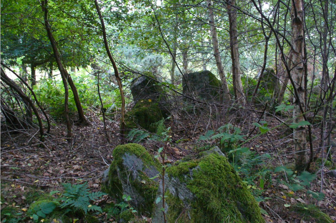
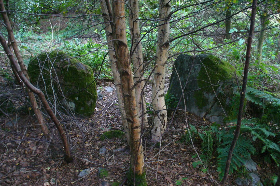
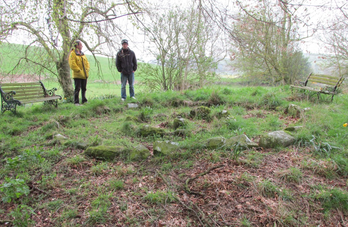
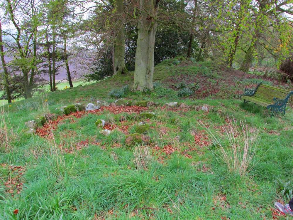
A truly fascinating and enigmatic arena for a host of reasons. The small and well-preserved ring of stones up the slope behind Creich Manse — looked after and recently cleared of covering vegetation by the present tenant — wasn’t born here, but originally lived more than a mile to the southwest, on the grounds of Luthrie House near the OS grid-reference NO 313 195. They were apparently under threat of being damaged and so, as James Taylor (1875) told, a “Mr Lawson got them removed, and placed them in a wood behind his manse in the very form in which they were found.”
Curiously omitted from the giant surveys of Aubrey Burl (2000) and other modern academics, the place was first mentioned in the New Statistical Account of the parish by Alexander Lawson. It told that in 1816 “trenching operations” were being undertaken in Luthrie village when, at some point, the men came across a curious group of stones that seemed to have faint carvings upon them — in the centre of a ring of stones! The land-owner and parish minister were called to the site and they found that a double stone circle had been unearthed. The account told:
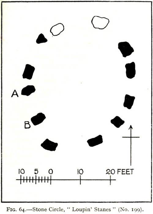
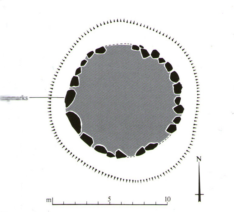
“In the centre was placed, in an upright position, a cylindrical sandstone, one foot two inches high, and having the diameter of its base one foot. Around this stone, as a centre, at the distance of three feet, were sixteen other stones, placed also in an upright position, and in the form of a circle. The stones of which it was composed were of various sizes, from fifteen to twenty inches in height; from eight to eighteen in breadth, and from four to nine in thickness. Due south of the centre, and between it and the inner circle, there were placed in a horizontal position, two stones containing hieroglyphics in alto relievo, very entire. The remaining space between the centre and the circle was laid with pavement. At the distance of seven feet and a half from the same central pillar, there was another circle of stones, thirty-two in number, placed in an upright position, and very much resembling those of the inner circle. The stones in both circles were placed close together. Between the circles there was neither pavement nor stone of any description. Neither were perfect circles, the diameter of one from north to south, being fifteen feet one inch, while its diameter from east to west was only fourteen feet nine inches; in the same manner, the diameter of the other, from east to west, was five feet ten inches, while from north to south it was it was six feet one inch.”
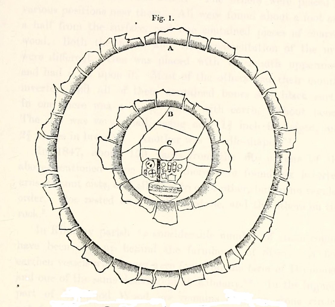
The account went on to describe there being a deposit of “burned human bones and charcoal” at the centre, below the larger of the two petroglyphs. Additionally, in one of those peculiarly common traits found at a number of megalithic remains, the Royal Commission (1933) lads pointed out that “it is remarkable that all the stones of the inner circle were of sandstone, which is not found nearer than Cupar, seven miles away, while those of the outer circle were of the local whinstone.”
Another description of the site was given in James Campbell’s (1899) updated and revised magnum opus on the parish of Balmerino, where some additional remarks were made about the petroglyphs. He told:
“Under one of the sculptured stones were found small burnt human bones and ashes. They were not enclosed in a cist, nor was there any building under the surface. Certain of the figures cut on one of the slabs of this monument are very similar to the figures on the sculptured slab of the one already mentioned. There are what appear to be representations of the soles of a pair of shoes, a circle with a cross within it — the limbs of the cross being: at right angles to each other — which may be intended to represent a wheel. On one of the stones is the figure of a spade. What the other figures represent is more uncertain. The sculptures raise difficult questions in regard to the time of the erection of these monuments. It is evident that cremation had been then practised at Creich, though the degree of culture and art indicated by the sculptures seems to point to a time subsequent to the abolition of this pagan custom elsewhere.”
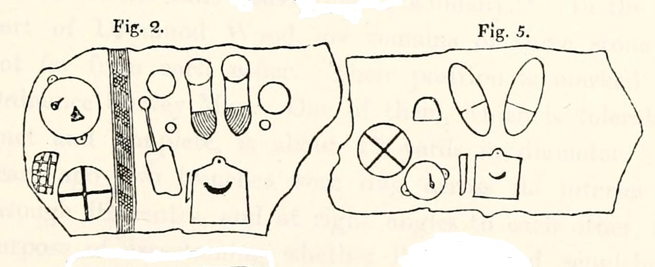
The carvings illustrated here are pretty unique in terms of them being standard prehistoric petroglyphs, as they seem to comprise more of a mix of Iron Age and Romano-British designs – though potentially we must take into account that they could be a form of Pictish. This region is littered with the remains of Picts, in place-names, folklore and archaeology. As such, it would be very helpful if someone qualified in Pictish studies could examine these designs. We do find petroglyphs of similar forms to this in Bronze Age Scandinavia and Iberia − but not Fife!
Folklore
In the only account of any folklore relating to this site, James Campbell (1867) told that local people said the place was “supposed to have marked the tombs of distinguished chiefs.”
References:
- Burl, Aubrey, The Stone Circles of Britain, Ireland and Brittany, Yale University Press 2000.
- Campbell, James, Balmerino and its Abbey – Volume 1, William Blackwood: Edinburgh 1899.
- Lawson, Alexander, “Ancient Circles of Stone Discovered Under Ground in the Parish of Creich,” in Edinburgh Magazine and Literary Miscellany, November 1817.
- Lawson, Alexander, “Notes of Urns and Sepulchral Monuments Discovered at Various Times in the Parish of Creich, Fifeshire,” in Proceedings of the Society of Antiquaries, Scotland, volume 7,
- Royal Commission on the Ancient & Historical Monuments of Scotland, Fife, Kinross and Clackmannan, HMSO: Edinburgh 1933.
- Taylor, James W., Historical Antiquities of Fife – volume 1, Johnstone Hunter: Edinburgh 1875.
© Paul Bennett, The Northern Antiquarian