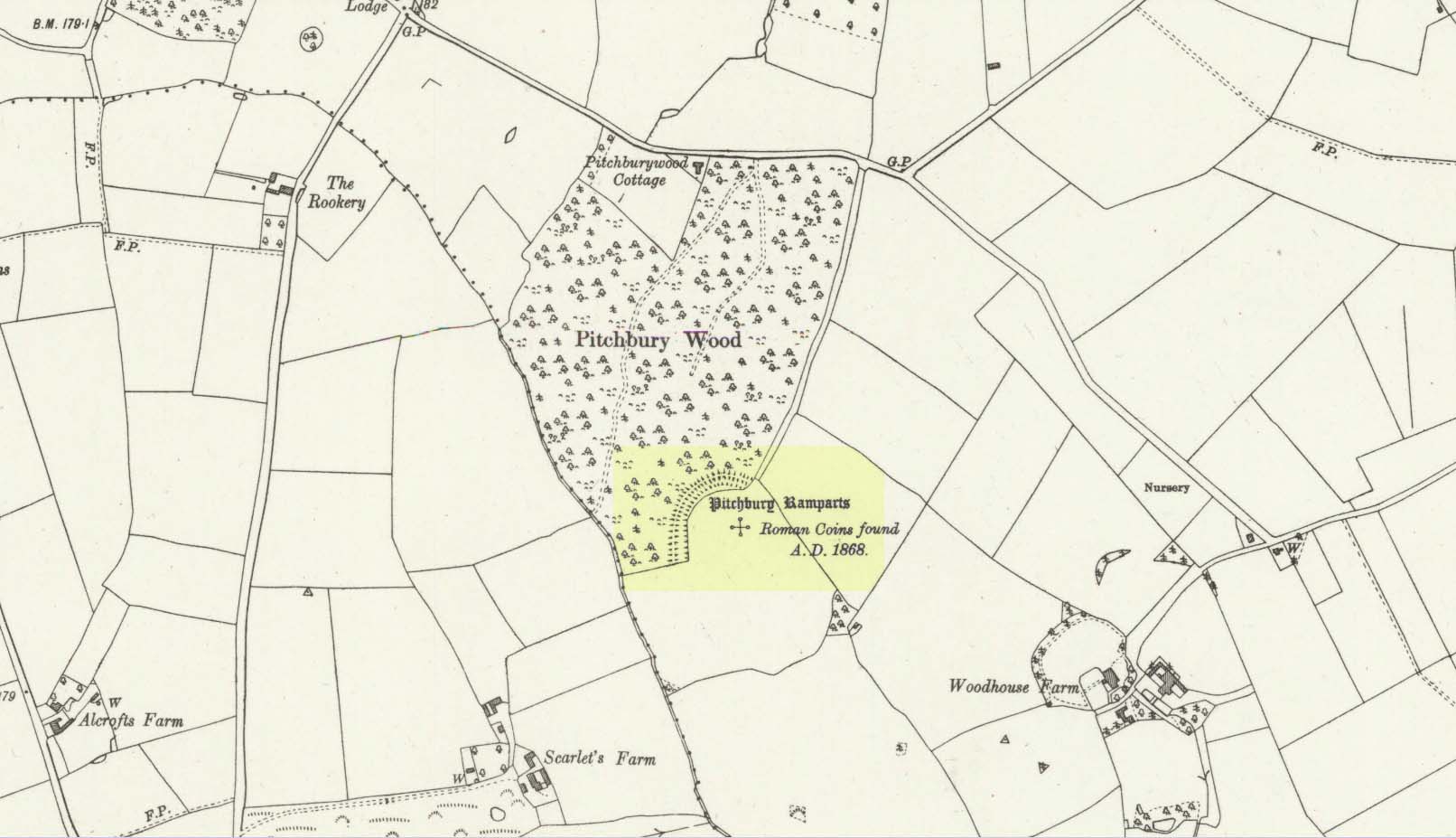
Along the A134 in Horkesley Heath, turn west along Coach Road and after a half-mile where it veers right, keep going for another half-mile where you’ll reach the woodland on your left. A path goes into the trees just before Pitchbury Lodge. Go along here and near the very far (southern) end of the trees, just before the open fields, you’ll see the large undulating ramparts of earth. Keep your eyes peeled. You’ll see them!
Archaeology & History
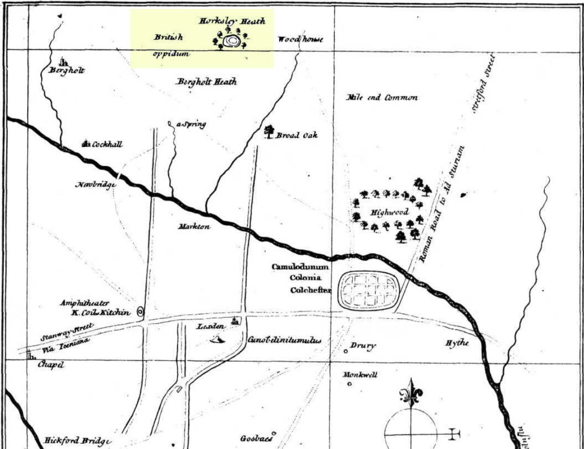
Stukeley’s 1759 map
This once large hillfort was described in the Colchester township perambulations of 1671 and cited in Philip Morant’s classic work. (1748) He told how the boundary line ran “under Chesterwell along the Rampiers by Horkesley Heath,” and which P.H. Reaney (1935) tells was our wooded hillfort. In Morant’s day, the place was all but complete and so would have been well recognised by local people. Certainly it came the attention of the great antiquarian William Stukeley who, in 1759, came to Colchester and met with Morant. Stukeley mainly surveyed the area south of here, at Lexden Heath, but one of his sketch maps clearly highlighted a place he called “a circular work on Horkesley Heath”, i.e., Pitchbury Rings. The site seems to have remained relatively intact until the middle of the 19th century when a local land-owner took it upon himself to plough over and vandalise much of the site, leaving only a small proportion of the earthworks that we can still see to this day.
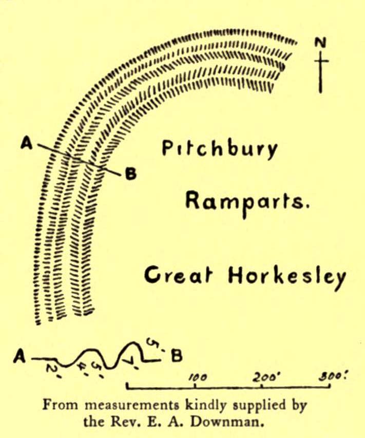
The ruins were described in I.C. Gould’s (1903) piece for the Victoria County History, where he told, at Great Horkesley,
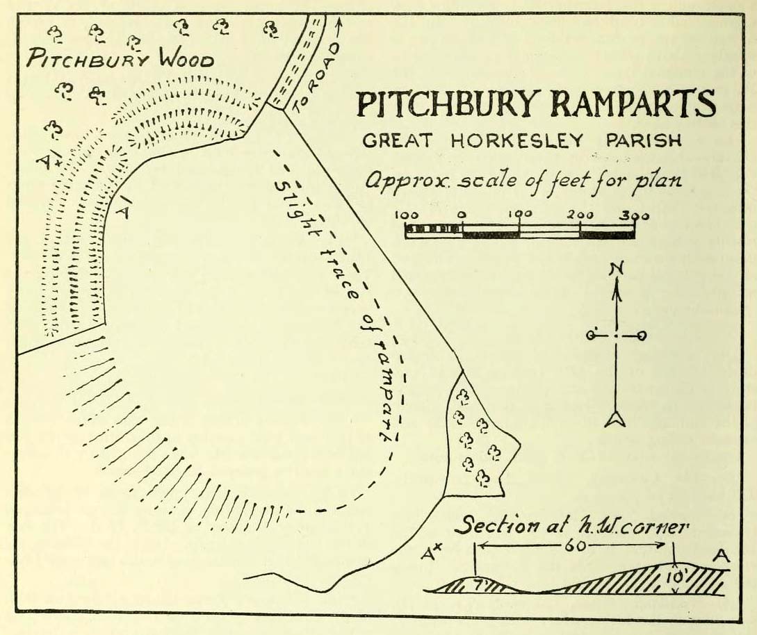
Gould’s 1903 sketch of the remainsRoyal Commission’s 1923 ground-plan
“are some remains of an earthwork known as ‘Pitchbury’ or ‘Pitsbury Ramparts.’ When the late Rev. Henry Jenkins described the camp in 1841, he stated that it was of oval shape, and contained about 6 acres. Most of it was levelled for agricultural operations about fifty years ago, but there are still some remains, consisting of two banks with their accompanying ditches. The lines moreover of that part which was destroyed, can be partially traced in the adjoining fields.”
When the Royal Commission (1922) doods wrote about the site nearly twenty years later, things hadn’t changed too much and they simply reported how the “ramparts have nearly disappeared, except for the north section.” In this “imperfect” condition, as they called it, they gave the following brief description:
“Pitchbury Ramparts, in Pitchbury Wood, about 2 mile south of the church, are the north end of a large camp, roughly oval in shape, and defended by a double rampart and ditch. The defences are well preserved in the wood, the inner rampart being 10 ft. above the ditch, which is 60ft wide from crest to crest, but the greater part of the work has been almost obliterated by the plough, and is now only faintly discernible in a large field S. of the wood. The camp appears to have been 800 ft. long and 600 ft. wide.”
Thankfully there seems to have been no real increase in damage to the site since then. It was excavated in some detail in 1933 and again in 1973 and the finds were published by the highly reputable Colchester Archaeological Trust, whose subsequent report by Hawkes & Crummy (1995) is required reading for anyone wanting to know the detailed archaeology of this and other sites in the area.
Folklore
An intriguing piece of folklore was described in John Round’s (1882) history of the early battles around Colchester Castle. During the time when the Roman Empire was starting to crumble, the great Pictish tribes of Scotland ventured here and, we are told, took control of the Pitchbury Rings where they stayed before attacking Colchester Castle.
“Traces have been discovered of some violent catastrophe, possibly the first capture of the Colony by the marauding Picts from the North. Allured, in one of their Southern raids, by the wealth of the goodly Colony, they swooped down like eagles on their quarry from the wooded heights of ‘Pictsbury’.”
References:
Gould, I. Chalkley, “Ancient Earthworks“, in Victoria History of the County of Essex – volume 1, Archibald Constable: Westminster 1903.
Reaney, P.H., The Place-Names of Essex, Cambridge University Press 1935.
Watson, J.Y., Sketches of Ancient Colchester, Benham & Harrison: Colchester 1879.
Acknowledgements: Big thanks for use of the 1st edition OS-map in this site profile, Reproduced with the kind permission of the National Library of Scotland.
The exact location of this site seems to have been lost. One possible candidate is on the south-side of the village where remains of a large moat exists, meaning that there was a good water supply here to maintain its existence. But this is pure guesswork on my part. The well was mentioned briefly in R.C. Hope’s (1893) classic book where he told us:
“There was a holy well or spring in the village of Holwell, on the borders of Bedford and Hertfordshire; unfortunately both history and site have been forgotten by the villagers at Holywell.”
The site was mentioned as far back as 1086 CE in the Domesday Book as ‘Holewelle’. The place-name authorities Gover, Mawer & Stenton (1938) tell us this derives from a “spring in the hollow” and not a holy well as subsequent writers profess. The only thing that could perhaps fortify the ‘holy’ element is that in some instances early citations of holy wells are written as holi- wells, which this may have been. As all historians know, early spellings of sites are far from accurate.
References:
Gover, J.E.B., Mawer, Allen & Stenton, F.M., The Place-Names of Hertfordshire, Cambridge University Press 1938.
Hope, Robert Charles, Legendary Lore of the Holy Wells of England, Elliott Stock: London 1893.
Smith, A.H., English Place-Name Elements – volume 1, Cambridge University Press 1956.
Holy Well (lost): OS Grid Reference – SW 6602 2053
Archaeology & History
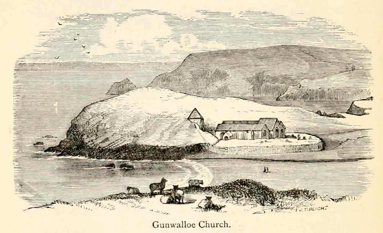
The old church at this headland just above the sea was, said Padel (1988), dedicated to Saint Gunwalloe or Winwalloe in 1332 and is thought to have been the character (a hermit by all accounts) who deemed this well to be ‘holy’. In Alfred Cummings (1875) history of Gunwalloe parish, he devotes a short but singular chapter to this holy well which, according to most accounts, has fallen back to Earth. It was found, said Cummings, “close to the church porch, only a few feet over the precipitous rock…and (was) doubtless the resort in former days of many a lad and maiden.”
Yet even in his day, he lamented its loss, telling that.
“The spring that once bubbled up in its rocky basin is no longer there; sand and stones fill up the well at each high tide, and though occasionally cleaned out for the satisfaction of the wayfarer’s curiosity is yet only an imperfect semblance of its former self.”
Yet remnants of practices and traditions of the well were thankfully remembered:
Gunwalloe church in 1885
“That Gunwalloe was considered by the country folk a well of some importance there can be little doubt, for one day in the year, which was called Gunwalloe Day, was set apart for cleaning out this holy well — it was quite at a different time of year to this parish feast — and now only remembered by two old men out of the whole population of the place.
“They fix the time in their memories as the period of tilling barley, for they recollect that on this Gunwalloe Day it was the custom for the men to mend all the cliff roads (doubtless these were useful in days of smuggling when a successful run was a desirable thing), and so strictly was it kept that, if any were found labouring in the fields, a party would go and take them by force, and press them into the service of the holiday makers, who, having mended the roads and cleared the holy well at Gunwalloe, wound up the day with merriment and revelry.”
Such practices are long since gone of course and, so most modern accounts would tell us, the holy well with it. But when J. Meyrick (1982) came looking for the site on the summer solstice of 1980, he seemed a little more fortunate than his predecessors. Located just a few yards from the detached church tower, he spoke with a
“Mrs Wilson, a churchwarden (who) told me that in heavy rain the tower continues to be flooded so the spring is still somewhere about, and curiously enough by the stile to the beach is a small granite trough with rainwater put there by someone no doubt in lieu of the Well and who is to say that the water is not holy! The stream across the dune still meanders a few feet beneath the tower and into this the water from the well would have run, but there seems now no sign of an originating spring in the rocks around.”
Folklore
The church itself possesses a folktale found up and down the land. “It is said,” wrote Blight (1885),
“that the builders intended to erect the church on higher ground, nearer the centre of the parish, at Hingey; but as fast as materials were brought to the place they were, by some mysterious agency, removed during the night to the present site. And here the church was built, it being found useless to contend with a supernatural power.”
The supernatural agencies that are nearly always responsible for such actions tend to be the devil, fairies or other types of little-people.
References:
Blight, J.T., Churches of West Cornwall, Parker: London 1885.
Holy Well (destroyed): OS Grid Reference – TQ 332 911
Also Known as:
My Lady’s Hole
Archaeology & History
Long since gone after drainage operations on Tottenham Cemetery made the waters dry-up, this was one of several holy wells in the Tottenham area. Its history has been described in various old tomes, but the most definitive is found in William Robinson’s (1840) classic on the parish of Tottenham, when the well was still visible. He told us:
“There is a spring which issues from the side of a small hillock on the south side of the Moselle, nearly opposite the Vicarage, leading thence to the Church, called Bishop’s Well. This spring was formerly considered famous for many strange and wonderful cures performed on the diseased by the use of this water. It has been for some years neglected, but of late the owner of the field in which this well is, had it cleansed, and planted some trees round it, and put up posts and rails to prevent the cattle treading down the sides of it. It is said that the water of this well never freezes. In former times this well was in great repute from the purity of its water. The ladies in the vicinity of it were accustomed to send their servants in the morning and evening for water for their tea, from which circumstance it was for many years known by the name of “My Lady’s Hole.” The water of this well is not only esteemed for its medicinal qualities, but particularly for curing disorders of the eye.
“There were formerly many other springs about the village, especially one which issued out of the hill on which the Church stands; and another in Spottons Wood otherwise Spottons Grove, on the north side of Lordship Lane, which in the fifteenth century was of considerable notoriety; but none of which have in former times been so much frequented and held in such repute as Bishop’s Well.”
(Please note: the grid-reference for this site is an approximation)
References:
Foord, Alfred Stanley, Springs, Streams and Spas of London: History and Association, T. Fisher Unwin: London 1910.
Hope, Robert Charles, Legendary Lore of the Holy Wells of England, Elliott Stock: London 1893.
Round Barrow (destroyed): OS Grid Reference — SU 1510 4330
Also Known as:
Durrington 70
Archaeology & History
Cunnington’s sketch of the barrow remains
This was one of four ploughed-out round barrows (or ‘ring ditches’ in modern archaeo-jargon) that once existed immediately southeast of the well-known Woodhenge and was the closest of the four to the monument, being just 60 yards away. It was first noticed as a faint crop mark in an aerial survey photograph taken in 1926 of the fields hereby. When it was investigated at ground level by Mr & Mrs Cunnington in August 1928, “no trace could be detected on the surface” of any extant monument—which they described as ‘Circle IV’ in their superb survey.
The Cunnington’s (1929) account of the excavation they did here was pretty brief, telling:
“The soil was removed and the chalk brushed over that part of the area enclosed within firm lines. Beyond a few shards of pottery in the soil, nothing whatever was found. As the ditch was comparatively shallow and the filling-in was in patches dark in colour, with much ash and some burnt flints in it, a considerable length was dug out, as shown (in the sketch, above). A few fragments of pottery similar to some of that from Woodhenge were found in and below the old turf line.
“The only find of interest was that of a piece of glass slag on the actual bottom of the ditch. It is true it was at the shallowest point, but there was no evidence of disturbance.
“Conclusion — Like those of the other rings (Woodhenge Circles 1, and 3, PB) this ditch may have originally surrounded a Bronze Age burial, placed on the surface and covered with a mound, both of which were destroyed when the ground was levelled.”
References:
Cunnington, M.E., Woodhenge, George Simpson: Devizes 1929.
Royal Commission Historical Monuments, England, Stonehenge and its Environs, Edinburgh University Press 1979.
Wainwright, G.J. & Longworth, Ian, Durrington Walls: Excavations 1966-1968, Society of Antiquaries: London 1971.
Round Barrow (destroyed): OS Grid Reference — SU 1511 4327
Also Known as:
Durrington 69
Archaeology & History
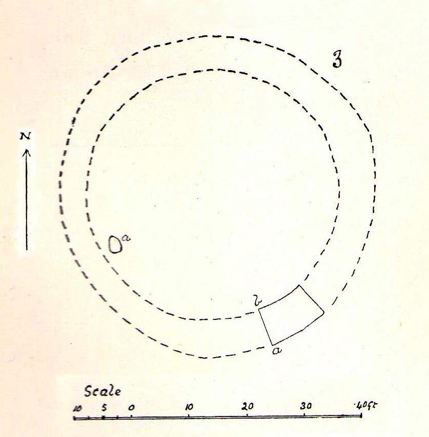
Cunningham’s sketch of Woodhenge-3 barrow
This was one of four ploughed-out round barrows (or ‘ring ditches’ in modern archaeo-jargon) that once existed immediately southeast of the well-known Woodhenge complex, constructed approximately 95 yards away. As with others in this field, the site was first noticed as a faint crop mark in an aerial survey photograph taken in 1926. When it was subsequently investigated at ground-level by Mr & Mrs Cunnington in August 1928, “no trace could be detected on the surface” of the monument in question—which they described as ‘Circle III’ in their superb survey.
Very little was found in the Cunnington’s (1929) excavation, as their following brief account indicates:
“The soil was removed and the surface of the chalk brushed, over the whole of the area enclosed within this ditch.
“Only one small oval-shaped hole was found, near the edge of the ditch at “a” (above), 33in x 22in, and only 5in deep in the chalk; in it were a number of fragments of bones of a small ox and pig, a piece of burnt clay and a flint scraper weathered white.
“As there was nothing dateable in the circle it was not thought worth while to excavate more than a short section of the ditch. Pottery comparable with that found at Woodhenge came from the old turf line and from the bottom of the ditch.
“Conclusion — Like those of the other circles (Woodhenge circles 1, 2 and 4, PB) it is probable that this ditch was originally made round a Bronze Age burial that had been placed on the surface, and that it was destroyed together with the covering mound when the ground was levelled.”
References:
Cunnington, M.E., Woodhenge, George Simpson: Devizes 1929.
Royal Commission Historical Monuments, England, Stonehenge and its Environs, Edinburgh University Press 1979.
Wainwright, G.J. & Longworth, Ian, Durrington Walls: Excavations 1966-1968, Society of Antiquaries: London 1971.
Sacred Well (lost): OS Grid Reference – SP 664 733
Archaeology & History
It’s difficult to know precisely which category this site should come under: sacred well or just a healing well. I’ve opted for ‘sacred’, due to its peculiar and rare properties, i.e., turning things into stone. For a spring to do such a thing would have been seen by our ancestors as it having some sort of magickal or supernatural ability. Sadly however, it seems that all trace of this well has long since gone.
It was described only in passing in Peter Hill’s (2005) folklore survey of Northamptonshire, to which he gave no reference. He told us simply,
“Guilsborough had a petrifyiong spring near the Grange, which was ‘good for several diseases.”
None of the early OS-maps of the area show any such ‘well’ immediately in or around Guilsborough’s Grange and so I surmise (perhaps in error) that one of the two ponds to the south of the Grange is fed by the spring in question. It would be good to know for certain!
References:
Hill, Peter, Folklore of Northamptonshire, Tempus: Stroud 2005.
Tumulus (destroyed): OS Grid Reference – TQ 1686 4958
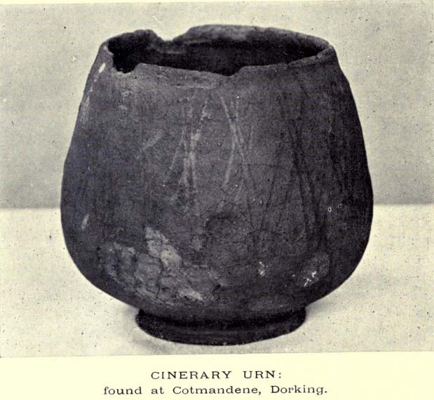
The Cotmandene urn
Archaeology & History
Highlighted on the 1914 OS-map (as ‘Site of’), nothing now remains of the prehistoric structure that either covered or surrounded the ancient burial urn, found fortuitously by a Mr Turner in the garden of Southdown Cottage at the beginning of the 20th century. Believed to be either Iron Age or Romano-British in origin, the find was noted by Mr Malden (1913) in his brief in the Surrey ArchaeologicalCollections, who wrote:
“Early in 1913 it came to my knowledge that some years ago some discoveries had been made in the garden of a house on Cotmandene, Dorking. Mr Turner…was digging for sand in his garden when he found a small cinerary urn (see illustration), with ashes in it. The height is only 5 inches, the diameter across the top about 4 inches, but at the widest part 5⅜. The urn is so small that it probably contained the ashes of a child: it is wheel-made, but badly; the diameter is not precisely the same across the top from every direction: Mr Reginald Smith attributes it to the first century BC. Some fragments of other urns were found. Mr Turner has kindly presented the whole specimen to the Society’s Museum. At a lower depth in the same garden were numerous flints, some implements, many flakes, and traces of a hearth with several burnt stones. These clearly belonged to an earlier date, considerably, than the interments, but as the finds were made about 1906-7, and not investigated till this year, it is impossible to be precise about the depth at which they occurred.”
References:
Malden, H.E., “A Cinerary Urn and other Matters found at Dorking and Betchforth,” in Surrey Archaeological Collections, volume 26, 1913.
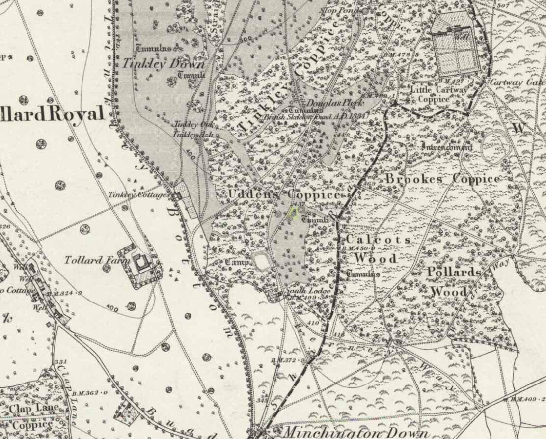
In what today seems a barely visible tumulus, amidst the large cluster that could once be found upon the large estate grounds of Rushmore House, were once the overgrown ruins of an old tumulus. It seems to have been rediscovered in the 19th century, when the legendary antiquarian, General Pitt-Rivers, moved onto the huge estate. It was all but hidden even in his day, he told, but being “of such slight elevation that, like many others, it had never been noticed.” It was the first of all the barrows they excavated on his Estate, and is to be found “near the house on the south side of the lower south coach road.”
So, in 1880, he got some of the estate lads to help him and Rolleston start a dig into the old tomb – and they weren’t to be disappointed. It wasn’t anything special, but it was the first amongst many hereby. In Pitt-River’s (1888) massive tome on the prehistory of the region, he told us:
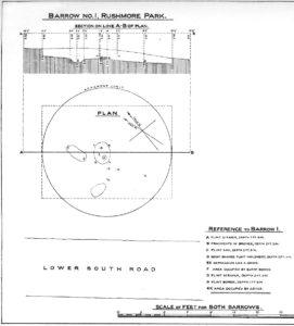
“This was the first barrow opened at Rushmore, on the 10th August, 1880. Professor Rolleston and the Rev. H. Winwood were present at the opening. The elevation was so slight that it had hitherto escaped notice. In the centre, 1 foot 6 inches beneath the crest, a layer of charcoal and ashes, 9 feet by 6 feet, was found containing a burnt body. The body appears to have been burnt on the spot, and not gathered up after cremation, but a mound raised over the funereal pile. A few fragments of bronze, probably the remains of some implement which had corroded or been burnt, were found in the ashes, and in the body of the barrow two flint scrapers, a well-formed flint borer, and a boat-shaped flint…were found (see illustration above, PB). A few scattered fragments of pottery found in the barrow were of a superior and harder baked quality than is usual in barrows. No trace of a ditch was found around the barrow, but towards the north of the centre, a depression—EE on plan—which might, or might not, have been a grave, but filled with mould and without remains, was discovered. The barrow is undoubtedly of the Bronze Age, and is interesting on account of it being the last at the opening of which Professor Rolleston assisted shortly before his death.”
As a result of this, he decided to name to barrow after his old friend and also planted a beech tree on top of it in remembrance of him.
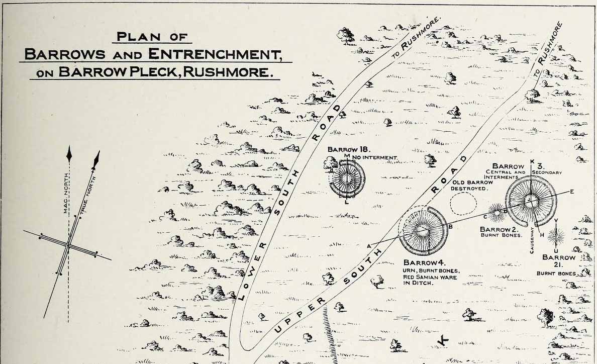
This long-lost burial mound was one in a large group of prehistoric tombs that were explored in the 19th century by the legendary antiquarian, General Pitt-Rivers. It had already been destroyed before the General came to live on his Rushmore estate in southern Wiltshire, but thankfully, his diligence as an inquirer prevailed and he was able to recover at least something of the old site. Shown on the 1889 OS-map of the area (despite already having been destroyed), in Pitt-River’s (1888) extensive writings he told how, in the scattered woodlands hereby, was
Pitt-Rivers 1888 site-mapOld Pleck Barrow urn
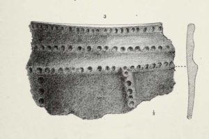
“a collection of large barrows near the South Lodge. They were covered with a thick grove of hazel and other underwood. One of the barrows—marked by a dotted circle (see sketch-map, left, PB)—had been destroyed before my arrival at Rushmore in 1880. The earth of the barrow had been removed and a good urn found in it, which had been broken and scattered, but I was fortunate enough to recover one of the fragments which had been preserved by the estate carpenter.”
From a sketch that was made of the urn remnant, Pitt-Rivers told how “the character of its ornamentation” resembled that on another urn found in one of the nearby tumuli.
References:
Pitt-Rivers, A.H.L.F., Excavations in Cranborne Chase, near Rushmore – volume 2, Harrison & Sons: London 1888.