To search for any sites in the northern counties of England (previously known as Brigantia), click on the list of relevant counties, below. Please note that not all these english counties were truly in Brigantia, but they came close to its southern edges; and as parts of them tickle the edges of the southern Pennines, I thought they should be included. Hope that’s OK with everyone!
Cross (destroyed): OS Grid Reference – SE 3071 3463
Archaeology & History
In James Wardell’s (1890) work on Kirkstall Abbey he describes several of the long lost stone crosses that used to exist in the area. This one,
“formerly stood by the road side at the south end of Sheepscar Bridge, in Leeds.”
The cross had already been destroyed by the time the Ordnance Survey lads explored the area in the 1840s, as there’s no showing of it on any of their maps. Wardell further stated that it was,
“called Killingbeck Cross, from being erected by either the Abbot of Kirkstall or the Vicar of Leeds, of that name.”
References:
Wardell, James, An Historical Account of Kirkstall Abbey, Yorkshire, S. Moxon: Leeds 1890.
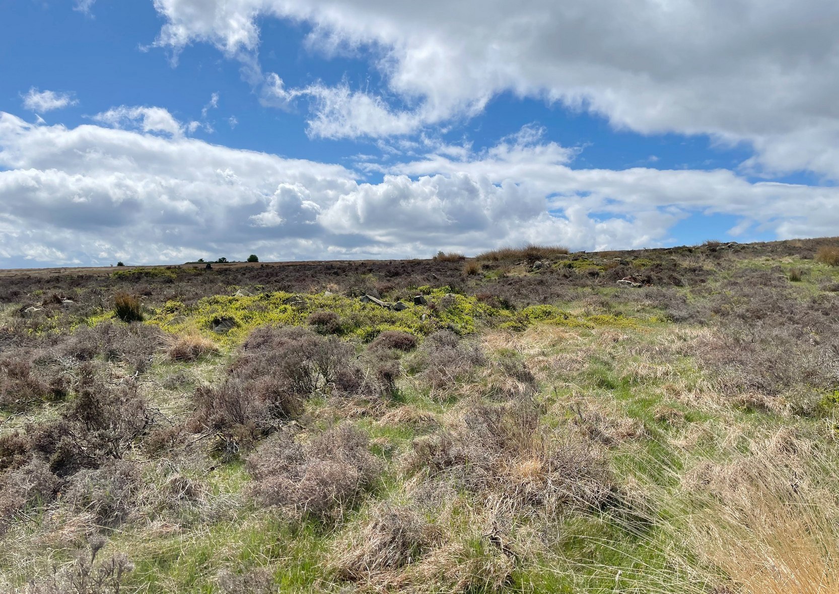
Park up at the singular dusty car-park on the east-side of Askwith Moor Road. If you walk to the sloping eastern edge of the car-park and then go down and over the collapsed fence onto the moorland immediately east, walk in the direction of the Tree of Life Stone to the north-east (be aware that there’s no footpath here and it’s boggy as fuck in places) . Just over halfway towards the carving, nearly 400 yards from where you’ve parked, you’ll begin to see various ruinous piles and scatters of stone. You can’t really miss them!
Archaeology & History
Cairn, looking north
In a region teeming with prehistoric sites, the great Eric Cowling (1937) seems to have been the person who stumbled across this “barrow group”, as he called it, during one of his rock art forays in this neck o’ the woods. Little has been written of them since. Not to be confused with the Snowden Moor cairnfield more than 350 yards to the north, at this place we find at least a dozen quite distinct cairns scattered around the grid-reference cited, most of them much larger in size than the cairns to the north, ranging between five to twelve yards across and up to three feet high. They have all been opened and robbed, with considerable disturbance on the largest of the ‘barrows’. We know not who may have done this, but there’s been a history of quarrying close by and it may have been some of the workmen who did the damage, knowingly or otherwise.
Large scatter of cairn-spoilCairn covered in bilberries!
As far as I’m aware, no burial or funerary remains have been found here—but there’s been negligible archaeological attention given to any of the sites on this moorland, meaning that we can draw no real conclusions about the nature of the cairns. They seem to be far too large to be clearance cairns; and the proximity of large scale prehistoric settlements and rock art all round here would strongly suggest they possessed a funerary nature. Several impressive petroglyphs exist right at the edge of this group, literally yards away from them. Check them all out out the next time you see the Tree of Life stone…
References:
Cowling, Eric T., ‘Cup and Ring Markings to the North of Otley,’ in Yorkshire Archaeological Journal, volume 33 (part 131), 1937.
Cowling, Eric T., Rombald’s Way: A Prehistory of Mid-Wharfedale, William Walker: Otley 1946.
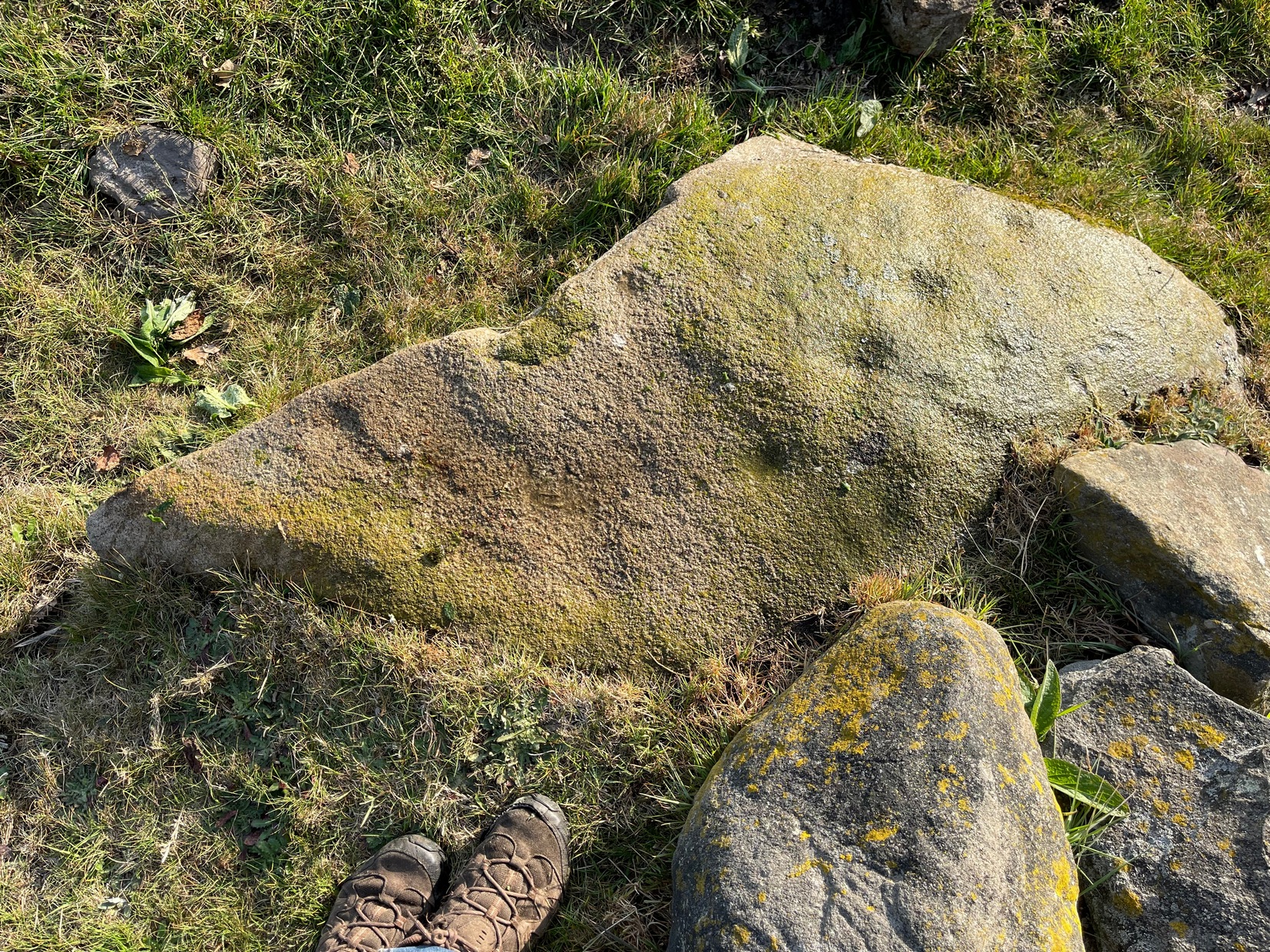
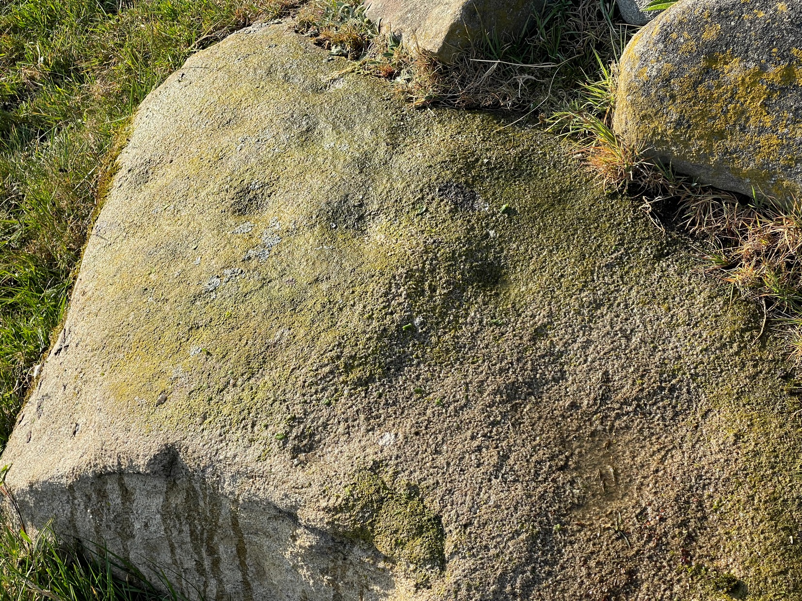
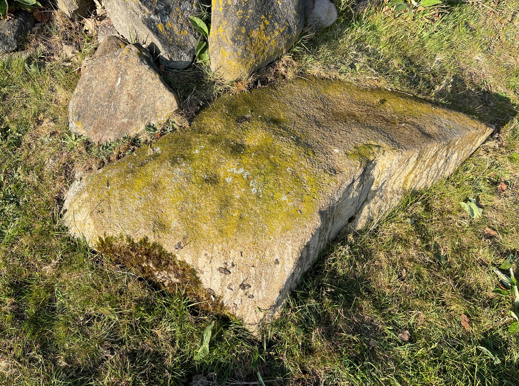
If you’re looking for this carving, you’ll have been to the impressive Tree of Life stone first. From there, you need to walk further away from the walling, 30-35 yards southwest, across the other side of the footpath. There’s a scattered mass of stones all over the ground here: you’re looking for a low-lying long curved stone—longer than most of them hereby. If the heather’s grown back over the stone, it might take some finding!
Archaeology & History
Close to a line of prehistoric walling (seemingly a section of a settlement), this typically curvaceous female stone is possessed of two pairs of faint cup-marks on the eastern side of the rock. It was included in Boughey & Vickerman’s (2003) survey where they described the carving as being, “two small cups visible and two further cups under heather.” A third possible cup exists close to one of the pairs. The carving is found in an area rich in untouched prehistoric remains.
References:
Boughey, Keith & Vickerman, E.A., Prehistoric Rock Art of the West Riding, WYAS 2003.
In Hawksworth village, less than 100 yards past the primary school, take the footpath on your left into the open fields. 200 yards down the fields, go over the stile on your right, into the next field and walk diagonally across it (SW) for 250 yards until you reach the wall; then walk alongside it, west, for another 150 yards where the walling goes due south and walk down here for 135 yards, going through the gate at the bottom into the next field and, at the bottom of this one go through the gate and bear right. OK, now walk along the wall-side for 55 yards and you’re just about standing on it! Alternatively you can reach it via the Hawksworth Spring (1) and (4) carvings, following the wall along for roughly 150 yards till you reach the gate. Go through here and walk diagonally NNW across the field for nearly 150 yards where you’ll see the stone stuck out in front of the wall.
Archaeology & History
My first sight of this came about as I walked alongside the walling. Approaching the stone, I noticed what looked like a recent cup-like marking with a curved line emerging from it on its eastern surface; but it didn’t look too old and was more like the scratch-marks you see sometimes when farmers have been dragging rocks along to be used in walling. So I shrugged in slight disappointment—until the far-side, the western-side of the stone came into view.
Line of cups
Main scatter of cups
Sloping ever-so-slightly down into the ground, the surface of the stone had a cluster of quite worn, shallow, but distinct cup-markings between one and two inches across, four of which ran in a line from the top to the edge of the stone in a slight curve. As I walked round it, looking from different angles, it became obvious that two or three other cups existed—mainly from the top to the western side of the rock. One seemed to exist near the edge, whilst two other faint ones sat to the side of the line-of-four—almost creating a square formation. From some angles it looked as if there may be faint lines running between some of the cups but (as usual) the sunlight didn’t really help highlight them and they could just be faded erosion lines.
Looking down at the cups
Water & sunlight & cups
It was obvious that a section of the stone on its southern edge had been broken off in the not-too-distant past, raising the idea that the design may originally have been larger than its present form. This thought returned when I walked another 60 yards west along the wall and came across a broken section of stone that had been placed into it, pretty recently, and on its vertical face noticed a single cup-mark in a good state of preservation, indicating that it had either been cut recently or instead been dug out of the ground not too long ago and shown intself to the world after a sleep of several millenia. Look at it when you have a gander at the main carving here and make up your own mind….
Take the same directions as if you’re going to visit the Hawksworth Spring (1) carving. From here, the small footpath at its side keeps going uphill, curving to the right and following the line of walling. After about 20 yards where the land begins to level out, keep your eyes peeled for a small elongated earthfast rock, less than three feet long, just to the left of the path and only three or four yards away from the wall. If the leaves have covered the stone, get on your hands and knees and scrub around a bit. You’ll find it!
Archaeology & History
Primary cup-marking
This was a frustrating find as there are several elements on the stone, only one of which I could be 100% certain about – and that’s the singular cup-marking on the top-left of the stone. Just next to this is what looks to be another one, unfinished, cut into a natural fissure in the rock—but the daylight was frustrating, allowing only glimpses of visual clarity on the stone. At the other end of the stone, as the photo shows, are what stand out as two or three more cup-marks, but these seem geophysical in nature—although examples such as these scatter the works of Boughey & Vickerman (2003; 2018) as authentic, which shows the problem we all have as rock art students. Anyhow, at least one of these cups is the real deal. I’ll let the computer-tech lads sort the rest of it out for us…
Once you’ve located the carvings of Hawksworth Spring (1) and (2), walk up the slope towards the topmost section of the walling where the land begins to level out. Hereby you’ll see the Hawksworth Spring (4) carving (if it’s not covered in leaves) several yards below the wall. Turn around and look diagonally to your left, into the trees, where you need to walk into and beneath the overhanging holly branches. Here you’ll reach the large earthfast rock whose edge rests up against the trunk of a larger tree. You can’t miss it!
Archaeology & History
Notable curious “cups”
I’m not 100% convinced that this a prehistoric design, despite it being listed as such in Boughey & Vickerman’s (2003) survey—although, to be fair, they do suggest it as being “doubtful.” The two most notable so-called “cups” have more of a recent hallmark to them and the other elements are troublesome to see with any certainty, but they may be geophysical in nature. Their description of it told us this was a “fairly large fine-grained rock with some included pebbles. Two pairs of cups, one pair connected by groove”. Make of it what you will….
References:
Boughey, Keith & Vickerman, E.A., Prehistoric Rock Art of the West Riding, WYAS: Wakefield 2003.
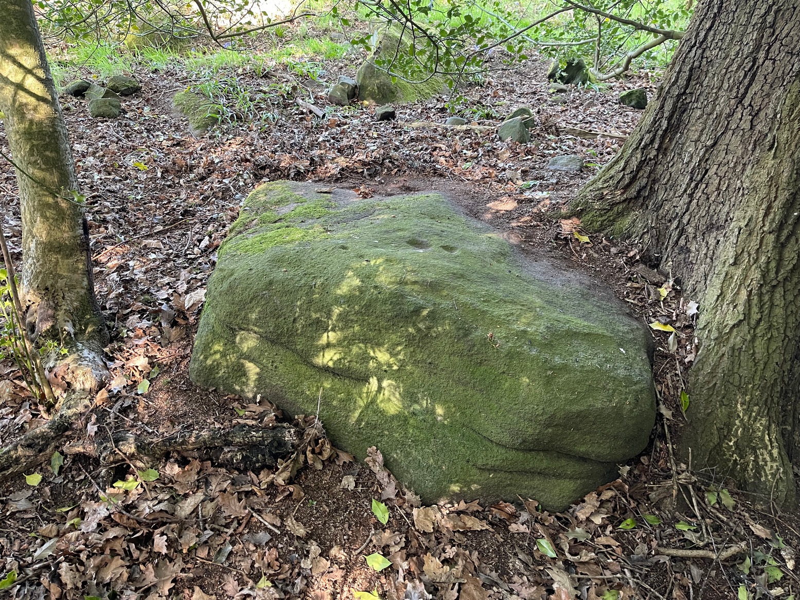
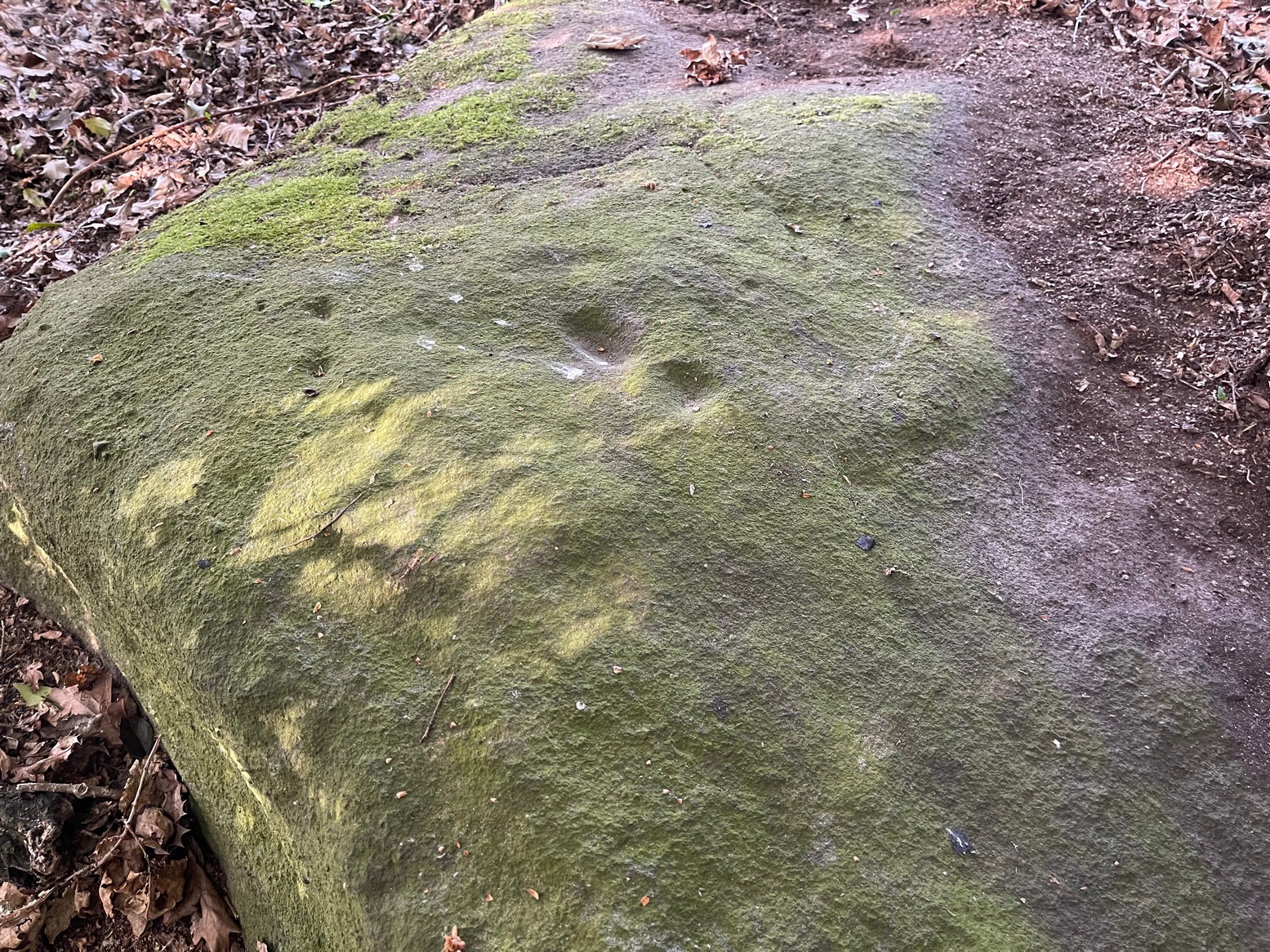
Cup-and-Ring Stone (lost): OS Grid Reference – SE 1347 3882
Also Known as:
Carving no.143 (Boughey & Vickerman)
Archaeology & History
In Johnnie Gray’s (aka Harry Speight) early work on Airedale (1891), he described a number of the prehistoric sites on and around Baildon Moor and Shipley Glen. Almost all of the things he wrote about have been identified, but a cup-and-ring stone at “Glen gate” (as he called it) remains elusive. He wrote:
“After crossing the stream from the Glen gate, and going about thirty paces, we come upon…an incised stone, whereon are a number of circling lines and cup-like cavities — one at each corner, with a long line branching off to the north-east; but this stone unfortunately has got broken, and lying on the main path is much defaced.”
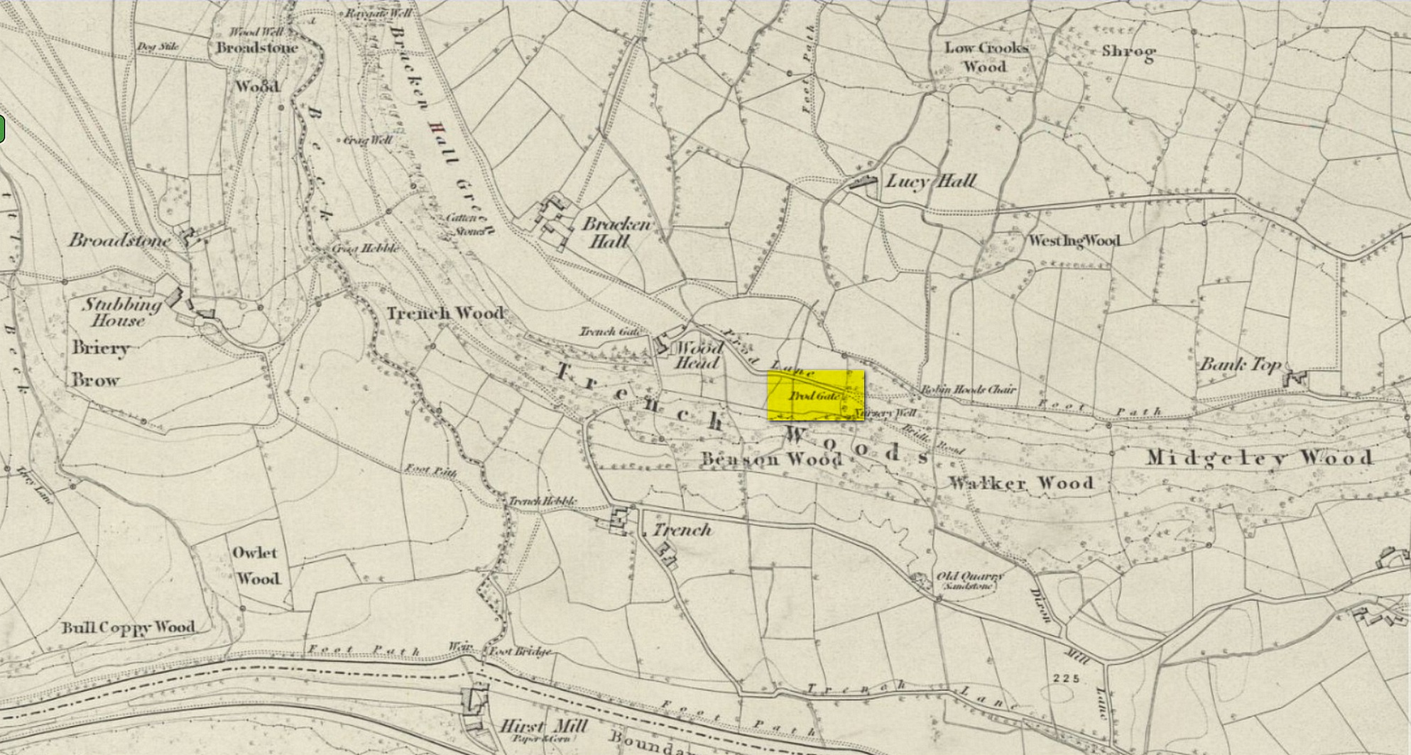
Prod Gate on 1852 map
The exact location of this has proven difficult as the name ‘Glen gate’ was obviously a local one as it wasn’t included on the Ordnance Surveys of the period. There are two named “gates” hereby: one is Prod Gate at the east end of Prod Lane, and the other is Trench Gate a few hundred yards west at the other end of Prod Lane. But the most likely gate of the two would be Prod Gate. When Speight wrote his words, a stream existed that crossed the track about 70 yards west of Prod Gate, whereas no such water-course existed anywhere close to Trench Gate. And so we assume that he was writing about “the stream from the Glen (Prod) Gate.”
Having said all that, there are no known petroglyphs like the one that Speight described anywhere hereby. There are a couple of so-called “carvings” that have been included in so-called official surveys (Boughey & Vickerman 141 and 142; aka ERA- 2445 and ERA-2446) another 150 yards or so on the left-side of the road that could have been regarded as contenders, but these stones have just a mix of modern and natural markings and can be discounted. In all likelihood, this impressive-sounding petroglyph was broken up and destroyed when the proper road was laid in the middle of the 20th century; or perhaps broken up and stuck into one of the garden walls along the roadside. Either way, the carving seems long lost.
References:
Boughey, K.J.S. & Vickerman, E.A., Prehistoric Rock Art of the West Riding, WYAS: Leeds 2003.
Gray, Johnnie, Through Airedale from Goole to Malham, Walker & Laycock: Leeds 1891.
Acknowledgements:Huge thanks for use of the Ordnance Survey map in this site profile, reproduced with the kind permission of the National Library of Scotland.
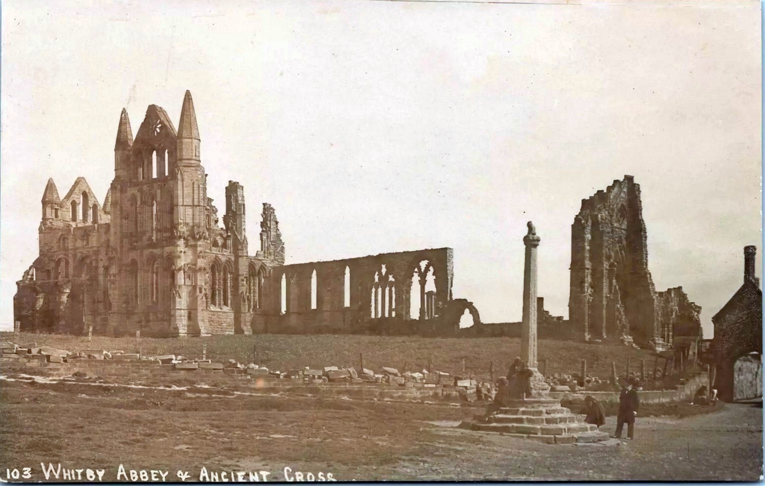
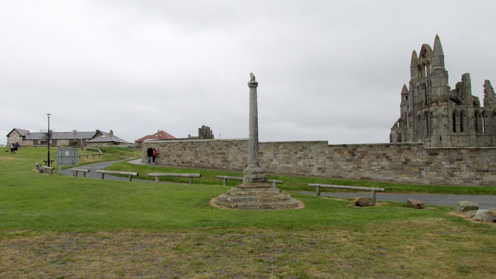
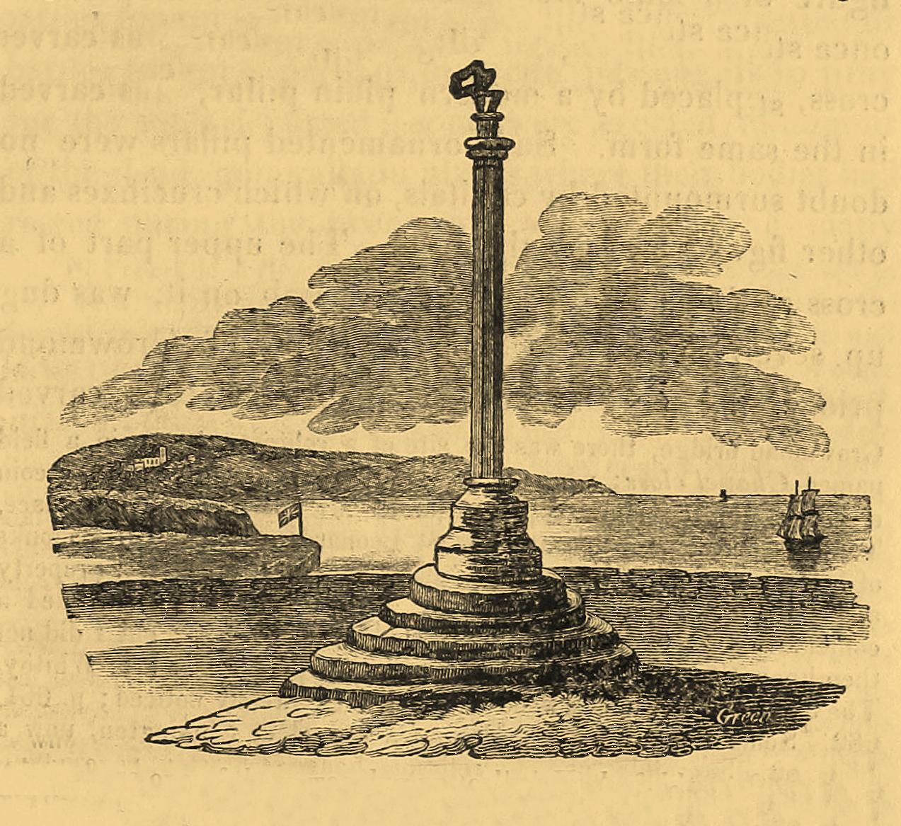
Pretty easy to find: from Whitby town centre, head uphill to the great ruins of Whitby Abbey. You go past Caedmon’s Cross and past the more recent church and graveyard to the car-park at the top, outside the abbey. At the edge of the car-park on the grass, you’ll see this tall hard upright, nice and erect!
Archaeology & History
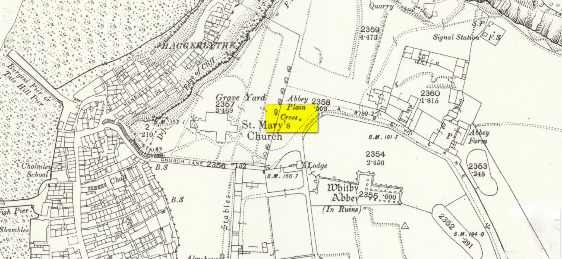
Cross shown on 1894 map
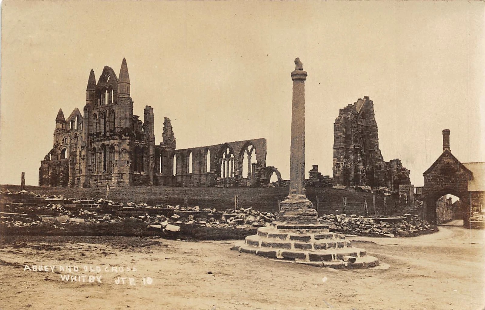
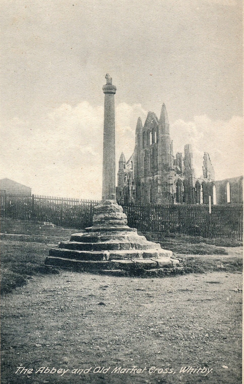
Highlighted on the earliest OS-maps and not to be confused with the nearby and more modern Caedmon’s Cross, this tall large monolith stands upon a stepped plinth comprising of six steps (originally five), about 18 feet high. The top of the cross was knocked off a century or two ago, when it was reported to have been twenty feet! Initially it stood about fifty yards closer to the Abbey, but was removed to its present position following the Dissolution.
The brief history regarding its origin was described in George Young’s (1817) major work, in which he told that in 1474, on John Nightingale, rector of Sneaton parish, in his will “appointed his burial to be on the north side (of the Abbey), before the cross,” which was already standing at that time. Young wrote:
“By this it would appear that the ancient cross, now standing in the abbey plain was then within the cemetery of the abbey.”
Abbey Cross, c.1900Young’s 1817 sketch
This has subsequently been taken as the standard regarding its origin. Tradition also told that it was an old market cross, but this was treated with considerable scepticism by George Young, who believed that the monks here simply wouldn’t have allowed such a thing at the edge the abbey and burial ground. He found evidence to indicate that it “was at the port or harbour of Whitby that corn was bought or sold, that here were kept the standard bushels for measuring corn, and that here the market-clerk had his station.” In spite of this, T.H. Woodwark (1934) reported that fairs had been held at the cross early in the 20th century. In a thoroughly profane way, electrical wiring was wrapped around the bottom of the cross and led to a generator, along with washing-lines running from it to a caravan! Mr Young would have been apoplectic!
References:
Atkinson, J.C., Memorials of Old Whitby, MacMillan: London 1894.
Holt, Robert B., Whitby, Past and Present, Copas: London 1890.
Woodwark. T.H., The Crosses on the North York Moors, Whitby Literary & Philosophical Society 1934.
Young, George, A History of Whitby and Streonshalh Abbey (2 volumes), Clark & Medd: Whitby 1817.
Acknowledgements:Massive thanks to Lindsay (wherefore art thou…?) Mitchell for getting us up here… Huge thanks for use of the Ordnance Survey map in this site profile, reproduced with the kind permission of the National Library of Scotland.
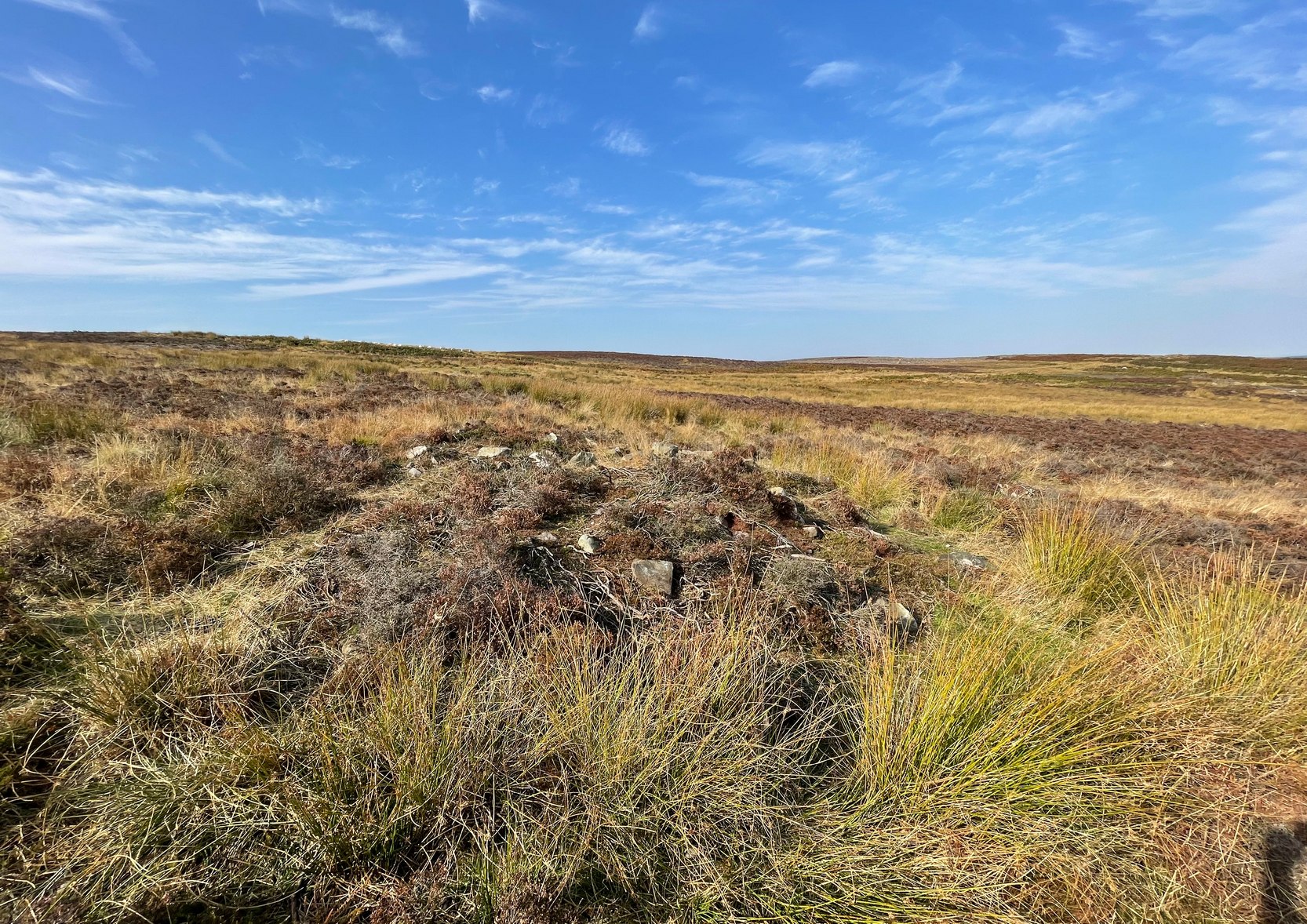
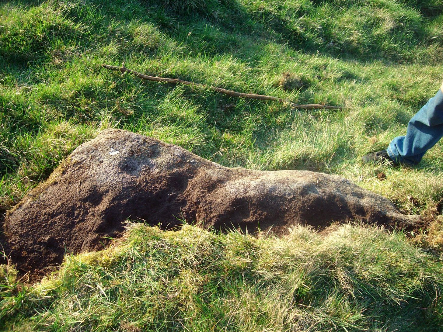
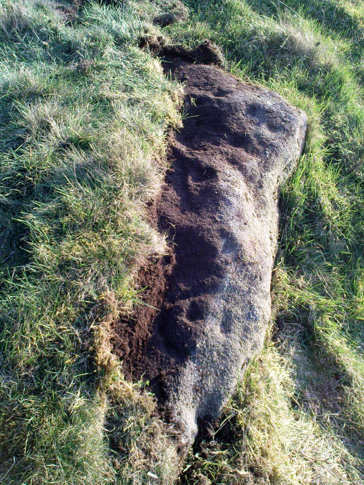
Along the B6265 old road between Keighley and Bingley, at Riddlesden go up Granby Lane, bending left into Banks Lane. About a mile up you’ll reach the moorland road. Turn left at the junction and nearly half-a-mile along there’s a layby on y’ right. From here walk along the footpath on the edge of the ridge, half-mile along bending slightly above Rough Holden Farm until, a coupla hundred yards on, you hit the dirt-track. There’s a long straight stretch of walling on your left: follow this for a few hundred yards, go through the gate and here walk on the other (left) side of the wall (if you’ve reach a derelict farm, you’ve gone too far). Some 60 yards or so down here, keep your eyes peeled on the long earthfast stone right near the walling. An alternative is to start at the steep hairpin bend up Holden Lane and follow the footpath into the woods. Walk along here (parallel with the stream below) for about 600 yards until you hit the bridge crossing the stream. Don’t cross over: instead double-back up the field on your right, go diagonally across and through the gate into the next field, and walk up along the walling to your right. 160 yards up, go through the gate and walk about 30 yards along the side of the walling again. Tis there!
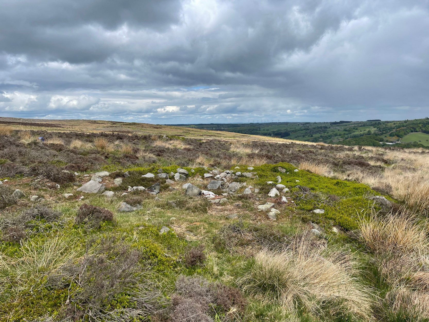
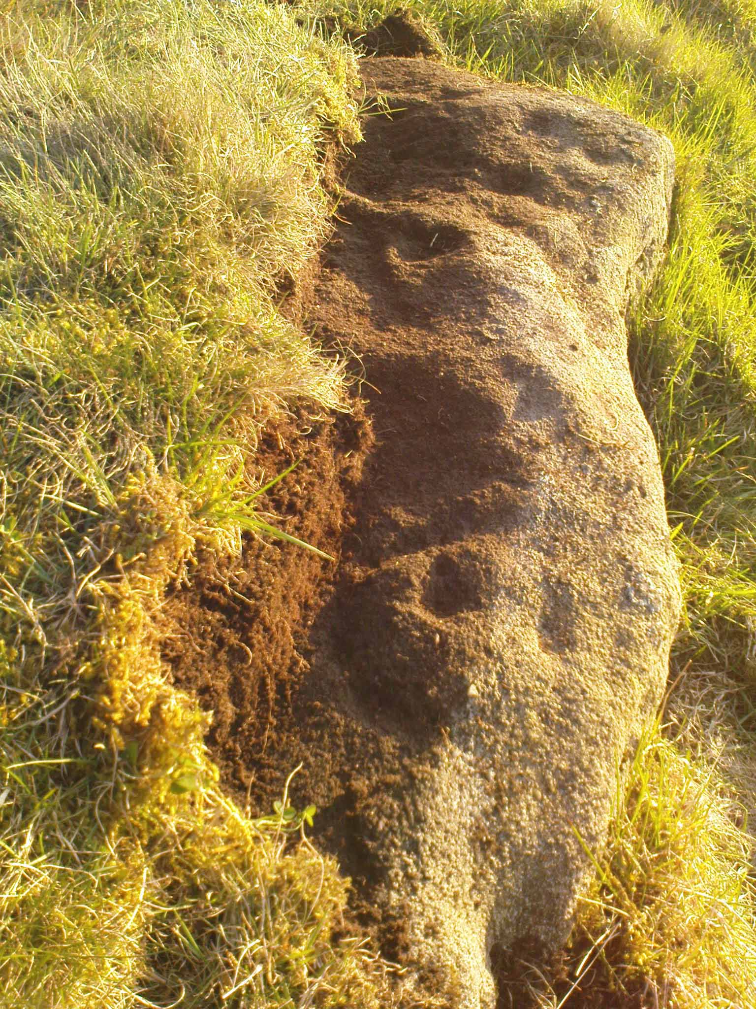
Archaeology & History
Unveiling the Sunset Stone
This is a fascinating carved stone on the western edge of Rombald’s Moor that I was fortunate to find in 2008. It’s found in association with two other cup-marked stones, north and south of it. I first noticed it when I was walking along the footpath by the side of the wall and saw that on a small exposed part of the rock a single cup-marking carved close to the vertical edge of the stone—and I’m glad that I stopped to give it more attention. The stone was very deeply embedded and the covering soil so tightly packed that I could only shift a small part of it—but the section that I managed to uncover and, importantly, the time of day when I did this, brought about an intriguing visage with subtle mythic overtones.
Carved arc on edge
Early photo in low light
The carving was found near the end of the day just as the sun was setting and touching the far horizon. I noticed there was a cup-and-half-ring to the side of where I’d sat for a rest, near the northern edge of the stone, and the clear but soft light of the evening caught this element and almost brought it to life! As I gazed down at the half-ring, the sun highlighted it even more and I saw that some extended carved lines continued and dropped over the near vertical edge of the stone, becoming an unbroken elongated ‘ring’ that stretched twice the length of the half-ring on the flat surface. Not only that, but a faint cup-mark seemed to be inside this extended vertical ring and, as I saw this, a dreaming epiphany hit me that the symbolism behind this was a representation of the setting sun that I was watching at that very moment. It was quite beautiful and the carving seemed to come to life. The thought, nay feeling, that this part of the carving symbolized a setting sun not only slotted easily into a common animistic ingredient, but hit me as common sense too! However, as my ego and rational sense rose back to the fore (I had to get mi shit together and walk a few miles home before night fell), I saw that this impression may be a completely spurious one; but, as the rock-face inclines west, towards the setting sun, the name of Sunset Stone stuck. As I carefully fondled beneath the heavy overgrowth of vegetation covering the stone, I realised that I needed to come here again and uncover more of it, as additional cups and lines seemed to be reaching out from the mass of soil.
Cups near the S edge
Close-up of ring-edge
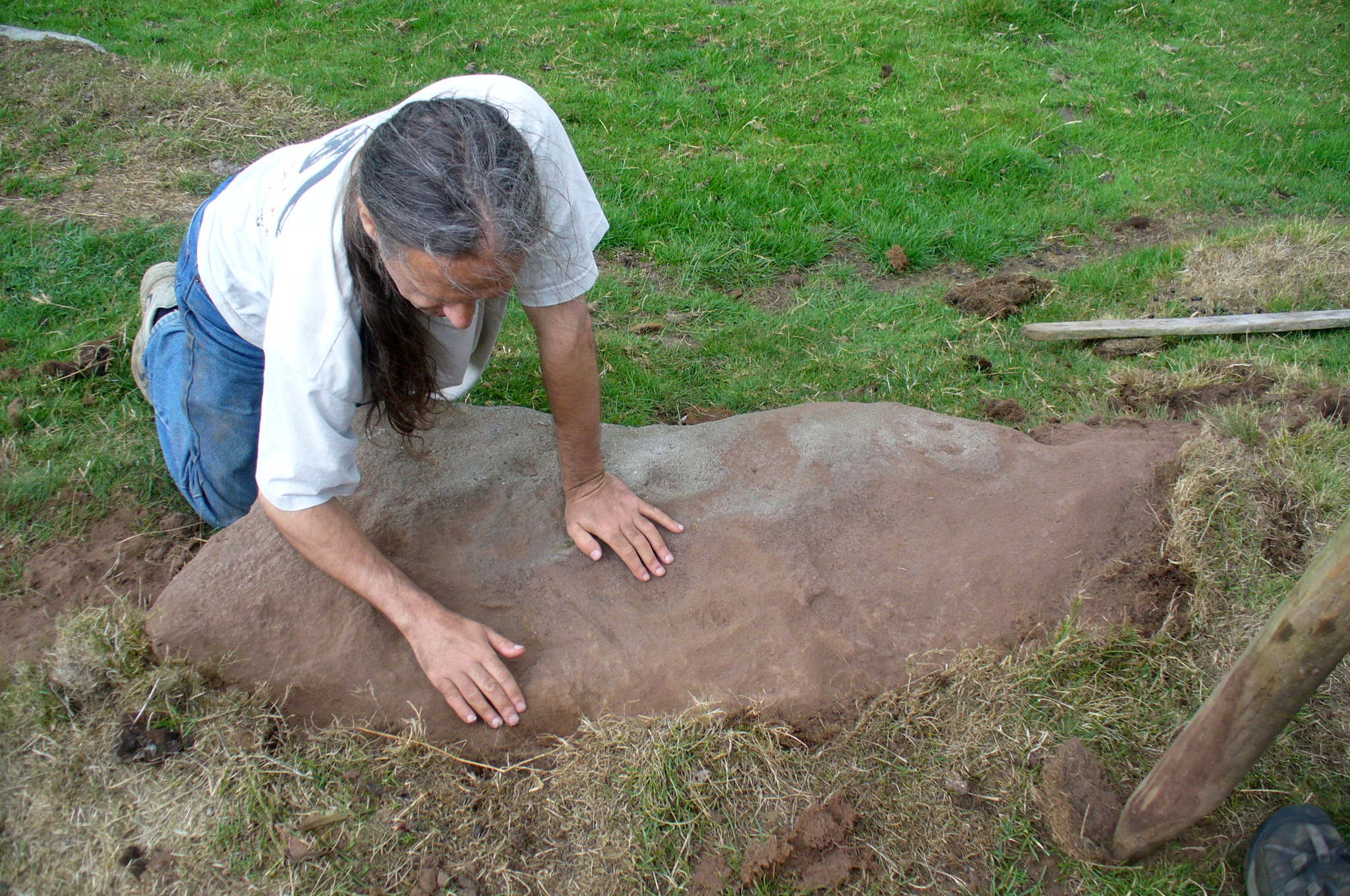
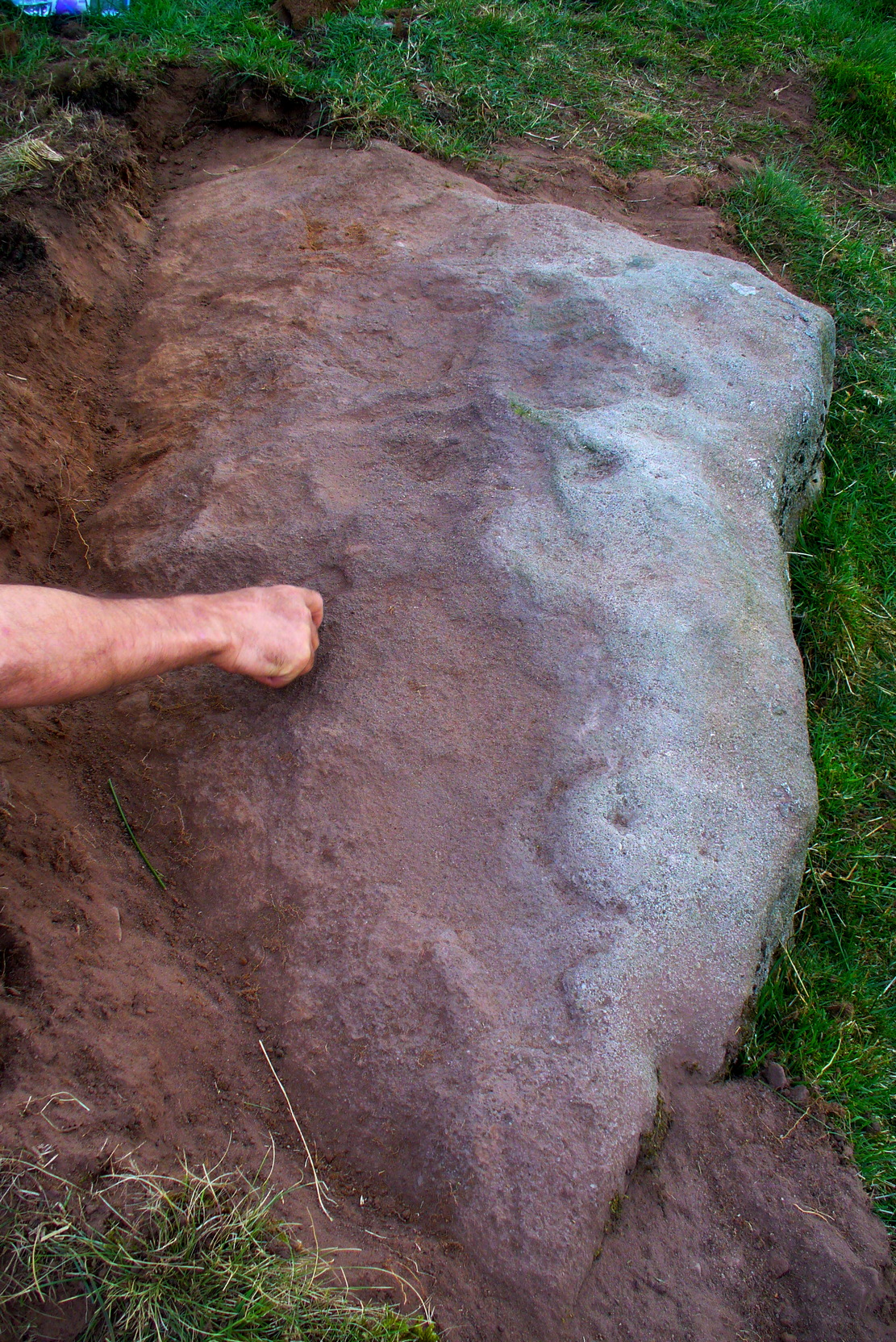
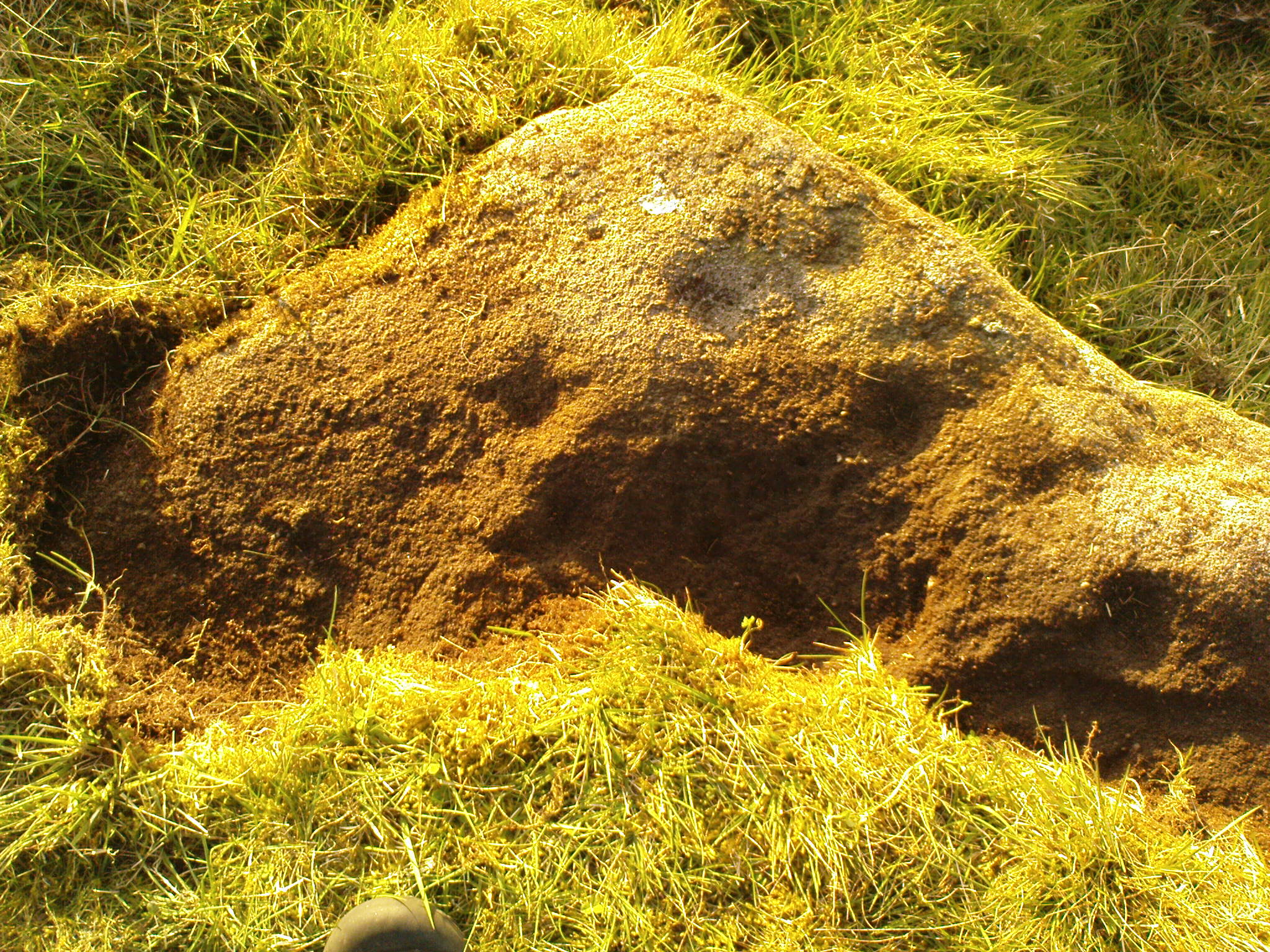
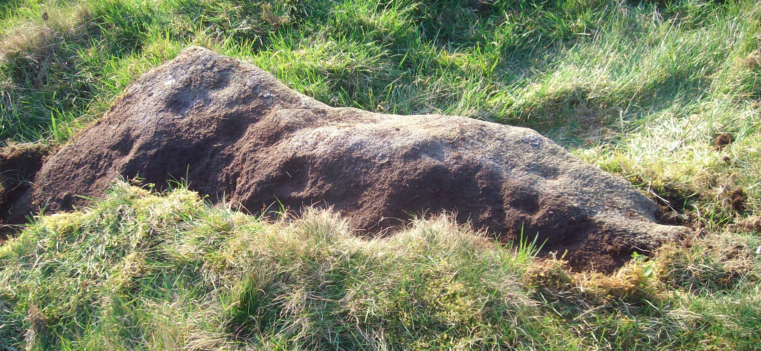
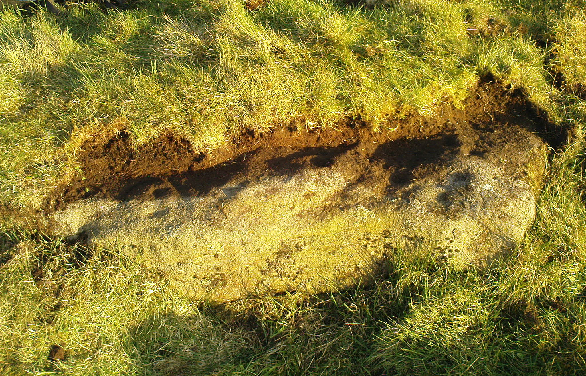
I returned to the stone a few times, but several years passed by before I revisited the site with the intention of uncovering more of the design in the company of Richard Hirst and Paul Hornby on August 4, 2013—and it took considerable effort to roll back the turf that covered the stone. But it was worth it! For it soon became obvious that much of the stone that was covered over had been unexposed for many centuries: as Richard pointed out, the edge of the rock was very smoothed by weathering, whilst the covered section of the stone that we were revealing was still quite rough and misshapen all across the surface, lacking weather and water erosion. Much of this design therefore, highlighted itself to us as it was when the mason first carved the stone. And it turned out to be a pretty curious design!
Faded photo of the carving
Faint proto-ring nr centre
Our first impression was that the design comprised of two cup-and-rings near the middle of the rock, with another cup-and-drooping-ring near the northern edge of the stone, and between ten and twelve typical cup-markings, many on the western exposed side. But curiously near the middle were also a couple of rings whose edges had been defined, but the hollowed-out ‘cup’ in the middle remained uncut or unfinished, being a proto-ring, so to speak. Also, lines leading from these unfinished ‘cups’ were also pecked and laid out, but they were also unfinished. Some sections of the unfinished lines ran onto the western edge of the stone and were very faint, but they were undeniably there. Unfinished cups is an unusual feature for carvings on Rombald’s Moor.
Mr Hirst’s clearance
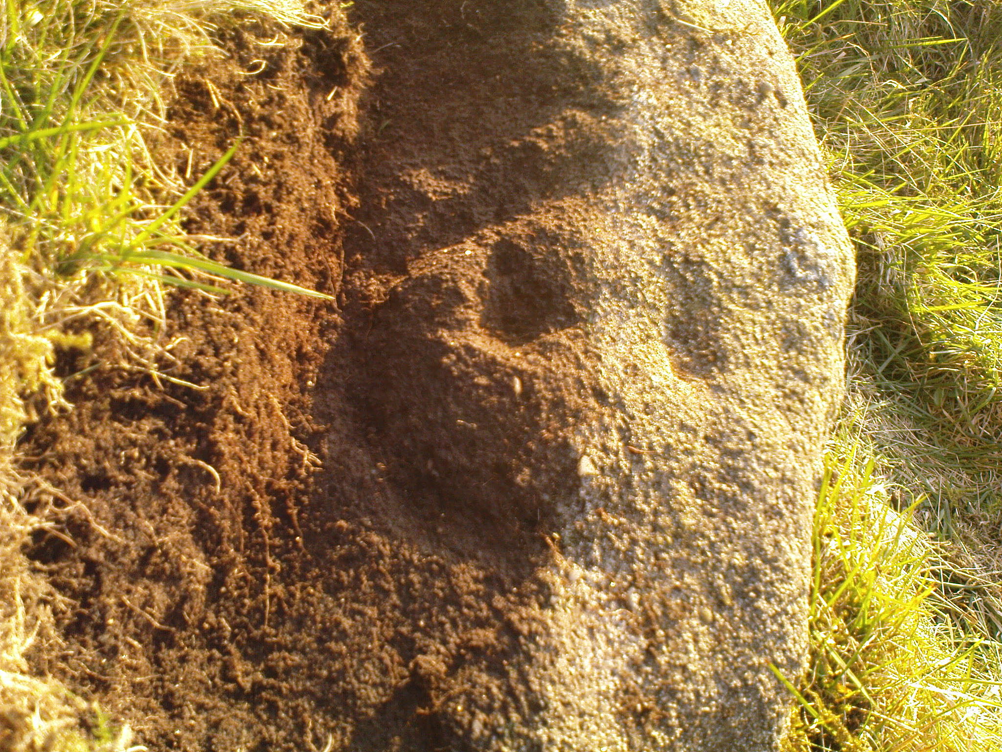
Cups & curves on edge
But the most interesting element in the fainter, seemingly unfinished carved lines, was what may be a small spiral that started above the two faint cup-and-rings. This then continued in a sharp arc which doubled-back on itself. In the other direction, the lines curve round and go down to the vertical face of the rock, before bending back up onto the level surface again, then disappearing. The topmost cup-and-half-ring is also a curious feature. When you visit here you’ll see how this aspect of the design looks for all the world like a simply cup-and-half-ring near the edge of the stone. But, as I’ve already mentioned, closer examination shows that this “half-ring” has a larger oval body beneath it on the vertical face of the stone, very worn due to its exposure to the elements and very much in the shape of a bell—and within this large cup-and-ring ‘bell’ is a much fainter complete cup-and-ring, just below the topmost cup-marking. I know that I’ve already mentioned this, but I’m giving it added emphasis as it’s a unique design element for carvings on these moors.
Early photo of the carving
Edge of the carving
The Sunset Stone really requires more attention, when the daylight conditions are just right, so that all of these intriguing aspects can be highlighted with greater lucidity. There is also the potential that more carved ingredients remains hidden beneath the compacted soil.
What seems to be a more trivial single cup-marked stone can be seen roughly 20 yards to the north.
Acknowledgements: Massive thanks to Richard Hirst of Hebden Bridge, and Prof. Paul Hornby, for their help in bringing this carving to light.
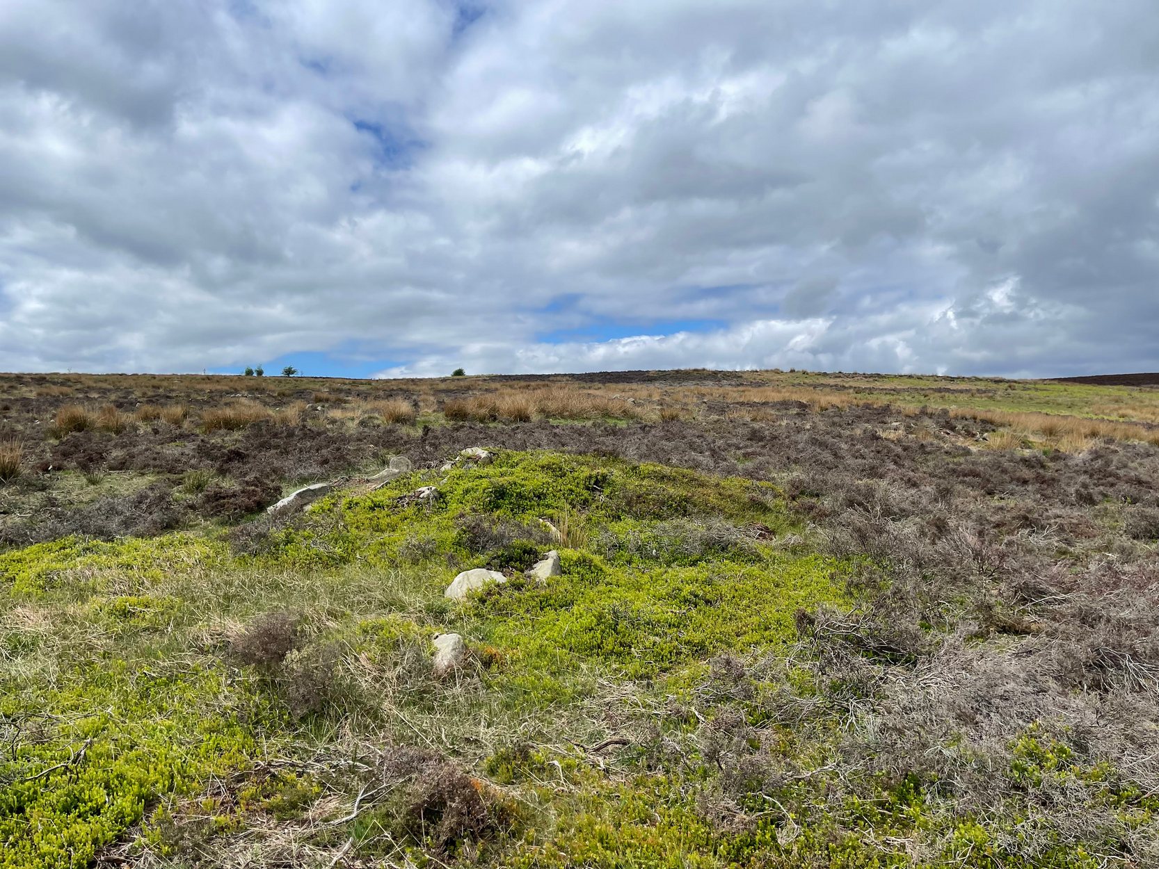
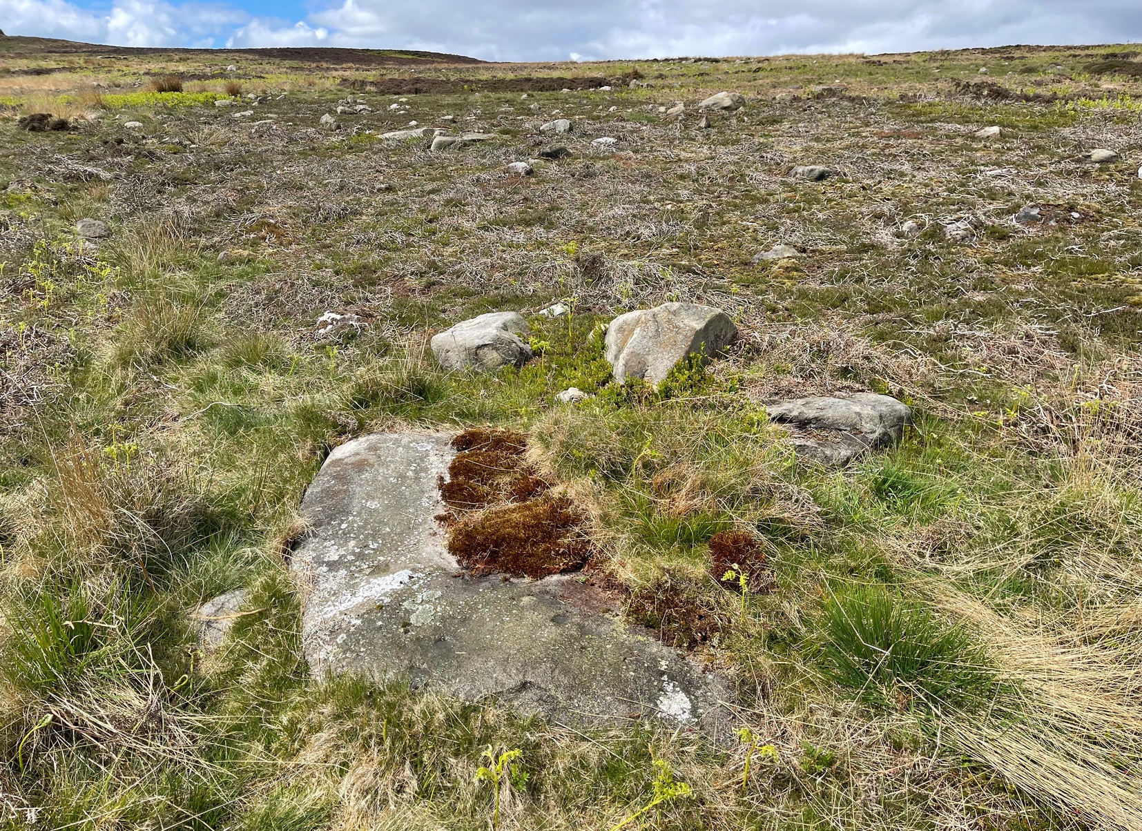
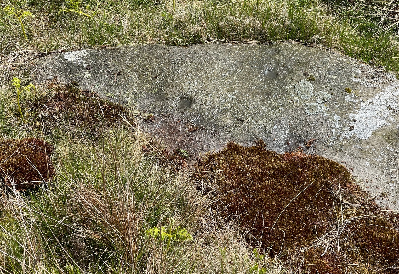
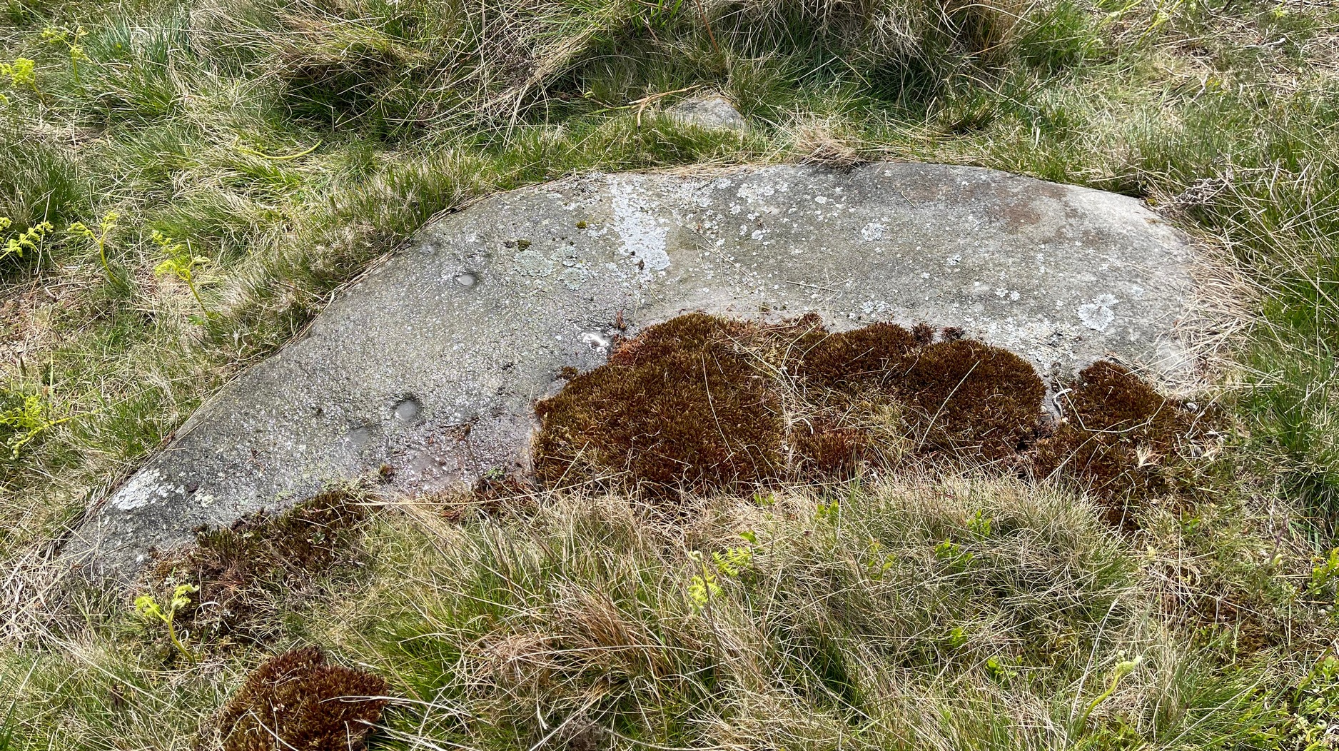
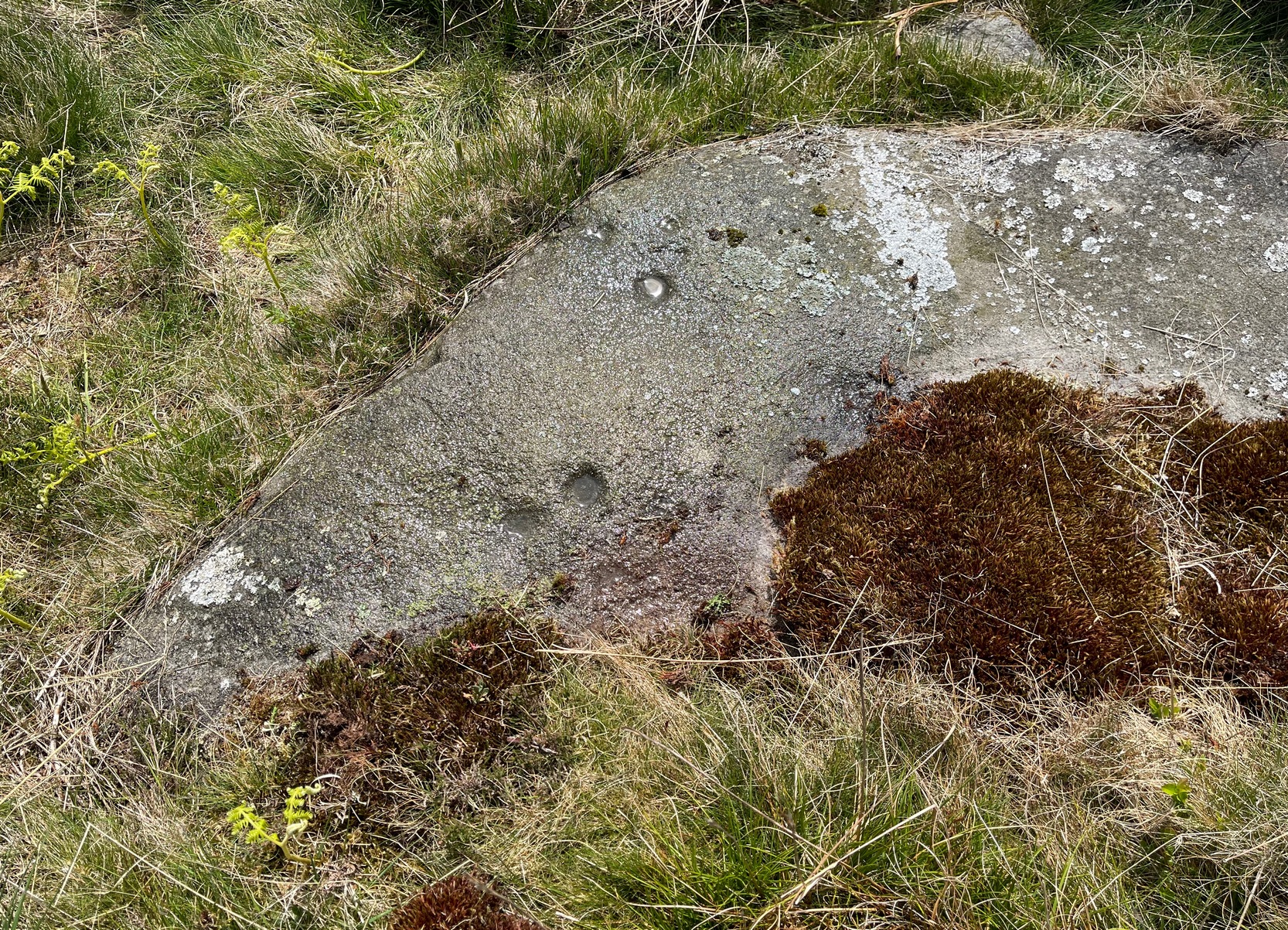
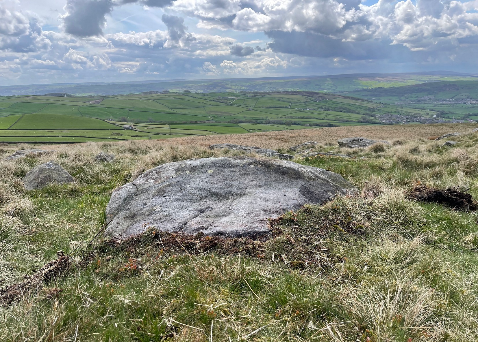
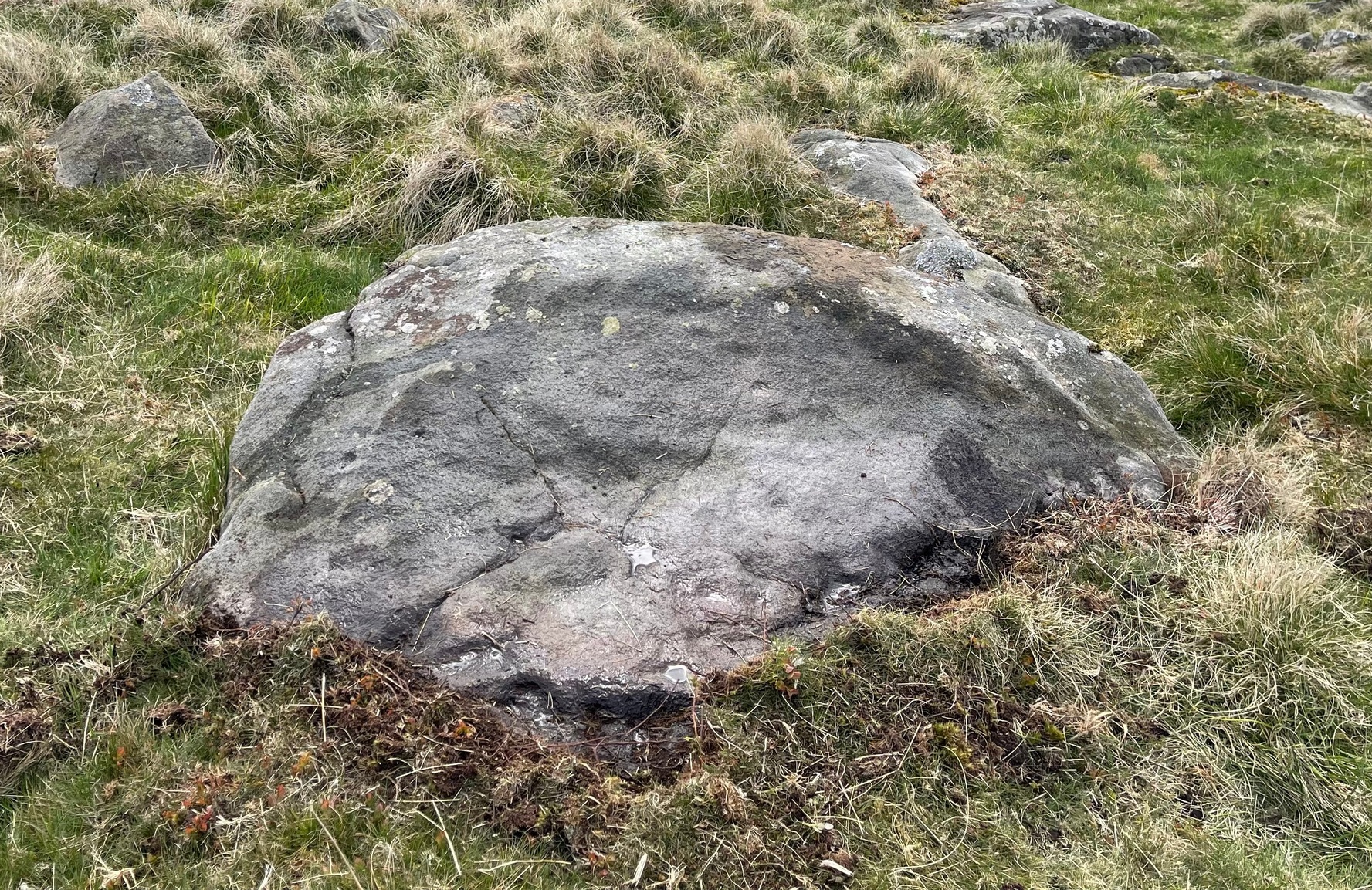
In High Bradley village, you need to go up Mill Lane for 140 yards and then bear left up High Bradley Lane for just over a half-mile, past the last row of houses on your left where it becomes a dirt-track and park-up a short distance up here. 400 yards up, in the field past the new house on your left, walk up the hill over the field, past the wall at the top and head for the large protruding boulder a few hundred yards further up on the near skyline. Once here, walk to the right of it and there’s a scatter of rocks and stones. Look around!
Archaeology & History
In an area that was extensively cut up by the Industrialists in the 18th and 19th century, Thomas Cleland came across this scarce example of a cup-marked, possibly cup-and-ring marked stone in March 2025 high up on Millstone Hill, where extensive views reach out to the south, east and west, gazing with particular attention to the mightily impressive King and Queen’s cairns, more than 1½ (2.6km) south of here—and which would have stood out much more back then than they do today.
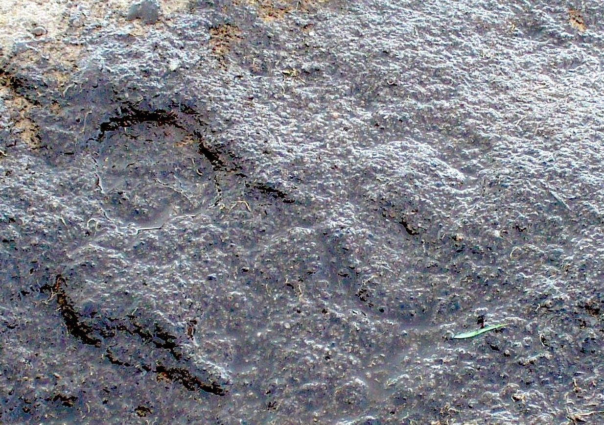
Close-up of faint arc
An arc of cups is faintly visible on the more western-side of the stone—five, perhaps six of them. Several others are in a typically chaotic scatter across the rock, with one or two looking as if they may have been affected by the heavy industrial actions that occurred up here. When Tom first found the carving, he could see a faint ring around one of the cups near the middle of the stone, but on our visit here the sun was near its apogee and due to the slope of the rock to the north where the cups are carved, this was nigh on impossible to make out. Near the bottom edge however (as shown in the photos), a cup-and-incomplete ring seems evident; although we didn’t notice this on our visit here and it may just be a fortuitous play of the light (but I hope I’m wrong!). This is a design that mainly comes to life, so to speak, is more easily visible, when the sun is either rising or setting. (typical of many petroglyphs on flat rocks)
Acknowledgements:Huge thanks to Thomas Cleland for use of his photos in this site profile.