Tumulus (destroyed): OS Grid Reference – SD 884 367
Archaeology & History
Long since destroyed, we are thankful to the writings of Thomas Booth (1899) that this site was recorded. In his rare work on the prehistoric burial sites of the region he told us how this tomb was unearthed,
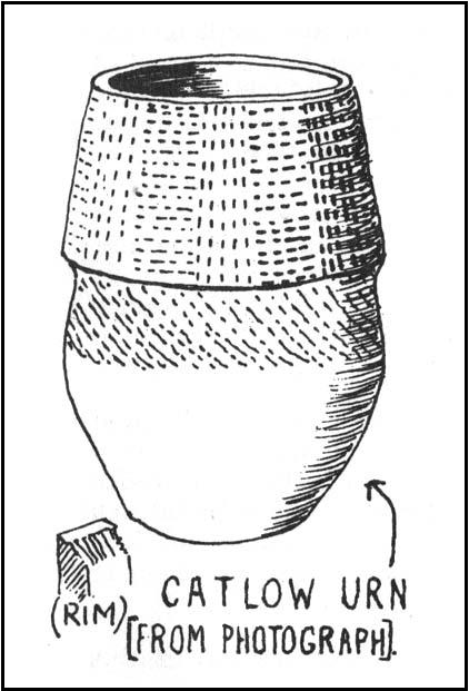
The Catlow urn
“in March 1854, at Catlow quarry, in Marsden (Heights), a few miles across the hills from Todmorden in the direction of Colne, where a number of workmen who were engaged baring the rock came across two or three cinerary urns. These were very carelessly handled by the men, and as these vases are almost always made of clay only partially baked…they are very easily broken; the result, therefore, of the rude treatment of the quarrymen was that the vessels were broken to pieces.”
The mound from which the urns had been dug was also destroyed, but apparently the last remnants of the urns were presented to the Burnley Literary Institution sometime in the late 1890s — though where they’ve travelled since then, 120 years on, I have no idea!
References:
Bennett, Walter, The History of Burnley – volume 1, Burnley County Council 1946.
Booth, Thomas, Ancient Grave Mounds on the Slopes of the Pennine Range, R. Chambers: Todmorden 1899.
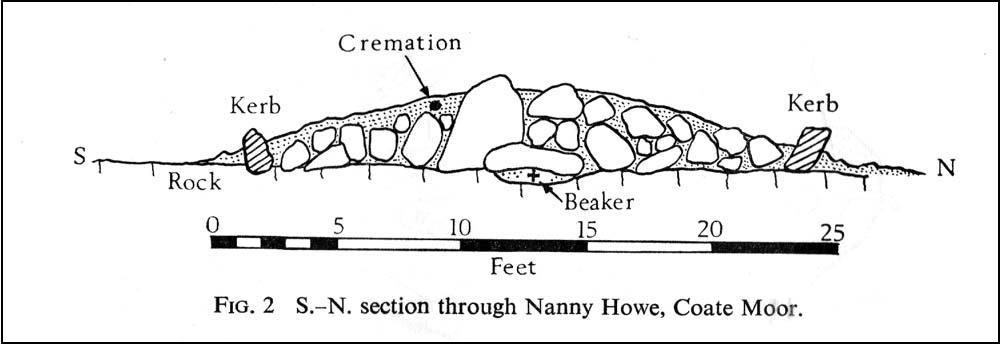
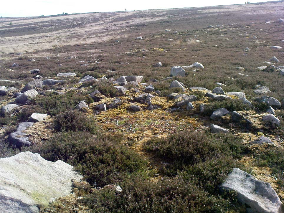
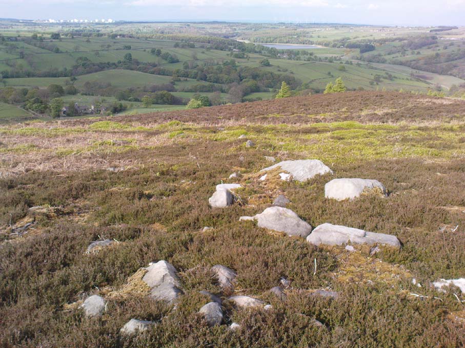
The Nanny Howe burial mound was one of a group of at least three tumuli that could be found on what is now the wooded hilltop of Coate Moor, a mile east of Great Ayton. Large and conspicuous in previous centuries, the site was described briefly in Elgee’s (1933) archaeological survey as being in association with a prehistoric settlement, which itself appears to have long since succumbed to forestation. An essay on the state of this apparent Bronze Age burial mound was written by Mr Hayes (1966), who told us:
“The kerb of the barrow was exposed and noticed by J.N Grayson whilst excavations were in progress on Great Ayton Moor. S.V. Morris, A.N. Pacitto and the writer examined the site. It was a cairn of about 30ft diameter and 3ft high in the centre, with a strong kerb of stones set on edge of 25ft diameter. Its construction, of massive stones was similar to the chambered cairn on Great Ayton Moor, one mile to the north, and very like the food vessel-urn tumulus on Danby Rigg which also had a kerb of the same diameter…
“When the heather and turf were removed on the south-east side of Nanny Howe, a mass of cremated bones with part of the rim and side of a typical Iron Age ‘B’ jar were found only 6-9in under the turf. This was clearly a secondary burial long after the cairn was built. The sherd may have been a token offering, but more probably the remainder of the pot so near the surface of the mound had been eroded. No other secondary burial was found, although almost all the cairn was removed.
“Under large boulders in the central area was a shallow pit or depression… Only minute specks of charcoal and some small burnt stones distinguished its filling from natural sand. It was about 3ft in diameter and not more than 9in deep… In it were the broken sherds, more than 80 in number, of a beaker… There were no signs of bones or cremation, although presumably a contracted skeleton had accompanied the beaker. In the acid sand all bones would perish quickly… No other relics were found in the cairn.”
To which Mr Hayes and his team concluded the Nanny Howe tomb was an example of a typical “beaker burial” as they used to like calling them, set within a ring of stones over which the cairn was piled; and long after this, seemingly the Iron Age, a secondary cremation was inserted.
Folklore
Folklore ascribed the entire settlement here to have heathen origins, with Nanny Howe also standing out with folklore of its own. As Mr & Mrs Elgee (1933) wrote:
“Half a mile east of Captain Cook’s monument…on Easby Moor is the Devil’s Court, where, according to tradition, witches congregated under the presidency of their lord and master. We therefore examined the Court and found what we expected, a typical moorland Bronze Age settlement site, with stone-walled enclosures, shallow pits, flint implements and many barrows, one of which is named Nanny Howe, after a famous witch, it is said, who also frequented Nanny Nook, a right-angled bend in a stone wall near Wayworth Farm, Commondale, marking another settlement site.”
Another tale of this legendary witch was narrated by folklorist and historian Richard Blakeborough in one of his many tomes, where he told:
“Again, old people of Great Ayton still aver that on a certain night a once noted witch, Nanny Howe, may be seen riding astride on a broomstick over Howe Wood just at midnight. This witch, so mounted, is said once to have chased the devil for miles — on this occasion the two must have fallen out ; perhaps at that time honest folk got their due. Howe Wood is near Kildale.”
Whatever the source of such stories, the respective archaeologists of Elgee and Hayes wondered if they derived from some pre-christian rites and events. Hayes asked:
“Was the person interred in Nanny Howe a famous witch? Or were the witch and the devil legends connected with the site faint echoes of ceremonials and rites held here?”
It would seem likely that the local peasant communities hereby were, thankfully, not inflicted with the empty spirituality of the christian cult when it tried taming the souls of the villagers living in and around here. The folklore would seem to reflect simple peasant gatherings and celebrations, frowned upon by those weird clergy-folk, no doubt striving to get the local children into their more demonic pastimes…
References:
Blakeborough, Richard, Wit, Character, Folklore and Customs of the North Riding of Yorkshire, W. Rapp: Saltburn 1911.
Elgee, Frank & Harriet, The Archaeology of Yorkshire, 1933.
Gutch, Mrs E., Examples of Printed Folklore Concerning the North Riding of Yorkshire, David Nutt: London 1899.
Hayes, R.H., “Nanny Howe, Coate Moor, Cleveland,” in Yorkshire Archaeological Journal, part 164, 1966.
Travel along the Askwith Moor Road between Blubberhouses and Askwith (near Otley) and park-up at the large gritted parking post on the moor edge. Walk straight onto Snowden Moor (east) and walk a few hundred yards north until you reach the brow of the small rounded hill, scattered with small stones and outcrop rock. The settlement is all around you!
Archaeology & History
As we already know from earlier posts on TNA, this moorland region is rich in prehistoric remains, and the settlement that I’m about to briefly describe here is another excellent site – when you can see it!
‘Hut circle’ at the rocky knoll
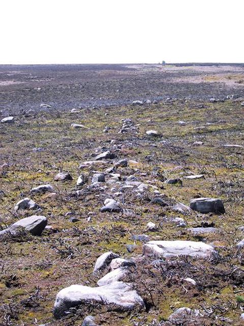
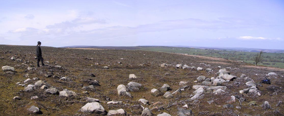
My first exploration here was in the company of Graeme Chappell more than 20 years ago, where we tried locating remains that had been described by Eric Cowling (1946) during a foray taking photographs of the cup-and-ring stones nearby. But due to an overgrowth of moorland vegetation at the time, the remains which Cowling described proved hard to find. Years later when Richard Stroud and I visited the place in May 2005, all the heather had been burnt back and much of what looked like the remains of an entire prehistoric village was in plain view for us to see. I was well impressed! This occurred again last year, enabling the bunch of us who came here a few times to see even more of the place. But — just like the newly discovered prehistoric settlement on Blubberhouse Moor a couple of miles north — once the heather grows back again you wouldn’t really think anything of worth was hidden here. In archaeological terms however — despite the lack of references and research by those who are paid to be archaeologists — we have one helluva little-known prehistoric settlement, complete with walling, hut circles, village hall (!), tombs, cup-and-ring carving and more, much of it probably dating from the Bronze Age, but some of the sites here indicate it was also much in use during the Iron Age period aswell.
Probably the best place to start exploring here is on the large flat rock on the rounded knoll at the edge of the moor (SE 1785 5129) with a simple cup-mark saying ‘hello’ on its surface, looking east down into the Fewston Valley and across lower Wharfedale, then veering up towards the hills above Nidderdale. The great prehistoric temple of Brimham Rocks is clearly visible from this spot aswell. Upon this rocky hillock we have a veritable scattering of several large, earthfast boulders and smaller rocks, from where much of the settlement expands, mainly to the west through to the south, across the open moors in front of you. On a clear day this is truly beautiful and quiet spot.
Line of ancient walling, running NELine of ancient walling, running SW
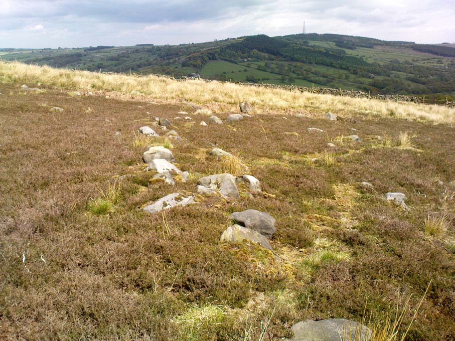
Just a couple of yards from the edge of the rocky knoll is a very good example of what would at first sight appear to a prehistoric hut circle. Its position at the top of this rocky knoll however, implies an additional function other than a purely domestic one. Also from here is a prominent long straight stretch of walling running roughly southwest for about 90 yards onto the moor, and also to the northeast, downhill off the moorland for some 30 yards before disappearing into undergrowth (we didn’t actually explore this lower section of walling running downhill, so there’s probably more to be found there). This long section of walling, mainly comprising small stones and rubble, with a number of larger uprights defining much of its length, is just one of several stretches of walls that are clearly visible hereby. There are also a number of other hut circles to be found scattered around this particular walled sections near the top of the rocky rise. When Eric Cowling (1946) came here he counted 10 of them here; but subsequent explorations have found at least 13 of them hereby.
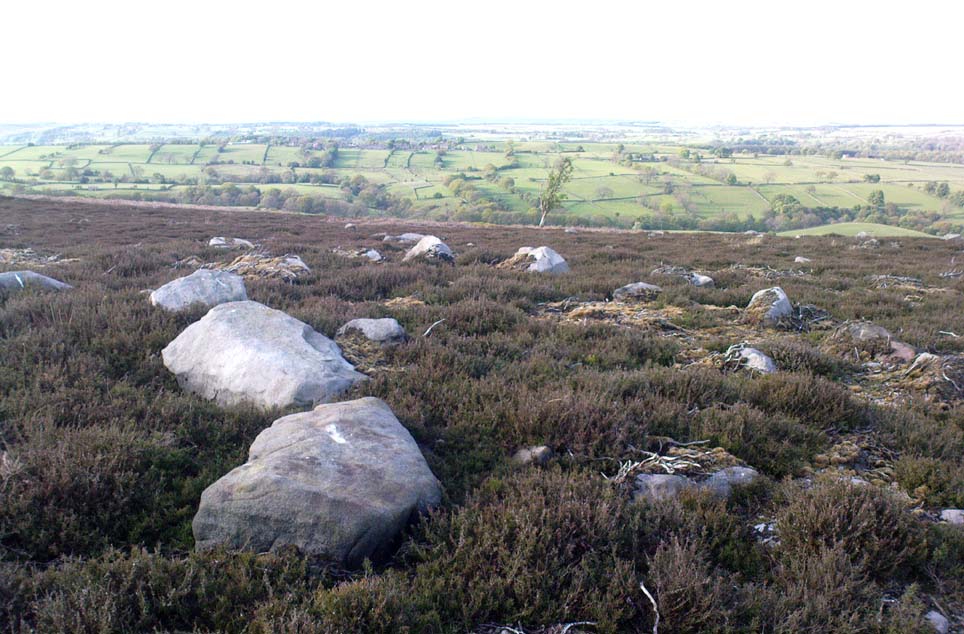
One of the most notable remains here is the large D-shaped enclosure about 25 yards west of the rocky knoll. This very impressive archaeological site was curiously not included in the Nidderdale Archaeological survey report of sites in this region. Either they hadn’t done their homework correctly when they came here, or the heather must have been really deep; cos as you can see in the photo here, it’s a decent size! I tend to see this large stone enclosure as a sort of tribal gathering building of sorts — a bit like a ‘village hall’ so to speak. If you get here and see it all in context, it makes a lotta sense (not that it’s right of course, merely an opinion). With the exclusion of the Cowling D-shaped enclosure more than 80 yards east of here, this is the largest monument on this section of the moor, measuring some 45ft along the NW to SE axis and 20ft across the NE to SW axis. The walling in parts is quite thick aswell and the stones making up the main north, east and southern edges are anything between 12 inches to 34 inches tall. Along its northeast edge is a curious stone, with what initially looked to be a most distinct cup-and-ring carving on the outer walling, but once we’d looked and looked again, saw it seemed to be one of the oddest light-created ‘carvings’ we’d ever seen! (i.e., it’s natural)
Denuded cairn? or denuded walling?Another arc of walling (shit picture though – soz…)
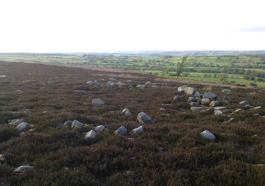
A few yards from here, heading to the little peak close by, more walls emerge. On the small rise in the land about 30 yards west you’ll see an arc of stones running around the contour line of another hillock on the moor. It’s difficult to say with any certainty, but a lot of this arc of stone is certainly man-made and at least Iron Age in date, perhaps earlier; but the line of stones itself may actually run all round the very edges of the hill on whose sides this section rests (see photo). You get a distinct impression here that this small hill was actually sectioned off all the way round, so to speak, for some reason or other. The remains of at least two small cairns can be found on the top of this small enclosed rise, close to one of which Boughey & Vickerman (2003) have designated there to be a cup-marked stone. From this elongated hillock we look immediately northwest onto the flat moorland plain of the Snowden Moor necropolis …amidst which the hardworking Keighley volunteer Michala Potts recently found the Snowden Crags cairn circle.
Section of Snowden Carr settlement walling
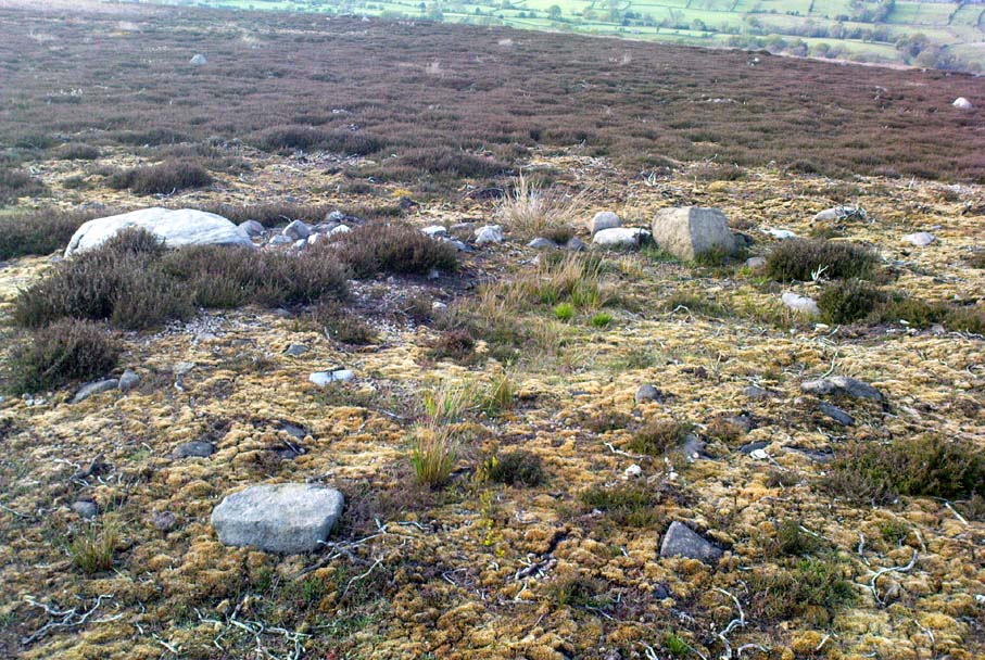
Further down the moorland slope—a couple of hundred yards below Cowling’s D enclosure—are yet more remains, many of which lie outside the geographical boundaries of the “official” Scheduled Monument Record for this settlement (known as SMR 28065). We’ve located several other cairns in relatively good states of preservation; more extensive lines of another walled enclosure (again in a large D-shape), as well as several cup-marked stones.
The Site and Monuments account of this place tells us simply:
“The monument includes a cairnfield and associated concentration of prehistoric features. Included in the area are a large sub-rectangular enclosure, two smaller enclosures, at least 17 cairns of various sizes, several lengths of boulder walling, a hollow way, and at least 17 carved rocks. There is also a bare patch of ground on which lumps of lead slag survive. This was produced by medieval or earlier lead smelting.
“This concentration of prehistoric features is situated towards the north east edge of Snowden Carr, and measures c.426m x c.155m. The cairns occur throughout the area and range in size from an elongated cairn 17m x 7m down to cairns c.4m in diameter. The cairns are best preserved in the north western part of the area. The large sub-rectangular enclosure has an earth and stone bank c.3m wide and c.0.6m high. The bank is double on the east side of the enclosure. The two smaller enclosures have rubble banks 1m-2m wide and up to c.0.6m high. They are more irregular in shape than the large enclosure. The boulder walling consists of a number of approximately linear rubble banks 1m-2m wide. It is concentrated in the area immediately north west of the large enclosure, and in the area to its south. The boulder walls are interpreted as part of a field system contemporary with the large enclosure. The hollow way is located within the southern group of boulder walls and may be contemporary with them. “
There is still a considerable amount of work that needs doing in and around this settlement complex and it seems any work here is gonna be done by the like of us amateur doods. Archaeological officials don’t seem interested here. I was informed by Neil Redfern of the archaeology department of English Heritage for North Yorkshire that they are unable to support any funding that might help towards any decent analysis of this important archaeological arena, nor do they consider the important cairn circle discovered a few months ago on the northern end of this settlement worthy of financial help either, which is of course very disappointing,* but typifies their lack of enthusiasm unless money comes their way. And so this site profile entry will be added to gradually as our amateur team visit and uncover further aspects of this neglected prehistoric arena – such as the finding of another previously unrecorded ancient circle of stones not too far away!
References:
Boughey, Keith & Vickerman, E.A., Prehistoric Rock Art of the West Riding, WYAS: Wakefield 2003.
Cowling, Eric T., Rombald’s Way: A Prehistory of mid-Wharfedale, William Walker: Otley 1946.
Acknowledgements: Many thanks for use of their photos to Graeme Chappell and Michala Potts.
* No doubt a church window somewhere will eat up a few thousand quid and weeks of their time to fit the little piece — along with all those prawn sandwich meetings that cost so much to endure. Much more important!
In days of olde this once proud tomb stood upright on the slopes below the more prominent Cliviger Laithe tumulus above. But, like many of the ancient ancestral tombs of this region, its days seem long gone. Although we’ve found what may be some traces of the outline of the cairn (further analysis required!), when the legendary Lancashire historian Thomas Dunham Whitaker (1872) wrote about the place, he was already writing about it in the past tense. He said briefly, that “this heap of stones was removed as materials for building a turnpike road” in 1763. The archaeologist Bernard Barnes (1982) told us that “a cist with an inhumation was found. In 1766 another tumulus was removed and an urn found. An axe-hammer is said to have been associated” here. The most lengthy description of this site can be found in Mr Booth’s (1899) short work where, in his summary of various prehistoric sites in this region, he told that,
“The first find recorded in this locality took place at Law House, near Mereclough, in the year 1763, when a mound was opened which covered a kistvaen, or stone cist, which, upon being opened, was found to contain a human skeleton. The information concerning this ancient burial is very meagre, and we have no information as to who were the discoverers of the mound. It may be noted that nearly 70 years before (in 1695) a number of Roman coins were found close to this barrow. The mound also contained a rude earthware vase filled with calcined bones.”
It’s unlikely that the earthworks by the walling hereby represent the denuded remnants of the monument in question, although the rise in the field here may be some remnant of the place, but without further excavation we might never know for sure. However, the recent discovery of what may be remnants of the cairn in an adjacent field requires further analysis. WATCH THIS SPACE – as they say!
References:
Barnes, B., Man and the Changing Landscape, University of Liverpool 1982.
Bennett, Walter, History of Burnley, volume 1, Burnley 1946.
Booth, Thomas, Ancient Grave Mounds on the Slopes of the Pennine Range, R. Chambers: Todmorden 1899.
Whitaker, T.D., History of the Original Parish of Whalley, London 1872.
Tumulus (destroyed): OS Grid Reference – SE 0095 2748
Archaeology & History
Up behind the old pub that was The Mount Skip, high on the ridge above Hebden Bridge and Mytholmroyd, overlooking the Calder Valley for many miles, was once — it would seem — a number of fine prehistoric remains, long since destroyed by the industrial advance of quarrying and such likes. Amidst what seems to have been settlement remains and, perhaps, timber circles, an ancient grave was also known here. In Mr Ling Roth’s (1906) essay on the prehistoric remains of the Halifax region, he wrote:
“In May, 1897, a grave was discovered at a quarry above Mount Skip Inn. The first indications were the rolling down of pieces of urns which the delvers called flower pots. Then in digging into a hole to fix the leg of a crane, human bones were discovered, Mr Crossley Ainsworth told me: “The grave was about 6ft (1.8m) long, from 14 to 18in (35-45.7cm) wide and about 2ft (61cm) deep…the head and feet were almost exactly north and south, with the face right towards the midday sun.” The bones were very brittle and crumbled easily in the hand. There was a lot of charcoal in the grave. In the ends of the grave which were undisturbed, “there appeared to be about 6in (15cm) thick of charred wood and bones mixed together at the bottom. Flints were also found. Also the larger half of a small earthenware vessel which had rolled down into the quarry ; this was picked up by a man named Thos. Greenwood, of Shawcroft Hill.”
The site was mentioned again nearly fifty years later in Geoffrey Watson’s (1952) survey, but with no additional details.
References:
Roth, H. Ling, The Yorkshire Coiners 1767-183; and Notes on Old and Prehistoric Halifax, F. King and Son: Halifax 1906.
Watson, Geoffrey G., Early Man in the Halifax District, Halifax Scientific Society 1952.
This little known site, long since destroyed during the construction of Keighley Railway Station, was found in a curious spot, close to the bottom of the Aire Valley. Most (known) prehistoric burials occur on the higher grounds in this area. And though we don’t appear to have the exact location of the find, it was pretty close to either side of Keighley’s old railway station (which is shown as 100 yards to the other side of the road of the present station on the 1852 OS map). This may position the site as being on the grounds opposite and below St. Anne’s Church; otherwise it was getting closer to where the River Worth runs by. In Keighley & Holmes’ early (1858) work they told that,
“Whilst excavating for the Railway within about a hundred yards of the Keighley station, one of the labourers discovered three urns containing a quantity of human bones. Two of them were unluckily broken, one being large enough to hold eight or nine quarts. The one brought away whole, and seen by the present writer, may hold about a quart; it is somewhat distastefully designed, moulded by hand out of the common clay, without glaze, and rudely ornamented on the outside by some sharp implement. The once animated contents of each urn were covered by a square flat stone.”
This final remark seems to indicate the urns were located in a cist (a small stone grave), but we don’t know whether this was found within the remains of a denuded tumulus or stone cairn. However, considering the lack of any remarks about a large pile of stones (which would have been very noticeable) covering this burial site, it would seem more probable that this site was originally an earth-covered tumulus, whose visibility and knowledge had long since diminished in this part of Airedale.
References:
Keighley, William & Homes, Robert, Keighley, Past and Present, R. Aked: Keighley 1858.
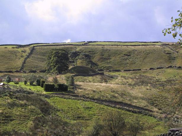
Go through the village of Stanbury, past the last of the two reservoirs until you’re on the western edge of Ponden. Stop and look up the slopes to your south. This spot was recently found and photographed by Richard Stroud: a curious-looking mound with all the hallmarks of being a forgotten tumulus. We’ve gotta check it out properly though!
Folklore
Although not in the archaeological records (not too unusual in Yorkshire it seems), the site does have some literary references and some all-too-common folklore motifs. Perusing my library for info about another nearby site (the Cuckoo Stones), I found the following said of this place in a rare book by James Whalley called The Wild Moor (1869, pp.103):
“It appears that some hills, as well as dales…have silvery names. There is a hill which is on the right hand on the way from Ponden House to Crow Hill Moor, which is distinguished by the beautiful designation of ‘Silver Hill.’ The hill is surrounded by a wall (I suppose to guard the treasure) and its surface is adorned with trees. Grey-headed men living on the borders of Crow Hill and Lancashire Moors affirm that during the Scotch rebellion here was deposited a large chest of silver, which was hid in the hill. It would appear as if the chest of silver is still there!”
This tradition was echoed a decade later by J. Horsfall Turner, and then again by Halliwell Sutcliffe in 1899, who reckoned the “vast treasure was said to have been buried during the ’45 rebellion,” adding how “the fields which climb this hill were well tilled aforetime through being constantly turned over in search of the treasure” – but nowt was ever found.
An additional bit of folklore tells of two spirits nearby: one of a man; another of a fiery barrel — either a remnant of earlier solar folk traditions hereby, or perhaps just an earthlight. One of these (the fiery barrel) rolled down the hill nearby; whereby the ghost of the man walked by the hillock along the track from Ponden House a little further east.
References:
Horsfall-Turner, J., Haworth Past and Present, J.S. Jowett: Brighouse 1879.
Sutcliffe, Halliwell, By Moor and Fell in West Yorkshire, T. Fisher Unwin: London 1899.
In the superb work of the legendary J.R. Mortimer (1905) he tells what was found when him and his team excavated this “remarkable barrow,” as he called it. Although Mortimer’s contemporary researcher, Canon Greenwell (1877), also looked at the site, the “mound was covered with a clump of old fir trees” which prevented further examination at the time. Mortimer and his team seemed to have worked here when the trees had been felled and following “a three-week free use of the pick and shovel during July and August, 1878,” they opened up this prehistoric mound to see what lay within.
Their discoveries here were intriguing: for this wasn’t merely a burial site in its early phase but, moreso, a house of the dead no less, where the people whose bodies, or those who cremated ashes were deposited herein, lived in their spirit-life. It was an abode for the spirits of the dead. Mortimer’s lengthy notes tell the story:
“At the time of opening, it measured 4½ feet from base to summit, and the natural surface of the ground beneath it stood fully 1 foot higher than the present surface of the land for some distance round its margin. It was formed entirely of chalk rubble and soil, mainly obtained from an encircling trench, which on the northwest side was very deep and wide.
“We turned over the whole of this mound except its outskirts. Near the northwest margin there was an excavation (D on the plan) extending 8 to 10 inches below the base of the mound, and measuring 8½ feet by 6½ feet, the floor of which was covered with a film of dark matter, in which were small bits of burnt wood. No relic, nor the slightest trace of an interment was observed. A little west of the centre (at B) there was s still larger excavation, 18 inches deep. It contained rough chalk, but no traces of an interment. East of this was a third excavation (E), oval in form and 3 feet deep. Like the previous one it was filled with chalk and contained no relic or trace of a skeleton. The digging of these had preceded the erection of the mound, as there were no indications of it having been cut through. These excavations were doubtless graves, the bodies having entirely decayed.
“This was not, however, the case with the secondary and comparatively recent interments of six adult skeletons, found at the south-east side of the mound, 1 foot to 2 feet below its base. Though unaccompanied by any relic, the very narrow form of the graves and the extended and slightly flexed position of the interments alone showed them to be Anglo-Saxons.
“Below these secondary graves was an older and far more interesting excavation. Its form and position is shown on the plan at A. At first it was thought to be a huge grave, but as the work proceeded appearances indicating it to have served some other purpose were visible. Its filling-in was peculiar. It consisted of broken chalk, surface soil, and burnt wood, presenting altogether a very unusual arrangement. Along its centre for a distance of about 15 feet were six carbonized uprights of wood, 6 to 9 inches in diameter, at about equal distances and in a row. Wood ashes were also found on the sides and bottom, and scattered in the material filling the excavation.
“Also along the centre many of the large flat pieces of chalk stood on their edges, and at various depths were portions of animal and probably human bone, burnt as well as unburnt, and many fragments of a reddish urn. It was observed that the east end of this excavation became narrower and shallower. It now seemed evident that it was a habitation. Its form, as shown on the (above) plan, was oblong, with a ground floor 25 feet by 4½ feet; and its greatest depth was 6 feet. To its east end was a passage 11 feet long, gradually sloping to the surface.
“”On the south side, commencing at the inner end of the passage and extending inwards for about 12 feet, was a ledge or rock-seat, about 13 inches above the opposite side of the floor, as shown by the dotted lines in the plan and section. The whole width of the floor at the south-west end, for a distance of about 6 feet, was 10 to 12 inches above the centre and lowest part of the floor. The roof of the cave had most probably been formed of horizontal timber, supported by strong uprights of the same material, and then covered with a mound of earth and stones. The roof eventually gave way and the superincumbent earth and stones slid into the dwelling, several of the large flat stones…remaining on their edges.
“The abundance of wood ashes affords unquestionable evidence of the dwelling having been burnt. The preservation of the remains of the six uprights was due entirely to their having been completely charred. The fragments of red pottery are quite plain and belong to three or more vessels, which were probably used for domestic purposes.
“The roof of the cave must have fallen in long previous to the Anglo-Saxon interments, as where the skeletons were found, partly over the cave and partly upon the undisturbed rock, not the slightest distortion was visible, which would have been the case had not the filled-in portion under the bodies become firm. Near the south-side of the dwelling, at about the base of the mound, were several broken human bones and pieces of a dark-coloured urn. Probably these belonged to a disturbed Anglo-Saxon burial.
“We also found in the mound, between the graves E, B, D, a considerable quantity of detached animal and human bones; the latter indicated three or more individuals; a few of the bones showed traces of fire. There were also several small pieces of a dark plain urn.”
Mr Mortimer then commented on the unusual ‘habitation’ section within the mound, not thinking that the dead themselves “lived” here! But we can forgive him this small detail as his work in general was superb. The site was of course a decent East Yorkshire chambered tomb, wherein the dead were laid and, if entrance was ever possible by our tribal ancestors when it was erected, would have paid homage the ancestral figures buried here. Traditional death ceremonies were pretty inevitable I’d say.
References:
Mortimer, J.R., Forty Years Researches in British and Saxon Burial Mounds of East Yorkshire, Brown & Sons: Hull 1905.
Standing Stone (destroyed): OS Grid Reference – SO 117 544
Also Known as:
Hundred House Standing Stone
Archaeology & History
Position of the old stone (on one of Alf’s leys)
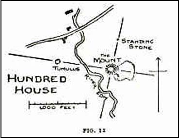
In a field less than 200 yards north of an old medieval mound known as The Mount, the great ley-hunter Alfred Watkins (1925) described a standing stone that used to be here along one of his leys, but which, even then, had been “inexplicably blown into several pieces by a quarrymen’s charge.”
The stone was said to have originally come from an adjacent field and then moved next to yet another monolith, which was also broken up. Can any remnants of these poor fellas still to be seen anywhere nearby? Or is it a case of yet another one bites the dust?
References:
Watkins, Alfred, The Old Straight Track: Its Mounds, Beacons, Moats, Sites and Mark Stones, Methuen: London 1925.
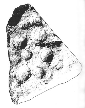
Prehistoric petroglyphs are rare things indeed in Leicestershire! But the example that was found here — at the now destroyed prehistoric tomb which archaeologists catalogued as ‘Lockington Barrow VI’ in this small graveyard — shows that such ritual art spreads further afield than previously reported by archaeologists. Yet as with countless other cup-marked stones, it should come as no surprise to be found associated with a tumulus. Death and petroglyphs are common bedfellows – even in this part of Britain!
Lockington cup-marking (courtesy Gwilym Hughes)Lockington cup-marked stone
Found on the northern edge of a ring ditch surrounding this once-fine tomb, the carving was found on a small, triangular-shaped, broken piece of rock , less than 12 inches across along its longest side. The small stone has what seems to be eight cup-marks (5 seem certain) pecked onto the stone: simple, without additional ingredients, akin to the basic forms found at Baildon and other more northern climes. The stone itself didn’t seem to be local and was thought by Hughes (2000) “to be from one of the outcrops of millstone grit to the north of the site in southern Derbyshire.”
Less than 7 feet from this petroglyph, inside the barrow, was a pit containing a hoard of ancient gold and copper ware — though any likely relationship between the carving and the treasure hoard is doubtful. The carving was probably a “portable” relic, carried some distance and put here for some reason or other: perhaps as an offering; perhaps a magickal artifact — we’ll probably never know…